
On Friday, June 16th, I made a quick trip to check the two passes that are sort of a barometer of when hiking and backpacking might be possible in the High Uinta Mountains. I stopped at the Kamas Forest Service Station, and learned that they are holding off making the “OPENING” official since up high “there is still ice on the highway.”

Here we are with Bald Mountain in sight, and as you will see the highway is dry and clear, at least during the day. There has been some snow fall in recent days and it was maybe at those times that ice formed.
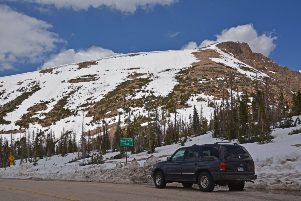
Here we are at the pass, 10, 759 ft. high, with 11,943 ft. high Bald Mountain in the background. I’ll insert below a picture used at the beginning of the last post of the pass in 2011 on June 28th, showing in that year more snow.

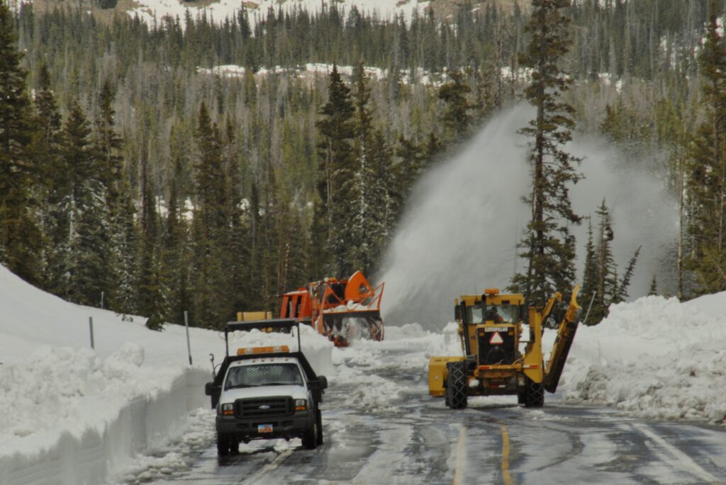
With the snow plows working just down the highway north near the entrance to Mirror Lake.
ON June 28, 2023 I will make another swing up over Bald Mt. Pass, take a few pictures, including of the HIGHLINE TRAILHEAD, and report quickly here the conditions I . I might quickly head over Wolf Creek Pass and down to the North Fork of the Duchesne and check out access to the GRANDVIEW TRAILHEAD, and report with pictures….maybe including you who will likely beat me to it to actually be backpacking already!!!.
Today, June 16th, the highway was clear and dry with all the snow removal equipment parked in a couple of places.

Heading down the highway towards the entrance to Mirror Lake, I took a shot through the trees of Mirror Lake that still has ice, but it is breaking up. The Lakes along the highway climbing up to the pass were all completely free of ice, as was Pass Lake, just down the road from here, but then up the highway to Hayden Pass (there is no sign, but it is where the entrance to the Highline Trail is found), we come to Butterfly Lake that as you see below still has slushy ice soon to be gone.

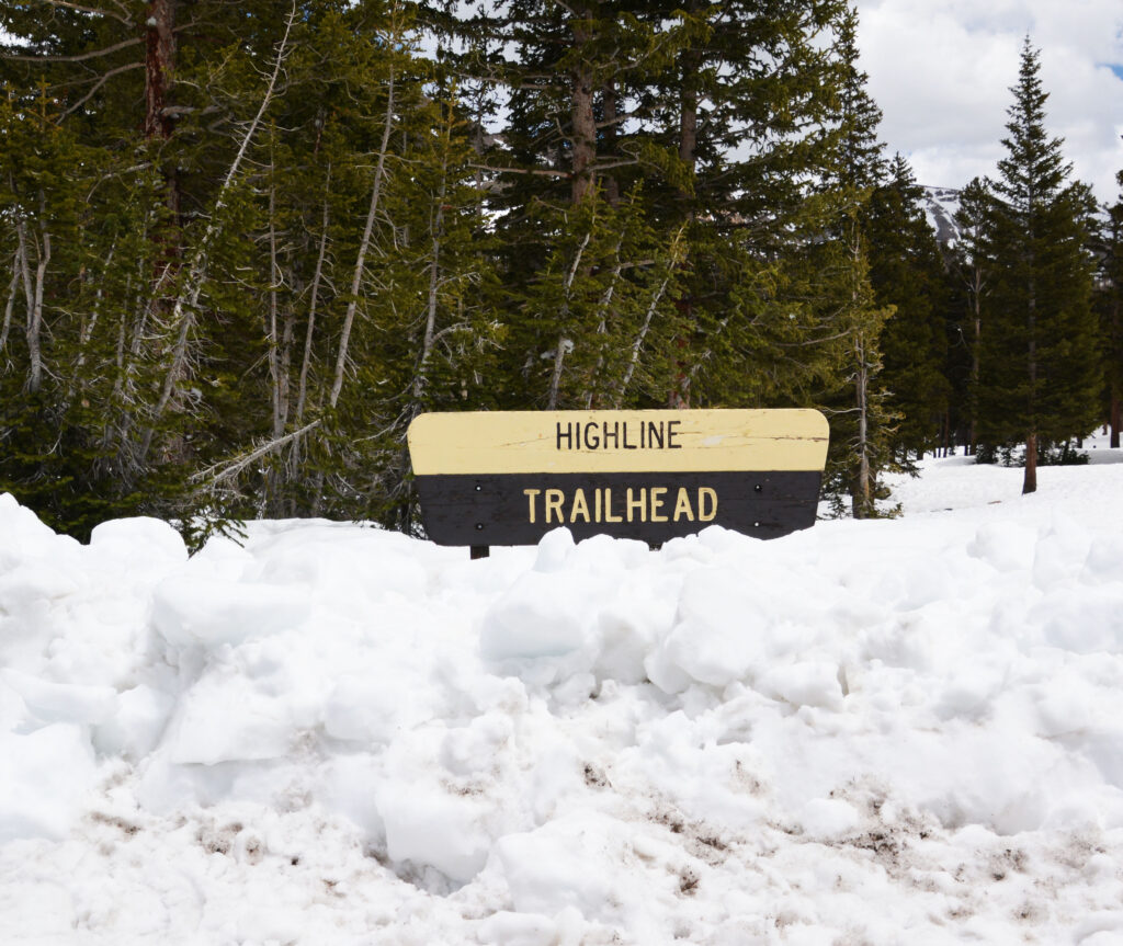
Sorry all you backpackers, but it will be a while yet before we can do any hiking to the Wilderness Area from the Highline Trailhead. For those who don’t know, the Highline Trail is the most famous trail in the Uintas. Beginning here it follows the spine of the Uintas east all the way to the highway that leads to Flaming Gorge Dam–a total of 106 trail miles.

We will now backtrack following the Mirror Lake Scenic Byway to Kamas, in this photo seeing Bald Mountain and Reid Peak. I should add that the highway north to Evanston, Wyoming seems to be clear and dry.

As we backtrack to Kamas we have to stop to see and photograph Provo River Falls, that is a raging torrent with the run-off.


Here I couldn’t resist to begin taking a few photos of the wonderful flowers….some of which are beginning to blossom and there will be a few more down the highway.

Down the Highway we begin to see the wise management of the forest to help prevent forest fires…..with piles of dead trees and underbrush cut and piled up last year……to be burned before the forest becomes dry and vulnerable.

We will see just a little further down the piles that they are working on burning….and within a few days these will be burned too.


This is the first trailhead as you come up the highway from Kamas. It is the Yellow Pine Trailhead with a number of cars parked and hikers, and even maybe backpackers, up the trail in this lower area–the first lakes being the Lower and Upper Yellow Pine Lakes, 4-5 miles up the trail at 9,620 and 9,700 feet elevation with eastern brook trout. Details in my book on pages 415-416.

The first flowers as you come up the highway from Kamas….and they’re all over the place!
Now we will quickly head for WOLF CREEK PASS that is at the same elevation as the Grandview Trailhead which is the Gateway to the Grandaddies, that will give us an idea as to when that trailhead will be accessible. The trail from there climbs up to Hades Pass, which is about the same elevation as Bald Mountain Pass.….so we can imagine that said pass will still have a lot of snow….so best be patient, and in early July call the Duchesne Forest Service office to find out about accessibility.

So, here we go on Utah State Highway 35 climbing up to the pass.

This is a beautiful drive up over the pass and down to Hanna that once was called “Little Italy” with a famous folk hero, Frank Defae, who according to the Salt Lake Tribune back during Prohibition produced the “sweetest mountain dew moonshine in 17 counties” and whose dance hall was the most “rip-roaringest west of Denver!” ….those stories of course told in my High Uinta Mountains book.

Here we are on 9,485 ft. WOLF CREEK PASS, mostly free of snow indicating more or less how the Grandview Trailhead is. You can call the Forest Service in Duchesne and most likely learn that the road isn’t open yet, due to avalanches, blocked road, etc. but learn when more or less we can think about the “GATEWAY TO THE GRANDADDIES!”
Below we see WOLF CREEK PASS on June 28, 2011…..OPEN but with a lot of snow compared to today. Those fields of snow today are not there, and plants and wildflowers are beginning to awaken. QUITE A CONTRAST!
On that 2011 trip I didn’t continue to the Grandview Trailhead, as a call to the Duchesne Forest Service had indicated the road to the Trailhead was not open yet.

Below are photos of my first trip in 2011 to the North Fork of the Duchesne River and the Grandview Trailhead, first the river itself, and then after three pictures on July 7th, I’ll post photos of the same on June 28th to compare and constrast the two years.

Below we see me making it to THE GRANDVIEW TRAILHEAD the first time in 2011, on July 7th, I recall perhaps sleeping in my car, and heading out the next day just in time, as behind me there was a wash-out of the road, making it just in time to not be stranded.
As I was descending to the Duchesne River, Defae’s Dude ranch and area, I could see the flooding of the area.

2011 WAS A MEMORABLE YEAR…..AS MIGHT BE 2023!
***********************************