**************UPDATE…July 15….Maybe I am both “stubborn” & “stupid” …as another backpack is already planned for mid-August as I JUST HAVE TO GET TO JEFF LAKE, and gradually get it all done!
If you go to the end of the following photo/essay, you’ll understand what I’m saying here!
So, in addition to the daily jog…as explained at the end of this post, I’m also doing the urban hike with backpack to keep my back strong.
****************
To some must sound “stupid”
but for me the other option will be avoided as long as I can!
***************
July 1-3, 2017 BACKPACK to THE GRANDADDIES
“Yes, I’M STUBBORN (or persistent)…but, IN MY 82nd YEAR I’M NOT COMPLETELY STUPID!”
Read on and you’ll understand the revealing experience I had during this simple, but great backpack.
Note: I had several purposes in this backpack. One was to do my best to get to two small lakes that have escaped me in the Grandaddy Basin: Range & Jeff Lakes. They are not listed by the Division of Wildlife Resources as being fisheries, but they do have names and I was curious to explore them.
The other purpose was to test myself in my 82nd year–4 months after back surgery, to see if I could accomplish the perhaps overly enthusiastic plans for this summer, mainly, doing in August the entire HIGHLINE TRAIL from near Flaming Gorge to Mirror Lake.
Below we see the Google Earth view of the specific area in the Grandaddies I wanted to get to.
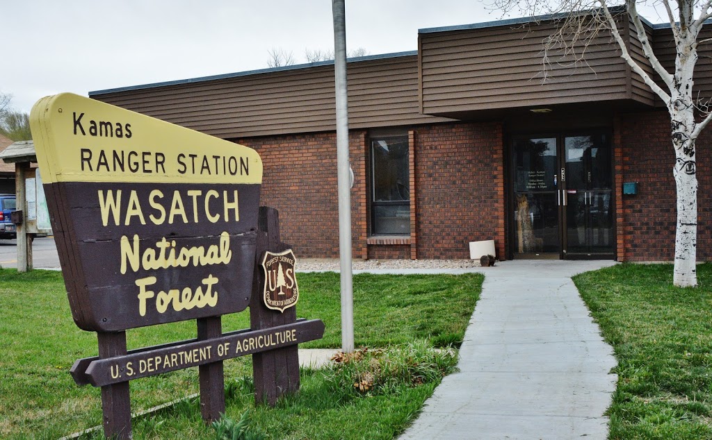
From the Salt Lake City/Wasatch Front area you travel east to Kamas, and from there two miles south to Francis where you turn east onto State Highway 35 to drive up and over Wolf Creek Pass. Below we see the beautiful valley as we begin the climb up the South Fork of the Provo River towards the pass–all on a beautiful paved highway.
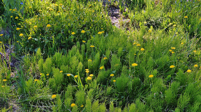
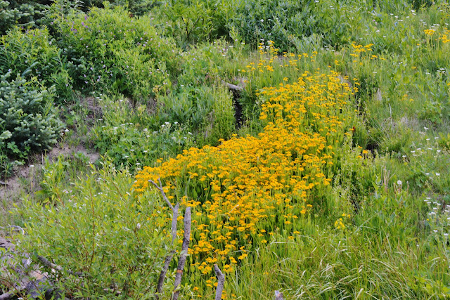
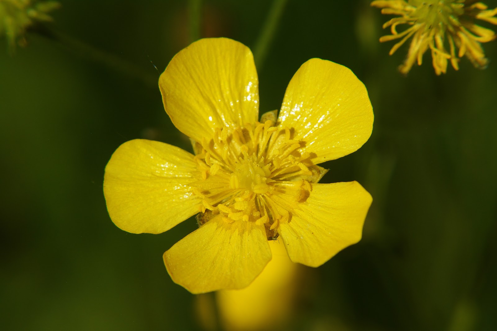
The flowers that carpet the valley with gold are buttercups we have to admire even more as we get close in the following photographs.
Buttercups, in a number of varieties are found right up to above timberline in the High Uintas.
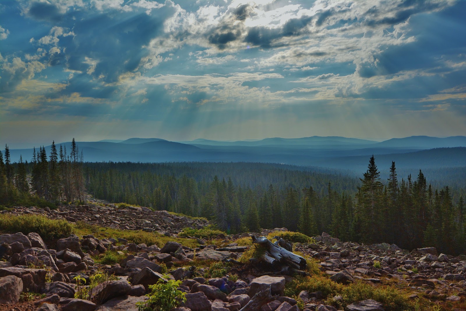
It’s a great drive, loved by all, up to the 9,485 ft. pass….and the mountainside is green and lush, with many wildflowers in bloom….a few of which I’ll insert below–all such I call VISIONS OF NATURE.
From Wolf Creek Pass the highway takes us down to the North Fork of the Duchesne River. Downstream 5 miles is Hanna, and then Tabiona. We turn north and drive up the river road, that eventually turns into a well graded dirt road that takes us past Defa’s Dude Ranch, and a little further we turn off to drive up…..
… Hades Canyon–6 miles to the Grandview Trailhead–
“The Gateway to the Grandaddies”
Around half way to the Trailhead we pass the ruins of what was called SPLASH DAM that used to have a lake where we are looking, but a couple of years ago excessive run-off ended that.
Near the Trailhead we pass on the right this wonderful water that catapults down the mountainside, and I stop to fill my water containers with its great, ice cold water.
From there we look down the canyon at Splash Dam.
We have arrived at the Trailhead, with only one car parked. Today, June 30th, was the first day the road was open to the public. It had been closed due to a timber sale in the area.
Down below near Defa’s Dude Ranch, where in my early years (1952) the Trailhead was located, there were quite a few cars parked and I assumed they were from the workers involved in the timber sale–but I was wrong. They were apparently cars of backpackers who couldn’t wait to get into the Grandaddies and had hiked the entire 10 miles up the canyon–just as we did back in “the good old days!”
The next day I was to meet some of them on their way out.
I slept in my car that night–part of the reason being to acclimatize myself to the higher altitude as in recent years that had become a problem for me.
To pump me up for the backpack, I watched that night ROCKY I on my laptop!
I was awake by 6:00 tuning into KSL RADIO and the OUTDOORS SHOW, and then made my attempts to report in to the program with the satellite phone Russ Smith and SKYCALL SATELLITE had provided. The box canyon made reception a bit difficult as the phone needed a clear view of the southern skyline, but I finally got my report in, and then began preparing for a big & decisive day. By the time I was ready to move up the trail, a number of cars had arrived and other backpackers were on the trail already.
Make sure and check-out all the information and “rules of the game” explained quite well by the Forest Service.
At 9:30 AM I was ready to go with vitals good: Blood Pressure 121/78, pulse 68, oxygen count in blood at 91 (normally at home it is 96). At my age coupled with having been a Medical Specialist in the Army, then doing thousands of medical treatments on Mayan Indians in Guatemala every year–for 35 years, along with my 8 survival experiences in the High Uintas, I have learned the importance of all of these things and so take with my blood pressure cuff, and my Oximeter–along with whatever I might need for almost any emergency.
The register–from the afternoon of June 30th– only had a couple of entries for 2017–most from last Fall.
UP THE TRAIL!
A few hundred yards up the trail we come to the bridge
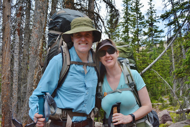
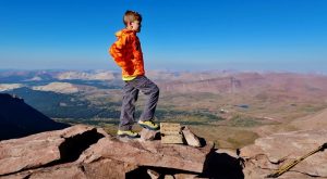
-Above we see THE 2017 PORTRAIT ON JULY 1st.
This is how it was on June 24, 2016
NOW….UP THE TRAIL!
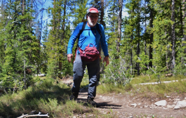
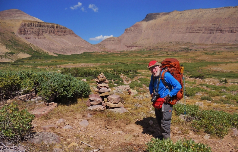
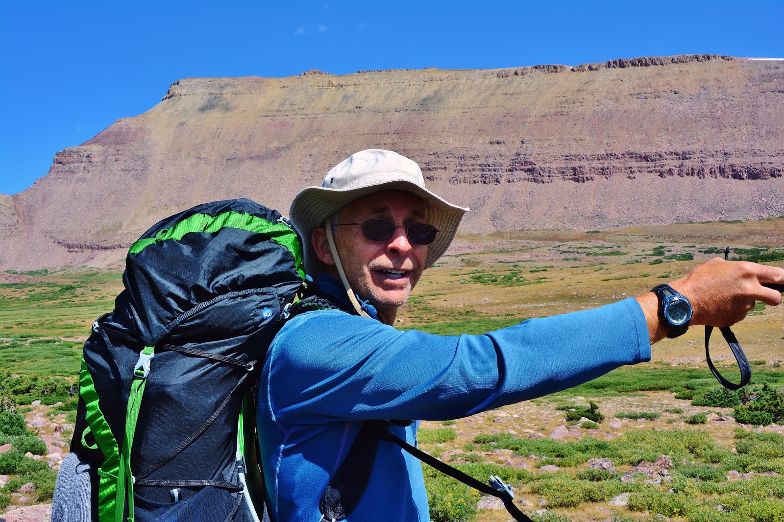
I’ll admit that hiking up this trail with a 35 lb. load wasn’t the same as hiking around American Fork recently with 52 lbs. I had to take it slow, carefully, and every 10 minutes rest a couple of minutes, and after 30, rest for 10-15 minutes. My vitals continued very good, but for the first backpack one has to be careful giving a chance for balance, agility, endurance, and stamina to catch up to the expectations and challenge.
There were many coming and going and I couldn’t stop and talk to all, but sort of randomly picked some–or were picked by them– that were impressive as you will see.
The first great opportunity came to rest a little and get to know my first
“2017 High Uinta Friends” who were…..
…..MARK & MELANIE WATHEN coming down the trail with this magnificent family
While Melanie was jotting down their email address, and all were gathering for a photo, Mark all of a sudden said,
“Don’t I know you? Yes, it was from the internet where I saw your blog and got all kinds of good information.”
That got me going on what I have been doing for 15 years, with 2,000 miles of backpacking exploring, photographing and finally reporting on the whole Wilderness. it went on and on, and we had a great time….and finally they continued down the trail, and I went back to working up towards the pass.
But, it didn’t last long, as once again I got into a conversation with the WINTERS FAMILY, and once again reviewed what a worn-out old guy in his 82nd year was doing in the Uintas.

As seen above, soon I came to where usually the entire trail for 30-40 yards has snow you have to wade through, but this year…..being about a week later than usual due to the timber sale, it’s nearly gone–and was gone when I returned a few days later.
At HADES PASS I was resting a bit off the trail when a young lady and her father stopped and asked me if I could take their picture. They were TERI & father, DOUG COATS.
As I was first taking their picture with my camera, all of a sudden Doug said,
“Hey, you’re Cordell Andersen. I know your website and have even downloaded your “Anti-Aging Challenge” article. Thanks for all your help!”
July 6th, Teri just sent me the picture she took of me, so I’ll insert it here. Thanks Teri.
After another bit of conversation, we continued on our way, me going over the pass–which you see below in 1954, along with Charlie Peterson, picture taken by Ted Packard–the three of us were on a two week backpack to traverse the entire PRIMITIVE AREA.
You see hanging there the great Forest Service sign that explained what the
High Uintas Primitive Area.
By 1984 it became the
High Uintas Wilderness Area,
doubling its size to around 459,000 acres.
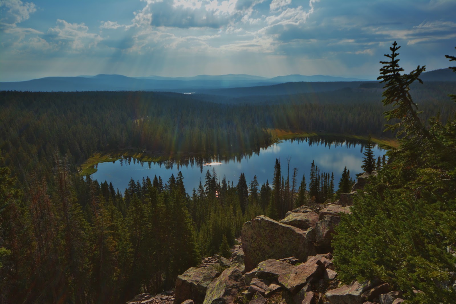
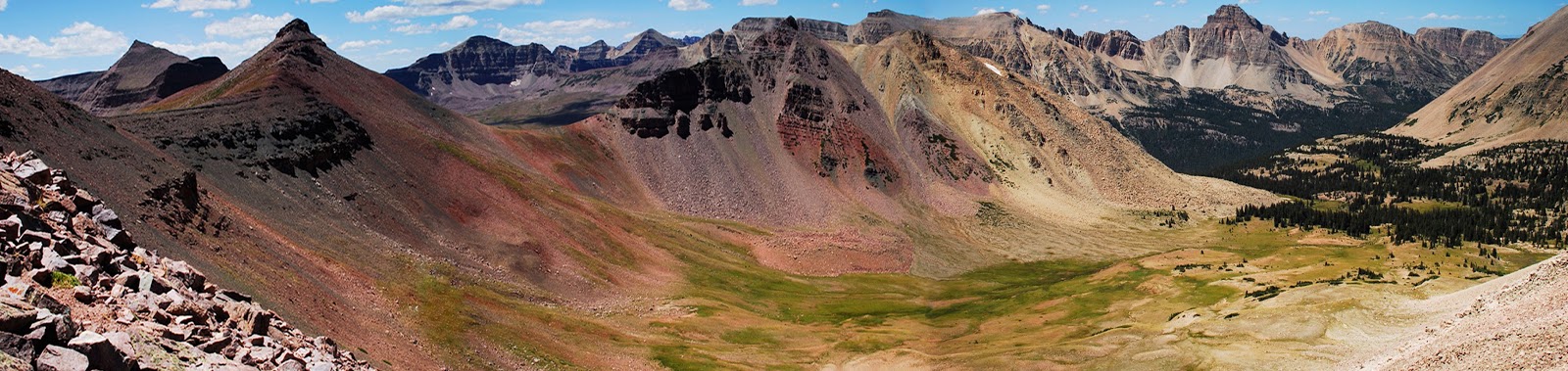
Over the pass one views the “GRANDADDY OF THEM ALL,” said by pioneer artist/photographer George Beard around 1906 when asked by a government surveyor which was the largest lake in the Uintas. Since then it has been Grandaddy Lake & Basin…..which by the way you don’t see like this from Hades Pass.
This is the spectacular view from the saddle of East Grandaddy Mountain, actually to the south of the basin. I’ve been up there 3 times, once bivouacking on the side of the mountain–to get photos in the evening, night photos, and photos at sunrise. All trips were made from the south side–the off-trail hike beginning at the end of the road up the South Fork of Rock Creek.
At the north end of Grandaddy Lake the trail takes us to a junction you see above.
Back in 2003, when I started the High Uintas Wilderness Project, the sign you see below was still there…..but on the ground. I propted it up for the picture. A year later it was gone,
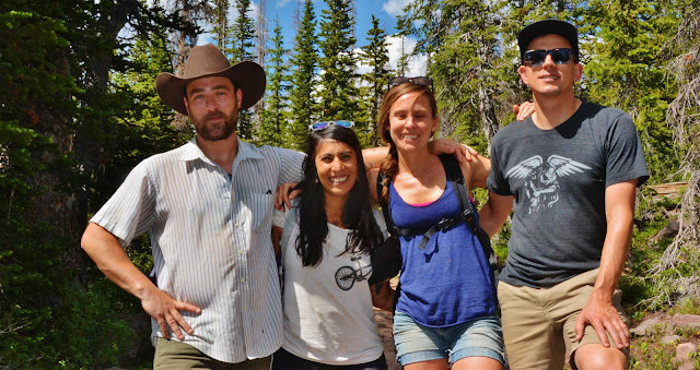
At the junction I met another bunch of infectious smiles coming from: Kent Hartley, Wes Talbot, Kami & Kevin Lynch…..sorry, one name is missing. The young lady with the long hair also had an OSPREY AURA “Anti-gravity” Backpack (the “AURA” is the womens model, men’s the “ATMOS” ) and agreed with me that it is so comfortable that that with it on your back you don’t even hardly notice it’s there.
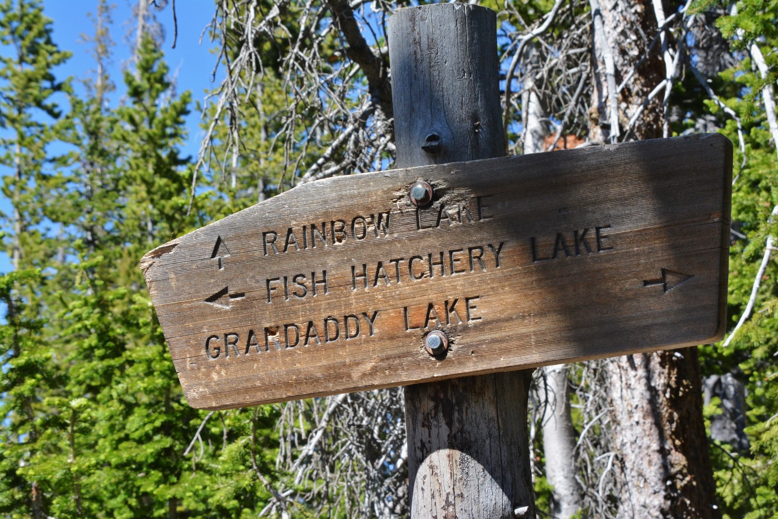
From the above junction the trail I took goes north by Betsy Lake you see above, and about at the mid-way point another trail takes off as seen below.
My trail would be to Rainbow Lake.
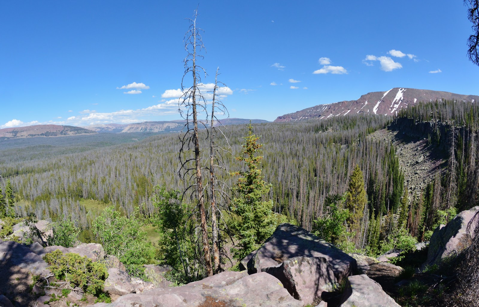
Eventually the trail that goes east takes the hiker down, viewing along the way to the south East Grandaddy Mountain……
……and looking southeast. Below to the left out of sight is off-trail Shadow Lake.
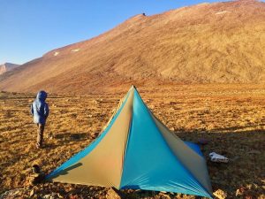
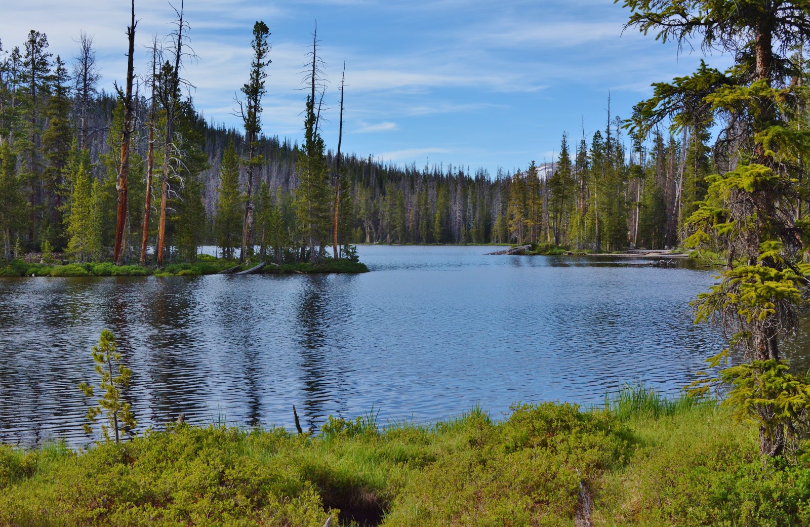
At the junction I had come around 6 miles and I’ll admit that I was quite tired. It was getting late and I was tempted to find a camping spot…..but after a little rest, I continued on down the trail for another 1-1/2 miles to Lost Lake, my original goal for the day, for a total of 7 miles from the Trailhead.
At the eastern end of Lost Lake I set up my camp for the night, and for the trip. Being at a much lower elevation, all of a sudden I was in “mosquito heaven,” but I was ready for them with 100% deet repellent.
The plan was to do my explorations in the Rainbow Lake area the next day as a “day hike,” and then return to my camp for the 2nd night.

Doing 7 miles the first day of the 1st backpack of the summer seemed necessary as the day developed, but I will admit that it was very hard for me, and the day ended up not being fun anymore, as had usually been the case in the past. I was really fatigued, and feeling actually sick (which in my 70’s and now 80’s has been common after a very hard day)–unable to eat, but I faithfully went through my “recovery” system of supplements and soon was ready to eat some dinner–which was a powder meal that included bone meal protein & nutrients providing a “complete meal,” plus dehydrated eggs and MCT oil powder.NOTE: But for complete disclosure, what happened was that I was so fatigued that around 9:00 PM I fell asleep without having eaten. I awoke at 12:40 AM a bit surprised, ate a little something, and went back to deep sleep.REALLY IMPORTANT The “recovery system” of supplements is based on two facts I learned over the years from RUNNER’S WORLD magazine that once reported a study done on marathoner’s running shorts that discovered the element they lost most was CALCIUM–so, it needs to be replaced. Another article focused on runners frequently getting sick with colds, flu and respiratory problems after a race, but the incidence was greatly reduced by runners taking after the race 5 grams of GLUTAMINE. The 3rd element was when feeling like one is getting sick, strengthening the immune system by taking WELLNESS FORMULA capsules. The normal use is to strengthen the immune system–so they became my multi-vitamin every day, but feeling sick tripling the dose–so it became part of my “recovery system.” All of this is explained in my“ANTI-AGING CHALLENGE” article, and in my2015 GEAR/SUPPLEMENT photo/essay
I was beginning to wonder how on earth I would do other backpacks that were harder, and much longer, especially the entire Highline Trail in two weeks (106-136 miles, depending on extras), but it would require an increased load of at least 50 lbs. which would have me going slower resulting in taking longer than 14 days and make necessary increasing food weight and slowing me down…..and as I reflected it seemed like it was becoming sort of a vicious circle continually adding more weight and stretching out the length of the hike making it all impossible for me in my 82nd year!
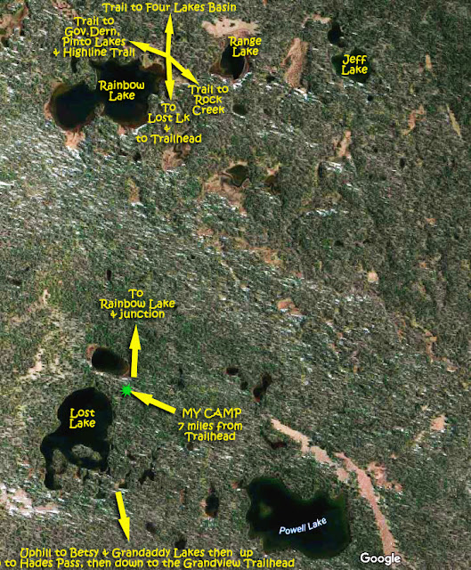
So above you can see my location and where I would be hiking to the next day.
My day hike would be from 3-4 miles, but without backpack. However I did need to take things important for my work, plus “emergency/survival items,” like: 1. Photographic equipment, 2. SPOT Tracker, 3. Satellite phone, 4. “Bodyguard” pistol, 5. “Meal in a bottle,” 6. Trail-mix plus Vital Reds, 7. Storm-proof matches, 8. Gerbers utility tool/knife (very tiny), 9. Sun-tan cream, 10. Mosquito repellent, 11. Rain poncho, 12. 3 oz. Golite windbreaker (& mosquito protector), 13. Topographical map & Google Earth print-outs, 14. Bum fodder, 15. Oximeter, and 16. Fishing equipment.
So, I had enough to fill my pockets and a tiny pack–probably 10 lbs. of load.
NOTE: That list might seem to be long, but I promise you that nearly all of those who have not survived in the Uintas….did not have these necessary survival/emergency items with them.
As was the case from the Trailhead, at times downed timer blocked the trail breaking up my rhythm, so….WE NEED THE WILDERNESS RANGERS…QUICK!
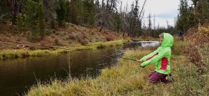
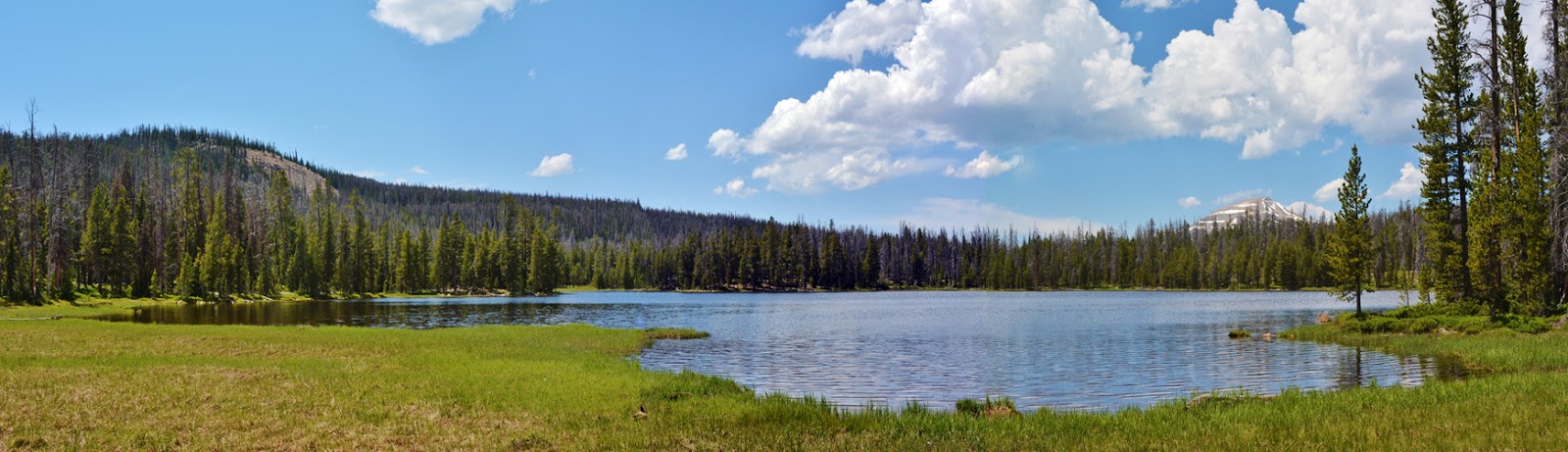
In about 45 minutes I was at Rainbow Lake, with Mt. Agassiz to the north where the Highline Trail squirts its southern base with the Naturalist Basin nestled into its eastern slope.
By the way, Rainbow Lake is great fishing for feisty brook trout.
Most of us notice the early blooming marsh marigold flowers in the marshy areas, but look down at the almost microscopic plants that are never noticed. I should have had my close-up lens to zoom in.
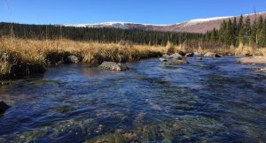
At the outlet of Rainbow Lake the trail crosses a bridge over Fish Creek, and a little further along is a junction with the sign seen above. My exploration would take me off-trail to the east to find Ranger Lake. It was found quite easily, and photographed as you see below.
The lake at this moment was full, but zooming in on the Google Earth view one sees the water level is shown to have dropped a lot. It is a shallow lake, and with the draw-down apparently experienced later in the summer, we see why the Fish & Game (DWR) doesn’t list it as a fishery. Winter-kill would be likely every year.
I then had some trouble getting to Jeff Lake making a mistake in my navigation mostly due to many detours to avoid swampy areas, and dead-fall like you see below–which is so difficult for me that in recent years that I have swore not going off-trail in such areas anymore.

When I finally realized my error, I was dead tired and could only think about getting back to camp and resting in preparation for going back up the trail the next day.
Here is a situation in which a GPS would have been an immense help….as it would also have been in a few other situations during my 15 year project.
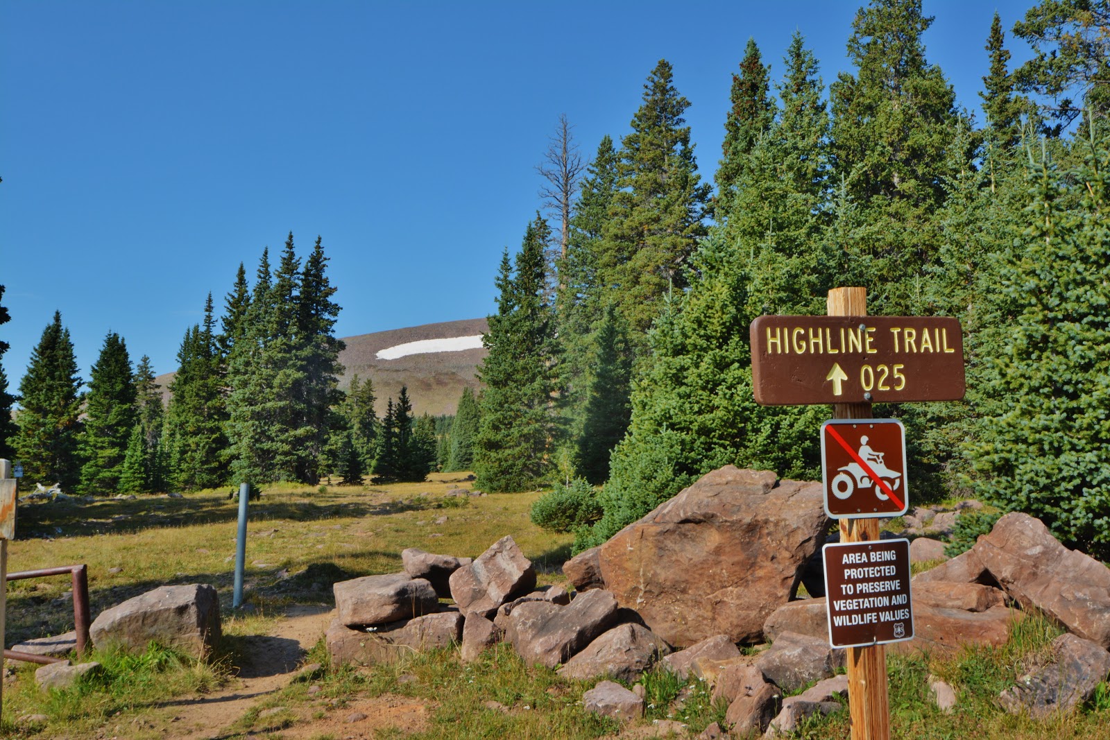
Back on the trail, I hiked a little bit further to get a picture of the sign at the junction where one trail takes off for the Four Lakes Basin–with Cyclone Pass to the east where are found remote Thompson & Sea Lion Lakes, and to the northwest the Highline Trail. I wanted this picture as somehow I had missed it a couple of years ago and needed it to complete my photo/essay “The GRANDADDIES.” and also the YouTube video, “THE GRANDADDIES”

The left fork, to Governor Dern Lake, also takes one to Pinto Lake, with another junction–the right fork taking one up to the Highline Trail. The left fork taking one down to the North Fork of the Duchesne River. It was from Pinto Lake that a few years ago I bushwhacked up to Margo Lake and from there continued off-trail over a pass and down to Pine Island Lake. So there are off-trail adventures awaiting you in the Grandaddies.
I then headed back to camp, having at least accomplished 50% of my objectives–remember batting .500 IS INCREDIBLE!
I was beginning to face reality that no matter what there would always be some “nooks & crannies” in the High Uintas I could keep chipping away at each year, and in the end no way to see all of them. I had to accept this and get on with my project.

Had more reflections during the night with the admission that this was hard for me, and not much fun like in the past. Because of not really feeling very well, and sort of being down in a hole facing one climb up to Betsy Lake, then another up to Hades Pass, I thought it might take me two days to get back to the Trailhead, but preferred going all the way in one day if I could.

I went through a good night with all vitals good, as they also were in the morning…..so began packing up for the hike out. Among other supplements: Two little bottles were prepared to move me along at critical points: I had a whole handful of little 1 cup “Surefresh” bags with “Vital Reds” powder seen on the left, mixed with water right in the handy little bag, then poured into the bottle each of which has two FRS chews (previously promoted by Lance Armstrong), along with a measure of MCT oil powder, all to give me almost instant energy on the trail.NOTE: You young bucks out there might laugh at all of this…just wait until you are in your 82nd year!
Above is where my tent was, which after pulling the stakes and before removing the pole framework, I hold it up and shake out all the debris you see on the ground above…….
….but remember,
THE FIRST LAW OF THE WILDERNESS
is to
“LEAVE NO TRACE”
So below is how I left the spot
ON THE TRAIL
I moved up the trail carefully and felt pretty good, making good time to the Palisades junction and then moved into my first real challenge–the climb up to Betsy Lake. I was determined to focus on getting all the way to the Trailhead–so I wouldn’t stop and talk to hikers….of which there would be many on the extended holiday weekend, but……
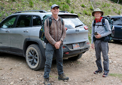
…….as I was doing quite well making it to Betsy, and then began the climb up to Hades Pass, a couple came down the trail and even before I could say “Howdy,” I heard,
“Hey, Cordell, thanks for your website that made possible us making this backpack!”
He was Clay Barrett and his wife. His comment got us into a prolonged conversation and they sort of agreed that I should begin focusing more on putting together the unique e-book (& then a simplified print version) that would have intertwined into a guide book for backpackers the history, the myths, the legends, the tall tales, and the survival stories of those who didn’t make it–and why, and then my 8 survival stories and why I’m still backpacking in my 80’s.
And, as I did with all those I talked to on the trail, I asked,
“Do you know about the tie hackers?”
NONE DID….that led to more exciting details about those “unsung American heroes,” that would also be part of the book, including the story of Beartown that was described as “the liveliest if not the most wicked town in America,” eventually wiped off the map like Sodom and Gomorrah, and the connected story of President Dwight Eisenhower’s hero, Tom “Bear River” Smith, etc, etc. WOW–all part of the High Uintas story–
–THAT NOBODY KNOWS ABOUT!
As I was saying goodbye to the Barretts, two backpackers bumped into us and called me by my name, thanking me for my website and the updates I do every year about
“High Uintas accessibility,” and more.

They were the BENSON BROTHERS–Brent & Jeff, from the Uintah Basin & Cache Valley, and there followed more great and appreciated conversation and encouragement.
With all the great people I was meeting, some who knew me and expressed appreciation, my “tough backpack” all of a sudden was transformed into a memorable experience, and I was beginning to recall the theme song from the famous TV series CHEERS, with this sort of tongue in cheek abbreviated version:
“Making your way in the world today takes everything you’ve got…..wouldn’t you like to get away…..where everybody–at least a few— knows your name and they’re glad you came?”
Then up the trail again, and over the pass and I began the 3 mile descent to the Trailhead, but by then I was in the talkative mood, and I kept meeting and talking to more & new
“High Uinta Friends” ..……………

………like TRUDY & DEX WHITEHEAD, who blessed my life with more conversation.
Hey Trudy & Dex, email me as my thick skull can’t quite translate your email address correctly.
..…..then down by the little stream, that crosses the trail–the only water on the climb up, I met another happy group of day hikers, got their picture and will send the photo to LIANNA LOPEZ, “from California” who, ” fell in love with a Utahan!”
Back up by the pond right on the pass, I said howdy to a young fellow who was with a bunch of children, one who was balancing herself on a rock and about to loose her balance, and I yelled at her, “No, don’t fall in until I get my camera out!”
The tall young fellow said the kids were his cousins. Others trailed behind them up to the pass.
Down the trail, as they were returning and caught up to me, I met the whole unique group–the “tall young fellow” lived in Utah, and was with his family who were from New York, although the father VESTERFELT was a BYU graduate who said “I then escaped from Utah!” But he was back with his family on vacation–and obviously love BYU.
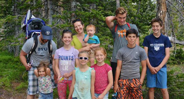
Once again great conversation, and in it all I mentioned having been introduced to the High Uintas in my youth, and vowing“one day I’ll explore, photograph and report on all the Uintas,” I then mentioned going off on my quixotic 35 year personal mission among the Mayans of Guatemala (http://www.guatemalanfoundation.org/)With that the “tall young fellow” asked where I had lived in Guatemala, and he expressed knowing about the Coban area having been in the El Salvador/Belice LDS Mission. That got us into some fascinating history of my more than 50 year involvement with the Mayans. Thanks!
I’ll insert the other family portrait as each is necessary to show the truth about each family member.

Before actually meeting the family, the two young men on the right and some kids caught up with me and we talked a lot as we hiked down the trail.
NOW A CONFESSION: Please forgive me guys as we were hiking and you two asked me questions and showed a lot of interest in what I’m doing–which I appreciated, but I’ll confess that my hearing is deficient and I didn’t really understand a lot unless we were talking face to face, so I just tried to fake it! Forgive me!
It’s another of those things I try and joke about saying about some of us old guys:
“To see we have to put our glasses on, to eat we have to put our teeth in, and to hear we have to turn up the volume–when we can!”

I only had one more business card by this time, and so was going to save it for….whatever, but one more group stopped and wanted to talk. Russell Harris, on the right, said we had met on the trail a couple of years ago and mentioned to his friends my website and effort. So, after gratefully meeting them and having another pleasant and appreciated conversation, I finally focused on
“Getting to the Trailhead and not talking to anybody!”
…..but just had to make one more stop as all of a sudden I ran into a Forest Service crew of Wilderness Rangers, led by friend Jeff Mitchell.
A young lady was busy with her saw cutting a downed tree crossing the trail with Jeff and two others urging her on!
I wanted to take a picture, but Jeff said their superiors frowned on such, even though my project certainly can’t be considered a commercial enterprise….yet!
But….thanks Jeff and crew for your good work & say hello to Lori & Shiela at the Duchesne office.
But, how I appreciated everybody I met and the encouragement given to get on with my project-
–the research and writing aspect of it–
“BEFORE IT’S TOO LATE!”

It was great to arrive at the Trailhead….which now was full of cars.
I dropped by Hanna for a cold drink, and then back up over Wolf Creek Pass, once again totally enjoying the VISIONS OF NATURE I saw at every turn.


The backpack was not easy like it once was, and except for all the wonderful people I met and talked to, the experience wasn’t fun like it used to be….…..BUT MAKE NO MISTAKE…I DID DO IT ACTUALLY IN 3 DAYS RATHER THAN 4, but I have had to make some serious decisions….since…..“‘I’M NOT COMPLETELY STUPID!”My decision is to now focus on completing theGOLDEN ANNIVERSARY of the Guatemalan Foundation and retire that mission at the end of August, and……. from now on begin putting this whole project together in the “REPORTING” phase I vowed to do in my youth.**********************************I won’t stop backpacking, as to do so would “have me grow old” which I’m not ready for yet….so there will be an occasional backpack–even this year in August when the mosquitoes are gone, but not the heavy duty schedule I have announced for 2017. I will persist working out daily and keep moving….and even work on preparing to run one more time in May 2018 the
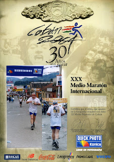
International Half Marathon in Coban, Guatemala.
************************
I WILL BE IN TOUCH & CONTINUE TO POST HIGH UINTAS INFORMATION & EVEN REPORTS ON OTHER’S EFFORTS.
I’ll inform all when the Project is ready for publication.
Thanks for everything….love you all and have you in my prayers!
***************************


