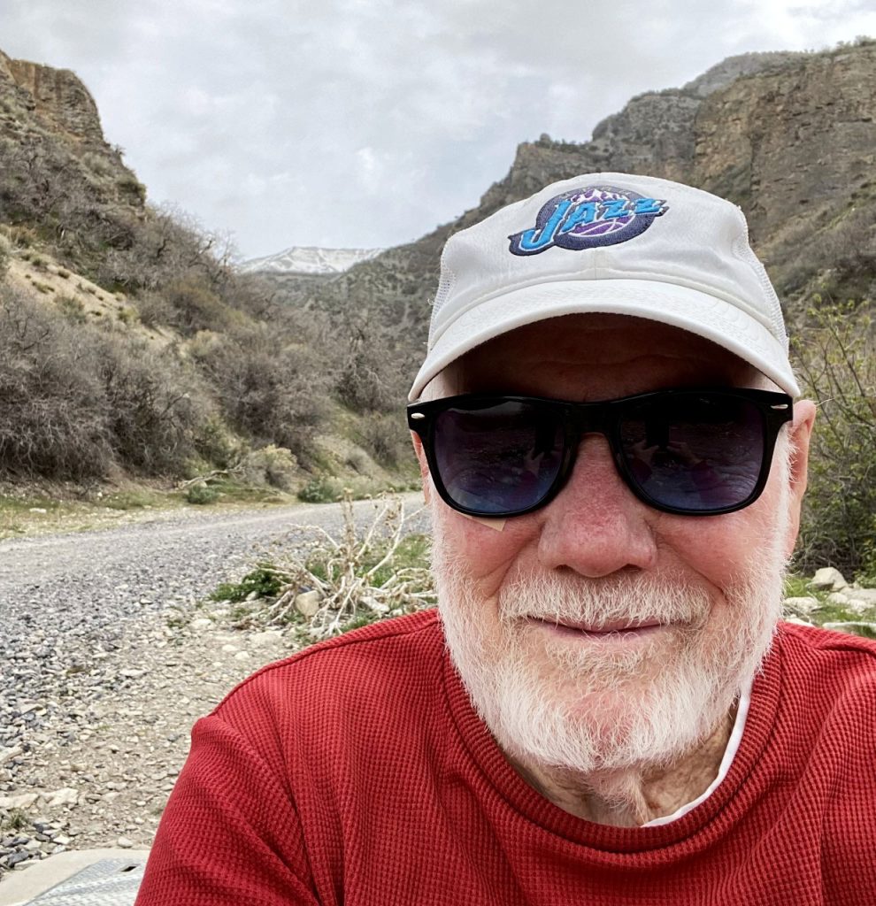
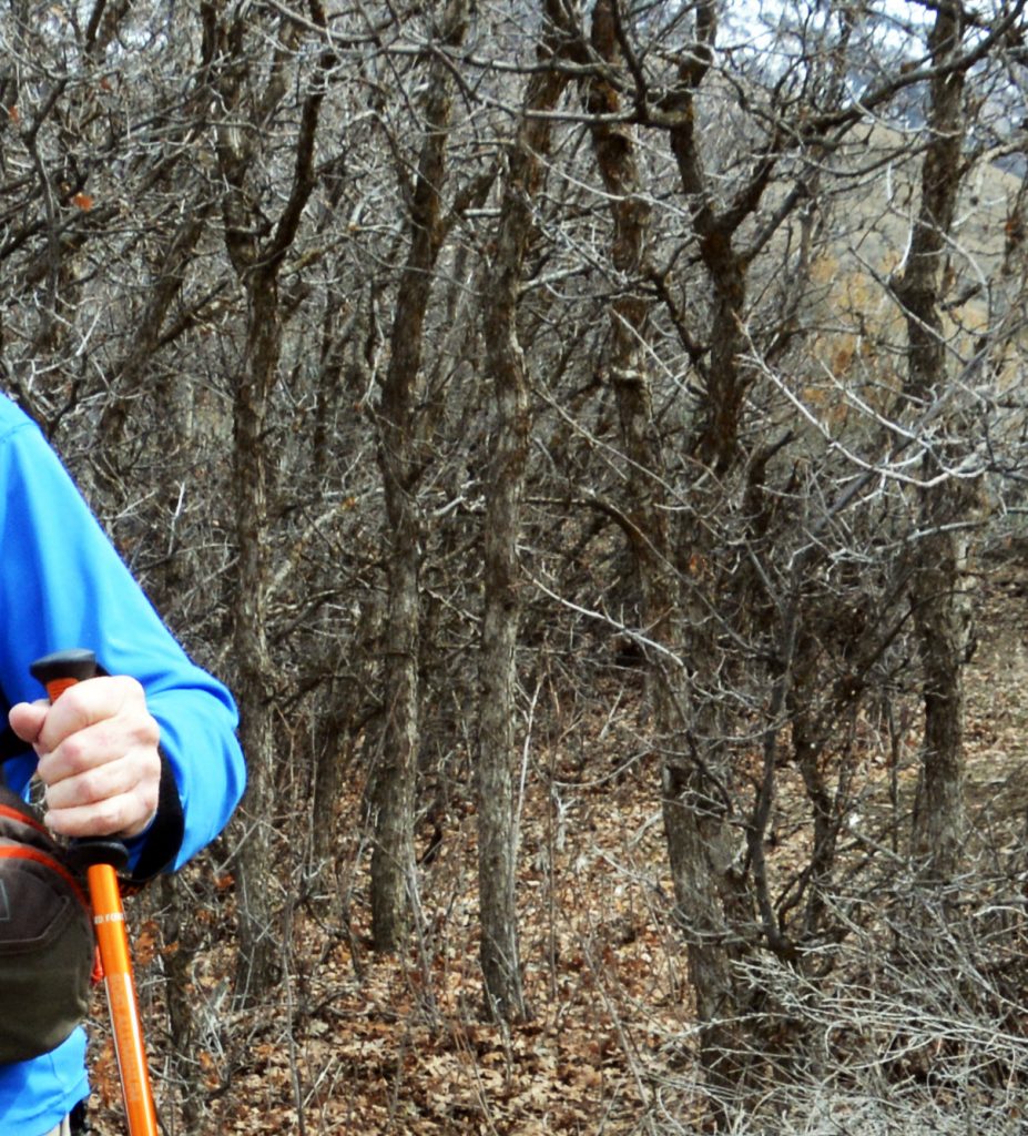
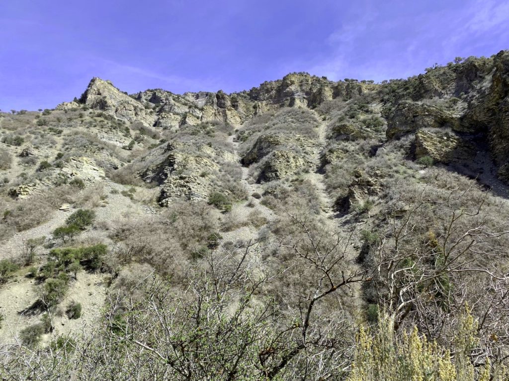
I CELEBRATED MY BIRTHDAY WITH A HIKE UP GROVE CANYON…and AGAIN FOUND IN THE STILL BLEAK LANDSCAPE SOME GREAT……
…..VISIONS OF NATURE
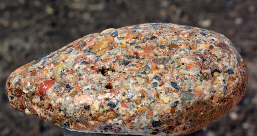
BEGINNING with one you’ve seen BUT WORTH SEEING AGAIN…..
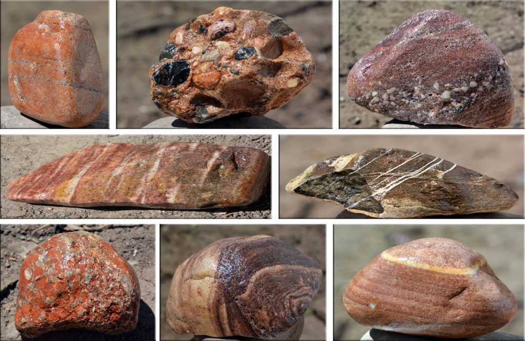
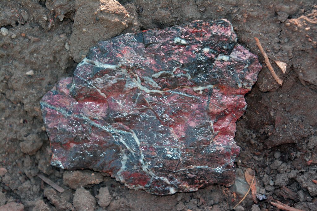
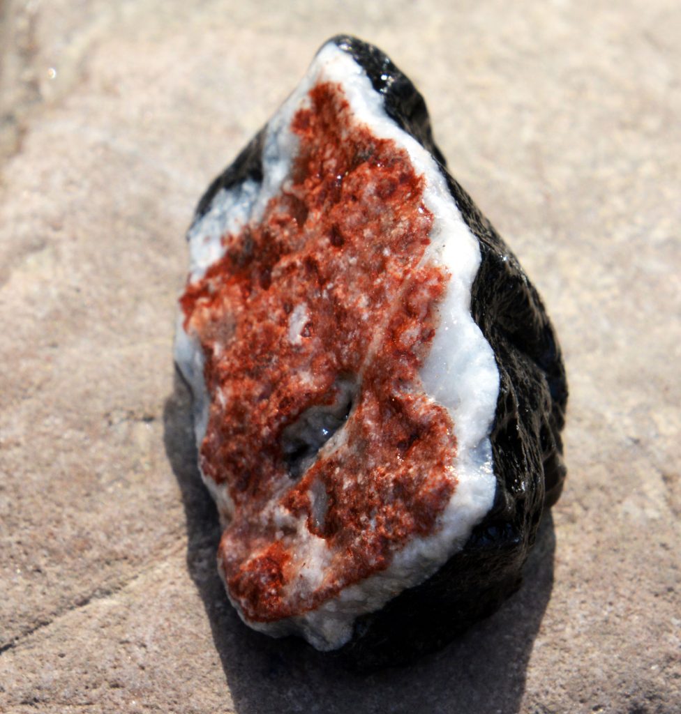
….A JEWEL STUDDED CONGLOMERATE –-My “QUEEN OF ROCKS”—
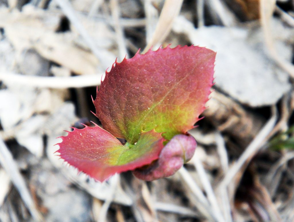
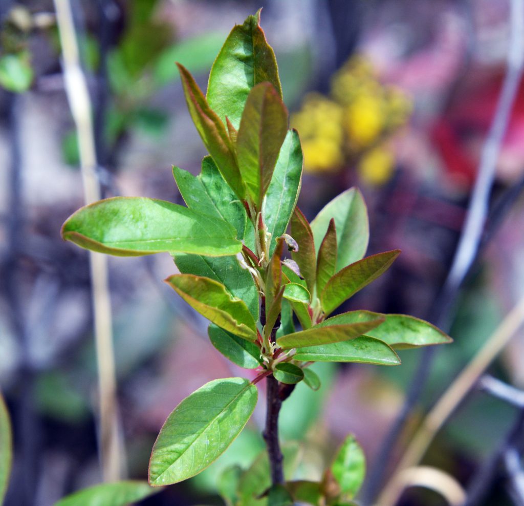
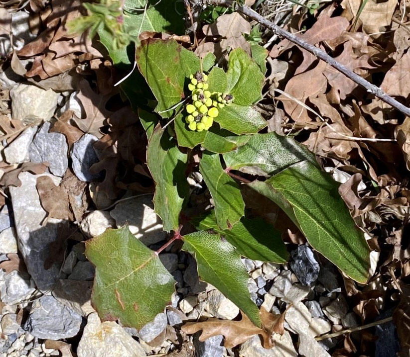
A new OREGON GRAPE PLANTsprouting
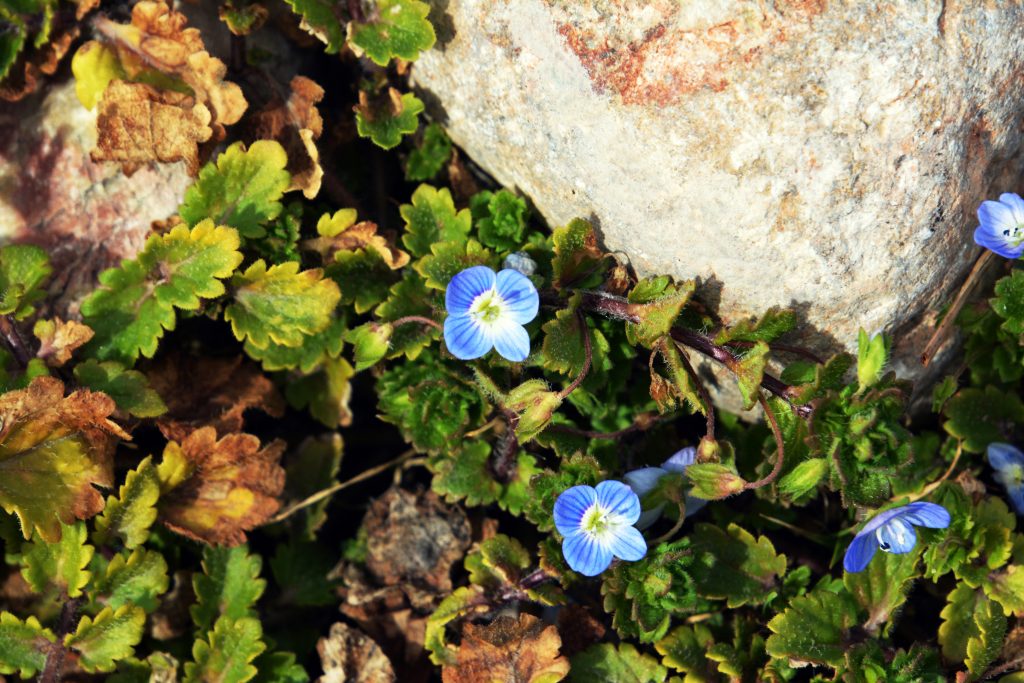
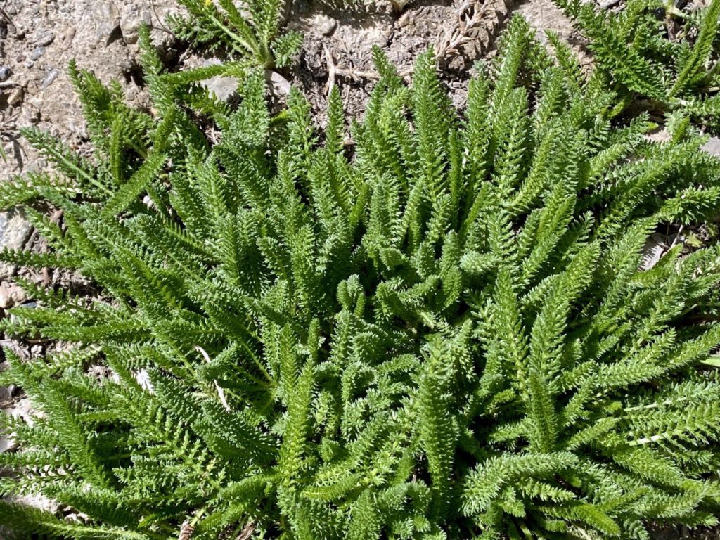
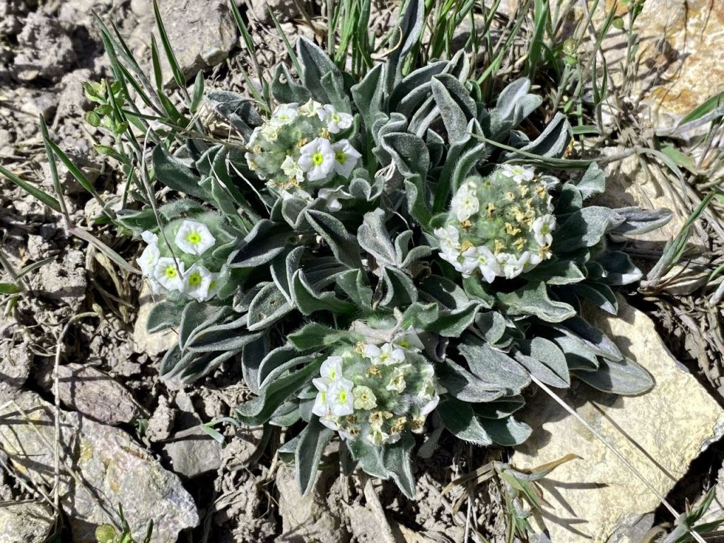
….and a tiny HEAVENLY WILDFLOWER...so tiny most hikers don’t notice it.
….and another of the more than 100 varieties of FOOTHILL WILDFLOWERS I have photographed and identified in the Wasatch and High Uinta foothills. Also so tiny most miss it and I had to use my Nikon camera to get this shot.
This WILDFLOWER was photographed several weeks ago way up high along the trail in a spot warmed by the sun, but it is now sprouting down lower along the trail.
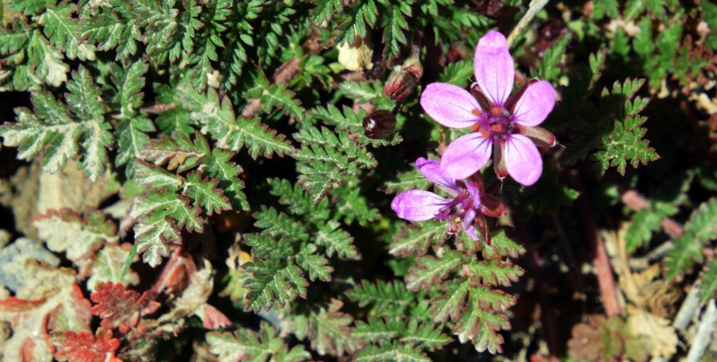
I failed to give this photo the depth of field I needed, but it is another of the early beauties in the canyon.I’ll get a better picture on the next hike.
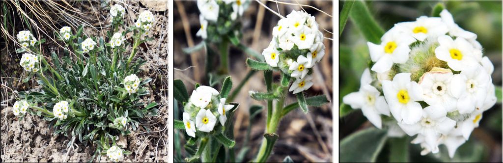
Here’s one near blooming that will be a beauty I’ll photograph on my next work-out, not classified as a wildflower, rather a shrub.
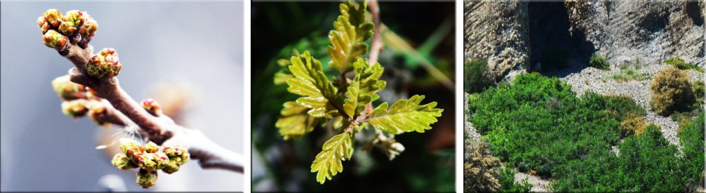
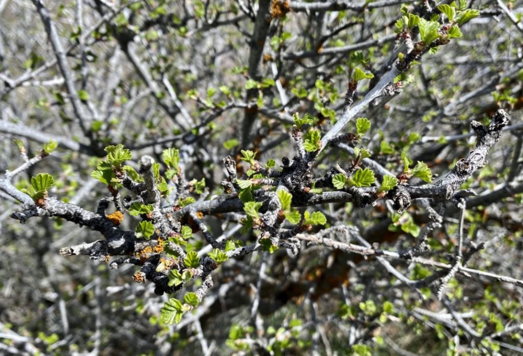
THEN WE COME TO ONE STILL MOSTLY DORMANT–ONE THAT MOST WOULD FIND SORT OF DRAB & UGLY….BUT you’ll see for me it was BEAUTIFUL–SCRUB OAK, or correctly, GAMBLES OAK.
Me calling it “beautiful” would have many calling me “CRAZY” for which I’m proudly known–even a BYU Agronomist/Animal Husbandry professor who visited me on my dairy in Guatemala began calling me a “RODEO CLOWN” because we didn’t use neither alfalfa, nor silage–both staples in the dairying industry in Utah. I rather showed him our lush pastures–a grass with 23% protein, the same as alfalfa, with our cows pasturing 24 hours/day, 365 days a year….and me laughing at him like aRODEO CLOWN…..
ALL THE WAY TO THE BANK!
I still love to call myself aRODEO CLOWN!
ON THE LEFT IS SCRUB OAK BEGINNING TO SPROUT ON MY LAST HIKE. IN THE MIDDLE IS THE WAY IT WILL COME TO LIFE WITH REAL STUNNING BEAUTY, & ON THE RIGHT THE GREEN THAT WILL SOON DECORATE OUR BLEAK FOOTHILLS.
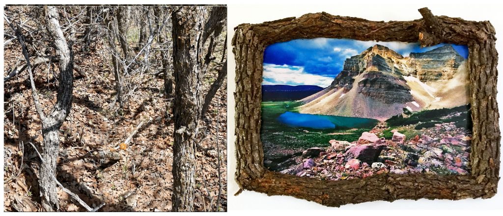
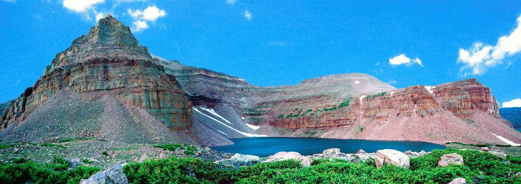
I CONVERT SCRUB OAK INTO BEAUTIFUL RUSTIC FRAMES. The stunningly beautiful picture in the frame is of TRIANGLE MOUNTAIN & RECONNAISSANCE LAKE, considered by me asONE OF THE MOST BEAUTIFUL OUTDOOR SCENES IN UTAH. It is located off-trail in the Rock Creek Drainage of the High Uinta’s South Slope.
AGAIN ON THE LEFT WE SEE WHAT NORMALLY WOULD BE SORT OF DRAB OR ROUGHLY UGLY SCRUB OAK, but on the RIGHT WE SEE HOW I WOULD TURN IT INTO BEAUTIFUL FRAMES I WOULD MAKE FOR MY FRIENDS in a TINY WOOD WORKING SHOP IN A SHED when we lived in Springville, Utah.
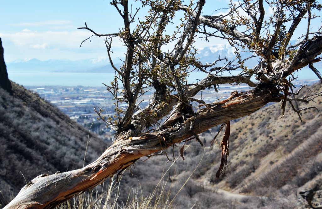
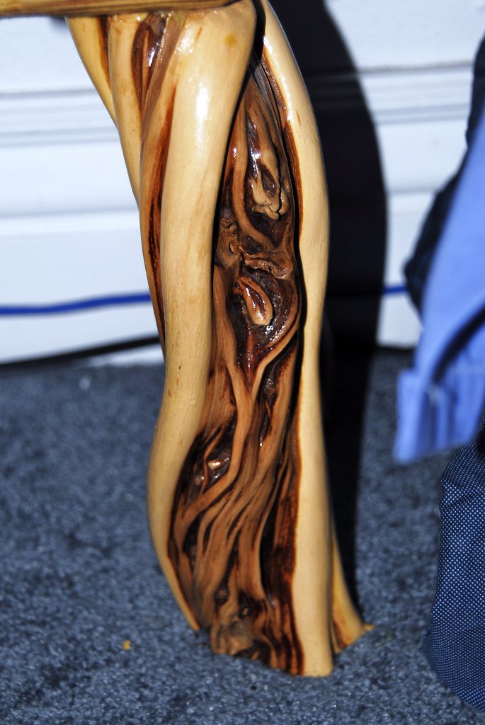
Here we meet another sort of unattractive tree/shrub that decorates the foothills. It is calledCLIFF ROSE, which soon I will show you how UNBELIEVABLY BEAUTIFUL IT BECOMES . Next, below I will show you what I do with its elegant wood disguised with its rough bark–which WOOD IS ALSO STUNNINGLY BEAUTIFUL as you see below what I do with it.
Here we see one of the legs of a coffee table I made for my daughter. I’m sure you can now imagine creating with it other VISIONS OF NATURE, like lamps, etc.
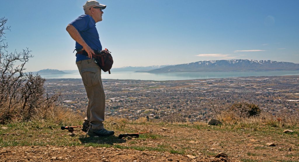
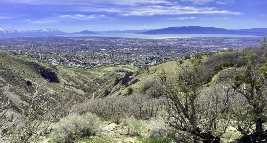
SO, my BIRTHDAY PRESENT for me was to again get way up the mountain with a beautiful view of Utah Valley–and get just a little stronger, with slightly improved balance–preparing me for the HIGH UINTAS come summer…in my 87th year.
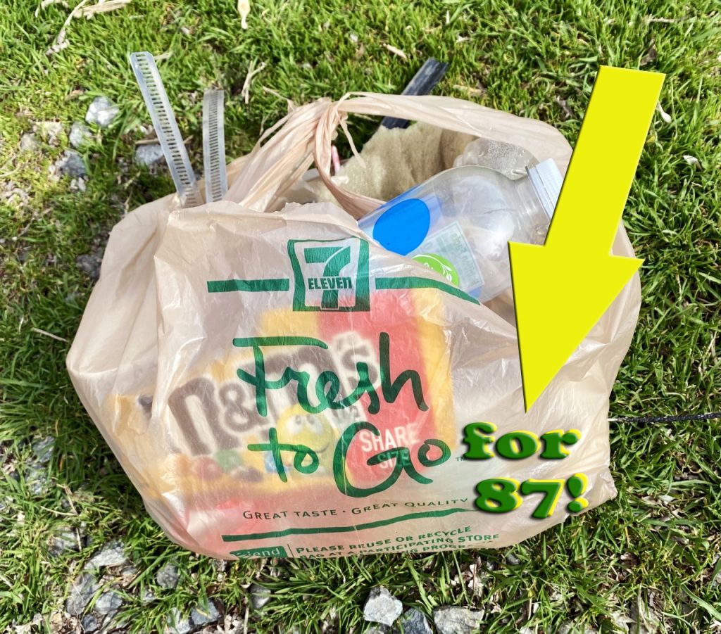
A BIG PART OF MY PREPARATION IS TO SOLVE THE HIGH BLOOD PRESSURE PROBLEM. Part of that was forced on me during my year+ of being a cripple and losing 32 pounds, but I have now noticed some of it coming back. So, I experimented with myself and learned that after eating EXCESSIVE SUGAR>>MY BLOOD PRESSURE WAS HIGH FOR THE NEXT TWO DAYS. Even more so did my BLOOD PRESSURE GO UP FOR TWO DAYS AFTEREATING EXCESSIVE ITEMS WITH SALT like you see to the right below..so I grabbed some of the things responsible for both problems, and…..
….. BURIED THEM IN MY GARDEN PLOT TO FERTILIZE MY: DANDELIONS & the Guatemalan “Miracle Weed” MACUY.
Soon I’ll get around to telling you all about those two items and my diet.
……and my BIRTHDAY PRESENT FOR ALL OF YOU has been the MAGNIFICENT VISIONS OF NATURE ….I have shared with you in this post…..now I want to share with you some of the
HIGH UINTA WILDERNESS.
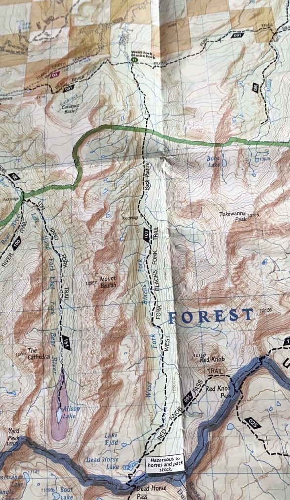
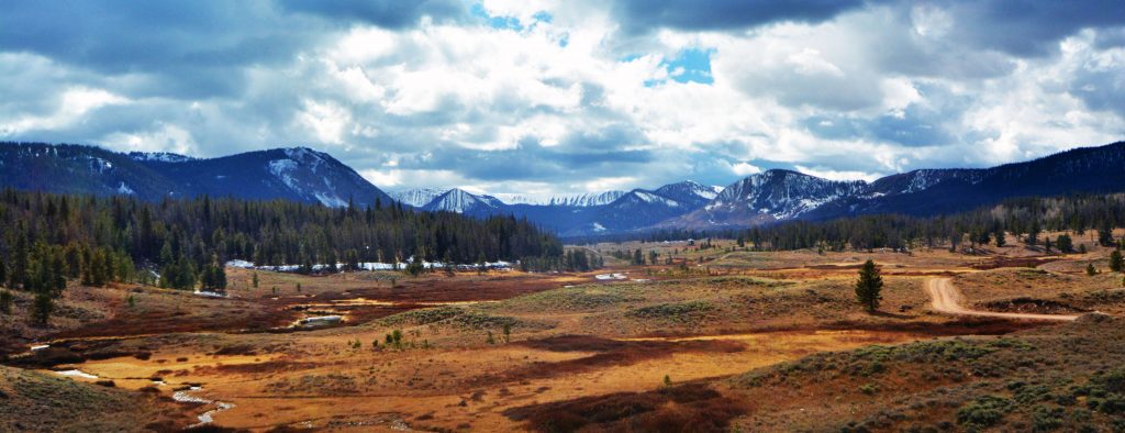
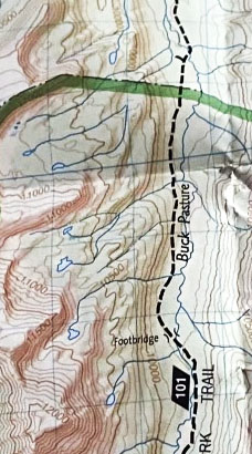
THIS WEEK WE’LL CONTINUE OUR TOUR AROUND THE WILDERNESS AREA, HEADING FOR THE WEST FORK OF BLACKS FORK (of the GREEN RIVER) with our first target being DEADHORSE LAKE we see below.
Below we will look at a map showing the area accessed on the NORTH SLOPE ROAD, the junction with the West Fork road about 18 miles from the Mirror Lake Scenic Byway.
FROM THE JUNCTION YOU GO ABOUT 5 MILES EVENTUALLY COMING TO A CROSSING OF THE RIVER WHICH SOMETIMES CAN BE DIFFICULT DEPENDING ON THE TIME OF YEAR AND HOW HIGH THE RIVER IS. YOU’LL SEE AFTER A FEW SCENICS THAT I HAD TROUBLE.
ONE CAN STOP AND CAMP MOST ANYWHERE with WONDERFUL SPOTS CLOSE TO THE RIVER WHERE HUNGRY BROOK TROUT ARE WAITING FOR YOU.
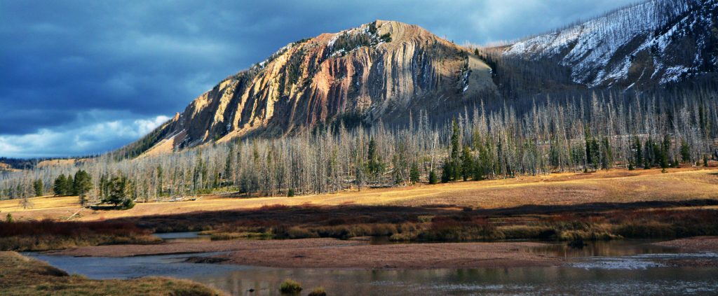
THE SCENERY IS WONDERFUL, BUT HERE, AS WAS THE CASE ON THE East Fork of Bear River, THERE ARE SIGNS OF FOREST FIRES IN THE PAST….SO BE VERY CAREFUL.
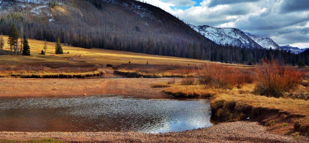
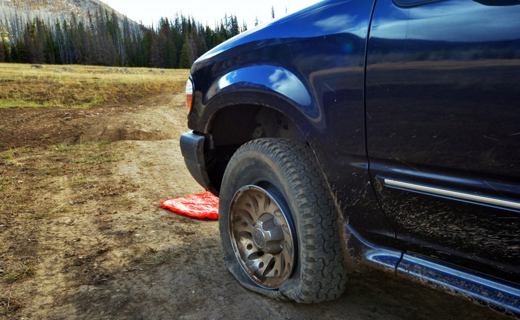
WE HAVE NOW COME TO THE CROSSING OF THE RIVER. AS YOU CAN SEE IT IS LATE FALL, EVEN WITH SOME SNOW ON THE MOUNTAINS ALREADY, SO THE RIVER IS LOW. I CROSSED SAFELY BUT ON THE OTHER SIDE REALIZED I HAD A PROBLEM YOU SEE BELOW.
I THOUGHT I HAD GOOD ENOUGH TIRES, BUT THIS WAS THE SECOND TIME IN AN ISOLATED AREA I HAD TIRE TROUBLE–THAT LEFT ME WITHOUT A SPARE, SO I HAD TO CAREFULLY GET BACK TO CIVILIZATION. I THEN GOT A MUCH TOUGHER TIRES, AND JUST TO BE SAFE I ALWAYS CARRIED 2 SPARES– & WOULDN’T YOU KNOW IT……. I’VE NEVER HAD ANOTHER FLAT!
THE TRAILHEAD IS ABOUT ANOTHER MILE FROM HERE, and THEN FROM THERE A 7.5 MILE HIKE TO DEADHORSE LAKE. BUT LET ME MENTION RIGHT HERE THAT ON THE WEST SIDE OF THE CANYON THERE ARE HALF A DOZEN SMALL ISOLATED OFF-TRAIL, SELDOM VISITED, LAKES YOU CAN SEE ON THE ENLARGED SECTION OF THE MAP BELOW.
FOUR OF THE SIX HAVE TROUT, 2 WITH BROOK, AND 2 WITH NATIVE CUTTHROAT TROUT.
FULL INFORMATION ON THE LAKES IS FOUND IN MY BOOK WHICH YOU CAN GET FOLLOWING INSTRUCTIONS AT THE END OF THIS POST.
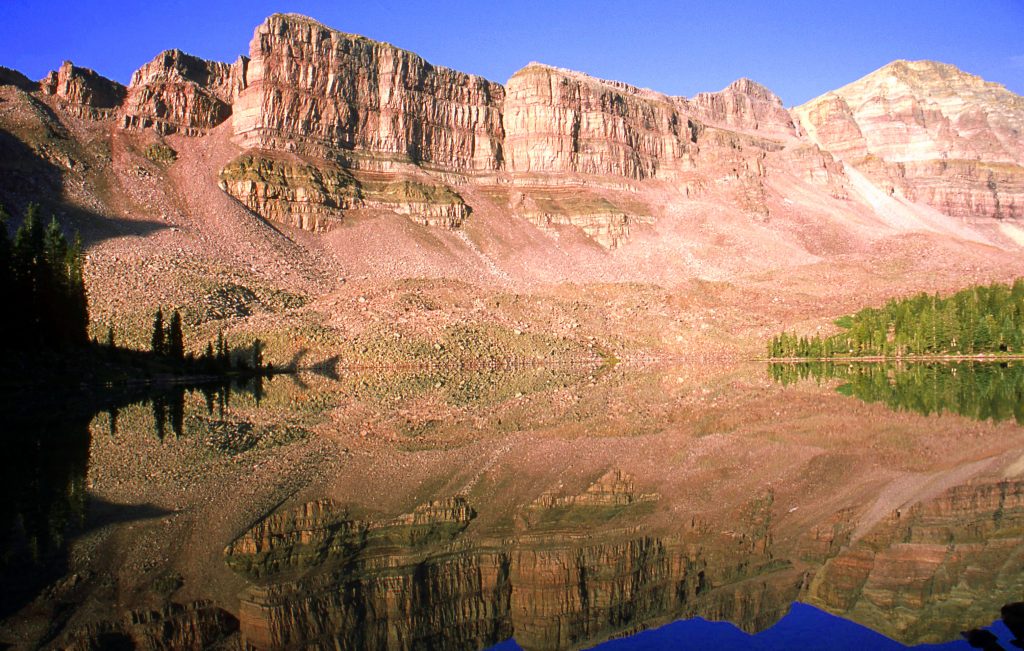
HERE WE ARE AT DEADHORSE LAKE. THE HIGHLINE TRAIL ZIG-ZAGS UP TO THE PASS ON THE UPPER LEFT FROM WHICH I’LL INSERT A PICTURE PREVIOUSLY USED–BUT WITH A PURPOSE.
THE TURQUOISE COLORATION IS DUE TO GLACIAL TURBIDITY AT A CERTAIN TIME DURING THE SUMMER. DEADHORSE LAKE has TIGER & CUTTHROAT TROUT.
In the right center of the photo is seenEJOD LAKE.Small and not very deep, but has Cutthroat trout the reproduce naturally.
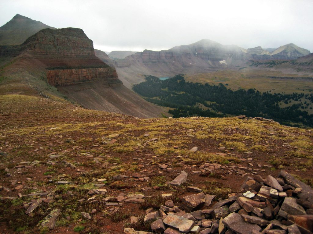
From Deadhorse Lake, to get to CRATER LAKE, you backtrack down the trail to a junction with the West Fork trail, and you continue on the HIGHLINE TRAIL climbing RED KNOB PASS from which, in the photo below, we look back towards Deadhorse Lake and Pass. The weather is a bit tough–which photo, along with the next, were purposely included so you’ll l always be warned that the weather in the Uintas is usually unpredictable….or maybe predictable as it almost always rains some daily…..usually in the afternoon. SO ALWAYS GO PREPARED FOR RAIN WITH A PONCHO THAT WILL ALSO COVER YOUR PACK–unless you have a rainproof cover for you pack as I do.
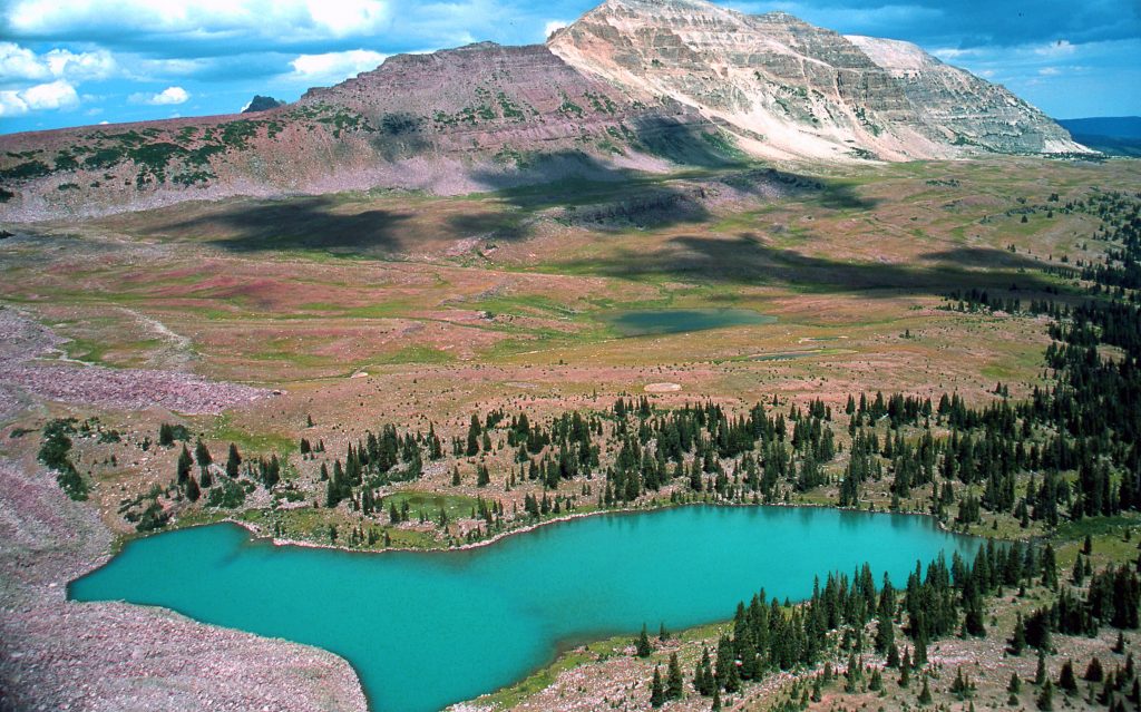
Once again this picture and the next were taken in the Fall, with the frost having turned the green grass to gold.Deadhorse Lake is in the upper center of this picture. Deadhorse Pass to the upper left of the lake.
FROM RED KNOB PASS WE ZOOM IN ON EXPLORER PEAK with a sliver of CRATER LAKE VISIBLE IN THE GLACIAL CIRQUE .
From the Pass you zig-zag down some and then go off-trail crossing arctic tundra to the base of Explorer Peak where you can camp in the trees along a nice creek that comes out of the lake. From there you can climb up to wonderful CRATER LAKE, which is Utah’s deepest lake at 147 feet. Traditionally it has had brook trout, but a few years ago Tiger trout were planted to help keep the population of brookies down–and let some grow bigger, and provide some tough fishing. Then a couple of years ago 700 SPLAKE–a cross between brook and lake trout were planted. I haven’t heard how they have done, but they have the potential of growing real big and should do great in Crater’s clear, deep waters.
With this photo we have come FULL CIRCLE from where I started this week on my FACEBOOK PAGE. Here I was attempting to climb up a chute to get up on the saddle for the ONE “PERFECT PICTURE” but a snow drift, seen in the previous picture stopped me. But I still got a pretty good picture of this……
ONE LAKE IN THE HIGH UINTAS NO ONE SHOULD FAIL TO GET TO.
FOR FULL INFORMATION ON THIS & OTHER AREAS, AS WELL AS TOPOGRAPHICAL MAPS WITH ROUTES, DISTANCES & LABELS — get an online copy of this book, some have called THE ENCYCLOPEDIA OF THE UINTA MOUNTAINS,send me $20 (don’t be afraid of sending a $20 bill as we aren’t south of the border) along with your email address, and I will immediately email you the link to download the book with my permission to share once with a friend. Or, send $25 for a thumb drive that will have the book, plus The History of it’s creation as detailed in a speech I gave at the Utah Valley Historical Society; plus my CHECKERED HISTORY & VISION QUEST–0-22 years. Send to:
Cordell Andersen, 444 Elm St., American Fork, Utah 84003
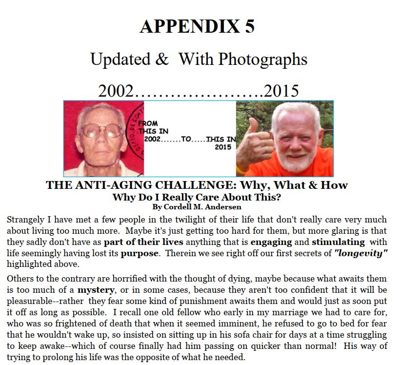
TO COMPLETE MY HIGH UINTAS PROJECT-Churchill and his “NEVER, NEVER, NEVER GIVE IN!” forced me—from 2003 to 2022–to go through 15 surgeries, 2 radiation treatments & become a “CANCER SURVIVOR” as well as discovering wonderful nutrition supplements — all revealed in my HIGH UINTA MOUNTAINS BOOK, on pages 616-649, the opening page below……to awaken your curiosity!
NONE OF IT WAS EASY, and I HAD TO LEARN TO ENDURE A LOT OF PAIN–actually worse today & I’LL CONFESS, as I do in Appendix 5, that 4 or 5 times I had what I call my……
“FOREST GUMP MOMENTS”
Discouraged with life–wouldn’t you know it, BECAUSE OF A WOMAN!—he started running all over the country for 3 years and had a following of odd-ball types that ran around after him…..and all of a sudden in the middle of the Arizona desert he stopped and turned towards them. One shouted, “QUIET, HE’S GOING TO SAY SOMETHING!” They expecting some kind of prophetic utterance…..but with heads hung low they all had to find someone else to worship–since FOREST WENT HOME!
BUT, IN MY CASE, I SEEMED TO SOLVE EACH “GLITCH” WITH ANOTHER SURGERY, OR MIRACLE SUPPLEMENT–like Dandelions, AND MADE ANOTHER…..surprise, surprise……..
There were 4 COMEBACKS & now working on ANOTHER!
Since not being able to walk a year or so ago, with a dead right leg, and a misaligned spine that should have killed me–I’ve been doing my darndest–interestingly one of my favorite series on TV, “DR. QUINN, MEDICINE WOMAN,” had SULLY, her–mountain man/adopted by the Cheyenne–boyfriend & later husband, had an accident and couldn’t walk–just like happened to me. His self-therapy followed mine and we both learned to walk again— but me now in my 86th YEAR have to sort of…….
….FAKE NOT BEING A CRIPPLE…again!
BUT, thanks to the Lord, I’M GREATLY BLESSED WITH DOING A PRETTY GOOD JOB OF IT…..LAST WEEK MAKING IT WAY UP GROVE CANYON as shown in my last post (scroll down if you missed it) …..
….. but last Friday, my blood pressure was sky high and it took me all morning to get it to near normal–by taking another dose of medication, then 30 minutes later checking the pressure, and then taking a double dose, etc., etc. until getting it near normal and then preparing to GO ALL OUT UP GROVE CANYON…..but at the trailhead REALITY SET IN(as I’m not completely a “dunderhead” — my MAYA BOOK explains that @ https://www.guatemalanfoundation.org/), and after a hike along the foothills I decided:
“I’M PRETTY TIRED…..I THINK I’LL GO HOME NOW!”
…… and NOW WORKING ON SOLVING THE GLITCH, while being careful with short daily exerciseefforts–several times a day— at the stairs, etc. and finished the week with some magnificent new VISIONS OF NATURE I want to share with all of you…. I’ll insert below:
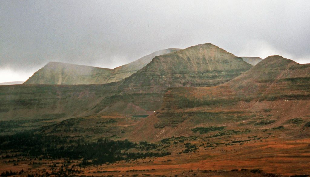
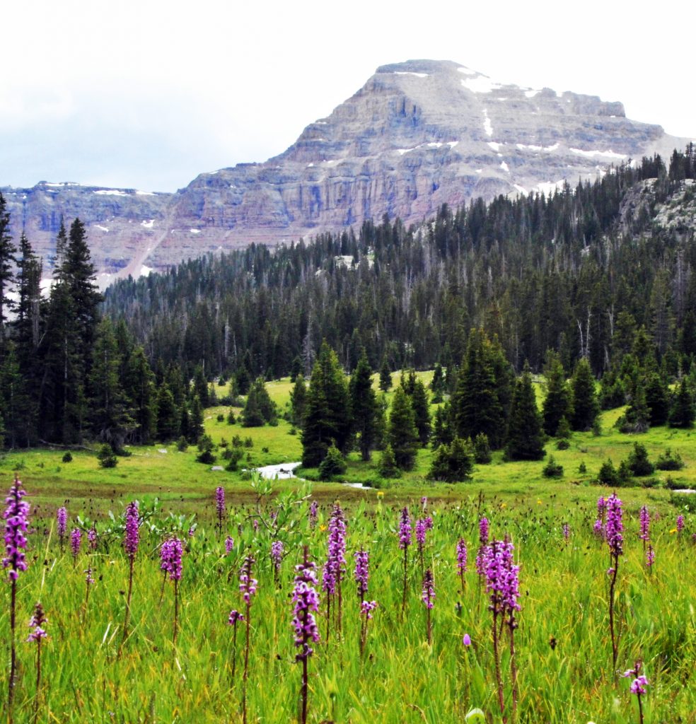
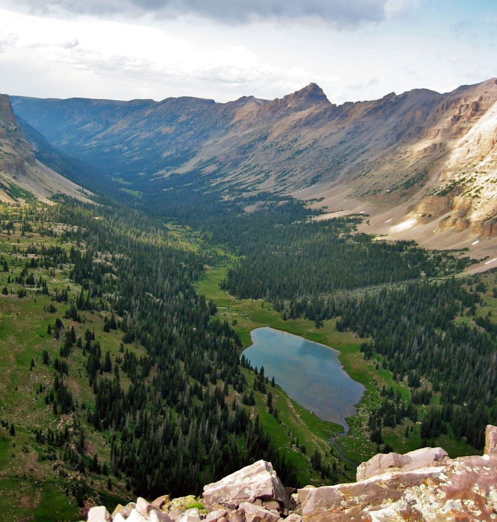
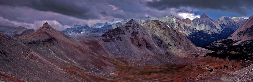
These are the best of myVISIONS OF NATUREfor this week, every one of them with a different creation process. Keep your eyes open and you’ll be rewarded, and it makes the hike a lot easier. You will notice that this old guy sees beauty in the order of nature–like flowers, plants, and wildlife, but also I evensee beauty in the chaos of naturethat helped in the creative process shown by these rocks, andon a huge scale the High Uinta Mountainsthat first were layers of different materials laid down in the ocean, then in gigantic earth movements were uplifted many thousands of feet, then erosion processes beginning with water carving out gullies, ravines, and canyons, and especially in the Uintas with glaciers creating the canyons like the one I show below with the East Fork of the Bear River and Allsop Lake, etc., and leaving beautiful mountains forming the spine of the Uintas, and the chains of mountains between the drainages on the North Slope and others on the South slope. You’ll notice later that I even see beauty–not just in the living trees, but in the dead ones. If you don’t recognize beauty all around us –YOU NEED TO TAKE A TESTOSTERONE BOOSTER!The one I use is ANDRO 400 MAX, that makes a noticeable difference in my mood, attitude, energy and ability to recognize BEAUTY!
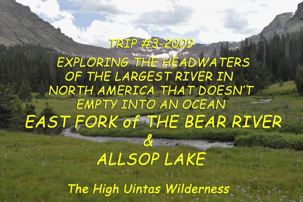
NOW TO THE HIGH UINTAS — THIS WEEK FOCUSING ON THE EAST FORK OF BEAR RIVER TRAILHEAD
So far this season–IN PREPARATION FOR THE HIKING & BACKPACKING SEASON– we’ve checked out the lakes accessible from the famous HIGHLINE TRAIL as far as Dead Horse Pass. Then we learned about the TIE HACKERS with a trip of discovery up the Main Fork of the Bear River to HELL’S HJOLE BASIN and learned about famous pioneer artist and photographer GEORGE BEARD. Then we went a little further down the Mirror Lake Scenic Byway to the CHRISTMAS MEADOWS – STILLWATER TRAILHEAD and saw how to get to some wonderful lakes in West & Middle Basins, then up a trail to the east and the AMETHYST BASIN with it’s beautiful lakes. Now we continue down the Scenic Byway to the NORTH SLOPE ROAD and head east, where in a mile or two we turn south on the road to the East Fork of Bear River Trailhead to learn about two separate drainages and lakes, as well as see ruins of the Tie Hackers
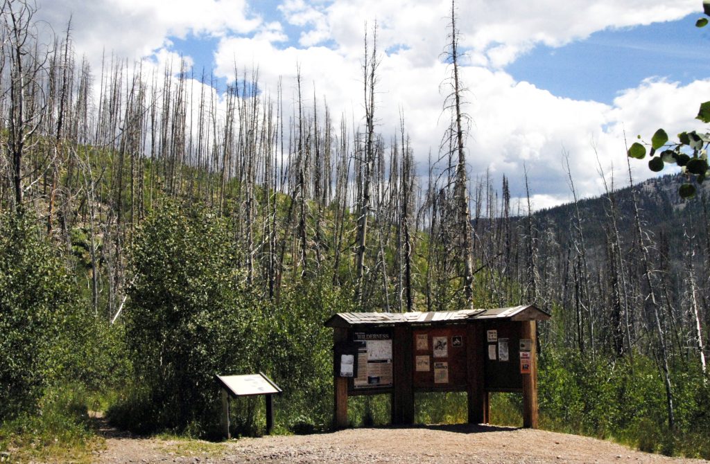
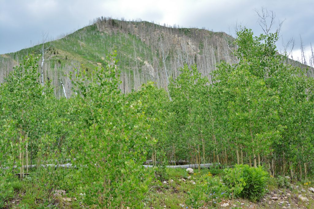
This is the TRAILHEAD. Very visible in the background are the evidences of a huge forest fire here years ago, with Forest Service displays giving us great information.
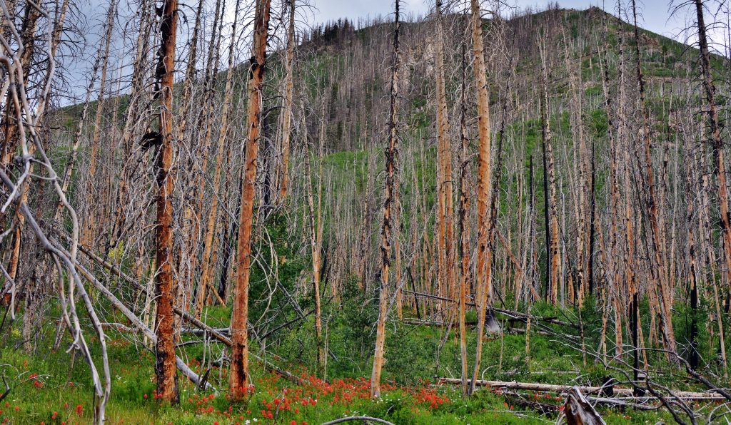
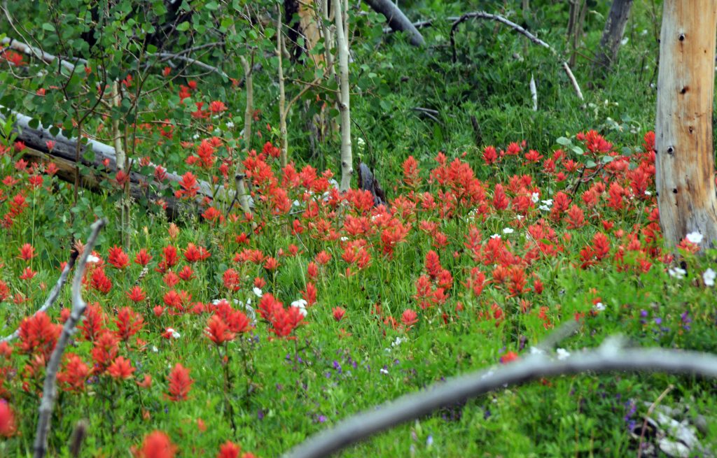
A forest fire–a terrible chaos of nature, soon has nature giving life to the survivors, like the Indian Paintbrush flowers, but you also see other vegetative heroes coming to the rescue.
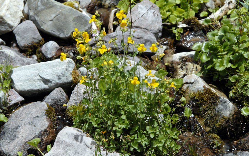
And, theseYellow Monkey Flowers, but you will mainly see a tree that comes back quickly first and saves the burned areas. It is theUTAH STATE TREE, the QUAKING ASPEN we see sprouting from it’s root system that survives the fire…..
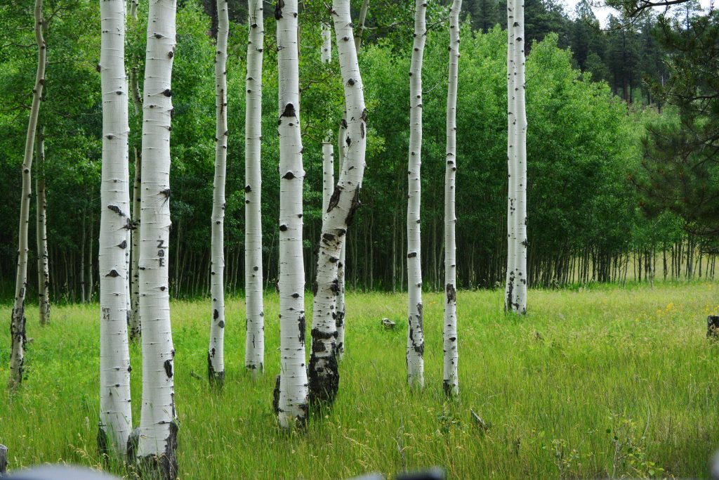
THE QUEEN OF UTAH’S TREES — THE QUAKING ASPEN
So, up sprouts from the ashes our UTAH QUEEN of trees, the QUAKING ASPEN.
And soon it becomes a whole forest of trees that protects from erosion, and provides for the much slower-to-sprout evergreens that over many years will reforest the mountains. In fact, in my BOOK I tell the story of one QUAKING ASPEN with the same root system–the same living organism–in the Fish Lake National Forest that is considered to be the largest living organism on the planet earth. For many years the Utah State Tree was the Colorado Spruce, but all of a sudden an Elementary School took the initiative to do what was logical and right and have theQUAKING ASPEN become our State tree, a very worthy QUEEN! I relate the details of that story also of course in my BOOK–YOU’LL SEE THAT MY BOOK IS NOT JUST A GUIDE BOOK FOR FISHERMEN & BACKPACKERS, but each section is prefaced with HIGH UINTA MOUNTAIN: HISTORY, LEGENDS, & SURVIVAL STORIES>>>>
>>>>THAT HAVE SAVED LIVES!
Here we see the more recognizable beautiful Aspen tree with it’s strikingly beautiful white trunk.
….and here a few showing how majestic they become.
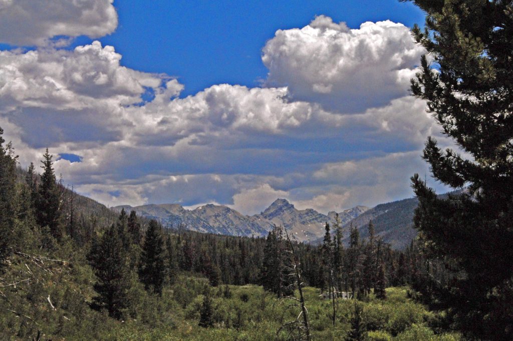
We are now past the burned area and see in the distance rugged MOUNT BEULAH which we’ll be going by shortly.
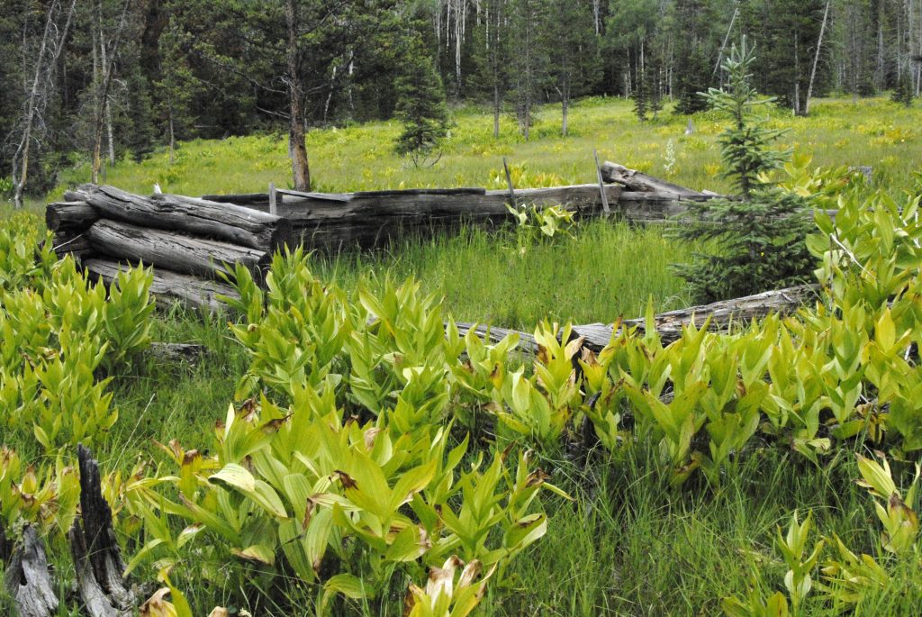
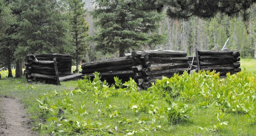
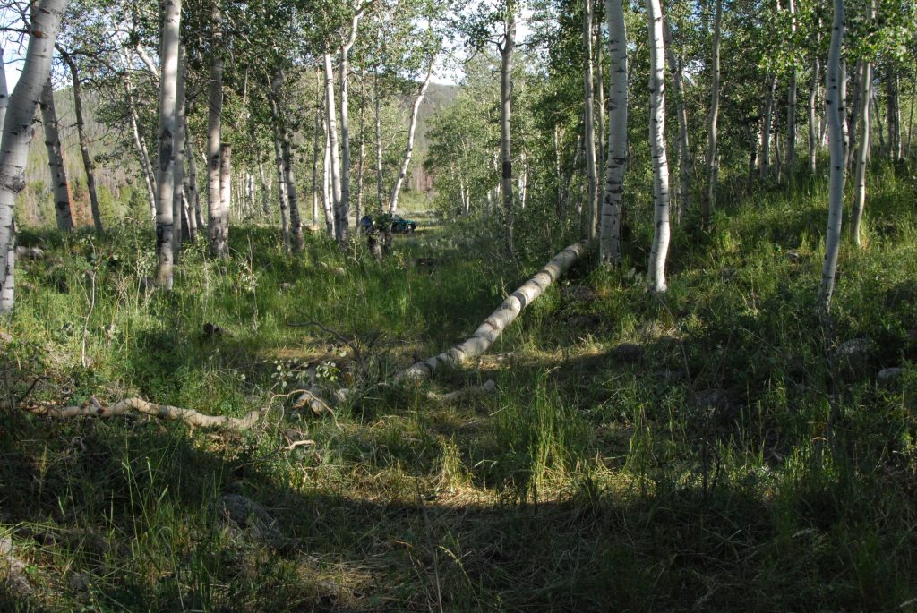
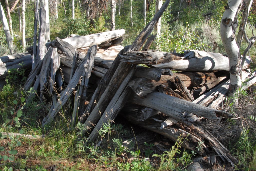
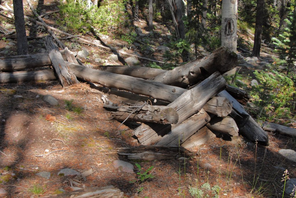
Along the trail we see a lot of ruins of the Tie Hackers,including evidences of outhouses, garbage dumps, and in the cabins higher doors, plus windows–all evidences that they are from
the 1912-1935 Tie Hacker period.
If you look for nails, you will find only round ones that weren’t invented until 1910. No square nails like we found in Main Fork in our last report on theearly period of Tie Hackers–1867-1880.
In the area of these ruins is where you can ford the river, and bushwhack your way off-trail up to Lake Lorena–which is not in the Wilderness area, but is a “wilderness lake.” All the info is in my BOOK.
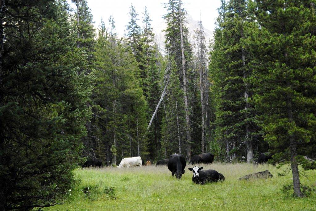
As I moved up the canyon I passed a herd of free range cattle, and a little later I lie down to rest a bit to be awakened all of a sudden by a CHAROLAIS BULL.
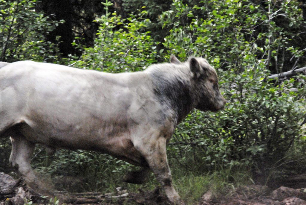
The bull wanted to move his cows up the canyon, and I was blocking his way, and HE HAD FIRE COMING FROM HIS EYES, SNOT DRIPPING FROM HIS NOSTRILS, AND SMOKE BELLOWING OUT OF HIS EARS WHILE PAWING THE GROUND READY TO CHARGE.…so I had to fire a warning shot and he swung away from me as you see here.
This was one of the two places and times when I had to use my .45 Colt Defender to scare off a possible attacker. The other time was with a mama moose when I carelessly got between her and her young one.
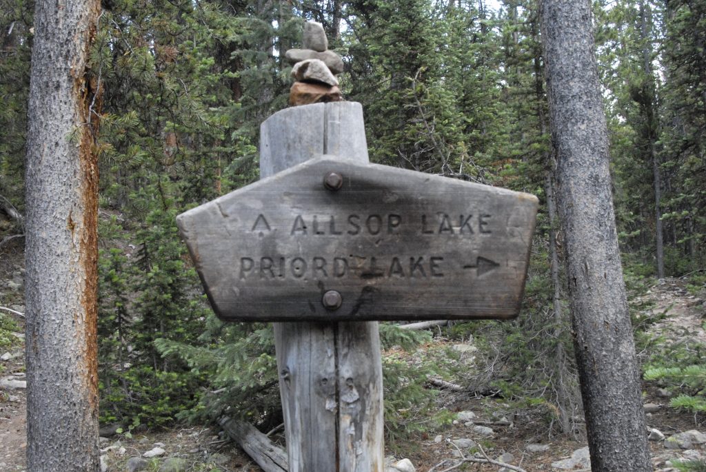
Soon we come to a fork in the trail — the right hand fork crosses the river and goes up a long canyon to Priord Lake that we saw from a saddle from the Rock Creek Drainage to the west—seen again below:
Here I am viewing Priord Lake from the saddle climbing up from the Rock Creek Drainage. Also in this above timberline basin is Norice Lake. Another lake is accessed from down the trail where you can bushwhack your way to this lake–Lake BR-44. Once again, info in my BOOK along with topographical maps.
From that trail junction you soon begin to climb quickly, with the river cascading down the canyon.
Then you come to the high country. The saddle from which the Allsop Lake picture was taken is seen in the far left upper center. It was at the foot of that saddle where the remains or Eric Robinson were found, 5 years after he went missing.
As we move up the basin we view the beautiful ELEPHANT HEAD FLOWER, and get a great view of a special mountain called THE CATHEDRAL.
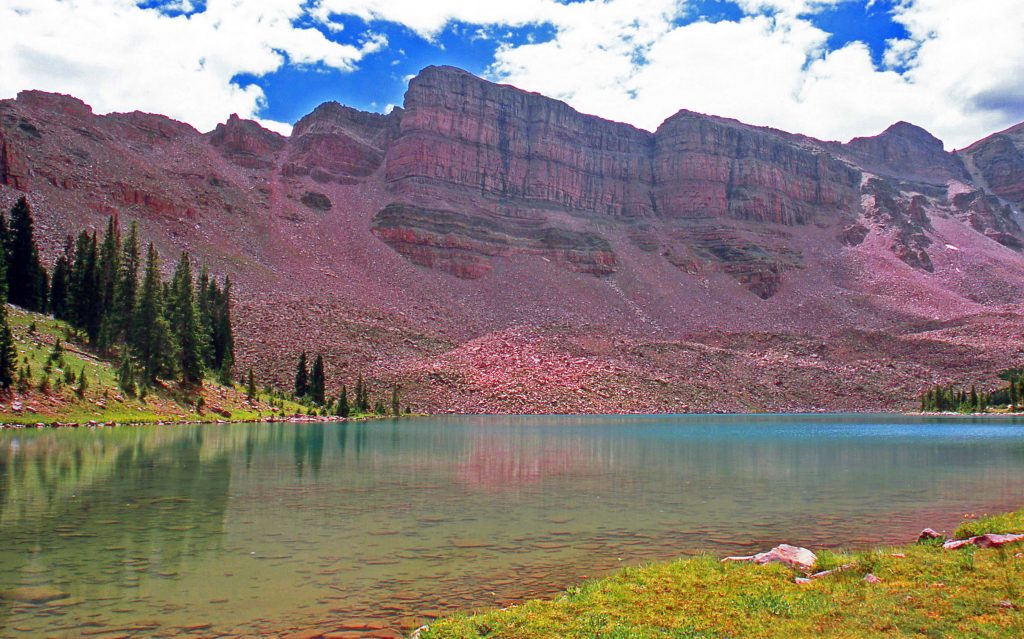
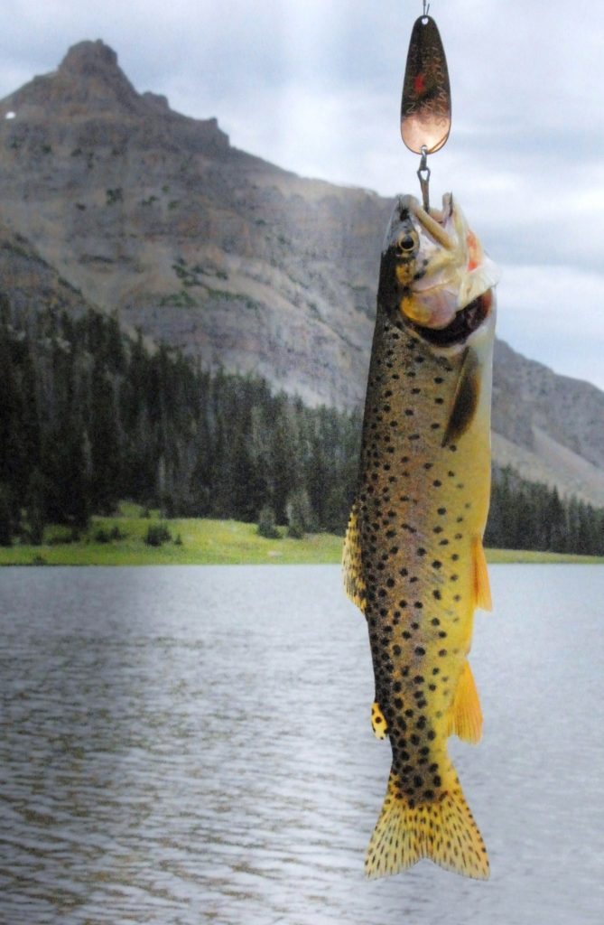
And, soon we come to ALLSOP LAKE that has Native Cutthroat Trout.
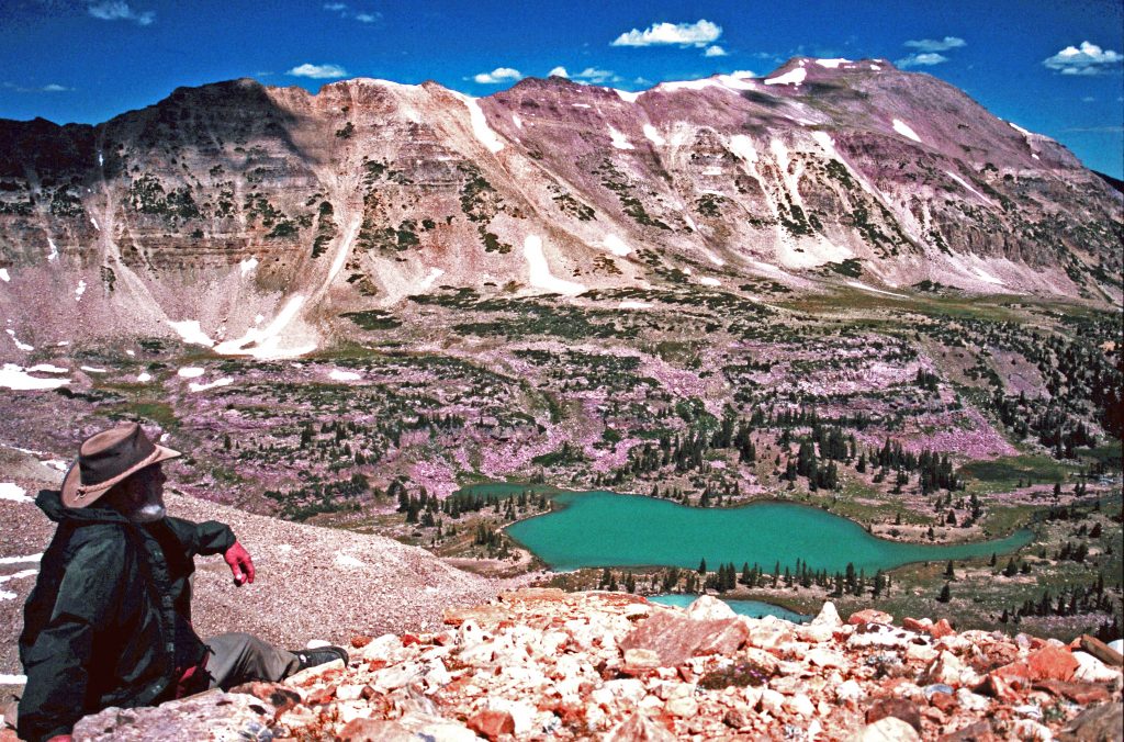
ALLSOP LAKE as seen from the saddle above Reconnaissance Lake and the Rock Creek Drainage.Canyons like this one were gauged out by glaciers many years ago.Note: A friend provided me with this photo. I’ll have to confess as an old guy my memory has failed me temporarily not remembering his name. Please forgive me.
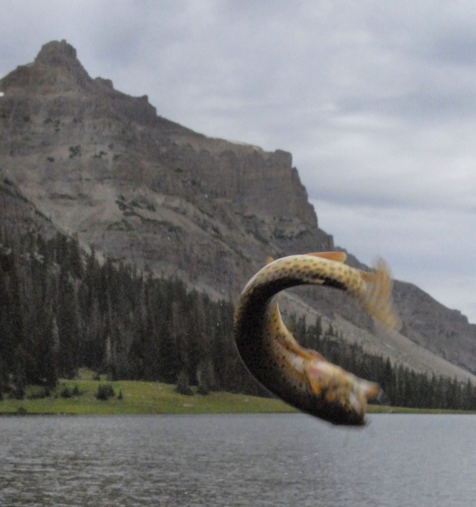
One of Allsop Lake’s feisty Native Cutthroat trout excited to see me come after him.
I got him, and then released him to grow a bit more. The strain of cutthroat trout is a bit different here, with the golden yellow color.
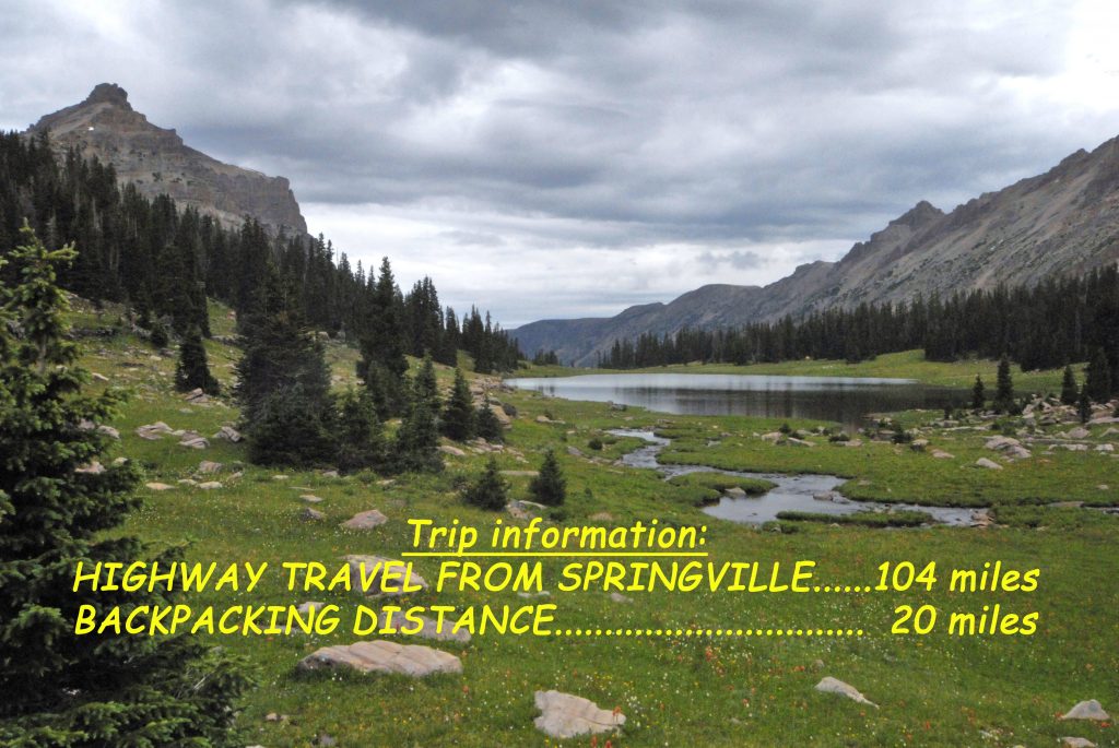
Here’s the trip information at the time when I lived in Springville up to May 2013. The backpacking distance is round trip.
FOR FULL INFORMATION ON THIS & OTHER AREAS, AS WELL AS TOPOGRAPHICAL MAPS WITH ROUTES, DISTANCES & LABELS — get an online copy of this book, some have called THE ENCYCLOPEDIA OF THE UINTAS, send me $20 (don’t be afraid of sending a $20 bill as we aren’t south of the border) along with your email address, and I will immediately email you the link to download the book with my permission to share once with a friend. Or, send $25 for a thumb drive that will have the book, plus The History of it’s creation as detailed in a speech I gave at the Utah Valley Historical Society; plus my CHECKERED HISTORY & VISION QUEST–0-22 years. Send to: Cordell Andersen, 444 Elm St., American Fork, Utah 84003
UP GROVE CANYON AGAIN–THIS TIME GOING FARTHER THAN I EVER THOUGHT I WAS CAPABLE OF…..THANKS BE TO THE LORD!
OREGON GRAPE one of the first plants brightening our hills and mountains.
THIS ONE WAS TOO BIG TO TAKE HOME & PROCESS–IT WAS THE WHOLE MOUNTAIN SIDE!
LOOKS PRETTY BARREN STILL, BUT ZOOMING IN WE SEE SIGNS OF LIFE!
FOR ME UNENDING MARVELOUS…..
“VISIONS OF NATURE”
WE’LL TAKE A PICTURE OF THIS ONE EACH WEEK TO SEE HOW IT DEVELOPS.
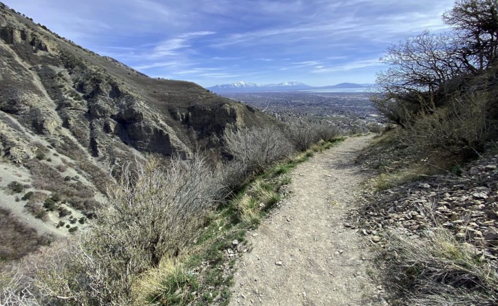
LAST WEEK I GOT TO THE FACE OF THE MOUNTAIN WHERE YOU SEE WAY BELOW US A WINDING TRAIL RIGHT CENTER…..AND FELT GREAT SO KEPT CREEPING UP THE MOUNTAIN!
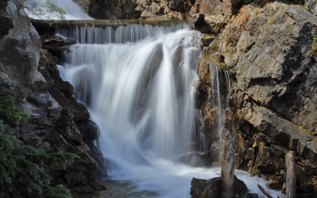
I GOT TO WHERE YOU CAN SEE THE TRAIL GOING UP TO THE V SHAPE IN THE CANYON WHERE THERE ARE WATERFALLS, THEN A BENCH WITH A PLAQUE ABOUT SOMEONE WHO LOST THEIR LIFE UP HERE YEARS AGO, THEN A BRIDGE, & INTO THE ASPENS…..I’LL GET TO THEM SOON! A YEAR AGO WHEN I COULDN’T WALK, I WOULD HAVE NEVER BELIEVED I’D BE BLESSED WITH DOING SO MUCH–EVEN THOUGH ADMITTING IT IS ISN’T EASY!
WE NOW CONTINUE OUR TOUR OF THE HIGH UINTA WILDERNESS, following the descriptions in the book pages 175-176.
GET THE ONLINE BOOK SO YOU’LL HAVE MUCH MORE DETAIL, INCLUDING TOPOGRAPHICAL MAPS.
To get an online copy of this book, some have called THE ENCYCLOPEDIA OF THE UINTAS, send me $20 (don’t be afraid of sending a $20 bill as we aren’t south of the border) along with your email address, and I will immediately email you the link to download the book with my permission to share once with a friend. Or, send $25 for a thumb drive that will have the book, plus The History of it’s creation as detailed in a speech I gave at the Utah Valley Historical Society; plus my CHECKERED HISTORY & VISION QUEST–0-22 years. Send to: Cordell Andersen, 444 Elm St., American Fork, Utah 84003
pages 175-176 of the HIGH UINTA BOOKTHERE ARE NO SIGNS AT THIS TRAILHEAD, AS IT IS ONE OF MY “unofficial” ONES. TO HELP ORIENTE YOU I’LL INSERT BELOW A GOOGLE EARTH VIEW OF THE ROAD YOU TAKE TO THE RIGHT, GOING DOWN TO A CIRCLE WHERE YOU SEE A CAR.
WE SEE MY CAR PARKED DOWN WHAT I CALL “THE HILLIARD FLUME PATHWAY” CONSTRUCTED IN 1870 BY THE “TIE HACKERS.”
Along with getting you the 5 miles to the HELL’S HOLE BASIN & ITS LAKE, I will introduce you to the “UNSUNG HEROES WITHOUT WHOM THE WEST WOULDN’T HAVE BEEN WON–THE TIE HACKERS.”
In the 1860’s the Transcontinental Railroad was being built crossing the U.S. and in 1867 millions of railroad ties were needed to get it across Wyoming and Utah. Irish immigrant lumbermen were hired to work 12 months a year in the North Slope of the Uinta Mountains with their broad axes to make railroad ties. They became known as “THE TIE HACKERS!” Without their railroad ties there wouldn’t have been a Transcontinental Railroad–yet in the history books about the construction of the railroad, tie hackers are never mentioned, nor given any credit.
MY BOOK HELPS REMEDY THAT HISTORICAL ERROR, AS I DISCUSS THEM, THEIR HEROIC EXPLOITS, COURAGE WORKING RIGHT THROUGH THE WINTERS, THEIR GHOST TOWNS–one of them called, “The liveliest, if not the wickedest town in America,” another site named “SUICIDE PARK,” AND HOW THEY GOT THEIR TIES NORTH INTO WYOMING. One way was described in a Forest Service display on the Whitney Road a mile or so north from the Hells Hole Trailhead, taking off up to the west. Said display has weathered away and is today illegible, but I got the following picture back in the early days of my UINTA PROJECT.
The Hilliard Flume takes off from Gold Hill, to the west of the Mirror Lake Scenic Byway, accessed up the Whitney Road. The history books say no remnants remain of the flume, as by 1880 it fell into disuse, the materials cannibalized by ranchers and others, or rotted away–EXCEPT FOR WHAT I HAVE PHOTOGRAPHED–ALONG WITH MUCH OF THE HISTORY IN MY BOOK, in YouTube VIDEOS ACCESSED FROM MY WEBSITE & IN THIS WEBSITE REPORT.
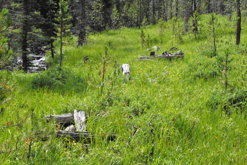
To get to Hell’s Hole Basin, from the edge of the parking circle in the Google Earth view, a trail crosses Hayden Fork, and goes east between two hills towards Main Fork of the Bear River. Main Fork was crucial for the Hilliard Flume as water was needed for the flume, so the HOWE FEEDER FLUME was constructed taking water out of Main Fork, said flume coming between the two hills, then downstream it added its water to the Hilliard Flume. As you do the short hike to Main Fork, keep an eye out to your left and you should see what I picture below–unless it is all rotted away since it was way back in the 1870’s, with most of it today gone–EXCEPT IN MY PHOTOS WHICH ARE THE ONLY ONES PUBLISHED OF THIS GREAT EFFORT.
AS YOU GET CLOSER TO THE ROAD THAT PARALLELS MAIN FORK, KEEP LOOKING TO YOUR LEFT and YOU SHOULD SEE A CUT IN A SIDE HILL THAT WAS THE PATH OF THE FLUME.
HERE WE ARE SEEING THE PATHWAY OF THE FLUME FROM UP ON THE HILL WITH THE TRAIL IN THE DISTANCE–UPPER LEFT CORNER.
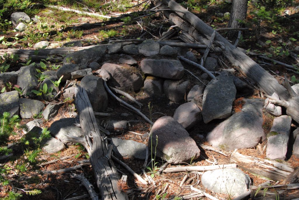
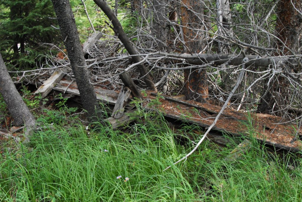
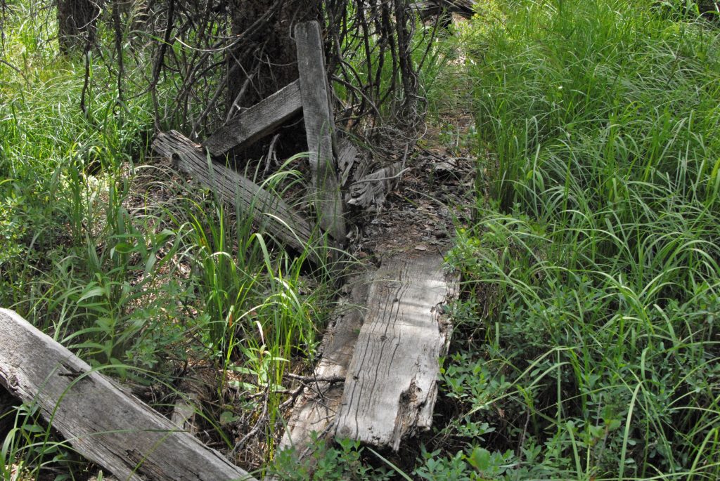
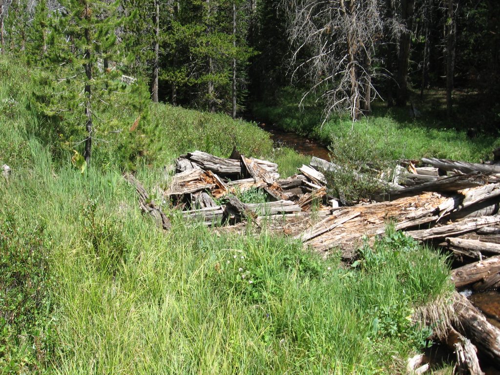
THEN YOU COME TO A ROAD–A CLOSED ROAD–AND CONTINUE SOUTH, and AS YOU GO LOOK TO THE AREA BETWEEN THE ROAD AND THE STREAM AND YOU’LL NOTICE A LEVEL AREA PARALELLING THE STREAM--IT WAS ALONG THIS LEVEL THAT I BEGAN DISCOVERING RUINS OF CABINS, SUPPORTS FOR THE FLUME & PLANKS.
RUINS OF CABINS, STUMPS, ETC. FROM THAT PERIOD, OVER 150 YEARS AGO, ARE MOSTLY ROTTED AWAY and even more so now than when I took these pictures more than 10 years ago.
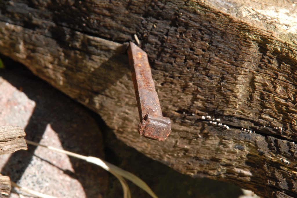
CABINS FROM THAT PERIOD (1867-1880) CAN BE IDENTIFIED BY: MOSTLY ROTTED AWAY, SMALL SIZE, NO WINDOWS, & ROCKS FROM CHIMNEYS AS THEY DIDN’T USE CAST IRON STOVES. OF GREAT IMPORTANCE IN IDENTIFYING RUINS FROM THAT PERIOD ARE THE NAILS–SQUARE NAILS as you see below. Round nails were not invented until 1910.
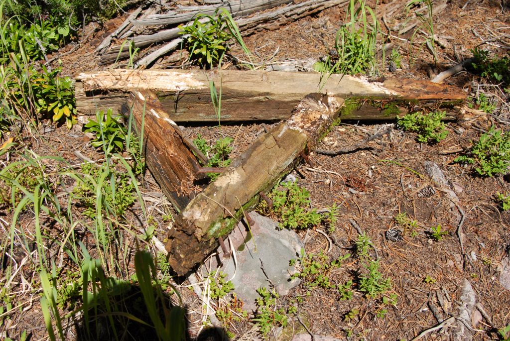
GRADUALLY I BEGAN FINDING REMNANTS OF THE FLUME, FIRST WITH BRACES OR SUPPORT STRUCTURES, ALWAYS WITH SQUARE NAILS–80 tons of them were used in the construction of these two flumes.
AND I FOUND PLANKS FROM THE FLUME, MOSTLY ROTTED AWAY–and MAYBE TODAY GONE. THERE ARE FOREST SERVICE REPORTS ABOUT THESE FLUMES BUT NO AVAILABLE PHOTOGRAPHS I KNOW OF , EXCEPT MINE.
EVENTUALLY THE PATHWAY OF THE FLUME GOES UP THROUGH MEADOW AREAS WITH A CHAIN OF SUPPORT STRUCTURES.
HERE ARE REMNANTS OF THE DIVERSION DAM WHERE THEY TOOK WATER OUT FOR THE FLUME.This picture and the next are courtesy of my friend Albert Richens.
To get to HELL’S HOLE BASIN, continue up the road until it takes a sharp turn ending in a gravel pit. The trail takes off from there and climbs up to Hell’s Hole Lake that has native cutthroat trout waiting for you.
Here we meet famous pioneer artist and photographer, GEORGE BEARD and his wife LOVENIA. You dedicated High Uinta lovers might recognize her name, as George gave it to the first 13,000+ mountain you come to on the Highline Trail as you go east past the Deadhorse Lake area and come to the Lake Fork Drainage. See it below.
Majestic 13,219 ft. high MOUNT LOVENIA with in the foreground what I have named East Fork Pass, 12,150 ft.one of the highest in the Uinta Mountains. It is at the head of the East Fork of Blacks Fork of the Green River from where you can see the most impressive view of the spine of the High Uinta Mountains I’ll show you below:
There is more information about GEORGE BEARD in my book, but best add here that he is famous for naming, and having named, important Uinta lakes: First, in 1906 a government surveyor asked him which was the largest lake in the Uintas? He pointed to one on the map, and said, “This is the grandaddy of them all!” That name stuck as GRANDADDY LAKE and consequently THE GRANDADDY BASIN with it’s 26 fishable lakes. Way east in the Uinta River Drainage, near Trail Rider Pass is found BEARD LAKE, where I caught an eastern brook trout that would have been a Utah State record if I could have got it out to civilization to be weighed and measured. Then following the trail from said pass towards Lake Atwood, you come to above timberline GEORGE BEARD LAKE where on my 27 day expedition I had the fastest fishing, at the head of an alpine basin I have named GEORGE BEARD BASIN.More details and maps showing all these locations in my BOOK.
GEORGE BEARD’S connection to HELL’S HOLE BASIN is mostly because in a visit he made here he wrote:
“HERE I SAW THE LARGEST GRIZZLY I HAVE EVER SEEN!”
REMEMBER, YOU MIGHT FIND INTERESTING THE BOOK ABOUT MY HALF CENTURY