Previous Post
You should all be aware of special Facebook Page:
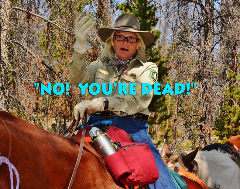
UPDATES ARE BEING MADE DAILY AS MY “FRIENDS” SEND ME PHOTOS & DETAILS–which I’m posting, like from:
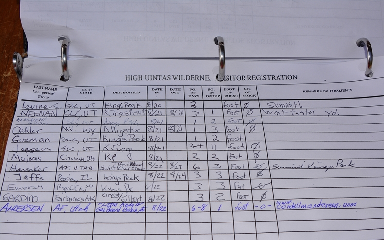
Cesar de la Cruz Santos, Paula & Wade, Elisabeth Johanson & crew, John Sowell, Nathan Gibbons, Christina Ogrin, Kevin Parks, Jake Hirschi & kids, Grace & Isaac, Brant & Jennell Humphrey, & Linda Turner….and I expect more soon
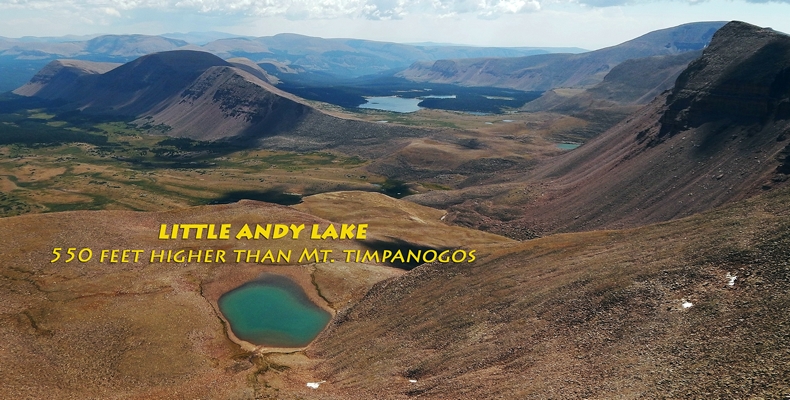
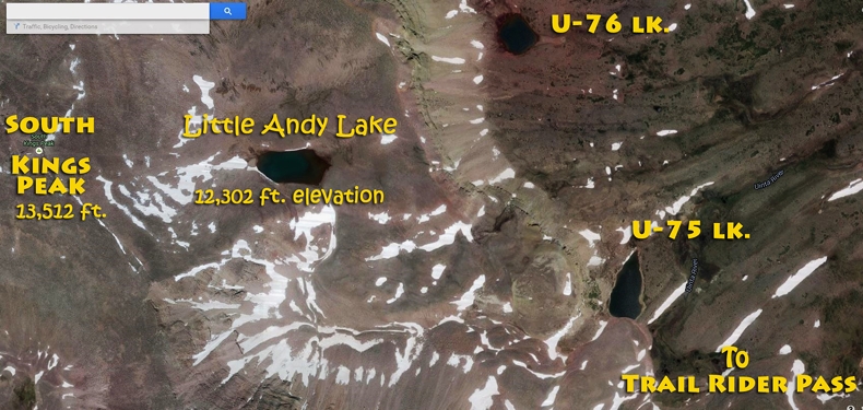
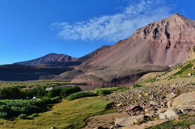
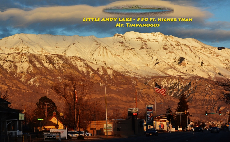
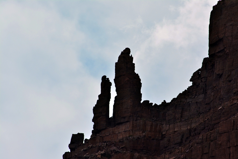
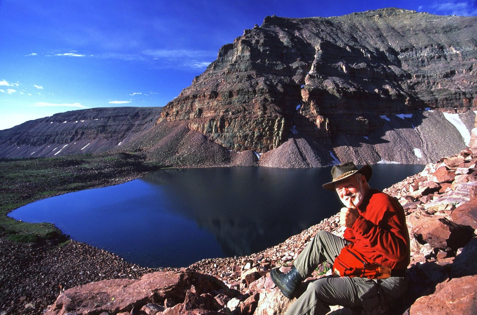
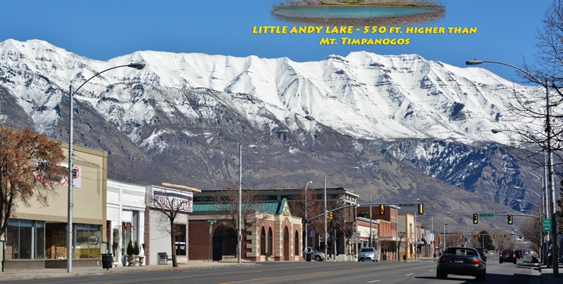
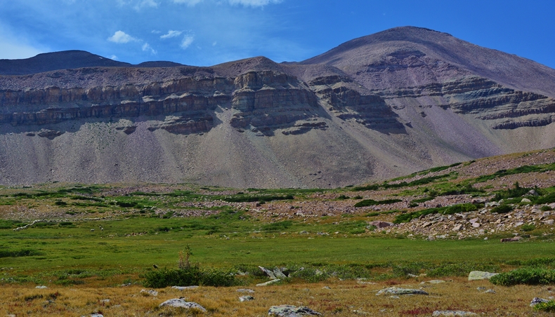
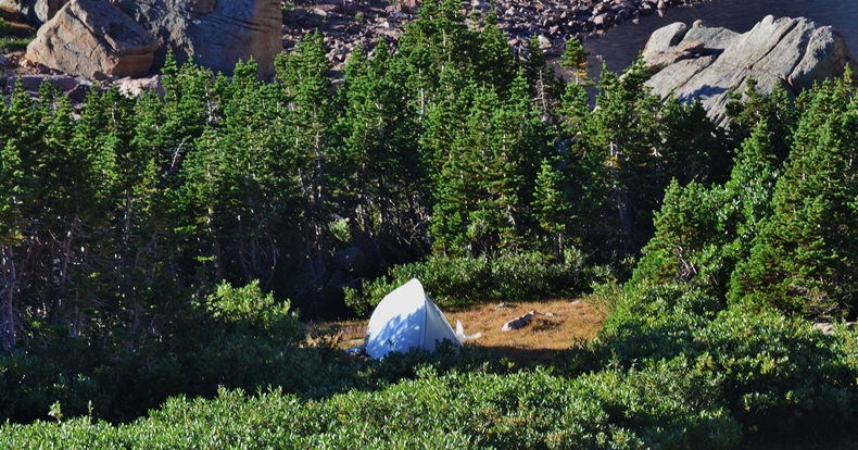
LITTLE ANDY LAKE
“The highest lake in Utah”
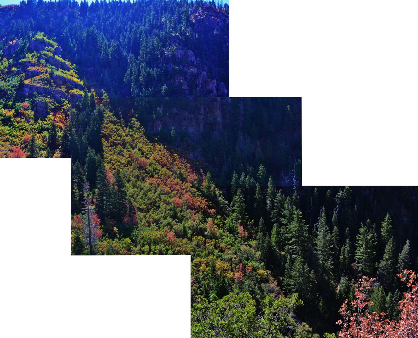
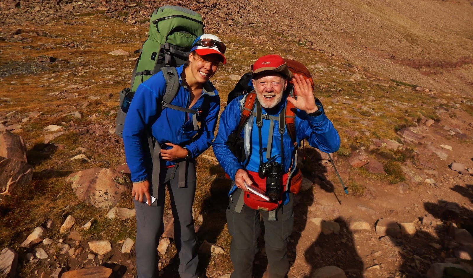
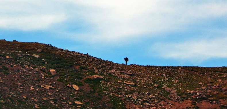
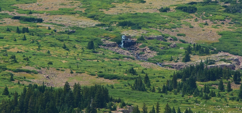
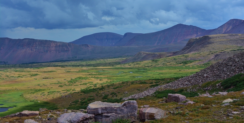
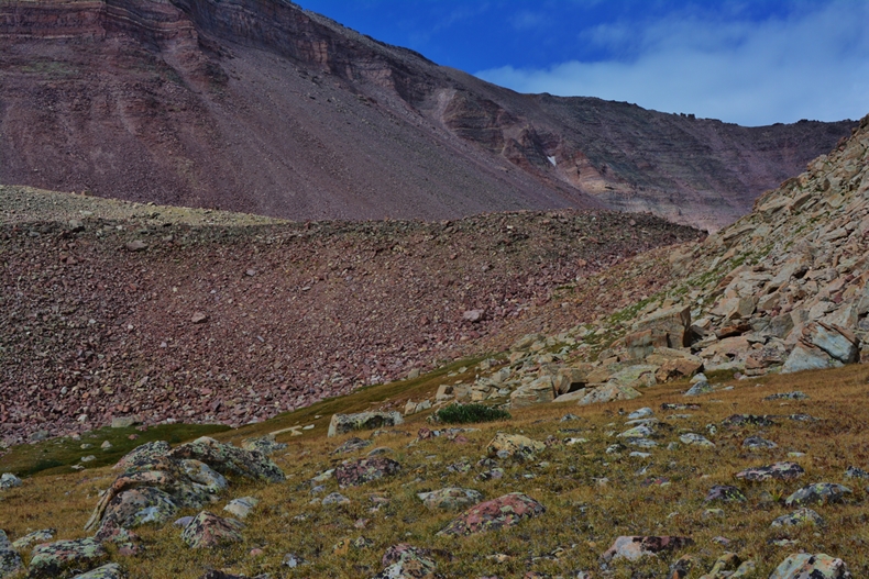
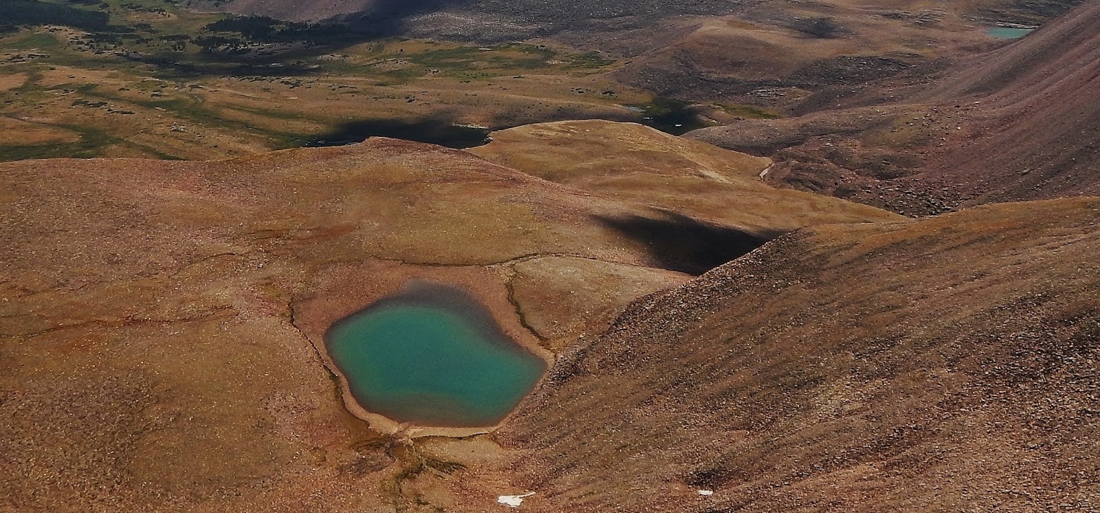
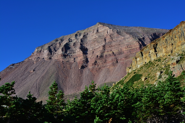
Note: It looks sort of low down & humble in this picture from 13,512 ft. South Kings Peak taken by my friend Elisabeth Johanson, but…..
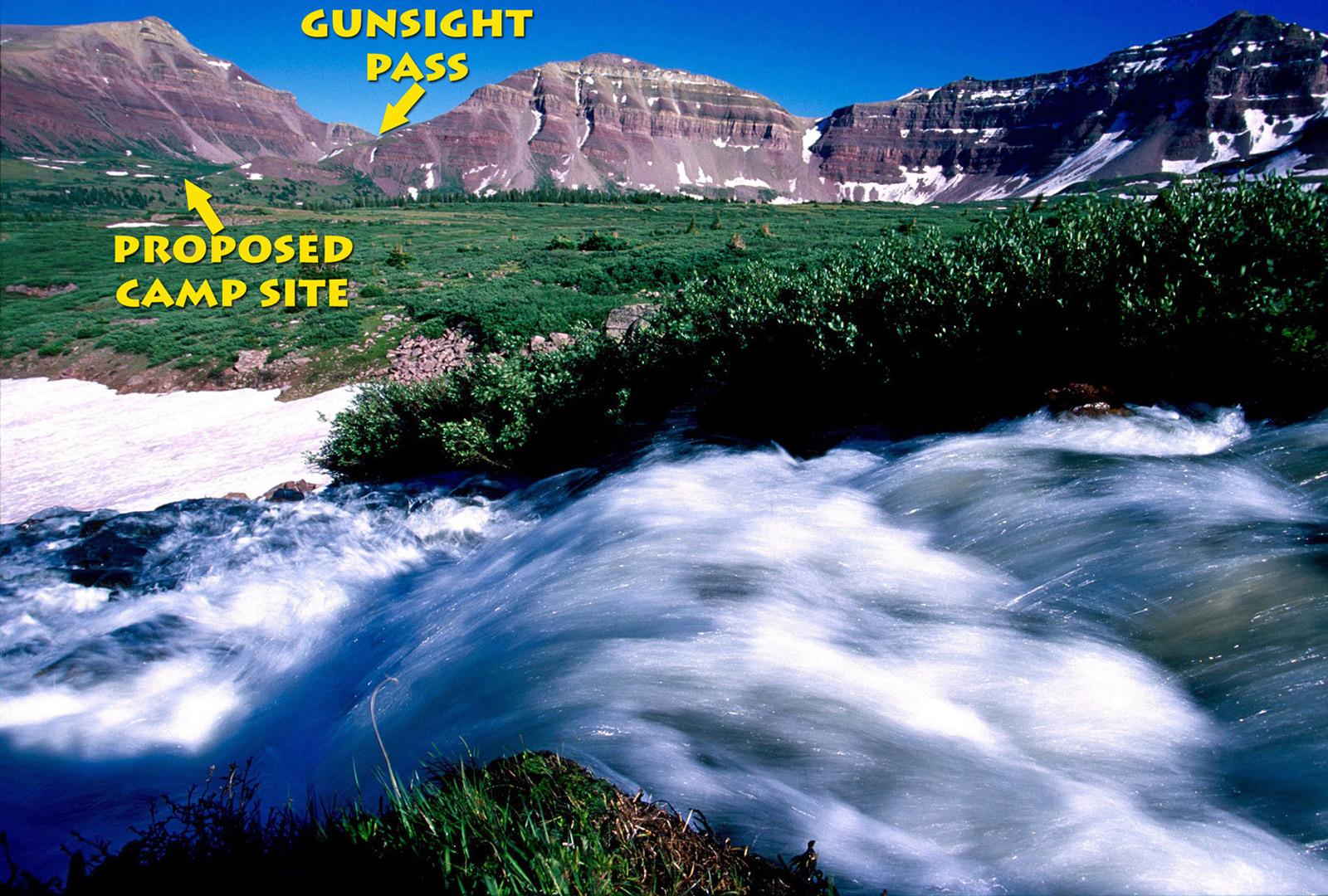
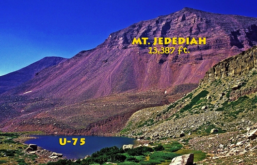
PERSPECTIVE: Little Andy Lake is 550 ft. higher than Mt. Timpanogos that looms over Utah Valley, 409 ft. higher than Gunsight Pass we will see in the report–which pass is also 141 feet higher than Timp. Mt. Jedediah that looms over it in the extreme right, 13,387 ft. high, is 1,085 ft. above LAL, & 1,635 ft. higher than Timp.
“Little Andy’s Olympics”
Maybe I should say “ParaOlympics”
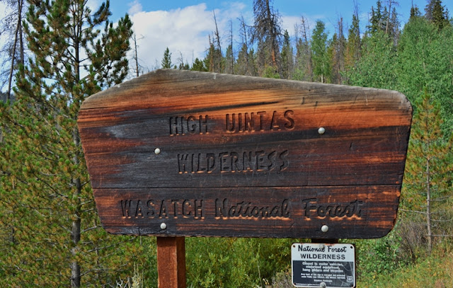
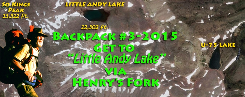
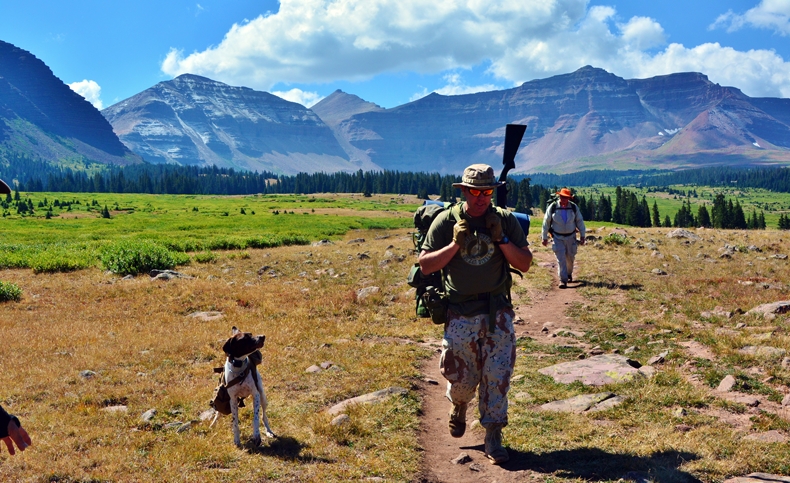
Backpack #3-2016 Aug. 22-27 On the HIGH UINTAS North Slope
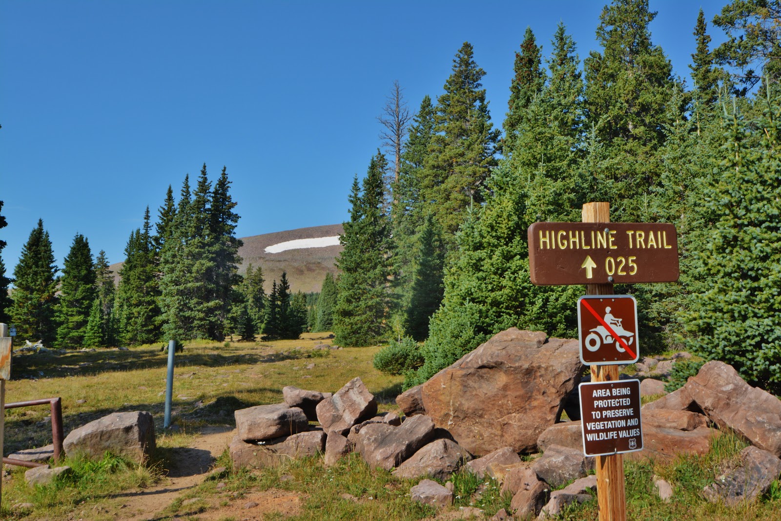
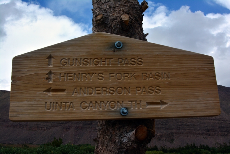
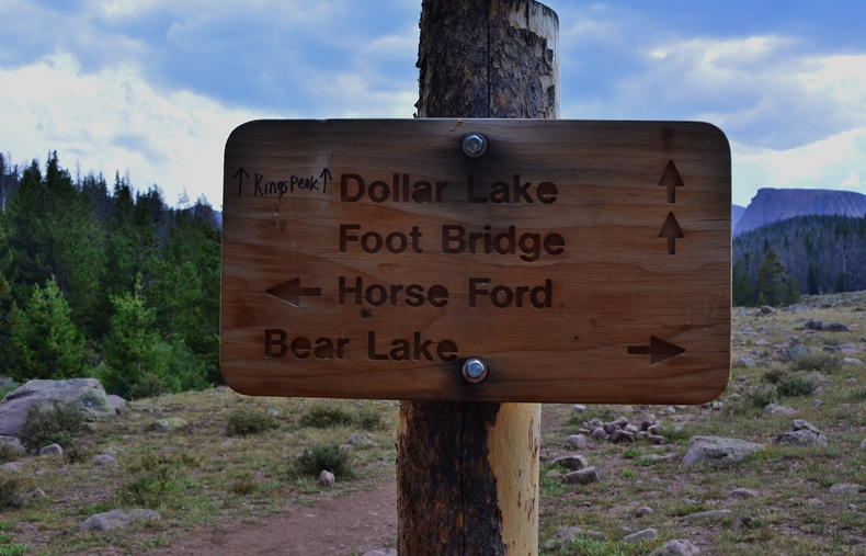
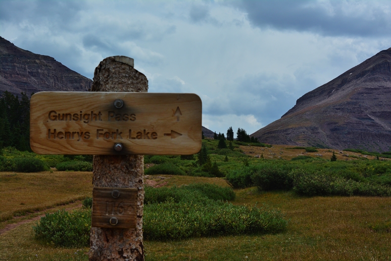
HENRY’S FORK TRAILHEAD (9,426 elevation) >Gunsight Pass (11,893 ft.)>
Highline Trail>U-75 lake (11,402 ft)>“Little Andy Lake”–The Uintas highest lake at 12,302 ft.>back to U-75 lake>Back to Gunsight Pass>to Henry’s Fk Basin> Timberline camp before Dollar Lake> Return to Henry’s Fk Trailhead> .
Note: Camp #1 to Camp #5 all above 11,000 ft. timberlineTOTAL MILES = 36 miles in 6 days
*****************************
The “Culminating Chapter” HOW AN 80 YEAR OLD OVERCAME “GLITCHES” LIKE:
“3rd worst backpacker among the 3 originals,” Cancer, Heart attack, Worn out “Football ankle,” Deteriorated “Motorcycle Knee,” Nasal obstruction–breathing problem, “Cripple” with worn out ankle, knee, hip & pinched nerve, “Metatarsalgia” in feet, “Peripharal Neuropathy” in feet, High Altitude Sickenss, & some said “being quixotic Crazy!”
********************************
SPOT Satellite Tracker link: SPOT
Note: My 1st SPOT track at the Trailhead starting point didn’t work, so the 1st SPOT track is where I got to the 1st day
*************************************
THE PHOTO/ESSAY WITH BACKGROUND HISTORY OF THE EFFORT TO GET TO
“LITTLE ANDY LAKE”
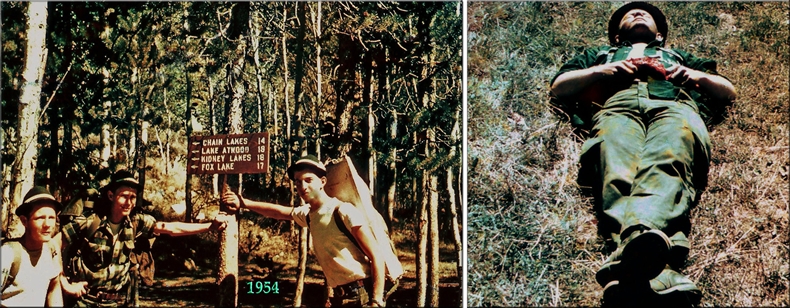
The actual HIGH UINTAS WILDERNESS PROJECT began in 2003, but really got its start in 1952 when my family moved from California to Provo, Utah, and soon afterwards Ted Packard and Charlie Peterson invited me to “The Grandaddies” beginning my 64 year relationship with the HIGH UINTAS. Below, to the left are the three of us in September 1954 after a two week backpack traversing what then was THE HIGH UINTAS PRIMATIVE AREA.
Ted & Charlie were always better backpackers than me, in spite of me considering myself an athlete even being Provo High School’s All-State Football Candidate in my senior year–when I was nick-named
“Little Andy”..
…but, in the Uintas I more often than not found myself in the prone position as seen on the right above…..and it isn’t a stretch to imagine me doing that much more now in my 81st year (I’m 80, but in “my 81st year”). Nevertheless, I fell in love with the Uintas and swore then that
“Sooner or later I will explore, photograph and report on the entire area,”
“The area” doubled in size when in 1984 it was designated the
HIGH UINTAS WILDERNESS AREA
From 1967 to 2002 I dedicated my life in Guatemala among the Mayans in a gigantic personal/family effort to save and help as many as possible (http://www.guatemalanfoundation.org/)….and it involved a lot of hard work with my plantation, dairy, and then coffee farm….. that kept me in pretty good shape, in addition to the dangers from guerrillas and criminals that forced me to be strong–always ready and able to either fight or flee. In the closing years I anticipated returning to Utah and making good on my vow with the Uintas, and so increased my work-outs, hiking 4 miles around my farm 2-3 times a week with a hundred pound bag of fertilizer on my back!
So, in 2002 I returned to the U.S. and in 2003 began what I called…..
THE HIGH UINTAS WILDERNESS PROJECT
….beginning with a 27 day, 236 mile–no re-supply–backpack across the Wilderness begining with 83 lbs. on my back and around my waist, then continued now for 14 years with around 1,900 miles of exploration….so far. Most of those years I became associated with Russ Smith/SKYCALL SATELLITE COMMUNICATIONS, and Tim Hughes at KSL OUTDOORS radio giving satellite phone reports from the Uintas.
Then, a couple of years ago, Tim & Russ suggested that a lake in the Uintas be given my name. The search was on for a no-name, no-number lake nobody would care about, and I found one under the eastern shadow of South Kings Peak, and named it
“LITTLE ANDY LAKE”
As it worked out, the small lake turned out to be what I’m told is
“the highest lake in the Uintas & in Utah!”
By that time in 2014, being 78 years old, backpacking was becoming a bit more difficult and I even mentioned on my website that getting to it would perhaps have to be done by some “young bucks” who would have to do me the favor……but, then…
…I experienced a renewal with better health & physical stamina and decided I had to do it myself!
So, during the 2015 backpacking season, I made my first attempt with the plan of going from the Uinta River Trailhead and ascending the Atwood Trail up to Trail Rider Pass and U-75 lake, but at the trailhead found a Forest Service notice that the trail was closed by a “FLY OVER” by helicopters working on the dam at Lake Atwood…..
…..so the first effort FAILED, due to the Forest Service.
A couple of weeks later I was back at the Uinta River Trailhead and ascending the Atwood Trail.
A PROBLEM: As I have got older, and, when adding to that weakness, due to sickness or excessive fatigue, I began experiencing HIGH ALTITUDE SICKNESS, and such was the case in this attempt up the Attwood Trail when getting near timberline, with tough Robert’s Pass ahead of me & then further along, Trail Rider Pass. My blood pressure was up, and I noticed all of a sudden an irregular heart beat–that I used to have, but which I thought had been overcome. So, not feeling well, and with worrisome vitals, indicating High Altitude Sickness, I decided it was wise for me to to retreat down the trail. So my 2nd attempt to get to “Little Andy Lake” failed….this time MY FAULT!
FINDING A WAY……..
Of course I wasn’t about to give up and came up with a plan that might work. The other approach to the Kings Peak/Little Andy Lake area, was the Henry’s Fork Basin on the North Slope. The Trailhead beginning point was 1,000 feet higher than the Uinta River Trailhead, and there was a gradual climb, giving time for acclimitazion as I scaled just one pass, Gunsight Pass.
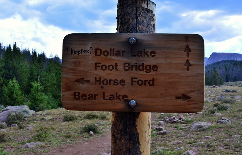
So, on August 19th I was at the Henry’s Fork Trailhead to make my 3rd attempt getting to Little Andy Lake. I made it to Elkhorn Crossing and camped, hopefully giving my body time to acclimatize. I continued the next day going by the Dollar Lake area and continued to above timberline where I hoped to camp and wait until the next day to climb Gunsight Pass…….but………it was there that “the silent killer” attacked again.
So, wisdom had me descending…..which I did going back to Elkhorn Crossing, and the next day back to the Trailhead.
That backing off….again, proved fortunate as it had me meeting up with an old friend, Teresa…..who when she saw me, screamed:
She had seen on the internet the obituary of CORDELL M ANDERSEN, who died a few years ago in St. Louis!
But, I assured her she wasn’t seeing a ghost.
SO…..BACK TO THE STRATEGY BOARD…...
The “strategy” during the remainder of 2015 and winter/spring 2016 was basically to workout everyday and get much stronger. So, with pack on my back–full of rocks & containers full of water, I was on the streets of American Fork, Utah every day, along with other exercises, and achieved losing 26 lbs. to get down to my weight when I was 20 years old.
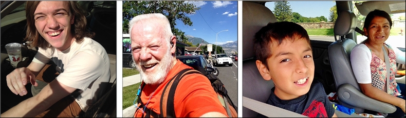
With the backpack, rather than the weighted vest, I had fun meeting a few good hearted people who stopped to offer me money and rides, like, Spencer, on the left, and Lincoln & his mom, Vilma, on the right. I’d tell them,
“Thanks, for being such good hearted people, but I’m not homeless, rather an eccentric millionaire out getting my exercise….and meeting my goal of:
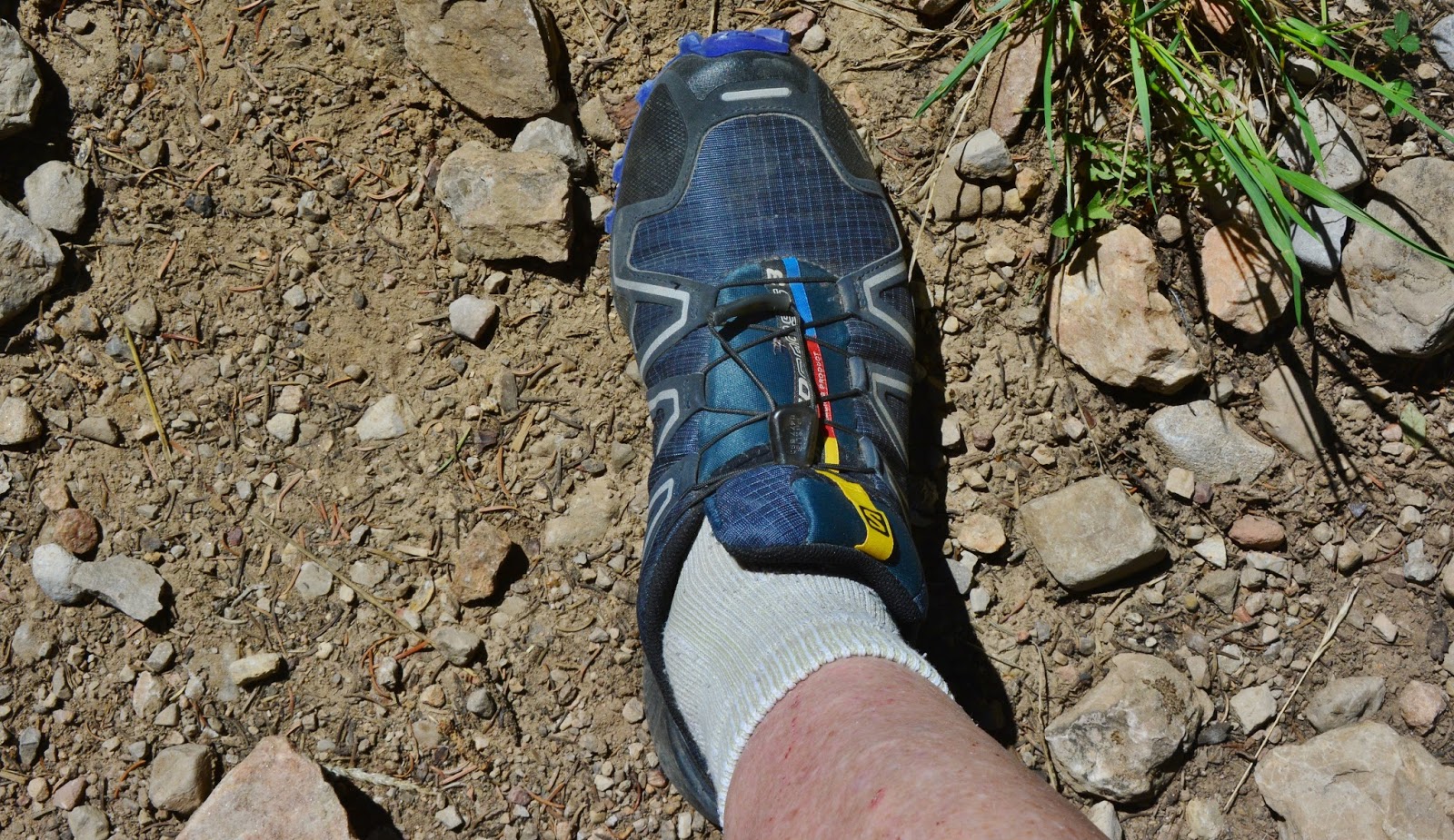
BEING 80+, LOOKING LIKE 60, BEHAVING LIKE 30, & WEIGHING LIKE WHEN 20!”*************************************WEIGHT?Let me comment on this critical item…I mentioned losing 26 lbs. of body fat. How important is it? I have calculated it for the half-marathons I used to run every year…and will again in May 2017 in Guatemala, in my 82nd year. I figure that I take more or less 26,000 steps during the 13 miles, and with having lost 26 lbs. each step lifts 26 lbs. less, for a total during the race of 676,000 pounds LESS!Add to all of that incredible amount of energy saved, I now use the lightest weight mountain running shoes pictured below…of the Saloman brand.
Each shoe, compared to the lightweight Salomon hiking books I used to wear, weighs 8 oz. less multiplied by 26,000 steps, comes to an additional 13,000 lbs. less weight lifted, for a grand total of 688,000 lbs. less weight lifted over the 13 miles. I averaged about 6 miles a day on this backpack, which comes out lifting 317,538 lbs. less every day–a total for the 6 days almost 2,000,000 lbs. less weight my body had to lift!
SIGNIFCANT? YOU’D BETTER BELIEVE IT!
Any additional weight that can be eliminated will just enhance the whole experience, making possible such efforts for an old guy like me.
Otherwise, I likely wouldn’t be able to do it!
WARM UP BACKPACKS
Two were done in June & July to help me be prepared, and then…..
…..I WAS READY FOR:
Backpack #3-2016 Aug. 22-27 On the HIGH UINTAS North Slope
>U-75 lk (11,402 ft) >The Uintas highest lake at 12,302 ft.>
********************************
GOING ALONE ON SUCH AN ADVENTURE? …..NEVER!
UNLESS YOU TAKE THE PRECAUTIONS LISTED BELOW:
SOME OF THE ESSENTIALS FOR ACHIEVING PURPOSE:
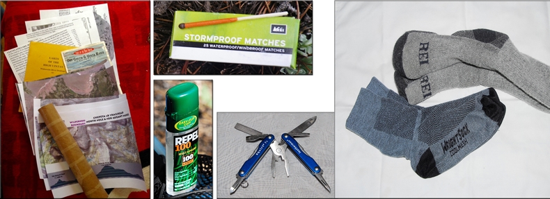
This obviously isn’t a complete list…..but let me say a word about two items…on the left and on the right:
On the left: Topographical maps, with elevation profiles, plus National Geographic High Uintas Wilderness Map, and prints of Google Earth.
On the right: Blister preventing socks next to your skin. I tire of hearing even experienced backpackers, mountaineers, marathoners, etc. talk about getting blisters. Since I started using “blister preventing socks” I have never had a blister–during the 14 year Uinta Project, and during 14 consecutive years running the International Half Marathon in Coban, Guatemala!
NOW THE CRITICAL ESSENTIALS
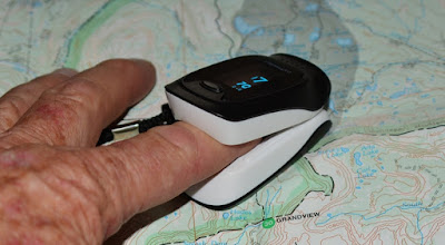
The SPOT PERSONAL SATELLITE TRACKER…..
…..or other similar devices to signal to family and friends each day one is OK, and a Google Earth view exactly where you are–and of course if the Emergency arrises, hit the 911 button to have Search & Rescue on the way. No one should go alone without such a device, and I believe each group should have one.
NOTE: Eric Robinson, 64 year old Australian adventurer went missing in the High Uintas 6 years ago, and during my backpack his remains were found. He had a personal satellite tracking device, but DIDN’T USE IT!
He was likely saving it for an emergency, but it apparently suprised him not giving him time to turn it on and press 911!
SATELLITE PHONE
Once again, I believe this is essential, especially if one goes alone, such as I have done on most of my backpacks over 14 years. I would also recommend that each group, like Boy Scouts, or Explorer Scouts, have one. I’m sure the parents would be happy to pay the rental cost.
Note: Once again, Eric Robinson, didn’t have a satellite phone to keep his loved ones aware of his whereabouts and changes in his schedule…..like somehow getting way off course from the Highline Trail onto the North Slope Alsoop Lake area where his remains were mysteriously found.
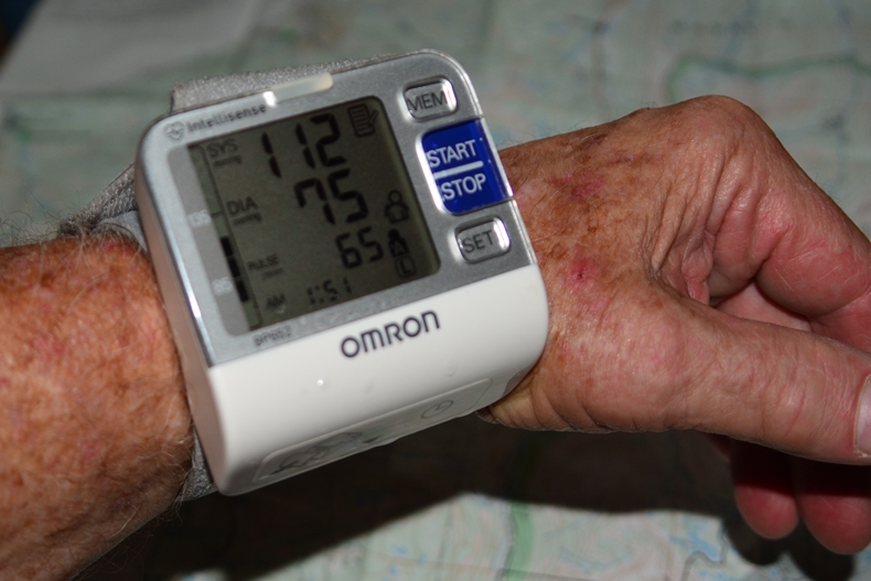
BLOOD PRESSURE GAUGE
Due to my history of heart and altitude problems I took with me my lightweight gauge, and used it often to monitor my vitals as I ascended to above timberline and beyond.
AN OXIMETER
It measures the oxygen content of your blood, along with pulse. My normal oxygen reading at home was 96. What would be dangerously low?
In 2006, when on a late season mid-September backpack to Crater Lake I ran into bad weather, was snowed on, and got sick–laying there for several days while the emergency anti-biotic I always take began taking effect. I then had to get out of there as big-time snow was on its way. Up on 12,150 foot East Fork Pass a blizzard hit, and everything went wrong……I called Russ Smith on the sat phone as depicted in an above picture, and asked for help. Soon it was a conference call between me, Russ, the Summit County sheriff, and the U of Utah Rescue unit. I was able to give them my coordinates as I moved down 1,300 ft. By the time the helicopter got there I was feeling pretty good and joked about them just doing me the favor of taking me to the Trailhead…..or the LaVell Edwards stadium as the BYU game was about to start!
They insisted on checking my vitals: Even after resting for 30 minutes my blood pressure was sky high, pulse racing, and oxygen in my blood at 50! They insisted on taking me out of there.
So: 96 is good, 50 is BAD….in fact a friend told me a corpse has a higher count than 50!
So on this critical backpack I was going to monitor my vitals as I ascended, and pause to acclimatize if I had to. I also had DIAMOX, a prescription medication that speeds up acclimatization, taking two tablets/day.
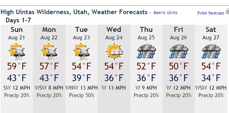
Had with me a print-out of
THE WEATHER REPORT FOR THE WEEK
At least it gave me the idea that I had to go especially prepared for cold, rainy & even snowy weather–including rain pants, waterproof gloves, and of course the normal rain parka, poncho, and warm/lightweight Mountain Hardware jacket.
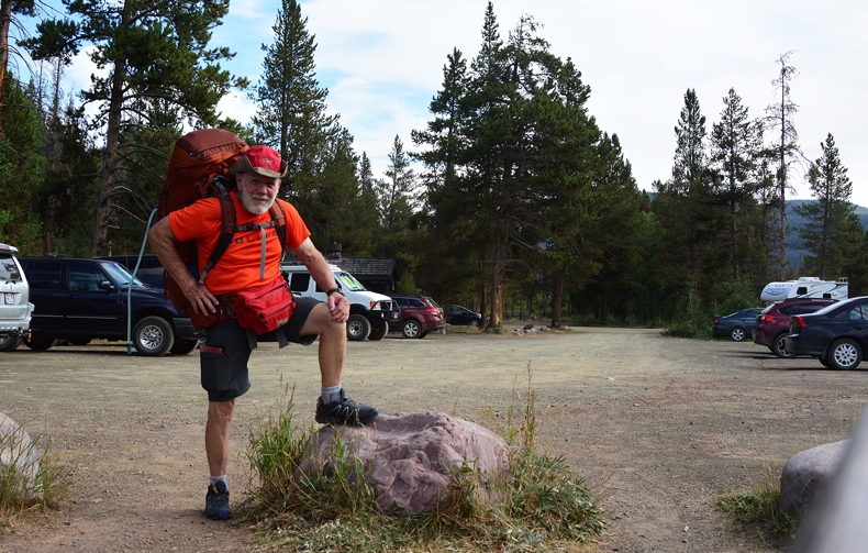
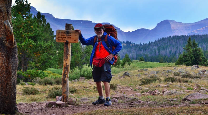
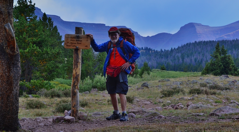
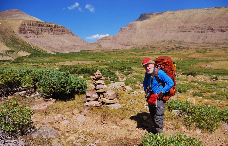
THE HENRY’S FORK TRAILHEAD
AS READY AS POSSIBLE!
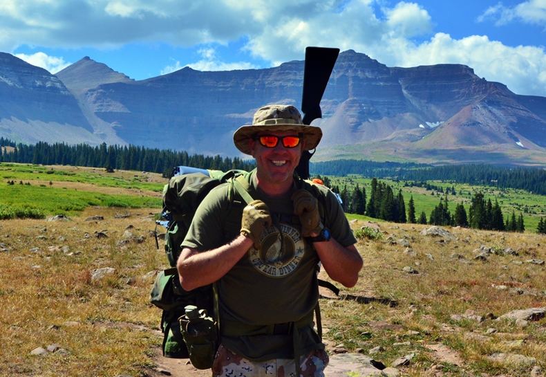
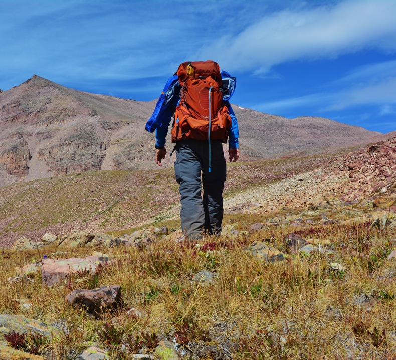
I actually went with 9 days of food in case acclimatization and/or weather would prolong the trip. That had my pack heavier than I wanted at about 46-48 lbs. But, if I deduct the 26 lbs. of body fat I had lost, it was like reducing my backpack load to 20 pounds! I had also trained with a gradually increasing pack weight up to 60 lbs., so…..….theoretically I would just float up the trail!
THE CHALLENGE at 80 years old…..….as I say, vainly, to be more impressive, “In my 81st year!”THE “GLITCHES” ALONG THE 1,900 MILES OF BACKPACKING!
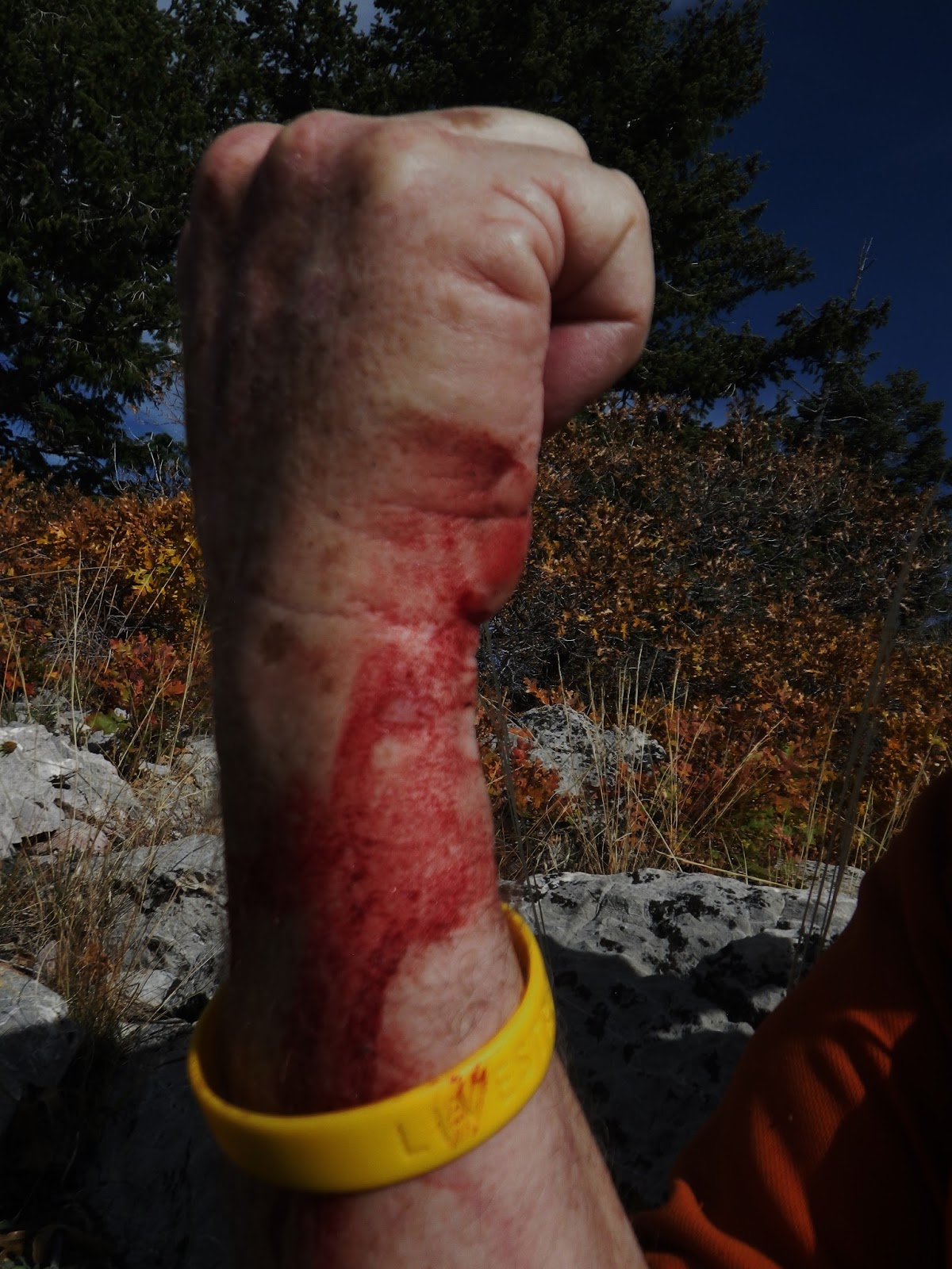
1. In 1994 I was diagnosed with “metatarsalgia” a painful problem with the ball of my feet, and told “No more running half-marathons, or backpacking” but of course I found a way to solve this problem myself, and, as I have reported, gradually cured the problem….except for only a partial cure with the right foot when doing heavy duty running or backpacking, that required extra Cod liver oil, Excedrin, etc. For this backpack #3-2016 I modified my lightweight mountain running shoes, with an extra insert with a hole in the ball of the foot area, and it worked for the “metatarsalgia” but caused a new problem, jamming my toes, especially my big toe that became extremely painful and I only made it back to the Trailhead with adjustments on the trail, but on the last day I was limping on arrival after my longest day of hiking–around 9 miles, going mostly downhill.
2. In addition, over the 14 years of the Project, every year I had to deal with problems, each in turn with a solution to make possible continuing. Problems, like: In 2003, cancerous thyroid removed, & two Mohs surgeries removing cancerous growths on my upper body, plus several radiation treatments over the next few years; Then in 2004 a temporary surgery on my “motorcycle knee,” & eventually, in 2008, reconstruction now with a titanium right knee; Then from 2004-to the present, coping with the aftermath of a heart attack in 2004; In 2007, reconstruction of the “football ankle,” with a tendon transplant and 3 screws holding it together; Next, in 2009 “terminate reduction surgery” to make possible better breathing; Then in 2011 came back surgery due to a pinched nerve that was making me a cripple, installing a device to keep spine straight; Last of all in 2012 hip replacement with a titanium joint on my left side; And, as explained lately, dealing with High Altitude Sickness and its corresponding complications.
3 Last of all from 2012 on “PERIPHERAL NEUROPATHY” in my feet, but which went away when I had a load on my back, motivating me to train usually with a backpack weighing around 40 lbs., and also when jogging with more than normal pressure on my feet that would have me feeling fine. So, even day hikes required me to have at least 10-15 lbs. of weight on my back.
THIS BACKPACK WOULD BE THE ACID TEST…..OF MY RESOLVE to
“NEVER, NEVER, NEVER GIVE IN…..EASILY!”
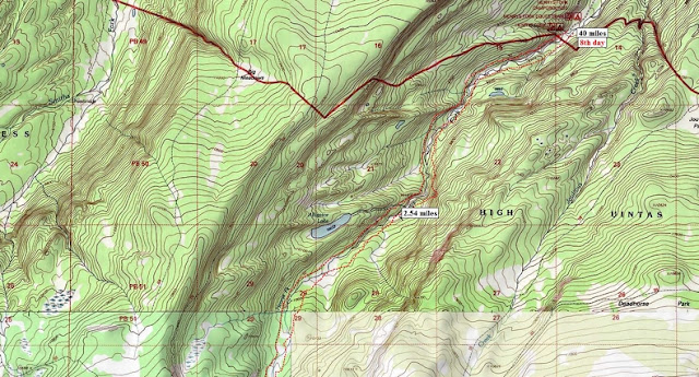
This is the first in a series of topographical maps……marking my route, including distances to key places, and elevations.
Note: For any who are new, I’ll insert some interesting historical info taken from my backpack last year up Henry’s Fork.
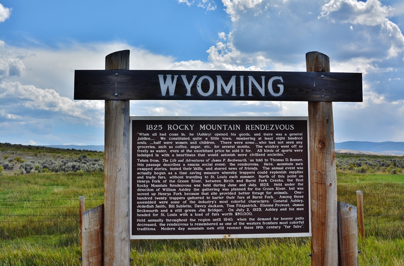
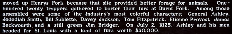
We are in historic country…..
The trail parallels the Henry’s Fork of the Green River. This well known land-mark river was named after he who most of his life was known as “Major Andrew Henry,” but who had actually ascended to be a brigadier general in the military, and then was elected lieutenant governor of Missouri. Later he became the partner of General William H. Ashley and their fur-trading venture on the upper Missouri River and together would go on to revolutionize the Western fur trade with the help of all the famous mountain-men such as Jim Bridger, Jedediah Smith, and others mentioned below.
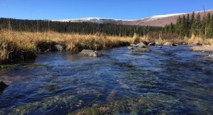
The historic HENRYS FORK OF THE GREEN RIVER the trail parallels.
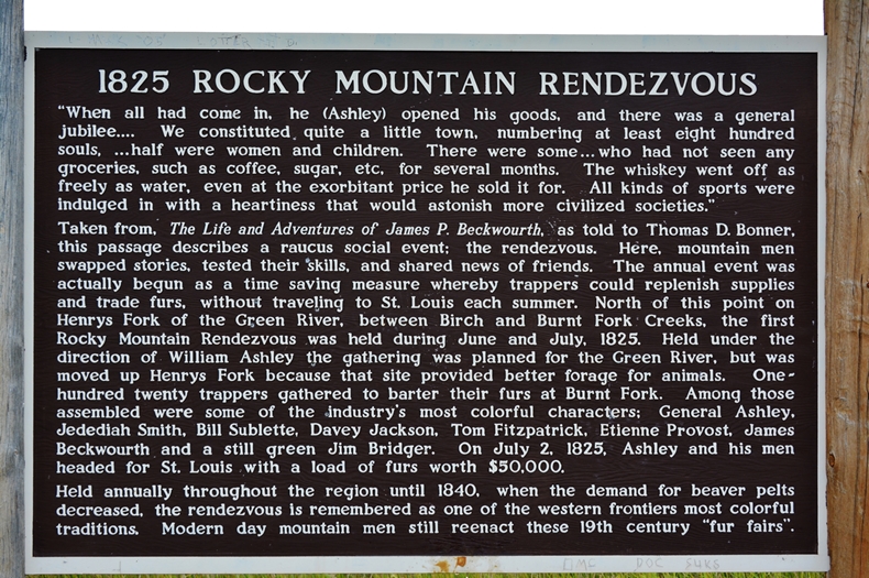
As we can read in this Historic marker just over the line into Wyoming, it was on the Henry’s Fork where the very first ROCKY MOUNTAIN RENDEZVOUS was held in 1825.
On one of my explorations I made it a point to try and pin-point the exact spot where this famous Rendezvous was held….seen below
A WHO’S WHO OF MOUNTAIN MEN & EXPLORERS
So, here we go up the famous Henry’s Fork of the Green River. Once again, as many of the streams coming out of the High Uintas, very seldom if ever fished. I’m toying with the idea that said “streams of the Uinta” will be my next focus, once I get the “unique book” put together I’m now working on.
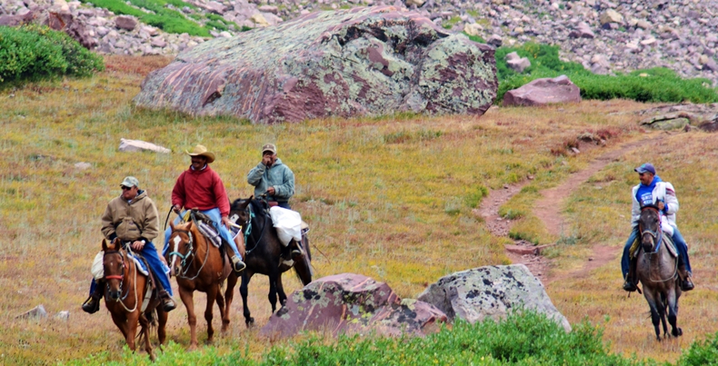
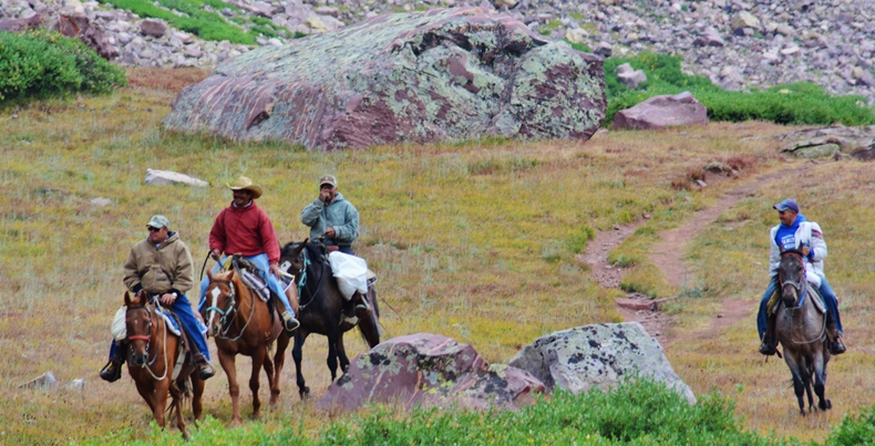
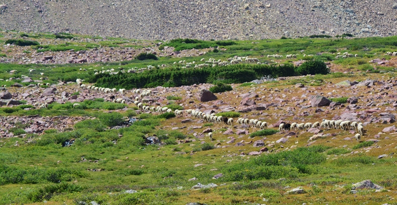
Up the trail a horseman approached with his pack horse. It happens to be one of the many sheepherders tending large flocks in the high country. Fifty years ago they were usually Basques, from Spain, but now are rather Mexicans, Peuvians and Chileans.
Cesar de la Cruz Santos happens to be from Peru on his way back to his Kings Peak (Painter Basin) camp and herd. Cesar spends his winters in Bigelow, Wyoming. Interestingly he gave me his Facebook page, and told me at their camp they had internet! So he would be able to check out my website with my business card I gave him. By September 6th they will begin moving their sheep down from the high country.
Here is Cesar’s profile picture on his FACEBOOK page…..
WOW!
We now have an incredible
“Peruvian sheepherder artist/photographer”
creating beauty from his camp in the eastern shadow of Kings Peak in the Painter Basin!
FELICITACIONES, CESAR!
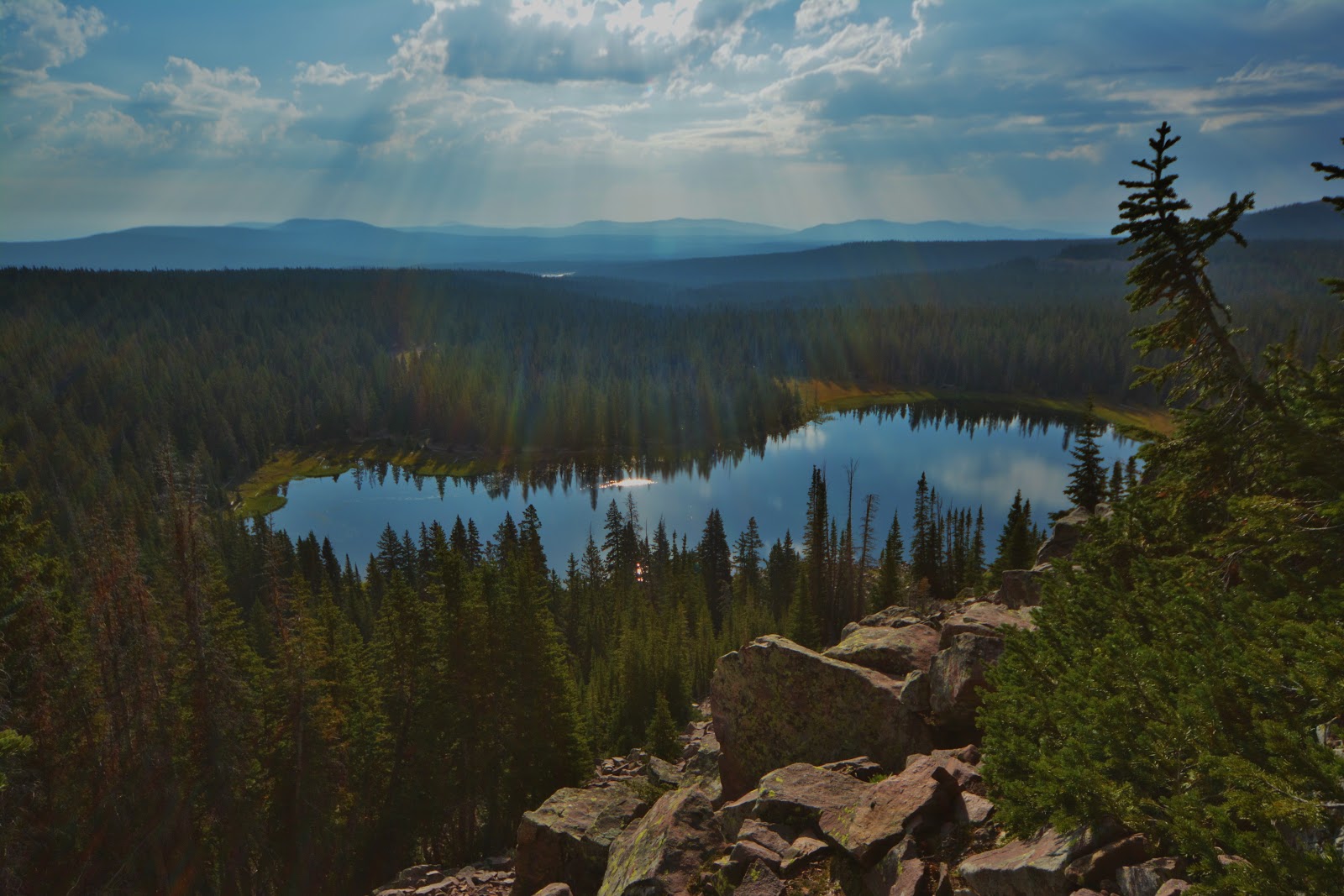
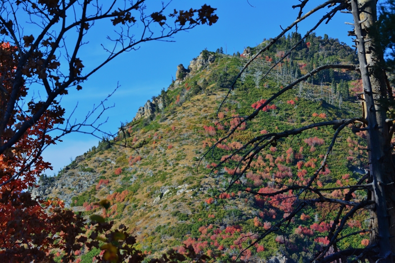
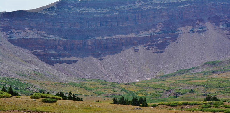
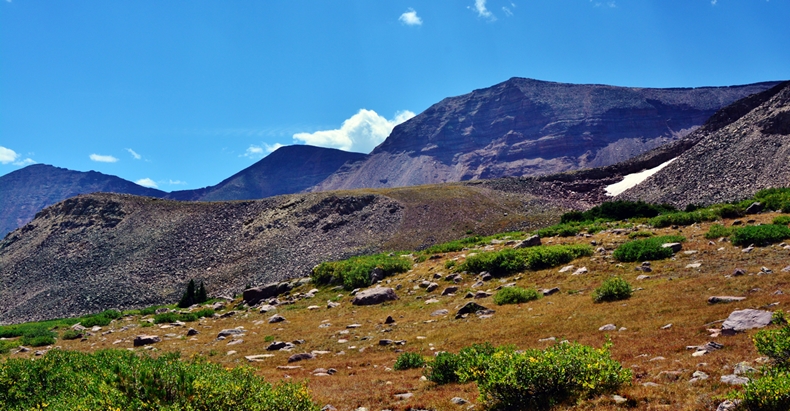
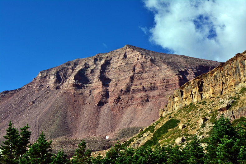
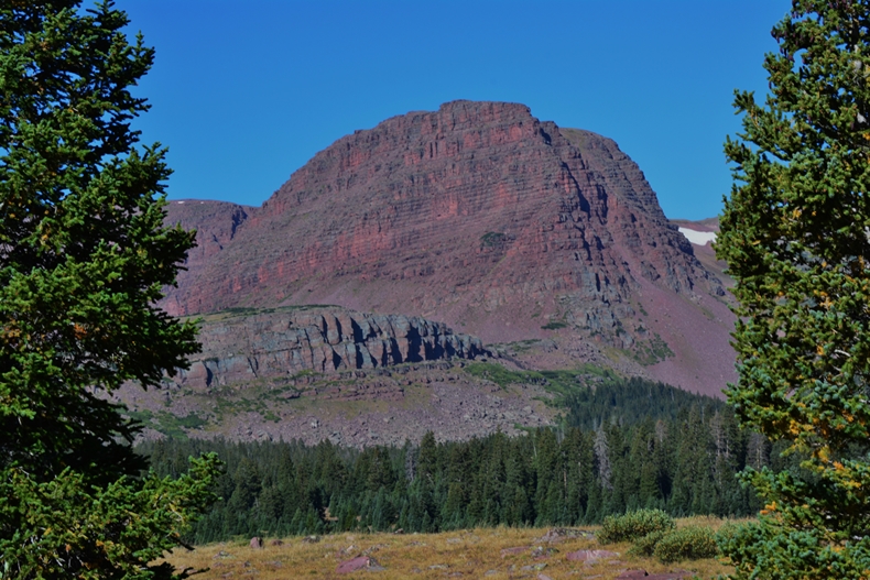
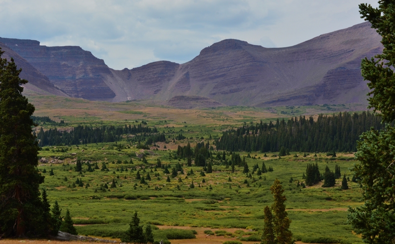
Soon we get our first glimpse of KINGS PEAK, Utah highest at 13,528 ft. The air was a bit smokey, as you’ll see, but not as bad as last year.
Elkhorn Crossing with trails going south to Gunsight Pass & Kings Peak, east to the Beaver Creek Drainage and on to Thompson Pass and to Hoops Lake, etc., and west on the North Slope Highline Trail, with take offs to Henry’s Lake and many others in the basin, on crossing Smiths Fork, Blacks Fork and on to to the East Fork of Bear River.
The original plan had been to camp out here, at about 10,400 ft. and give my body time to acclimatize, but my oxygen content was only down to 89, actually up 1 from the 88 at the Trailhead. After a 20 minute rest the oxygen had risen to 91, and I so decided to go on to the Dollar Lake area.
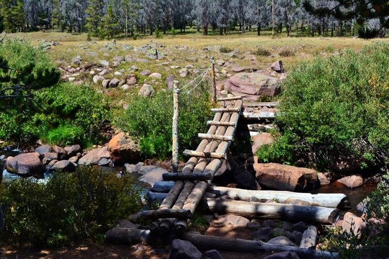
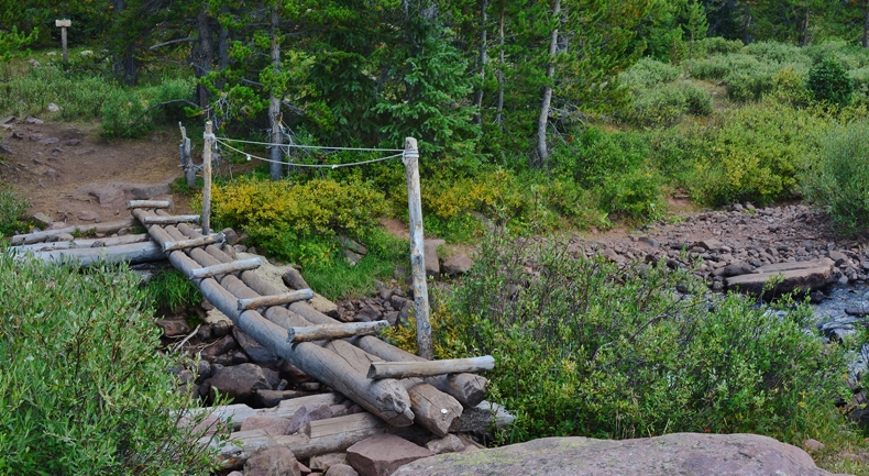
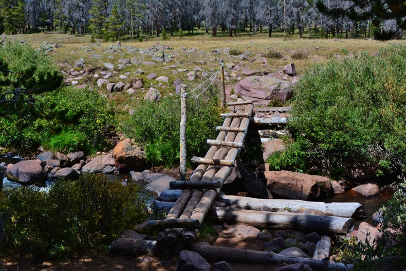
So up the trail, crossing the bridge, and to the junction on the other side, and from there head south and up into the high country.
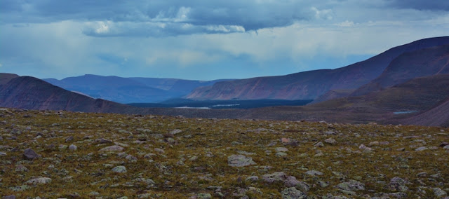
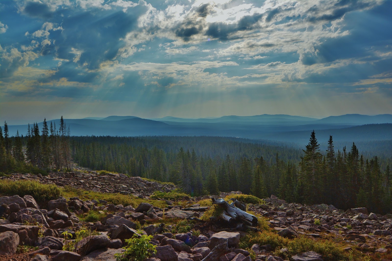
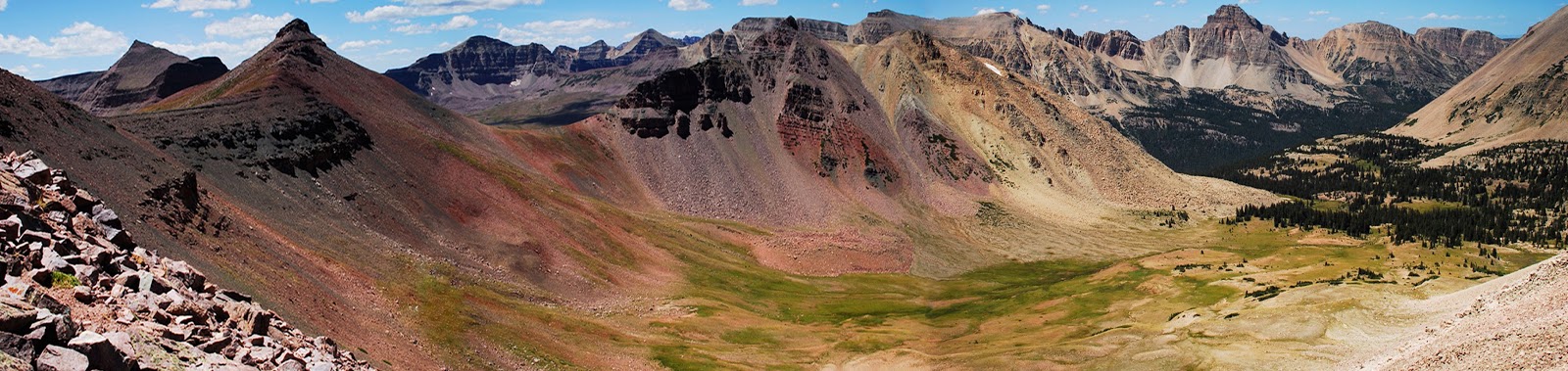
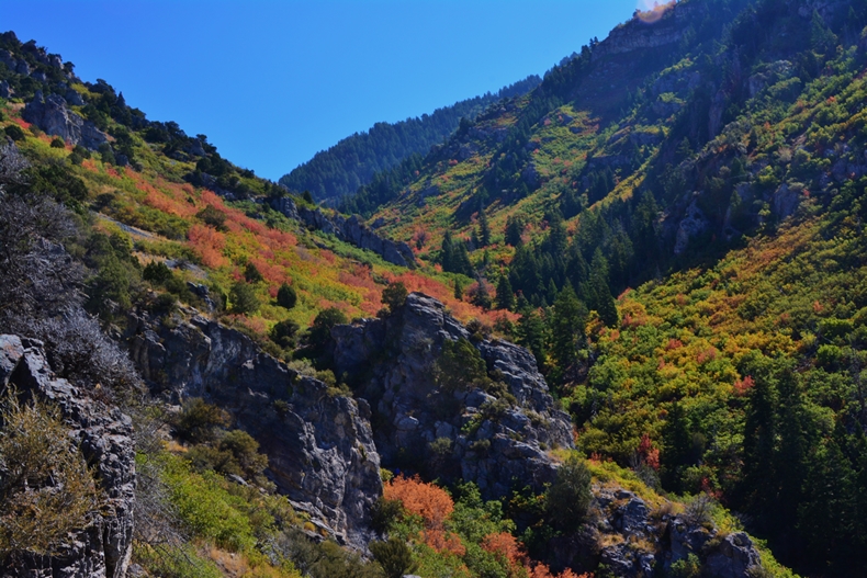
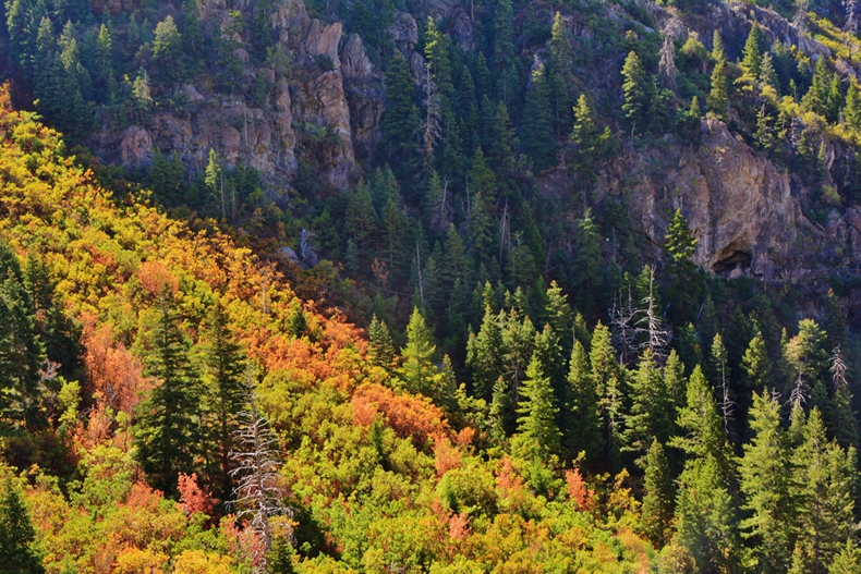
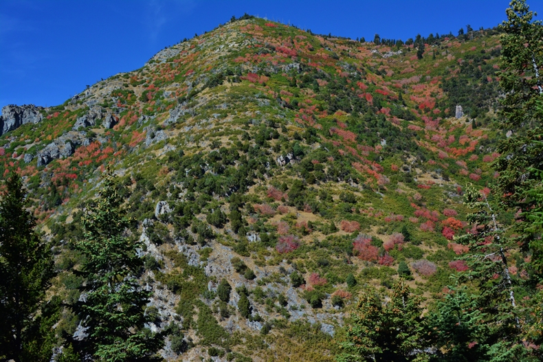
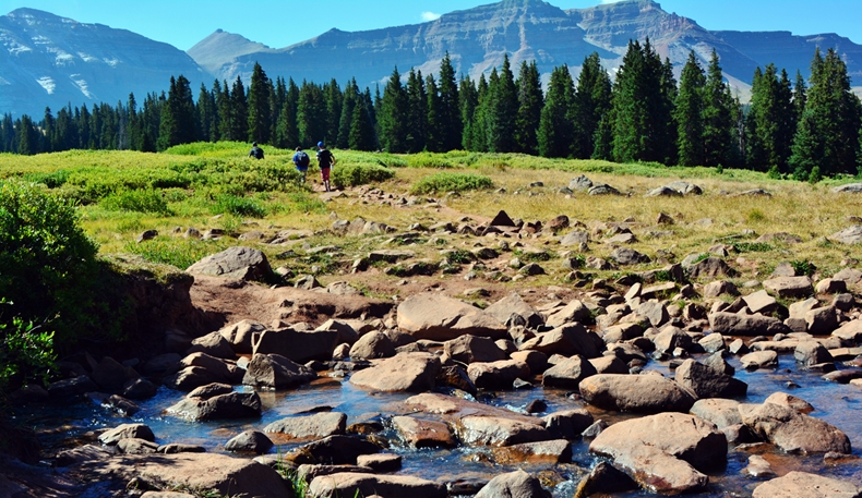
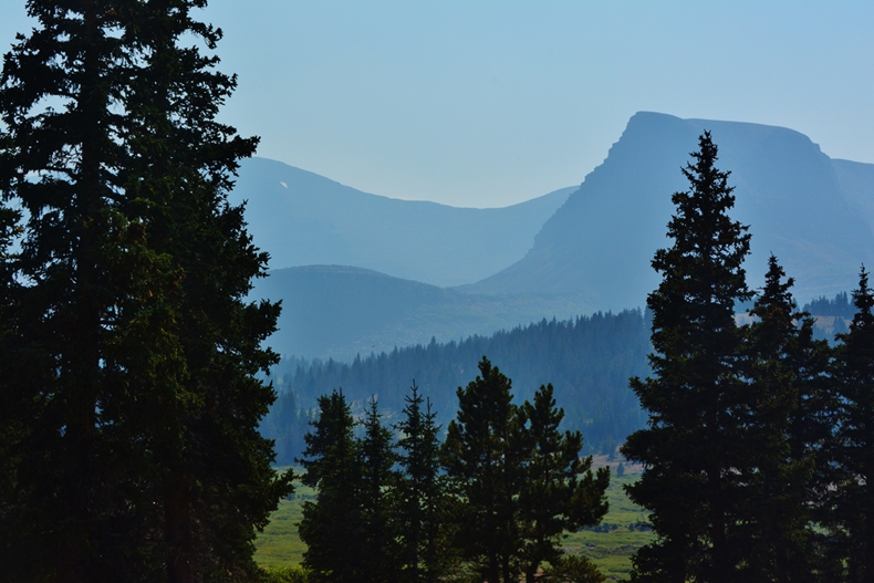
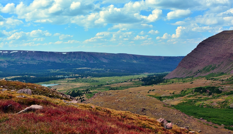
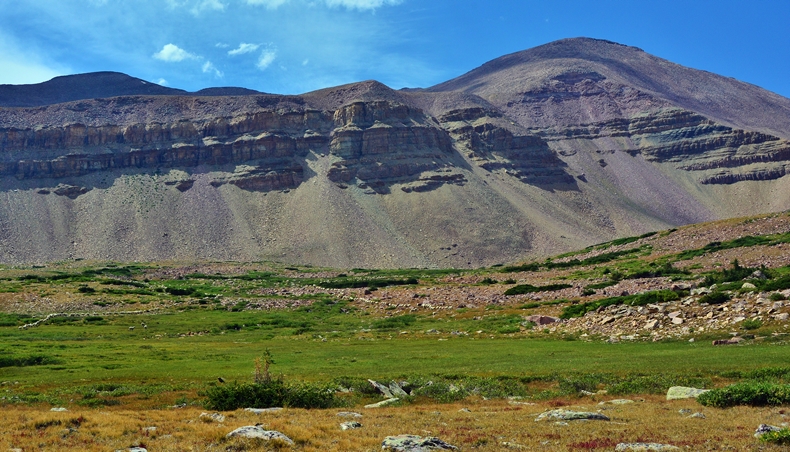
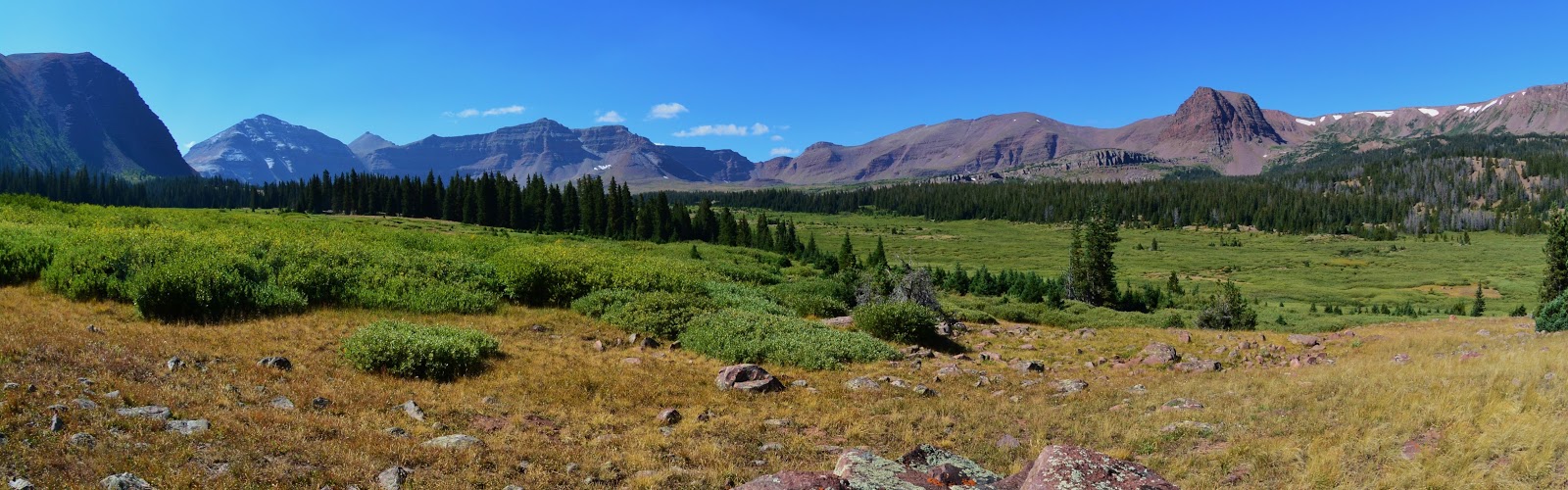
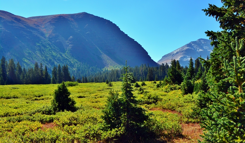
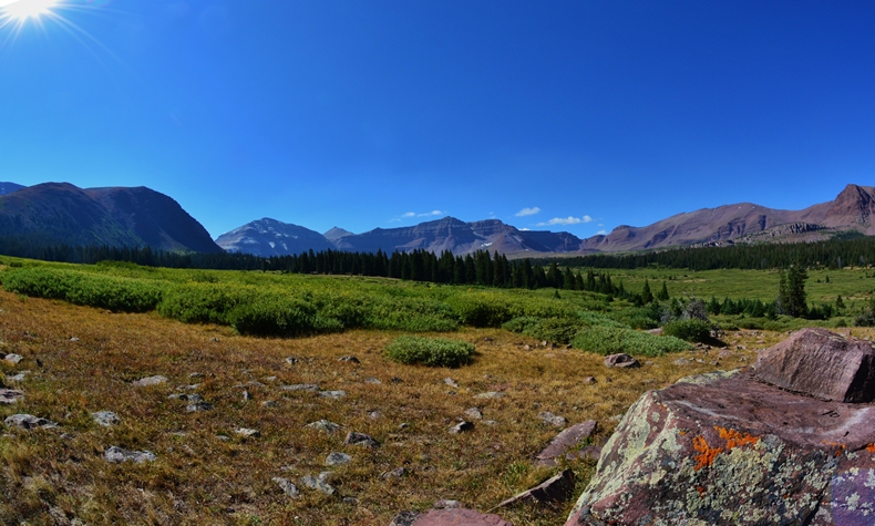
Now, up out of the canyon with the wonderful panorama of the High Uintas spreading before us: Gilbert Peak, 13,442 ft (3rd highest); no-name, 13, 263 ft.; Kings Peak, 13,528 ft.; no-name, 13, 260 ft.; etc.
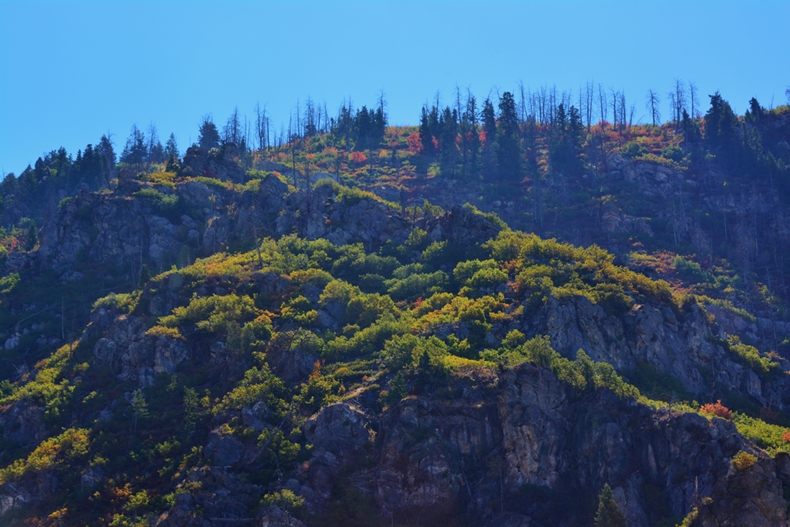
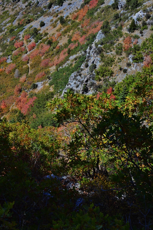
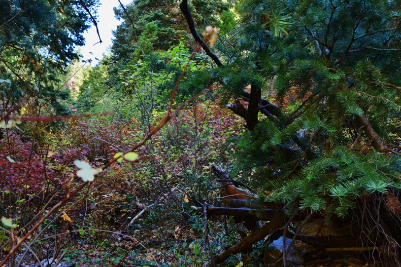
All the light green vegetation we see are willows.
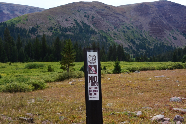
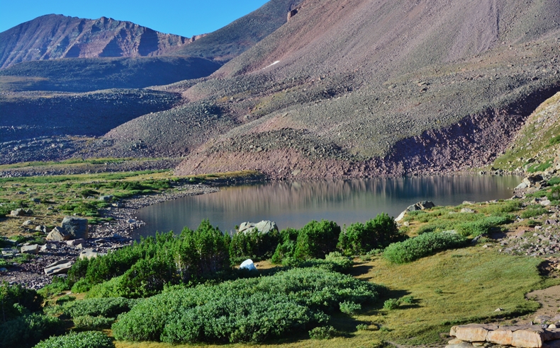
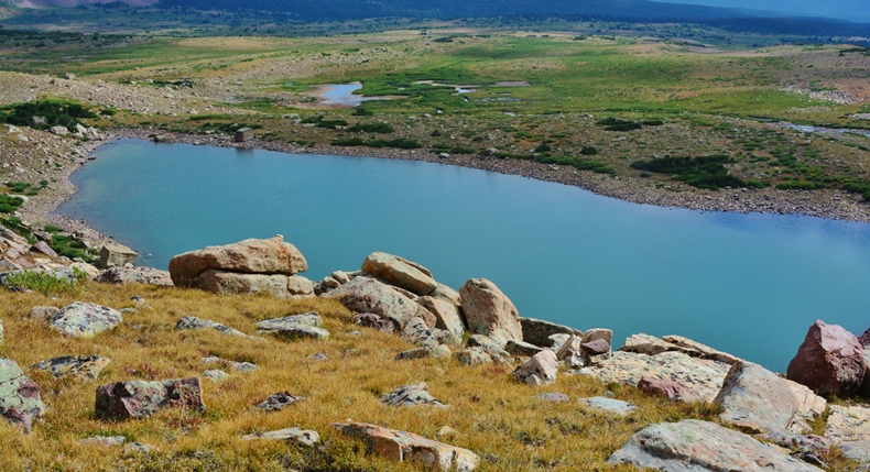
At Elkhorn Crossing I had a little water left, so decided to go on a mile or so where the maps indicated the trail crossing two small streams, but when I got to them they were dry, and I was out! There were signs everywhere of this being a dry year for this portion of the Uintas. I had to push on until getting to the outlet of Dollar Lake we see below.
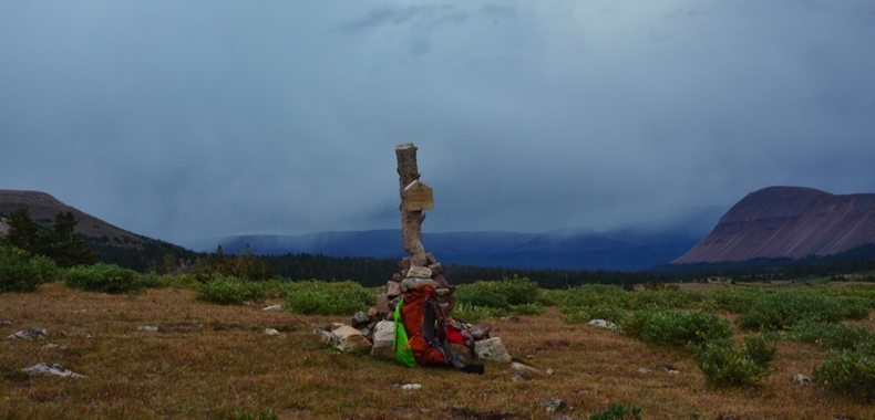
This Forest Service marker prohibiting campfires closer than 1/4 from the lake, indicates the lake is close–actually a little to the east behind the row of pines in the picture. I chose to be separate from the many who camp there. Most of them make it here the first day and set up their camp, then the next day make a round-trip day hike of 16 miles to Kings Peak.
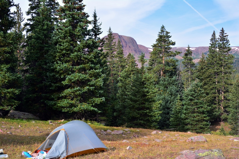
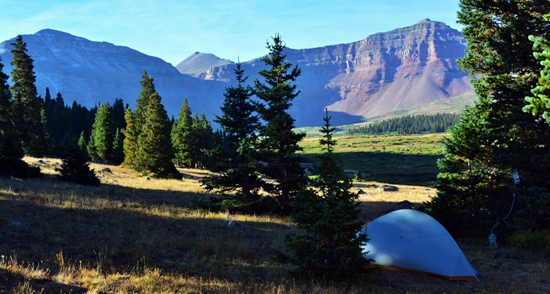
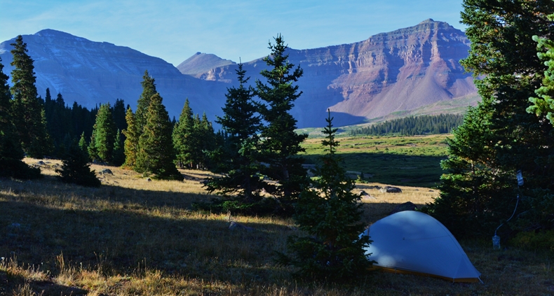
CAMP # 1 at 10,700 ft. elevation.
Oxygen at 87, until after taking my recovery supplements, when it rose to 91. Most of my “recovery” formula was:
1. Three Calcium/Magnesium gel caps (studies of marathon runners shorts show that the mineral lost most is Calcium);
2, 5 gms. of Glutamine (studies among marathoners show, if this is replaced after a race, the chance of sickness is vastly reduced);
3. Then I follow my formula to strengthen the immune system, when one feels you are on the verge of getting sick (which as an old guy I feel always after a hard day): 6 Wellness Formula capsules; 1 Defense Plus tablet; and suck on Cold-Eeze (same as Zicam Cold Remedy, but better & cheaper).
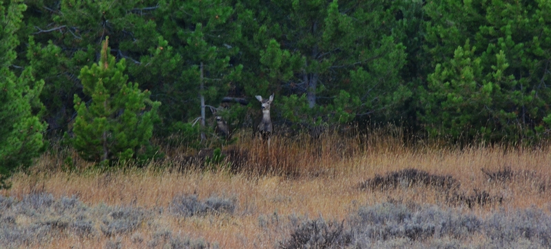
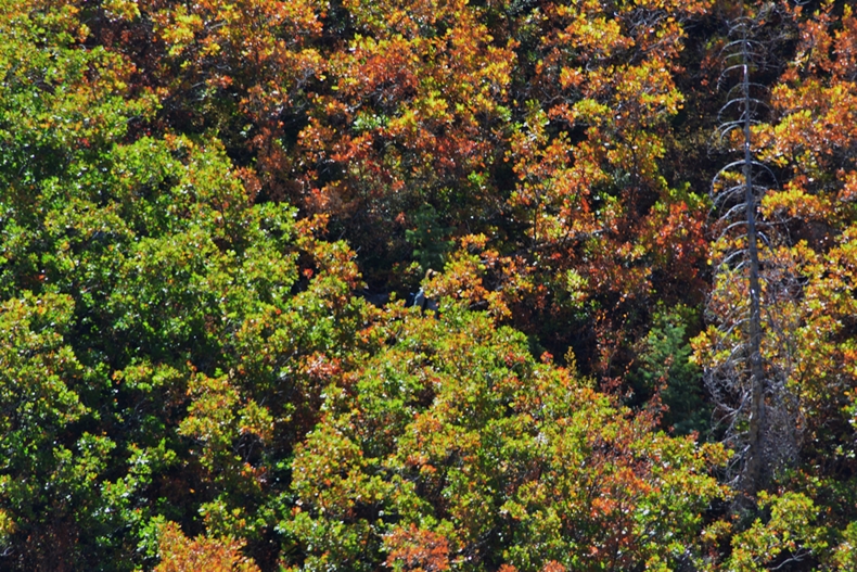
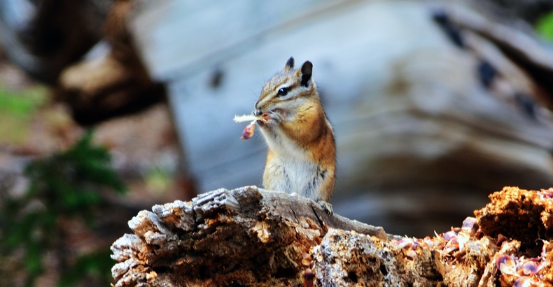
A little friend near my 1st camp.
*******************
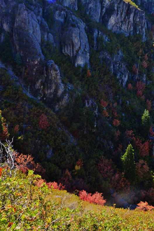
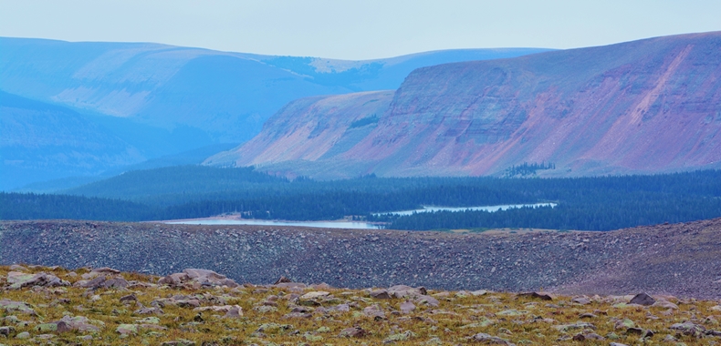
2015 photograph of Castle Peak, with “mysterious” Castle Lake at its base found at the low spot in dead center. This picture shows there was much more smoke in the air from forest fires last year.
Up the trail, DAY TWO, getting closer to Kings Peak.
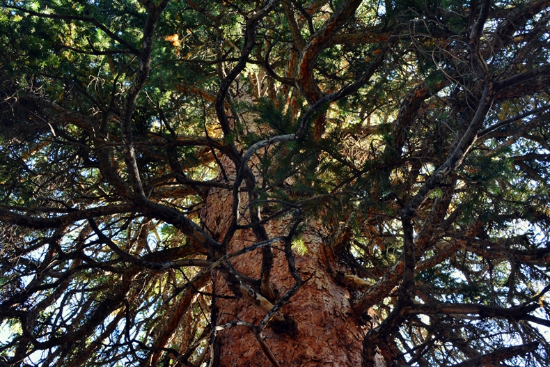
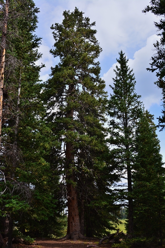
A GIANT Spruce, be it Englemans, or Colorado–which used to be the Utah State tree, up the trail a bit from the Dollar Lake area.
Looking up the trunk through the abundance of branches……and…..
looking down at the massive roots.
Getting up near timberline, the low spot in the middle of the picture is where no-name lake G-98 is located which originally I had hoped to visit on my way back…..but as you will notice, all the extras listed were left pending a backpack just into the Henry’s Fork Basin for 2017.
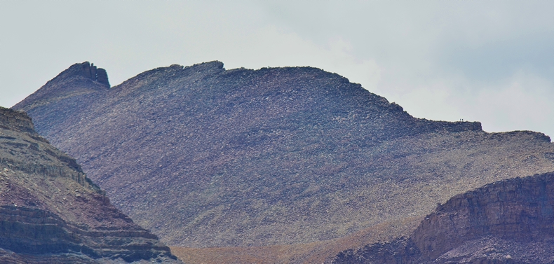
To the right, or west, of G-98 lake, we see Kings Peak and the “chute” some use to get to and from King’s Peak.
Zooming in on KING’S PEAK,we just barely see a few hikers scaling the peak.
Continuing towards the west we come to the basin where Cliff Lake is found–the most remote lake in the Henry’s Fork Drainage–where I once had an “alligator-like” rush at my spoon that splashed water 20 feet to the shore where I stood. I still want to get back there….one more time (2017)
Down the drainage and more to the west from Cliff Lake we see the stream that comes out of Blanchard Lake….a picture of which I’ll insert below looking back towards the Gunsight Pass trail.
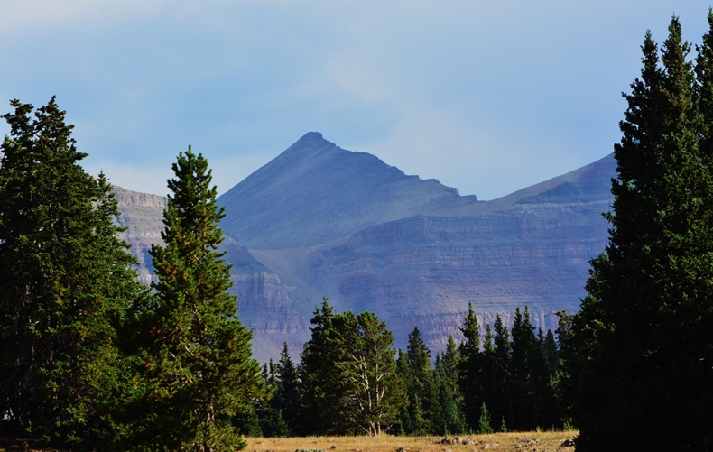
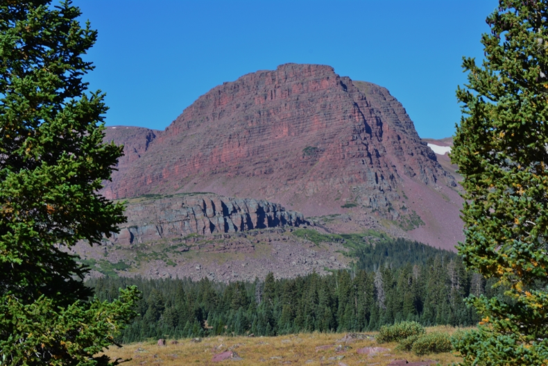
Our photograph swing around the basin ends at Castle Peak
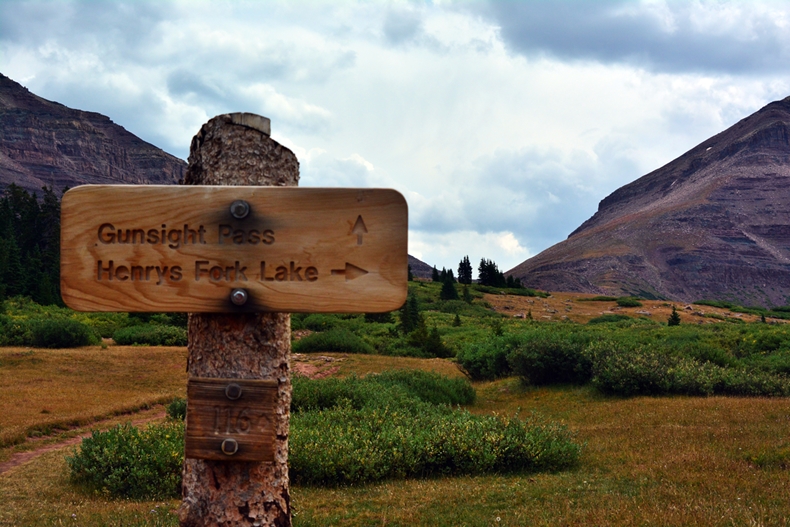
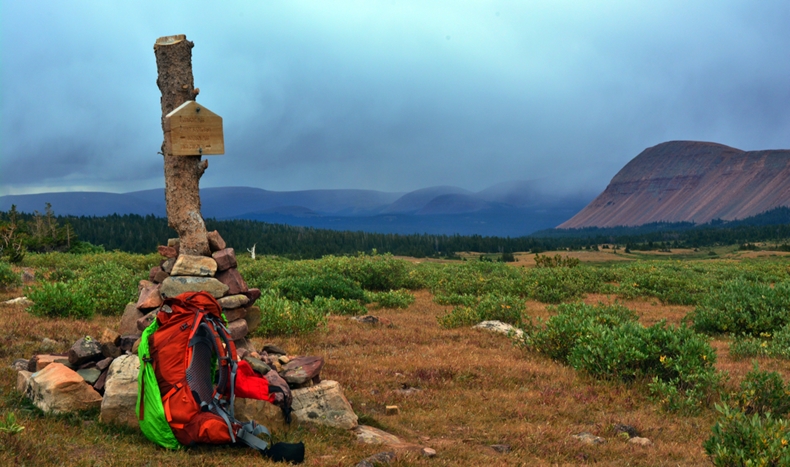
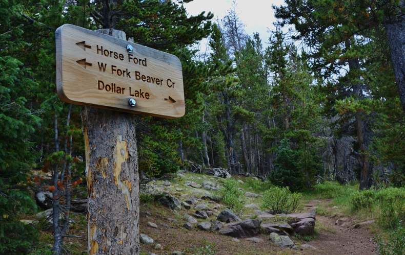
Right at timberline we come to the trail that will take one west to Henry’s Lake and many others in this basin. Our trail continuing towards Gunsight Pass.
More sheepherders coming down the trail……but they strangely didn’t respond to my greeting in Spanish and veered off trail to keep their distance from me. Who knows why? I guess I looked pretty tough!
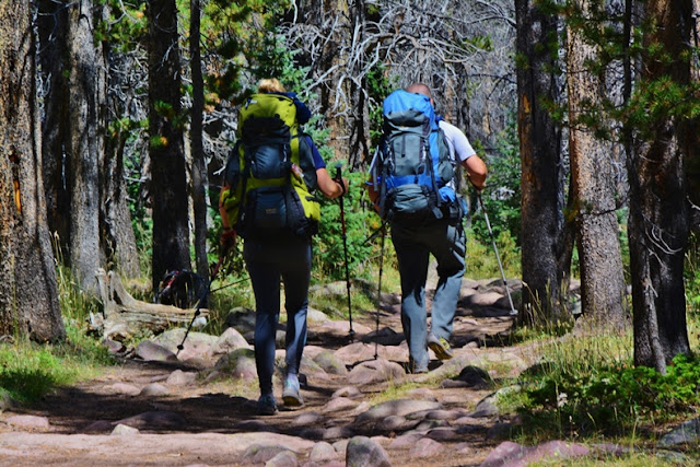
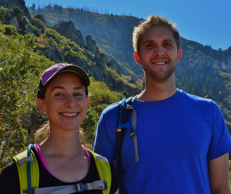
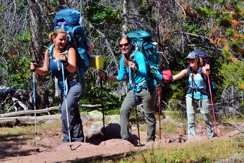
As I approached the pass, two backpackers were coming towards me, and I met Paula & Wade Whitlock.
Note: Remember the low spot–Gunsight Pass is 141 ft. higher than Mt. Timpanogos!
They were on a very ambitious backpack, having left their car at the Hoop’s Lake Trailhead, way to the northeast, and from there worked their way up into the high country coming over Divide Pass into the Uinta River Drainage, and then followed the Highline Trail across that drainage, then over Gunsight Pass where we met. From there they would continue down to Elkhorn Crossing and there take the North Slope Highline Trail taking them through the Beaver Creek Drainage, and over Thompson Pass 11,450 ft. and back to Hoopes Lake. I calculate the distance at 65 miles.
Above is the elevation profile of their trip from Hoopes to Hoopes. WOW!
Congratulations to Paula & Wade. I’ll look forward to getting a report from them.
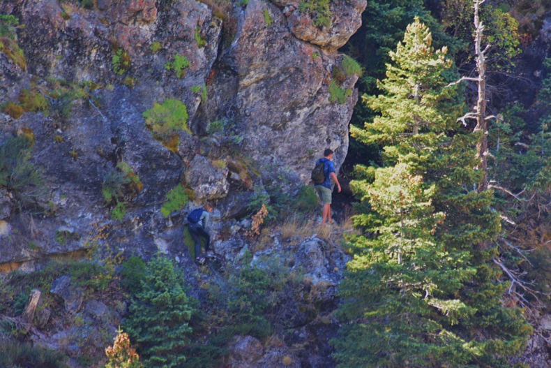
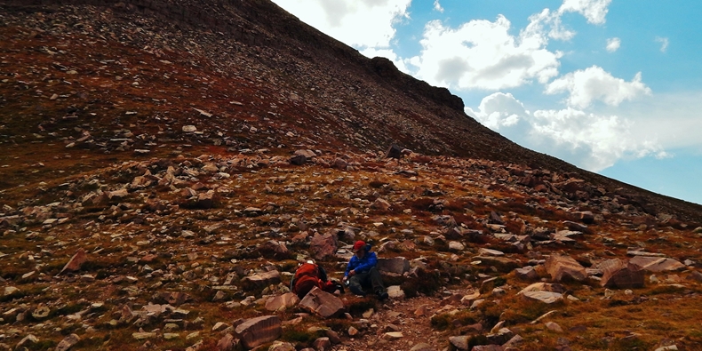
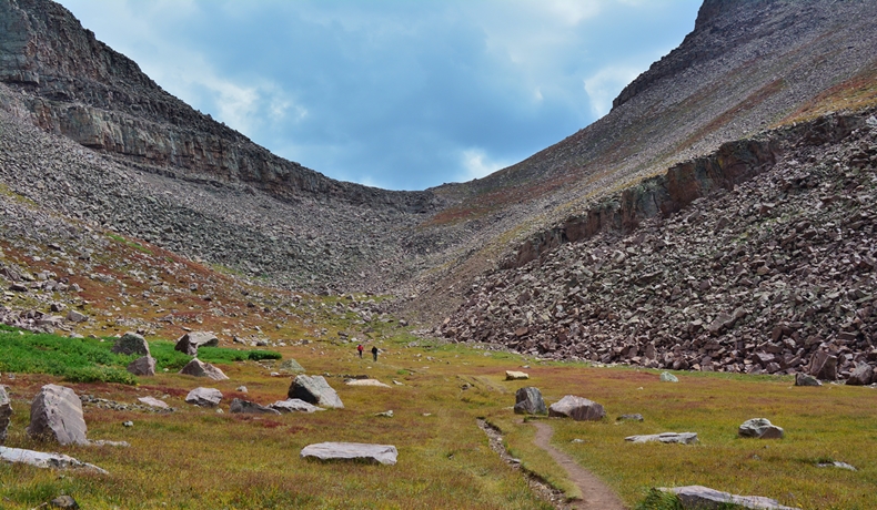
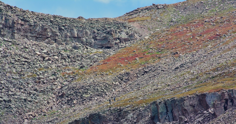
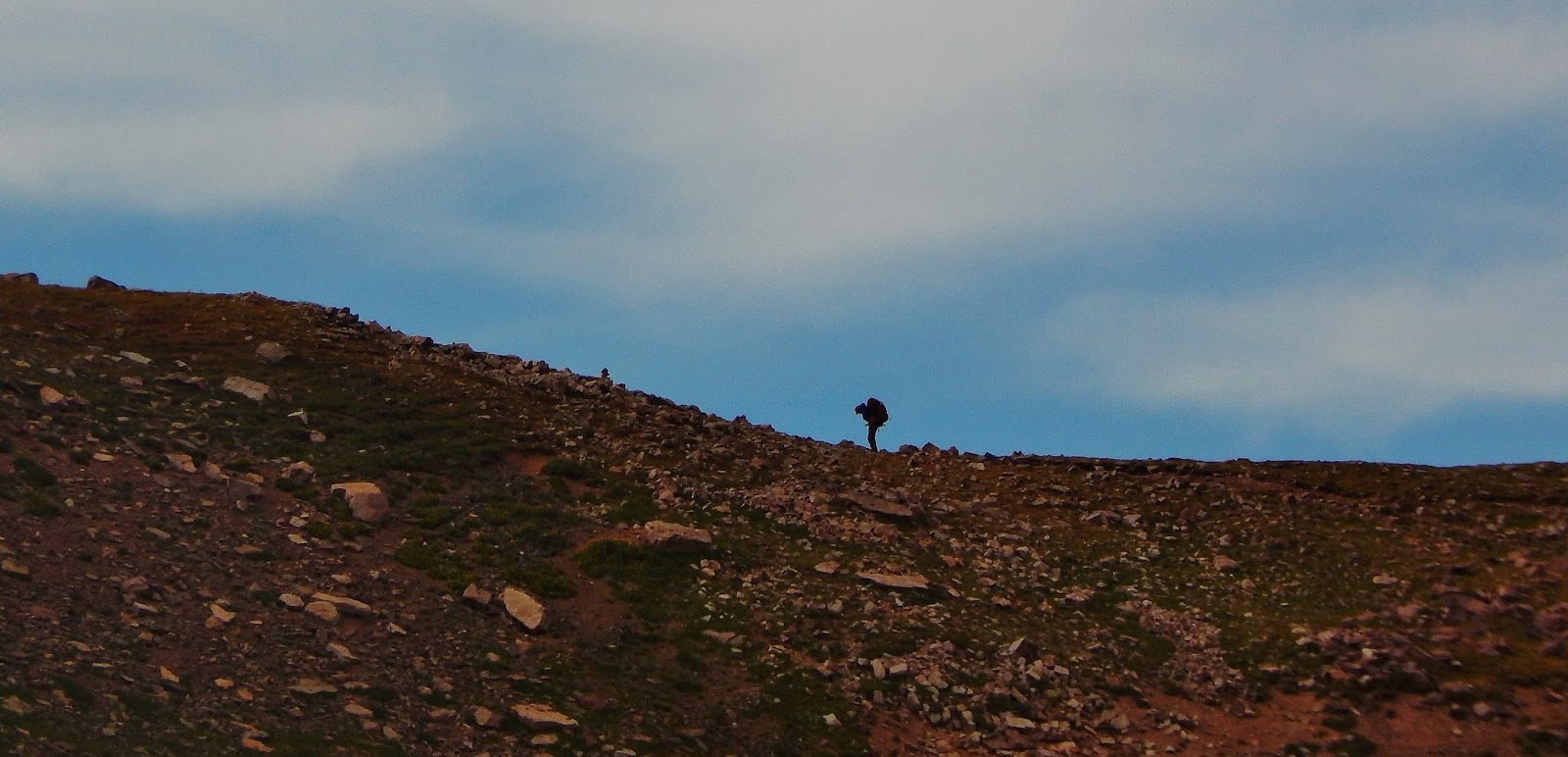
To the pass there are two long switchbacks. We can see two hikers on the first switchback.
There is also a very rough trail that goes right up the ravine, the beginning of which I didn’t like–just a bunch of boulders, so I backed off and started up the switchbacks.
Now, on to the 2nd switchback!
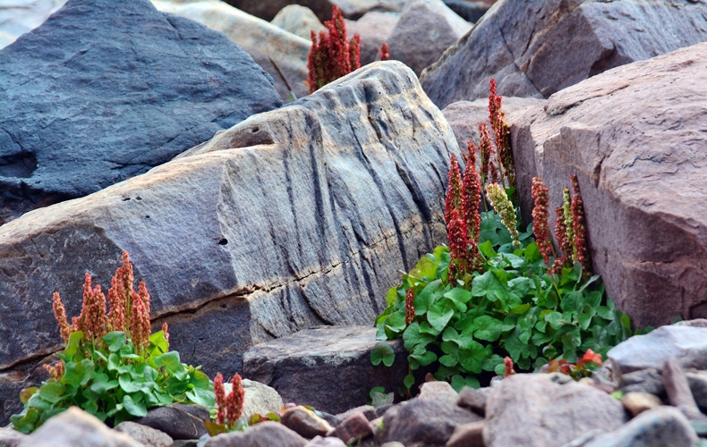
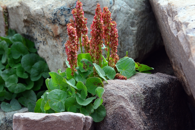
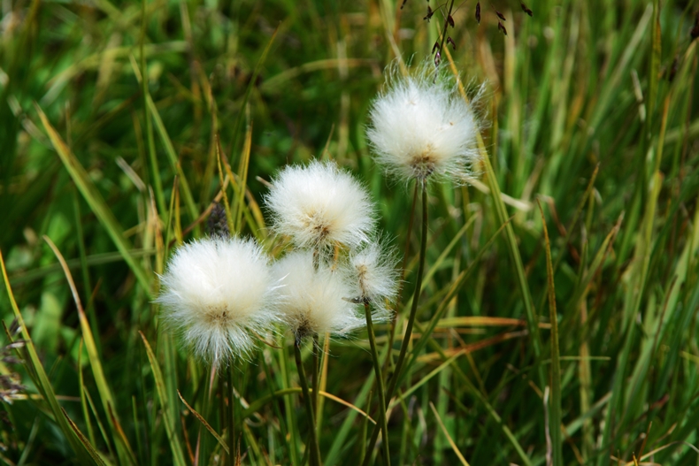
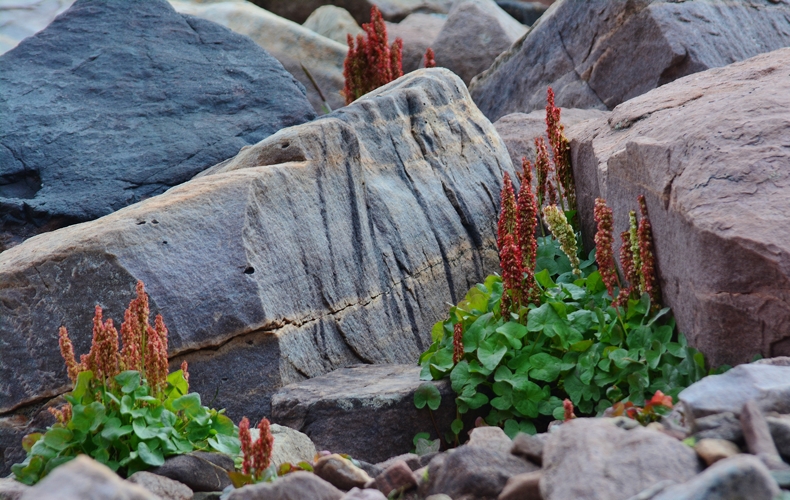
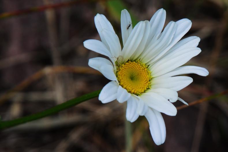
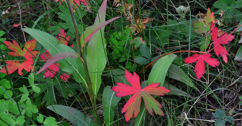
It was a good time to see the hearty Mountain Sorrell , a beautiful, delicate plant that grows in very harsh conditions.
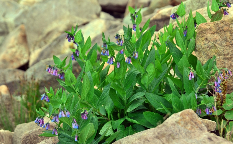
The Bluebells were also doing fine.
Looking back at the Henry’s Fork Basin.
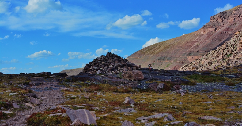
The wind was blowing hard, and it was quite cold, so my gloves felt good as I came right up to the 11,893 ft. pass, with a huge rock karn marking the spot.
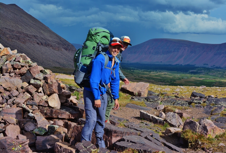
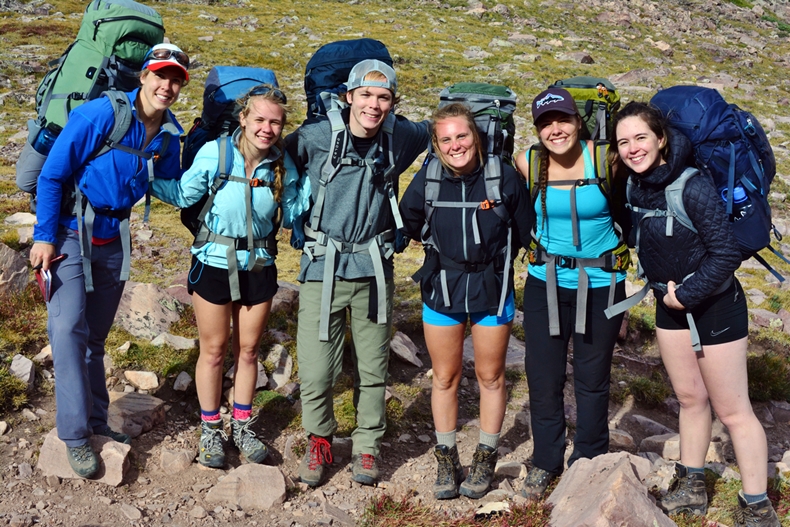
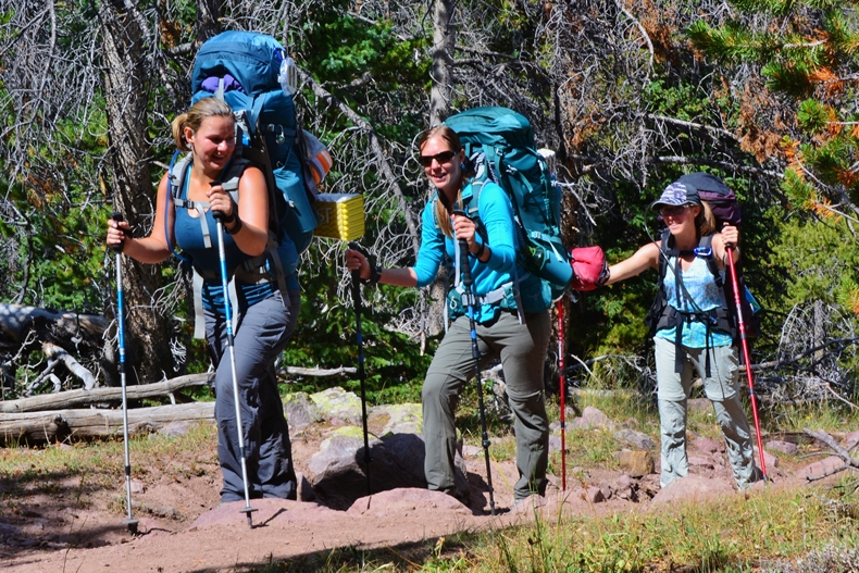
Coming right up the difficult “ravine trail” was a young lady, followed by her companions, and it was great meeting a pretty unique group of youth from Washington, working on climbing the 50 peaks, along with Utah’s Thirteeners.
Meet (not necessarily in order), Phebe, Rachel, Ben, Elizabeth, & Naomi JOHANSON, & McChensi McClellan. They not only were on their way to climb Kings Peak (13,528), but from there follow the ridge south and southeast climbing South Kings Peak (13,312), then continue down the ridge climbing 3 no-name 13,000+ peaks, including 13,387 ft. Mt. Jedediah (I have named), and end at 13,440 ft. Mt. Emmons, and from there hike back to the Henry’s Fork Trailhead–ALL OF WHICH I FIND INCREDIBLE!
I didn’t want to discourage them, but did mention that it would be miles and miles of boulder hopping, no flat areas to set up tents, only water likely being melting snow, plus they would be right up in the weather that was forecast and did happen as I show further along. Many times in the next few days they were in my prayers!
I will be anxious to get their report and publish it here.
UPDATE: September 2, 2016I just reeived an email from Elisabeth Johanson and some special photographs a few of which I’ll add here, and others later when we get to Little Andy Lake.
I also expect to receive some details about what Elisabeth called
“Our hike up to Kings Peak and across to Mt. Emmons that was amazing!”
As soon as I get more information I’ll add it to this post, and then advise my entire list of “High Uinta Friends.”
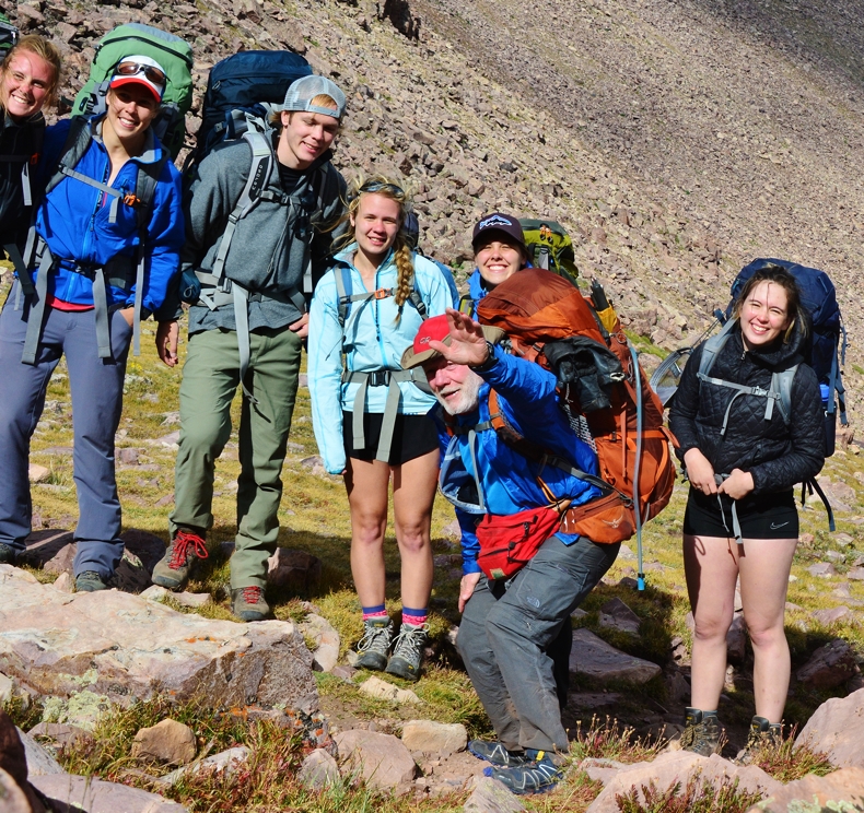
This photo was taken without me realizing it….as I was checking my vitals, seeing that at 11,893 ft. my blood oxygen count was down to 81, the lowest on the trip. Dropping down to where I camped, where the group was also camped, my oxygen went back up to 92 quickly after taking my “recovery supplements.” It likely would have normalized even up on the pass by just waiting 30 minutes or so.
Another picture taken of me by Elisabeth as they were dropping down ahead of me, and I was shouldering my pack to follow them.

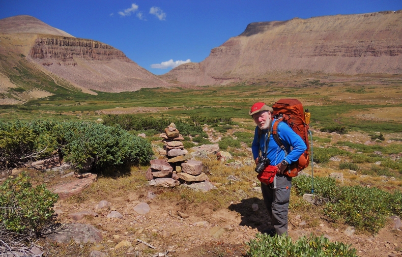
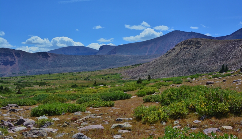
As mentioned above, before leaving the pass, I checked my blood pressure, which was fine, and then the oxygen which was 81, the lowest so far. I then shouldered my pack and headed down from the pass. Along the way we view the Painter Mountain, on the other side of which are the isolated Painter Lakes, and on this side the arctic tundra of Painter Basin.
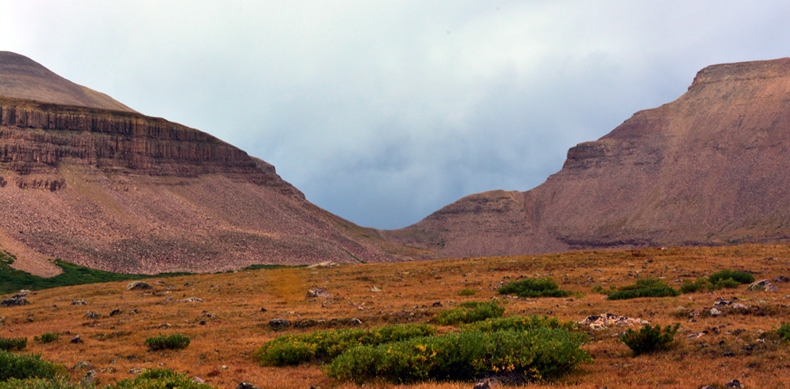
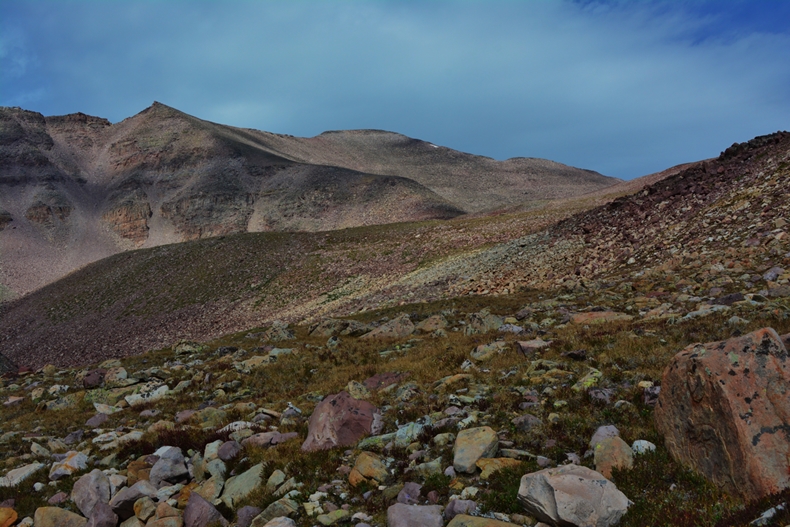
Following the Painter Mountain to the west we come to Trail Rider Pass, 11,780 ft., seen faintly in the middle of the photo, with Mt. Emmons in the center, and Mt. Jedediah, 13,387 ft.–5th highest in Utah, on the extreme right. The mountain between those two is a no-name mountain, 13,305 ft. high.
Once down off the pass you come to a junction. The right hand fork is the short-cut for those climbing King’s Peak. The left hand fork, goes out in the middle of the valley and eventually connects onto the Highline Trail. I came up that trail on my return.
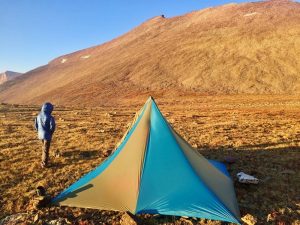
As I came down from the pass I needed water, and a good place to camp as I was pretty tired, and water gone. I soon found myself in the first Alpine firs where the youthful mountaineers were already camping, and nearby I set up my camp.
My 2nd CAMP at about 11,400 ft. with Gunsight Pass in the distance, and Gilbert Peak on the right. After my recovery my oxygen was up to 92, and blood pressure perfect.
From my camp I followed the trail until it headed straight up the mountain towards King’s Peak. I then went off trail until I began seeing the rock karns of the Highline Trail………
………and there met a lone backpacker coming from the east.
It was John Sowell, from Colorado, who was another unique backpacker working on doing something most don’t even know about. He was doing the ENTIRE HIGHLINE TRAIL, including a 30 mile segment from what most think is the eastern end at the Hacking Lake Trailhead, near Leidy Peak, to the Highline Trail’s actual starting point on Utah Highway 191 between Vernal and Flaming Gorge. I’ll soon make a trip over there to at least get a picture of said starting point of the famous trail.

I knew something about this and once had the plan of doing as he was doing–and even made a series of 14 topographical maps showing the route, distances, etc. My total distance came to 106.6 miles. I since have been in email contact with John who met his objective, for which I heartily congratulate him.
I should add that John talked about once, I believe with a son, being on South King’s Peak, and for some reason they decided to go down the mountain, and in so doing passed by Little Andy Lake, and from there dropped down into the Painter Basin, one ravine before the one I went up from U-75 lake. I thought he maybe had a picture with the LAL included, which he’d send to me so I’d have a picture in case I didn’t make it. So, I know of at least one person who had in a sense been to the lake…..so I wouldn’t be able to claim to the first
John took my picture with his camera and emailed it to me–you see above, with Gunsight Pass in the background.
Thanks, John!
Note: Remember Gunsight Pass is 141 ft. higher than Mt. Timpanogos
I bid farewell to John, he heading up towards Anderson Pass, and me bushwhacking south, soon with Kings Peak in full view as seen above……..
……..and swinging our view a bit to the southwest, Mt. Jedediah is getting closer, my objective for the day being at its base at U-75 lake……
…..and then directly south looking at Trail Rider Pass, that leads to the George Beard Basin, and then to the Lake Atwood area. Along the way I began seeing signs of sheep in the area and soon got a shot of some of the herders horses.
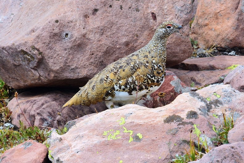
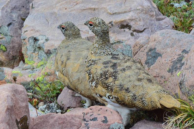
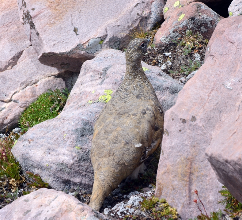
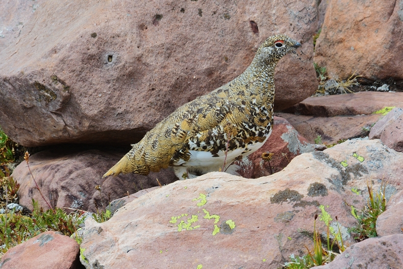
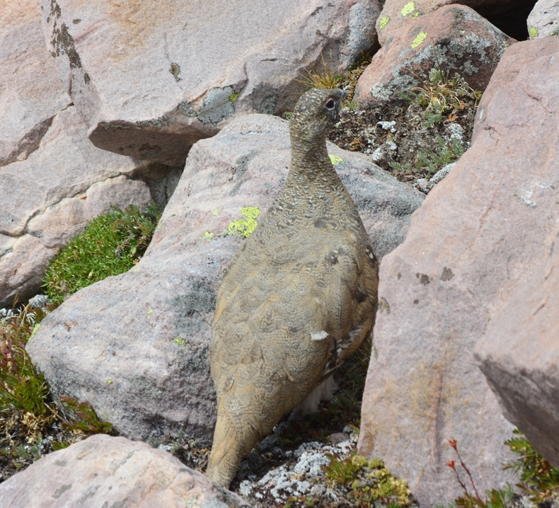
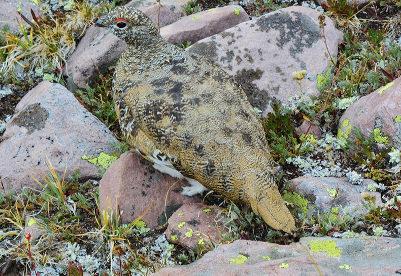
Then jumped a few Arctic Ptarmigan, better pictures of which I’d get a day later…….
…….and then I begin hearing and soon seeing Cesar’s flocks of sheep.
Crossing the arctic tundra I got a good view of Kings Peak all the way south to Mt. Jedediah…….and beyond.
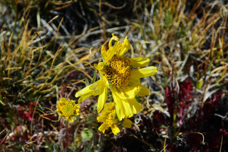
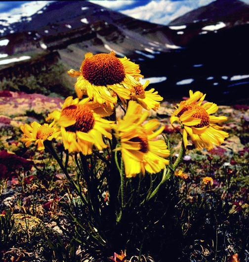
……..and found an OLD MAN OF THE MOUNTAIN still…sort of… in bloom.
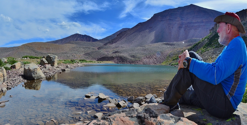
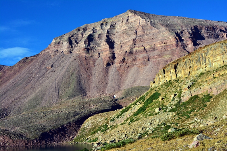
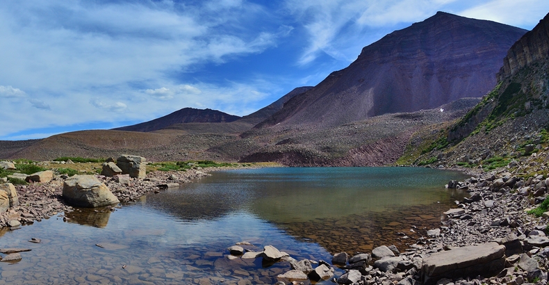
Finally made it to U-75 with Mt. Jedediah looming over it.


This is one of my favorite pictures from near Trail Rider Pass, looking north at Kings Peak, with no-name U-75 lake in the middle, with a blossoming OLD MAN OF THE MOUNTAIN and Gunsight Pass on the right.
UPDATE: I’ll insert below the response by Linda Turner in relation to Mt. Jedediah & the photo/essay:
Cordell,
Oh my gosh, such beauty, and your writings are so informative. I feel like I was there! Of course, my favorite…the trappers and *Jedediah Mountain. Okay…the whole thing was my favorite. I especially love the photo with Old Man in the Mountain flowers/clouds/peaks. I hope you make a ‘hard copy book too.
Well, my new dream and hope is that someone knows how make it official… ‘Jedediah Mountain’ the 5th tallest in Utah. I’ll forward your email to the Jedediah Smith Society near Sacramento if you don’t mind, so they can see the mountain and your work sharing the adventures. Thank you for being you, a very rare and special person. God bless you sweet (and your family), kind, Cordell.. courageous and bright light of the Uinta’s.
Best always,
Linda Turner
OCTA Crossroads PR
Salt Lake City, Utah
I named the mountain in honor of Jedediah Smith, for me one of the very greatest of all the mountain men and explorers of the West.
Mt. Jedediah is the 5th highest mountain in Utah.
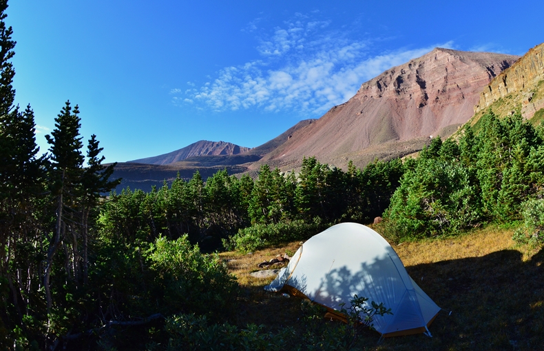
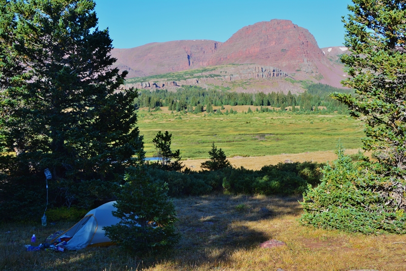
Do you see my camp?
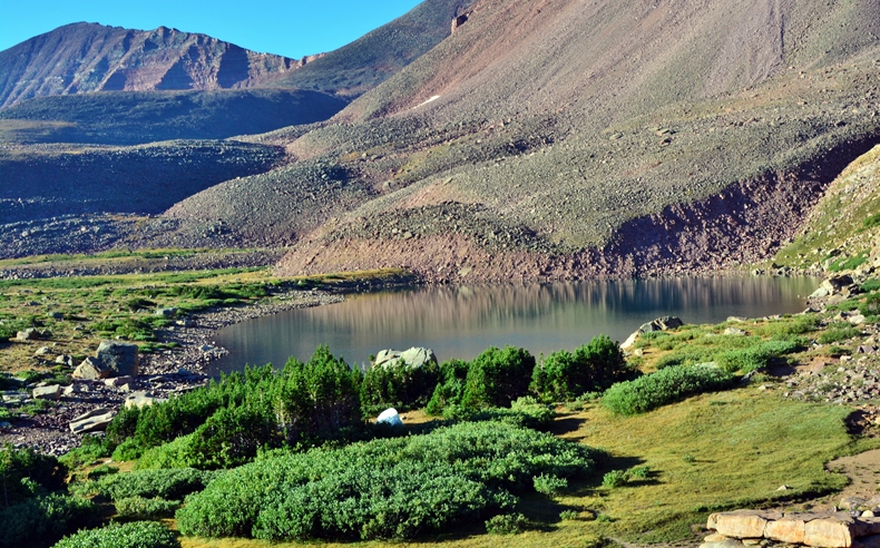
I set up my CAMP for nights #3 & #4 at one end of lake U-75
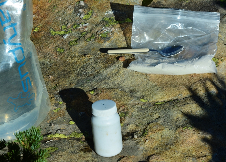
For whatever reasons I was having digestive problems, but they were solved by taking Redmond Clay, the powder mixed in a small bottle, with water and left for a couple of hours turning it into a thick, gel-like mixture, swallowed by the spoonful, with a glass of water afterwards. Pretty soon I was regular again. This is another item I won’t go on a trip without, be it to the Uintas, or to Guatemala.
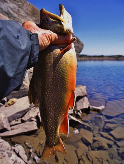
U-75 produced in 2003 on my 27 day expedition incredible fishing for Eastern brook trout, one you see below.
This was a heavy bodied brookie 17″ long. Don’t know about the weight.
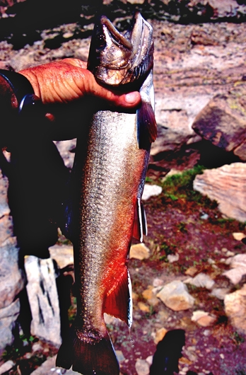
Two years later I was back and caught the brookie seen below which measured 21 inches long, but emaciated and ready for the grave. The cycle for U-75 ended in 2005. Since then it has gone through two more 5 year cycles.
Lakes planted by airplane are usually done following a cycle of 5 years. So if you get to a lake at the beginning of the cycle, you will only see fingerlings that have been planted by airplane and fishing won’t be good. On the other hand, if you get to a lake at the end of the cycle, you might just catch large fish.
2016 seemed to be the beginning of the cycle as I could only see tiny fish. Maybe 2019-20 will be a year when the long hike in would payoff!
NOW TO THE ASSAULT ON
“LITTLE ANDY LAKE”
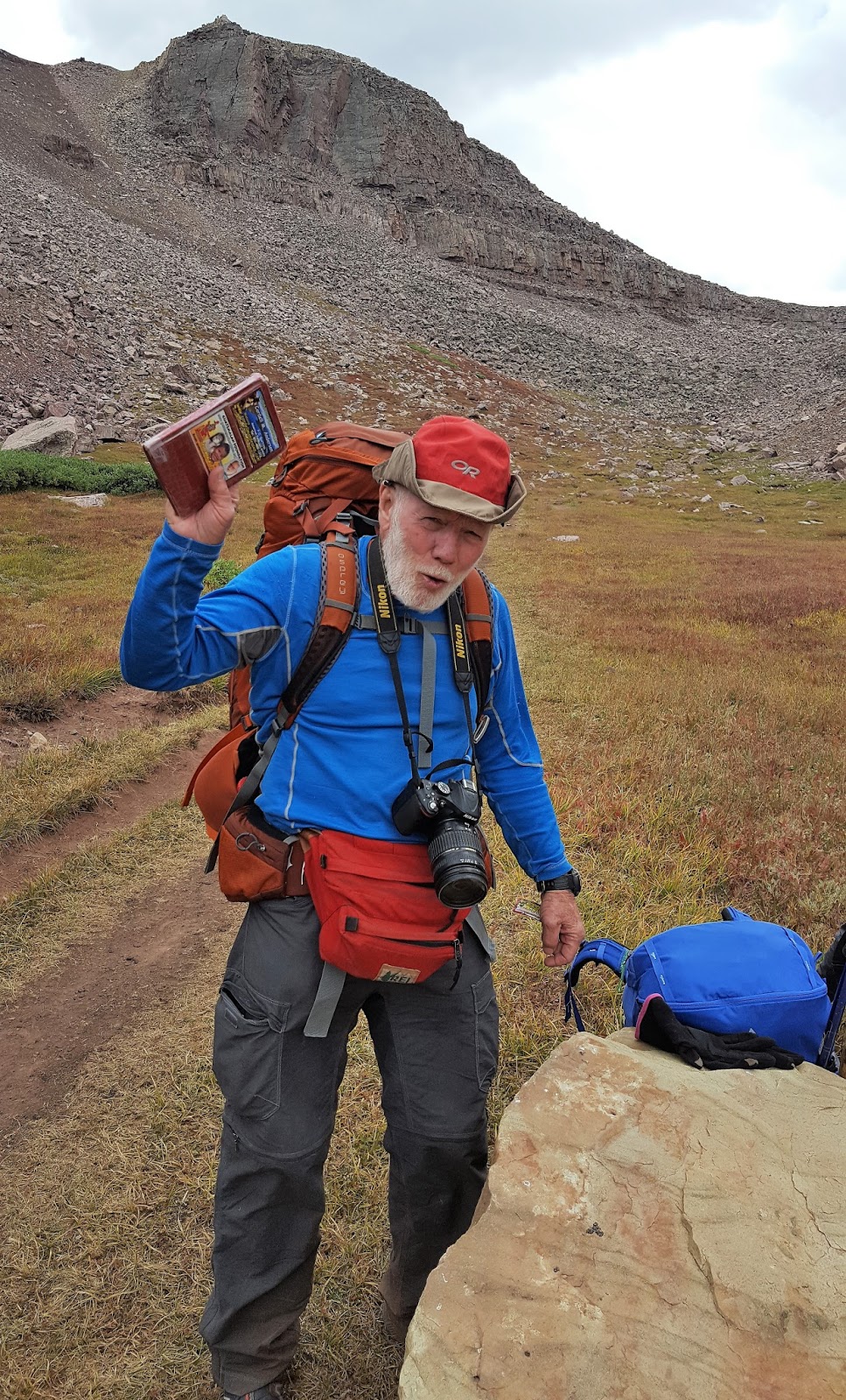
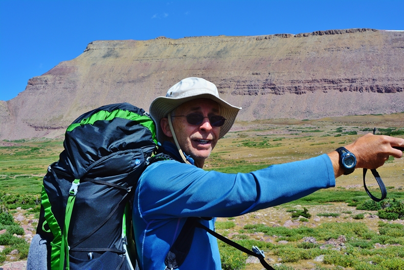
My pack just had water, food, RAIN GEAR, CAMERA & EMERGENCY ITEMS ALREADY EXPLAINED TO MONITOR MY VITAL SIGNS, plus SPOT TRACKER & SATELLITE PHONE.
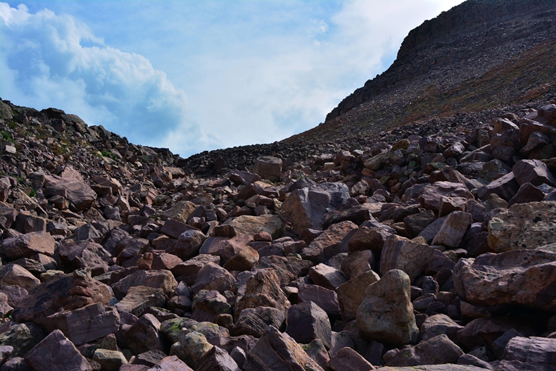
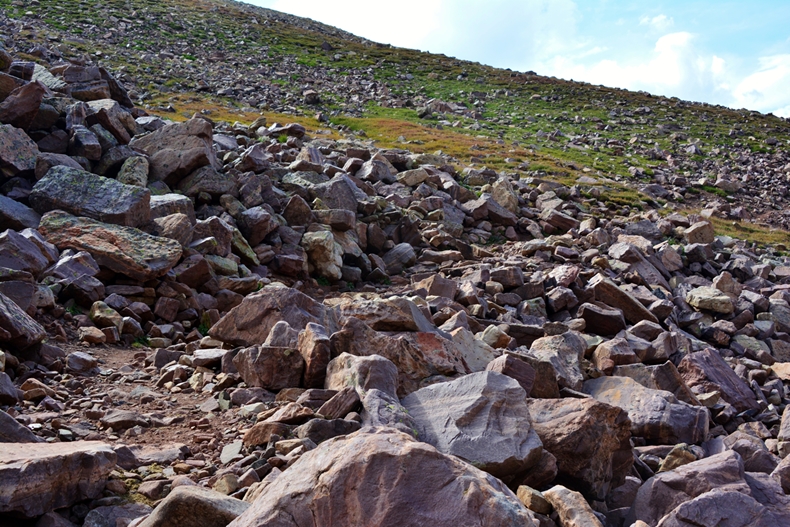
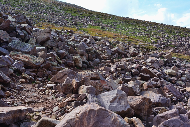
I leave below lake U-75, after getting through steep boulder fields.
I gradually worked my way up the ravine that I had thought would have a little stream coming out of the lake. As it worked out, it was mostly underneath the boulder fields.
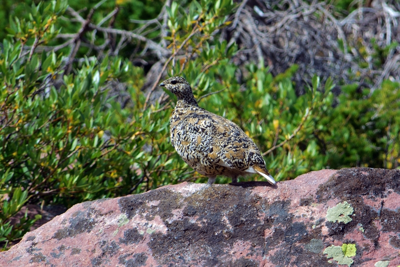
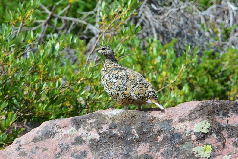
Getting some photographs of a pair of Arctic Ptarmigan, made the steep climb a bit more interesting.
They were found at an elevation higher than the summit of Mt. Timpanogos.
As seems to be the case in nature, the male is the most colorful. The female more adaptable to hiding and blending in with the terrain.
As I got closer, and higher, the wind was biting and very cold, and once in a while there were snow flakes in the air.
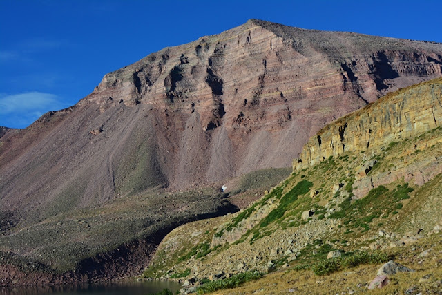
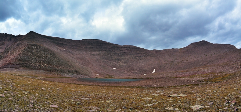
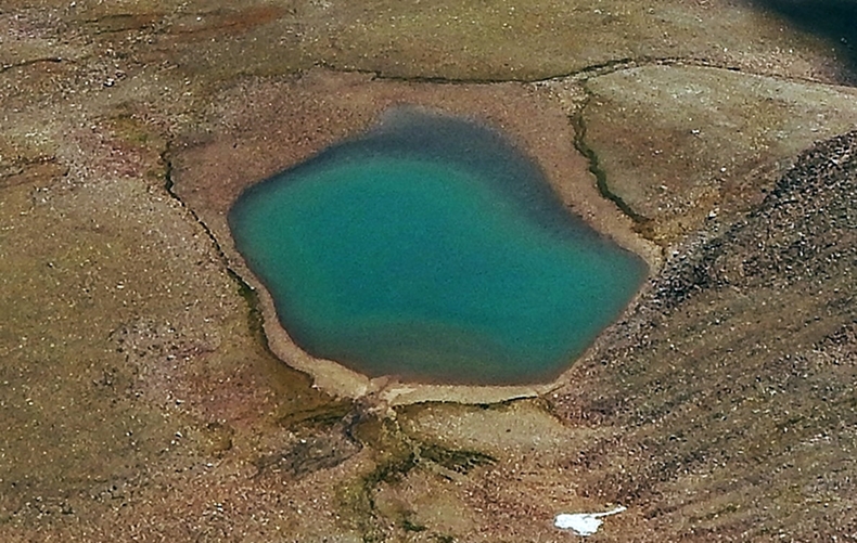
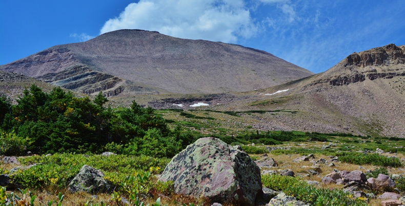
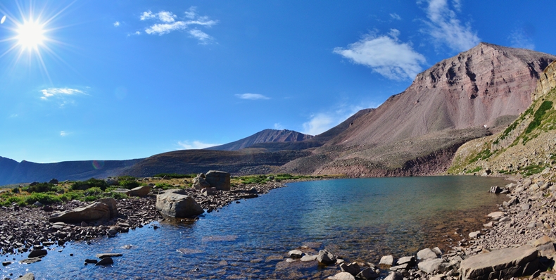
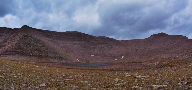
I finally came over a rise and there it was in the distance at the foot of South Kings Peak.
We are here at an elevation 550 ft. higher than the summit of Mt. Timpanogos.
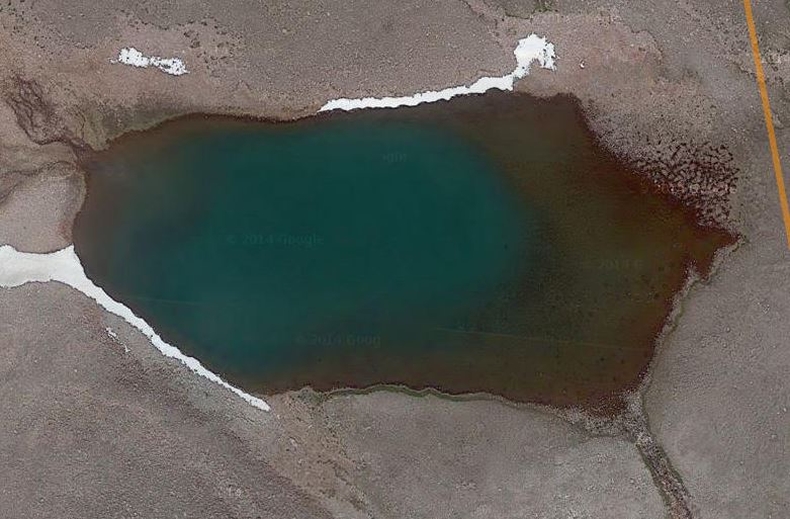
As I got closer I could see that the dry year had dried up the shallow end of the lake, revealing what looked like dry mud flats, and my joke over the last couple of years about “finding a swamp,” seemed to have come true! But, as I have said–like on KSL OUTDOORS,
“IT’S MY SWAMP & THE ONLY ONE I’VE GOT!
Closer examination and zooming in show that we aren’t seeing a mud flat, rather rocks covered by sediment and water growth that has dried, but there is a deeper portion of the lake as we see by zooming in from Google Earth.
So it’s not so bad after all and it might be a good idea to have the DWR plane drop a few trout in next year…….in old man’s talk I’m talking to you guys at Utah FISH & GAME!
But, the weather was closing in on me and I didn’t want to have to navigate some steep, rocky areas if wet with rain and snow–so did what I had to do and then headed quickly for camp…..I actually forgot the SPOT Tracker, until about 150 yards down from the lake, but remembered just in time.
I checked the oxygen and found it at 82, about the same as had been the case at Gunsight Pass, and immediately headed down the mountain, seeing along the way my old buddy, OLD MAN OF THE MOUNTAINS, in much worse shape than me.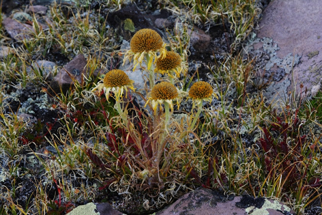

OLD MAN OF THE MOUNTAIN on Trail Rider Pass in 2005, early in the season with gale force winds blowing.
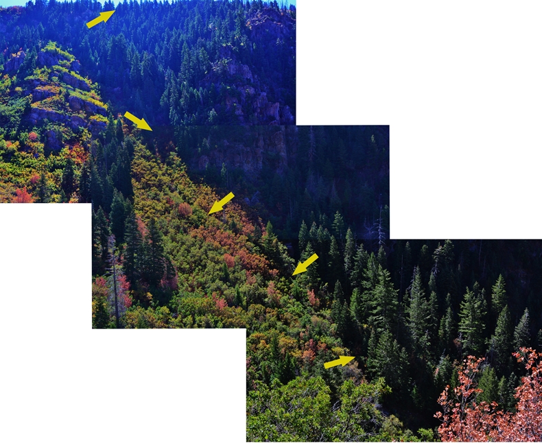
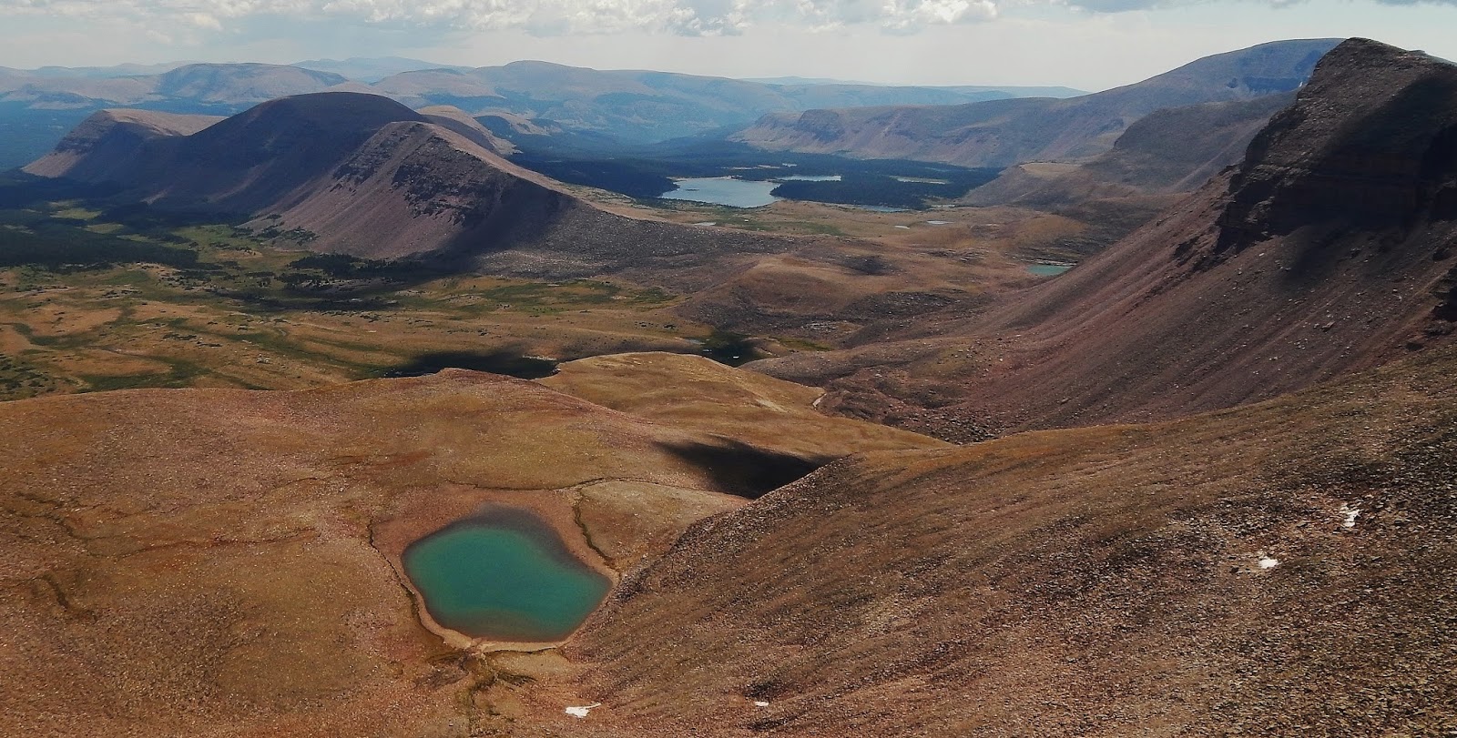
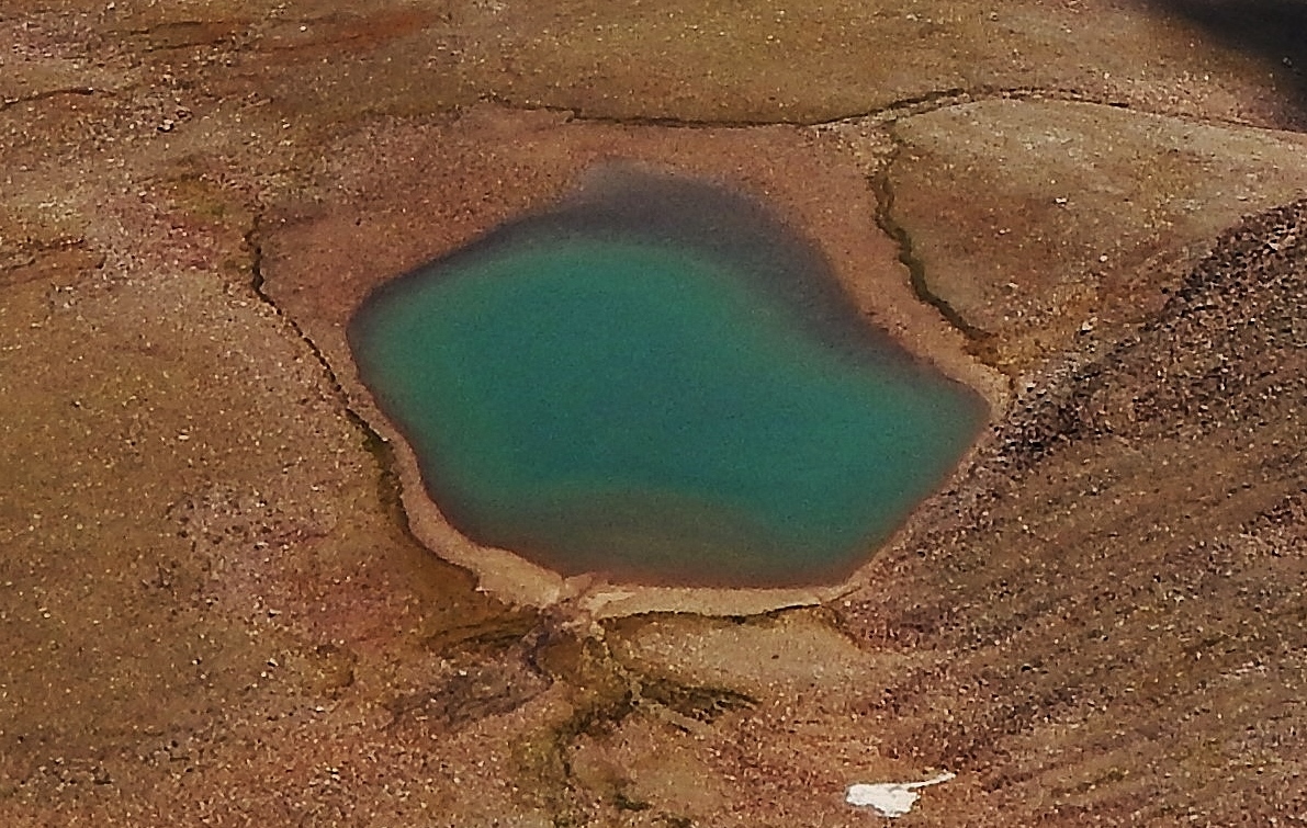
NOW THE GOOD FORTUNE!I’ll insert here a photograph of Little Andy Lake taken by Elisabeth Johanson from South Kings Peak, just sent to me today, September 2nd,
and then zoom in some.

This is a wonderful photograph showing that Little Andy Lake really isn’t a “swamp” as I have talked about jokingly…like on KSL Outdoors, but does show that the level has dropped a lot due to the dry year, but a fairly deep portion remains. Remember lowly looking Little Andy Lake is 550 ft. higher than Timp!
On the left is seen the long Painter Mountain, dominated by Trail Rider Peak, then in the middle 11,780 ft. Trail Rider Pass, with Lake Atwood in the background. To the right of the Pass is seen 11,745 ft. high Beard Lake (U-74), then in the right background 13,440 ft. Mt. Emmons, with Mt. Jedediah’s 13,387 peak on the extreme right.
Special thanks to Elisabeth Johanson for the photograph taken from South Kings Peak (13,512 ft. 2nd highest in Utah).

Here we zoom in a bit on 12,302 ft. high Little Andy lake, with
Beard Lake just barely seen on the extreme right–a zoomed in view of Beard Lake is shown in a couple of pictures, along with the record brook trout that fell there for my Thomas Cyclone Spoon.
But first let’s zoom in just a little more….
Along the way I focused on Trail Rider Pass, seeing on the other side Lake Attwood, with Beard Lake on the extreme right.
Zooming in a bit.
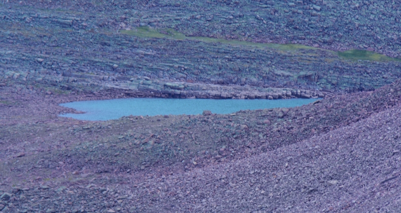
And, zooming in on Beard Lake (U-74) right near Trail Rider Pass. It was in this alpine lake that I hooked the brook trout seen below that I have calculated would easily have been a Utah State record, if I could have got him out of the water and to a certified scale! The present record is 7.5 lbs. from the Boulder Mountains…..I calculate this one as much as several lbs. heavier.
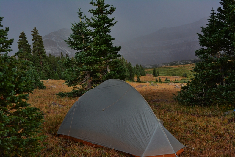
I got back to camp just as the snow was beginning to fall and took refuge in my tent and did some reading & resting, grateful for having achieved my objective of getting to “Little Andy Lake,”
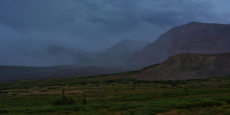
The next morning, day 5, I waited for the sun to warm things up and melt some snow, and then packed up and was on my way, determined to get to the Dollar Lake area for my last night. By around noon thesky gave all the signs that I was in for some weather that day, but I was ready for it.
I bid farewell to Mt. Jedediah, and was on my way.
As I hiked towards Gunsight Pass, I looked back and saw the area I had been in shrouded in the weather, and also wondered about the kids who maybe were up high on those mountains trying to achieve their objective–and said repeatedly a prayer for them…a prayer that seems to have been answered. Prayed for me too, as I was pretty tired and having a tough time.
The weather looking east, where I had been on Backpack #2 was also closed in.
As I plodded along, I entertained myself with prayer, and reviewing out loud some of the greater spiritual experiences of my life–and I more than once prayed that the storm be “held back just a little” so I could get up and over the pass.
Maybe it was a lack of faith, but several times, just to be safe, I put on my rain pants, my Mountain Hardward jacket, with rain parka over it, and got out the rain cover for my pack.–and then moved along.
Anticipating bad weather ahead of time is an important skill to help one get properly dressed in time, and getting your tent set up before the storm hits.
I finally got to the Highline Trail junction, and removed my pack to rest a little and take a few pictures.
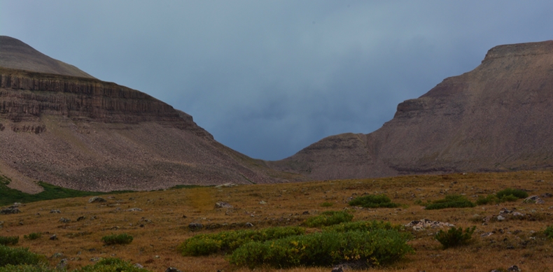
Fox Queant Pass, conquered a few weeks ago, is seen enshrouded in tough weather, as is North Pole Pass.
Looking back again at where I had been…..and grateful as it seemed like I was leaving the storm path behind me.
Soon I was past the forked trail and climbing the pass, and got over it and down the other side without actually being rained on. There were many storms, but they would move through quickly and be gone. I had wanted to get to the Dollar Lake area, but it didn’t look like I would make it as the night was coming on, so when I saw water down below the trail, I turned off and located a spot for my tent with the opening pointing south which I needed for the satellite phone in the morning for my call to KSL OUTDOORS.
My prayer to hold back the storm to get my tent set up worked, and so I pushed it wanting just a little more time to run down and get some water and have my gravity purifying system working……and just as I got it all done…THE RAIN, SLEET and SNOW all of a sudden broke lose from the heavens–but I was snugly into my little abode with enough water to mix up a couple of egg nogs that would be my dinner and breakfast.
Had a great call with KSL OUTDOORS, and then snuggled into my sleeping quilt again and waited for the sun to warm everything….BUT IT NEVER HAPPEND!
In my hurry the evening before I had forgot to position the tent to get the first rays of sunlight in the morning….so finally just got up and packed up.
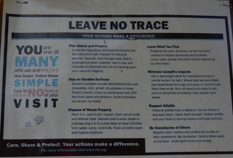
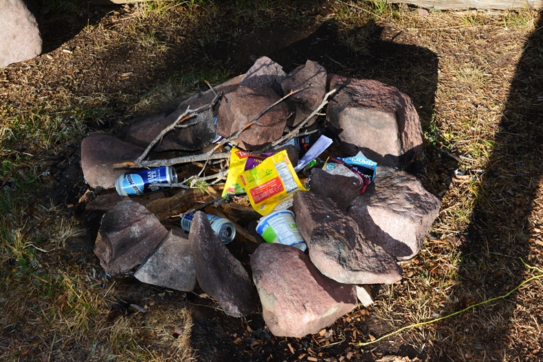
Nearby other campers had left a mess…..but at least gathered it up into their fire-pit.
LET ME SAY, THIS VIOLATES THE FIRST LAW OF THE WILDERNESS:
LEAVE NO TRACE!
As I shouldered my pack, I got the last shot of KINGS PEAK, but vowed to be back to the Henry’s Fork Basin next year, and focus just on the many lakes of the basin I’d like to visit one more time.
That will include getting to the base of Castle Peak where Castle Lake is found.
As I headed down the trail, all of a sudden I heard:
“HEY CORDELL, I FOUND YOU!”
Nathan Gibbons, went on saying,
“I’ve been following your SPOT Tracks all week, and knowing you’d be here, I jumped in my car and came running up the trail to meet you!”
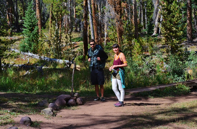
While we talked, all of a sudden we were joined by two young ladies, Cameo White and Janae Welling. Their emails indicate “ldschurch.org” so, were they missionaries on their “P Day,” or seminary teachers? Hey gals, tell me what the deal is.
Whatever, it was nice meeting them, along with Nathan and they helped us out by taking a picture of me and Nathan with my camera, seen below.
Soon I was back to the huge Spruce, and in the Dollar Lake area.
With a unique backpacker coming up the trail…..
In the area I was looking for a memorable spot that I had got to in mid-September 2004, in fact a SACRED SPOT which is seen below:

In mid-summer 2004 my “motorcycle knee” was operated on. Six weeks later I was determined to do a special backpack camping out near Andersons Pass under the eastern shadow of Kings Peak. My 3rd day had me day hiking down to U-75 lake, but along the way I became very sick, with high fever, an acute digestive component, headache, etc. but made it to U-75, took one cast and decided I had to focus on survival–getting back up to my camp where I had emergency medications, etc. That climb back up was a faith filled experience and I was deeply grateful for having made it and started an emergency anti-biotic. I laid there two days letting it to begin taking effect but on the 3rd day I had to get out of there as snow was on its way.
That afternoon I did a test to see if I might be ready to make the move in the morning. I hiked up to Anderson’s Pass and took the picture at sunset when I found
“the whole mountain turned to gold!”
In the morning I packed up knowing I had to move carefully in hopes that the sickness wouldn’t notice it had a great opportunity to knock me down for the count. I had to hike the 8 miles to the Dollar Lake area, and then hope to do the remaining 8 miles the next day.
I made it to the spot above and set up camp, believing I was like, “Home free!” On the sat phone I called the family letting them know I was alright.
But, I was having a hard time resting as every time I would dose off I would suddenly awake unable to breath. By around 10 I was imagining how long it would take me to get to the Trailhead the next day, when…..ALL OF A SUDDEN IT FELT LIKE KNIVES WERE BEING JAMMED INTO MY HEART! I grabbed my chest putting pressure on believing that it would burst without the pressure. As the unbearable pain continued I cried out a simple and desperate prayer,
“Father in Heaven, too many people are dependent on me and I have to hike out of here tomorrow. PLEASE HELP ME!”
At that instant I felt my heart literally jumping around inside my chest….and IT WAS OVER!
I carefully let up the pressure on my chest and finally removed my hands.
The next day it took me all day to do the 8 miles, but I made it and was alive, and since, at the Cardiologist’s suggestion, have carried constantly a little packet with aspirin, Nitro Glycerin, and extra blood pressure medication.
THE SPOT I FOUND & PICTURED ABOVE IS SACRED GROUND FOR ME!
***************************************8
I continued down the trail passing the Dollar Lake area……………and looked back up towards the pass, with Gilbert Peak on the left, and grateful for having been able to do as well as I could in my 81st year.
Remembering all the special experiences had in this whole area, and feeling a renewed gratitude to the Lord……
…….I found the wonders of nature even more amazing as I hurried down the trail.
WOW!
Soon a backpacker approached coming up the trail slowly. He introduced himself as
DARRYL CHRISTOFFELSZ from Calsbad, California.
Nathan came down the trail and joined the conversation with Darryl…….
…….and took my picture along with Darryl.
Darryl is a member of THE HIGH POINTERS CLUB, dedicated to climbing the highest point in each of the states, having already done 42 states, but with the tough ones remaining. He was making his 5th attempt at Utah’s Kings Peak. Each previous time stopped due to some problem, like once in October with a couple of feet of snow.
Apparently he was having some difficculties at 57, even with only a backpack weighing 22 lbs. and wondered how the heck I was able to do what I was doing being 80 years old?
“Did you smoke or drink?” he asked.
Hearing my reply that such have never interested me, he pressed for what my secrets were, and I replied telling him I have revealed pretty well everything in a long article on my website, entitled:
I went on to explain to Darryl, and Nathan, “I take a lot of stuff, but something is working so well that I’m afraid to leave any of it. Once I started experimenting stopping one item at a time and noticing the results, and with some didn’t feel an effect, but there were 4 or 5 that made such a difference I got back on them quick, and before I sacrifice any of them, I would rather sacrifice my Mt. Dew or eating!”
Then we were invaded by an armed group…..of Arctic Ptarmigan hunters led by Johnny Clare.
I told them where I had seen Ptarmigan on this trip and previous ones and told them to keep an eye on my website and I’d include some pictures and description of where they were seen….but basically it was in alpine tundra between 11,500 and 12,000 ft. It would be one tough hunt, with little to show for it, except some great exercise and seeing many beautiful
“visions of nature.”
The hunters hurried down the trail, as had Nathan, leaving me with Darryl.
Darryle expressed profound gratitude for our chance meeting, and felt like my example, and what I’ve written about “longevity secrets” would be a great blessing in his life, and that it was almost like “divine intervention” that we had met.
I hope and pray he will take seriously my “secrets!”
Down the trail three young ladies stopped to say hello, as I was resting at the moment. They, as almost everybody else wondered about what the heck I was doing up there. I got names and emails for some, but passed out my business cards to all, and hope they will email me, and check out the website. The middle one, Christina Ogrin, emailed me today and reported that two out of the three made it to the peak.
There were dozens of others I didn’t talk to or take pictures of–as it was just too time consuming.
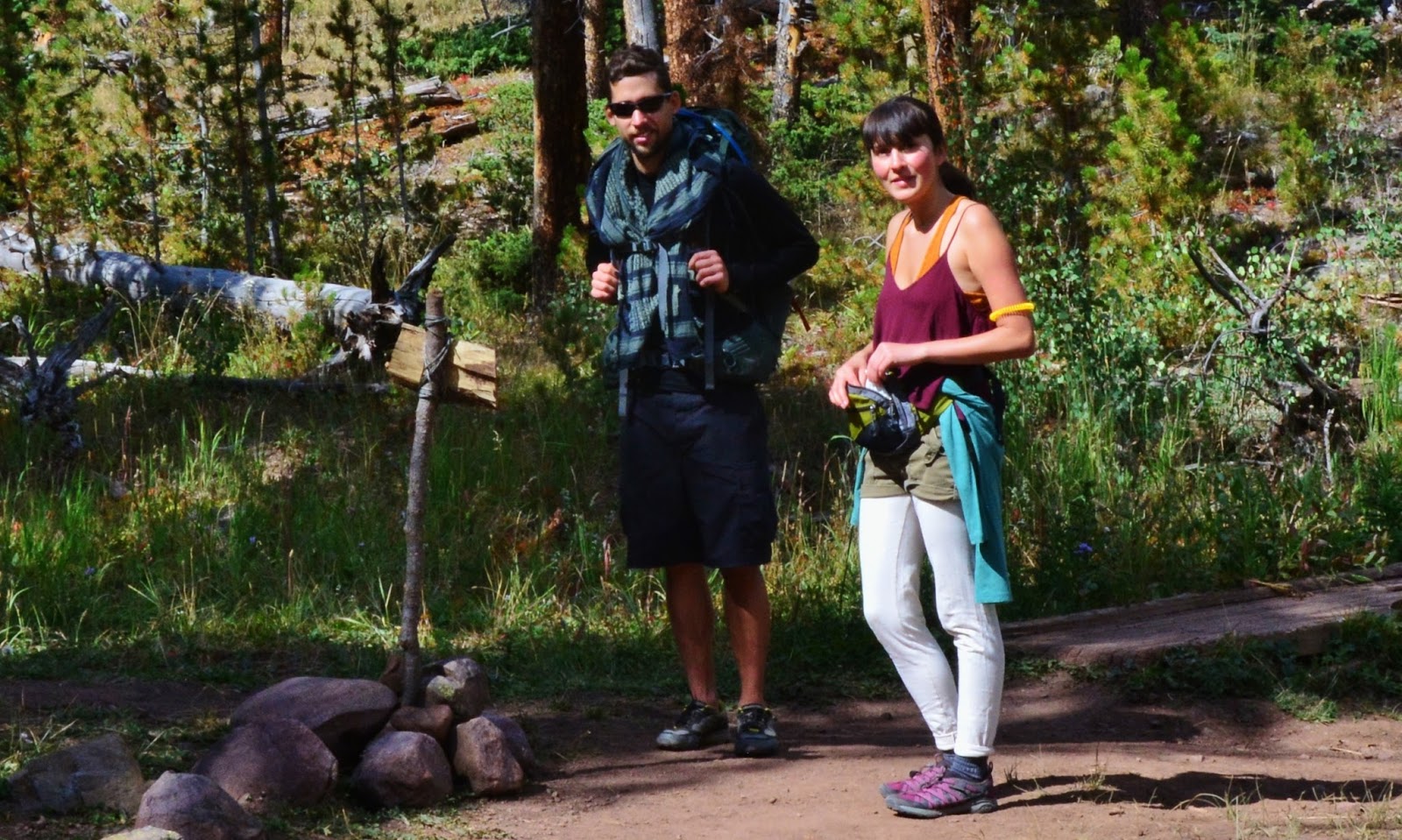
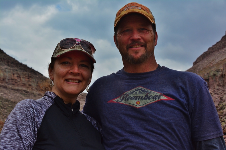
Finally got down to Elkhorn Crossing, and a bit below a handsome couple from Montana I had talked to the day before stopped to talk a little, and I was able to get their picture.

I thought I had got their names, but I’m afraid I lost pages that started falling out of my ledger. But they got my card and I hope they will contact me and become High Uinta Friends. RECEIVED THEIR EMAIL….WHAT A RELIEF, as I didn’t want to forget Brant and Jennell Humphrey, from Helena, MONTANA
Speed & Power.
Brant Humphrey, MS, CSCS, FMSC
Director of Performance
Fundamental Athlete Sports Training
406-502-1901
Thanks, Brant & Jennell for contacting me and assuring our
“HIGH UINTA FRIENDSHIP!”
I’m not surprised at all about your business….as both of you are
INCREDIBLE ATHLETES!
I’ll now go back to my description done initially:
They referred to something that had worried me the day before when seeing them. As I was coming down the pass at about 5:30 three young men, obviously on a day hike, only with wind breakers, passed me saying they were going to climb Kings Peak. That worried me as at best it would take them until 7:30 to scale the peak, and then in the dark, rain and maybe snow, have to come all the way back to their camp between the pass and Dollar Lake.
My Montana friends said they had seen them on Andersons Pass late at about 6:35 and being late & with bad weather, they had decided it not wise to scale the peak, but rather decided to work back to Henry’s Fork Basin by going down the “chute,” mentioned previously. So, at least they would have been going down, rather than up into the teeth of a storm and the jaws of Kings Peak!
I meant to ask them about Montana and tell them how I used to love my fishing trips on the Beaverhead River near Dillon, Montana…which I will soon be doing again. I actually tried to hike pretty fast to catch up to them….but apparently fast for this old guy was pretty slow compared to this athletic couple…so I never saw them again…and hope they will make contact……
…..which of course they did. THANKS BRANT!
P.S. When I get some pictures from them, I’ll insert them here:

Down the trail I was passed by a number mountain runners who had left the Trailhead early, and were almost back after a run of 32 miles in tough terrain and at high altitude….all done the same day….which for me is awe inspiring!
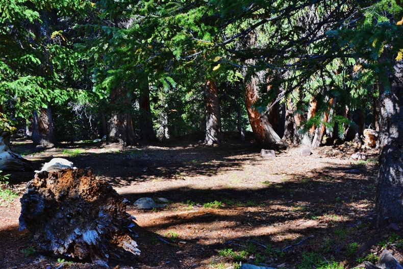
Soon I was in the Lodgepole pine belt, where the tie hackers did their heroic work 150 years ago. We need them again to do a little thinning!
Soon it was heartening to get into the Quaking Aspen belt, knowing that I was getting close to the Trailhead.
Then a father, who said he had climbed Kings Peak a number of times, came up the trail with his two kids who he was helping to also do the Peak.

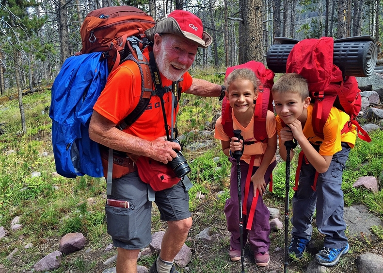
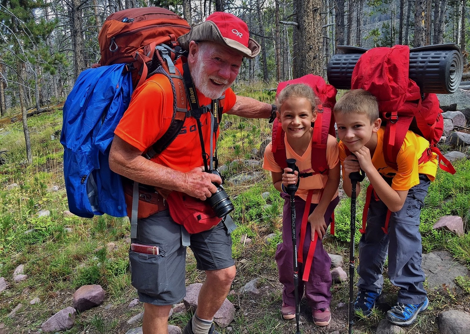
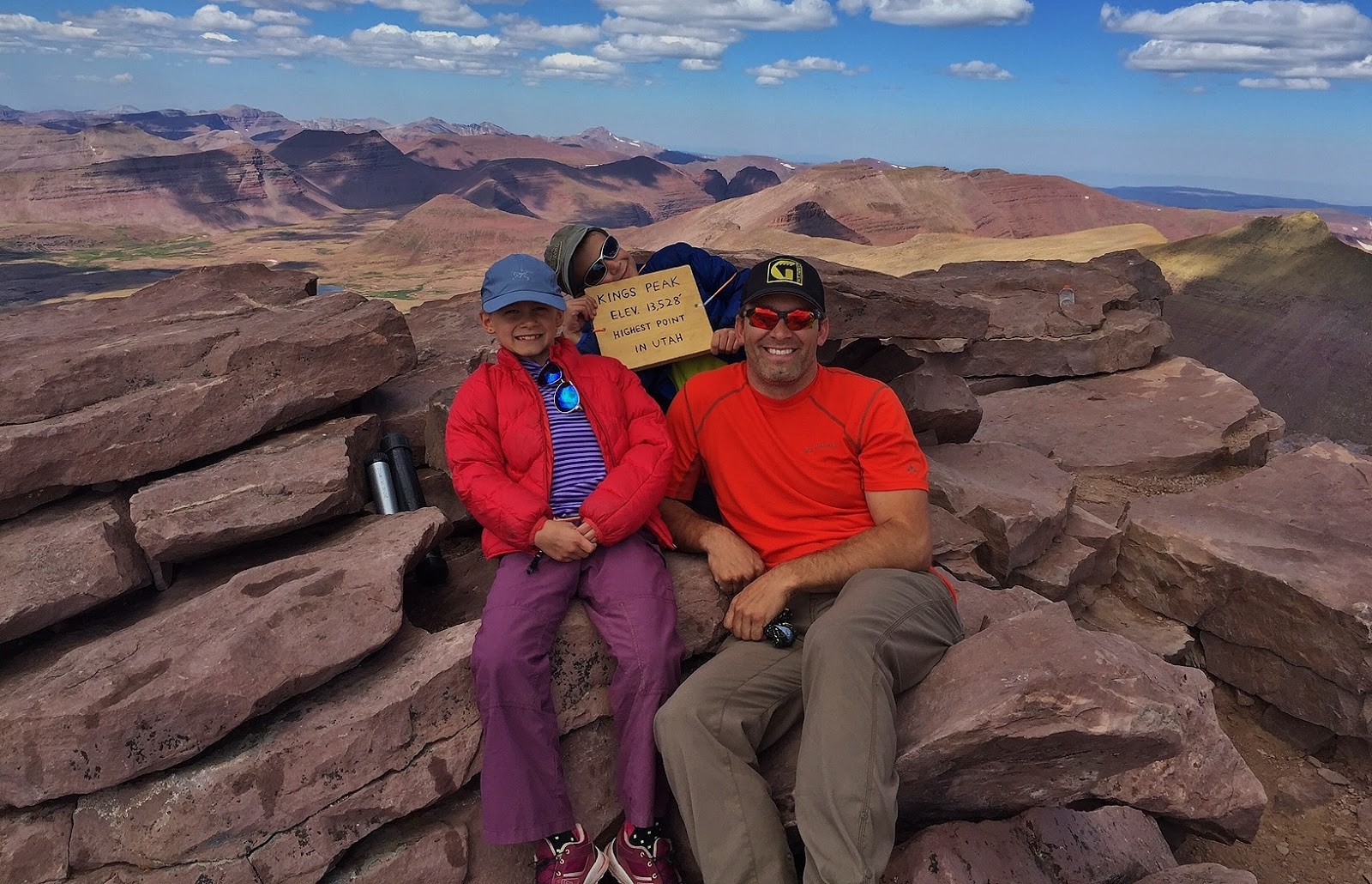
Once again I seem to have lost their names, but did leave a card and hope they will contact me as I want to give them a photograph to remember this special experience.HOLD ON..JUST HEARD FROM THEM. I did have the father’s name, but didn’t recall who it was. He is JAKE HIRSCHI with the following report followed by their pictures:
Cordell,
Nice to meet you on the trial last weekend.
We spent one night at Dollar Lake and headed for Kings early the next morning.
y 9 and 10 year old made it to the top of Kings Peak by 11:30am. We then stomped all the way out to the car that day by 8:30 PM just as darkness closed in. We easily made it home that night in time for school on Monday morning. Mom was impressed.
First mountain peak for my 9 year old. She did great on this long trek. My 10 year old had done Mt Ogden 2 time and Ben Lomond 1 time before. They both helped motivate each other.
I took the tent, one sleeping bag and one pad and our stove to the peak for safety. We were set for self containment in case of accident or need to help others along the trail. We had good weather and no accidents. Not one trip or fall. Kids did great. Some sore feet but they didn’t seem to mind after a little doctoring
Another email from Jake introduced me to his kids….now with names as seen below.
Here I am with Jake’s kids: GRACE, 9, and ISAAC, 10
Grace & Isaac fooling around and getting ready to climb KINGS PEAK, seen in the background.
Jake, justly proud of his two climbing companions on top of Utah’s world!
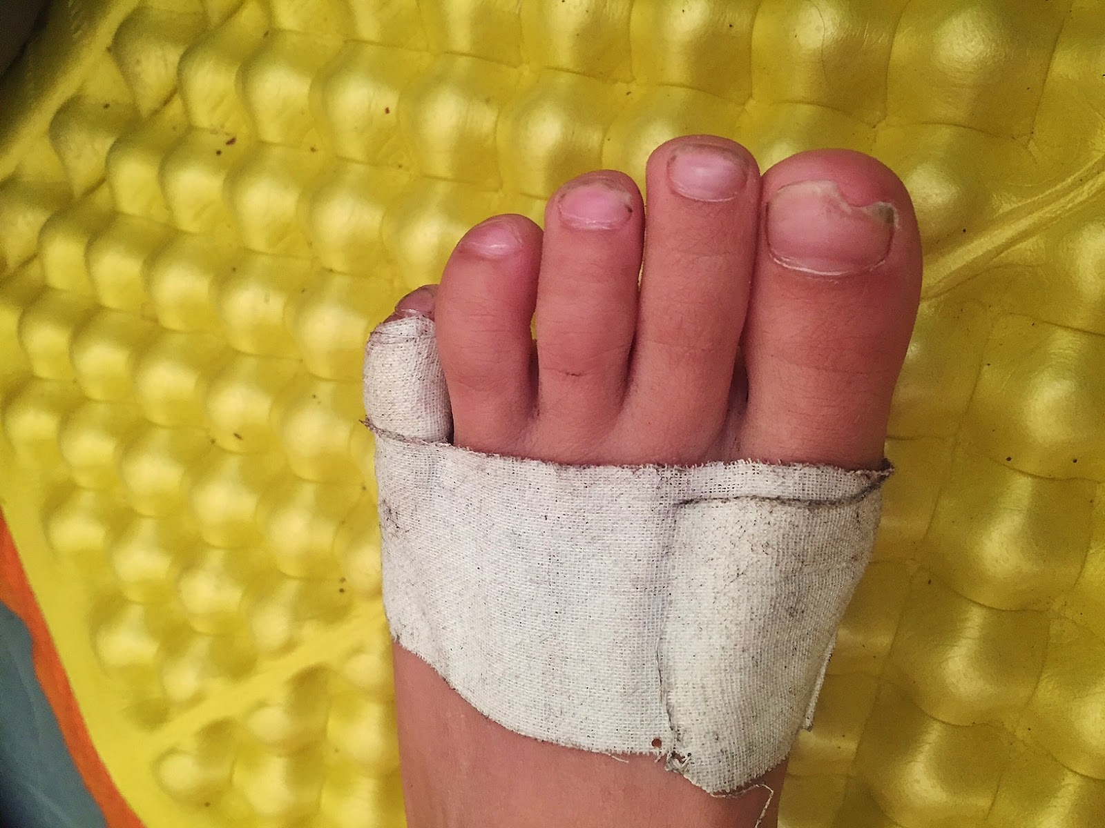
I’m not sure whether this foot belongs to Grace or Isaac?
JAKE’S REPLY this morning, September 3rd:
You are an inspiration for them and for me. Hope to follow in your well traveled footsteps. They remembered the exact spot on the trail where they met you while we were hiking out the following day. They referred to our “trail buddy” (that’s you) many times along our journey.
Hope our paths cross again.
Happy trails,
Jake
Since I’m now the kid’s “TRAIL BUDDY” I’ll insert a picture of me also on top of Utah’s world, back on my 27 day “expedition” in 2003:
Now, down the trail, anxious to get to the Trailhead
Met more new High Uinta Friends, Kevin Park & friend, at the junction where the trail takes off to Alligator Lake. Kevin has emailed me and I have emailed him this picture as I will for any photographed on this wonderful backpacking experience in our wonderful Wilderness.
We all admired the sign made by someone and hope that the Forest Service will take the hint!
More mountain runners….now walking almost as much as jogging, but I don’t blame them a bit!
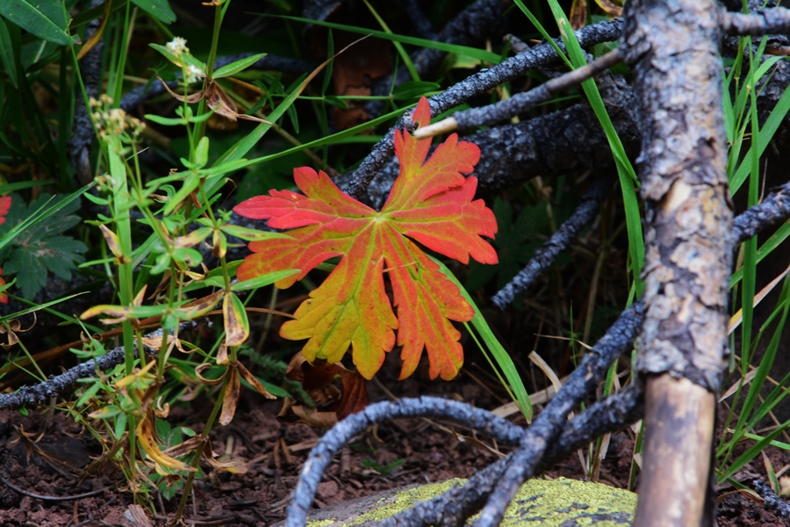
It was August 27th, and all along the trail signs of summer coming to an end were colorfully visible.

I was very grateful for having been able to finish off my summer of backpacking by achieving my goal of getting to LITTLE ANDY LAKE, & in a sense finishing the backpacking/exploration portion of my Project…..although backpacks will continue each summer, gradually filling in the gaps with explorations into areas that have escaped me.
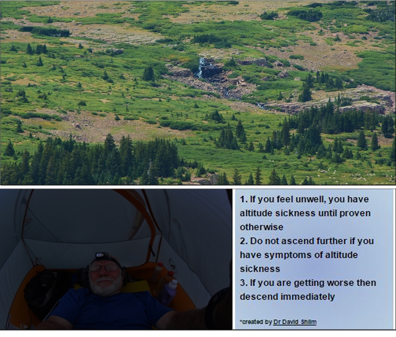
HIGH ALTITUDE SICKENSS...
… was avoided due to several critical factors:
1. Having done heavy duty workouts all winter & spring, had me STRONGER; 2. LOSING 26 lbs. following a special diet to lose fat, rather than muscle;
3. Persisting with my special supplements designed to STRENGTHEN MY IMMUNE SYSTEM, & COUNTER-ACT THE AGING PROCESS;
4. Taking DIAMOX, that helps speed up the acclimatization process;
5. Monitoring my vitals with Blood Pressure gauge & Oximeter, and at times resting a little more than usual to give my body time to acclimatize before continuing.
EXCITED WITH THE NEW FOCUS OF MY PROJECT
I will now begin serious efforts of putting together the unique book which will be much more than a guide book for hikers, but will….let me insert here what I told several on Backpack #1 into the Grandaddies:
It will be an E- book with lots of the stunning color of the Uintas none of which is seen in any of the guide books. Yes, it would be a guide book for hikers and backpackers, but much more mixing throughout the incredible history, the fascinating legends and myths of gold & Big Foot, and, I asked, “Do you know about the tie hackers?” They shook their heads, and I described these “unsung heroes of the Uinta’s North Slope without whom the West might not have been won!” I went on mentioning Tom “Bear River” Smith, President Eisenhower’s hero from Abelene, Kansas, and Beartown, where Tom got his nick-name, which tie hacker/railroad town was described as
“The liveliest if not the most wicked town in America!”
all tied to the Uintas, and much more that will be in the book, with special emphasis on SURVIVAL, telling the stories of those who didn’t make it, and WHY…
……then my personal survival experiences, and lessons learned
that will save many
lives,
plus enhance everyone’s enjoyment of the Uintas. They were wide eyed and seemingly pretty interested and said,
Their reaction?
“WOW….You’d better get to it before it’s too late!”
“I WILL NOW FOCUS ON THAT!”
*****************************************


