3/26/2022: CHALLENGE to hike & backpack again — More “VISIONS OF NATURE” — NEW HIGH UINTA FRIENDS! — WEEKLY SNOW DEPTHS IN UINTAS — Final segment on HIGHLINE TRAIL west: Featuring THE ROCK CREEK DRAINAGE –THE BOOKS — Remember UKRAINE & the RED CROSS……..

DAILY THE STAIRS &

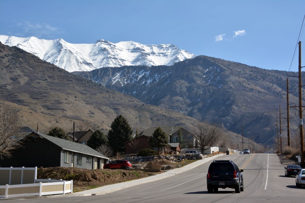
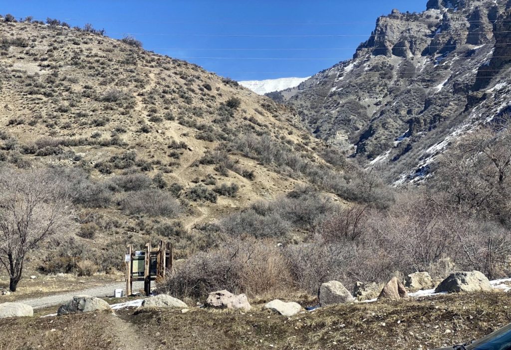
THEN EVERY FRIDAY UP TO THE FOOT OF TIMPANOGOS HIKING UP GROVE CANYON, EACH WEEK A LITTLE FURTHER UP THE CANYON & HIGHER ABOVE UTAH VALLEY

MY GOAL THIS WEEK TO GET UP TO THE THIRD LONG SWITCHBACK WHERE THE TRAIL OVERLOOKS THE VALLEY & TURNS UP THE CANYON HIGH ABOVE THE CREEK.

THE SECOND SWITCHBACK TOOK ME HIGH ABOVE THE CANYON WHERE I HAD GRADUALLY GOT A LITTLE FURTHER EACH WEEK. THE COUNTRY-SIDE STILL PRETTY BLEAK, BUT WITH WARMING TEMPERATURES WE SHOULD SOON SEE SOME BUDS APPEAR & THEN GRADUALLY GREEN WILL EXPLODE ON US!

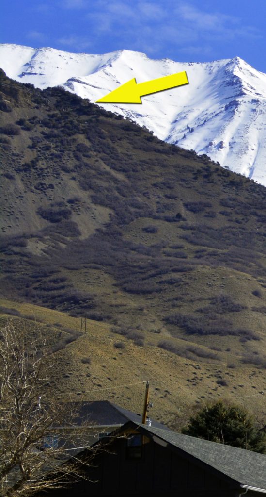
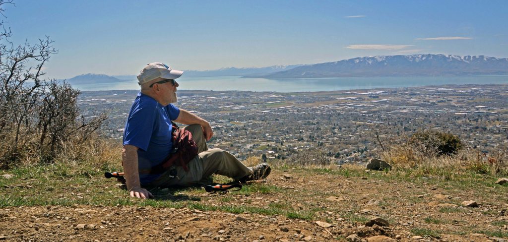
FINALLY MADE IT & SAT DOWN FOR MY PICNIC LUNCH and NEEDED REST.

ALL PRETTY “MICKEY MOUSE” BUT CONSIDERING A YEAR AGO I COULDN’T EVEN WALK–WITH NO MUSCLES IN MY LEGS THAT HAD ME LOOKING LIKE A HOLOCAST VICTIM & NO BALANCEI FEEL MORE THAN GRATEFUL FOR BEING BLESSED BY THE LORD WITH FOR ME “MIRACULOUS” PROGRESS & VERY REAL HOPE FOR SOME KIND OF “EXTREME LIGHT WEIGHT BACKPACKING” IN THE HIGH UINTAS!

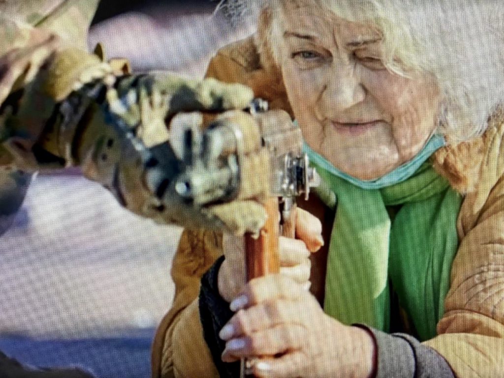
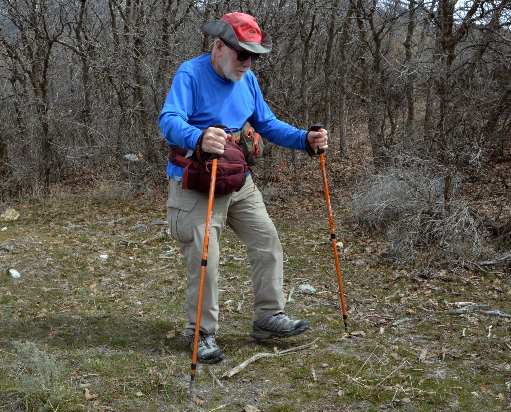
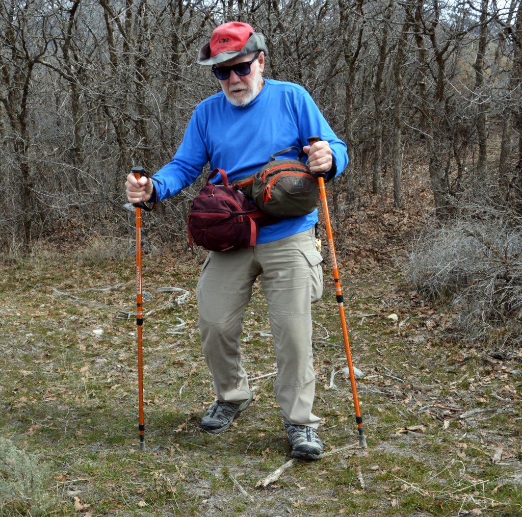
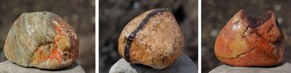
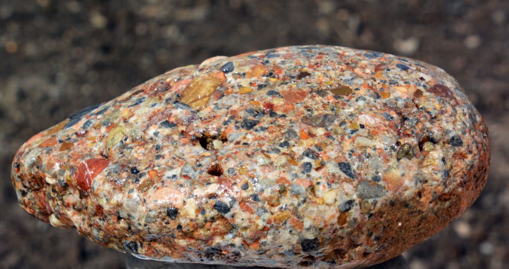
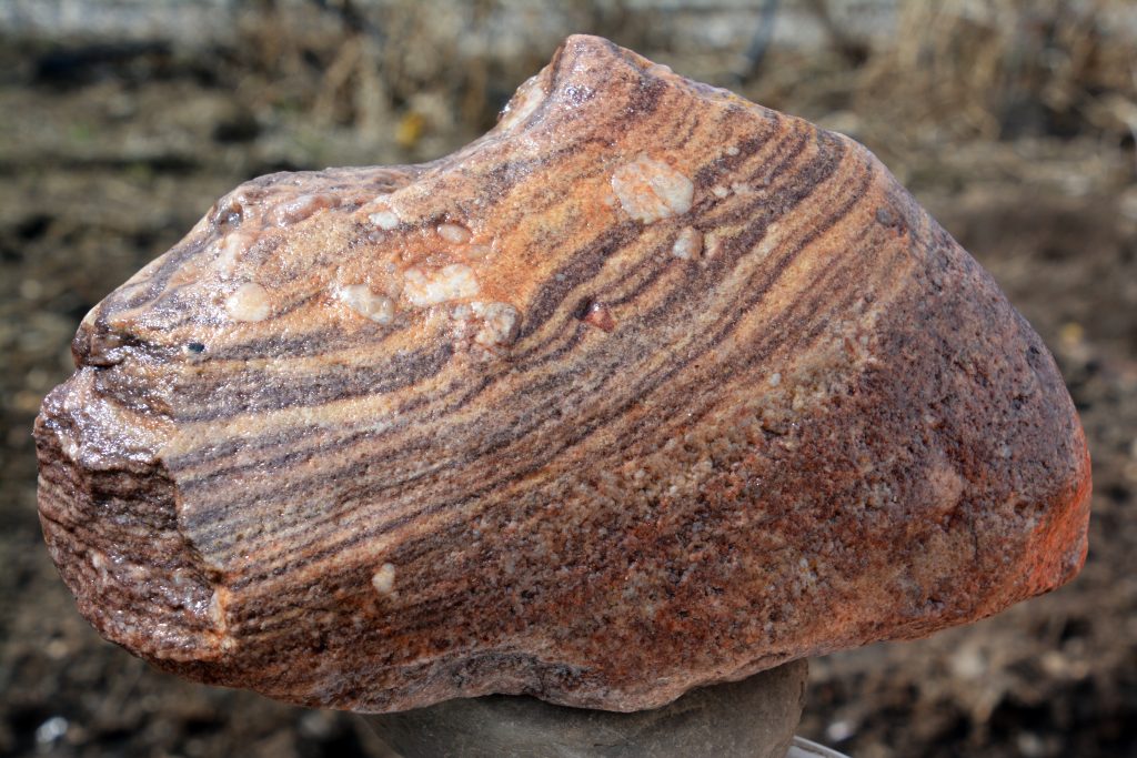
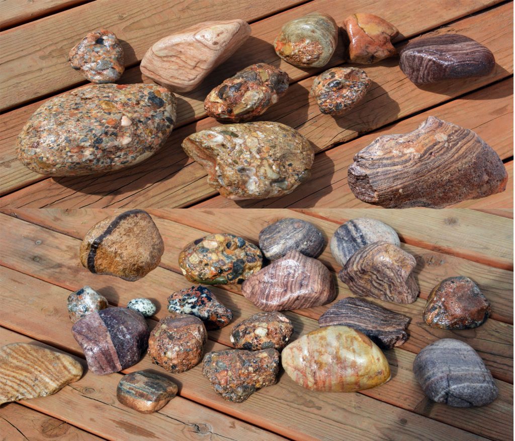
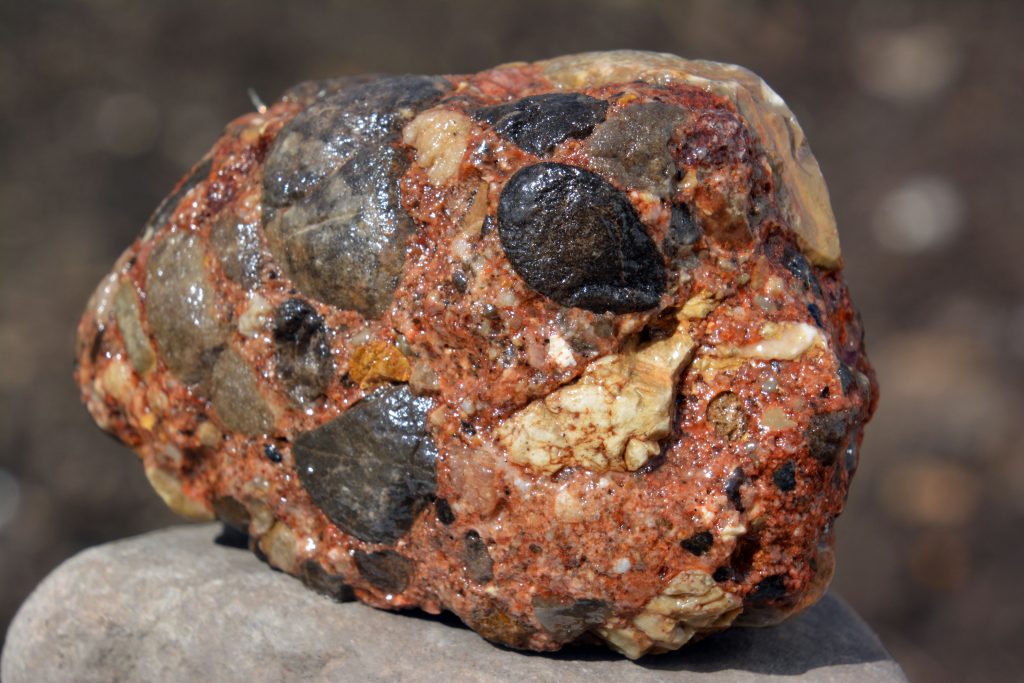
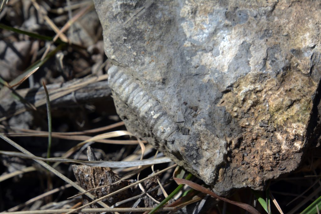
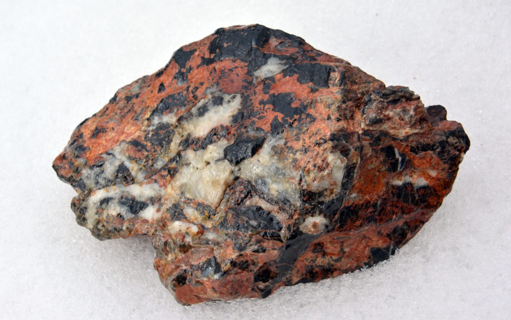
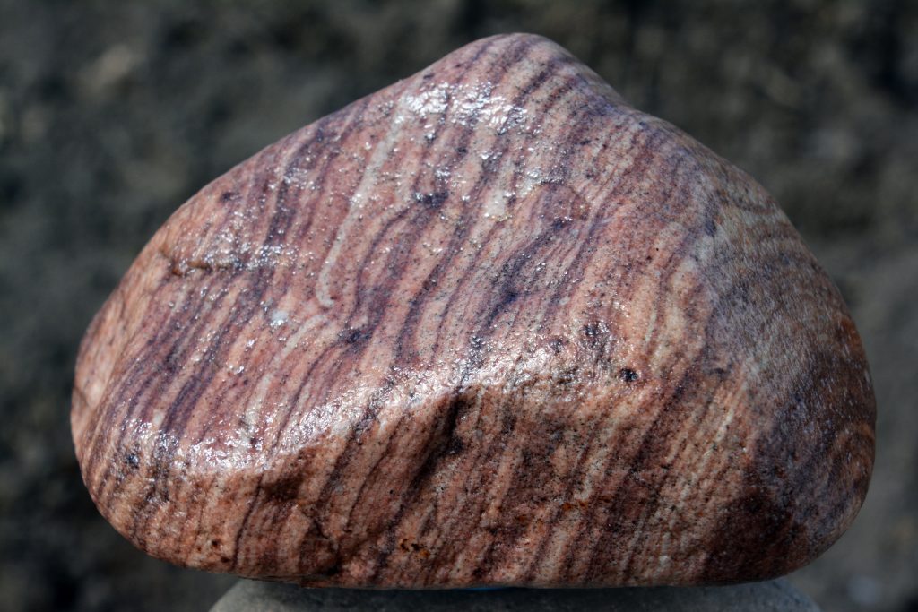
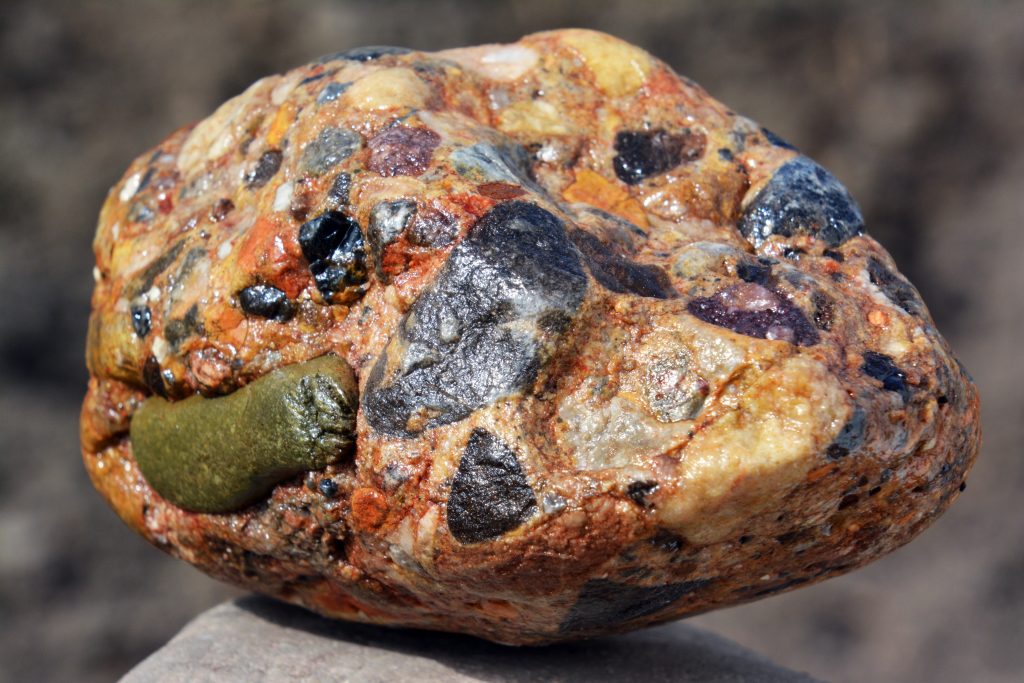
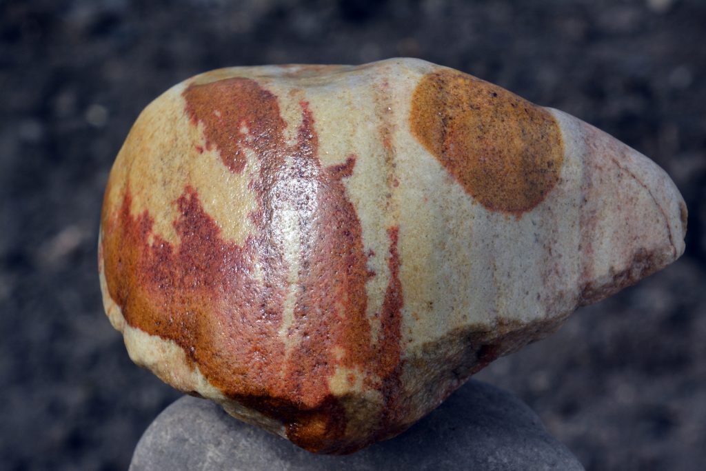
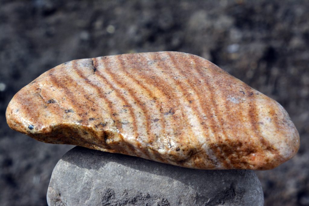
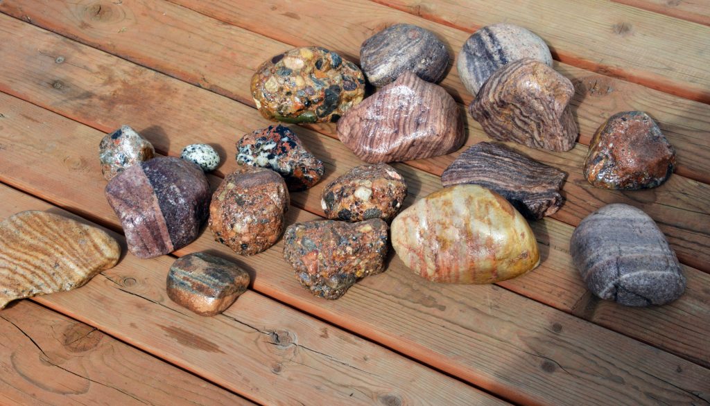
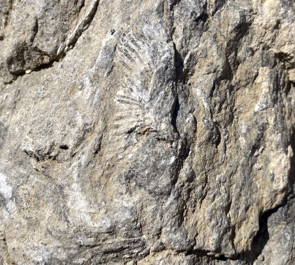
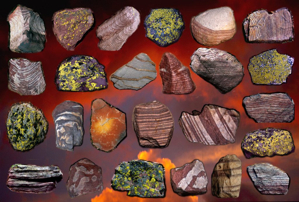
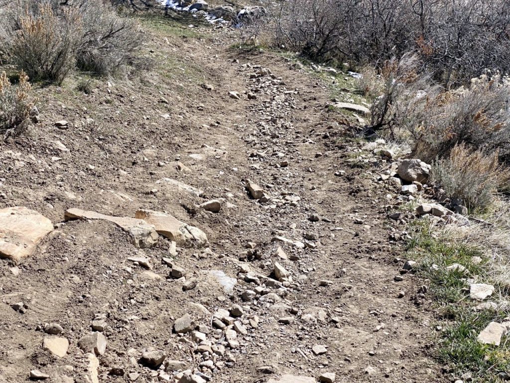
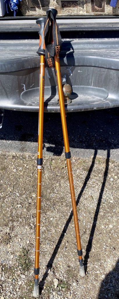
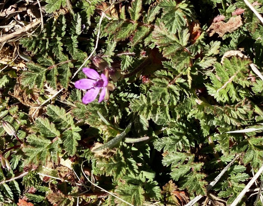
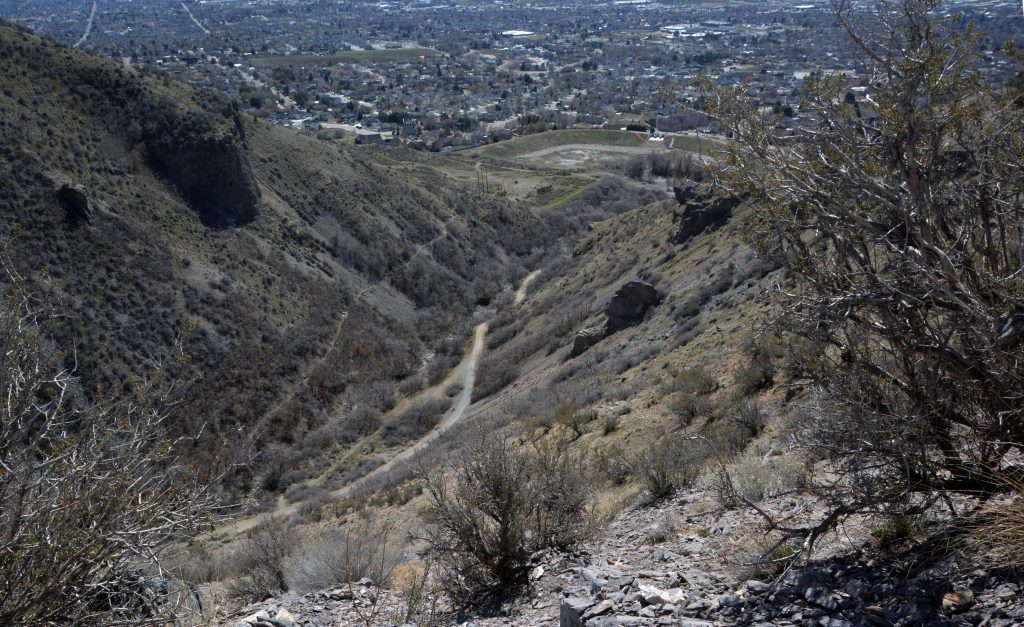
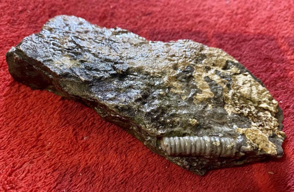
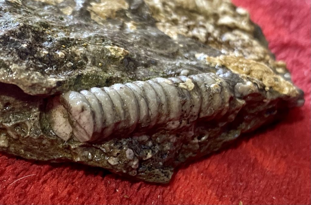
GOING DOWN, WITH STEEP DROP-OFFS ALONG THE WAY, HAD ME HIKING VERY CAREFULLY USING MY TREKKING POLES & IT WAS EASY TO IMAGINE HOW OLD GUYS LIKE ME–WITH POOR BALANCE– ON SOME HIGH UINTA TRAILS TO PASSES, COULD LOSE BALANCE & FALL OUT OF SIGHT TO NEVER BE FOUND! DOWN LOWER I CAREFULLY LOOKED FOR THE ROCK WITH A FOSSIL FROM MY LAST HIKE. I FOUND IT AND at home WASHED & VARNISHED IT–SEEN BELOW.

IT CLEARLY ISN’T A SPRING OFF OF SOME HIKER’S PISTOL FROM MODERN TIMES, RATHER A LIVING ORGANISM TURNED INTO STONE OVER THOUSANDS OF YEARS. IMAGE WHAT IT WAS!

NOW I’LL TELL YOU OF A WONDERFUL EXPERIENCE & MY TERRIBLE GOOF!

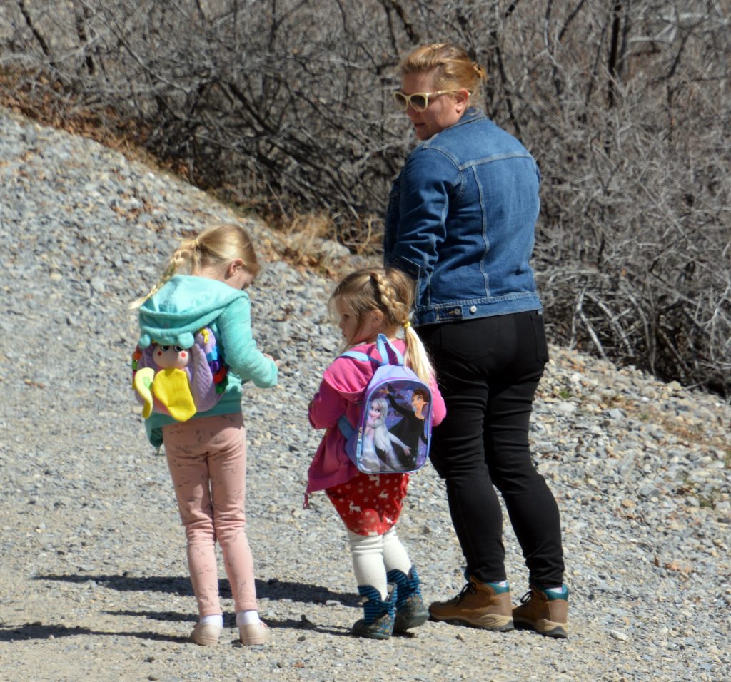
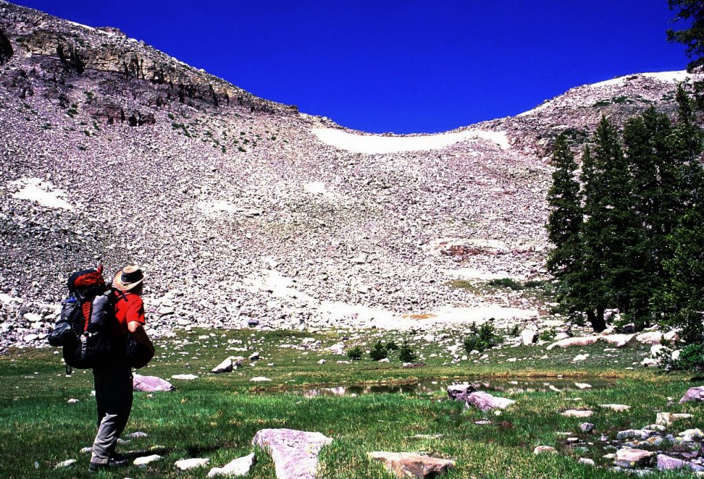
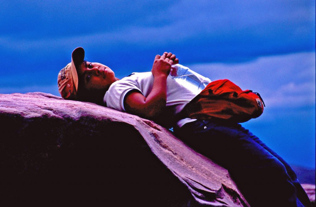
SOON AFTER FINDING MY ROCK I WAS RESTING A BIT WHEN A TALL GOOD LOOKING HIKER, WITH HIS BEAUTIFUL DAUGHTER, CAME DOWN THE TRAIL–STOPPED & SPOKE:

“YOU’RE CORDELL ANDERSEN!”

I was pleased to learn he was one of my “HIGH UINTA FRIENDS” who I had never met, but he followed me on my website, and had even driven to 444 Elm St. in American Fork, to give me $20 and get the link on his computer my HIGH UINTA MOUNTAINS book, but nobody was home. I told him to just send a $20 bill in the mail along with his email, and I’d immediately email him the link and told him he could share with a few others as MY INTEREST is to get it spread around to help ALL HAVE GREATER AND SAFER ADVENTURES IN THE UINTAS. We talked some about my struggles, etc. and he did give me their names–but I goofed by not jotting them down on my smartphone and taking their picture–as an OLD GUY my memory is slipping. I think I remember the names, but to not completely embarrass myself, best wait until I hear from him, and then I’ll introduce him to everybody.

WOW! I remembered right! I received his letter and $25 in the mail today with a nice letter and request for a thumb drive with the book. My High Uinta Friend is: JEFF JOHANSEN, and his daughter is KARA. In my note I even got the SEN right, easy for me because I’m also an SEN Andersen. We are both either Danish, or Norwegian, in my case a little of each. I even had an ancestor who was KING of Norway for a short while in the 1200’s until he was poisoned!

Thanks, Jeff, for the order. I’ll get it in the mail today, and hope to meet you tomorrow (Friday)–as I understand it won’t be raining–on the Grove Creek trail between 2:00 and 4:00. Best not send the thumb drive, but take it with me tomorrow in hopes we meet–so I can get that needed photo of–YES, the “GOOD LOOKING” hiker & his “beautiful daughter.”

GET THE BOOK FOR DETAILS IN PREPARING YOUR SUMMER ADVENTURES!

NOW TO CONTINUE OUR MINI-TOUR OF THE HIGH UINTAS

First just a simple mention of the SNOW DEPTHS in crucial places (posted weekly here–later by the day) :

BALD MOUNTAIN PASS…..3/26 = 37.3″ of snow

WOLF CREEK PASS……3/26 = 43.5″

HEWINTA on the North Slope……3/26 = 26″

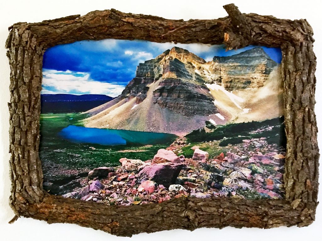
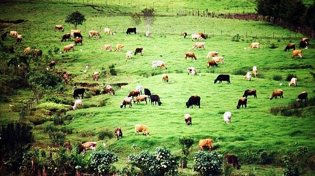
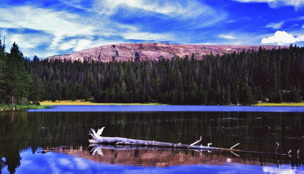
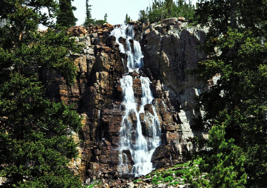
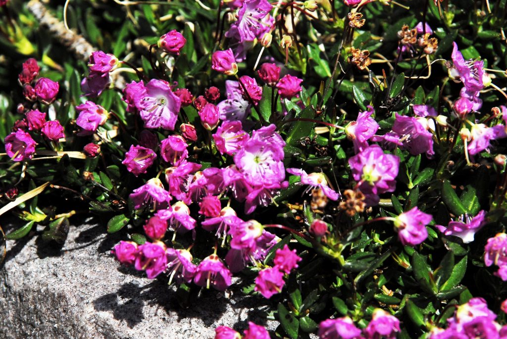
THE TOUR will first take us to “THE WILDERNESS AREA” – Utah’s greatest Wilderness.…so far we have reviewed lakes accessible from the Norths Slope’s Christmas Meadows Trailhead–which logically we should have held off on until after the Grandaddy of Uinta’s Trails we have been reviewing taking you to lakes accessible along the Highline Trail . We have seen the Wilder/Wyman/Packard area, Naturalist Basin, Carolyn, Bedround & Allen Lakes, Cyclone Pass and Sea Lion & Thompson Lakes, & The FOUR LAKES BASIN, taking us to Pigeon Milk Springs. From the Springs we head east climbing first ROCKY SEA PASS (11,200 ft.)……

Mahana, my daughter along with me on a Goat Packing trip with Clay Zimmerman, on the way to ROCKY SEA PASS in 2005.
ON THE OTHER SIDE OF THE PASS MAHANA FIRST EXPERIENCED SNOW!

…… that early in the season has a large snow bank on the eastern side–so be careful. See details & topographical maps on pages 168-173 of the HIGH UINTA MOUNTAINS book.

In this first segment of the HIGHLINE TRAIL we will review the upper reaches of the Rock Creek Drainage. The lower reaches will be mentioned when we swing around to the South Slope. From here below the pass to the east, we head north to swing around the large basin, and 1.7 miles from the Pass come to a junction where the actual Highline Trail goes down directly in a mile to cross Rock Creek where there’s a trail 12 miles long coming up along the creek from the Trailhead, but following the actual Highline Trail you climb out to meet the trail–that we will now follow swinging around the upper reaches of the Drainage.

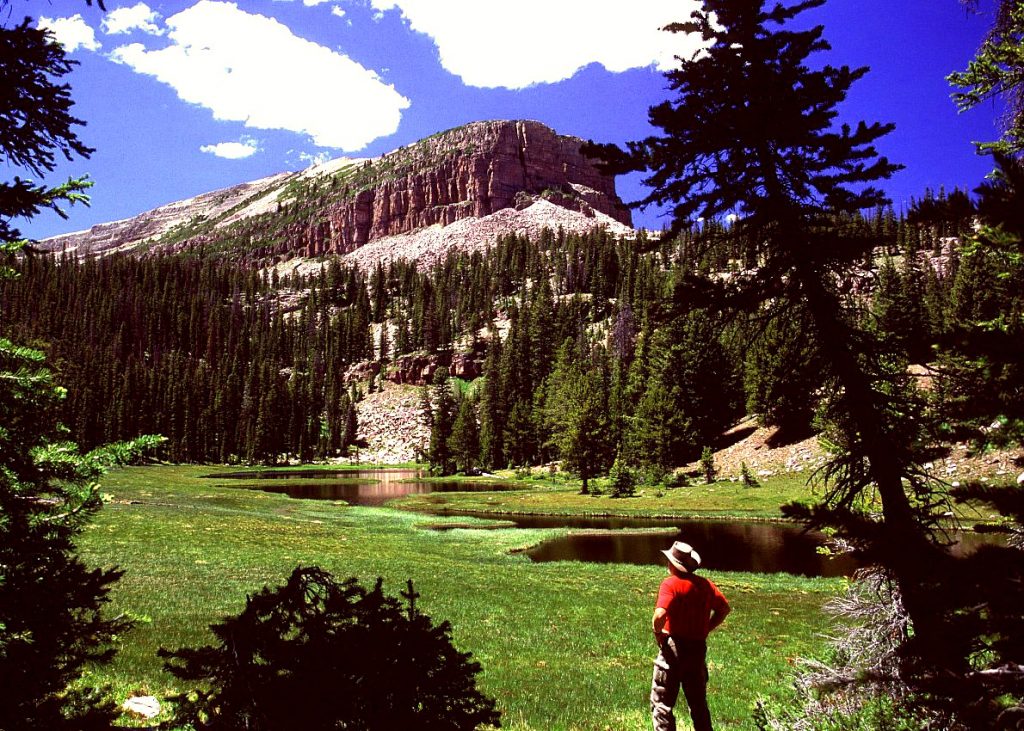
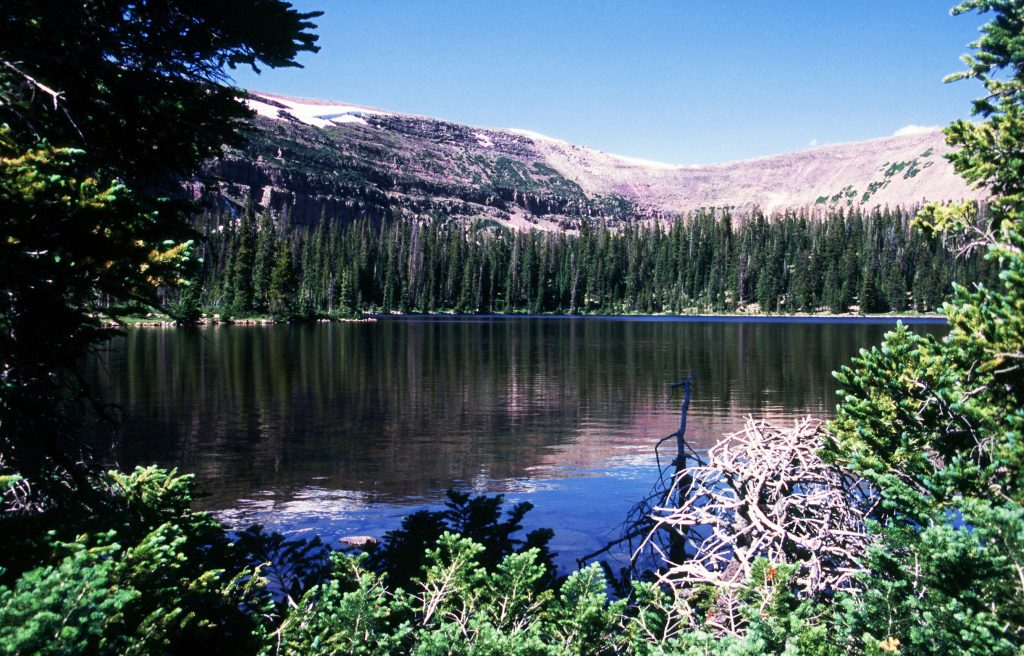
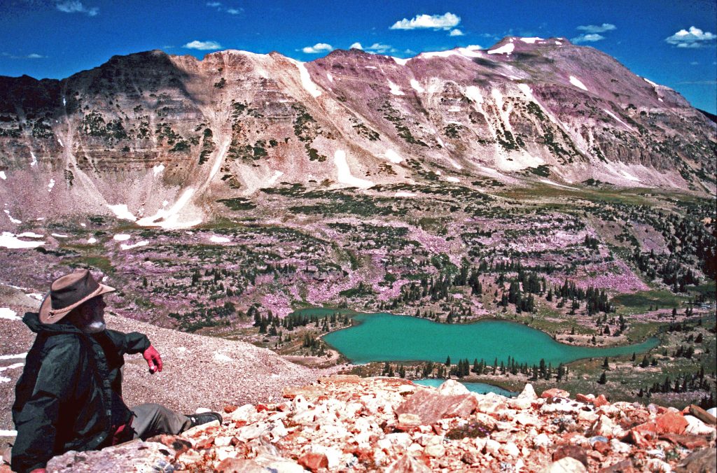
We first come to the Huntley Ponds, seen above, that have brook trout, and just a little further Brinkley Lake with Mt. Ostler way to the north on the north side of the spine of the Uintas.

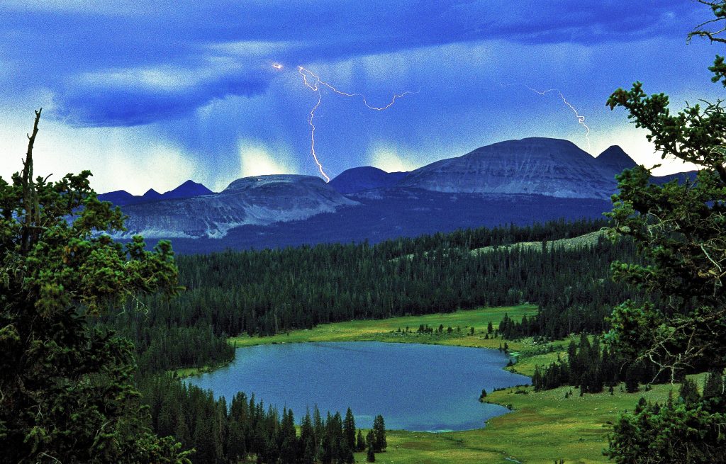
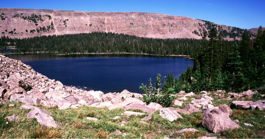
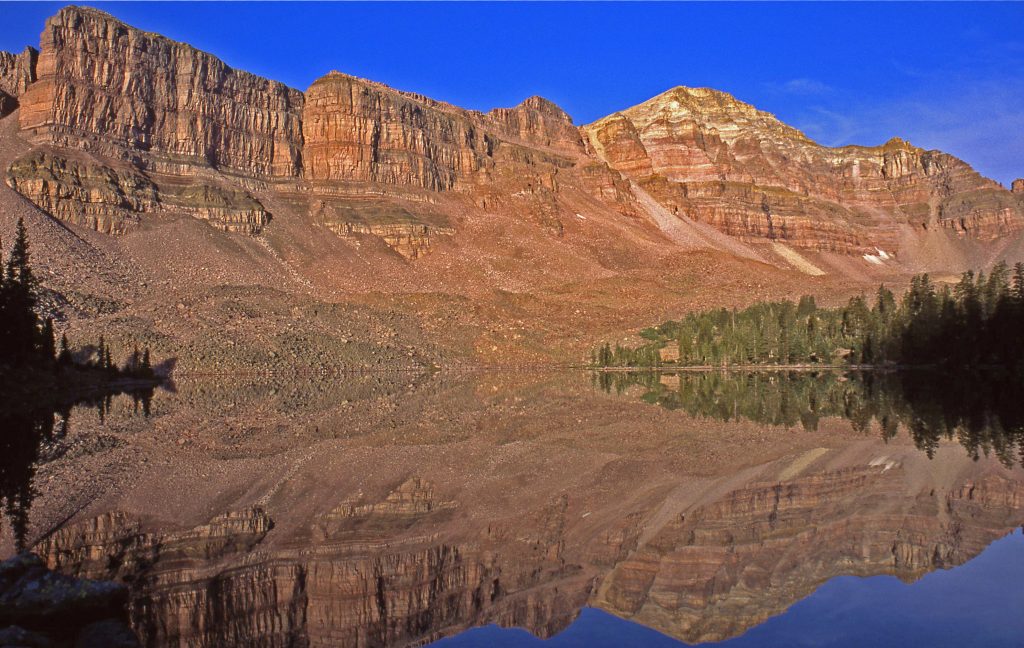
Another mile north we come to another junction, with one trail heading down across the basin passing by Black, Ouray, Jack & Jill Lakes and continues on to join the trail that circles the upper reaches. We will rather take the left fork to visit Rosalie, Uintah, and Margie Lakes, then swing up above timberline passing by Glady’s Lake, and then drop down to Lightning, and Helen Lakes. Before dropping down to Lightning is where I left the trail and climbed off-trail up to the Ostler Saddle to get a picture of Amethyst Lake already seen. Below, we are looking at the Ostler Saddle over Lightning Lake.

LIGHTNING LAKE with the OSTLER SADDLE in the background.

From between Lightning and Helen Lakes we follow the trail down some and bypass a basin to the east–that you can climb up into it and from there climb the saddle to see on the North Slope Priord Lake.

PRIORD Lake is where is born one of the tributaries of the Bear River on the North Slope

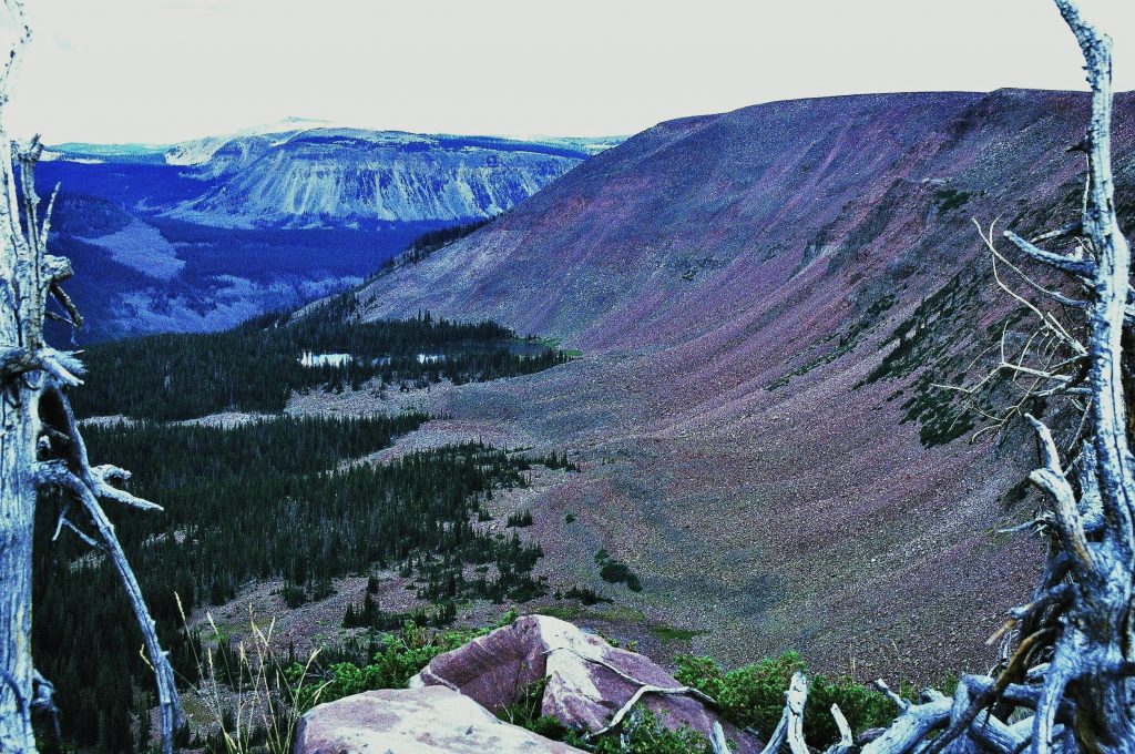
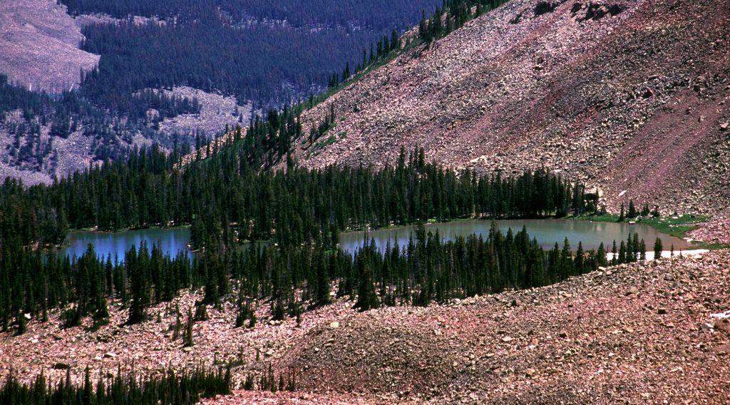
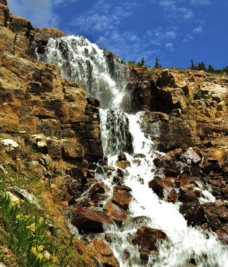
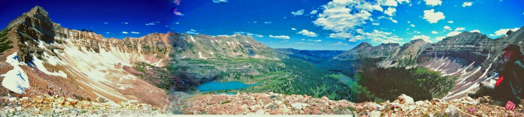
MANY YEARS AGO I MADE A CRUDE PANORAMA–combining three photos- of the Priord/Norice Lakes basin, I’ll insert below to give you an idea about how spectacular the scenery is.

FROM THAT little side-trip, WE FOLLOW THE TRAIL JUST PAST THE NEXT POINT OF THE MOUNTAIN and after crossing THE FIRST STREAM COMING DOWN FROM THE BASIN, you can climb northeast on the south side of that mountain point which is basically Triangle Mt., and in about 1 mile of easy climbing come to what some of us have called:

ONE OF THE TWO MOST BEAUTIFUL MOUNTAIN SCENES IN UTAH, TRIANGLE MOUNTAIN and RECONNAISSANCE LAKE.

FROM HERE YOU CAN ALSO CLIMB THE SADDLE TO THE NORTHEAST AND SEE ALLSOP LAKE WHERE THE EAST FORK OF THE BEAR RIVER IS BORN. In the cliffs above Allsop Lake were found the bones and equipment of Eric Robison, Australian adventurer who was supposed to be following the Highline Trail 5 years before when he went missing.
HERE IS WHERE MAHANA CAUGHT HER FIRST TROUT & OBVIOUSLY LOVED IT!

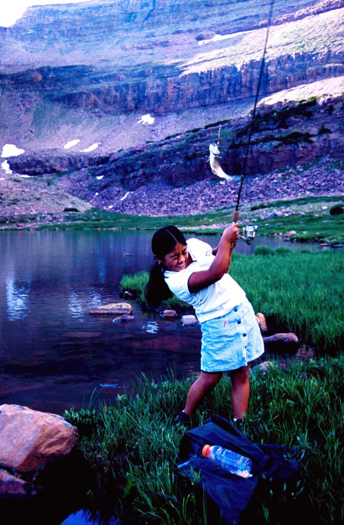
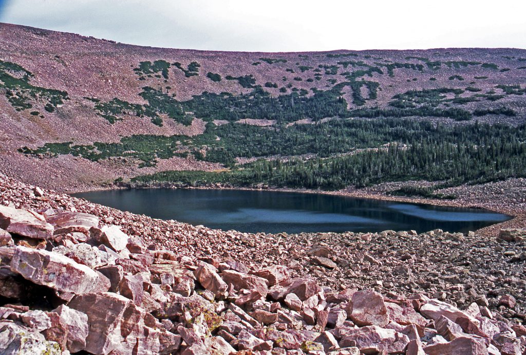
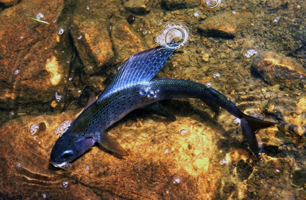
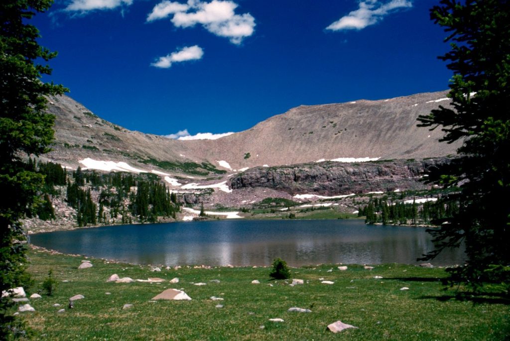
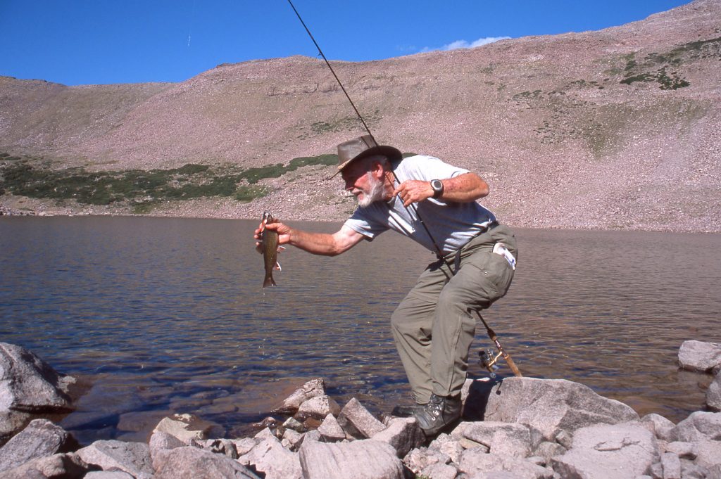
FROM RECONNAISSANCE LAKE YOU CAN WANDER DOWN THROUGH THE BASIN VISITING BENCH LAKE (on the way up), BOOT, DOUG & JODIE LAKES, and then find the trail where one comes from Jack & Jill Lake, and soon the other, the actual HIGLINE TRAIL that has cut across the basin, and on it follow it around the point of the next mountain to LEDGE LAKE, where also is found the junction of a trail coming up 16 miles from the Rock Creek Trailhead. From there follow the Highline Trail about 1 mile north to DEADHORSE PASS, but I recommend along that one mile cut across a short stretch of arctic tundra to visit CONTINENT LAKE, you see me fishing in below.

From here it is just a short hike to DEADHORSE PASS.

HERE MAHANA IS ON 11,700 ft. high DEADHORSE PASS.

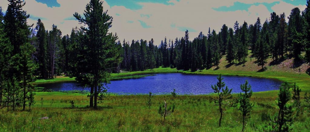
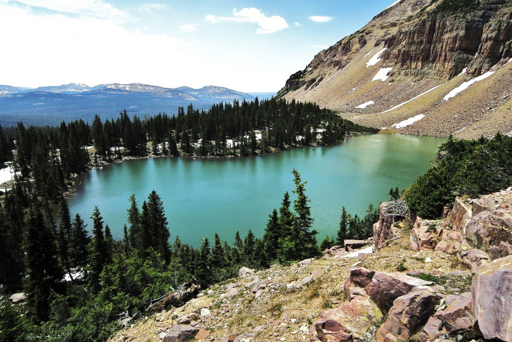
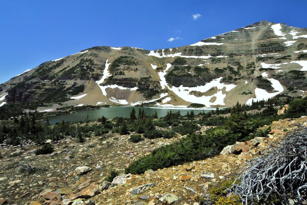
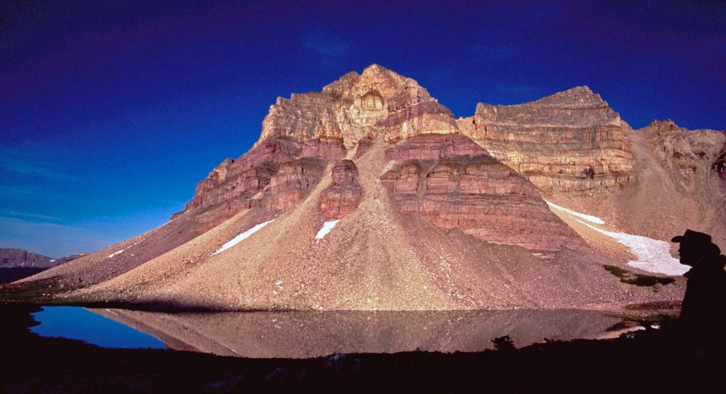
Below is seen DEADHORSE LAKE with it’s turquoise colored waters from glacial turbidity common on the North slope in high altitude lakes, along with another view of the Lake as our concluding photo of this post, plus one more….

AT DEADHORSE LAKE IT HAD RAINED IN THE AFTERNOON, THEN STOPPED, AND EVEN THOUGH THE LIGHT WASN’T GOOD I WENT STALKING AS I HAD SEEN NICE HOOFPRINTS OF A GOOD MULE DEER.….. and ALL OF A SUDDEN HE BOLTED WITH ME TRYING TO HOLD MY TELEPHOTO LENSE STEADY & CREATED AN INTERESTING ACTION SHOT.
MAHANA, ON THIS PACK-GOAT TRIP BECAME THE FIRST GUATEMALAN TO HIKE THE ENTIRE HIGH UINTA WILDERNESS AREA!

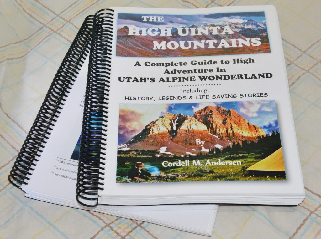
GET THE ONLINE BOOK & PREPARE FOR MUCH MORE ENJOYABLE & SAFE ADVENTURES.

To get an online copy of this book, some have called THE ENCYCLOPEDIA OF THE UINTASsend me $20 (don’t be afraid of sending a $20 bill as we aren’t south of the border) along with your email address, and I will immediately email you the link to download the book with my permission to share once with a friend. Send to: Cordell Andersen, 444 Elm St., American Fork, Utah 84003

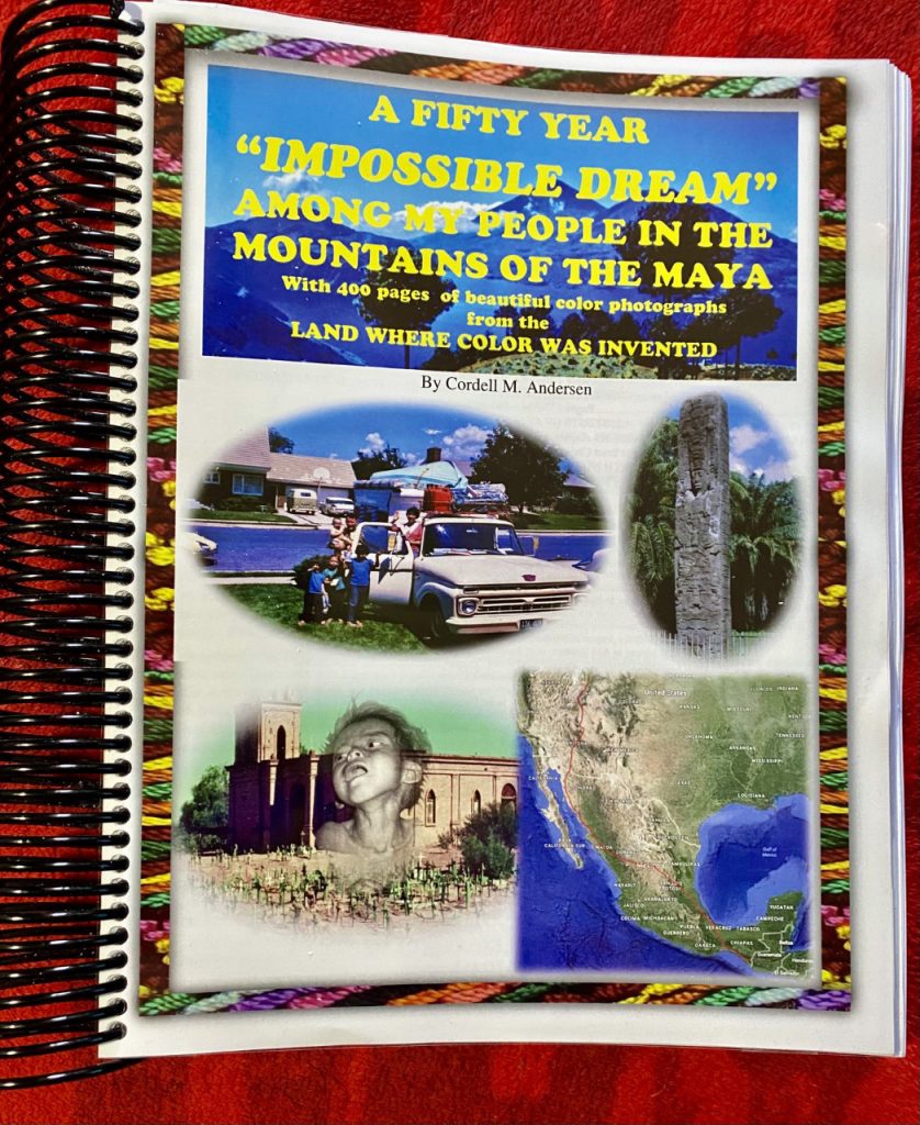
And remember, the 570 page book,

A 50 YEAR “IMPOSSIBLE DREAM” AMONG MY PEOPLE IN THE MOUNTAINS OF THE MAYA,

…….that is now finished “completely” with one more page added with a portrait of each of my TWO FAMILIES.

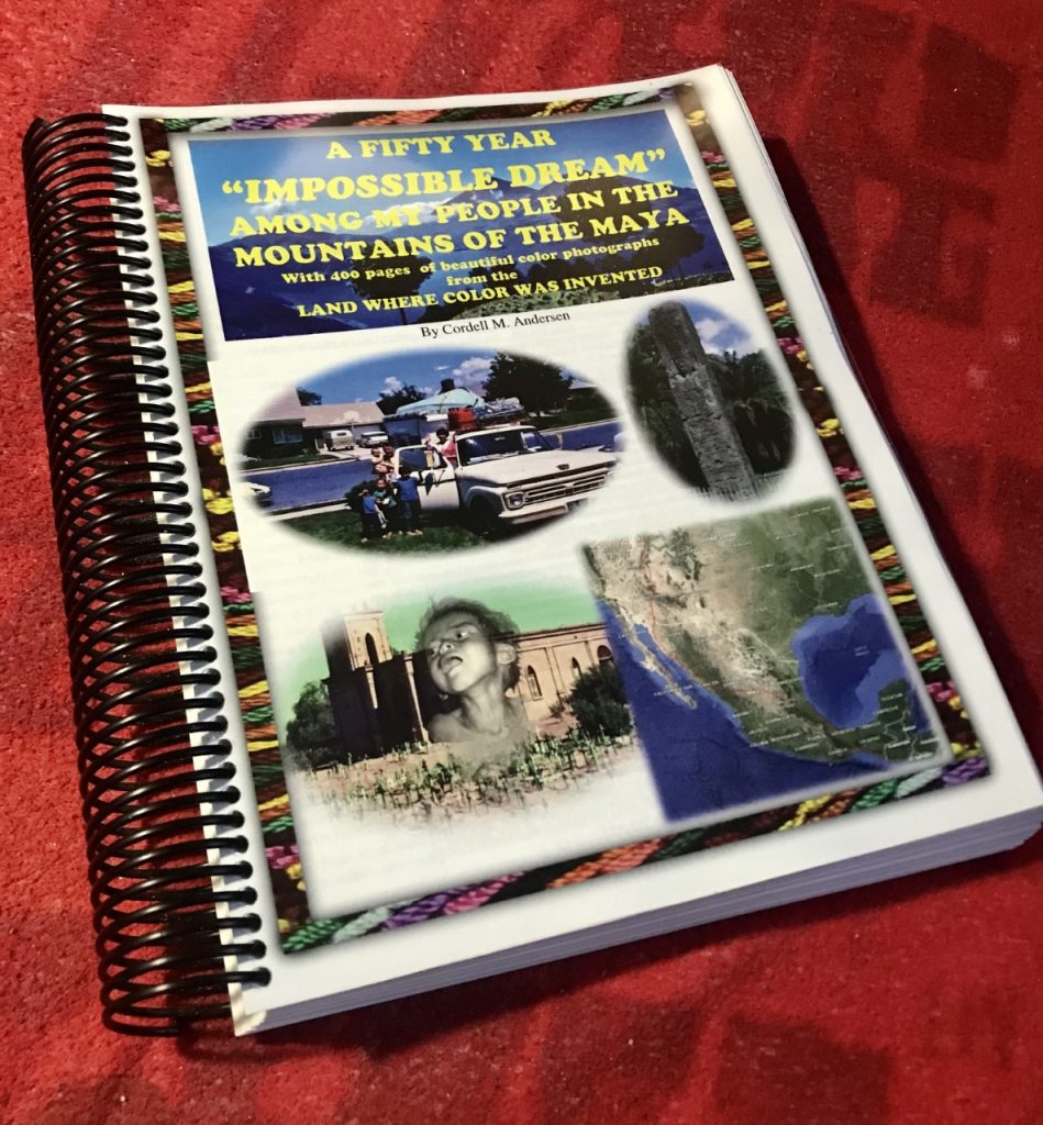
TO SEE A DESCRIPTION OF THE ONLINE BOOK & BE ABLE TO GET IT ON YOUR COMPUTER, go to: https://www.guatemalanfoundation.org/

REMEMBER: Each Wednesday on my Facebook Page–by evening I will have a new post in Spanish with a historical review each week of photographs of that 50 year experience–eventually with THOUSANDS OF PHOTOS, many never seen before — and of course every Saturday a post & report like this one of my

CHALLENGE & the HIGH UINTA MOUNTAINS!

ACUERDENSE QUE CADA MIERCOLES PARA LA NOCHE PONDRE EN MI PAGINA DE FACEBOOK UN NUEVO REPORTAJE HISTORICO DE MIS 50 ANOS ENTRE LOS MAYAS–AL FIN CON MILES DE FOTOS NUNCA VISTAS ANTES….DE CADA UNO DE UDS.!

IN THE MEANTIME HELP IN UKRAINE @: RED CROSS AID TO UKRAINE

***********************************

My email address is: cordellandersen@hotmail.com

“RED DAWN” & MY YOUTH — UKRAINE–An ATROCITY (horror & wickedness) because of ABSURDITY (insanity & idiocy) — but, THEY NOT GIVING IN–NOR WILL I! PEACE IN THE HILLS with PURPOSE — More VISIONS of NATURE & Dr. W. Kenneth Hamblin — BACK TO THE HIGHLINE TRAIL accessing beautiful areas!

I describe in detail in my Maya Book an ATROCITY in Guatemala because of important people believing an ABSURDITY, pages 442-456, and in a sense followed Clint Eastwood’s advise from his movie,

THE OUTLAW JOSIE WALES, on page 555, part of what he said was: “Remember, when it looks bad like you’re not going to make it, then you have to get mean! I mean plumb mad dog mean! Because if you lose your head and give up, then you neither live nor win. You have to be a guerrilla fighter and take the fight to the enemy!” You’ll have to read my book to see how I became very honest and frank in telling the history–which some important people are supposed to study carefully……the full 569 pages–with lots of beautiful photos…… go to: https://www.guatemalanfoundation.org/

Now we have to mention the Atrocity going on in:

UKRAINE

THE HEARTBREAKING ATROCITY IN UKRAINE & THE COURAGEOUS “NOT GIVING IN” WILL OF THE PEOPLE BRINGS TO MIND SOMETHING FROM MY YOUTH.…….

….. in Provo, Utah (1952) there was fear of a Chinese invasion of the west coast & I remember vividly us guys from the neighborhood planning on heading into the mountains with our deer rifles and becoming guerrilla fighters–and we loaded up on extra ammo–cheap Army Surplus 30-06 cartridges– to be ready. Years later our dream happened in the movie RED DAWN!

TODAY THAT IS HAPPENING IN THE COURAGEOUS FIGHT BY THE PEOPLE OF UKRAINE…..THOUSANDS, INCLUDING GRANDMA, GETTING THEIR AK-47 & WILLING TO FIGHT and DIE RATHER THAN GIVE IN!

IN 1967 THAT WAS IN PART MY MOTIVATION TO GET OUT ON THE FRONT LINES IN GUATEMALA TO OPPOSE THE CUBAN/COMMUNIST EFFORT TO TURN THE COUNTRY INTO ANOTHER CUBA–YES, I ARMED MYSELF TOO, and OVER THE YEARS GOT BETTER WEAPONS, after having a DREAM, “seeing me fight off and win against the guerrillas with a Baby Browning .25 which kept jamming with me struggling each time to unjam, then to fight on to win–then the Army arrived to collect the bodies and an officer hearing about how I eliminated the attackers advised me to get rid of the Baby Browning and get larger caliber weapons of the “BEST BRANDS,” which I did including with David’s help, a sub-machine gun!”

BUT OUR MAIN EFFORT WAS TO WORK TO SOLVE THE PROBLEMS OF POVERTY & IGNORANCE THAT HAD OPENED THE DOOR TO THE “GUERRILLA WAR!”

THE “ATROCITY” in Uktraine, now with me a bit older–has at least MOVED ME TO DONATE TO THE RED CROSS TO HELP WHICH I RECOMMEND ALL OF YOU DOING TOO! AND ALSO–for me–WORK HARDER TO GET IN SHAPE–for the High Uintas, and keep alive long enough to finish my reports with thousands of pictures from Guatemala, and/or to be a guerrilla fighter sneaking down the face of Mt. Timpanogos to make devastating hits on the enemy–I can at least be a good snipper!

SO I PERSIST DAILY WITH MY STAIRS AT THE AMPHITHEATER/JOGGING BEHIND MY WALKER, & ONCE A WEEK UP TO THE FOOT OF MT. TIMPANOGOS & GROVE CANYON you see in this shot a couple of miles from my Cabin-A.

AND, AS YOU SEE BELOW I’M ALSO WORKING ON KEEPING FROM GAINING BACK THE 30+ LBS. I’VE LOST DURING MY BACK-ORDEAL–GETTING MAD AT MYSELF FOR BUYING COOKIES & OTHERS SUCH STUFF and ALONGSIDE OF MY CABIN–BURYING IT IN MY GARDENING PLOT ALONG WITH ANYTHING THAT WILL DECOMPOSE–to produce for me my Guatemalan “Miracle weed-MACUY”

Burying what my body doesn’t need to fertilize my MACUY
THIS WAS MY GARDEN OF “MACUY” IN 2021. IT WILL BE BETTER THIS UPCOMING SEASON WITH ALL THE STUFF I ADD TO IMPROVE THE SOIL. I’LL SHOW YOU–NEXT WEEK–HOW I EAT THE NUTRITIOUS LEAVES–SHOWN BY AN ANALYSIS OF ANACAFE in Guatemala to be more nutritious than any of the domesticated vegetables we now have to pay too much for!

AND, YOU CAN SEE I’M TAKING MY GOALS SERIOUSLY–NOW, BY ADDING A LITTLE WEIGHT–NOT ON MY BACK THAT WOULD HURT ME, RATHER WITH WAIST PACKS loaded with my picnic lunch, water, emergency stuff I always take–even on these simple hikes–THE WEIGHT YESTERDAY COMING TO 8 LBS.–most of it my professional NIKON CAMERA AND ITS GREAT (but heavy) 18mm. to 400mm. ZOOM LENS, but has me thinking for the High Uintas I might have to sadly sacrifice that and just go with my smart phone–at least to begin with, but as I get stronger I’m sure I’ll soon be lugging my Nikon again to get great photos of VISIONS OF NATURE to share with all of my friends.

ACTUALLY FOR BACKPACKING IN THE UINTAS I WILL HAVE MY 4.5 lb. SURVIVAL BACKPACK (shown on my tiny backpack last summer–scroll way down to see it), PLUS THESE COUPLE OF WAIST PACKS, PLUS A NEW LUMBAR/WAISTE PACK I’LL SHOW YOU LATER–THAT WILL MAKE POSSIBLE GOING FOR SEVERAL DAYS IN THE HIGH COUNTRY IN MY 87th YEAR.

I WASN’T ALONE ON THE GROVE CREEK TRAIL, BUT ALSO MET A COUPLE OF BACKPACKERS WITH THEIR MOM!

I’M GRADUALLY INCREASING THE DISTANCE TOO–YESTERDAY HIKING ABOUT A MILE UP THE CANYON--FOR A TOTAL OF 2 MILES round trip! I’LL ADMIT IT TIRED ME OUT, BUT IN A MONTH I’VE AT LEAST TRIPLED MY DISTANCE, & HELPING TO MAKE THE CONSTANT BACK PAIN ENJOYABLE WAS THE CONSTANT EYE OUT FOR MORE “VISIONS OF NATURE” YOU’LL SEE BELOW WITH A NEW FLOWER BLOSSOMING. IT’S NOT MUCH, BUT I’M MAKING PROGRESS as is THE SPRING!

ANOTHER LITTLE TRICK, TO MAKE WHAT FOR ME IS PAINFUL PROGRESS, IS UNSELFISHLY WORKING ON HELPING TO KEEP OUR BEAUTIFUL OUTDOORS LITTER-FREE BY PICKING UP THE GARGAGE ALONG THE TRAIL, or along the STAIRWAYS!

TAKE ALONG WITH YOU A SHOPPING BAG & MAKE A LITTLE COLLECTION OF ANYTHING NOT NATURAL! BENDING OVER A FEW TIMES ON EVERY HIKE WILL ALSO BE A BLESSING FOR YOUR BODY!

“LEAVE NO TRACE!”

GLANCE UPWARDS TOO….and ZOOM IN ON THE “VISIONS OF NATURE” ABOVE YOU & BELOW YOU AT YOUR FEET…..& BE REWARDED WITH CLOSE-UP VISIONS of FASCINATION & BEAUTY!
WITH EACH OF THESE JEWELS OF NATURE & MANY MORE YOU’LL FIND–IF YOU LOOK CLOSELY, TRY AND ENVISION & IMAGINE WHAT WERE THE EARTH PROCESSES THAT CREATED THEM & HOW MANY YEARS DID IT TAKE? AND, HOW ABOUT THE INCREDIBLE ONE WE SEE BELOW?

WOW! IS WHAT COMES TO MIND WITH THIS CONGLOMERATE BEAUTY–each of those different colored rocks was once a part of a layer created by the rivers washing different materials into the sea forming sedimentary layers, eventually uplifting them above the ocean, then turning each layer into stone, followed by another cataclysmic earth process breaking it all up into pieces and then the water in the bottom of creeks and rivers gradually wearing off their sharp edges turning them into rounded stones that then, in another earth creation process jumbled them together in yet another layer that turned it all into stone that was then broken up by more catastrophic earth movements followed by gigantic uplifts moving it all thousands of feet higher creating……for example the High Uinta Mountains, then with erosion processes–like glaciers, and rivers carving out canyons, and valleys, etc., etc. WOW!

HERE’S ANOTHER EXAMPLE TO STIR OUR IMAGINATIONS WITH HOW IT WAS CREATED, somehow with rocks of a different age and process being inserted into the sedimentary lays as they were forming.

My fascination with rocks & minerals began in 1954 as a freshman at BYU when for a year I was a Geology majoralong with Ted Packard and Charlie Peterson–my original two High Uinta buddies–I ending that year with a graduate class in GEOMORPHOLOGY, I being the lone freshman along with 15 graduate students–and Dr. Rigby graded using the curve– and how grateful I was to get a C!

Later my first commercial project as a freelance photographer in the 1960’s was photographing all the rocks and minerals for Geology Professor, Dr. W. Kenneth Hamblin, who used them as the basis for his first book, now in its 9th edition–which photographs made him famous, and rich. Two of his books are available at Amazon and seen below:

Go to AMAZON for interesting details, like, “The Ninth Edition continues to offer a stunning and sophisticated art program that is virtually unmatched by any other geology text.” His textbooks for many years, originally and maybe still with my photographs, have been used by universities all over the globe.

Dr. Hamblin passed on in 2009 at the age of 81.

I might add, when he would bring me a new collection to be photographed, we would talk and once I asked him if he fished or hunted. His reply,

“Hobbies are only for people who don’t love their profession!”

MY SECOND–and last– SIGNIFICANT PROJECT AS A “FREELANCE PHOTOGRAPHER” was my 3rd exploratory trip to Guatemala in 1966, but first to the Izapa archaeological site in Southern Mexico with Garth Norman getting for him with night-photography the picture(s) he used to make himself famous–of the TREE OF LIFE STONE (see the MAYA MOUNTAINS BOOK). A few months later, with my entire Family, we made our 4th exploratory trip lasting 75 days, then gave away my 4″x5″ professional cameras, and prepared our move made the next year…..me becoming for the next 35 years what I have sometimes called, “A TROPICAL TRAMP,” other labeling me as a “RODEO CLOWN” and others a “MODERN AMMON!”

THIS IS MY SELECTION PROCESSED of the many COLLECTED SO FAR OF ROCKS FROM MY EFFORTS TO CLIMB STAIRS & HIKE GROVE CREEK CANYON. I’ve washed them, then varnished them to bring out their beauty, which you can do on the trail by just wetting with water a rock you envision as beautiful, with one more below, followed by one from my recent hike with a fossil.
NOTE: If you object to me varnishing them to create stunning beauty, think how all of that beautiful natural wood in your house would look, if it wasn’t finished with a protective & beauty enhancing coating of varnish, polyurethane, etc. ? (I actually use polyurethane).
IT’S FASCINATING TO NOTE HOW SOME OF US SEE BEAUTY IN WHAT IS REALLY “THE CHAOS OF NATURE” chaos being a disorderly mass, yet we are intrigued by it and see in it beauty. By the way, IF YOU DON’T, you should take regularly a Testosterone Enhancer (like Andro 400 Max), which, among other things improves your mood and ability to appreciate beauty.
ON MY NEXT HIKE UP GROVE CANYON–Friday, March 25th–I’LL BRING THIS ONE HOME, CLEAN IT UP & PROCESS IT TO SEE BETTER WHAT WE’VE GOT and LIKELY INSERT IT BELOW.

NOW TO THE HIGH UINTAS & MORE AREAS ACCESSIBLE FROM THE HIGHLINE TRAIL

OUR LAST AREA VISITED WAS ALLEN LAKE. From there you can go northwest to hit the trail or just bushwhack your way 1/2 mile north to get to the FOUR LAKES BASIN, first coming to Daynes Lake you see below but taken from half-way up to Cyclone Pass, with a lightning storm over distant Bald Mountain.

This hike to Bedground and Allen Lakes, then to the Four Lakes Basin and over Cyclone Pass, is all a side trip from the Highline Trail we will get back to in our next post, but first well climb Cyclone Pass (11,150 ft.) to pay a visit to two quite isolated lakes. First, from the pass we see Sea Lion Lake off to the southeast.

FROM 11,150 ft. CYCLONE PASS: AS YOU CAN SEE, THE HIKE TO SEA LION LAKE ENTAILS 1.3 miles of DIFFICULT “BOLDER HOPPING”

BELOW WE ZOOM IN ON SEA LION LAKE.

Remote THOMPSON LAKE, seen below, is our main objective, also entailing “boulder hopping” but I felt it worth the risk as there were some reports it could have “monarch” brook trout, which didn’t work out that way in 2003, but MIGHT TODAY!

From CYCLONE PASS we descend into the FOUR LAKES BASIN. We’ve seen already Daynes Lake, and below we see DEAN LAKE.

DEAN LAKE is the deepest (44 feet) with brook trout and grayling. It is the northern-most lake in the Basin. From here we backtrack past JEAN LAKE we see below, with DALE LAKE –the smallest of the 4, located in the center of the basin.

JEAN LAKE we see below is very near the trail from which this picture was taken. On the far right we see CYLONE PASS. On the far left we can see a sliver of DEAN LAKE, pictured above.

JEAN LAKE

On the south side of Jean Lake we find the trail, and follow it around the point of the mountain and in 1.5 miles we come to the HIGHLINE TRAIL, and follow it northeast for 1/4 mile and come to Pigeon Milk Springs that produces ice cold, pure water, but with a glacial whitish hue–called, “glacial milk.” Our next post will take us up and over the mountain to the east. Information on this area, including topographical maps, is found on pages 164-168 of my HIGH UINTA MOUNTAINS book.

To get an online copy of this book, some have called THE ENCYCLOPEDIA OF THE UINTASsend me $20 (don’t be afraid of sending a $20 bill as we aren’t south of the border) along with your email address, and I will immediately email you the link to download the book with my permission to share once with a friend. Send to: Cordell Andersen, 444 Elm St., American Fork, Utah 84003

For the latest & to download the final version of my book,

A 50 YEAR “IMPOSSIBLE DREAM” AMONG MY PEOPLE IN THE MOUNTAINS OF THE MAYA,

go to: https://www.guatemalanfoundation.org/

I’ll see you again in a couple of days when we’ll follow the HIGHLINE TRAIL to the Rock Creek Drainage, and then on Wednesday–y luego en miercoles ver el primer reportaje de mis 50 ANOS ENTRE LOS MAYAS, que mayormente seran fotos–muchas fotos.

IN THE MEANTIME HELP IN UKRAINE @: RED CROSS AID TO UKRAINE

**********************************8***************

Update: March 6, 2022– SPRING AMBUSHED by WINTER –VISIONS OF NATURE Wildflowers replaced by FASCINATING ROCKS — LEARNING TO HIKE CONTINUES for an OLD CRIPPLE called by Gringos visiting in Guatemala, a “RODEO CLOWN” — why I was proud of that! — THE HIGH UINTAS lakes with Arctic Grayling.

WINTER VIEW OF THE SPINE OF THE HIGH UINTAS from the North Slope Road. Kings Peak, 13,528 ft., Utah highest, is the highlighted peak left center. Red Castle Peak is on the far right. Gilbert Peak, 13,448 ft., Utah’s 3rd highest mountain on far left.

My last post was a bit premature welcoming SPRING with the first wildflowers. Snow this week can have us focusing on what the cold won’t hurt–THE BEAUTIFUL ROCKS of our exercise area–the foothills of the Wasatch–the one below, nestled in new snow, is my FIRST VISION OF NATURE treasure and reward found this week….

WHAT WERE THE INCREDIBLE GEOLOGICAL PROCESSES THAT CREATED THIS JEWEL OF NATURE — A TYPE OF CONGLOMERATE COMPOSED OF ROCKS OF DIFFERENT TYPES CREATED EACH BY DIFFERENT CATASTROPHIC GEOLOGICAL EVENTS & THEN JUMBLED TOGETHER IN ANOTHER INCREDIBLE EARTH CREATING PROCESS.

….followed by a few others collected on my recent walks in the hills and along the creek–as I learn to hike again. In my freshman year at BYU in 1954 I was a geology major, planning on finding riches in the West Utah Desert and becoming rich. Geology fascinates me as it should all of us and the HIGH UINTA MOUNTAINS is a geologic treasure as I show you in my BOOK. I am grateful to see and appreciate BEAUTY in the VISIONS OF NATURE–including these magnificent rocks.

This rock should have been photographed with the layers horizontal as they were laid down underneath the ocean, or a large lake–as level, parallel layers, each from a different season with contrasting conditions that washed distinct types of materials to form each layer that eventually under great pressure and the right temperatures were turned into hard rock.
This is what we call a CONGLOMERATE, a jumbled up mixture of layers formed under the oceans, then in cataclysmic earth processes were broken up, some rounded by the rushing waters of streams, and then all lumped together and solidified. IMAGINE THE EARTH PROCESSES THAT FORMED THIS KIND OF ROCK & HOW MANY YEARS IT TOOK, ETC.

WOW! says it all.

I’ll insert below a picture of my recent collection–THE BEST from the last month or so…..

I washed and cleaned them up. Then varnished them to bring out their beauty.
AND, DON’T FORGET THE FOSILS, THIS ONE PERHAPS BEING THE WING OF A BIRD.

Below Iwill insert a page from my BOOK, a magnificent collection of rocks from the HIGH UINTA MOUNTAINS.

BY THE WAY, THE BRIGHT YELLOW ISN’T GOLD, RATHER LICHENS of which there are many thousands of varieties in the Uintas which I talk about some in my BOOK.

EVENTUALLY I’LL FIGURE OUT HOW TO PUT THEM TOGETHER TO CREATE A MAGNIFICENT VISION OF NATURE, such as I did creating with SCRUB OAK from the foothills an incredible frame you see below embracing a wonderful view of TRIANGLE MOUNTAIN & RECONNAISSANCE LAKE, off-trail in the Rock Creek drainage of the Uinta’s South Slope, a rival to RED CASTLE as “THE MOST BEAUTIFUL OUTDOOR SCENE IN UTAH.

He’s a “RODEO CLOWN” said an Animal Husbandry professor from BYU, visiting my Las Victorias Dairy in Guatemala.

The complete story is told in what simply we can call THE MAYA STORY . GO TO THE FOUNDATION WEBSITE TO GET THE link to download it free: https://www.guatemalanfoundation.org/ . The visiting professor first asked, “Where are your alfalfa fields?” I replied, “Rather than use alfalfa, and silage, the staples of the U.S. dairy industry, we have our cows on high quality pastures of an African grass with 23% protein–similar to alfalfa, 24 hours a day, 365 days a year!” I continued, “We took over a bankrupt dairy, eventually purifying our milking herd using artificial insemination to produce pure Jersey cows, and increased daily production per cow from 3.5 liters to 16.5 liters, the best in the country.”

Since we didn’t have alfalfa or use silage he began calling me a “RODEO CLOWN.” I loved it as……..

I LAUGHED ALL THE WAY TO THE BANK!

Two of our cows and a heifer defeated in a Livestock Show the Central American Grand Champion of the Jersey breed. We see them above shown to us by my three kids: Julie with the new Champion “MAJA,” David with 2nd place, “MILADY,” and Richard “Dito” with 3rd place, “WALESKA”

ALL THE DETAILS OF HOW I BECAME A “RODEO CLOWN” WITH THE CHAMPION JERSEY COWS OF ALL OF CENTRAL AMERICA, & FOR MANY YEARS SUPPORTED MY FAMILY as well as 39 fulltime employees and their families-all the while that making possible me dedicating all we had to have projects that it was said,

“SAVED THOUSANDS & AIDED MANY TEN’S OF THOUSANDS OF MAYANS GET AN EDUCATION……as well as stimulate the organization of a WORLD-WIDE HUMANITARIAN SERVICE!”

Click on this link to READ & SEE THE DETAILS OF THE MAYA STORY https://www.guatemalanfoundation.org/

NOW ON TO MORE GLIMPSES OF THE HIGH UINTA WILDERNESS, seeing wonderful areas accessed from the HIGHLINE TRAIL: This week, two lakes with Arctic Grayling: CAROLYN & ALLEN LAKES

From our previous point along the Highline Trail, 4 miles from the trailhead at the junction with the Naturalist Basin trail, hike two more miles (and 1/2 mile before the junction with the Four Lakes Basin Trail) , look for a trail taking off through a meadow to the south and hike 200 yards to Carolyn Lake that has brook trout and hungry Arctic Grayling like you see below. Usually they are caught using artificial flies as they have small mouths, info on Page 164, with the topographical map on page 168.

From Carolyn Lake, backtrack to the Highline Trail and follow it 1/2 mile to a major junction where a trail takes off to the southeast. The trail leads to the Four Lakes Basin and from there continues all the way to the Grandaddy Basin. But, 1/2 mile down said trail, there is another junction with a little used trail–a shortcut– heading south that in about a mile hits the main trail to the Grandaddy Basin, and at that point is found small BEDGROUND LAKE, you see below, reputed to have very large brook trout and Grayling.

From Bedground pretty well due east towards the mountain and in about 3/4 mile you come to ALLEN LAKE where it has been said the “Utah State Grayling record will be caught.”

Let me say a word about Allen Lake before going on to the theme of “the record Grayling.” When I first visited Allen Lake I found the Forest Service sign that told the story of the lake and its name, but it wasn’t legible, so I scraped it producing what you see below:

The next time I visited the posts had rotted and the sign was on the ground, so I propped it up. Later some friends purposely went in there with tools and bolts to do a proper job putting up the sign in honor of Floyd R. Allen, Forest Ranger who was killed by lightning here in 1938.

The “unofficial Utah State record Arctic Grayling” was caught by my buddy Ted Packard in 1962, seen below, when we were taking a group of 22 Explorer Scouts on a two week backpack. We had all climbed King’s Peak and then come down over Trail Ryder Pass to Lake Attwood and were spin fishing using red & white Daredevil lures and all of a sudden began catching huge Artic Grayling–which we had never caught on lures before.

THE DAMAGED PICTURES CAME ABOUT WHEN AT THE CHAIN LAKES MY CAMERA FELL IN THE WATER AND WAS RUINED, BUT SOME OF THE FILM WAS SORT OF SAVED AS YOU SEE HERE.

But they were large with big mouths. My largest was 18-1/2 inches long, seen on the right, then Ted caught the largest that measured 19 inches long that would have, and still would be a Utah State record–if we could have got it to civilization and had it properly weighed and measured. The present State record is 17-1/4 inches long caught at Big Dog Lake — South Slope Uintas in 1998. Mine would “also be a record” Grayling. Steve Clark, one of our Explorers is seen in the background also with his Grayling.

GET THE DIGITAL BOOK & BEGIN MAKING YOUR PLANS FOR GREAT ADVENTURE

To get an online copy of this book, some have called THE ENCYCLOPEDIA OF THE UINTAS, send me $20 (don’t be afraid of sending a $20 bill as we aren’t south of the border) along with your email address, and I will immediately email you the link to download the book with my permission to share once with a friend. Send to: Cordell Andersen, 444 Elm St., American Fork, Utah 84003

March 2022 — FIRST SIGN OF SPRING — WORKING ON COMEBACK at 86 — High Uinta HIGHLINE TRAIL 2nd area: NATURALIST BASIN — MAYA BOOK reports ATROCITIES

GROVE CANYON — TIP OF MT. TIMPANOGOS –Still seemingly in WINTER SLEEP
PURPOSELY, with CAUTION, DOING STEEP, ROCKY TRAILS
TO AVOID FOR ME A DEADLY FALL — USING THE HATED TREKKING POLES

FINDING SIGNS OF SPRING WITH THE 1st FLOWERS

THESE ARE THE TINY PLANTS & FLOWERS THAT MANY DON’T SEE — sorry for the flower being out of focus! But, I’m sure you’ll get my point.
I’M THERE TOO…..HONEST, DOING MY DARNDEST ONCE A WEEK! The other days on the stairs, and/or jogging behind my walker!

NOW FOR ANOTHER GLIMPSE OF THE HIGH UINTA WILDERNESS with the 2nd area along the HIGHLINE TRAIL…..after last week hiking the side-trail down to WINDER, WYMAN & PACKARD LAKES. From Packard Lake you can go off-trail up towards Mt. Agassiz to get to the trail to the next area…..or do the long way following the trail back to the Highline Trail, then head east for 1.5 miles.

THE NATURALIST BASIN

The section on the WILDERNESS AREA begins in my book on page 154 and goes to page 409. The part on the Highline Trail in this section will describe the trail just to Deadhorse Pass and Lake, page 173. The description of the lakes in the Naturalist Basin is on pages 163-164. The topographical map, with trails and distances in the Basin is on page 167. The TRAIL TO THE NATURALIST BASIN is found 4 miles from the Trailhead. 1.1 miles along the trail that takes you north, is the FIRST IMPRESSIVE SIGHT: THE WATERFALL COMING OUT OF THE MORAT LAKES.

DON’T OVERLOOK NEAR THE FALLS THE BEAUTIFUL “BOG LAURELS”

THE TRAIL TAKES YOU BETWEEN THE MORAT LAKES. Morat 2 is on the east and is a shallow lake. To the west is MORAT 1, THE BEAUTIFUL LAKE WE SEE ABOVE. From there you can continue to climb up along the wonderful waterfall we see below that comes out of BLUE LAKE.

THIS IMPRESSIVE WATERFALL COMES OUT OF BLUE LAKE WE SEE BELOW,.

GUARDED BY MT. AGASSIZ WE SEE BLUE LAKE, STILL WITH SOME ICE ON JULY 4th. FROM HERE YOU CAN MAKE A SWING UP EVEN HIGHER AND AROUND AND DOWN AND VISIT–and fish in other lakes in the Basin: LECONTE, SHALER, JORDAN & EVERMAN following the suggested route on the topographical map, then back to the Highline Trail. The loop to explore the Naturalist Basin is approximately 7 miles. ALL THE INFORMATION & TOPOGRAPHICAL MAPS YOU’LL NEED FOR YOUR ADVENTURE ARE FOUND IN MY BOOK:

To get an online copy of this book, some have called THE ENCYCLOPEDIA OF THE UINTAS, send me $20 (don’t be afraid of sending a $20 bill as we aren’t south of the border) along with your email address, and I will immediately email you the link to download the book with my permission to share once with a friend. Send to: Cordell Andersen, 444 Elm St., American Fork, Utah 84003

Next week we’ll visit the next wonderful areas accessible along the HIGHLINE TRAIL: CAROLYN LAKE & Arctic Grayling, then ALLEN LAKE–named for a Forest Ranger who gave his life there–and I’ll give you the details. About Allen Lake it was said the record grayling would be caught there.”I’ll show you THAT DIDN’T HAPPEN & WHERE IT DID!

*********************************

MY LIFE AMONG THE MAYA BOOK — along with 50+ years of adventure, as well as a lot of exciting history, it importantly demonstrates cases of VOLTAIRE’S statement about “absurdities” and “atrocities!”

Click on this link to READ & SEE THE DETAILS OF THE MAYA STORY https://www.guatemalanfoundation.org/

A ONE PAGE STORY Click to download to help one understand the BOOK. It’s from the heart warming and insightful TV series:

*************************