FLY FISHERMAN MAGAZINE: Utah’s Trout Wilderness

JUST OFF THE PRESS
by 
Salt Lake Tribune Outdoor Editor 
BRETT PRETTYMAN
with a mention or two of our  
The High Uintas Wilderness Project

See below a tidbit or two….then go to Barnes & Noble and other suppliers to get your copy spotlighting Utah’s greatest Wilderness

WEIRD OLD HOMELESS GUY?….. ECCENTRIC MILLIONAIRE?……or… A MODERN DON QUIJOTE?………….. & FLY FISHERMAN MAGAZINE: Utah’s Trout WILDERNESS

Click here for 

For Grandaddy, Rock Creek, Yellowstone Creek, Uinta River Trails

Click here for previous reports & YouTube video on


ANNOUNCEMENT:
JUST POSTED…click to open 

Photo/essay explaining what I do to keep moving as I’m now into my 80th year (check the words..I didn’t say I’m 80…yet).  It will reveal all my secrets in a writing I’m entitling:

THE ANTI-AGING CHALLENGE: 
A Fun Filled, Humorous, Tough but Wonderful Journey


NOTE:  If I even accomplish only half of what my challenge for this season is…300 miles of backpacking in the Uintas.…It will pretty well confirm that I’m doing something right….so you can take seriously what I do….and remember:
Further note:   I have posted over the weekend the NEW…
……2015 GEAR/SUPPLEMENTS section 
It includes new REVOLUTIONARY CHANGES IN MY LIGHTWEIGHT BACKPACKING STUFF!

Scroll down for FLY FISHERMAN MAGAZINE article
WEIRD OLD HOMELESS GUY or ECCENTRIC MILLIONAIRE?
A young boy jumped out of a car and gave me something….he didn’t give me time to say I wasn’t homeless.  Then, just yesterday, May 2nd a nice fellow stopped and offered me a ride….I guess I don’t look as good as I think I do!  I thanked him and lied saying,
 “I’m an eccentric millionaire out getting my exercise with 40 pounds on my back!” 
The only thing for sure is that I’m having a ball working out now twice a day to get ready for my Olympics–300 miles of backpacking in the High Uintas to get to the last remote areas and then when snow flies go to work putting it all together into ……
….a unique package like no one has ever seen on Utah’s greatest WILDERNESS…THE HIGH UINTAS.

Soon my “mansion” in which I live year round (with 2 years logged…and counting), seen below, will be drug up to Bald Mountain Pass and area, likely by June 4th,  to acclimatize myself  as in my “golden years” (now in my 80th)  high altitude   has been a problem for my first few backpacks…..then be ready for my first backpack of 5-7 days in the Grandaddy  Basin to photograph and fish in 17 lakes  some I haven’t been to in 60 years,  a couple of three off-trail lakes never explored, and otherI just want to see one more time………

By the way….don’t feel sorry for me–I’M NOT ALONE AS YOU CAN SEE BELOW…
“WILSON” never abandons me, agrees with me in everything,  never talks back nor insults  me, and doesn’t eat a lot either, so I’ve got the ideal companion!
NOTE:  If you’ve been out of touch and don’t know “Wilson,” check out Tom Hank’s  great survival movie, CASTAWAY.

Here’s a fisheye view…… not only is it my home all year round, but for me really is a “mansion” compared to the needy Mayans I have been helping as a volunteer for half a century…this also is the World-wide, Interplanetary Office of the GUATEMALA FOUNDATION, 93% of donations going to help the needy…….
….this in stark contrast to a recently publicized well-known billion dollar Foundation that only spends 15% of their income on charitable projects–the founder of which recently justified his activities saying something like, “I’ve got to pay my bills!”    Click on the above  Guatemalan Foundation link and learn about “the rest of my life’s story”  and help a little…or better A LOT!  There’s no better place to invest your charitable dollars as you’re assured many will be effectively helped.
Below is an example:  Right now we are building for elderly Izabel Cho & her great-grandson a simple home….that will be inaugurated on MOTHER’S DAY.
BACK TO THE UINTAS:  After circling the Grandaddies I’ll start pecking away at my list which includes some remote lakes I haven’t ever heard of anyone getting to, including Little Andy Lake, which I’m sure no one has heard of, nor visited– and do just as much as the Lord let’s me do.  
Maybe I’d better explain.  Once my buddies on KSL Outdoor Radio suggested a lake be named after me….so I named one that the DWR hasn’t even given a number to which  is at 12,307 ft. elevation (600+ ft higher than the summit of Mt. Timpanogos)  in the eastern  shadow of South Kings Peak, above no name lake U-75.  Getting to it and photographing it will be one of my objectives this summer as well as other similar lakes. 

  Between each backpack, I’ll  go where I can get internet access like public libraries in the surrounding towns, to report here, re-program my SPOT Tracker, catch up on Guatemalan Foundation business, and then disappear again into the High Uintas  and be out of touch, except for SPOT tracks, and to report in each Saturday morning via sat phone to KSL Outdoors Radio.    


Click for ACCESSIBILITY UPDATES ON THE HIGH UINTAS
or scroll down

JUST OFF THE PRESS

by 
Salt Lake Tribune Outdoor Editor 
BRETT PRETTYMAN
with a mention or two of our  
The High Uintas Wilderness Project

See below a tidbit or two….then go to Barnes & Noble and other suppliers to get your copy spotlighting Utah’s greatest Wilderness

Rusty Swenson’s Trip: Solitude in the Uintas

NOTE:  The following email message was received from “High Uintas Friend”  Rusty Swenson and reproduced here with his permission– with his photos interspersed, ending with a short 360 degree video from Rocky Sea Pass.

Cordell, 


Thanks for all of the information that you’ve provided on your website.  It has made trip planning much easier.  I didn’t end up in Four Lakes Basin as planned, I visited the area and found crowds of noisy people back there and had no interest in camping with them.  I decided 
to head up over Rocky Sea Pass for the first time to try my luck in the Upper Rock Creek area.
Looking east from Rocky Sea Pass
Looking east  with Explorer Peak showing on the left center–and snow bank showing that you have to navigate to switchback down into the Rock Creek Drainage.

I took a trip to the Upper Rock Creek area this week, just got back today.  I was surprised at how quiet the area was, as I didn’t see a soul for two days while beyond Rocky Sea Pass.

 Looking west from Rocky Sea Pass with Mt. Baldy in the distant left center, and Mt. Agassiz on the right               

View from Rocky Sea Pass looking towards Hades Pass in left center and West Grandaddy Mt. in the center.
 I camped at Black Lake both nights, where the fishing was fast for Brookies and Cuts.  Friday, I took a side trip up to Lightning and Helen lake where there was still a good amount of snow.  I couldn’t find any rising fish at either, but was able to catch a few at Helen with some metal lures.  I made a post to a fishing forum if you want to see any more details, http://www.bigfishtackle.com/cgi-bin/gforum/gforum.cgi?post=681775;forum_view=forum_view_collapsed;page=unread#unread

Thanks again,

Your friend
Rusty Swenson


Steve Anderton’s Report on Hades Canyon and the Grandaddies

July 7, 2011
The following email was received on July 6th and published here with permission from Steve, along with a few photos –Thanks, Steve.

From: sdanderton@gmail.com
To: cordellandersenphotos@hotmail.com
Subject: RE: THANKS– WOW–It Got Complicated!
Date: Wed, 6 Jul 2011 19:37:30 -0600
Hi Cordell – just read on your web page that you are waiting for an update on the Granddaddy Basin…
Contrary to my best judgment, I went ahead and did my day-hike last Friday. I can report that we were able to drive to the trailhead no problem… the snow slide had melted back enough to not cause any issues.
I have attached a few pictures of what we found. We hiked all the way to Hades Pass (My daughter and I). We stopped there because my daughters feet were soaked (hiking in running shoes…). But my brother-in-law and nephew went on to the shores of Granddaddy Lake. They said there was some  open water at Granddaddy, but mostly still iced over.
The trail was good until it topped off after the first mile of climbing – then we were hiking in unbroken snow (2-3 feet deep) all the way to the pass. The snow was very compacted and crusted, so we weren’t post-holing…but still tough walking. The first stream crossing was tough…the bridge had about 4 inches of icy cold water cascading over it…and we found no other way to cross beyond wading!
It was melting VERY fast, so you might find a completely different scene by tomorrow?
Your friend,
Steve
 The North Fork of the Duchesne River near Defai’s Dude Ranch
Lots of parking available at the Grandview Trailhead 


 The first obstacle for our day hike.


Drying wet feet near Hades Pass.
Looking from Hades Pass towards Heart Lake.

THANKS STEVE FOR YOUR REPORT–from Friday, July 1st.

Today, Thursday  July 7th, I will leave for the Grandaddy Basin and hope to report on KSL OUTDOORS this coming Saturday morning.

UNTIL THE THAW– ENJOY 2010 WILDFLOWERS

Click for:   SCHEDULE  –  CONTENTS OF SITE  – REAMS key to my energy
I have quite a nice collection of wildflower photographs from the 2010 backpacking season in the High Uintas Wilderness Area.  Many of the varieties are already in my collection but eventually some will be inserted in the Gallery section albums to improve the quality.  There are around 12 new varieties bringing the total in the Foothills and Alpine abums to 247.  I have not worked on identifying the new ones, nor labeling the others.  I will include a few photographs of the areas where the photographs were taken.   Just view and enjoy.  

Click on the image (not the play triangle) and you will be able to choose a fullscreen slide show.


Memories of Hades Canyon and the Grandaddies


·      INTERESTING EMAIL FROM AN OLD FRIEND

   Re: URGENT FOREST SERVICE INFO ON HADES CANYON, etc.‏
·         To Cordell Andersen
Cordell, Thanks for the fascinating info on Hades Canyon.  I sent your email to brothers Charlie and Steve and
 son Wes.  Wes and I got twelve inches of heavy snow dumped on us one night at we slept in our old “Jimmy”
 at Splash Dam.  The spot is such an icon in all of our lives. 

 Not long after Charlie’s mission during the early years that the Hades road was being built, Charlie and I 
planned a trip into the Granddaddy’s thinking we had to hike Lightning Ridge.  As we came up the North Fork
 in Charlie’s VW
 Beetle he could see the cut being made up Hades.  I remember how disappointed he was that the Grand-
daddy’s would now be so easily accessible.  We still had to hike from about a mile below the dam.  We had a
 great trip.  Camped at the cabin at Lodgepole, hiked East Granddaddy Mountain, slid down the snow fields,
 jammed in, Palisade, Lost, Pine Island, Fish Hatchery, Betsy, Granddaddy. 

 It started to rain hard and we ran to the cabin packed up and head for Hades Pass hoping to get there before
 dark and hike the trail to the car by moonlight.  The rain got worse.  The moon never came out.  Charlie had a
 light colored poncho that I focused on and just kept stepping lightly.  I remember to this day Charlie saying,
 “Put your feet down easy. We roll an ankle tonight and we’re in trouble.”  I remember following the trail along 
Splash,  crossing the stream below and following the CAT road to the VW.  We were cold, wet, exhausted, 
and hungry.  When we got to Defa’s everything was closed up.  Charlie pounded on the bar door until a light
came on.  The lady looked at us and said, “I ain’t cooking nothing for you, but you can buy a Coke, some
chips and a candy bar.”  It was a Hersheys.  Deep feelings and memories.

Kent Peterson

MOUNTAIN-MAN FIGHT WITH GANG-BANGERS

UNTIL THE HIGH UINTAS THAW OUT  …… ENTERTAIN YOURSELF WITH A LITTLE HISTORY and A FURIOUS FIGHT WITH GANG-BANGERS 
It happened back in 2001 on the main street in Guatemala City right in front of Taco Bell and described  in this issue of COMBAT HANDGUNS.
The Introduction on the Contents page said:
The following two pages describe that event and one other.  All of it sort of helps make sense out of my mention in some of the reports on this website about me often carrying my Colt .45 Defender in the High Uintas.  I got used to being armed as I lived through the 35 year long Guerrilla War in Guatemala, and here in Utah  have my Concealed Carry Permit.

Only once in the High Uintas was it necessary to draw my .45 Defender and fire a warning shot.  Read about it at:  A WILDEYED BEAST

Trip #5-2010 WEST BEAVER CREEK-GILBERT PEAK

THE BEAVER CREEK DRAINAGE and UTAH’S 3rd HIGHEST PEAK
A Lessor Known drainage of the High Uintas Wilderness
INTRODUCTION:  As always I will take you with me on this trip, showing you my exact route to enable you to go there too, and give you a taste of the journey to the Trailhead, and then up into the Wilderness.  If you desire seeing more of what I experienced and photographed, you can go to my Picasa Web album, but the text will only be here in this article.  In the album click on the first photo and then one by one, or click on “slide show.”
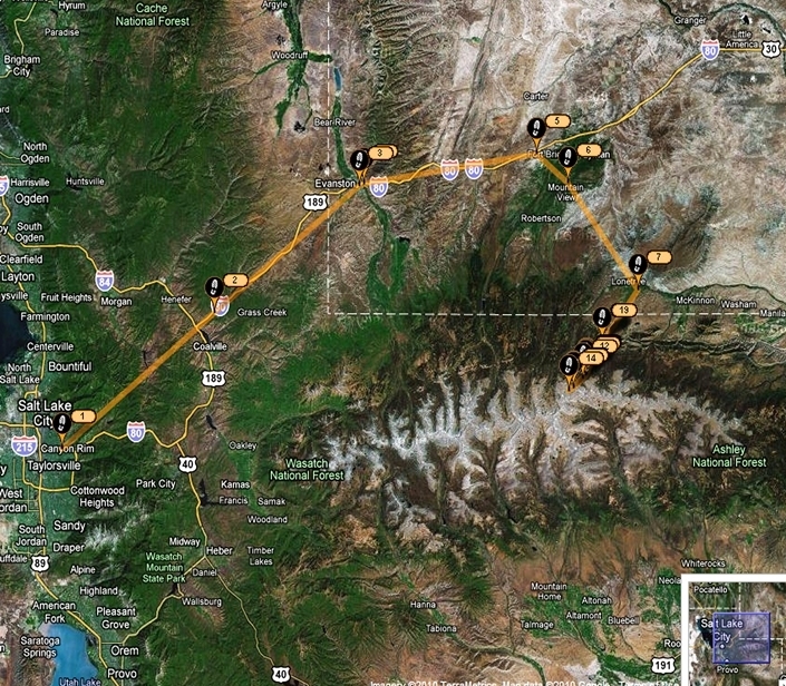
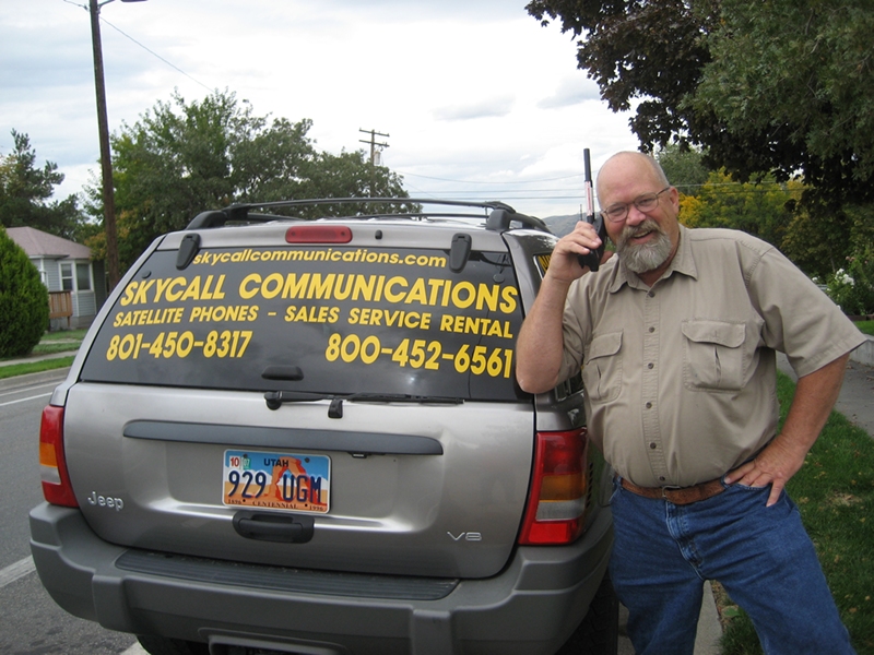
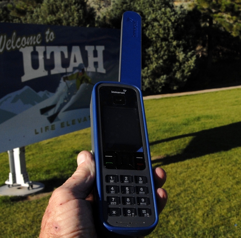
I will begin my report showing the  Uinta Mountain Range and the route I took to get to the northeastern Beaver Creek Drainage.  The Division of Wildlife Resources describes the area as “remote” with most of its lakes “seldom visited” and a good area for those seeking “solitude.”  As I would be going into such an area alone I began my SPOT Tracker route (#1) in Salt Lake City at the home of Russ Smith and SKYCALL COMMUNICATIONS where Russ provided me with a satellite phone.

To rent a satellite phone, or SPOT Tracker go to SKYCALL COMMUNICATIONS.
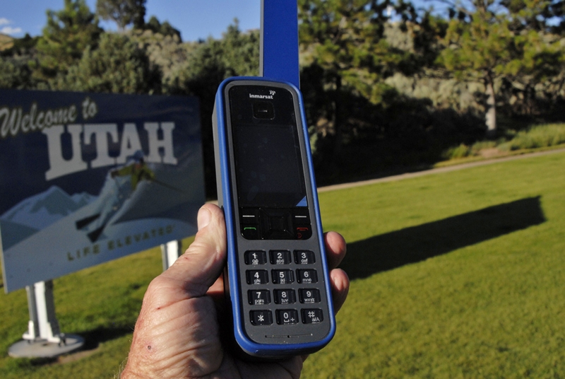
This is the new satellite phone Russ provided me with to use to call KSL OUTDOORS RADIO on Saturday morning, and for use in case of any emergency.  

LET’S GET GOING!
As you can see from the Google map I traveled up I-80 thru Evanston, Wyoming and on to Ft. Bridger and thru Mt. View (116 miles from SLC) where you can gas up at the Maverick and get whatever you might have forgotten at the supermarket.  From there you can head south towards Robertson and hit the turnoff towards the Henry’s Fork Trailhead and from there east on the North Slope Road, but I took the route with the most pavement–towards Lonetree and  Green River.
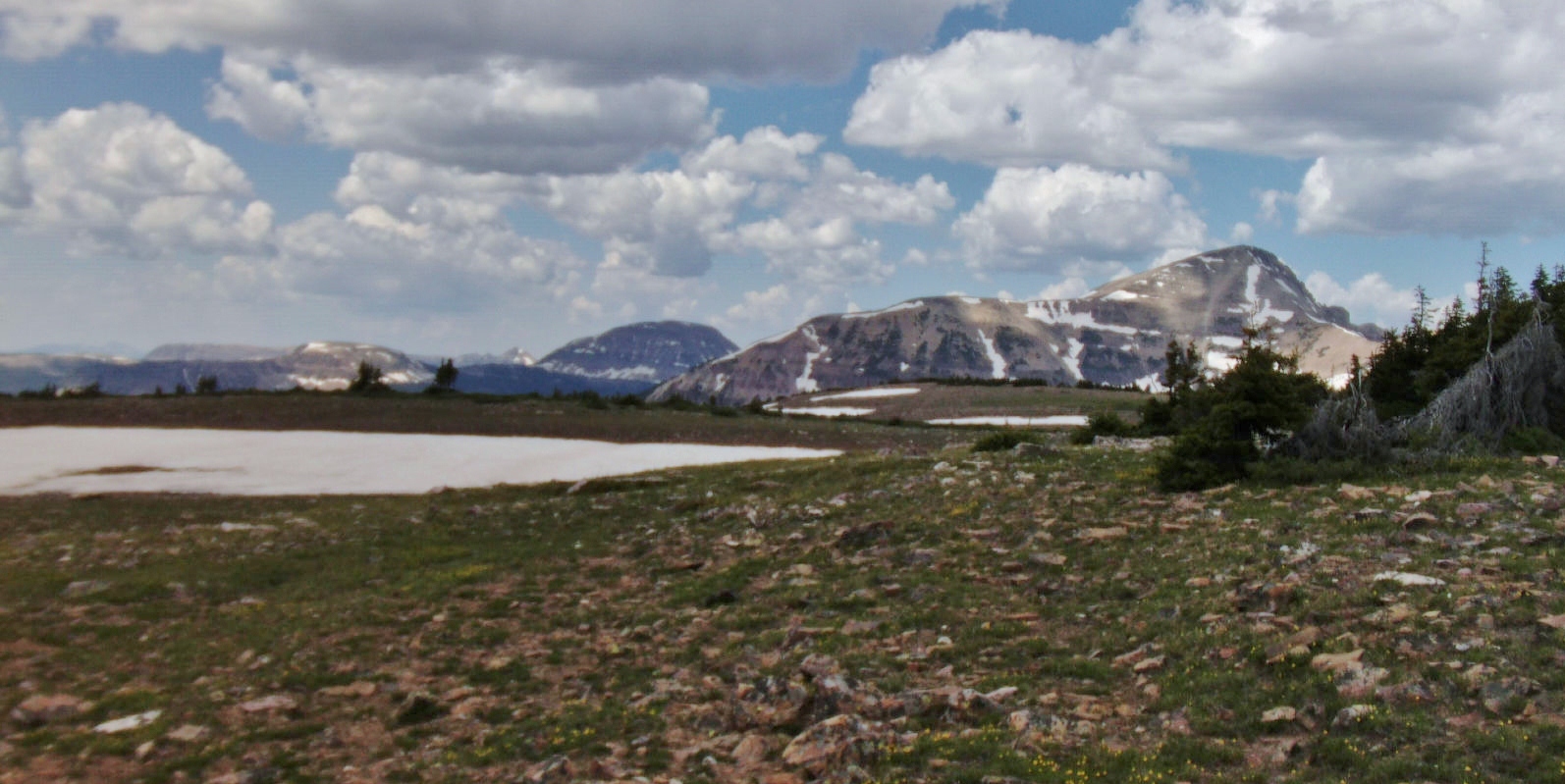
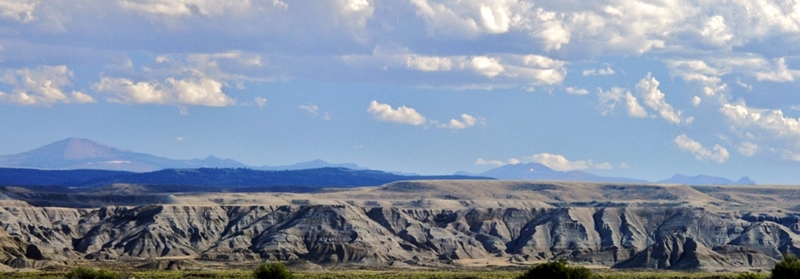
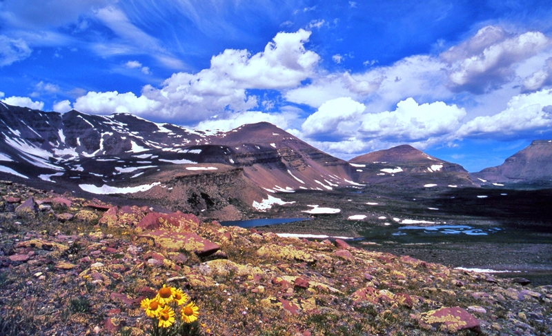
This panorama was taken between Mt. View and Lonetree looking south across Wyoming badlands towards the  High Uintas.  On the far right you can see (barely) Red Castle Peak and Mt. Wilson, then Mt. Powell, and to the left center Kings Peak (highest in Utah) and South Kings Peak (2nd highest), and on the far left dominant Gilbert Peak, 3rd highest in Utah at 13,442 ft.

Why head for the little known West Beaver Creek Drainage, Gilbert Lake and Peak?

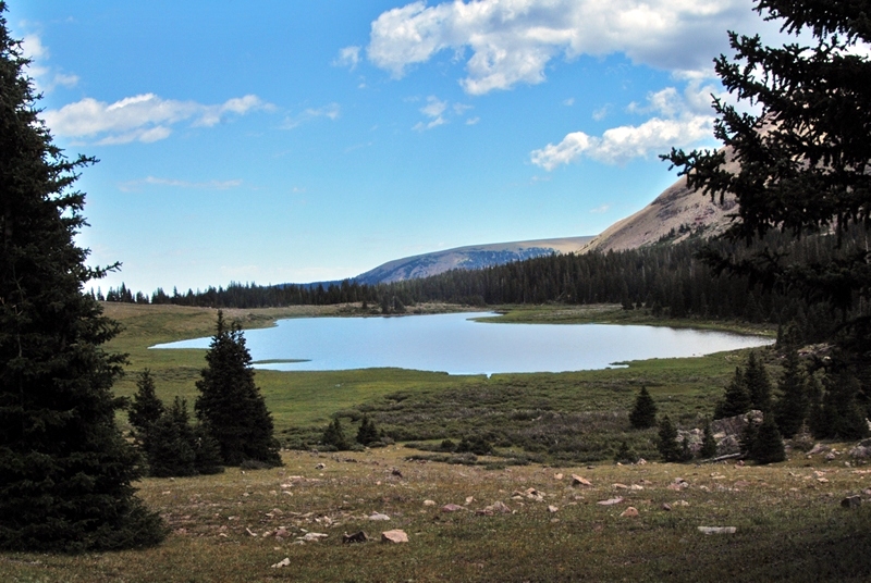
In my now 1,410 miles of Uinta backpacking since 2003 I have had special experiences photographing magnificent mountains and the nearby lake of the same name. First is Kings and South Kings Peaks you see below.
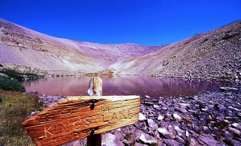
In the southern shadow of the two Kings Peaks is found rarely visited KINGS LAKE which you see below.
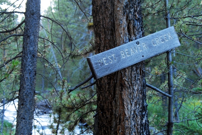
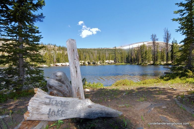
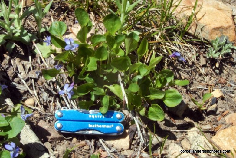
The sign was so weathered that only the “IN” WERE legible.  I filled in the blanks with my little Leatherman Squirt tool.
Another impressive mountain, in fact the one many call “the most beautiful mountain in Utah,”  Red Castle Peak, also has its lake you see below in a stunning panorama (if you want to see all the Red Castle Lakes click on this link  and go forward a bunch of times).
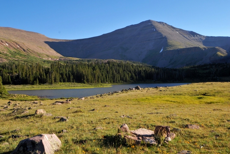
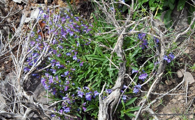
Utah’s 3rd highest, GILBERT PEAK (13,442 ft.) also has its lake, GILBERT LAKE, and I just couldn’t rest until I got shots of the duo–so off we go to the remote Beaver Creek Drainage. Gilbert Peak is named for Grove Karl Gilbert a geologist of the Wheeler Survey of 1871-75, and the Powell Survey of 1875-1879. 
As we head south Gilbert Peak begins coming more into view.
At about this point the highway crosses the Henry’s Fork River, and then you come to Lonetree.
The highway curves a bit to the east and soon you come to the turn-off going south.
As you will see this is the right path to take.  On the highway a sign indicates it is 32 miles short of Green River ( and about 21 miles from Mt. View or 137 miles from SLC).
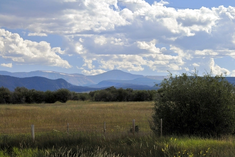
Here we are heading south towards the Uintas crossing Wyoming cattle country, but those lines of trees mark the streams coming out of the Uintas and are in Summit County, Utah–dozens and dozens of miles of streams that are rarely if ever fished.  Soon I’ll be circling the Uintas with my tiny house trailer to check all of them out and get material for a new book.  NOTE:  By the way several of my High Uinta Friends have been pushing me for some kind of book on the High Uintas.  I just need a couple of real experts and people in the field to help guide me putting it together.  It will be like none other with chapters on the heroic tie hackers, the “liveliest if not the most wicked town in America–Beartown,”  lost gold mines, a little known High Uinta gold rush, a life and death Uinta whiskey bootlegging  operation,  etc.   Contact me if you can help in any way.

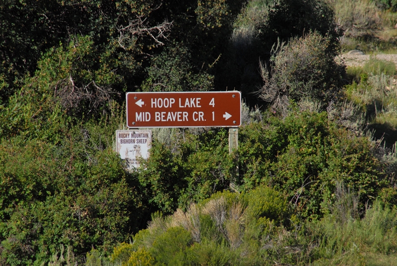
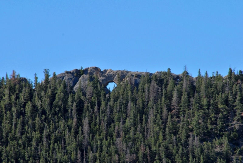
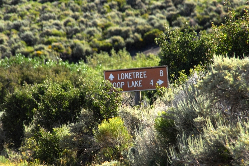
 We are now getting into Beaver Creek country, with a turn-off to the left.
The left fork takes you to Hoop Lake and along the way you can see Hole in the Rock.  This is not the famous Hole in the Rock of Butch Cassidy fame, nor the one of the Mormon pioneer saga.

At this point you have come 8 miles from Lonetree.
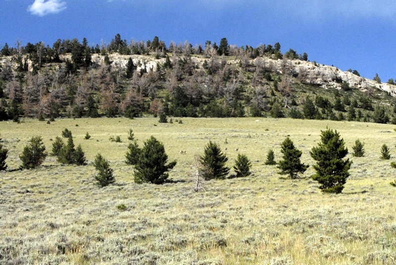
We are traveling west with Beaver Mountain to our north.  Do you see the wildlife?


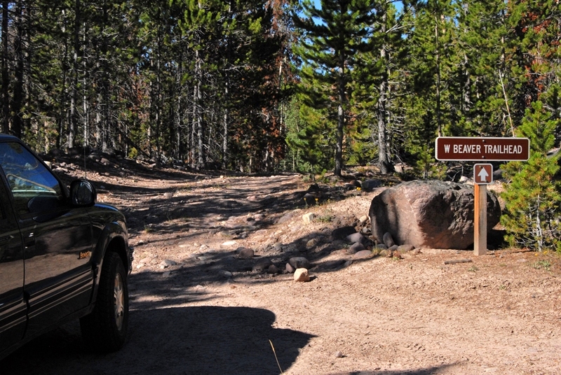
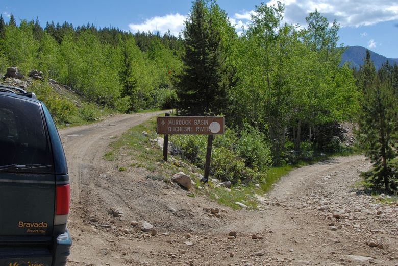
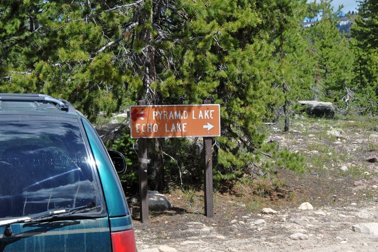
The Trailhead is a short distance from the main road.  As you can see the  13-14 miles on dirt roads can easily be handled by any car.  In fact below at the Trailhead you see a luxury car.
It’s a very small and simple trailhead with little use.
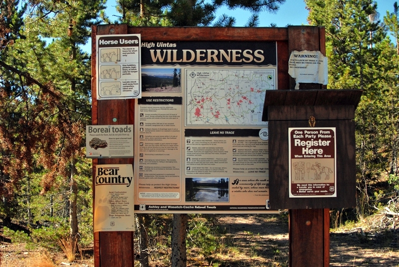
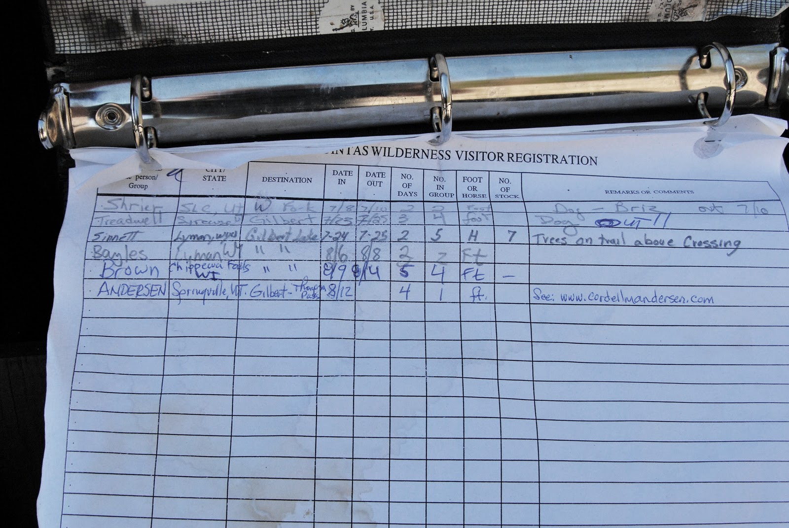
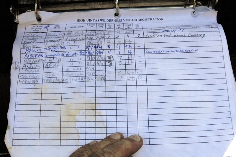
You can see in the Forest Service Register very few people have visited the area this year.
The “Brown”  party above my entry was from Wisconsin.  I would meet them the next day.

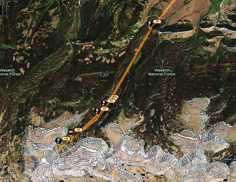
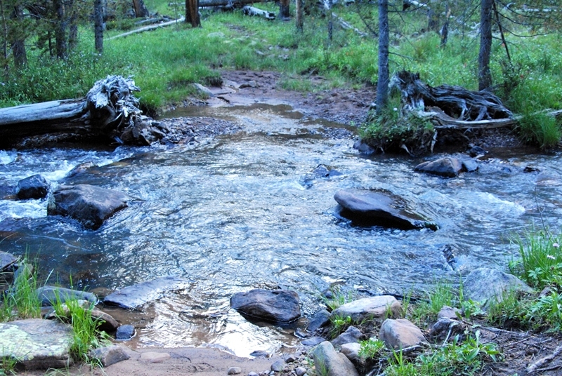
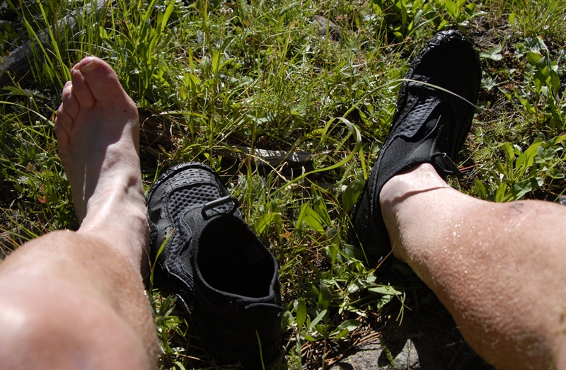
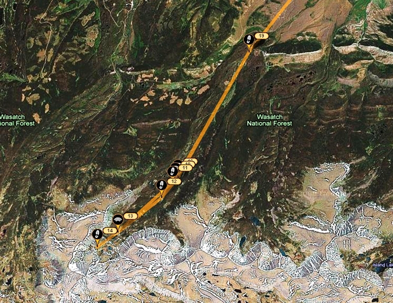
Here you see, after the fact, my route during the next 4 days.  Click on Google Earth to zoom in on this area.   You can’t distinguish it here, but the maps indicated that I was going to have to ford the stream at least 2 times.  So this time I went prepared, with my wadding slippers.
You will note that I don’t use the big, bulky, heavy plastic ones used so commonly nowdays.  I got these very light, effective slippers at REI a few years ago.
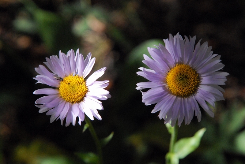
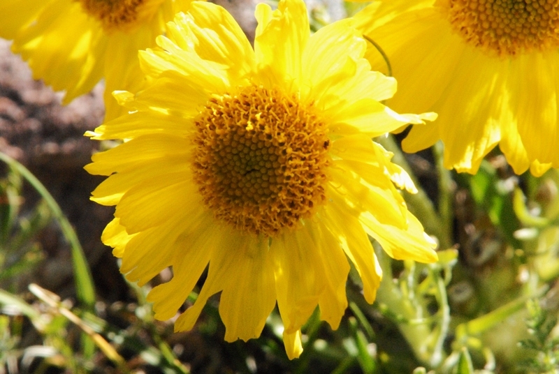
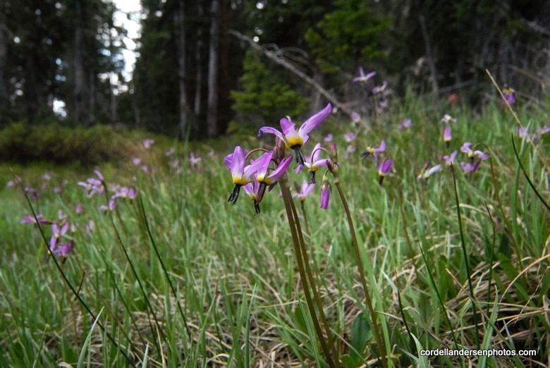
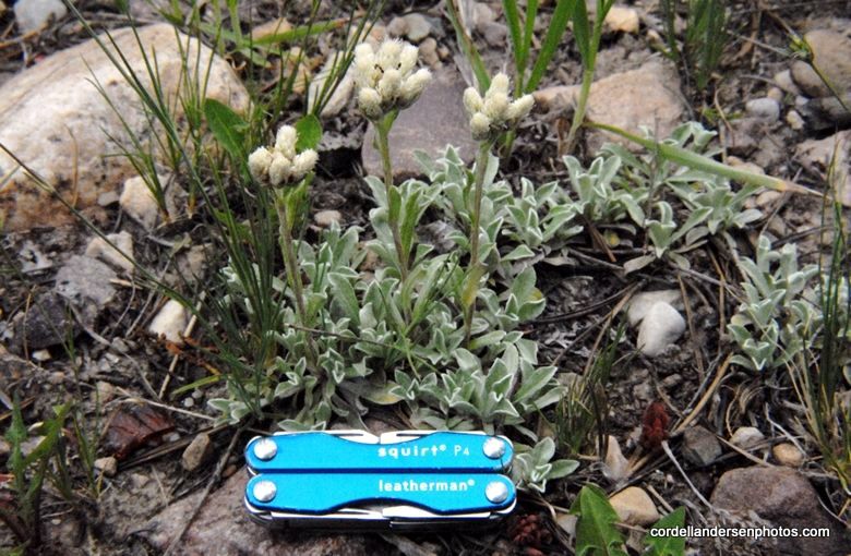
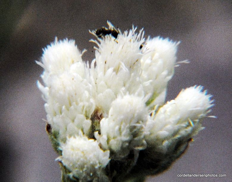
If you know me by now, you can expect me focusing a lot on the beautiful wildflowers of our foothills and mountains.  This one was right at the Trailhead–Sub-alpine gumweed.  I will only insert a few in this report out of the more than 40 varieties I counted in bloom on the trip.  For the more complete collection go to:  WEB ALBUM  At the end of the season I will upgrade my two wildflower albums, likely increasing the number to over 245 varieties.  For what I’ve got so far (thru 2009) go to FOOTHILLS  and   ALPINE
Up we go along West Beaver Creek.
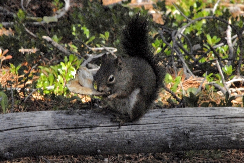
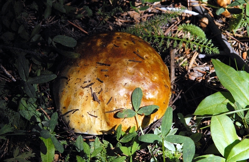
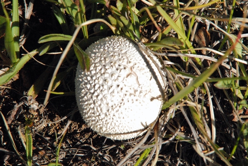
An always beautiful  red squirrel eating a mushroom along the trail.  As you will see I began focusing more on the many varieties of mushrooms, most of which are poisonous, so don’t fool with them–unless you are a squirrel and know what you’re doing!

Prior to getting up to the North Slope Highline Trail you cross into the Wilderness Area.
This  is a far cry from the main HIGHLINE TRAIL that follows the spine of the mountain range and is used by many hundreds and even thousands of outdoor lovers each year.  This Highline Trail is quite faint in many areas.
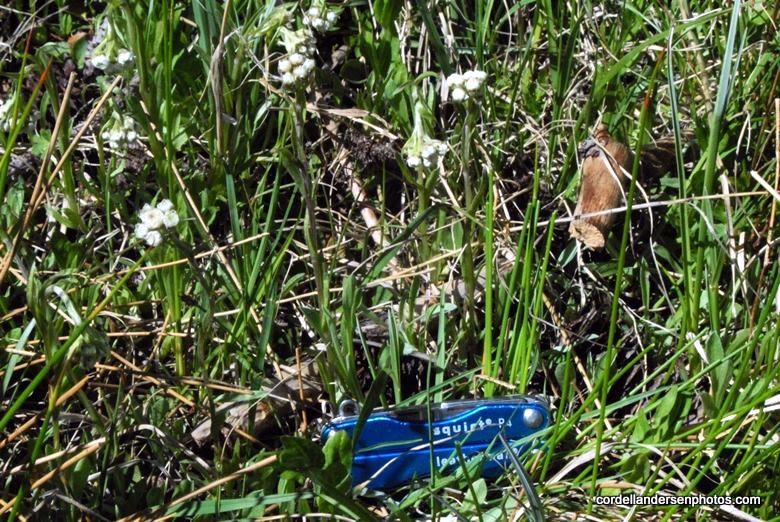
To this spot it is about  6 miles from the Trailhead, and 3.5 miles over to the Middle Beaver Creek Trail.  The trail to Gilbert Lake is just down across the stream and shortly heads south up the West Beaver Canyon.  Someone scratched it in for us on the above sign.
 
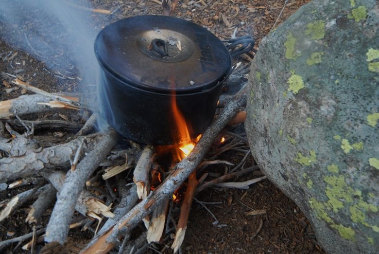
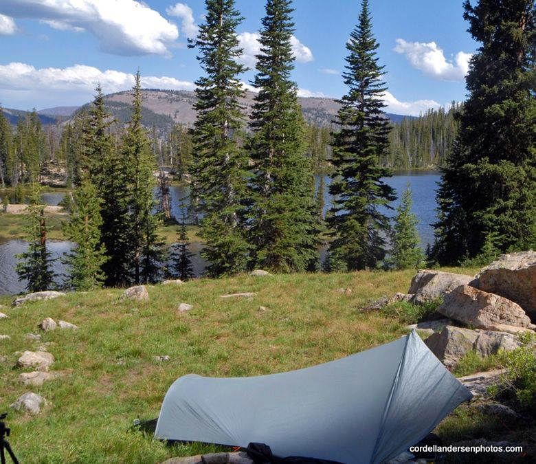
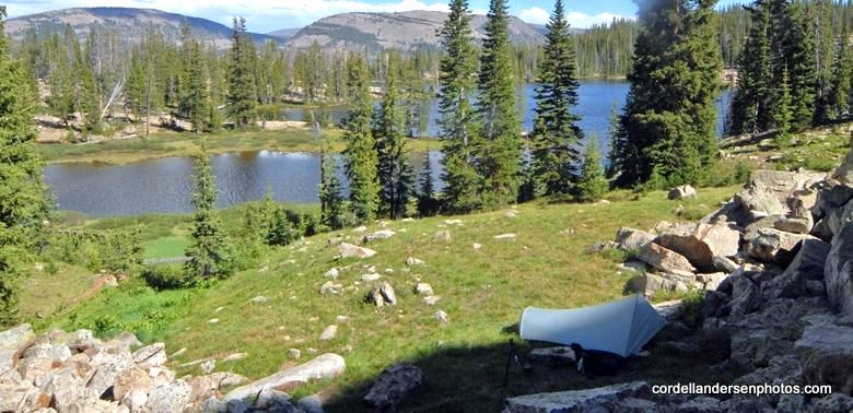
My map indicated that a couple of miles upstream the trail crossed again the stream coming back to my side, so I decided to be cute, avoid fording the stream (in the bad light) and just bushwhack up the west side of the stream.  I did so for a couple of hundred yards and it was easy going–so I was convinced my decision was a good one.  I camped for the night, had a good meal, and tested very successfully the new satellite phone.  What you see below isn’t what I encountered prior to camping for the night.  I’ll get to what you see below, but first “the night.”
At about 10:00 p.m. I was snugly in my tent with headlight on and doing some scripture  reading when all of a sudden all hell broke lose outside my tent with loud voices and bodies stumbling through the forest around me.  “ARE YOU ALRIGHT?” shouted a manly voice.  
“Of course I’m alright, as long as you guys don’t plow into my tent!”  I replied.
They asked me where the trail was and I told them it was on the other side of the stream–but thought I should have asked, “Where the trail is depends on where you’re going.”  They stumbled off up the canyon  but apparently stopped and  camped  a few hundred yards away as I kept hearing them having a rowdy time most of the night.  
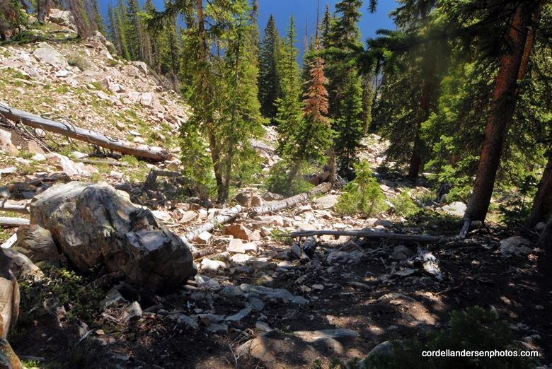
The next morning I was on my way and soon found my “cute” decision to  bushwhack up the canyon got turned on its head and, to use the  vernacular (as Paul Dunn used to say), I had one hell of a hike!
WOW!  What great exercise.  The fascination of nature of course helped make it bearable.

Eventually I came to a couple of nice streams that crossed broad meadows coming from the west.  I assumed they came from some large marshy areas shown on the map.  With each I finally was able to find some sturdy logs to inch my way across.  I was now viewing the mountains that form the backbone of the Uintas.  This one is Anne Peak,  12,713 ft. high–964 feet higher than Mt. Timpanogos.
Further to the east I found the trail that quickly climbed up the canyon into the high country and there I was in full view of Gilbert Peak, with West Beaver Creek to cross.  Apparently the several streams I had crossed down the canyon were the same stream that for a distance was divided.
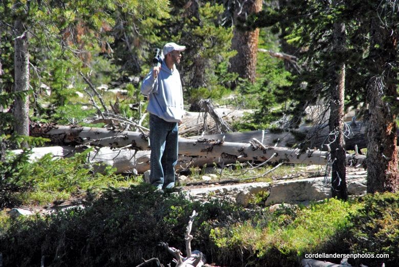
As I was getting my wadding sandals on the backpackers from Wisconsin came visiting.  They had been there for several days, deciding to camp out an hour or so down from Gilbert Lake as they said it was so windy up high that their tents would have been blown away.  They had backpacked in the Wind Rivers and other alpine areas of the West but loved the  High Uintas.  In their exploring of the high country around the base of Gilbert Peak they had seen elk, a very large coyote (maybe a wolf?), and every afternoon observed moose feeding in shallow Gilbert Lake.
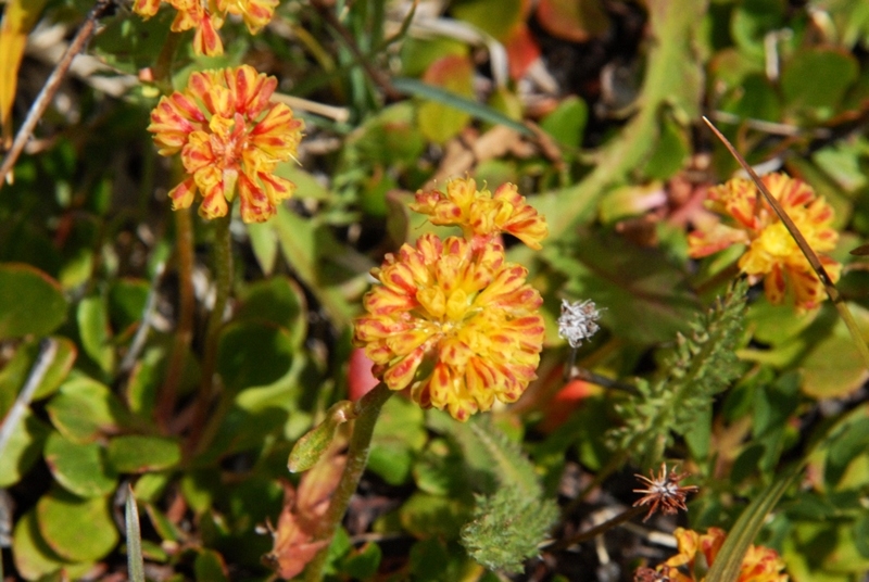
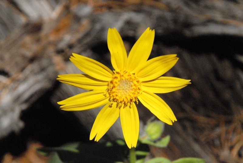
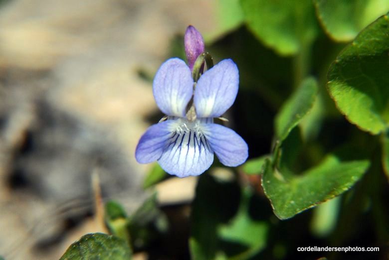
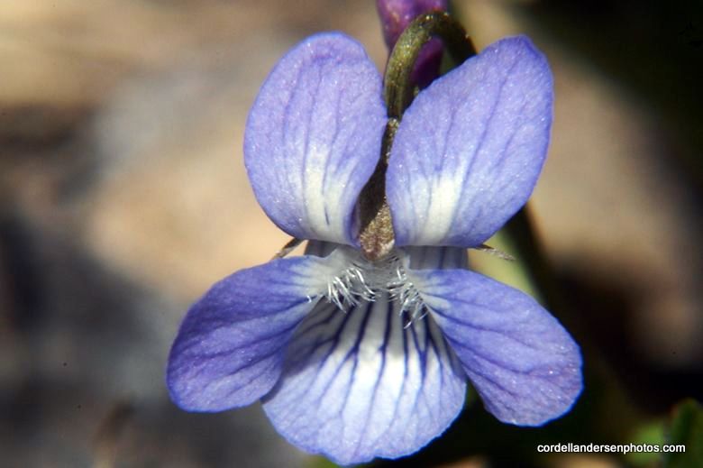
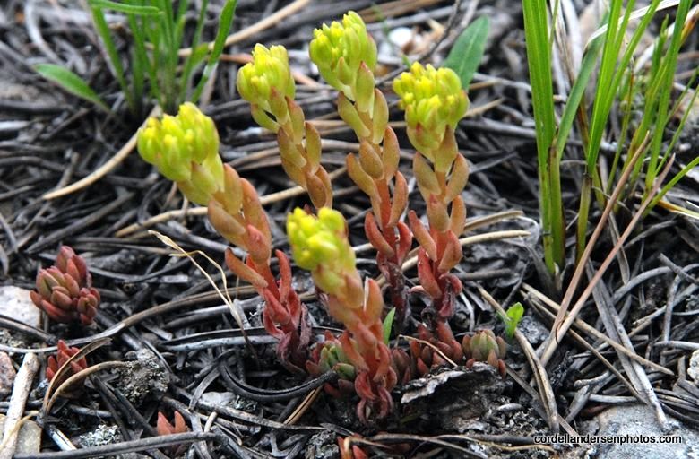
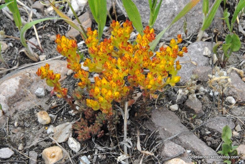
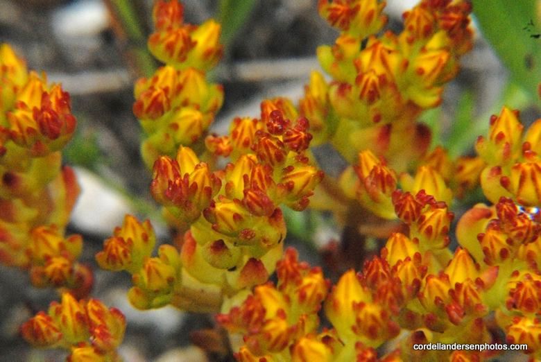
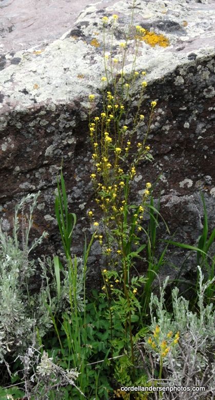
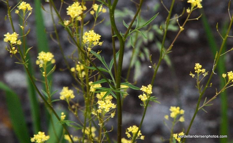
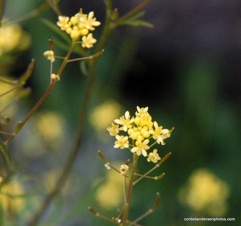
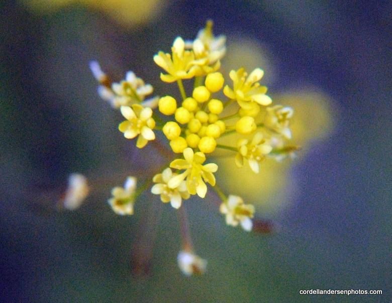
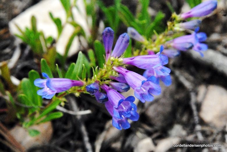
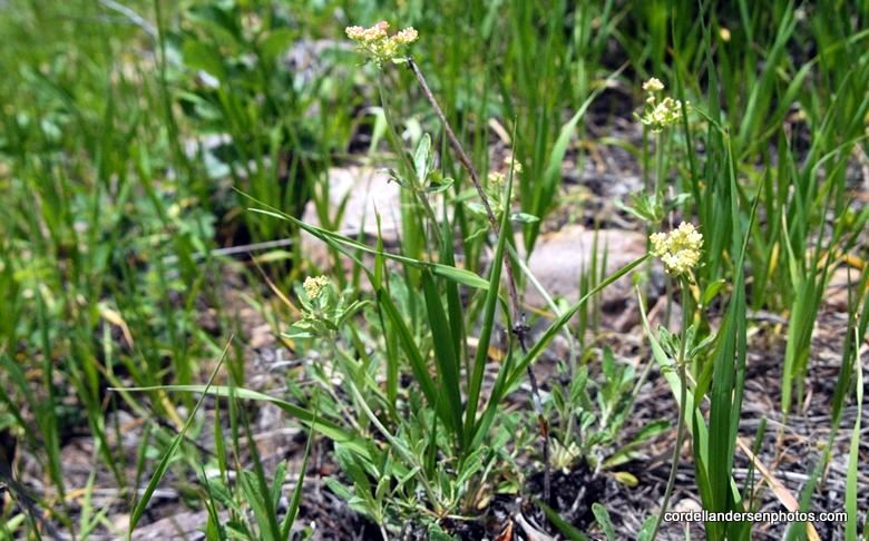
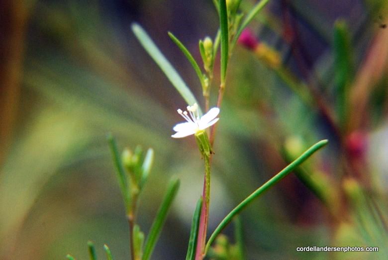
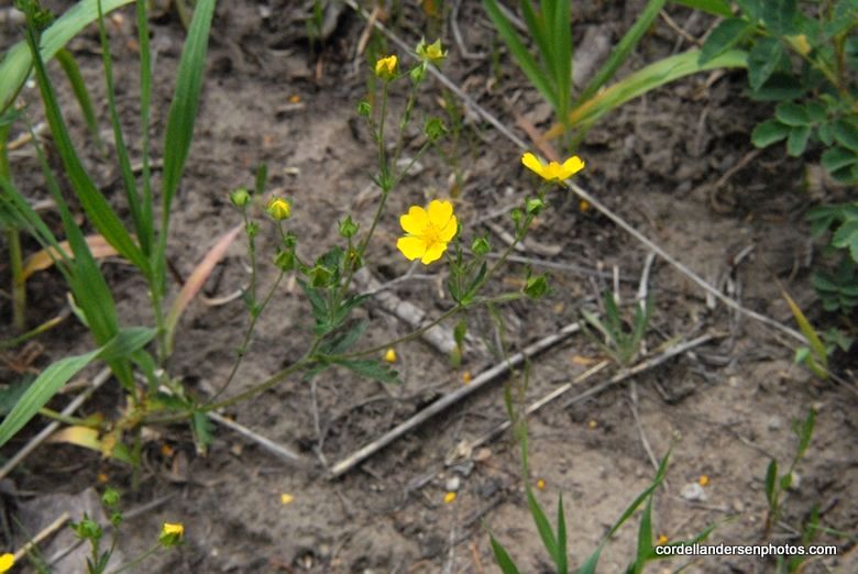
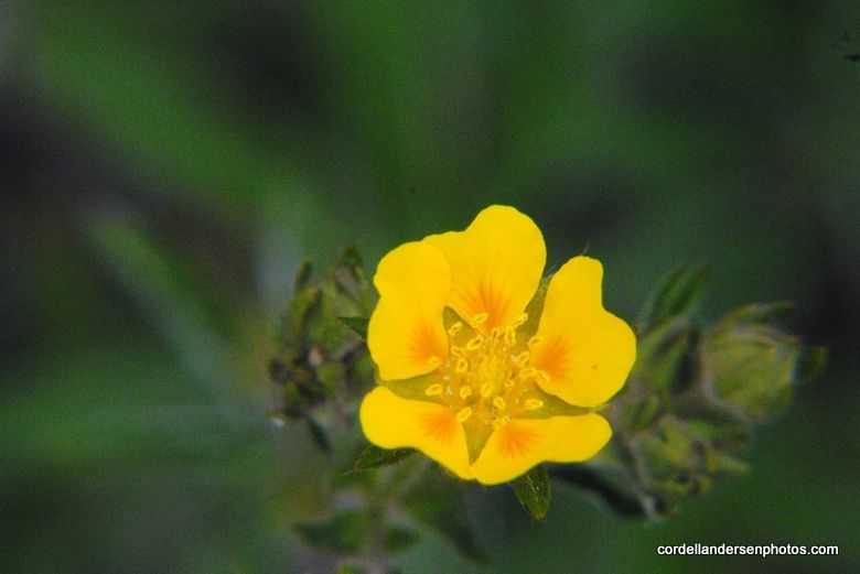
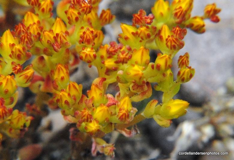
I said goodbye crossed the stream and headed towards Gilbert lake.  Small wildflowers were everywhere, like the common brilliantly yellow  stonecrop that seemed to be everywhere.
Most of the flowers are very smal– so tiny that many don’t notice hardly any of them.  I have felt it part of my mission to focus on them, zoom in and enlarge them enough so all can appreciate them and be inspired by these incredible creations of the Lord.


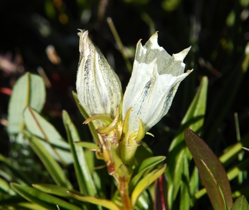
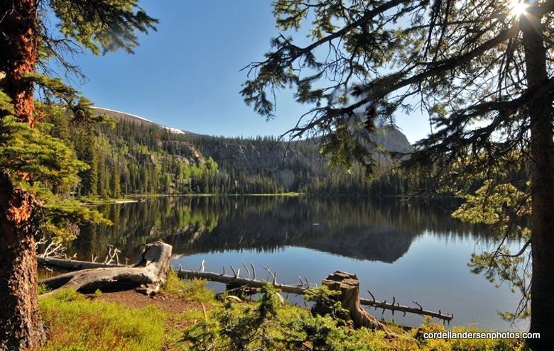
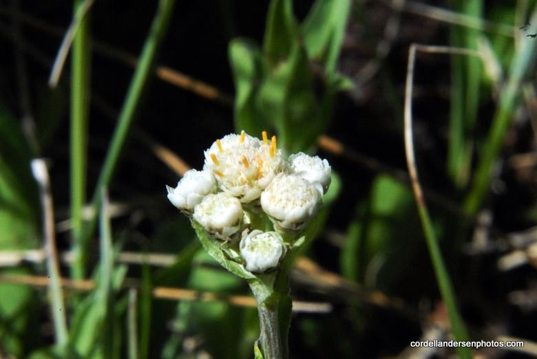
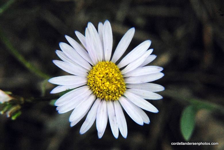
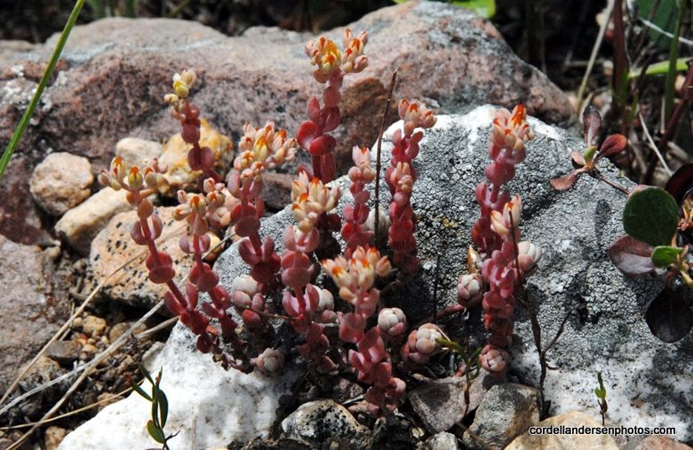
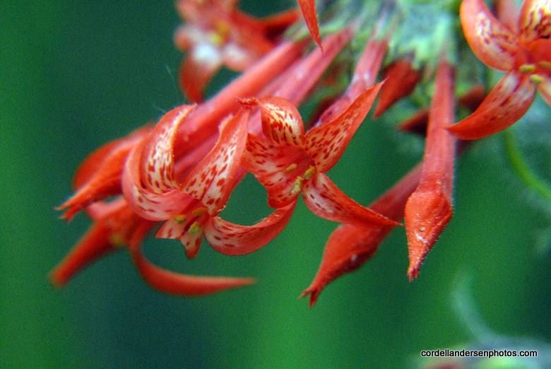
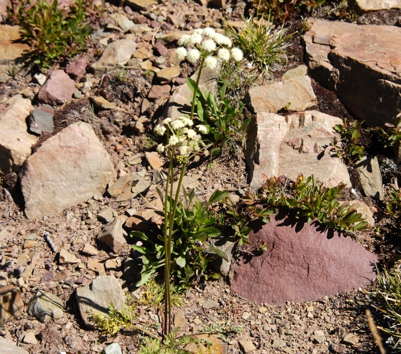
Finally I made it to Gilbert Lake in the shadow of Gilbert Peak, and put off setting up my camp as I was fascinated by the beautiful flowers, including one I have only seen once before.  It is Old Man of the Mountain, most of which were in the final stages of their life.
My only other photo of this flower is seen below, on the eastern slopes of Kings Peak on the way  to Trail Rider Pass.


The night before I had done as Russ Smith suggested and tried out the new satellite phone.  It functions with just one satellite fixed due south over the equator.  So it had to be aimed low to the south.  It had worked well in my first camp, except through the side of the tent.  Here at Gilbert I had to position  the tent opening due south aiming for the saddle to the east of the peak. That way I would be able to make my call to KSL OUTDOORS without getting out of my bag in what was cooler than normal weather.  I tried it out calling one of my kids and it worked fine, so I was ready for the Show.
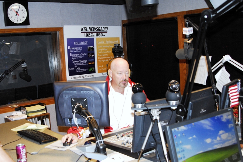
At 6:00 a.m. I was awake listening to the program on my tiny Grundig radio. I finally got a strong signal and talked to Tim and Russ.  
 If interested  you can listen to the podcast at:  KSL OUTDOORS PODCAST at about the 6:43 a.m. time slot.
Tim Hughes runs the show for KSL.
Russ Smith is his partner talking to those who have his satellite phones all over the world–including a few years ago from the top of Mt. Everest.
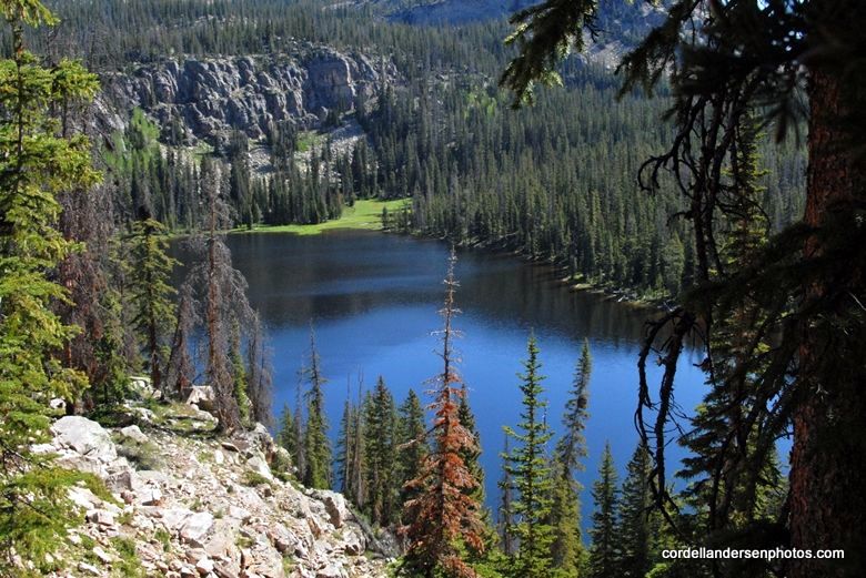
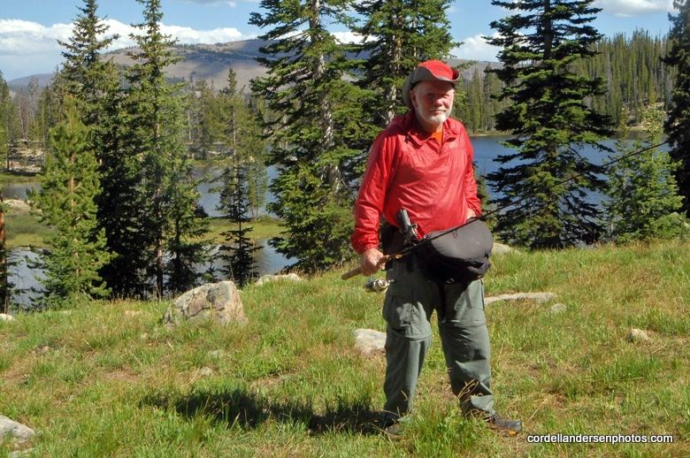
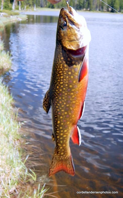
I was soon up and on my way to make a swing around Gilbert Lake, and then up above timberline checking out the fishing in all the lakes I could get to.  Gilbert Lake is extremely shallow with murky water due to wind action.  With very cast I only caught moss.  Even the Division of Wildlife Resources say it is only 2 feet deep, but nonetheless “offers good fishing for native and brook trout that sustain themselves by natural reproduction.”    Why such a shallow lake doesn’t totally winter-kill is a mystery to me.  Fly fishing would be the way to catch trout there.  I headed for the upper lakes.
On the way I photographed this beautiful flower that I also have photographed on the Bald Mt. Trail, and above McPheeters Lake in Stillwater’s Middle Basin, but haven’t identified yet.  If you know, send me an email.  I will appreciate any help I can get.

Looking back at Gilbert Lake as I climbed up towards timberline.
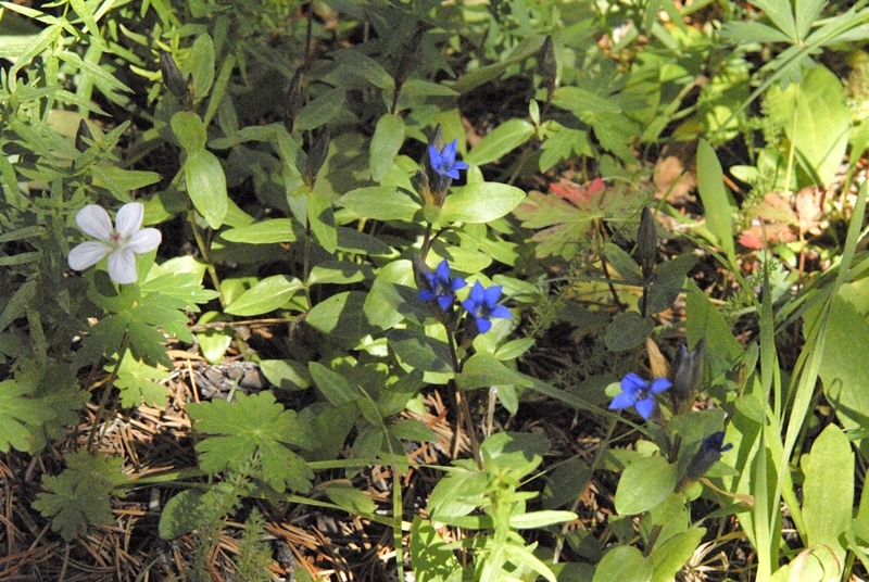
A beautiful example of Arctic Gentian.
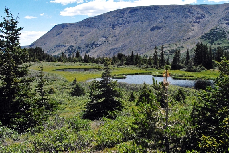
I first did a lot of hiking looking for what was a lake years ago, supposedly formed by a large beaver dam, but apparently it has disappeared with only a few shallow ponds remaining.

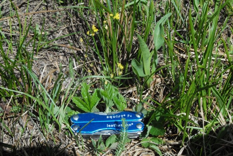
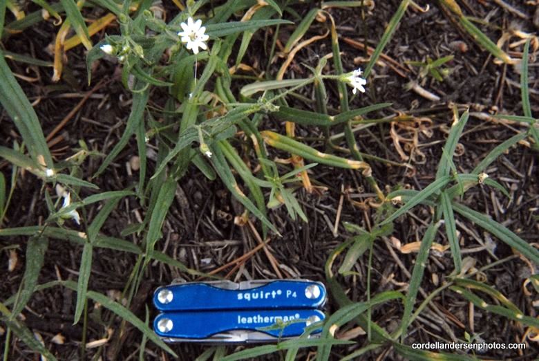
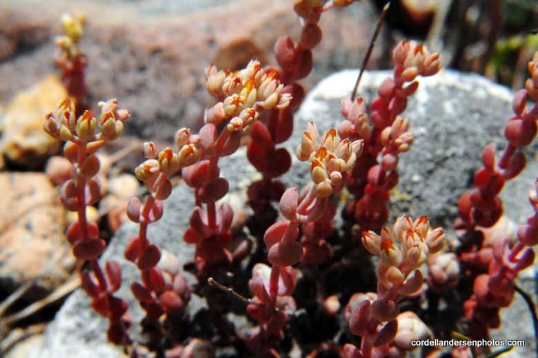
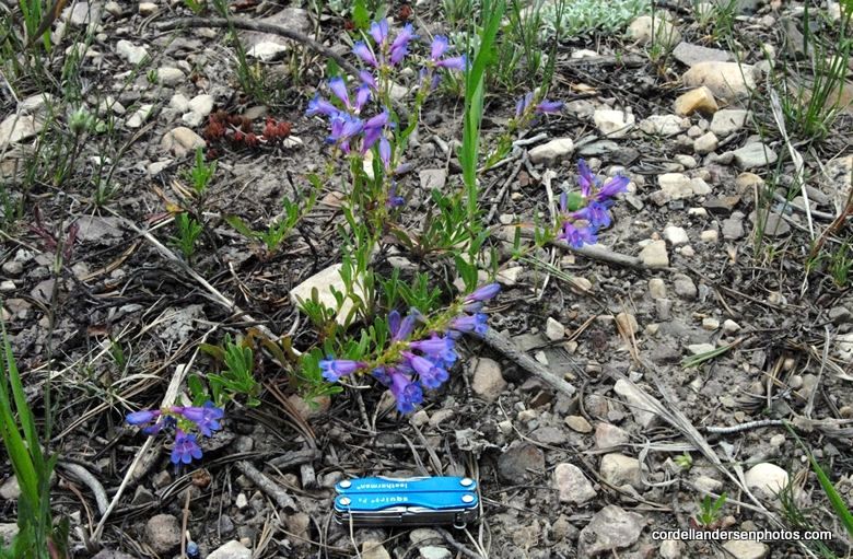
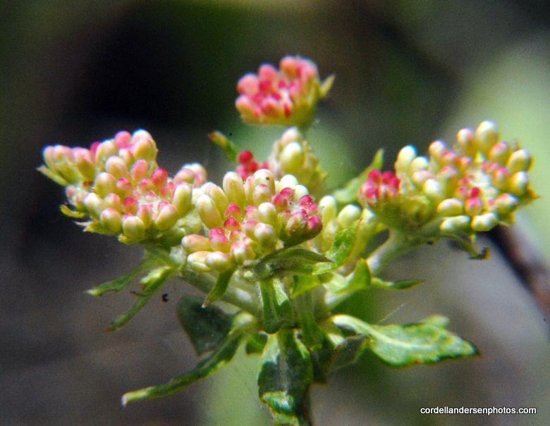
My tiny 2 inch long tool gives an idea of the size of these tiny flowers which many hikers wouldn’t even notice.

Gilbert Peak from up where I was looking for GR-153.
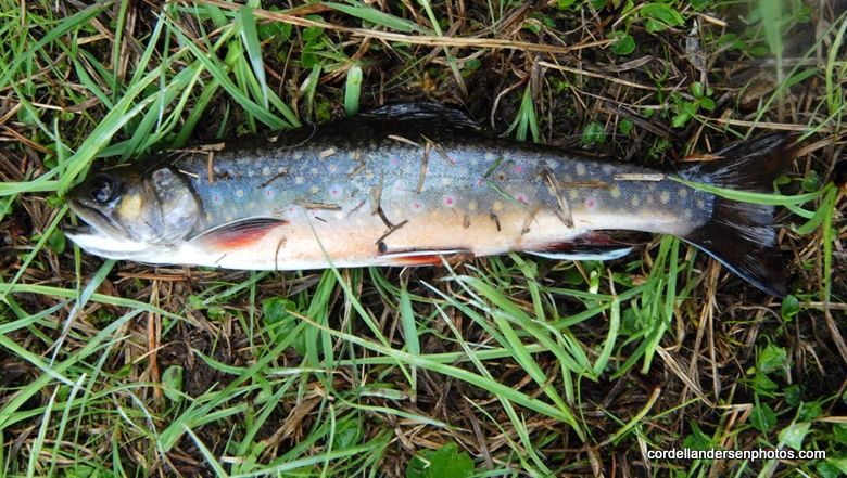
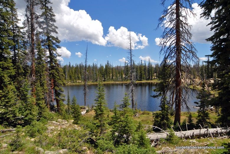
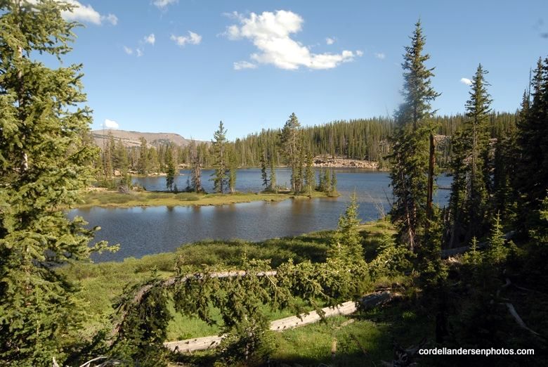
I then came back down to the larger upper lake, GR-151.  It  again has sort of turbid water with only a 11 foot maximum depth, but  supports  natural reproducing  brook trout.
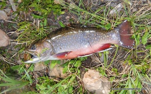
I caught many small brook trout here–none in my opinion large enough to keep for my lunch.
The lake is fed by a waterfall coming down from a small upper lake, GR-152.  It is quite small but has a 13 foot maximum  depth.  
It is stocked with brook trout and according to the DWR is  “seldom visited by fishermen.”  Case in point, I didn’t make it up there either.  I was pretty tired at that point, but my main problem was that I had to get back to camp, pack up and move at least part way down the canyon, to get back to the Trailhead the next day in good time to drive home and rest up a bit for my Monday morning job.  
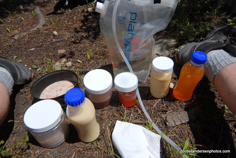
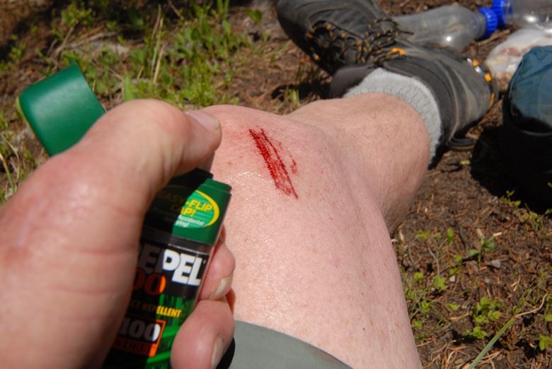
This especially became urgent as I had lost up high my last toilet paper, and also my insect repellent sputtered EMPTY!  I shouldn’t be admitting these blunders, but maybe what I did to survive will help one or two of you.  
My insect repellent this trip was BEN’S that has a screw top.  When the spray aparatus sputters empty, it’s like your car fuel tank gauge on empty but you have another 30 miles or so.  Removing the top I was able to pour enough into the palm of my hands for applications that got me to the Trailhead  the next day.  If I had of had the other repellent I use with no screw top I would have had to drill a little hole in the plastic bottle to get out what I needed, but left with an open bottle for a day or so.
The lost toilet paper was another story.  The pages from my small Moleskine notebook were pretty thick–ineffective and rough on me–if you know what I mean.  I resorted to my dirty socks as a soft finisher.  Sorry, if that sounds gross, but for those of us that date back to before disposable diapers, we had a diaper bucket and had to wash the dirty cloth diapers–so a dirty sock or two was no big deal–and INCREDIBLY SOFT!  I of course also had “ye old red bandana”  good for all kinds of emergencies as I explain in several articles.
On my way back to camp at Gilbert Lake.
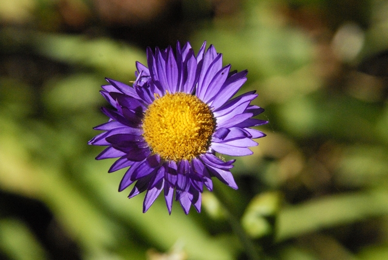
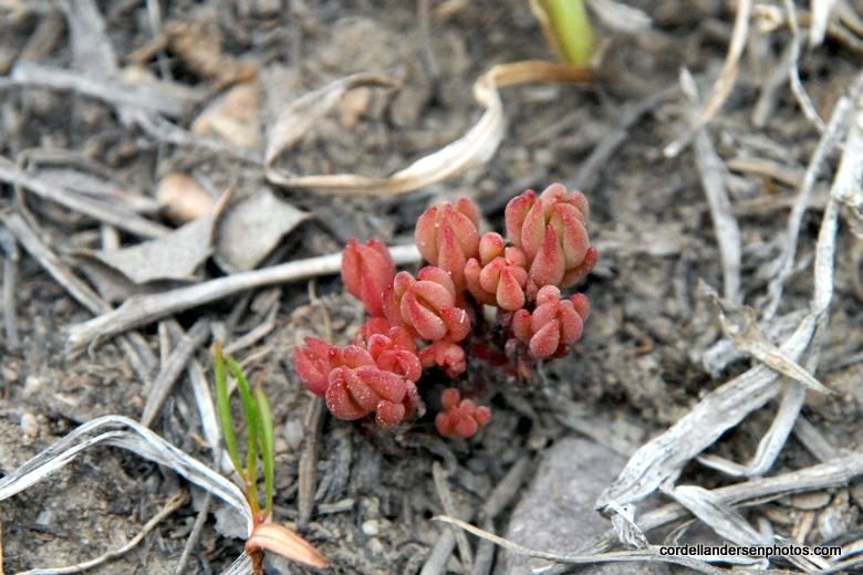
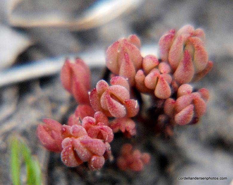
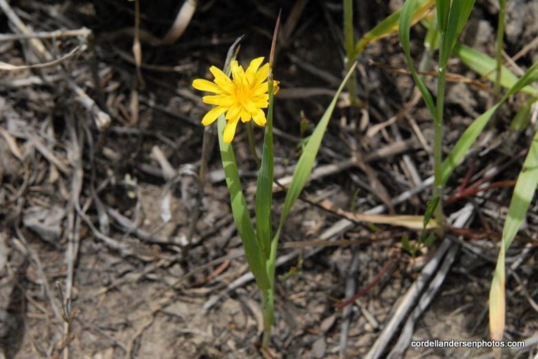
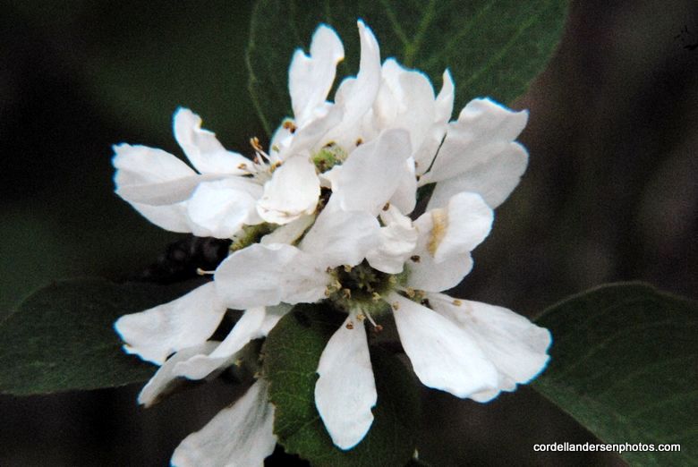
Another new wildflower.

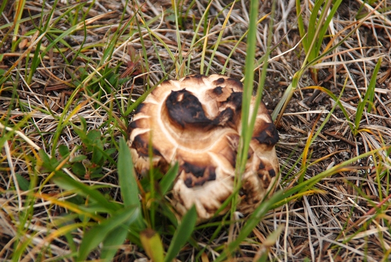
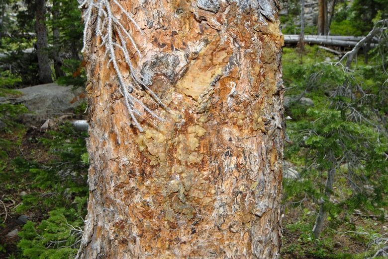
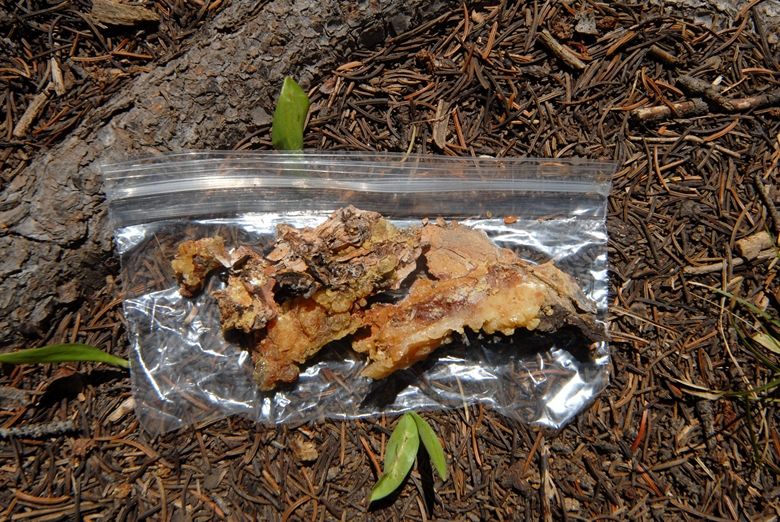
And more varieties of mushrooms, including the one below that could be
 named “Toasted marshmallow.”

Back at Gilbert Lake a cow moose was feeding on the moss.  I packed up and headed down the canyon.


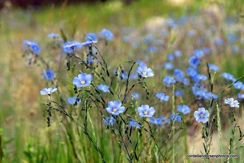
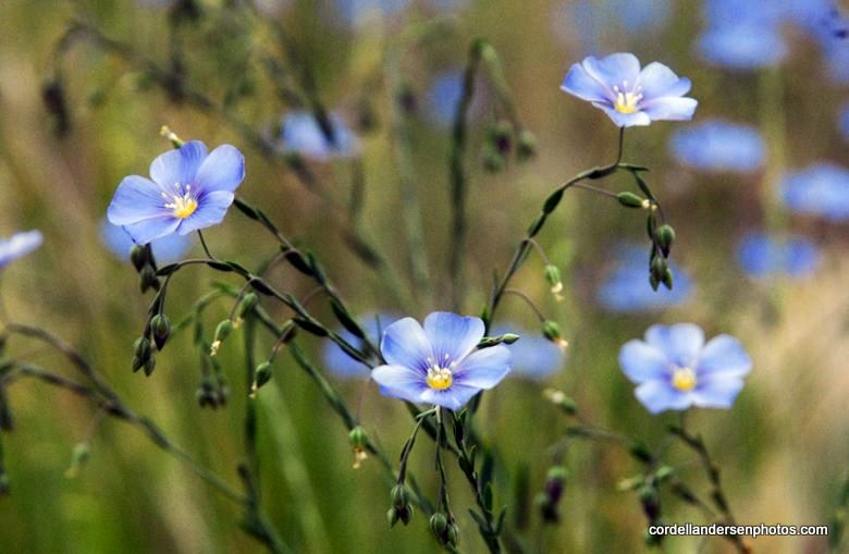
The blue flower is another new one.
Down at the Highline Trail I approached West Beaver Creek but it was a bit dark and I couldn’t see what the footing would be so set up my camp to do the ford the next morning.
The wadding slippers worked well again.  Just remember when you cross a stream, always find a pole to steady yourself finding a firm spot upstream for the pole and follow with secure footholds, then move the pole,  and progress across the stream.  Just in case, it’s a good idea to put your expensive camera into a Ziploc bag.


Moving down the canyon the trail eventually joins an old jeep road (closed to vehicle use).  When you come around a turn and see Beaver Mountain, you know you have about 700 yards to go.
At the Trailhead I checked the Register again.  Several new entries were written in.  The party under me had to be the guys that stumbled through my camp in the dark.  They and all the others listed Gilbert Lake as their destination, but I never saw any of them in the area.  Who knows where they ended up?  Two of them listed coming out the day before me.
Now let’s do a little analysis.  Below we see again the SPOT Tracker Google view of the 4 day, 27 mile trip. It was a trip I had to make, but the beauty of the lakes and the fishing wasn’t on par with many other trips I have taken.  Maybe for elk hunting it would be great as I saw elk sign from soon after leaving the Trailhead, and especially up high.  
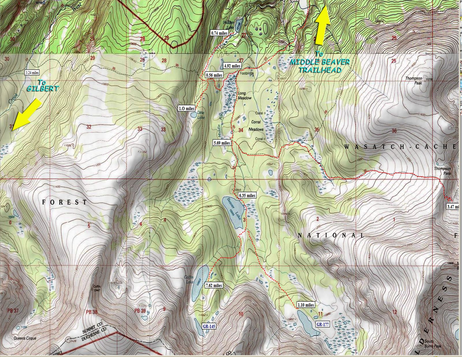
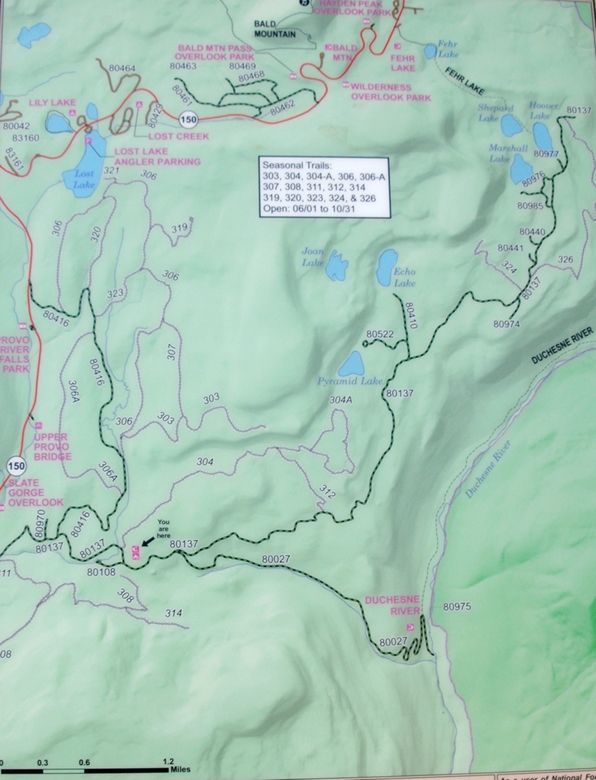
In my opinion a better option is the drainage where we see “Wasatch National Forest.”  This is  Middle Beaver Creek.  There are beaver ponds down low, and then up into the high country there are a number of good options.  Let’s look at a topographical map of the area. 
If the labels are too small to read, click on the picture to see an enlarged version, or go to the Web Album where the image should be  large enough to read everything.  
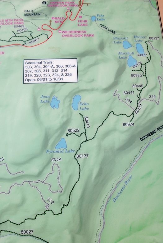
The Middle Beaver Creek Trailhead is 2 miles in from the main road and is on the Wilderness boundary.  The  distance to the North Slope Highline Trail is about 5 miles.  From there it is about 1.5 miles to Beaver Lake which is more than twice as large as Gilbert and is 30 feet deep. The trail stops at Beaver.   It’s  the most heavily visited lake in the area and so fishing would only be mediocre, but better than Gilbert.  There are other wonderful options you can get to off-trail nearby.  1.5 miles south is Coffin Lake with a 28 foot depth and has native cutthroat trout.  Less than 1/2 mile south is above timberline GR-145 that has been experimentally stocked with Arctic grayling.  Further to the east, accessed from Beaver Lake is above timberline GR-177, but which is only 11 feet deep and characterized by glacial turbidity.  Lower down, near the Highline Trail are other options, like, Dine and Hidden Lakes, both off-trail offering  solitude.  From this area you can also access Thompson Pass, one of the 23 passes in the Wilderness Area.  It is 3.5 miles from the trail that leads to Beaver Lake.
This will very likely be one of my next trips in the High Uintas Wilderness.
Let me conclude by mentioning that this season, in my 75th year, you haven’t noticed me complaining about joint and feet problems, nor high altitude sickness, much less heart problems, or excruciating fatigue or such–all of which have been problems over the years.  I find all this  an incredible blessing from the Lord, and a pretty strong endorsement for what I recommend in my article entitled:  Where Do You Get So Much Energy?   Check it out as some of what I have discovered and proven effective might just help you keep going and avoid the other option–you know, the one we should fight like the plague!   The links I provide will get you the good stuff cheaper than anywhere else without having to leave your living room.


SEARCH FOR THE GOLDEN TROUT–TONS OF COLOR FOUND!

TRIP #2-2010 EXPLORING THE MURDOCK BASIN–July 2-4, 2010
This is an area outside of the Wilderness Area, but worthy of checking out as reportedly Golden Trout could possibly be found there.  You go east from the Wasatch Front to Kamas and there get on the Mirror Lake Scenic Byway–SR-150.  About 14 miles from Kamas you come to this worthwhile display that for me is new, concerning the Civilian Conservation Corp (CCC) of the Great Depression era.  Many of its projects were in the High Uintas, such as construction of trails, the Mirror Lake road, etc.  Later, for your enjoyment,  I’ll put on the website a photo essay based on this display
Leaving this rest area one sees a sign indicating distances to key spots along the highway seen below.  It will help you get your bearings as you drive up this marvelous scenic highway.
About 5 miles further, or 70 miles from Springville, you come to the Murdock Basin Road.  It being paved is very deceptive to say the least–I’ll explain  in a moment.  Just a short distance down the road is the first sign:
Soon the pavement ends and the real road begins, but first a Forest Service information sign welcoming you to the area. 
The map shows a short distance ahead a fork in the road, the right fork leading down into the Canyon of the Duchesne River.  We will take the left fork our goal being Echo Lake.  Below is a zoom in of the map with our target area in the dead center.
The road becomes very rocky and rough to say the least.  You would not want to navigate this road in a passenger car.  My small 4×4 SUV had me many times on the verge of parking to go forward on foot with  pack on my back.  Somewhere along the way my side view mirror got ripped off.
Here we see the fork in the road.
The road looks pretty good in this shot, but believe me I had to many times go very slowly easing myself along as I rode the high center hitting my frame more than once, just barely slipping between boulders I didn’t have the clearance to go over, etc.  If you aren’t familiar with the phrase “ridding the high center” you’d better not attempt it unless you have a larger, high clearance 4×4. 
The next sign you come to gives you the choice of going to Pyramid Lake and  Echo Lake, then a fork giving you the choice of one or the other.  I continued to Echo.
Soon I decided to hoof it and started with pack on my back, but then realized that most of the road behind me was worse, and then continued in the car to the end of the road with the lake in sight.  With pack on my back I continued to the lake and then circled around to the northern shore where high cliffs guarded the lake.  Finally I was able to relax a bit and begin noticing the beautiful colors of wildflowers all around me.  I will not make any effort to identify the flowers I insert, but leave that for the Wildflower Albums in the Galleries section.
This is a tiny flower not more than 1/2 inch wide. 
Beautiful Echo Lake about 9,700 ft. elevation.  By the way NOW THE MOSQUITOES WERE OUT IN FORCE–so from now on go prepared with 98-100% Deet insect repellent.   I was assured by the Division of Wildlife Resources that the lake still had Golden trout, last year some being caught as large as 12 inches.  The Utah State record is 14 inches from Atwood Creek of the Uinta River Drainage.  They are native of portions of the Sierra Nevada Mountains in California, but the world’s record is a bit over 11 lbs. from Wyoming’s Wind River Wilderness.
I set up my camp, fetching and purifying enough water for all my needs.   
Then put  to soak all my supplements, dinner, and breakfast and then went fishing.  I tried lures like my favorites Colorado Spoon and Thomas Cyclone, but with no luck.  As the evening approached the lakes surface turned to glass and surfacing fish were seen so I changed to flies.  
With mosquitoes all over I thought that pattern would be a winner, but nothing.  Finally a larger pattern sort of moth-like began working on almost every cast.  Time after time I was excited hoping to see a Golden trout, but small Eastern brook trout is what I caught, and kept one for my dinner.
In circling the lake and navigating downed timber I scraped my knee and immediately disinfected it  with what I had at hand–insect repellent.  Later I added Neosporin antibiotic ointment.
To get my small campfire going I replenished my supply of pine pitch–enough for the several fires I would need on the trip.

Very quickly I had the fire going and dinner was soon ready.
The next morning I was awake listening to KSL OUTDOORS and at 6:35 made my Satellite call. When I talked to the guys I didn’t know that in the 2nd hour they were going to talk about “BIG FOOT.”   This was of great interest to me as my next trip will be backpack through the area where reports of his (its) sighting have been reported, and where I have said, “Rumors have it that Big Foot is waiting for me up there to take a family portrait!”  
I tried again to luck out catching a Golden trout, but failed, so packed up and headed up the mountain–and I really mean “UP!”
I circled south around the lake until the cliffs ended and I could see a possible pathway up the mountain.  It was very steep and rocky, with a lot of downed timber.  I found that I was doing a lot better with my balance–that was questionable on my first trip.  My “mountain legs” were beginning to work for me.  The guidebooks state that there is no trail from Echo Lake up to Joan, but when almost to the top I found a trail that angled up from about the area where the road  ends.  It is not a maintained trail with much downed timber blocking it one has to work around. Along the way the view of Echo Lake was breathtaking as you see below.
Soon Joan Lake appeared with an old sign post, and a piece of wood with “Joan Lake” written on it with charcoal.  The lake is at 10,030 ft. elevation.
As I was trying to get a photo of the lake Dan Olsen appeared with a rifle over his shoulder.
He told me he had seen bears in the area down-below.  I had come prepared for such with my Colt .45 Defender just in case I needed to fire a warning shot.  
I worked myself around to the northern edge of the lake  and set up my camp, preparing all my stuff for the evening and the next morning, and then headed out on a day hike to test the waters of Gem Lake upstream from Joan.  My paddle holster worked well with my camera waist-pack.
Less than a mile upstream I came to Gem Lake.
Its waters looked dark, sort of like stagnant water, but there seemed to be many Eastern brook trout.  I caught a few like the one below, but saw somewhat larger brookies following my lure.
Up above the cliffs to the north is found Blizzard Lake, but according to the DWR pamphlet it doesn’t sustain fish life, so I didn’t bother with it, but returned to Joan Lake which actually was a fairly large and pretty lake.
It was time to test its waters.  The wind was picking up quite a bit so I continued to use spinning lures–the Colorado Spoon being the one that always worked at Gem, and so I stuck with it at Joan fishing the northern shore that had cliffs and talus slopes coming down into fairly deep water.  Once again I only caught Eastern brook trout, but seemingly of two different types–both seemed very strong.  One type  thick or heavy as seen below.
The other type was more normal in body configuration, but with brilliant orange on its belly.
There are supposed to be native cutthroat trout also in the lake, but so far this season I haven’t seen one–apparently the “urge to merge” is still pretty strong, but should end soon.
Having failed at catching and photographing a Golden trout, I decided to focus the rest of my time photographing the ABUNDANT COLOR  of wildflowers.
My Leatherman Squirt tool, about 2 inches long was used to give size perspective, so these tiny purple flowers are about 1/4th inch wide.


Here we are seeing a flower perhaps 1/8th inch wide.  Many of these flowers are never noticed by hikers.


On Sunday morning I was hoping to get an impressive photograph during that magical sunrise moment, but during the night there was thunder and lightening all around me, and when the day dawned I was under a dark and menacing sky.  I decided it best to pack up and get out of there before the rain–there isn’t hardly anything worse than to have to break camp and pack up under a good rain.  I got out of there in record time and made it back to the car.  
We are now back along the Mirror Lake Scenic Byway.


Two different types of Stonecrop.


So I found tons of color–but in flowers, rather than the colorful Golden trout.  I’ll have to put back on my future schedule The Search for the Golden Trout in the Lake Atwood area of the Uinta River Drainage.

NEXT UP:  Trip #3 From the East Fork of Blacks Fork Trailhead, SEARCH FOR “BIG FOOT” up Little East Fork of Blacks Fork–Testing the drainage’s alpine lakes, then on to Squaw Pass and down to Porcupine Lake.  From there, over Porcupine Pass (12,236 ft) and testing the 3 no-name lakes above North Star Lake, on to Tungsten Lake and Pass to test the waters of Y-19 and Y-20 lakes.  From there, back over Porcupine Pass and if I have time explore and test off-trail Oweep and Lambert Lakes, and back over Squaw Pass and down to the Trailhead.  This will be my only long backpack of the season.  See my  revised schedule for details.