Eastern Brook Trout Records

EASTERN BROOK TROUT 
 The one pictured below and the World Record
No-name lake guarded by Mt. Beard produced this brookie estimated at between 9-11 lbs.

In the Galleries section, Fishing the Uintas album I tell the story of this fish I hooked in Beard Lake near Trail Rider Pass.  The caption says:
A Utah State record breaking Eastern Brook trout!
I let the monster swim around while getting out my tripod for a good photograph, and then he was gone!  I estimate his length at between 24 and 30 inches, and heavy bodied. Let’s just say 27 inches and apply the 6.1 oz./inch that would have him weighing  10.3 lbs. or 10 lbs. 5 oz.  and a Utah State record which is 7.5 lbs.
But I would  have had to get him out of the water, then hauled 20 miles down to the Trailhead,
and 30 miles to Roosevelt to have him weighed. He had to easily exceed the 7.5 lb. Utah State record for Eastern Brook trout. 
To understand the base figure of 6.1 oz. per inch go to my discussion of a large Native Cutthroat trout caught in Upper Red Castle Lake  and go forward to get the whole story.
THE WORLD RECORD
The World’s Record  brook trout was 14.5 lbs. caught in Ontario, Canada back in 1915. Click on that link to see the story.
A 29 inch long brookie was caught in Manitoba, Canada recently but apparently wasn’t weighed before being released.  See its picture clicking on the link.  The photograph makes our High Uinta’s brookie from Beard Lake look to be smaller than the 27 inches I used to calculate its weight at 10 lbs. 4 oz.
So let’s go with the 24 inch estimate that would have it weighing 9 lbs. 2 oz. and still a Utah State record.  Of course it’s all speculation since I didn’t even get him out of the water.

GRANDADDY BASIN—MOSQUITOS—BEAR SCAT—WOLVES HOWLING IN THE UINTAS

NOTE:  Until I can get my act together and get a post and YouTube video online about my 
recent trip, let me post here an email interchange with one of  you  “Uinta Friends,”  but first 
an important notice from the Duchesne Ranger Station:  

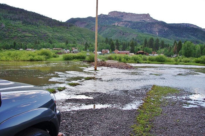
The Hades Canyon is closed to backpackers wanting to  head for the Grandaddies–and will be until reconstruction of the road is completed.  For up-to-date  information, call and talk to Lori or Shiella at:  435-738-2482. 


Date: Wed, 20 Jul 2011 00:09:23 -0600
Subject: Re: FW: GOING BACKPACKING….FINALLY!
From: jason.douglas.webb@gmail.com
To: cordellandersenphotos@hotmail.com

Cordell,
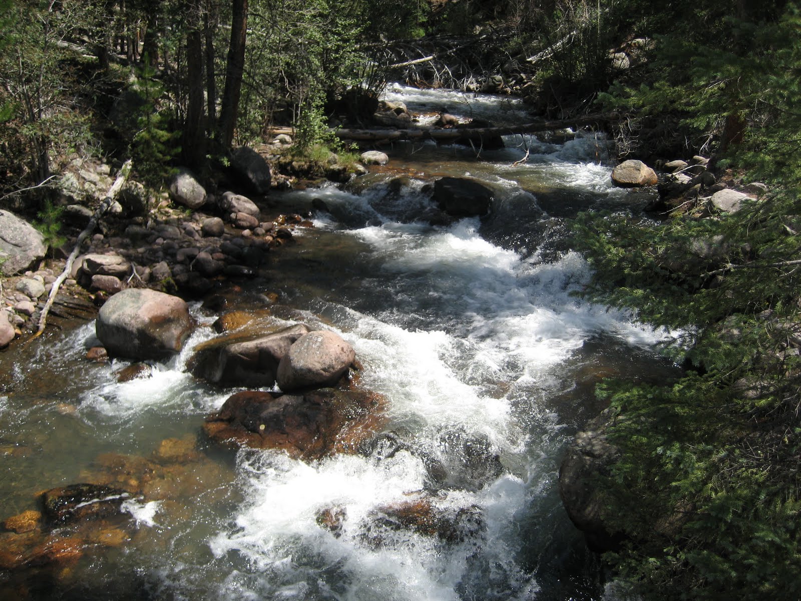
    I spent this last weekend (July 15-18) in the High Uintas. We started at mirror lake and backpacked into the grandaddy basin, then up around the four lakes basin and then on to the naturalist basin. It was beautiful, but still very wet. It was amazing to see all of the waterfalls in the naturalist basin that I doubt have ever been there before. There was still a pretty good amount of snow in the naturalist basin as well as the four lakes basin, but the beautiful thing about it was NO MOSQUITOES!!!  We were the only ones in there and only saw one other person on a day hike the entire time we were in there. The only place we ran into mosquitoes was in the grandaddy basin as the lower elevation has taken care of the snow and the eggs have started to hatch. The fish weren’t rising yet though as they had no bugs to eat, but we were able to catch a couple just before getting back to mirror lake on our last day. We covered some 40 miles in our four days and it was a beautiful environment.

 We found a lot of bear scat surrounding Governor Dern Lake and listened to wolves howling most of the night. The trails need a lot of work as there are probably 20-30 trees down across the trail every mile.  The rivers are all running pretty high, but luckily there were plenty of trees fallen over them to cross. There were plenty of blooming wildflowers around and we got a nice thunderstorm and rain shower on our last night.

 I took a lot of pictures but haven’t gotten them uploaded yet. As soon as i do I will send a couple of the best ones on to you. It was a beautiful trip and reminded again why I love the Uinta Wilderness. Best of luck on your trips this summer and I will continue to follow your progress as your explore more places along the way. 

Sincerely,
Jason Webb

MY REPLY TO JASON….Mon, July 25th:
Thanks, JASON, for your report, and happy you had a great trip.   One reason you didn’t see others is that the Forest Service has closed Hades Canyon even to backpackers while they work with heavy equipment to rebuild the road. They thought of letting people go up the “Service Road” at the bottom of the canyon, but from it the old trail hasn’t been maintained for decades and would be quite impassable.  At least that was the report they gave me last Wednesday in Duchesne.  I suspect that the Fish & Game guys would say you were hearing coyotes rather then wolves, but whatever, it is always fun to hear them at night.  Interesting about the bear scat (the Fish & Game guys would like to see photos of it–did you take any?).  Along with a few of your photos, would you mind me posting your report on my website?  I would use word for word your report, with photos interspersed.  

You might be surprised hearing from me as I’m supposed to be in high country for another day or two.  I’ll get a report up on my website about one of the toughest days so far in the experience of this 76 year old worn out mountain man.

Hope to hear from you soon.  Thanks again.

Your buddy, CORDELL

JASON’S REPLY…. 7/25/11
Cordell,
   I look forward to reading your report. Please feel free to use my update on your website. I didn’t take any pics of the bear scat and I haven’t uploaded the pictures I took yet, but I will send you some as soon as I do. About the coyotes/wolves. I grew up in the idaho mountains and have heard thousands of coyotes, so if these were coyotes, they were definitely from a different family. 🙂  We actually have wolves that have been caught on motion cameras around our farm in southern idaho (declo/burley area). They are definitely further spread than what the fish and game would like to believe. It all adds to the mystique of the outdoors. Talk to you soon,

Jason


FINALLY….BACKPACKING IN THE HIGH UINTAS

PACKED UP  AND READY TO GO
It’s Tuesday evening and I’m packed and ready to leave early tomorrow for the Uinta Basin, first checking with our Forest Service gals in Duchesne.  I’m packed for an 8 day trip and will have 50 lbs. on my back and around my waist.  That’s quite a bit more than most of you would need, and more than I would like, but I need the 13+ lbs. of photo equipment.  Most of you could get by with just a tiny Waterproof point and shoot camera like I just did a YouTube video about (click on that link to see the 5 minute  video).  Going alone I also have another pound of sat phone and Spot Tracker, another pound of reading material, and 3.5 lbs. of marathoner’s supplements you can learn about in “Where I Get My Energy,”  critical perhaps because of going on 76.
I have chosen an area I checked out last week, the Center Park Trailhead, and my scheduled Trip No.4 to Swasey Hole and the Garfield Basin (click to see topo route maps and elevation profile).  The hike starts at 10,500 ft. and eventually leads to much above timberline alpine tundra where there will still be quite a bit of snow, but there shouldn’t be problems with streams too high to ford, or washed out bridges.  There are at least 23 lakes with brook and native trout, and one with Arctic grayling–some of which I have never tested.  For me this is an incredible, high priority area that I look forward to reporting on to all of you friends.  Below is a view of the upper Basin with Tungsten Lake in the foreground,  12,236 ft. Porcupine Pass in the middle background and 13,000 ft. Mt. Wilson on the right..
For those who want to track  me click on SPOT for the link.  I will be making a satellite call to KSL OUTDOORS Radio on Saturday morning at  about 6:40 a.m.  Click on that highlighted link to listen online, or afterwards you can listen to the podcast.  Most of the program will be reporting on Tim, Russ and Navi who are fishing in Alaska.  Hope they can squeeze me in.

For an interesting email  about Hades Canyon and the Grandaddies from an old friend, Kent Petersen, click on the above highlighted link.

NEWS FLASH:  The High Uintas Project photographs have become almost the entire record for the WILDERNESS AREAS website at www.wilderness.net/high uintas wilderness 


Recommended Waterproof Camera — and a YouTube Video

Pentax Optio WG-1 Adventure Series 14 MP Waterproof Digital Camera with 5x Wide-Angle Optical Zoom (Black)
Learn about my experience that taught me the importance of having a Waterproof Digital Camera.
   
It is waterproof, shockproof and dustproof they call “Adventure Proof”  with incredible options like Panorama mode that stitches 3 pictures together, Microscope mode for getting real close, HD video, and much more.  Click on the link above and learn much more, and do as I did, saving $100 over the best price around.

Video #3 – Conditions on the South Slope –An Old Memory–NEWS FLASH

For an interesting email  about Hades Canyon and the Grandaddies from an old friend, Kent Petersen, click on the above highlighted link.


NEWS FLASH:  The High Uintas Project photographs have become almost the entire record for the WILDERNESS AREAS website at www.wilderness.net/high uintas wilderness 


New YouTube Video:   “Why Buy a Waterproof Camera?”


The areas reported on in this video are: Hades Canyon/Grandview Trailhead,  Yellowstone and Swift Creek Trails,  Dry Gulch/Crow Canyon access, Hells Canyon and Center Park Trailhead/Mills Park, and Lakefork Trailhead /Brown Duck Basin/Tworoose Pass.
July 13-14, 2011
Click for the URGENT UPDATES FROM THE FOREST SERVICE or scroll down
and enjoy the added benefit of seeing our cute Forest Service gals!

URGENT Update from the Forest Service and Personal Report

For 9 years this has been a public service that apparently has helped hundreds and maybe thousands.  Find out how you can help it to continue going to:

In Duchesne Sheila and Lori were most helpful and send the word that conditions are still very wet and muddy,  snow in the high country, and  dangerously high streams with  some roads and trails closed.  I’ll give a place by place report, then insert the most recent Forest Service bulletins   (from the South Slope).  Eventually I’ll get to my brief trip report–frustration again, and in a day or two have a couple of YouTube videos on the web–one extremely informative, another ACTUAL VIDEO, and then the regular “video slide show.”  I’ll advise all my Uinta Friends when they are up and running.

1.  HADES CANYON leading to the Grandview Trailhead and Grandaddies–CLOSED!
FASCINATING NOTE:  Last Friday on hearing that heavy rains were expected for the next 2 days, I decided to get out of there and avoid getting stranded.  That night the rains came and the Splash Dam gave way and washed out the road and at 2:30 a.m. they had to evacuate the Hades Campground and Sheila and Lori described the whole situation as chaos!  To get to the Grandaddies you have to do it the old fashioned way–hiking up the whole canyon!  You’ll never forget Lightning Ridge!
2.  LAKEFORK TRAIL to Brown Duck Basin, Tworoose Pass and beyond.  Very wet, flooded, and incredibly  muddy trail.  One bridge out.
3.  CENTER PARK TRAILHEAD – I tested the road as it was in doubt, but it was in wonderful shape with 3-4 vehicles at the Trailhead.  Expect a couple of miles of muddy trail, and likely a lot of  snow above 11,000 ft.
4.  SWIFT CREEK (Yellowstone River) TRAILHEAD – Trailhead and trails open, but up  the Yellowstone River trail 9 miles  the crossing to go up into the Garfield Basin is impossible.  The same up the Swift Creek trail where a couple of miles up there is a ford that right now would be deadly! I will post pictures when the creek was normal, and how the stream is this week.
5.  CROW CANYON and DRY GULCH DRAINAGE – To get there you drive up Road 120 that leads to Jackson Park.  Sandy, at the Ranger Station in Duchesne warned me not to try it as it was right now an impossible jeep road.  I tried it for 1 mile and then gave up–my motor started heating up some again which had me worried.  I have an appointment with the shop again on Monday.
6.  UINTA RIVER TRAIL – Presently you can only get to the Chain Lakes.   Roberts Pass and access to the Attwood area is still impossible.

RECOMMENDATION:  Sheila and Lori beg us to wait until August, and suggest NO HORSES as they are ruining the trails.  See the following Forest Service bulletins for details:

Click on image to enlarge.


Click on image to enlarge.

IMPORTANT NOTE:  The bulletins, the gals in Duchesne, and your’s truly all suggest calling the Forest Service offices for up-to-date information before you leave on a trip.  In LINKS and in my previous posts I have inserted all the phone numbers, but remember they only work 4 days a week–off Friday thru Sunday.   One solution……

Check the Forest Service websites listed below:
South Slope:   ASHLEY NATIONAL FOREST
North Slope:   UINTA-WASATCH-CACHE NATIONAL FOREST

ADDITIONAL RECOMMENDATION:  Might not be possible for some schedules, but they suggest backpackers wait until August.


I’ll post this and work on my photographs and video and post a report and a beautiful tour of the South Slope of the High Uintas a bit later–I’ll let you know.  I’ll just insert one photo of  Swift Creek back in normal conditions, and then insert Swift Creek today:

 2006

July 14, 2011


WHAT TO LOOK FOR ON THIS SITE:

Click on this link for:   2011 BACKPACKING SCHEDULE
Go to ARTICLES for all photo essays or click on item of interest below:
Go to GALLERIES for:
 2008 Trips — 2009 Trips
SLIDESHOWS: With narration and background music

Off Again for Scheduled Trips to Crow Canyon and Tworoose Pass area


The view from East Basin Pass
OFF AGAIN to the High Uintas Wilderness by noon Wednesday, July 13, hoping access has improved.  See SCHEDULE and Trip #2 and #3.
I will drop by the Forest Service office in Duchesne to check on conditions, and hope to do:
Trip #2 to Crow Canyon in the Dry Gulch Drainage, 
and
Trip #3 from the Lake Fork Trailhead to Brown Duck Basin and Tworoose Pass, on to Squaw Basin and to Cleveland Pass and swing back through East Basin, over East Basin Pass and down through Brown Duck Basin to the Trailhead.
If you want to track my whereabouts each day and see it on  Google Earth, use the following link:

For 9 years this has been a public service that apparently has helped hundreds and maybe thousands.  Find out how you can help it to continue going to:


 July 9th  KSL OUTDOORS RADIO podcast  (at the 36:40 minute point) 

Forest Service Info–KSL Outdoors podcast–YouTube video No.2

For 9 years this has been a public service that apparently has helped hundreds and maybe thousands.  Find out how you can help it to continue going to:
HOW TO HELP?


Steve Anderton’s report on the Grandaddy Trail

UPDATE:  Saturday, July 9th. Listen to the KSL OUTDOORS RADIO podcast  (at the 36:40 minute point) where in 3 minutes or so I give a quick report of the  recent exploratory trip, reporting on the 3 places marked below on my SPOT tracker.   
The following YouTube video slide show is now up and running:
Trip #2 High Uintas Report on Grandview and Highline Trailheads and the Blind Stream Rd
x

Steve Anderton’s Report on Hades Canyon and the Grandaddies

July 7, 2011
The following email was received on July 6th and published here with permission from Steve, along with a few photos –Thanks, Steve.

From: sdanderton@gmail.com
To: cordellandersenphotos@hotmail.com
Subject: RE: THANKS– WOW–It Got Complicated!
Date: Wed, 6 Jul 2011 19:37:30 -0600
Hi Cordell – just read on your web page that you are waiting for an update on the Granddaddy Basin…
Contrary to my best judgment, I went ahead and did my day-hike last Friday. I can report that we were able to drive to the trailhead no problem… the snow slide had melted back enough to not cause any issues.
I have attached a few pictures of what we found. We hiked all the way to Hades Pass (My daughter and I). We stopped there because my daughters feet were soaked (hiking in running shoes…). But my brother-in-law and nephew went on to the shores of Granddaddy Lake. They said there was some  open water at Granddaddy, but mostly still iced over.
The trail was good until it topped off after the first mile of climbing – then we were hiking in unbroken snow (2-3 feet deep) all the way to the pass. The snow was very compacted and crusted, so we weren’t post-holing…but still tough walking. The first stream crossing was tough…the bridge had about 4 inches of icy cold water cascading over it…and we found no other way to cross beyond wading!
It was melting VERY fast, so you might find a completely different scene by tomorrow?
Your friend,
Steve
 The North Fork of the Duchesne River near Defai’s Dude Ranch
Lots of parking available at the Grandview Trailhead 


 The first obstacle for our day hike.


Drying wet feet near Hades Pass.
Looking from Hades Pass towards Heart Lake.

THANKS STEVE FOR YOUR REPORT–from Friday, July 1st.

Today, Thursday  July 7th, I will leave for the Grandaddy Basin and hope to report on KSL OUTDOORS this coming Saturday morning.