BALD MT. & WOLF CREEK PASSES=OPEN — UINTAS ABOUT TO OPEN UP! “IT’S A WONDERFUL WORLD!” Spring introduces to us UTAH’S STATE FLOWER-the SEGO LILY, maybe RATTLESNAKES, plus much more in my COMEBACK efforts — Then to the HIGH UINTAS TOUR, with LITTLE EAST FK OF BLACKS FK & and a mystic ENCOUNTER with BIG FOOT! —

**************************

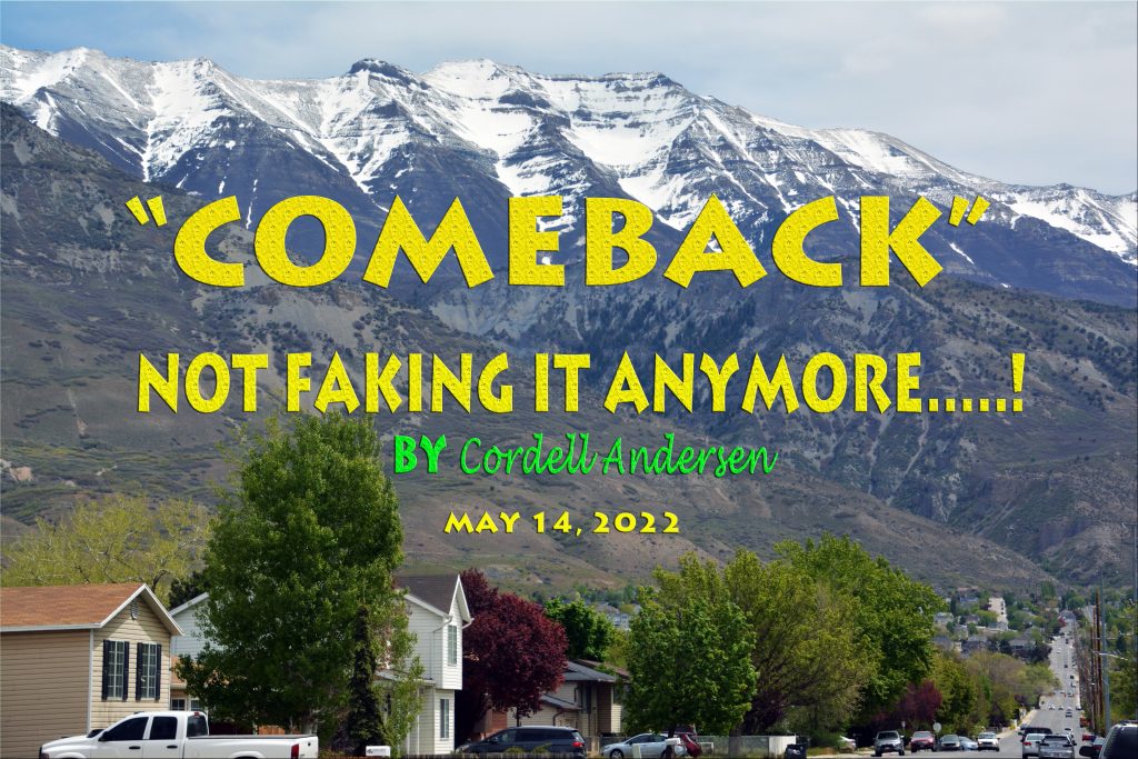
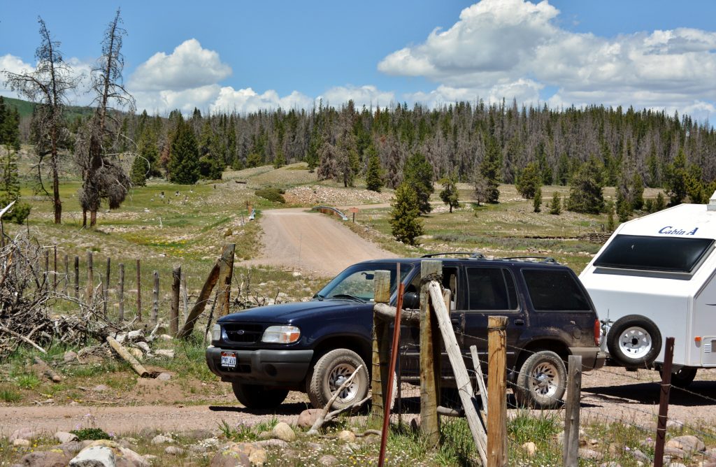
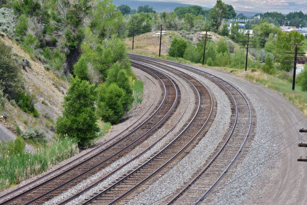
WOLF CREEK PASS – OPEN for several weeks… with NO SNOW 5/27.

NOTE: The elevation of Wolf Creek Pass is about the same as the Grandview Trailhead. Hades Pass is about the same elevation as Bald Mountain Pass, so those comparisons will give you some idea about when for backpacking.

BALD MOUNTAIN PASS–Mirror Lake Byway..OPEN– NO SNOW – 6/4

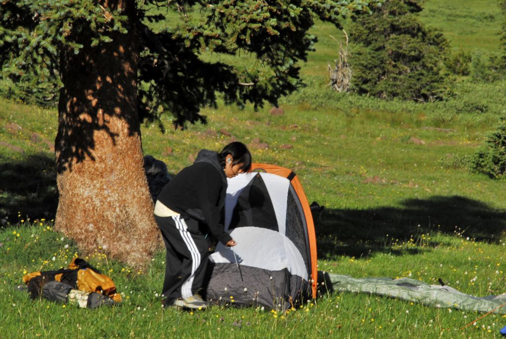
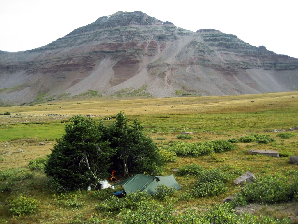
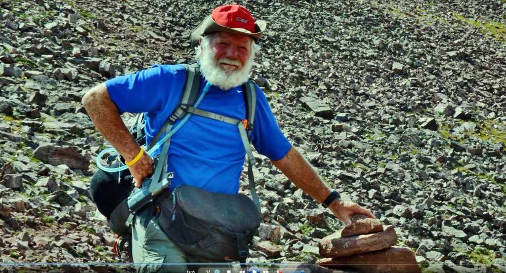
Next week–as seen below with my two front waist-packs, in the rear my lumbar waist pack, & tiny 5 lb. backpack–I will do my FIRST OVERNIGHT BACKPACK to Fehr Lake & likely one other. Then before the mosquitos hatch…….

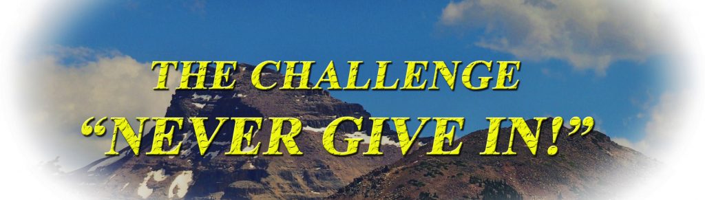
……..I will MAKE IT TO THE

GRANDADDIES!

Taking me 70 years to come FULL CIRCLE, the first backpack in 1952 and maybe(??) the last in 2022.

*********************************

The May 22, 2022 report:

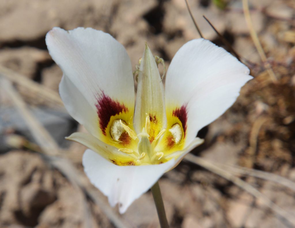
THE SEGO LILY The Utah State Flower

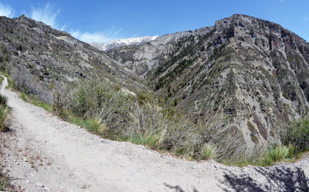
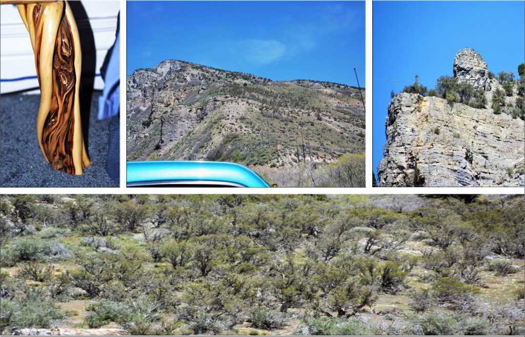
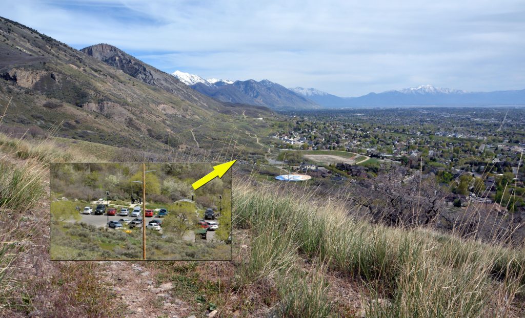
On Saturday, May 21st, on a hike up quite high on the foothills north of Grove Canyon, I found my first SEGO LILY of this season. Before I got back to the parking lot, going cross-country I found at least a half dozen more of them.

During the First World War the flower became a symbol of peace. Karl E. Fordham’s poem “Sego Lily” portrayed the plant as an image of home, mercy, freedom, and peace for the men and women of Utah who were serving on the battlefields of Europe. The blooming stage is very short, at most two weeks. The bulb is sweet and nutritious and is the size of a walnut. It can be eaten raw or cooked as an emergency food. It tastes like a potato when boiled.

The Mormon pioneers made much use of this plant as a source of food. It is illegal to pick any wildflowers on Public Lands.

Next up – A WARNING!

As the weather warms in the Spring, snakes come out of their dens–THE ONE TO WORRY ABOUT IN UTAH OF COURSE IS THE RATTLESNAKE. To introduce you to the danger we all face now along the Wasatch Front foothills, I’ll tell you a story below the picture.

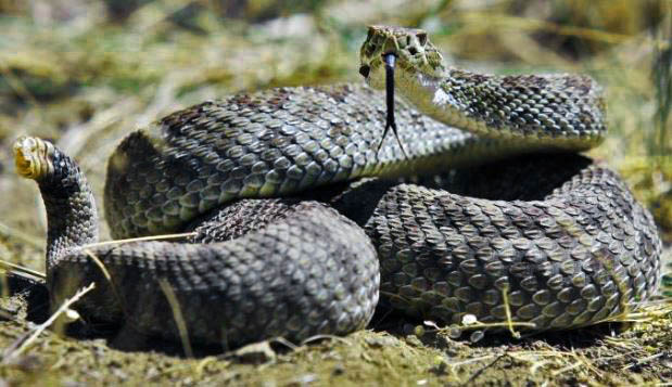
Back quite a few years ago, before my life among the Maya, when living in Provo, one Spring in the middle of May I decided to climb LITTLE SQUAW PEAK….just down the ridge north of Squaw Peak and Rock Canyon. As I approached the summit going between two large rocks I noted movement nearby–it was a rattlesnake that didn’t rattle as it was in the stage of shedding its skin to allow for more growth, and eliminate parasites. It actually struck at me, but missed. When sloughing off the old skin they are usually blind, and can’t rattle, but are aware of any danger, and will strike blindly. So NOW IS THE TIME TO BE CAREFUL.

In another few steps there was another from the other side, and when arriving at the summit there were several more–SO I CAN’T REALLY BRAG ABOUT HAVING CLIMBED LITTLE SQUAW PEAK! On my way down I was more alert and several times safely encountered more rattlesnakes. I had never before, nor since, encountered so many rattlesnakes in such a concentrated area, and the last time I found one in the foothills was when climbing to the Y, and it was a small one I captured as it was way back when it wasn’t illegal to kill or have a live rattlesnake–AS IT IS NOW!

Best mention if you find one in the wild, just leave it alone. During my 18th & 19th years when working at Dugway Proving Grounds as a hunter and trapper for the University of Utah, I captured several rattlesnakes and had them in my office in cages and they were very effective to scare off any visitors I didn’t want to see! The second they stepped into my office, they would hear the rattle and FREEZE!

There are about 7,000 people annually bitten by rattlesnakes in the U.S., most of whom get medical care quickly, with only about a dozen deaths yearly, one of whom could be you–so best not play the odds, and be very careful.

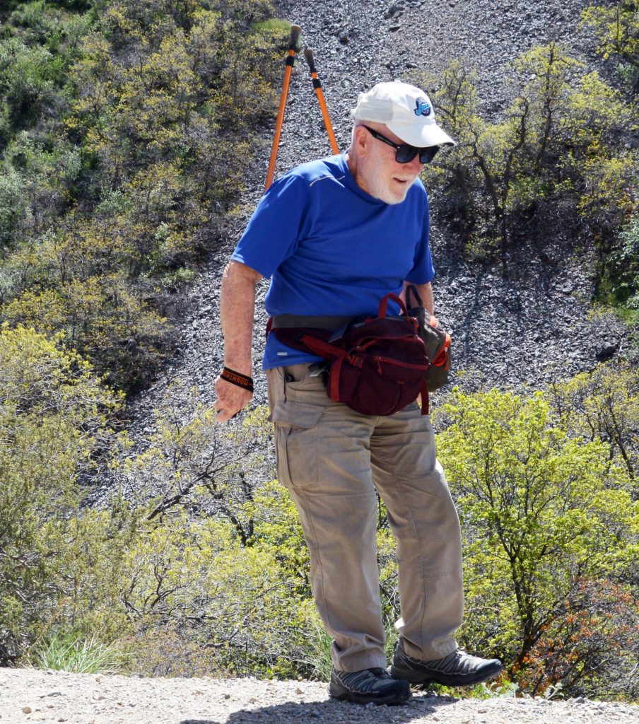
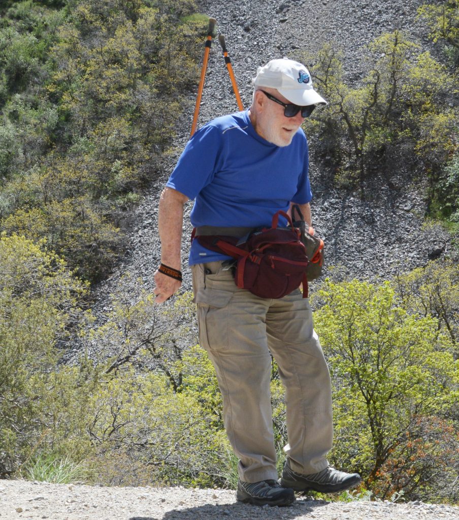
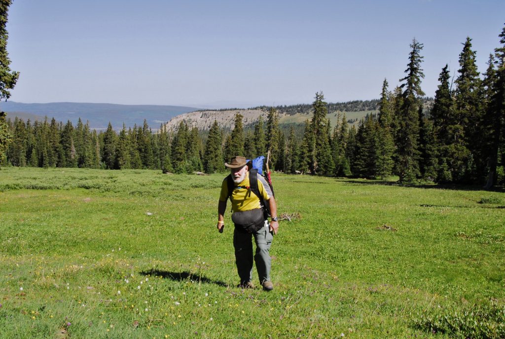
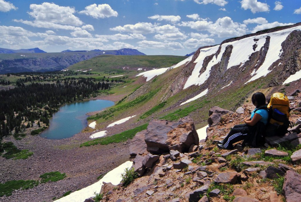
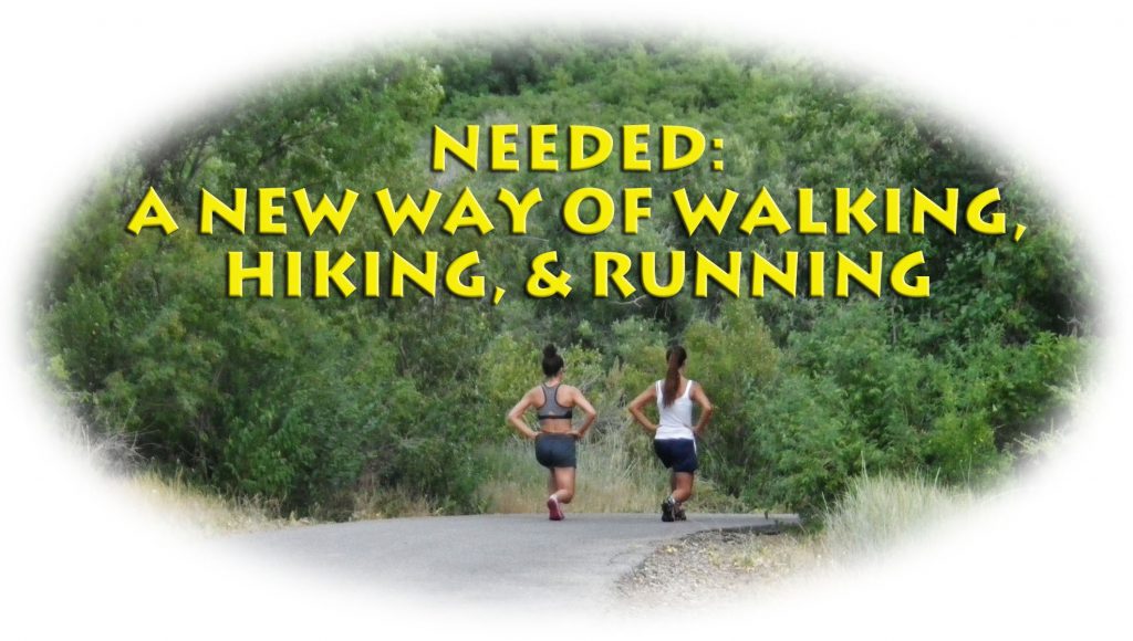
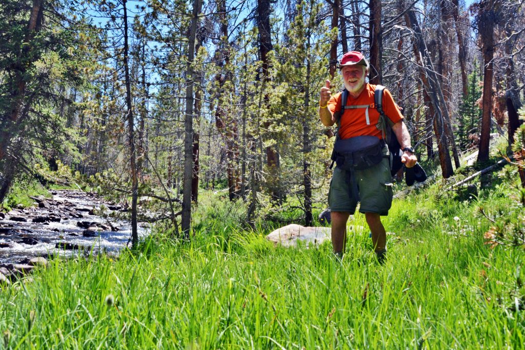
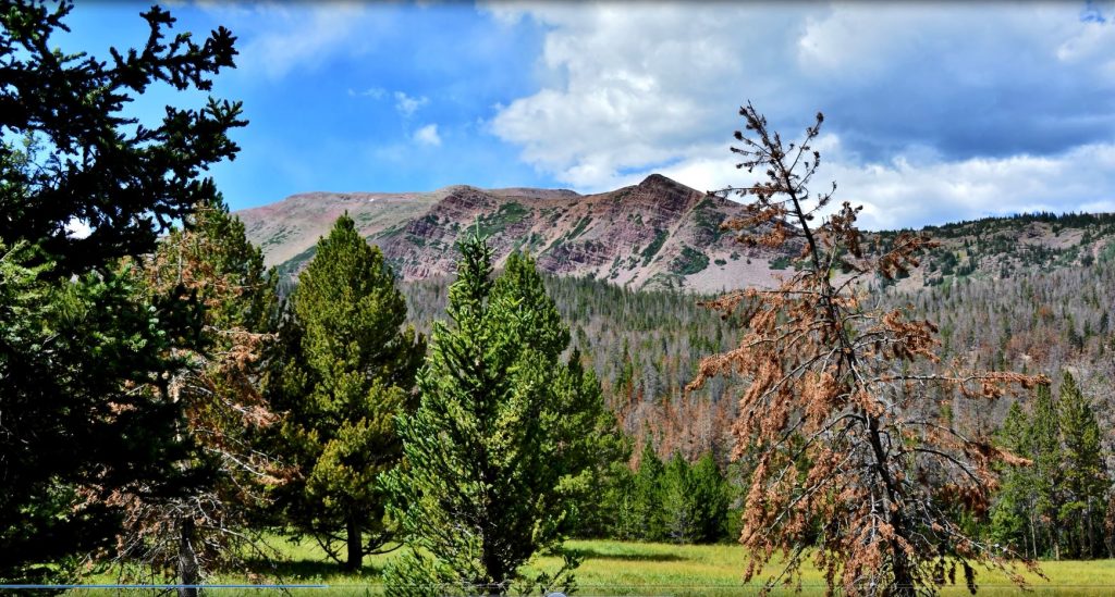
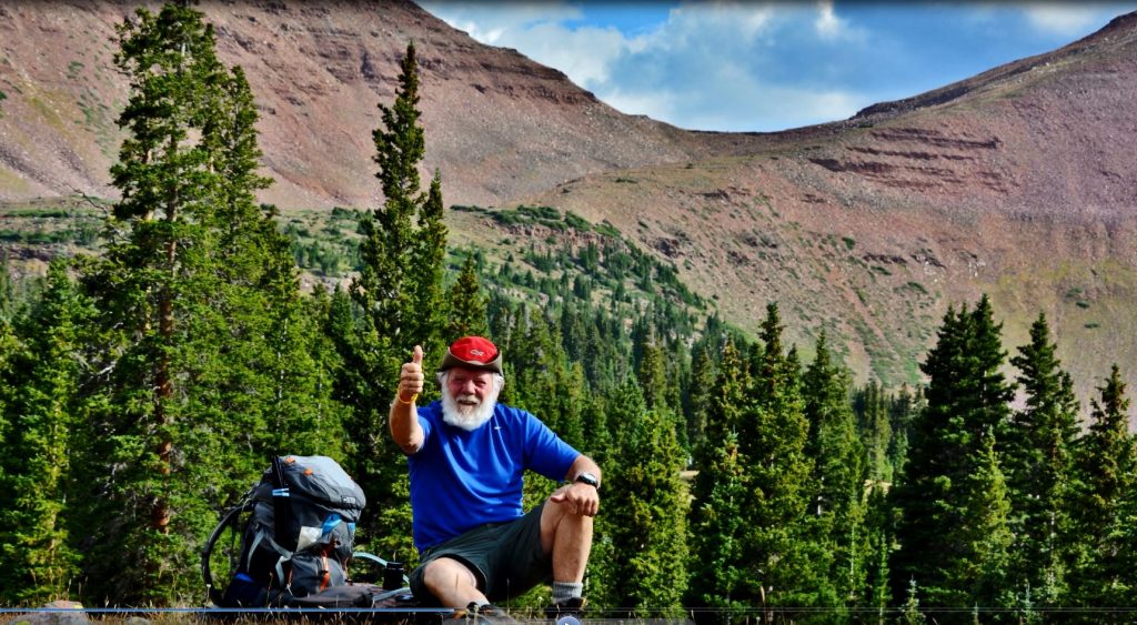
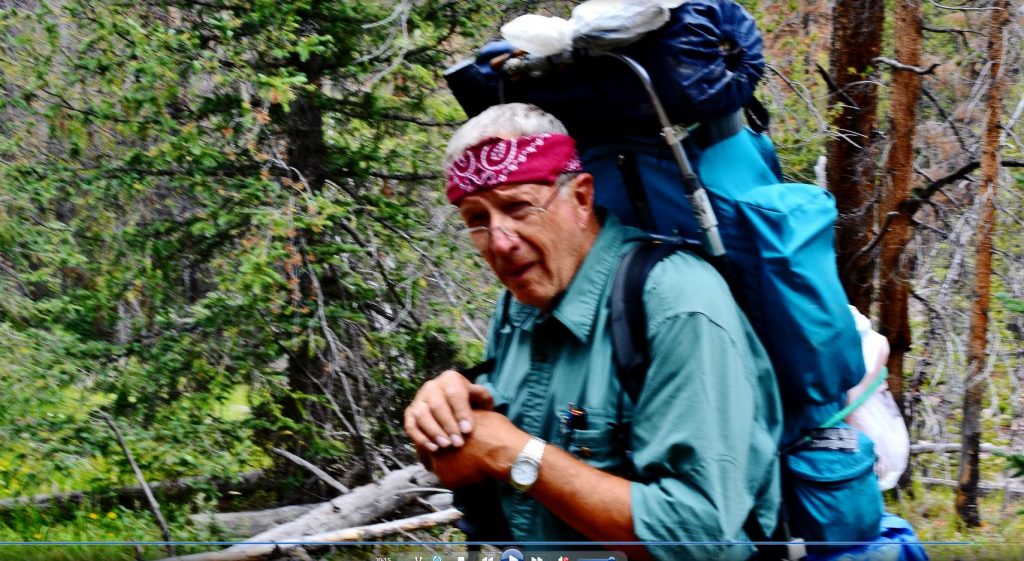
NOW INTO THE HILLS AGAIN–which I have to do every other day to help control my blood pressure, and keep getting a little stronger each time, as well as trying to get my BALANCE BACK, as I hope to actually be doing some BACKPACKING IN THE HIGH UINTAS SOON! A week from now I’ll show you my new LUMBAR WAIST PACK, and you’ve already seen last year my small 4.5 lb. backpack, all the rest being around my waist as you’ve been seeing in these reports.

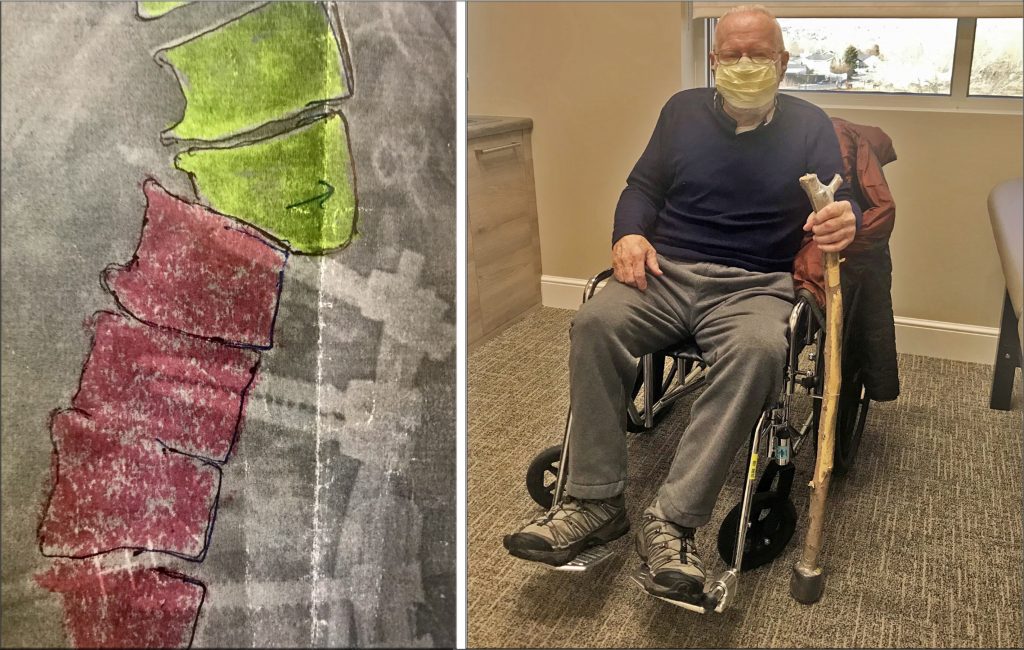
My QUARTERLY VISIT WITH MY SPINE SURGEON, was this past week, and he continually seems amazed at what I’m doing, but INSISTS I USE MY TREKKING POLES ALL THE TIME! Of course, I KNOW BEST, so when it is 100% SAFE I PERSIST IN NOT BECOMING 100% DEPENDANT ON THEM. Follows a few pictures of the…….

WONDERFUL WORLD….

……even in the almost totally desert-like foothills of the Wasatch where I am blessed with high testosterone (I take daily Andro 400 Max for helping me have a good mood & recognize beauty in everything) and capable of recognizing…….

BEAUTY EVERYWHERE & FEEL GRATEFUL TO BE ALIVE!

SPENDING TOO MUCH TIME WITH THESE REPORTS, SO WON’T RACK MY MEMORY TO REMEMBER NAMES, JUST HOPE YOU ENJOY THE PICTURES I LOVE TO SHARE WITH EVERYONE INTERESTED.

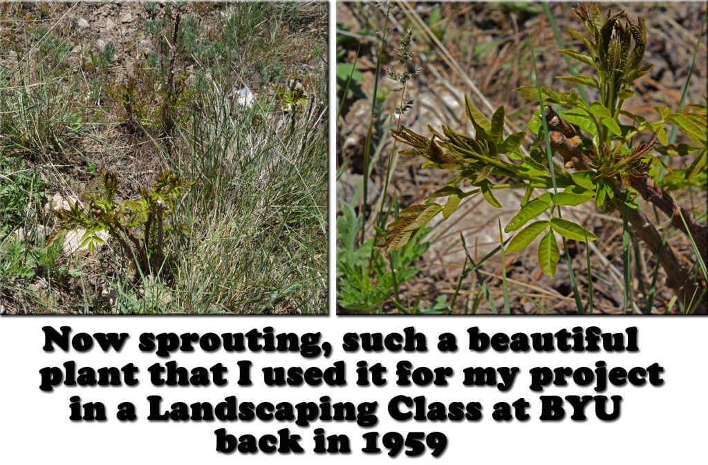
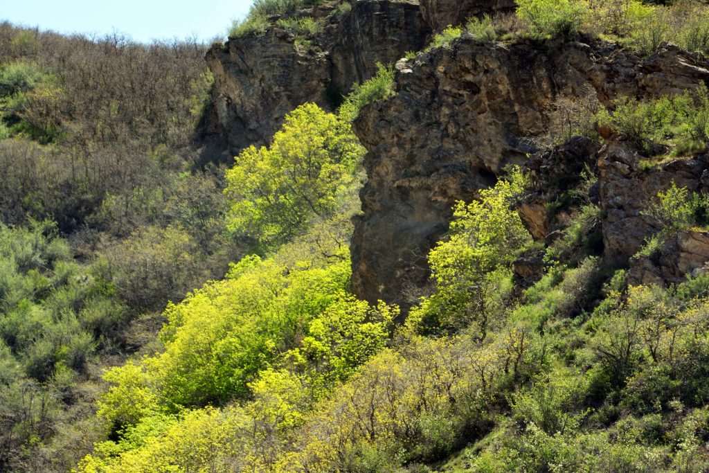
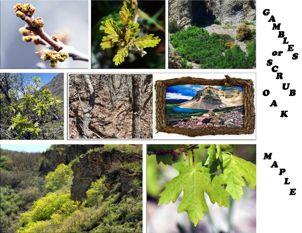
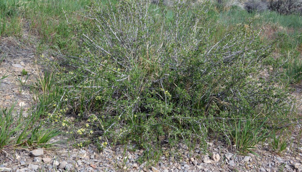
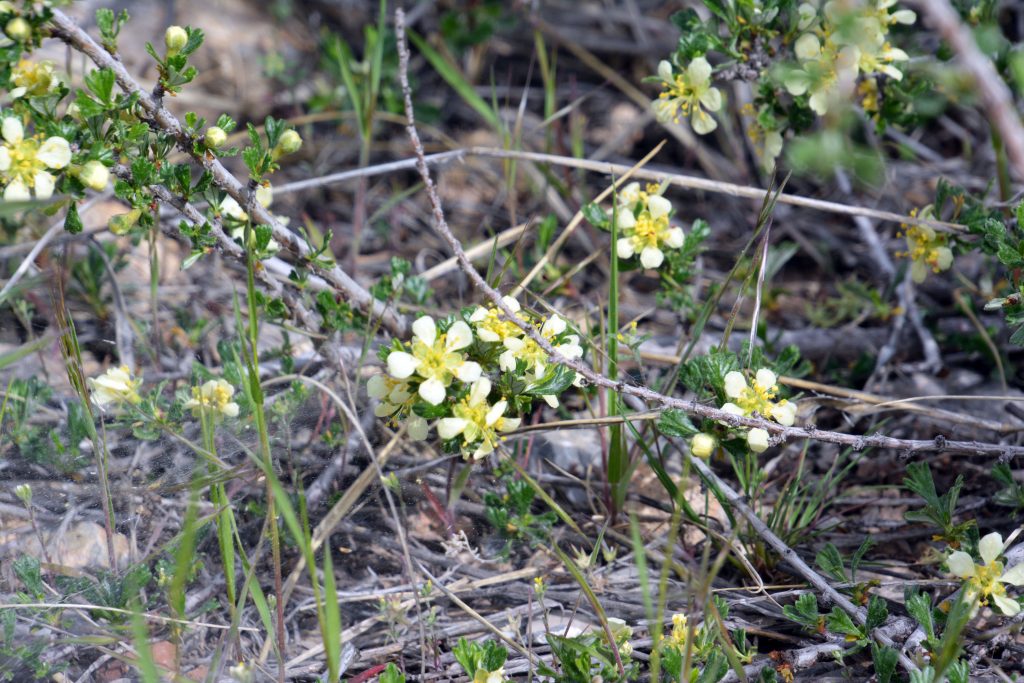
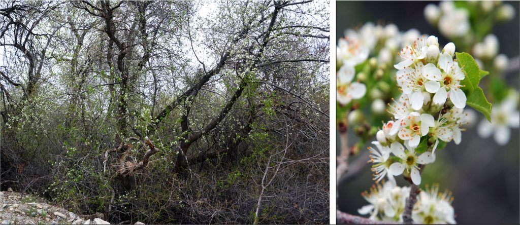
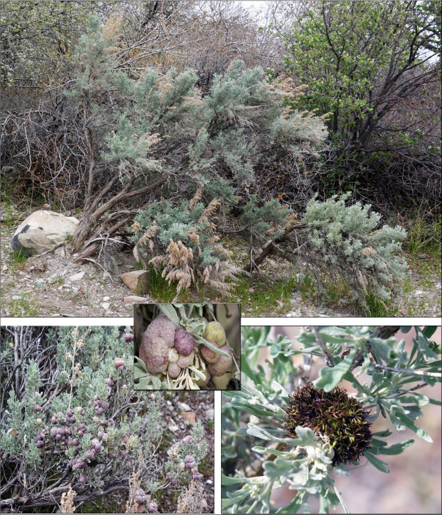
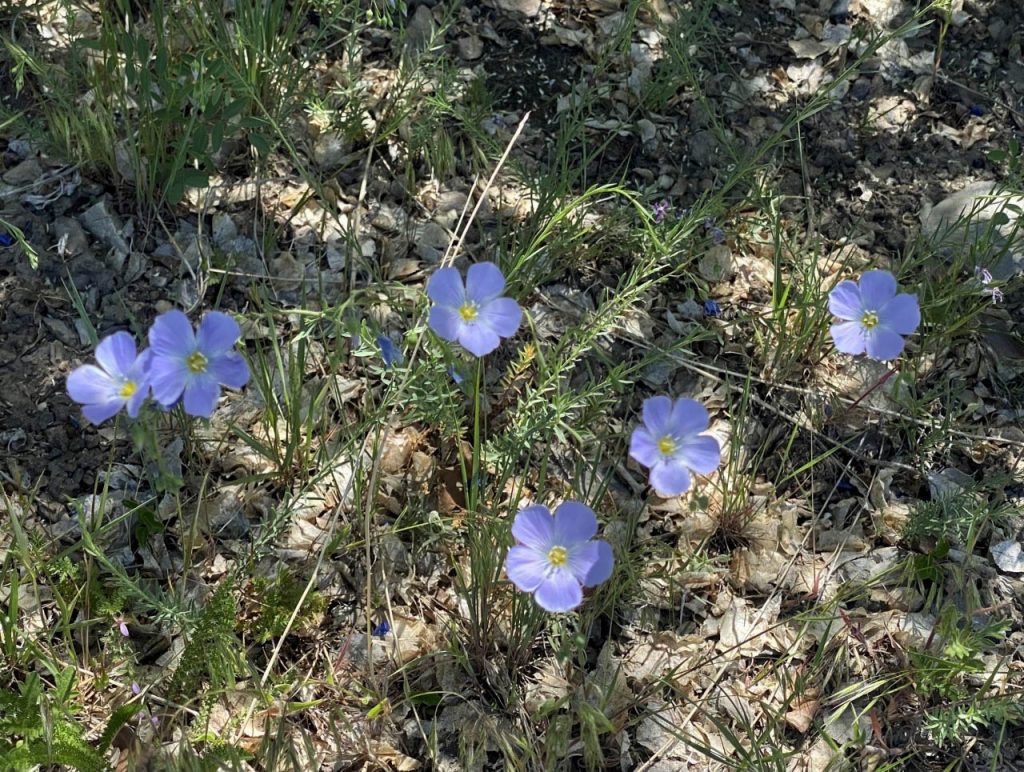
Do you remember this one….that I used as a project for a LANDSCAPING CLASS AT BYU BACK IN THE 50ies?

If not, scroll down to the last post. The beauty of this bush will WOW you later when it matures!

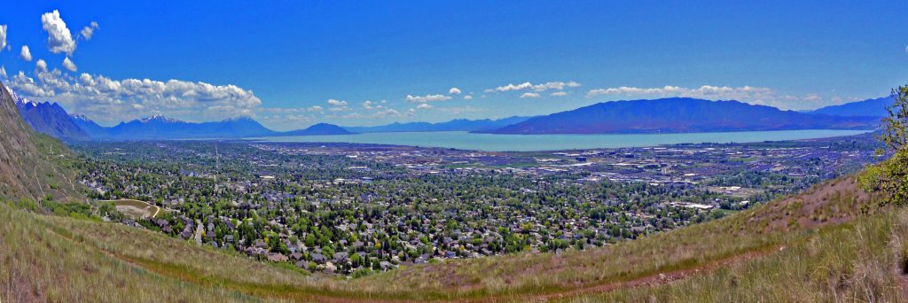
I’ve mentioned previously the first white men to visit Utah Valley, they being Fathers Escalante and Dominguez in 1776 who in a letter to the King of Spain described the valley as,

” THE VALLEY OF OUR LADY OF MERCY OF TIMPANOGOS IS THE MOST PLEASING, BEAUTIFUL, AND FERTILE SITE IN ALL OF NEW SPAIN!”

As also mentioned before, they had a good relationship with the Timpanogos-Ute Indians and promised to return and establish here a Mission. If they had of done so, the history of Utah would be very much different than the way it worked out with the Mormons.

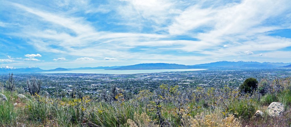
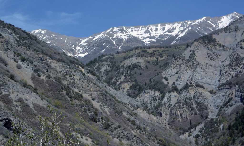
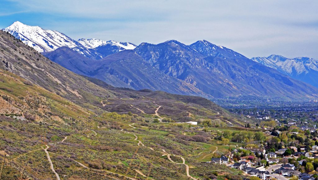
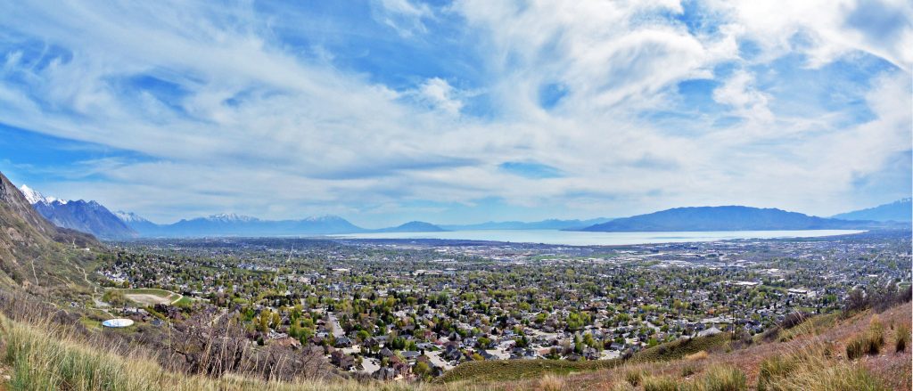
It was up here at the highest point of my hike, where I took the panorama of Utah Valley, that…

….. I found the first SEGO LILY.

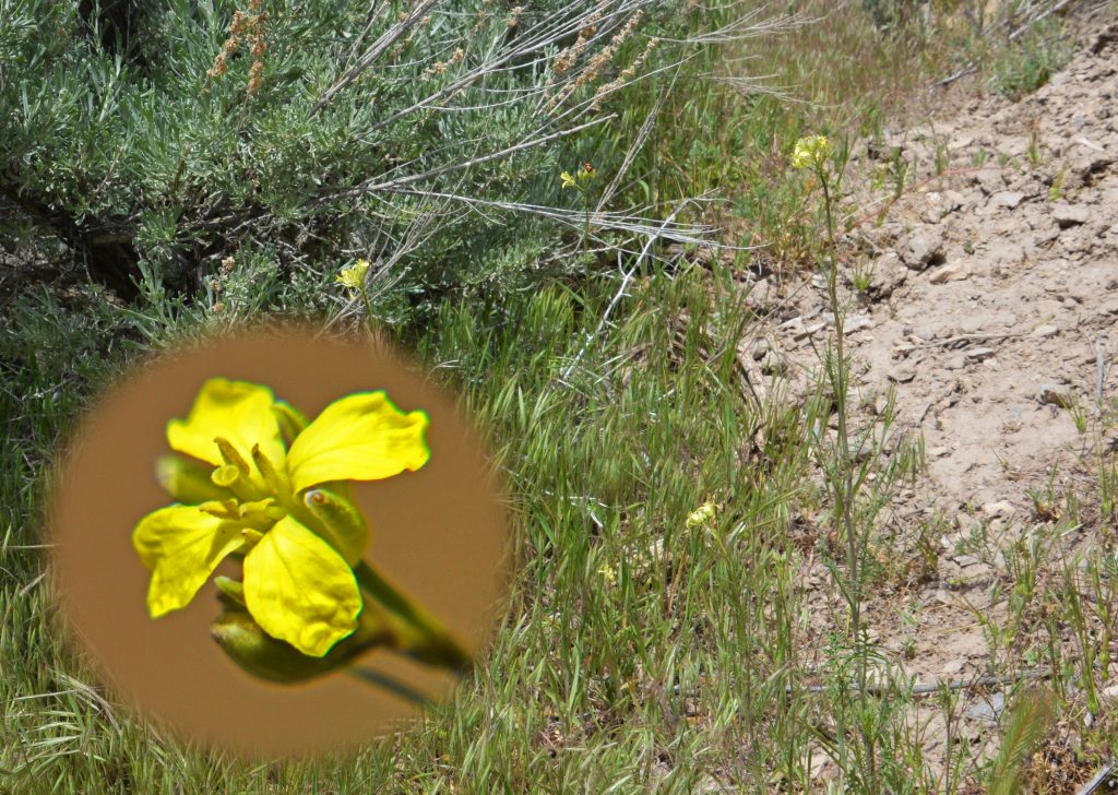
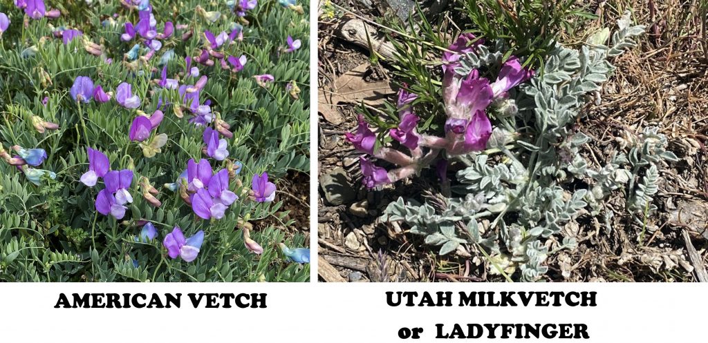
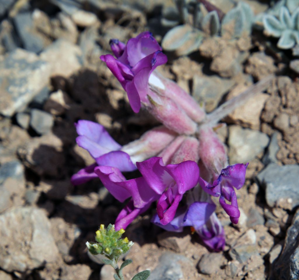
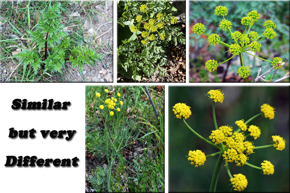
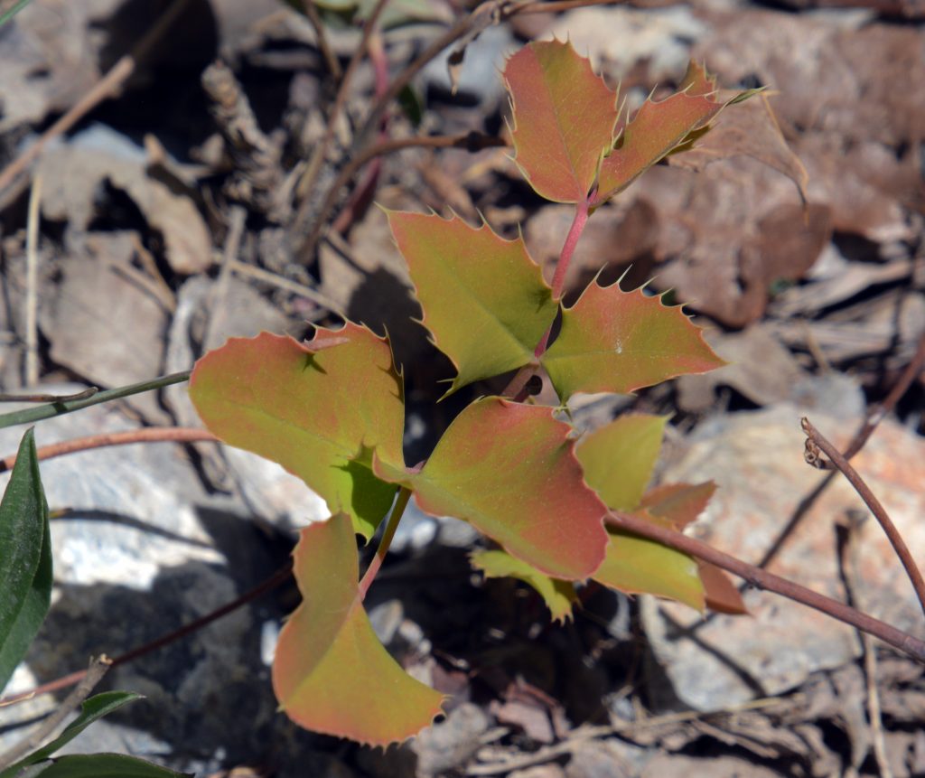
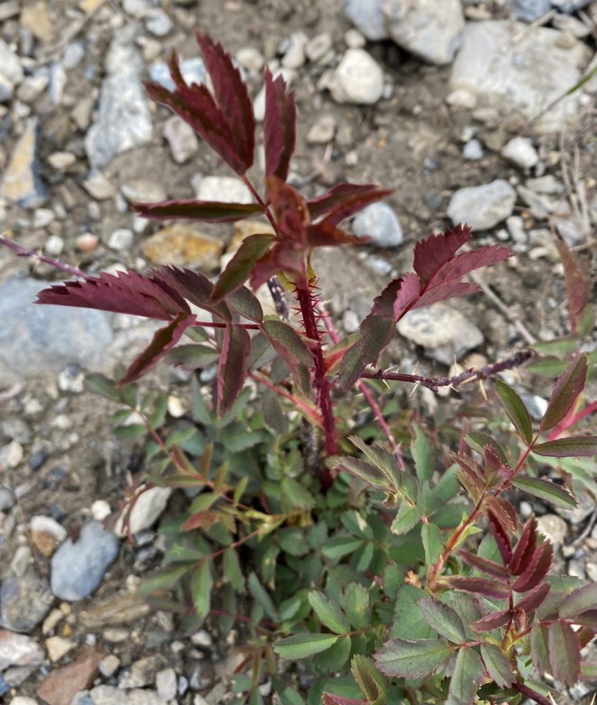
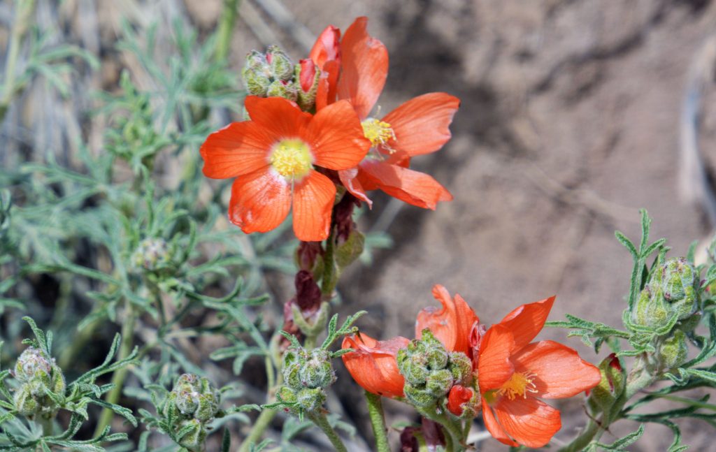
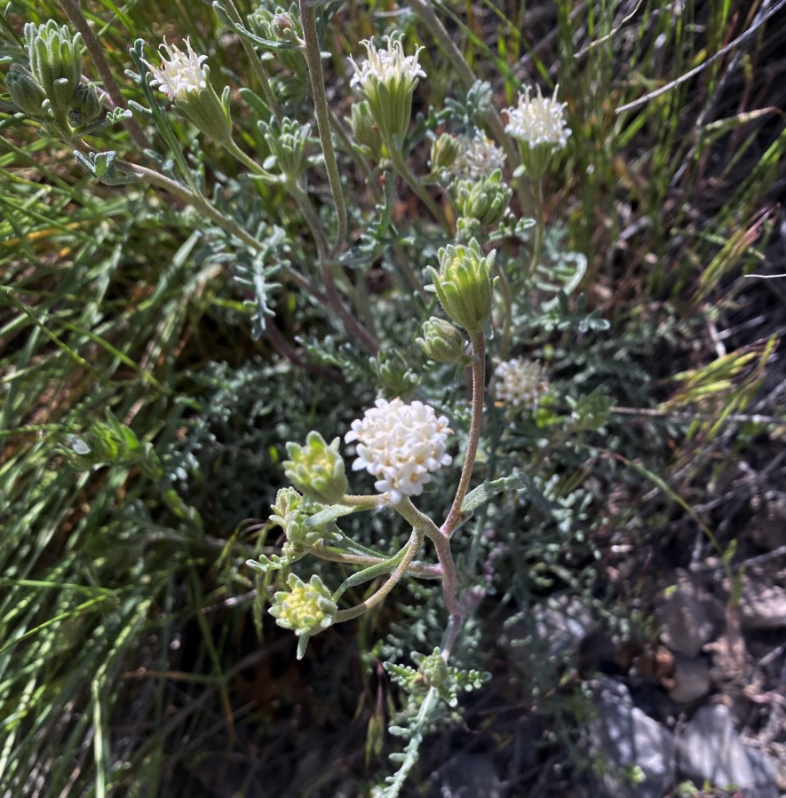
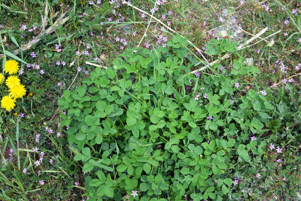
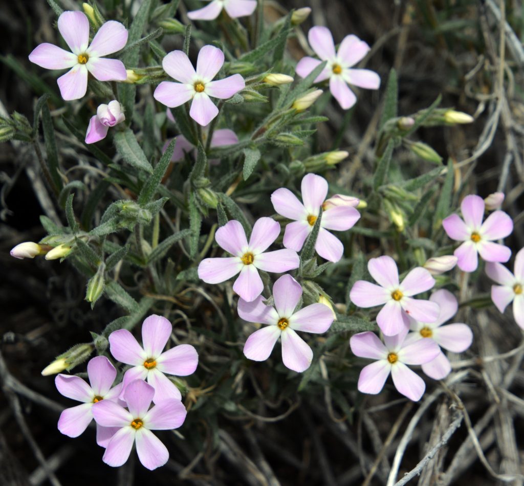
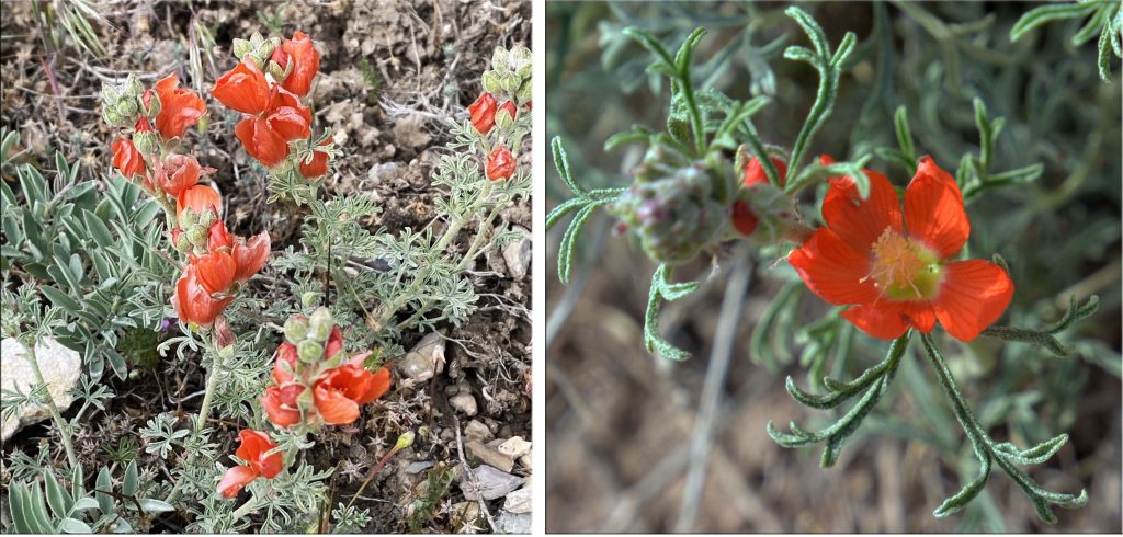
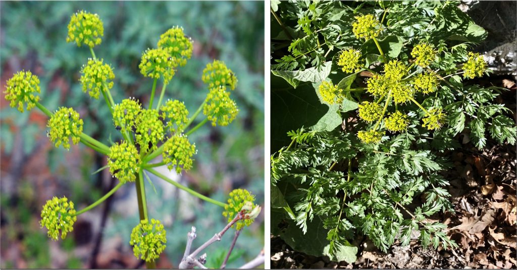
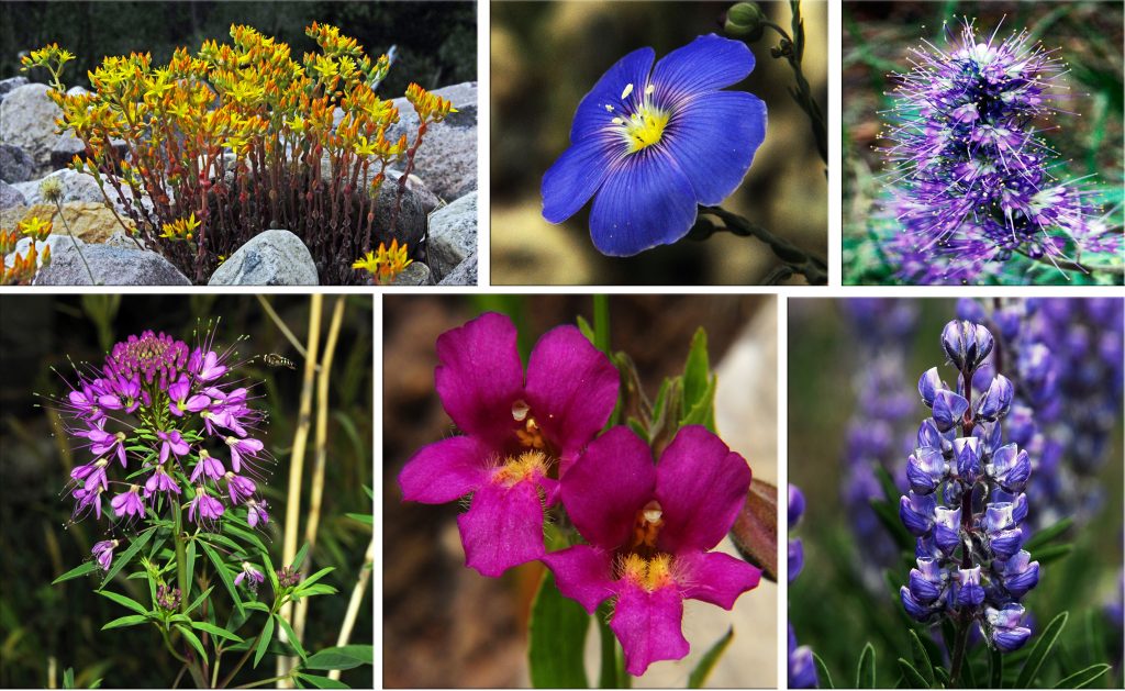
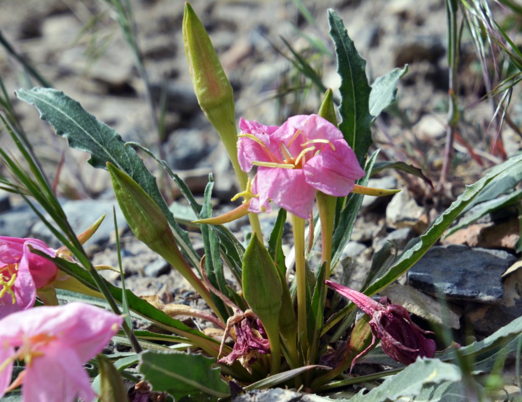
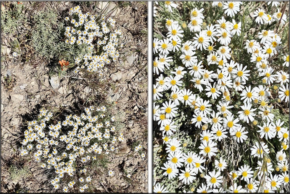
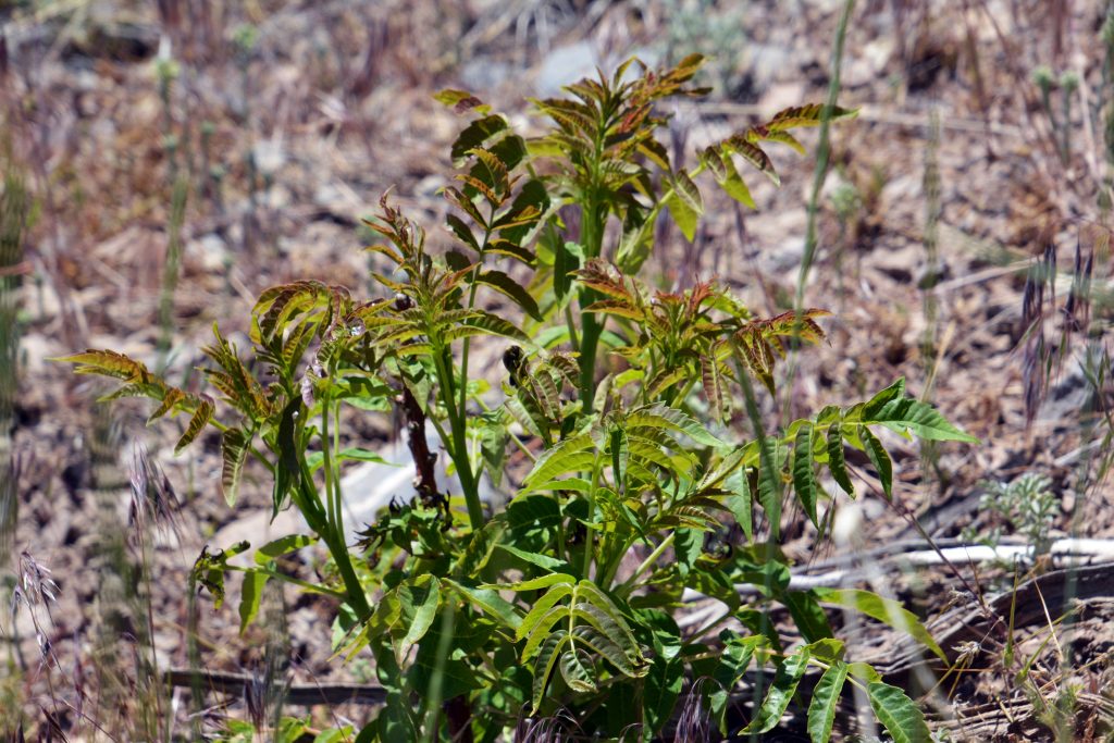
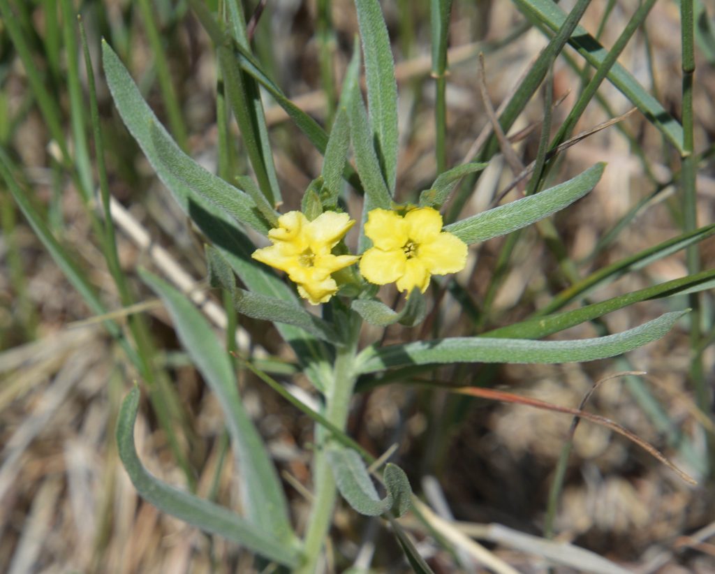
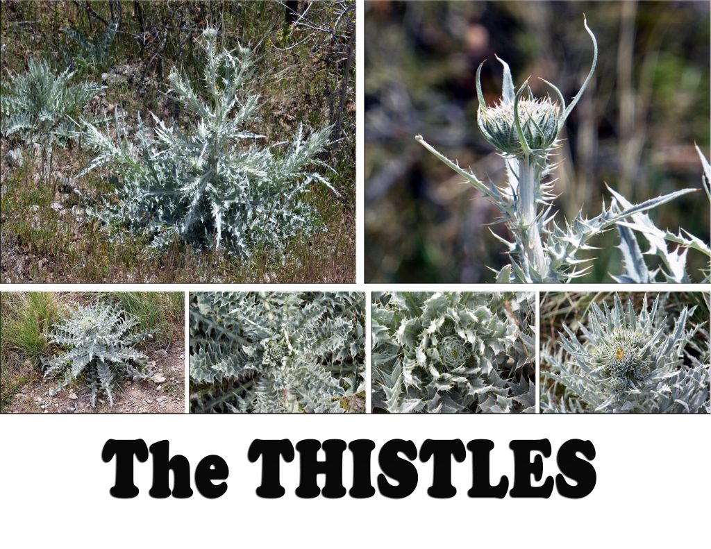
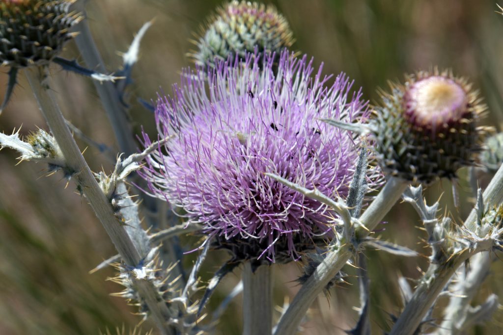
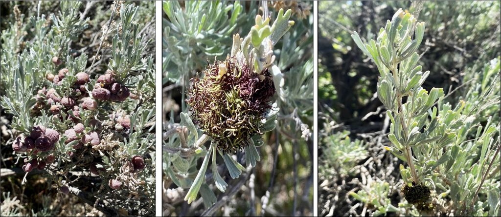
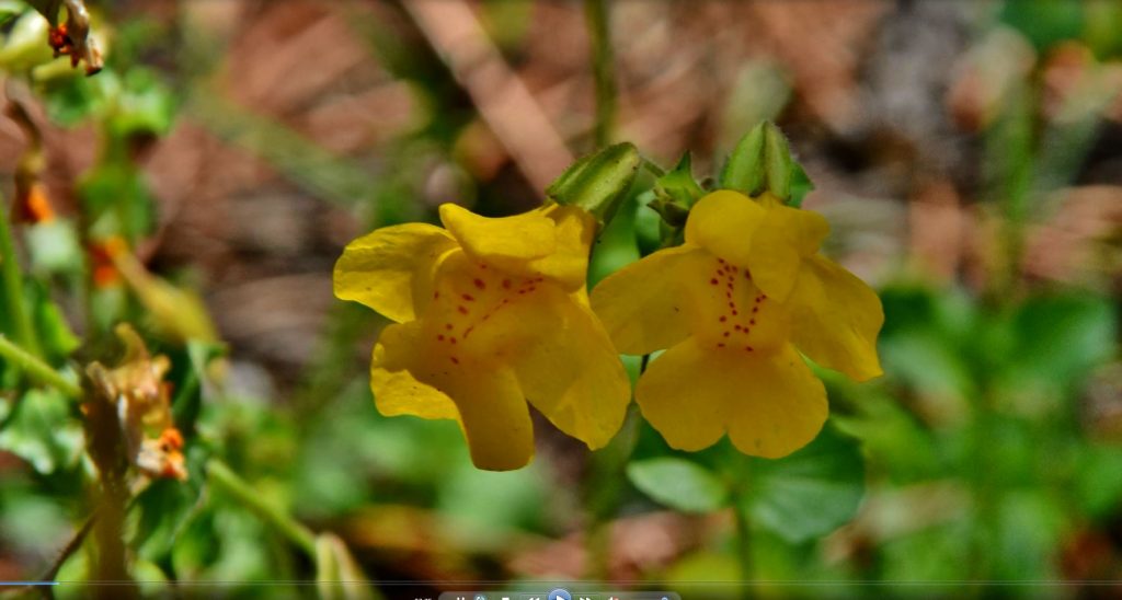
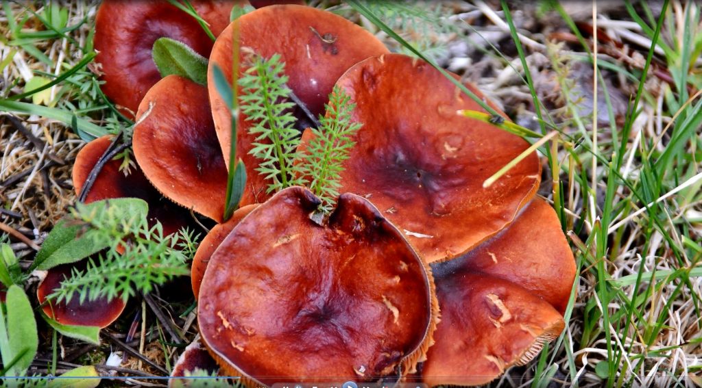
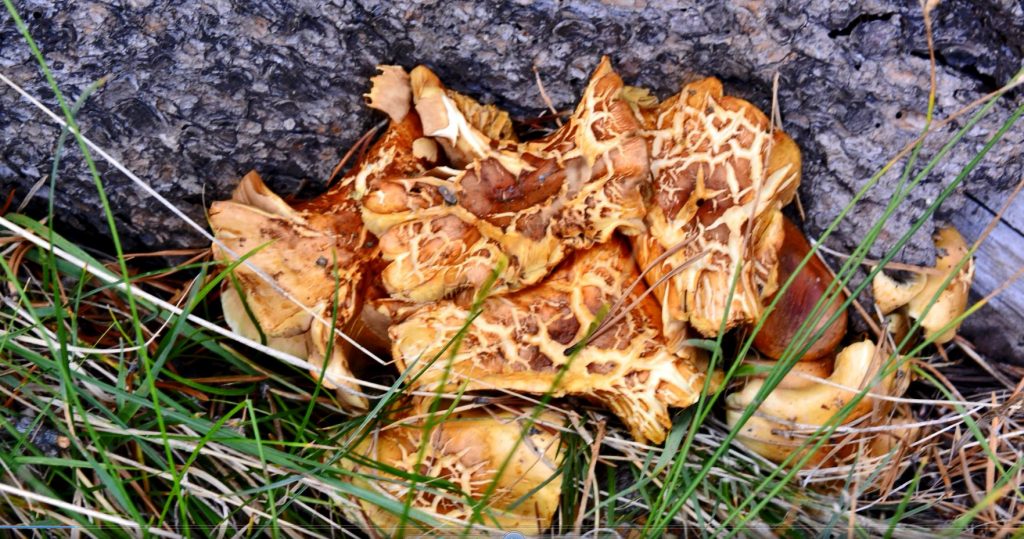
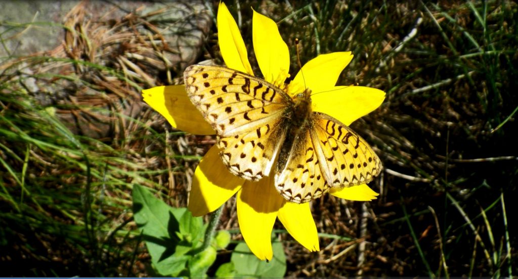
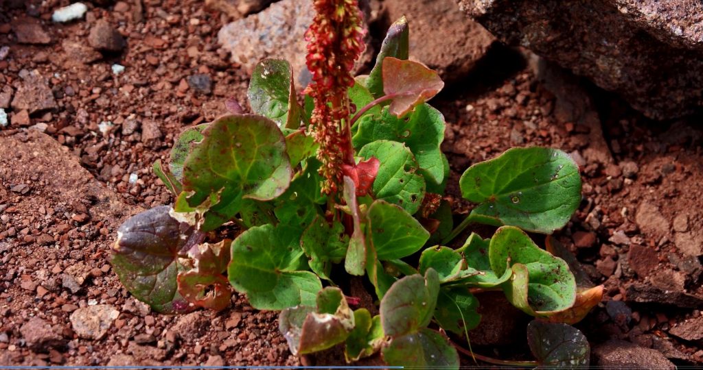
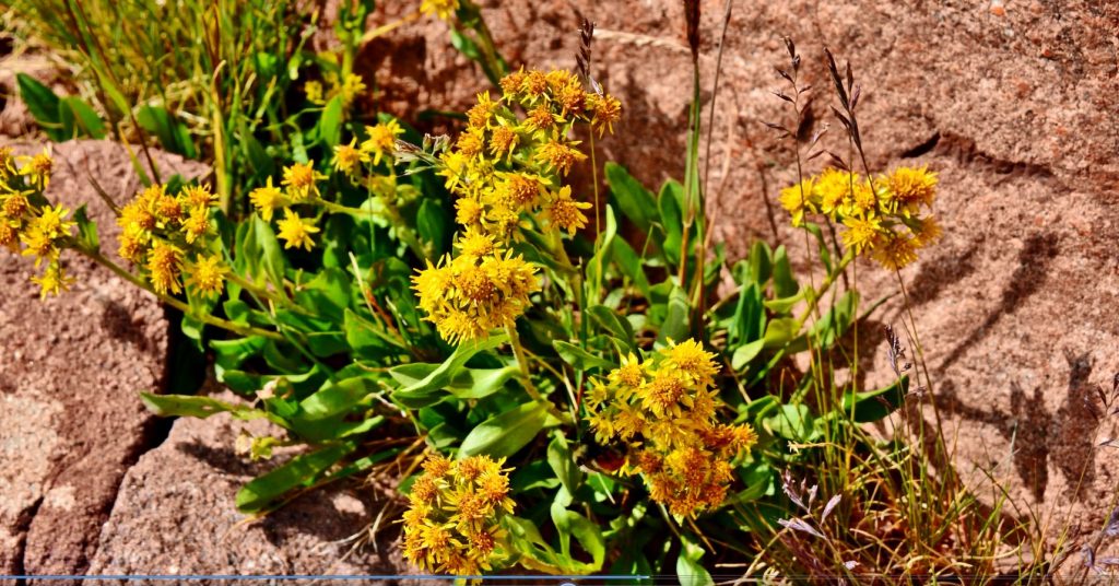
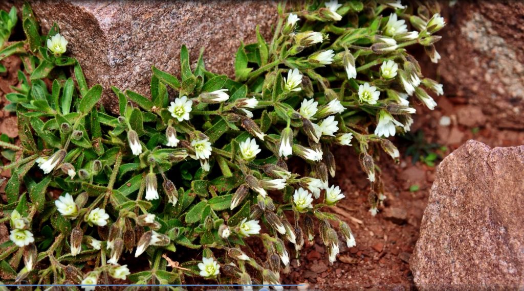
Then on my way down cross-country, I was happy to find this UNIQUE WILDFLOWER we will see much more of soon.

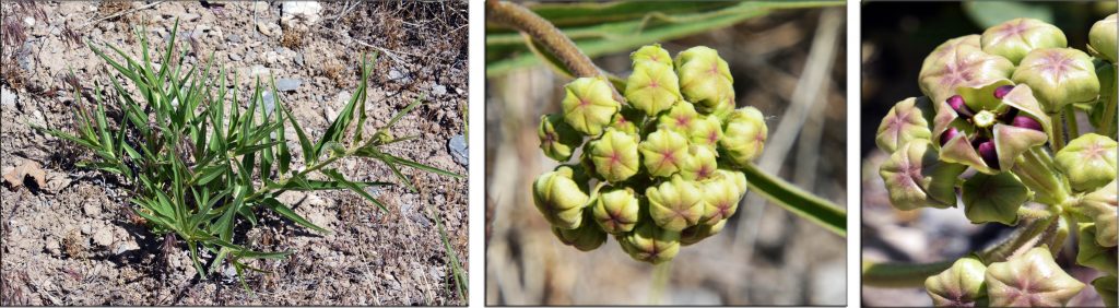
This plant is just getting started. The middle shot shows the flower developing on the right of the plant. The 3rd picture shows the beginning of the blossoming process–THAT WILL ALSO WOW YOU!

Thanks to our loving & perfect CREATOR for all of HIS AWESOME VISIONS of NATURE and the WONDERS IN OUR BEAUTIFUL WORLD! MAY WE ALL BE DESERVING and APPRECIATIVE STEWARDS!

*********************************

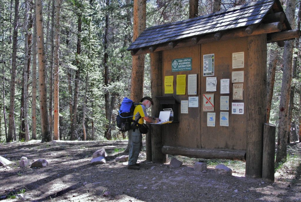
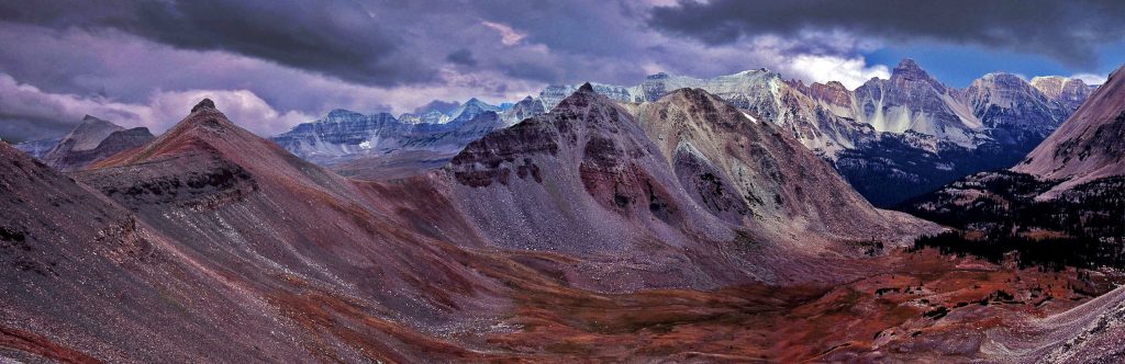
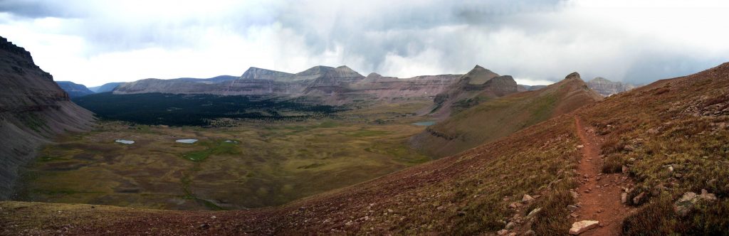
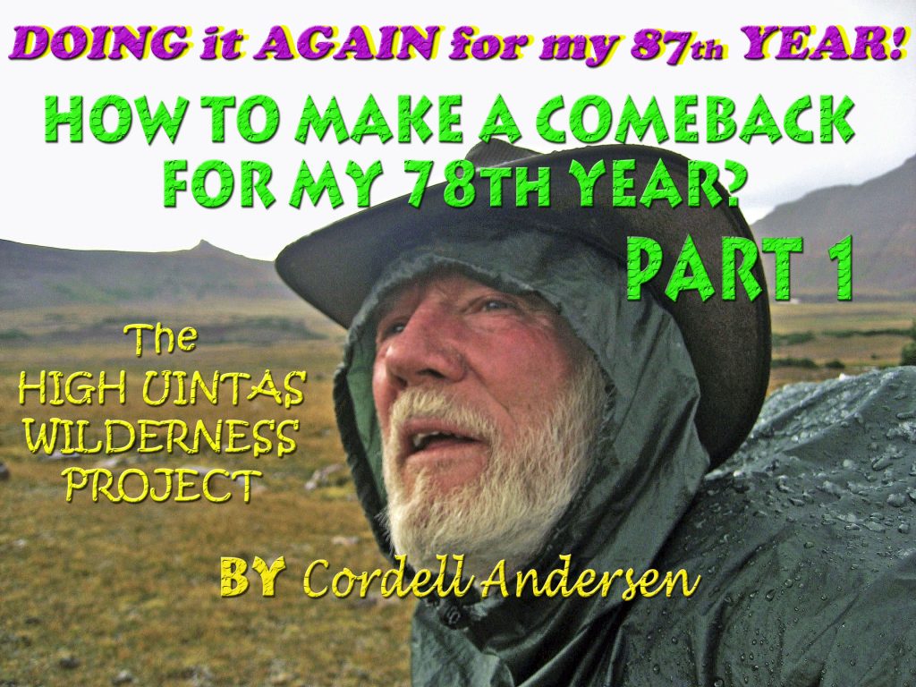
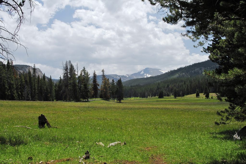
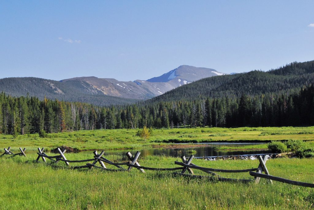
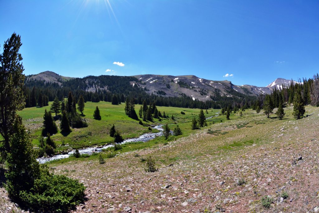
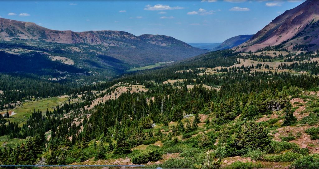
Now, to the HIGH UINTA WILDERNESS at LITTLE EAST FORK OF BLACKS FORK & BIG FOOT

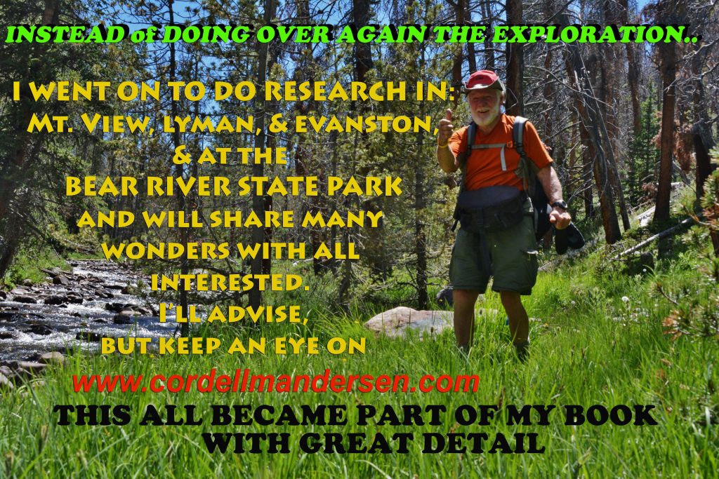
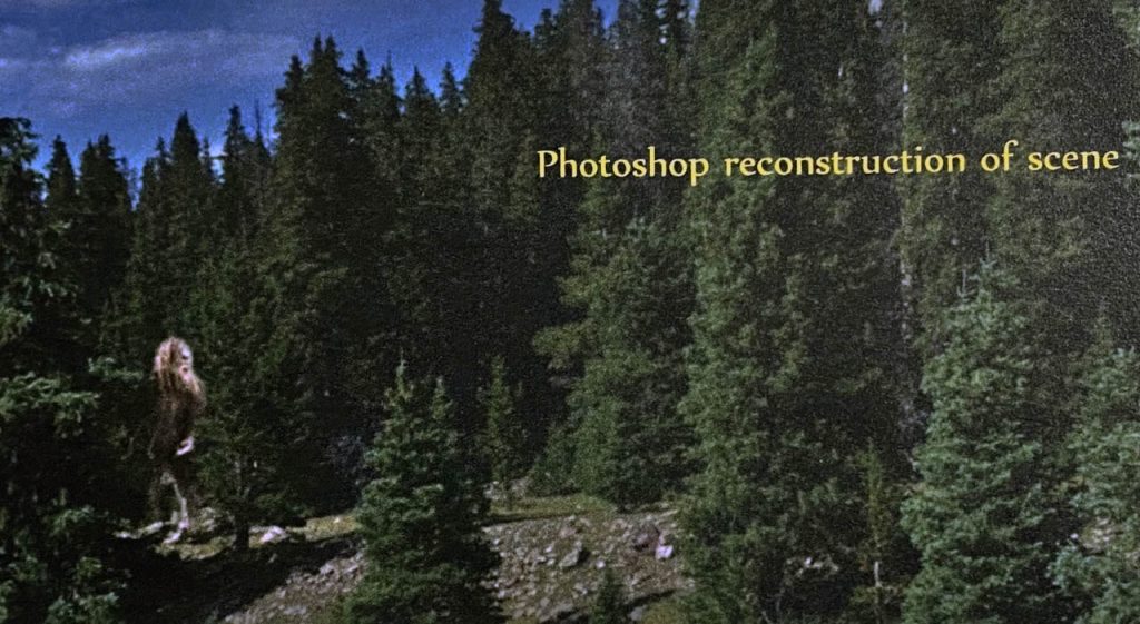
Once, way back in the beginning of my HIGH UINTA WILDERNESS PROJECT, I went to Google Maps of the High Uinta Mountains and all of a sudden I was seeing where there had been reported sightings of BIG FOOT or SASQUATCH. It indicated that most sightings were in the drainage of Little East Fork of Blacks Fork….and my interest was CAPTURED! Eventually making 3 backpacks into the area. I’ll sort of combine all of them into one trip I reported on my website as a photo/essay with lots of pictures and detail, going all the way up the drainage–ALWAYS READY WITH MY CAMERA, LENS CAP OFF, JUST IN CASE THIS “BIG FOOT LEGEND” had some truth in it! Then over Squaw Pass, and to Porcupine Lake in the Lake Fork Drainage.

In the background of this picture is Squaw Pass

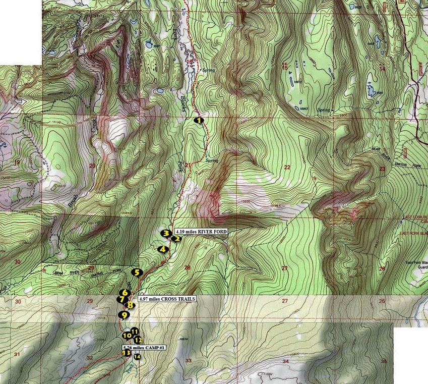
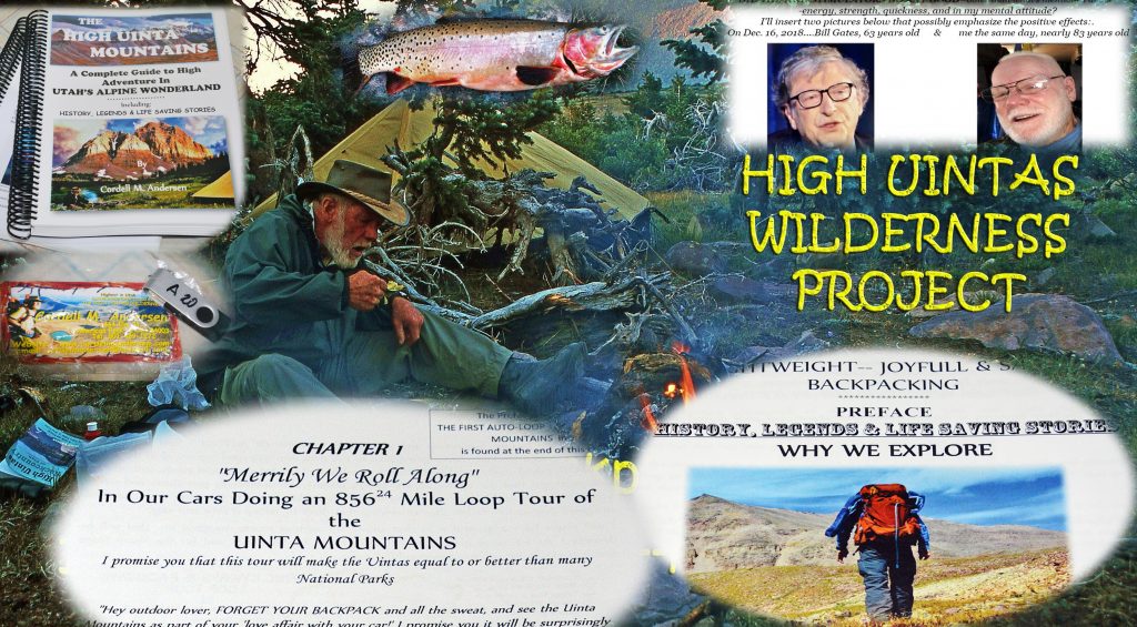
For full information on how to get here, as well as topographical maps, fishing information, distances, etc. go to pages 224-231 of my BOOK–info about acquiring it will be inserted at the end of this post. The Preface to this Chapter 2, Section 8 of the book, is entitled:

“THE LEGEND OF BIG FOOT — SASQUATCH

In that writing is told the story of my sort of mystical encounter with Big Foot, his son on horseback, and them laughing at us civilized humans needing all the sophisticated and expensive gear to survive in the Uintas! If you are really interested I could say, “GET MY BOOK!” but I’ll sort of tell the story briefly along with the wonderful adventure I had in this often overlooked area.

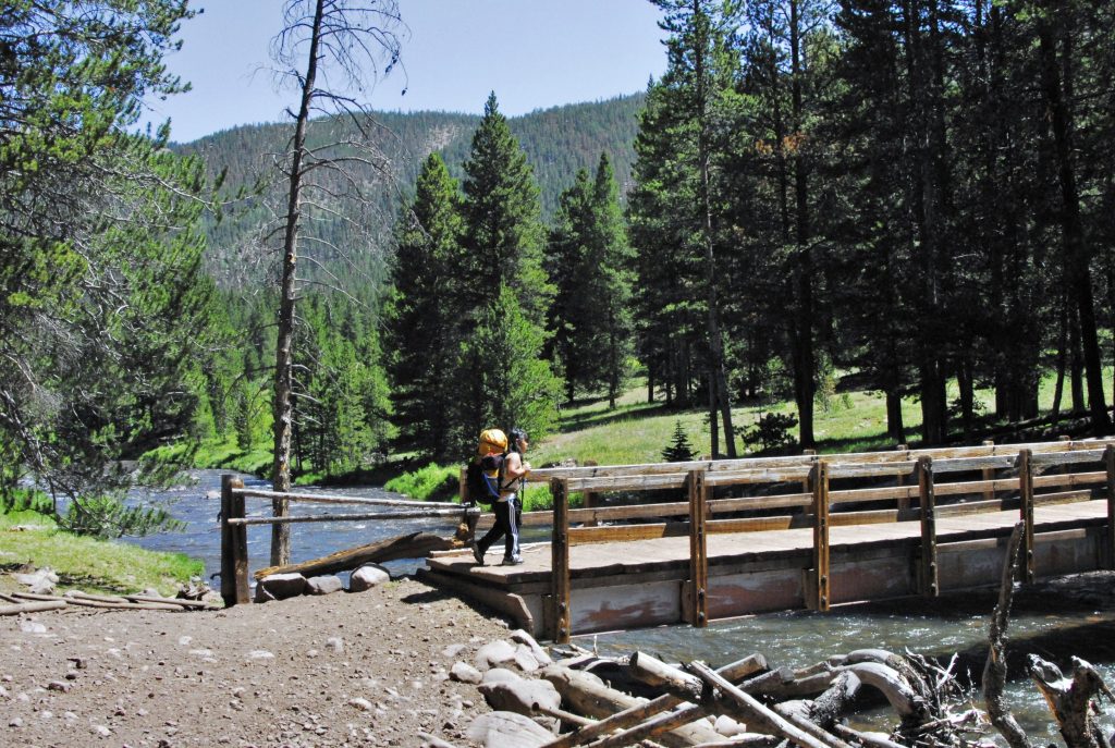
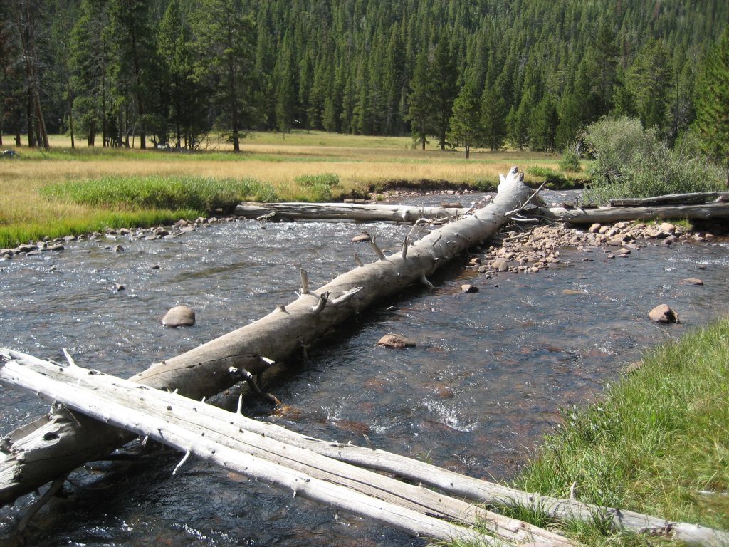
AS YOU PROCEED UP THIS DRAINAGE THERE WILL BE SEVERAL FORDS OF THE STREAM NECESSARY.

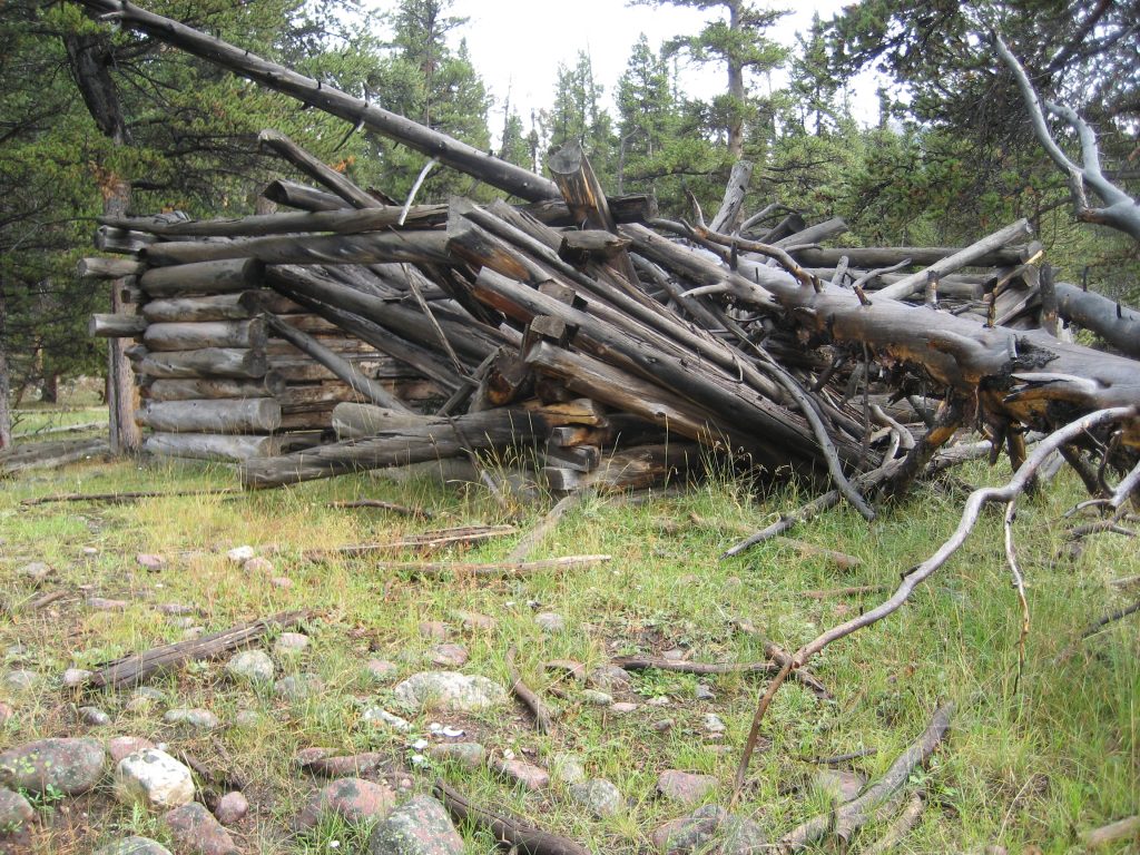
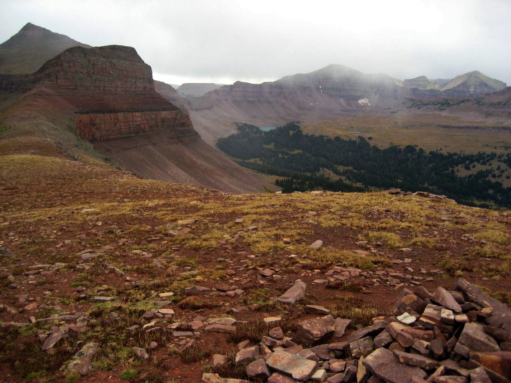
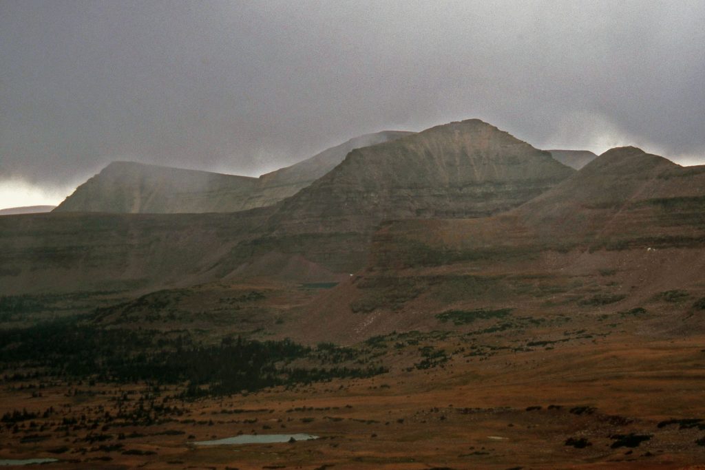
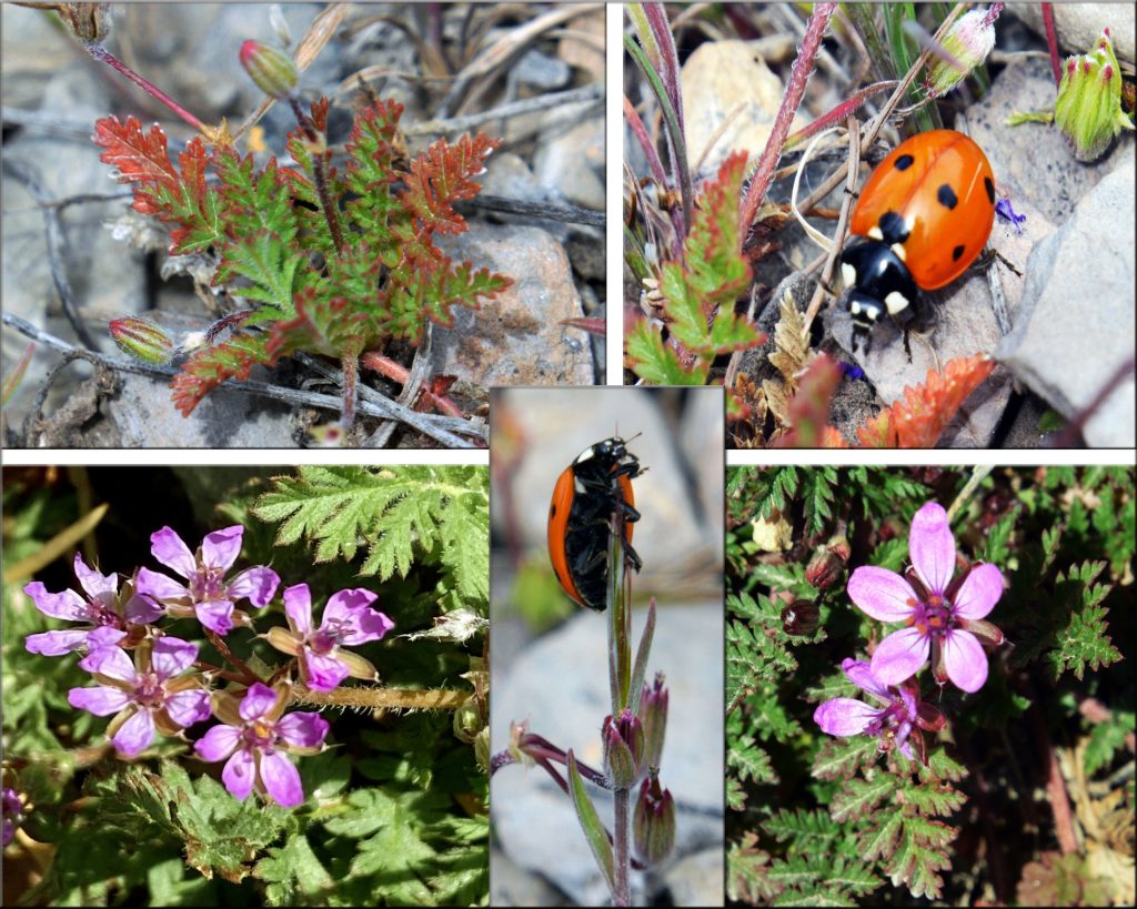
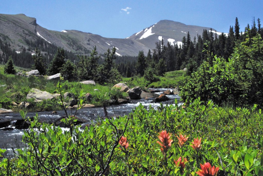
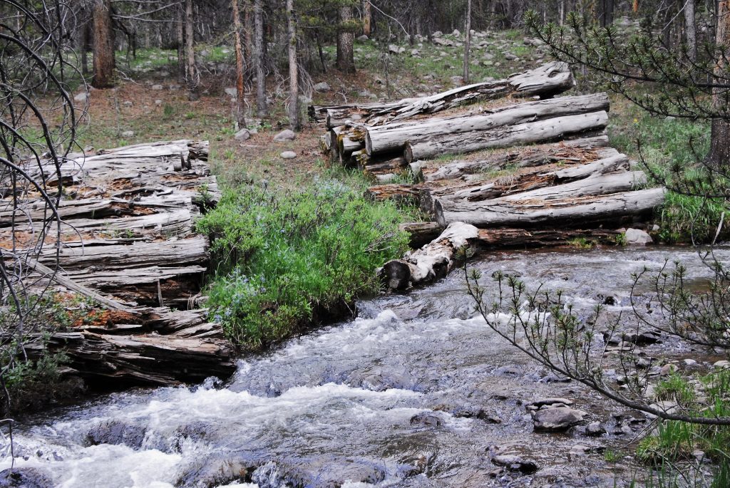
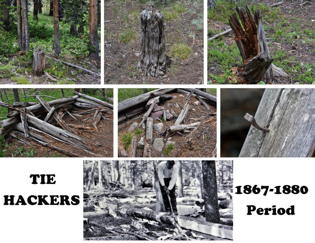
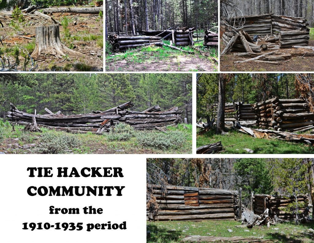
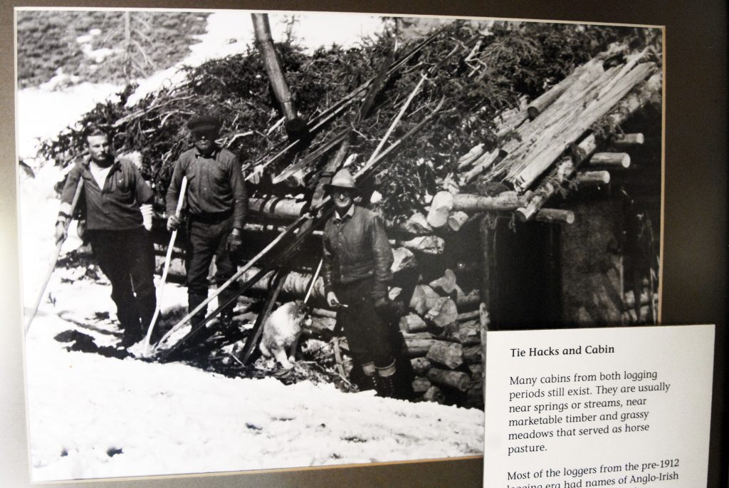
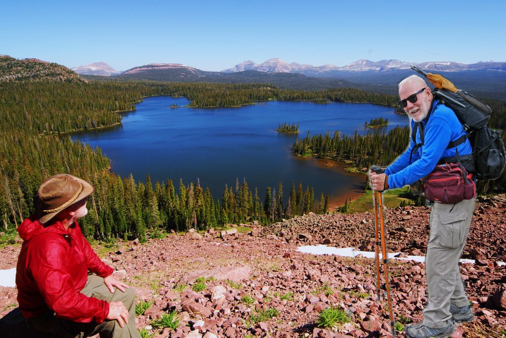
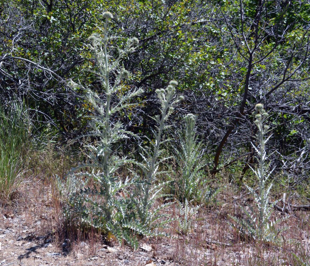
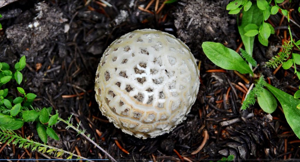
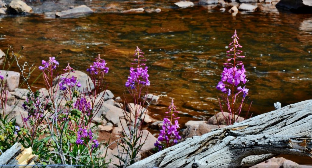
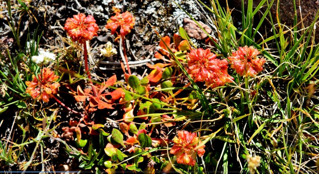
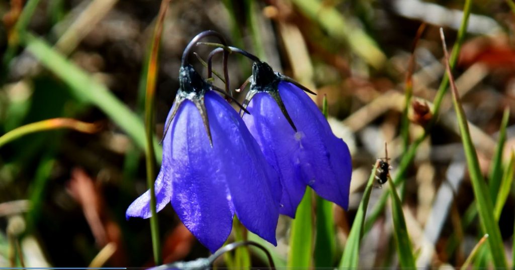
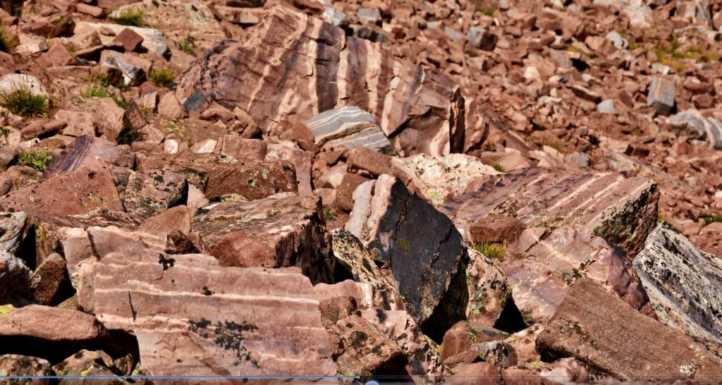
As you continue up the drainage you will see many of what I call VISIONS OF NATURE, with many wildflowers, mushrooms, signs of Tie Hacker culture, some strange mounds I have since learned were left by glaciers, and much more. As you go southeast you will notice off to the west side of the canyon an above timberline level up above those pines where there are 7 remote lakes, none with a name–only numbers, and all have fish. You will have to use your maps and my book to guide you.

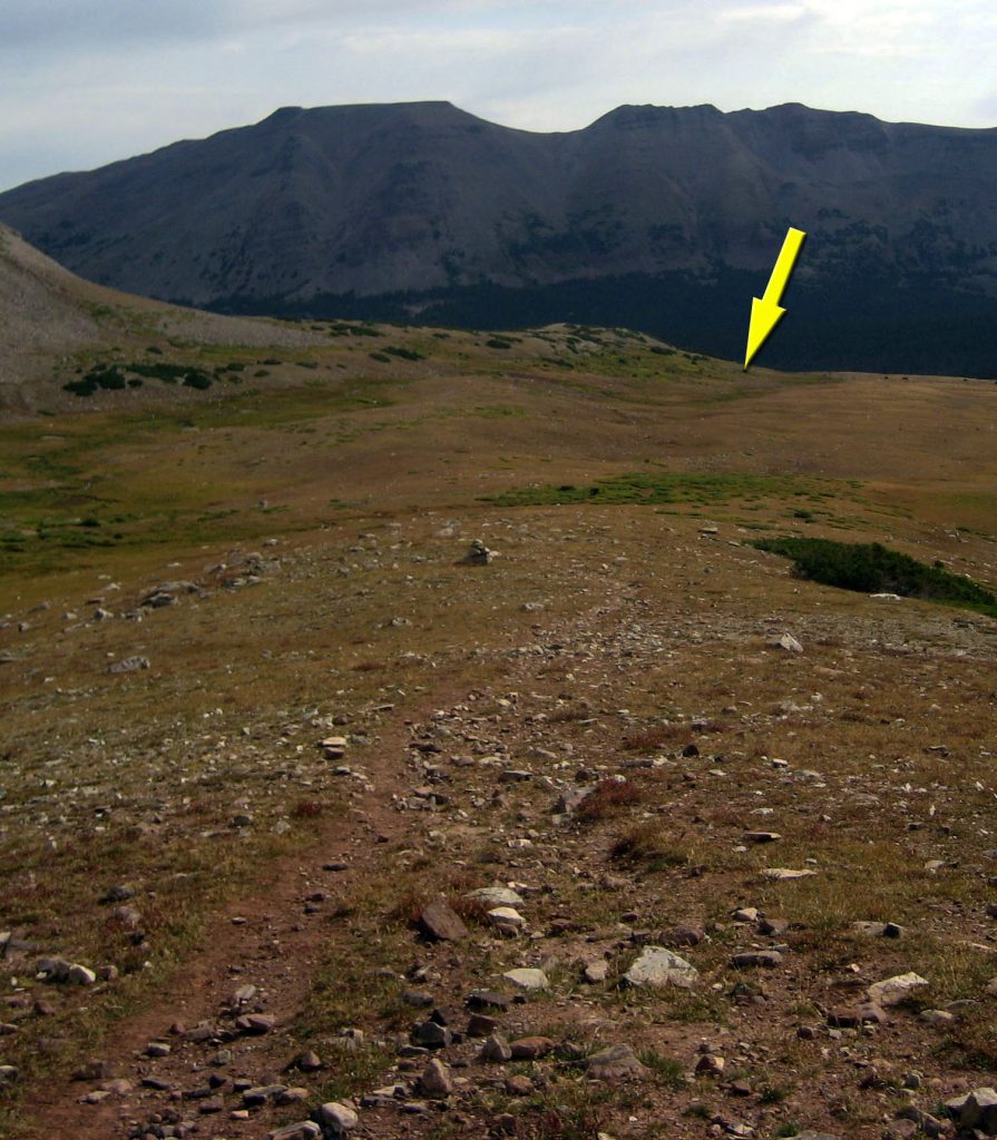
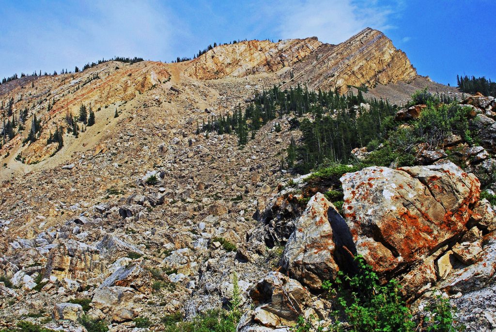
Here I am with 11,600 ft. high SQUAW PASS behind me.

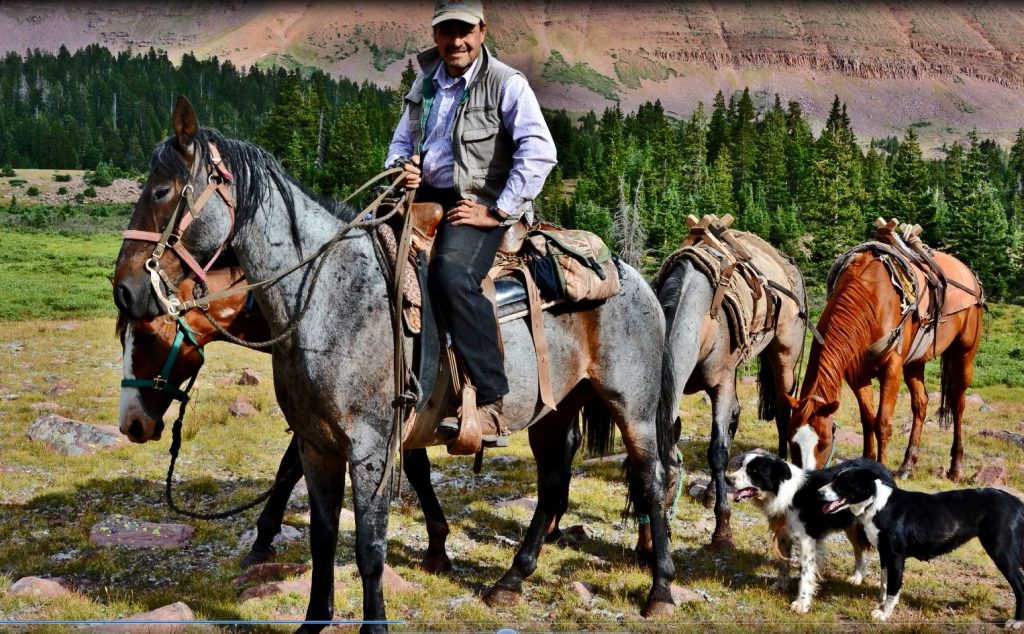
I met a sheepherder from Peru going out for supplies. Their sheep were over the pass in the Oweep Drainage.

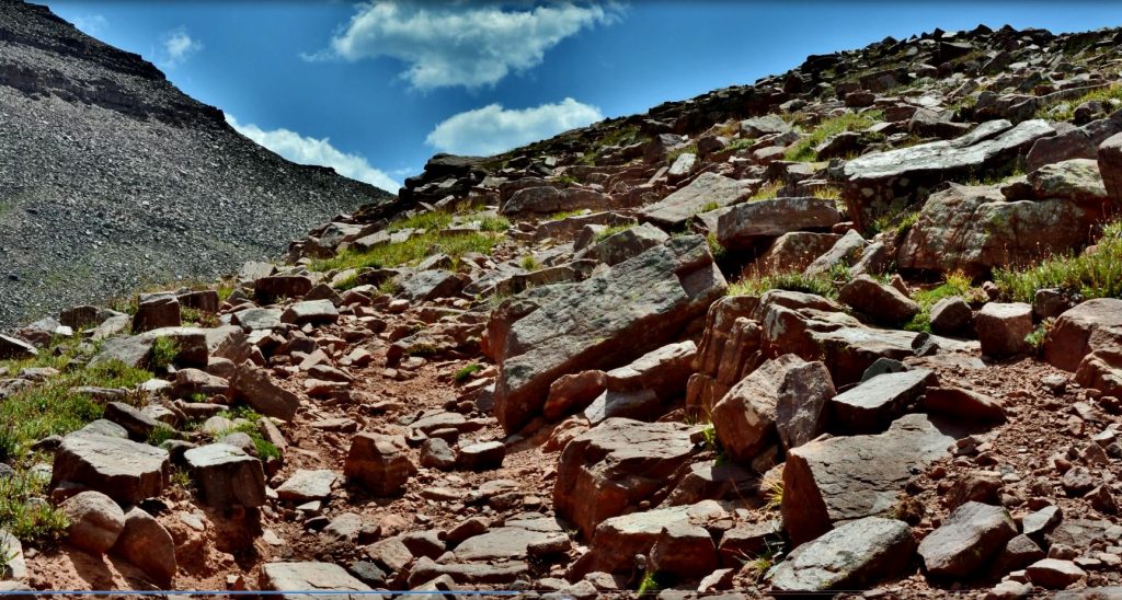
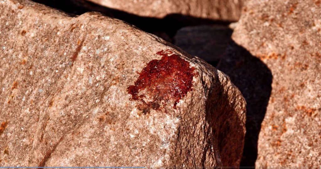
Climbing the pass over a very rocky trail, with spots of blood here and there from the herder’s horses.

Looking back down Little Fork of Blacks Fork canyon.

On the 11,600 ft. pass.

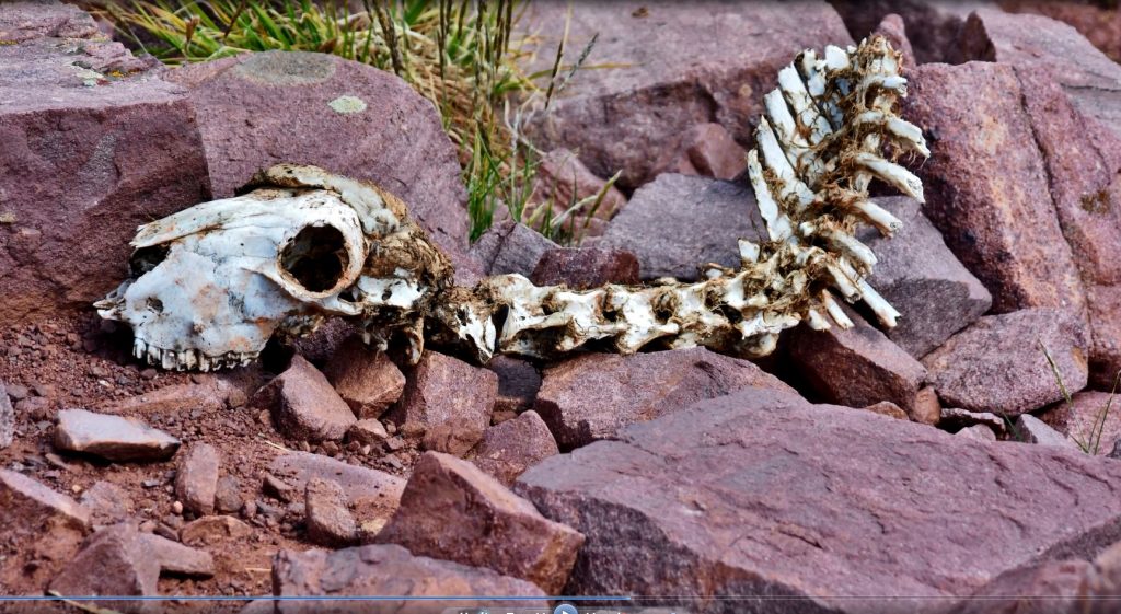
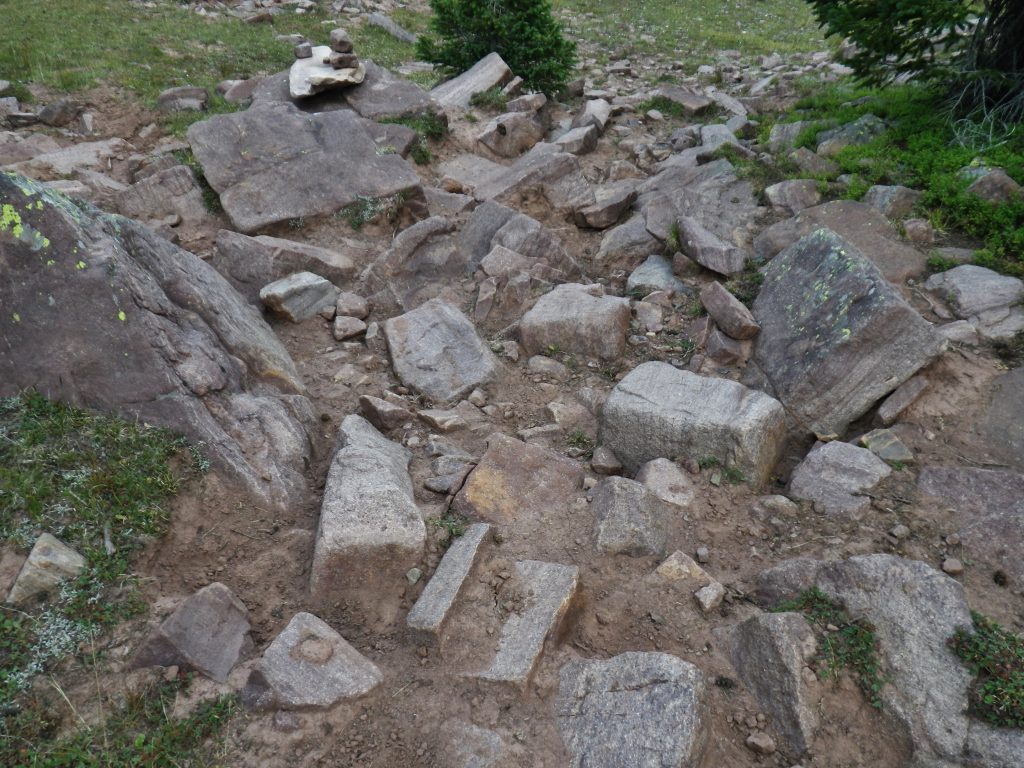
One critter that didn’t make it.

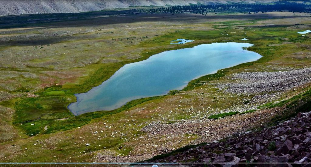
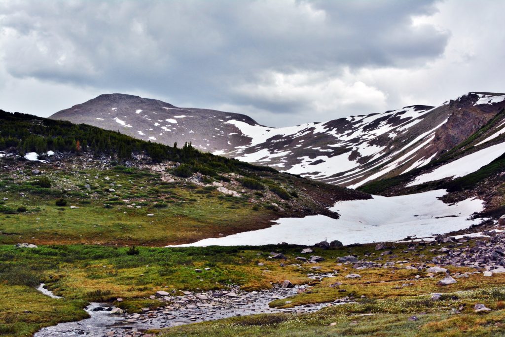
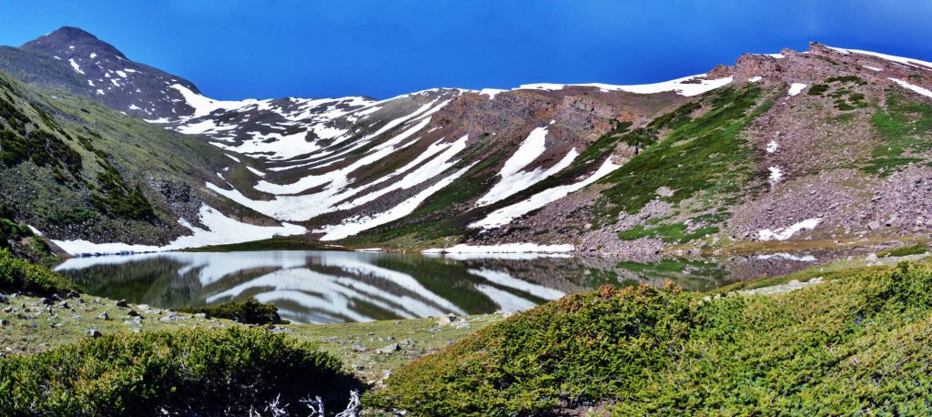
Looking down on Porcupine Lake in the Oweep Drainage.

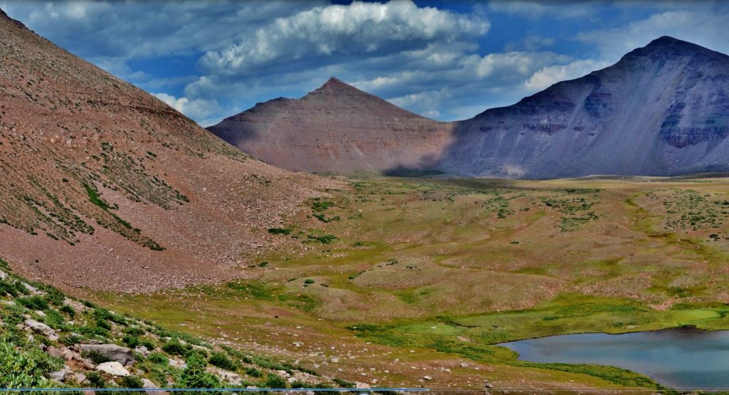
Looking east from Porcupine Lake towards Porcupine Pass, 12, 260 ft. high

A shot of myself on PORCUPINE PASS on my 27 day/no-resupply backpack in 2003 to begin my HIGH UINTA WILDERNESS PROJECT. I’m looking down on Porcupine Lake.

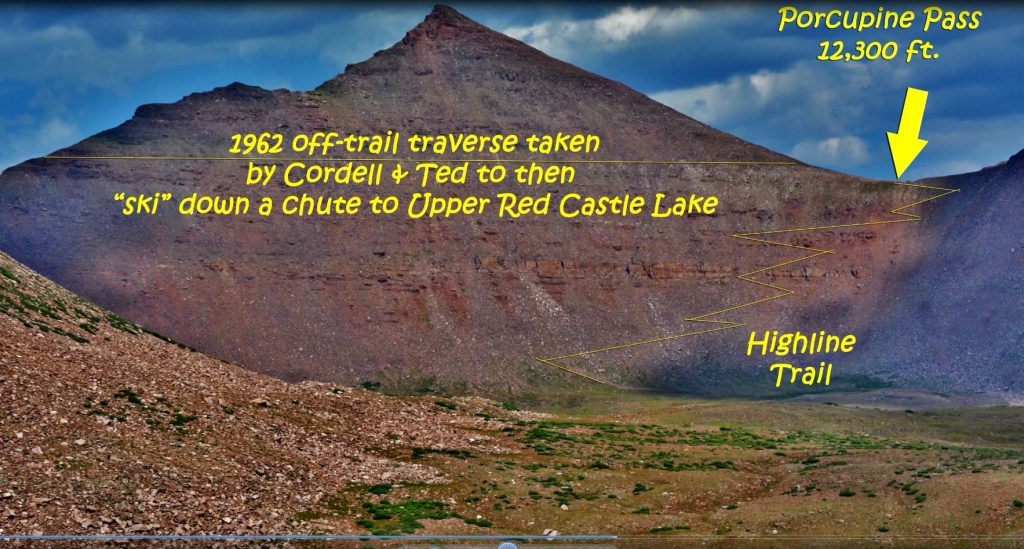
This is a shot again of Porcupine Pass, with 13,000+ Mt. Wilson rising up in the middle, and a line drawn across the picture that was the pathway for Ted and me in 1962, somehow traversing that mountain to get to the saddle above the Red Castle area.

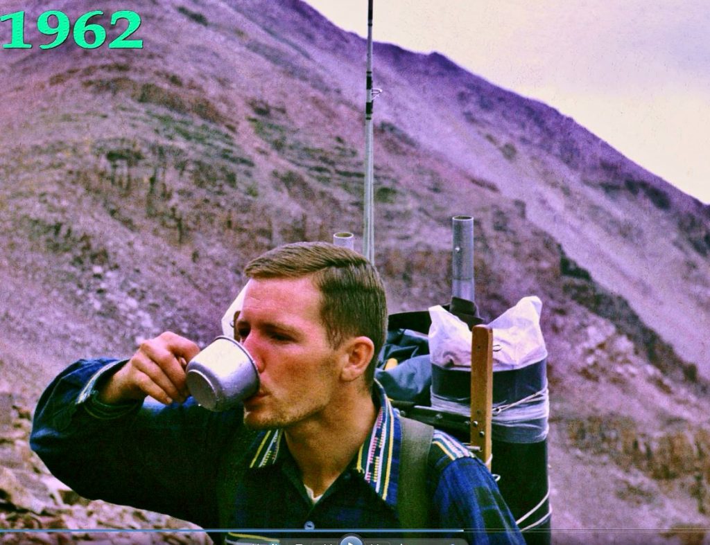
Here I am along the dangerous traverse getting a drink from a spring. You can see my Guatemalan shirt. Five years later our family left on our RISKY & BREATHTAKING PIONEER JOURNEY TO THE MOUNTAINS OF THE MAYA!

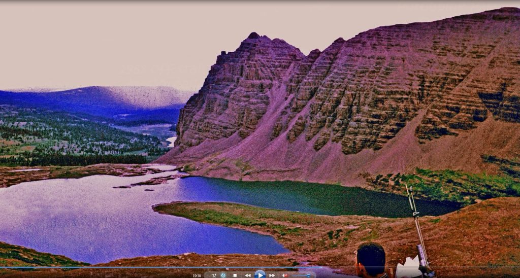
Here we are on the saddle above the Red Castle area on that 1962 adventure. We would eventually camp high above Red Castle Lake on those vegetated cliffs on the right.

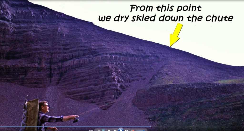
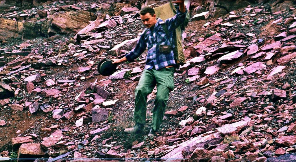
Here you see me dry skiing down the chute. You can also see an experimental backpack I made and fooled around with some.

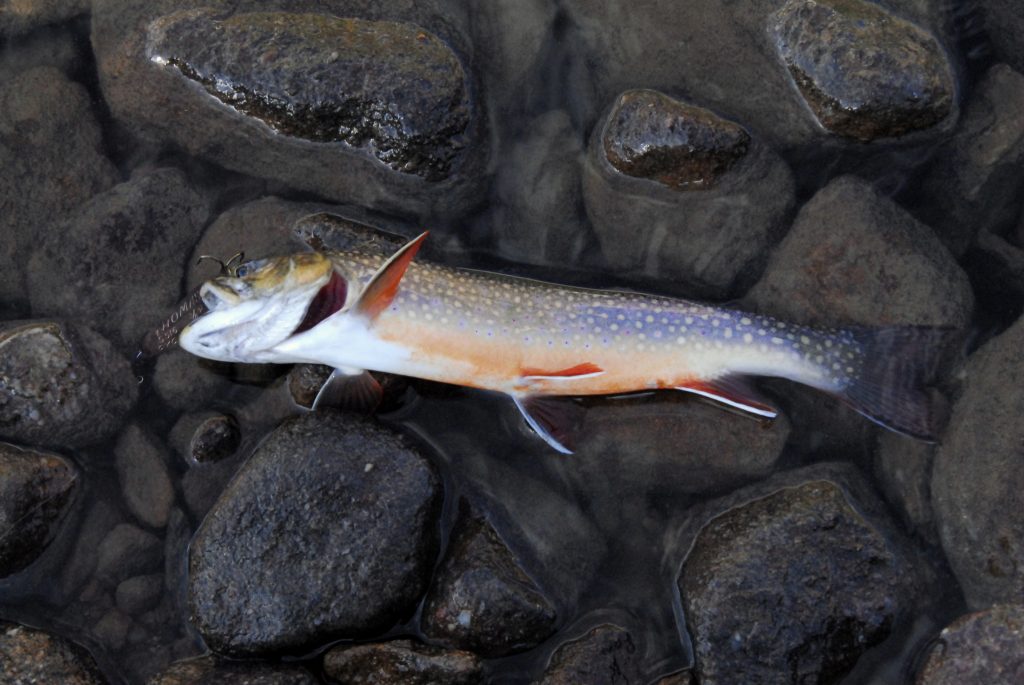
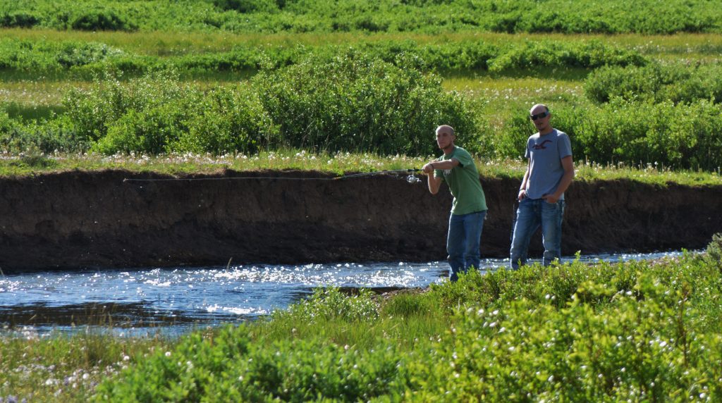
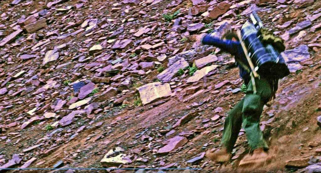
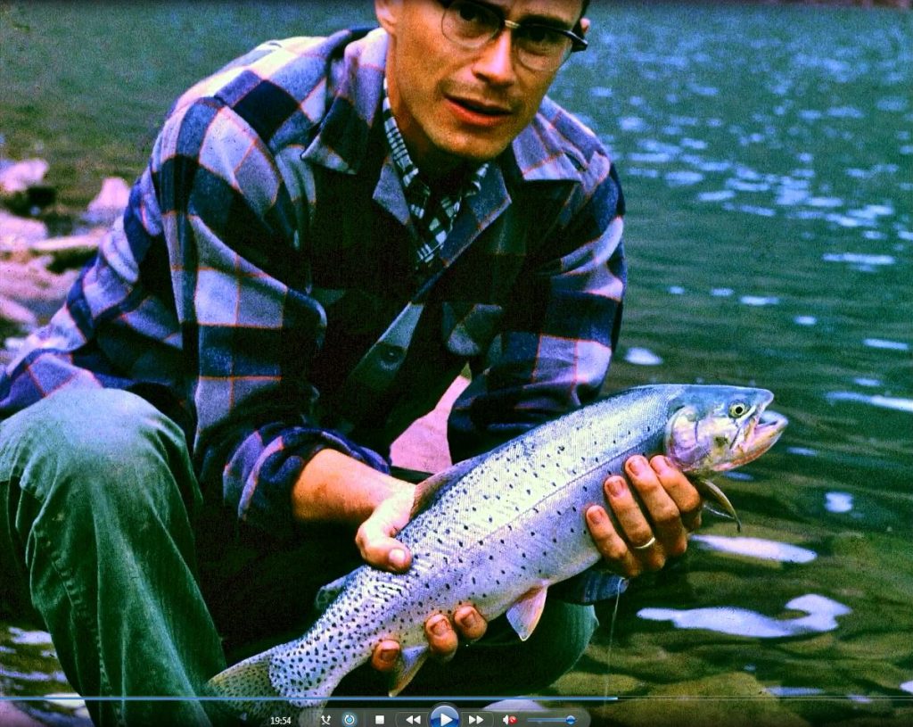
…..and here goes Ted (Packard) going down the chute to first get to Upper Red Castle Lake. From up high we noticed fish rising on the lake and so wet a line….and WHAM! We were into some of the greatest fishing we ever found in the High Uintas.

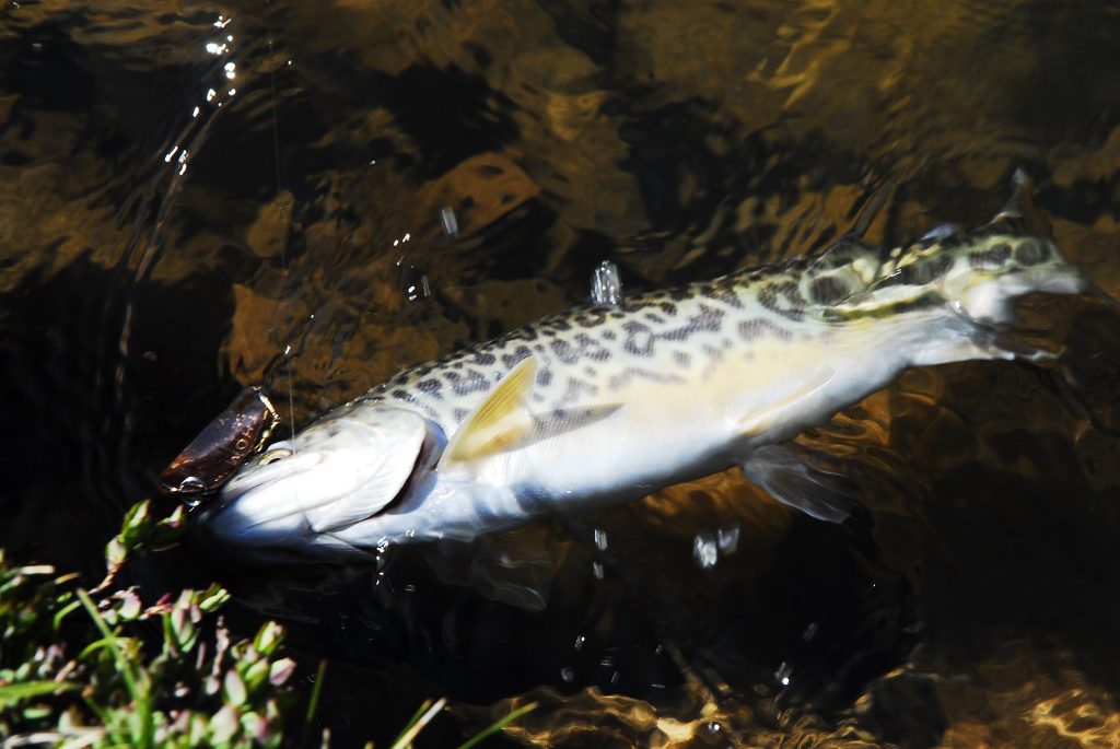
A day or so later from our camp on the cliffs on Red Castle Lake, we hiked back up to Upper Red Castle Lake, and in the clear water noticed a school of Native Cutthroat trout, with an even larger one trailing behind, sort of like an outcast, or maybe the Leader herding his harem around the lake.

We became a little frustrated casting ahead of them as they ignored our lures, but then the wind picked up messing up our clear image of the fish, and I took one more cast where they had been…….and WHAM–THE HIGH UINTA FISH OF MY LIFE WAS ON!

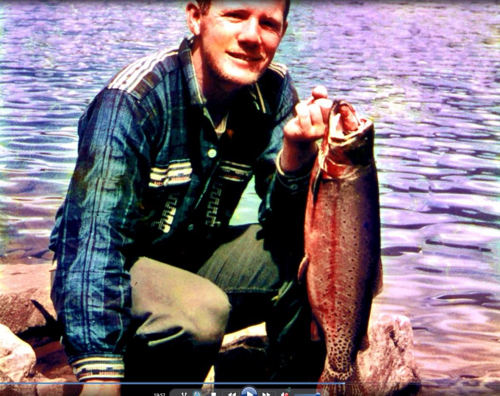
He was very heavy bodied, almost like a large-mouthed black bass. I wanted to take him (or her) back to civilization whole, uncleaned to get an accurate weight for the 21″ native, so buried it in a snow drift intending to come back and get it the next day when we would hike back to civilization.

The next day as we approached the snow drift, a marmot jumped down off the snow drift. Marmots are vegetarians, but we found most of my trophy had been eaten by some critter. Only the the tail half was left, with all the entrails gone too. I carefully wrapped the half and we headed out, going down past Lower Red Castle Lake and swung around on the trail going over Smiths Fork Pass, and down through the Garfield Basin to the Center Park Trailhead and the car. Back home that, what we logically believed was the LIGHTER HALF, weighed 3.5 lbs. So we calculated that the whole fish would have exceeded 8 lbs.

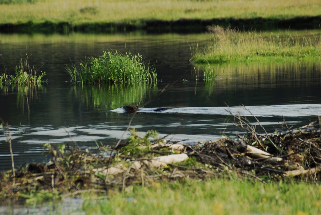
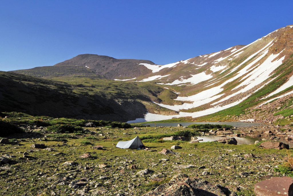
Here I am at PORCUPINE LAKE, inserted with a photo from my “Expedition” I used it as the opening photograph on my Facebook page seen below (https://www.facebook.com/cordell.andersen )

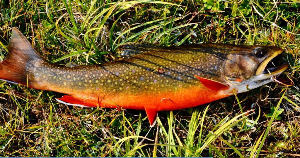
Porcupine Lake is full of the most colorful eastern brook trout I have seen in the Uintas, but the whole area is scheduled for elimination of brook trout and the restoring of native cutthroat trout, along with several other such areas in the Uintas.

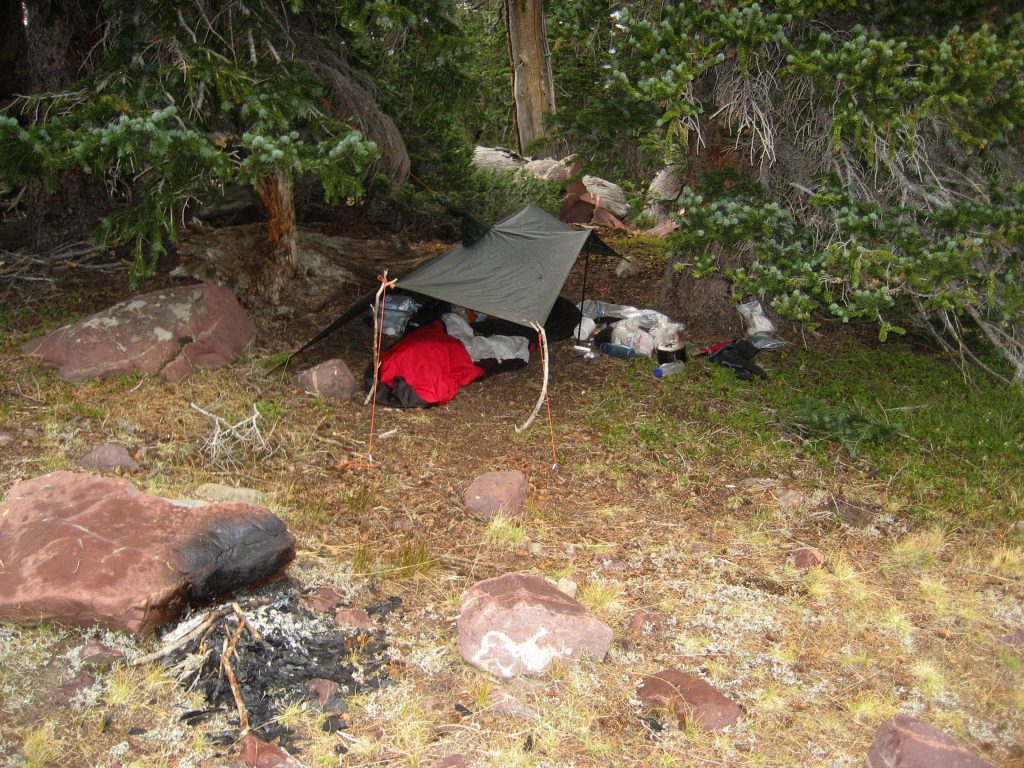
After camping one night on Porcupine Lake I headed back over the pass always with my camera ready for a hopeful encounter.

I was hiking down a rocky ravine, and I felt tired so sat down to rest.

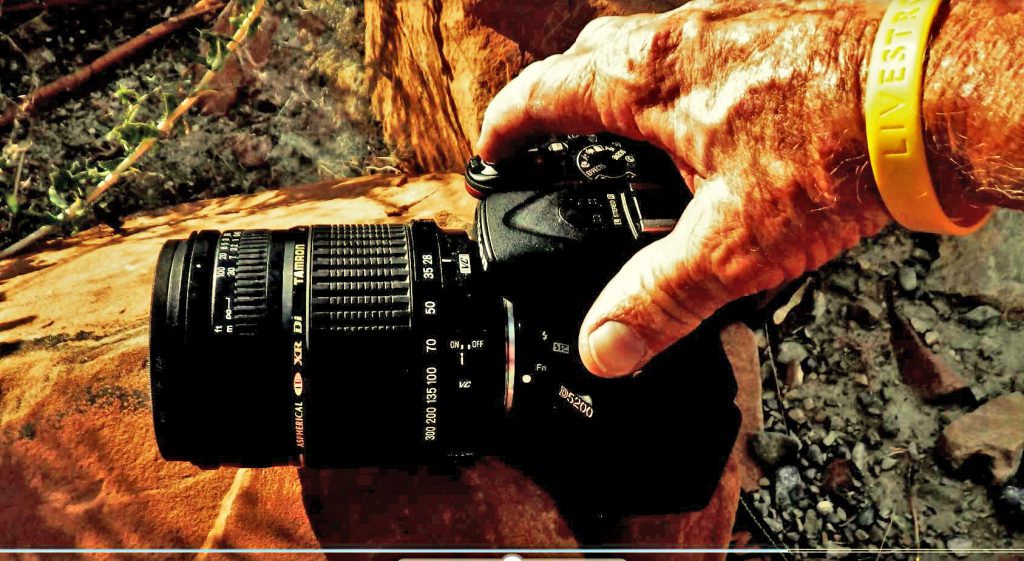
I set my camera down on a rock next to me–always having it ready to get that BIG FOOT portrait–hopefully a FAMILY PORTRAIT! I dozed off when all of a sudden BIG FOOT appeared and seemed friendly, so I tried to communicate, asking him using sign language about a wife and children, but he didn’t understand, so then I tried asking what they ate? He made a movement like a prancing deer, then mimicked jumping on its back and made a wrenching movement like breaking its neck!

Then LITTLE FOOT appeared riding a horse, and I recalled that a sheep herder had reported missing a horse a couple of years ago in this area.

With this incredible scene I was very carefully–without frightening them–manipulating my camera next to me hoping to get the

“PHOTOS OF THE CENTURY!”

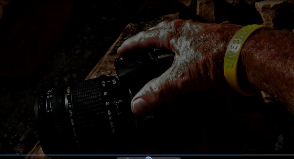
They communicated with each other, and pointing at my equipment were laughing, like saying, “These humans are so pathetic needing all this equipment to survive in the mountains. We get along just fine without any of that!” With that they turned and headed into the forest, me manipulating like crazy the camera with one hand, until almost out of sight, when I lunged for the camera to get a parting shot.

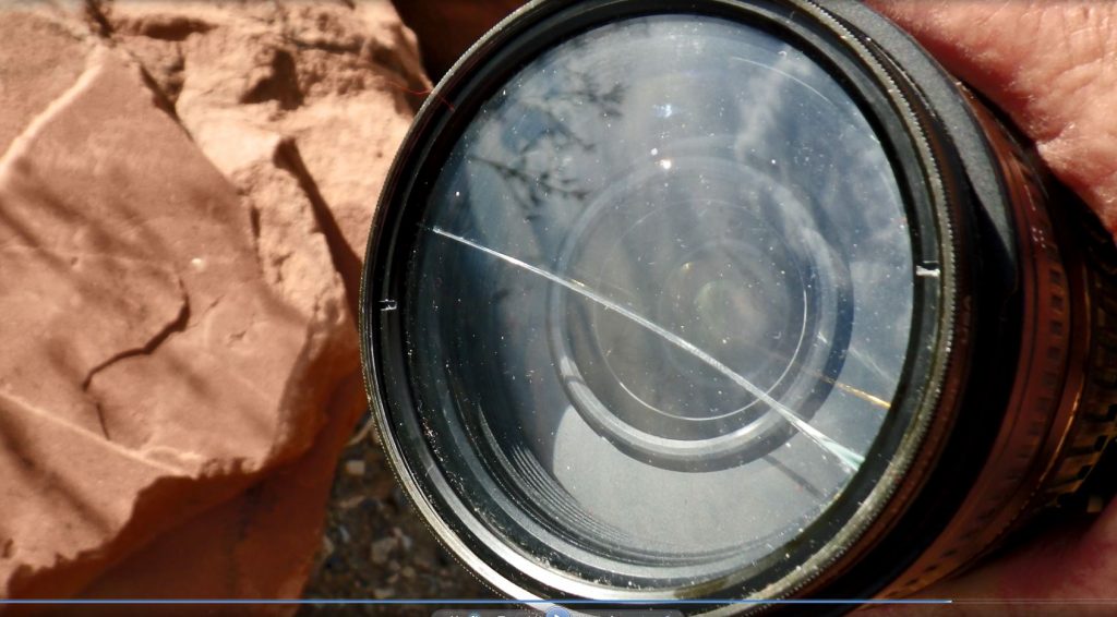
But, I didn’t get a good grip on the camera and knocked it off the rock and it CLATTERED DOWN INTO THE ROCKS BELOW–WAKING ME UP FROM AN INCREDIBLE DREAM! Or, had it really happened, and maybe my camera was full of the definitive proof not only of BIG FOOT, but also LITTLE FOOT!

I hopefully picked up my camera…now with a cracked skylight filter, and checked to see if I had got any photographs…..but luck wasn’t with me!

But, it was so real! I thought maybe it was like the prophets of old having a “VISION IN A DREAM” to get across to me that maybe there was something to the legend…SO I BEGAN MY HIKE DOWN THE TRAIL, MORE READY THAN EVER….WHEN ALL OF A SUDDEN I WAS SHAKEN BY WHAT SEEMED LIKE A GIANT FIGURE COMING THROUGH THE LARGE TREES!

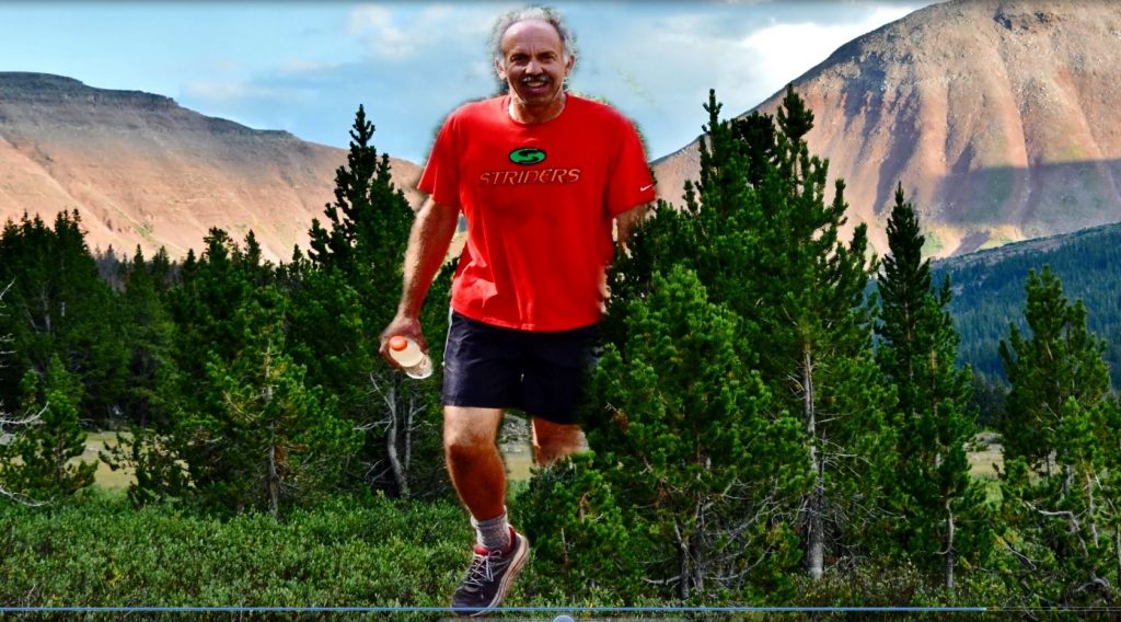
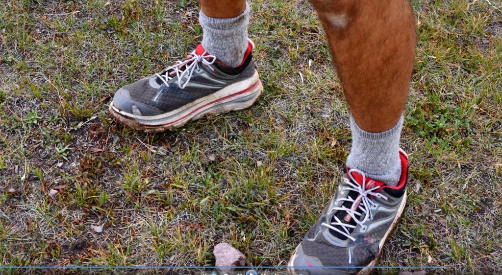
He was wearing a red “Striders” T-shirt and carrying a water bottle! And wearing running shoes on feet that were SMALL!……….not BIG FOOT!

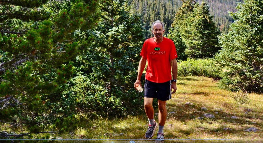
It was ROB WILCOX, mountain runner, with his family camped down below. He was running to and from Squaw Pass.

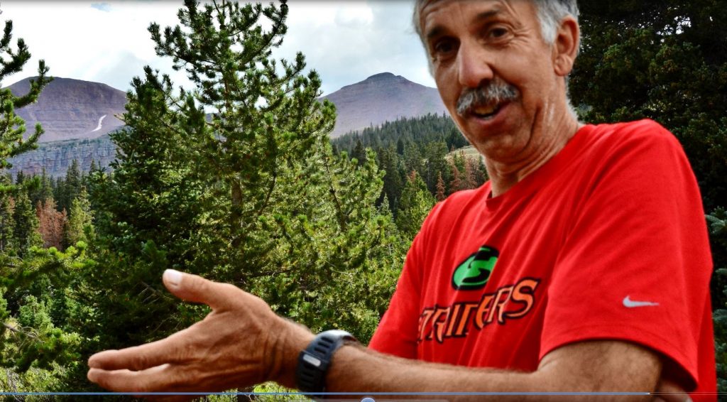
I told him about my mystic encounter with BIG & LITTLE FOOT, and he reacted,

“Who knows? Could be!”

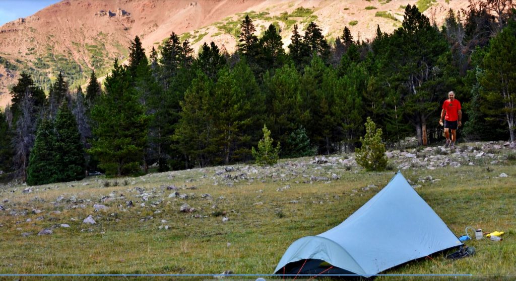
I camped a little ways down the canyon, and later Rob passed by on his way down from the pass to invite me for dinner. Sadly I had just had my dinner of dehydrated food, so had to SADLY pass on what I believe were CHICKEN DUMPLINGS!

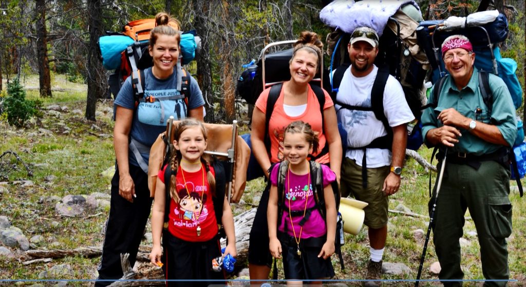
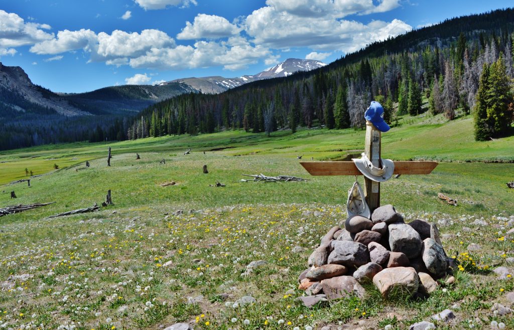
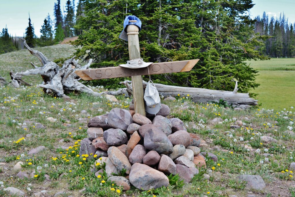
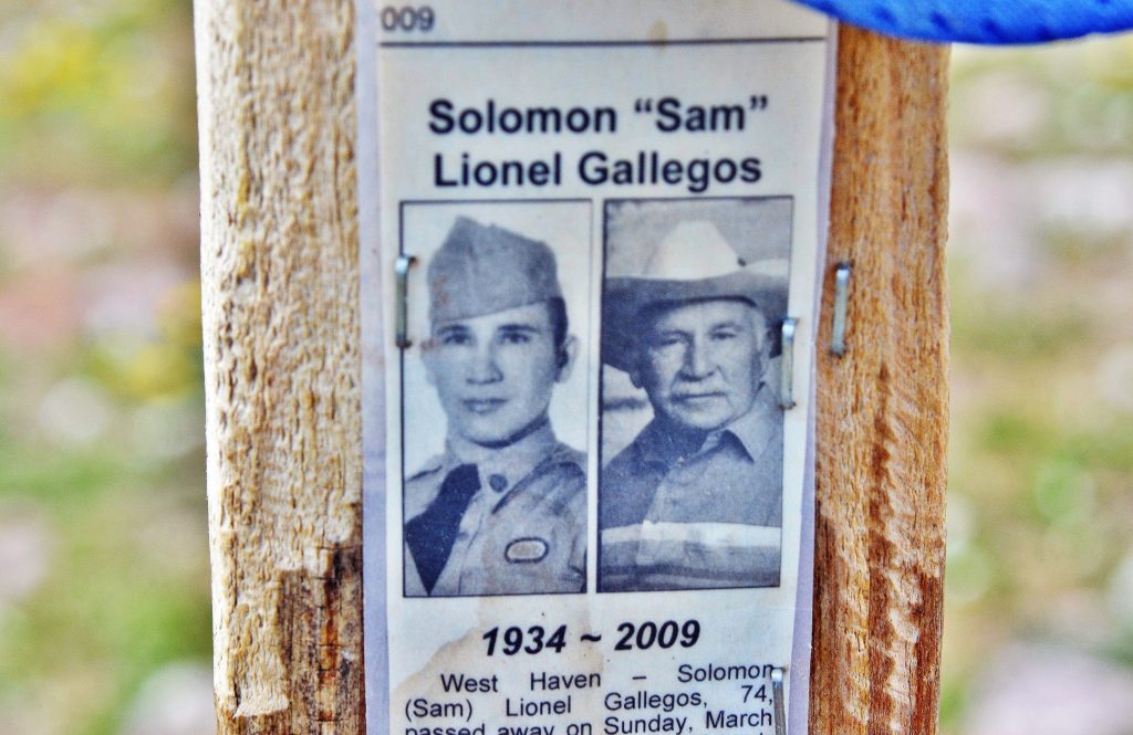
Down the trail I met a great family on a backpack. GRANDPA MIKE ATKINSON, all of a sudden looked at me, and said,

“YOU’RE CORDELL ANDERSEN!”

He continued, “My brother and I saw on your website the writing about the ANTI-AGING CHALLENGE, you describing the solution to arthritis using cod liver oil. Both of us carefully followed the system, and…..

…… IT WORKED MIRACLES FOR BOTH OF US!”

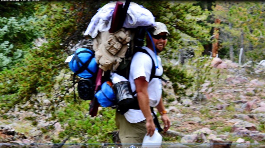
SORRY THIS PHOTO IS OUT OF FOCUS, BUT JUST HAD TO USE IT AS IT TELLS AN INCREDIBLE STORY……Here we are seeing the rewards of having a big family on a backpack–LUCKY HE WAS A ‘TOUGH AS NAILS’ EX-MARINE!”

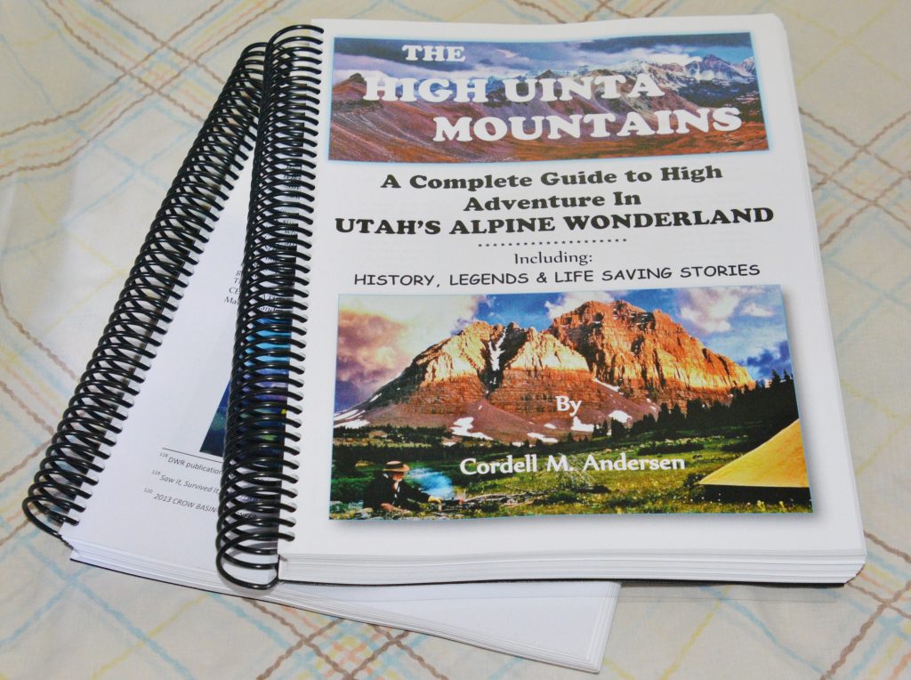
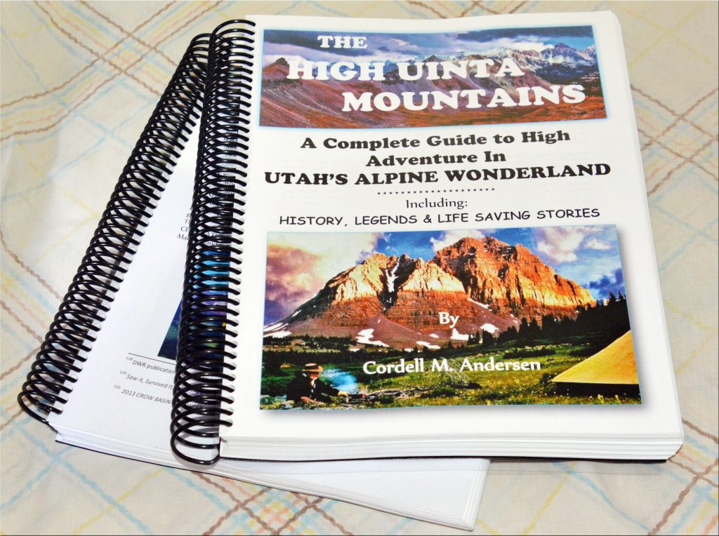
The 730 page digital book is a Guide for adventuring in the Uintas, but also with HISTORY, LEGENDS, the SURVIVAL STORIES OF THOSE WHO DIDN’T MAKE IT & WHY, plus my 8 SURVIVAL STORIES and WHY I’LL BACKPACK THIS SUMMER IN MY 87th YEAR, plus a detailed APPENDIX (among other things has the Anti-Aging Challenge writing), & 14 PAGE INDEX, AS WELL AS TOPOGRAPHICAL MAPS WITH ROUTES, DISTANCES & LABELS — get an online copy of this book, some have called THE ENCYCLOPEDIA OF THE UINTA MOUNTAINS, send me $20 (don’t be afraid of sending a $20 bill as we aren’t south of the border) along with your email address, and I will immediately email you the link to download the book with my permission to share once with a friend. Or, send $25 for thumb drive that will have the book, plus The History of it’s creation as detailed in a speech I gave at the Utah Valley Historical Society; plus my CHECKERED HISTORY & VISION QUEST–0-22 years. Send to: 

Cordell Andersen, 444 Elm St., American Fork, Utah 84003

NOTE: You of course can take it on a thumb drive to your favorite printer and for around $190 have a printed copy as seen above in two volumes. My printer is COPYTEC in Pleasant Grove, Utah. They do a fantastic job.

**************************

A SMALL HILL for YOU, A MOUNTAIN FOR ME I HAD TO CLIMB! COMEBACK GETTING BETTER….NO NEED TO FAKE IT ANYMORE — THE EAST FORK OF BLACKS FORK & SURVIVAL AT CRATER LAKE/EAST FORK PASS! — AN ADDICTION DEFEATED!

HIGH UINTA PASSES?

WOLF CREEK PASS OPEN for several weeks… with NO snow 5/20.

BALD MOUNTAIN PASS–Mirror Lake Byway..CLOSED-21″ of snow 5/20

But first, my persistent efforts to NOT GIVE IN….EASILY, but rather make some good strides away from not being able to walk anymore….like 18 months ago, and importantly, NOT “Faking I’m not a cripple,” that I once had to do, but actually making some progress in hiking again.

Now I have graduated from the several sets of stairs that helped me begin building back muscles, and NOW go every other day to the foothills and the Grove Canyon Trailhead, TODAY with the intention of not following the trail up the canyon, and switch backing up to the “valley view” spot, but rather go straight up the mountain.

Yes, I had to give in and begin using TREKKING POLES, that I used to say were for “WIMPS!” But now on smooth, secure trails, even where the slope up, or down is not extreme, and where losing my balance won’t kill me–like falling into a ravine to never be found, I’m weaning myself off of them, swinging them up behind me and hiking normally. This is actually also helping to straightening out my spine and reducing the normal pain I feel all the time when walking or hiking.

A LITTLE HILL FOR ALL OF YOU, was for ME, considering a while back I couldn’t walk, WAS FOR ME A GIANT MOUNTAIN I HAD TO CLIMB!

So here we are the arrows indicating my starting point near the trailhead and going up a trail you can see winding its way up to the ridge. The upper arrow is a bit deceiving, as it doesn’t make it look very far, which my aching muscles today–the day after–tell me it was a pretty stiff hike for this old guy in his 87th year. For this challenge I WOULD HAVE TO USE MY TREKKING POLES!

Along the way I noticed one of the real pretty bush type plants of the foothills is beginning to sprout. You’ll see later why I used it 63 years ago to actually be a major part of the landscaping of an apartment where we lived when first married. 

LATER YOU’LL SEE WHY IT IMPRESSED ME.

Soon I found this tiny cluster of yellow flowers on a long stalk and stopped for a needed rest and a photo shoot. To use my close-up lens and do it right would have required having a tripod to steady the camera, but I didn’t want to take the extra weight–already with 8 lbs.–with my Nikon camera and 14mm. x 400mm. lens, survival equipment, and a picnic lunch. So just took a bunch of shots hoping one would be sharp, and one was, even though I goofed on the background with photoshop. This flower measures about 1/8th of an inch.

I soon learned that the pathway worn smooth by hikers sliding down a quite steep section, was too steep and dangerous for me, so I had to detour off to the left following deer trails and zigged and zagged up until getting above the dangerous portion, then sort of on top of the ridge followed it up the mountain, and….yes I had to rest here and there, and so actually took longer to get to the view area, than it would have taken me to follow the trail up the canyon.

Here’s another quite tiny flower about a quarter of an inch wide, which I got with my zoom lens. 

There were times during the climb, especially in the beginning, when I decided it was too dangerous for me and my condition, but rather than giving up, just took an easier and safer pathway, taking longer, but finally made it to the viewing area and photographed this plant I hadn’t seen at lower elevations. 

With my fish-eye lens I got yet another panorama of beautiful Utah Valley, from on the very right the tip of the Point of the Mountain, all the way across Utah Lake with Mt. Nebo in the distance on the left.  When all is in bloom, and the sky is clear with beautiful clouds, I’ll insert the actual quote from Escalante & Dominguez in their letter to the King of Spain describing this valley as the BEST THEY HAD SEEN IN THEIR EXTENSIVE TRAVELS IN THE NEW WORLD.

Another Lichen garden impressed me. If you missed the discussion about Lichens, go back a bit and learn about this unique life-form, and even better get my HIGH UINTA MOUNTAINS BOOK, with more complete descriptions of this incredible life form, 3,000+ varieties of which are found in the Rocky Mountain area.

The American vetch has been in bloom at lower elevations for some time. The Utah MilkVetch was first seen up here at the View area, but now is sprouting all over. 

This is the flower of the Milk Vetch, or Ladyfinger.  An extremely tiny yellow flower has sneaked into the picture at the bottom.

I had my picnic lunch and feeling much better than I thought I would, proceeded up the canyon some, but decided I would wait for another day to make it all the way to the water falls and bridge. 

In this photo you can see the trail cutting across the hillside from the left. 

Up high I also found another flower similar to the one first seen several weeks ago much lower, and got pictures of it and the whole plant, showing it is much different than the one on top, and smaller too. 

Then headed down getting a picture here and there, many more than I’m including here, and saving them for my own enjoyment once I start getting OLD! 

The variations in coloration of the Oregon grape plant always fascinate me. 

And, I’ll be anxious to see how this one develops with it’s thorny stalk. 

Once down in the bottom of the canyon on the trail I was impressed with vegetation coming into bloom. This one is seen in the following montage, on the bottom portion.

You Canadians should immediately recognize the leaf seen below. 

Soon the various varieties of THISTLES will begin blossoming with a beauty that has us forgetting the thorny side of the plants.

Dandelions have of course been out for a long time. In fact down in the valley in our lawns they are usually the first to bloom, and the last green plants before the onset of winter. I will soon do a report on this plant, but let me say it is the first plant or flower of any kind that I remember in my life as a child 6 years old. It was in Cincinnati in 1942 when I vividly recall noticing black people, who were properly called “negros” back then (the other “n” word always sparked a fight….sometimes to the death, except among them–I know what I’m talking about as I went to high school where 30% were African Americans), but we would see them in the parks wandering around the grassy areas picking dandelion leaves and going home with bags of them to take the place of expensive green vegetables.

I have since learned they are more nutritious than most of the vegetables, and so a portion of my garden is planted intentionally with DANDELIONS.

While resting and thinking about them, all of a sudden one of the Lord’s beautiful creatures decided I was right and dropped in for some nutrition. Do you notice how its long, elephant like snout dips down into the flower? 


This morning my private Sunday DEVOTIONAL had me hearing the celestial words “ALL THINGS BRIGHT & BEAUTIFUL,” preparing me for sharing with you this INCREDIBLE CREATION OF THE LORD…..or if you prefer of MOTHER NATURE!

WOW! says it all.

Yellow and white seem to be quite dominant among the VISIONS OF NATURE, so a splash of ORANGE always attracts attention.

This is a plant shown in a post weeks ago, me saying it will be interesting to see its flower blossom. We’ll, I can now show you below.

So, down the canyon I went with my trekking poles up behind me and concentrating on walking a straight line, and doing so normally….as normal as an old RODEO CLOWN in his 87th year can do!

I think I mentioned that was one of my labels in Guatemala by a BYU Agronomy professor and friend, Keith Hoops, because we bypassed the use of alfalfa hay and silage, and rather had our cows on high protein pasture grass 24/7×365 days a year, LAUGHING ALL THE WAY TO THE BANK!

I still love my nickname, RODEO CLOWN, as well as some calling me a MODERN DON QUIJOTE DE LA MANCHA!

I LOVE IT, especially my friend and LDS LEADER, Harold Brown, seriously gave me a nickname calling me a “MODERN AMMON!” That was due to my life-long love affair with the Native Americans–Mayans, Navahos, etc–See: https://www.guatemalanfoundation.org/

NOW INTO THE HIGH UINTA WILDERNESS, still on the NORTH SLOPE.

After the Middle Fork of Blacks Fork, for last week–we come to the next–the EAST FORK OF THE BLACKS FORK which is also FONDLY REMEMBERED. We are here leaving the Mirror Lake Scenic Byway to follow east the North Slope Road.

Following the signs, after about 25 miles you come to the TRAILHEAD. From the Trailhead, you can head in one of three directions. By the way, IF YOU DON’T WANT TO GET LOST…..GET MY BOOK with maps and all the info.

Nearby we see a lively VISION OF NATURE, a Red Squirrel that is lactating

My daughter, Mahana, is heading across the bridge and then will turn left to take the trail that after some steep climbing eventually comes into wide green meadow areas where it is a pleasure to hike….on the way to Bald Lake, or on and on to the Red Castle area.

I must add...IT IS A WONDERFULLY BEAUTIFUL WAY TO GET TO RED CASTLE, as you will see in the next picture or two.

See what I mean? Wonderful hiking as you climb up above timberline.

A COLORFUL HIGH UINTA LICHEN GARDEN!

Here, along the edge of the Uinta’s 2nd BALD MOUNTAIN, Mahana is looking down on Bald Lake full of feisty brook trout.

We will now backtrack to the trailhead and head up the East Fork of the Blacks Fork Trail.

NOW TO THE OTHER HIKE FROM THE TRAILHEAD…..it was to be for me my 2nd backpack to Crater Lake, and was done late in the season so hopefully the snow drift that prevented me from climbing up a chute to get on a saddle for the “PERFECT PICTURE!” It was about September 9th. It would be ONE OF MY MOST REMEMBERED BACKPACKS!

In the first couple of miles you see remnants of the Tie Hackers. About 1.5 miles from the Trailhead the trail divides, the left hand trail going up Little East Fork of Blacks Fork. We will cover that area next….and it will be exciting as it is an area where BIG FOOT has been spotted more than other areas. 

Soon you cross the river. What you will find, who knows, so be prepared to wade the stream.
NOW A PROBLEM: Towards the afternoon of my first day a light rain began. I set up my tent to pass the night, and realized I had a problem. I had already had a cancer surgery, and radiation treatment, as well as two Mohs cancer surgeries for skin cancer. Plus in the middle of 2004, my 2nd season of the Project, my right “motorcycle knee” had collapsed and there was an emergency temporary surgery, and I had pain pills prescribed by the doctor for that knee and also my “football ankle” that was beginning to cause a lot of pain. But, I had forgot my pain medications.

I felt like I had to go back and get them and then return to do the backpack. Since it had been raining there were a few drips inside the tent, but midway through the night they stopped. When I felt thirsty and tried to drink some water I found my water bladder was frozen. The drips had stopped because my tent with it’s coating of water was frozen over me like it was an igloo! In the morning I headed for home, got what I needed and returned, but had decided that I didn’t really need a tent–for sure no mosquitos anymore– and could save the weight and use my poncho, and bivouac bag as seen in the next picture. 

I made about 10-11 miles that first day of the 2nd attempt and set up my camp protected by some alpine firs as seen above, with 13,219 FT/ Mount Lovenia in the background.

Ahead was my pathway to 12,150 ft. pass I labeled EAST FORK PASS.

Here I was on the Pass, with Mt. Lovenia in the background. The weather again was closing in on me. Those of you who are sharp will notice the vegetation was green, so this picture was taken early in the season on a previous exploration. In September all would be golden-tan with winter coming on as you’ll see in the following pictures.

Do you remember from my posts who named this mountain and why? Yes, it was famous pioneer artist, photographer, naturalist and explorer, GEORGE BEARD, who named it after his beloved wife.

It was from up here where I got this photograph of THE SPINE OF THE UINTAS seen from here like no where else.

Below I’ll insert a set of three photos of this magnificent scene at different seasons of the Uinta’s short season.

It’s my buddy TED PACKARD seen in the lower panorama.

From East Fork Pass you actually go down towards Red Knob Pass, about 11,700 ft. in elevation. We see here the very most upper reaches of the Lake Fork Drainage on the South Slope.

This is the view from Red Knob Pass looking towards the Deadhorse Lake area.

And here we are looking towards my destination, Explorer Peak, with a sliver of Crater Lake seen in the glacial cirque at its foot. At the pass I put on my rain pants, parka, and poncho, and from here to the foot of Explorer Peak, I was constantly rained, and snowed on.

I set up my camp in the protection of some trees, as by then I was feeling sick….like the flu. I had a slight fever, and had the additional complication of a molar that was aching on my only good side, as the other side also had a dental problem. I couldn’t chew anything. My jerky was cut up in small pieces and put to soak as was everything I had to eat and swallow whole. I of course was prepared with pain medications, and with a complete emergency anti-biotic treatment that I immediately started taking–doubling the first dose to give it a good start.

The thought of getting up to Crater Lake had disappeared from my mind. I had to focus on getting well enough to get out of there and survive. As I rested for two days to give the antibiotic time to begin taking effect, I listened to the news on my small radio, and was hearing that snow was on it’s way. For sure I had to get out of there in two days.

I had a satellite phone, with an extra battery, but as I tried to use it, I couldn’t get a signal as I was right up against the mountain. I used up an entire battery trying, and then stopped trying to have enough battery left to get a call out once I was on my way away from the mountain. In my weakened state my big challenge was to climb Red Knob Pass, then keep going up to East Fork Pass, before dropping down.

Interestingly I had with me a READERS DIGEST with Reese Witherspoon’s beautiful smile along with a title: LAUGH MORE, LIVE LONGER! So I decided to record on my little recorder all the jokes and funny stories, and as I tackled the challenge of climbing over that big mountain, I would listen to all the jokes and funny stories and LAUGH MY WAY OVER THAT COTTONPICKING MOUNTAIN!

After two complete days of rest I began feeling somewhat better, packed up and was on my way. I knew I had to be careful, hike slowly, carefully and not give the sickness a chance to know it had a GREAT CHANCE OF KNOCKING ME DOWN FOR THE COUNT!

I got about halfway to the mountain and at the last large pines stopped to try the phone. I immediately got my buddy Ted Packard on. He said he would call the Forest Service and get the weather report for my area, and get back to me. A little while later he called and told me the Forest Service reported it was going to snow that night and to “STAY PUT AND DON’T MOVE OR YOU’LL DIE!” But, that by morning it would clear some when I could move.

I set up my camp and waited.

There was some sun showing through in the morning, so I moved towards Red Knob Pass, and got out my tiny recorder….

I literally laughed my way to Red Knob pass, but as I approached it, I began feeling sick, weak, a headache, but I had too keep moving up towards East Fork Pass, so I CONTINUED TO TRY MY BEST TO LAUGH MY WAY TO THE PASS...until the weather made my situation a bit desperate! 

As moved I took all but my last medications for pain and high blood pressure, and as I approached the pass, a blizzard hit me with winds like I had never experienced in the Uintas.

NOTE: You don’t see any blizzard in the photo…..I couldn’t take a photo in that deathly survival situation–so the photo was photoshopped inserting me, but I couldn’t figure how to photoshop SNOW & THE RAGING WIND!

I felt pain coming up my left arm, and pains and pressure on my chest like it would burst, plus nausea and worsening of the headache, and I got out my satellite phone…..luckily I getting Russ Smith from Skycall Communications on the line. He was about to leave for a commitment somewhere, but afterwards told me he recognized I was in a desperate situation, so not only kept me on the line, but also formed a conference call with the Sherriff from Summit County.

As I was talking I was moving down as I had to get out of that blizzard. The sheriff said something about trailering some horses to the trailhead and coming for me, but I somehow got across that something quicker was needed. 

So they got on the line the University of Utah emergency helicopter service, and it was agreed they’d come after me, but I had to get down off of that mountain where they could land, or where I could survive on my own if it came to that. I had to get back to that little clump of alpine firs where I had camped coming in.

But they needed my coordinates, so Russ went to work to help me figure out how to do that with the sat phone, which I finally accomplished, and then the call was cut….

…… As I came down quickly in elevation I began feeling markedly better, and finally I got to my spot. I tried to call, but nothing, but set my phone on a rock turned on ready for a call. In about 30 minutes it rang, and it was the helicopter pilot telling me they were 4 minutes out and to put something bright on the ground so they could locate me. I put my bivouac bag out held down with rocks, and all of a sudden here the helicopter came.

I was waving my hands, but smart enough to not yell as you see people do in the movies. He flew right over me and disappeared. But I was in radio contact, and got them turned around and coming in lower, and they spotted me and landed. 

By then I was feeling great, thanked them for coming and just said, “Just take me down to the Trailhead and I’ll drive home!” They didn’t pay any attention, and hooked me up to their machine.

As they were doing so, I said, “Well, at least take me to the LaVell Edwards Stadium in Provo as BYU’s game is about to begin!”
Don’t know what was wrong with them, but they didn’t laugh, shut me up with an oxygen mask, saying the oxygen in my blood was half of what it should have been, my blood pressure was sky high, and my pulse at around 135 even though I’d been resting for half an hour. 

They loaded me and my pack in and we were on our way! 

Flying over my beautiful High Uintas! 

At the University of Utah Hospital they wheeled me in and were all over me, my mirror image seen, if you look carefully in the ceiling thing. 

By the next morning all my vitals were fine, and Jesse came to pick me up, then we headed for the Trailhead and I drove my car home.
For sure I had multiple problems, but the one that overall seems to be now glaring, was that my weakness caused by several things had triggered THE SILENT KILLER–HIGH ALTITUDE SICKNESS. When I got higher and higher climbing that mountain, it got worse and worse, and when I came down 1,300 ft. in elevation I felt pretty good, even though my vitals still needed some attention.

If I had to do it all over again, I would have said, “To heck with climbing that cotton picking mountain, I’m hiking down the canyon to Moon Lake and from there have Jesse come and get me, then go for the car.” I could have likely made it fine, and saved the $1,000 the helicopter ride cost me (without my insurance it would have cost $10,000)!

SO GET MY BOOK AND LEARN ABOUT THE SILENT KILLER. I tell in the book the most prominent survival stories of this century, including 8 of my own, and I have been told by several that LIVES HAVE BEEN SAVED BY THE BOOK! 

FOR FULL INFORMATION ON THIS & OTHER AREAS, AS WELL AS TOPOGRAPHICAL MAPS WITH ROUTES, DISTANCES & LABELS — get an online copy of this book, some have called THE ENCYCLOPEDIA OF THE UINTA MOUNTAINS, send me $20 (don’t be afraid of sending a $20 bill as we aren’t south of the border) along with your email address, and I will immediately email you the link to download the book with my permission to share once with a friend. Or, send $25 for thumb drive that will have the book, plus The History of it’s creation as detailed in a speech I gave at the Utah Valley Historical Society; plus my CHECKERED HISTORY & VISION QUEST–0-22 years. Send to: 

Cordell Andersen, 444 Elm St., American Fork, Utah 84003

**************************

THE SEQUEL…..

On that 2006 survival backpack, my “FOOTBALL ANKLE “ from a football injury in 1953 started giving me trouble–and actually finally wore out requiring surgery in early 2007 shown on the page I put together. 

After returning from the hospital, my kids came in the house finding THIS! They were beginning to panic, but Jesse noticed I was softly snoring and ALIVE. So, they quickly got a camera and shot this WONDERFUL PHOTO!

After months of recovery I all of a sudden was IN DEEP TROUBLE!

This was my first and last ordeal learning about the acute dangers of taking PERCOCET + AMBIEN and feeling WONDERFUL sort of for a time until realizing I had become addicted!

I went COLD TURKEY, suffered the pains of HELL for a week, I don’t think sleeping at all, but finally SURVIVED….AGAIN! — learning my lesson to never let that happen again. 

****************************************

THE “COMEBACK” KID tries again….like for the 5th time! So, to control high blood pressure–EVERY OTHER DAY INTO THE HILLS to be inspired by SPRING COMING ALIVE! Then our tour of the HIGH UINTAS continues at the little visited MIDDLE FK of BLACKS FK & BOB’S LAKE, plus discovering a whole COMMUNITY OF SCANDINAVIAN TIE HACKERS!

Until today, May 5, 2022 I’ve done this FOUR TIMES! Each time after giving up due to problems, but then remedied with yet ANOTHER SURGERY to keep me going. To today 15 surgeries, plus two radiation treatments and becoming a cancer & heart attack survivor, etc.

All of a sudden by Fall 2020 I was in a wheelchair, and in November the 3rd back surgery but made me worse, then the 4th spine surgery to kind of fix me a little. But by mid-2021 my spine became DANGEROUSLY MISALIGNED as shown above on the left–a fall could paralyze, or kill me, so I carefully went to work again on ANOTHER COMEBACK as too much of me worked pretty good to accept the other dire alterative–but with great precautions.

But, now also with a dangerous HIGH BLOOD PRESSURE problem, but as explained in past posts, learning to reduce salt and sugar intake, but JOYFULLY LEARNING THAT 1-2 HOURS OF VIGOROUS OUTDOOR HIKING REDUCED MY BP for the TWO DAYS.

So….INTO THE HILLS every other day! Now forced to use the previously hated TREKKING POLES….thought previously THEY WERE FOR WIMPS! Now without them I’m maybe dead on tough foothill & High Uinta trails!

Do you remember CLIFF ROSE and its BEAUTIFUL WOOD? Up above the parking lot of the Grove Canyon Trailhead, on the right we see a whole forest of Cliff Rose, that we’ll visit later when it begins the SPECTACULAR BLOSSOMING STAGE.

NEAR THE PARKING LOT WE SEE A CLOVER PLANT....and LOOK FOR THE FOUR LEAFED ONE to bring me GOOD LUCK! Didn’t find one, but HAD GOOD LUCK ANYWAY!

This past week several hikes along the foothills, getting higher and higher. This photo zooming in on Provo Peak (on the left), then Little Squaw Peak, Squaw Peak, Y-Mountain, Maple Mountain, and Provo at their feet, with Orem, and then Pleasant Grove along the foothills of Mt. Timpanogos.

I was well rewarded with the first blossoming of WESTERN BLUE FLAX, upper shots at the entrance to Grove Canyon. Higher in the foothills, leading to the Uintas, they blossom profusely, and even are found in the lower High Uintas among the Quaking Aspen.

Another tiny wild flower seen already, but in upper left the sprouting of a new plant, and the Lady Bugs out protecting them from aphids and other tiny insects.

Near the Trailhead I found this plant beginning to blossom as seen below.

And, out now all along the foothills AMERICAN VETCH.

And, I discovered a WHOLE GARDEN ON A ROCK!

FUNGI form a symbiotic relationship (partnership) with ALGAE creating what we call LICHENS. The fungi and algae each fill a role in the survival of their partner and together fill a slow, but crucial role in the process of breaking down rocks and trees. It was said by an expert: “LICHENS ARE FUNGI THAT HAVE DISCOVERED AGRICULTURE.” Rocky Mountain Goats eat lichens as an important part of their diet. Over 3,000 varieties have been identified in the Rocky Mountains region.

More and more shrubs and trees are now blooming and will soon adorn our foothills with beautiful green colors.

This was one of the first wild flowers I found in the foothills, but way up Grove Canyon. It is now blooming along the lower foothills.

This TINY BLUE WILD FLOWER is one of the smallest. I should have had my Nikon camera with close-up lens to show you how beautiful it is. Maybe next time.

SORRY, THE FLOWER ITSELF OUT OF FOCUS. I’LL DO BETTER NEXT TIME.

By the next hike or so this one should be blossoming.

I’m getting higher and higher, far above the parking lot, but am aiming for getting higher up than ever before. No es una gran logro, pero tomando en cuenta que hace 1 ano y mas, NI PUDE CAMINAR, para mi es UNA GRAN BENDICION PODER HACERLO, Y PODER AGUANTAR EL DOLOR!

You might remember way back I got some pictures of this plant sprouting, and then later the one on the left. Here we see the whole plant to connect the two pictures.

From as high along the foothills as I have ever got to, I got this fish-eye photo of beautiful UTAH VALLEY gradually being decorated by nature with its many varieties of trees among our homes. Father’s Escalante and Dominguez were the first white men to record a visit here in 1776 and in a letter to the King of Spain called it the “most beautiful and fertile land” they had seen in all their explorations, including their swing up from Santa Fe, following the “Old Spanish Trail” to the Uintah Basin, and from there came by Utah Valley where they had a good relationship with the Timpanogos-Ute Indians and promised to return and establish here a Mission. But, they never returned. Can you imagine how the history of Utah would have drastically changed if they had of kept their promise? In my YouTube video on the Pioneer Timber Slides I give their exact quote and details.

Up high in the foothills I all of a sudden had a quite large bird soaring above me. Often we imagine we are seeing a Golden Eagle–and sometimes we are, but even my slightly blury pictures show us otherwise. We are seeing a TURKEY VULTURE, or BUZZARD, native to Utah, easily identified with a telephoto picture by it’s red head.

We are now back down near the Trailhead and begin our study of SAGEBRUSH so critical to the deserts and foothills of Utah. As the season progresses we’ll keep an eye on it and follow it’s development, some of which we observe in the montage above.

NOW ON TO WHAT’S LIKELY OF MORE INTEREST…..

THE HIGH UINTA WILDERNESS…STILL ON THE NORTH SLOPE

Our last tour was of the West Fork of Blacks Fork (of the Green River). This week I’ll show you a few pictures from two of my three explorations of THE MIDDLE FORK OF BLACKS FORK.

It is rarely visited as you will see, but one of the most important explorations as I discovered there more TIE HACKER RUINS THAN ANYWHERE ON THE NORTH SLOPE. My research showed nothing ever recorded or mentioned about this area by the scientists. So my 3rd exploration was to go back and forth as I went up the drainage to locate every site, get an accurate reading on each with my SPOT TRACKER, then measure and photograph everything. AND, OF COURSE END UP DOING A LITTLE FISHING AT BOB’S LAKE.

MUCH MORE DETAIL, INCLUDING TOPOGRPAHICAL MAPS, CAN BE FOUND IN MY BOOK, pages 204-207

A YOUTUBE VIDEO WAS MADE OF EACH OF THE ABOVE EXPLORATIONS.

One gets to the area by going down north on the Mirror Lake Scenic Byway and turning east on the NORTH FORK ROAD with 20 miles to go to get to the road that is marked for the East Fork of Blacks Fork Trailhead.

At 20 miles from the Scenic Byway, you come to a junction and turn south on the road to the East Fork of Blacks Fork Trailhead, and shortly cross this bridge.

The junction and bridge is seen in the center of the picture. Shortly, as you can see, you will come to a gate that you go through. There are no signs, but believe me the road takes you to the “unofficial Trailhead,” I have named–a distance of about 2 miles….

As you can see…..SOMETIMES THEY ARE TOUGH 2 MILES!

….and sometimes you’ll have to park your car and hoof it to get to the “trailhead”

Believe it or not, THIS IS THE TRAILHEAD!

A short hike through the lodgepole pines has you arriving at a beautiful meadow with 13,165 ft. TOKEWANNA PEAK in the distance–one of the seven officially named 13,000+ ft. peaks in Utah. The 8th would be the 13, 387 ft. high Mount Jedediah–I named to honor for me the greatest of the explorers and mountain men of the West–JEDEDIAH SMITH, whose story I tell as a Preface to one of the sections in my BOOK.

On my important 3rd exploration, from this point I hiked to the right and went some downstream looking for signs of a tie hacker SPLASH DAM. Later I’ll explain what a SPLASH DAM was for the Tie Hackers.

Instead of tie hacker ruins I found a MONUMENT TO A UINTA LOVER —

SOLOMAN “SAM” LIONEL GALLEGOS

Then, up the drainage in search of beautiful VISIONS OF NATURE and the TIE HACKERS.

On the lower portion of the stream I did see two fisherman. They were the only two human beings I had seen on my three backpack/explorations, but they were just on a short day hike to fish. By the way, they are casting a spinner! Can you see it?

As I worked my way up the drainage I crossed a section of a rough intrusion that I had also seen on the West Fork of Blacks Fork. Once past that I entered a lush area of even more wild flowers than seen on the lower drainage.

I don’t recall seeing any area in the High Uintas with such a profusion of colorful wild flowers.

STICKING CLOSE TO THE STREAM I ALL OF A SUDDEN I FOUND PILES OF ROTTED LOGS, LIKELY FROM THE EARLY PERIOD. WHO KNOWS WHY THEY WERE ABANDONED.

Then I came to the first stumps from the tie hackers–almost completely rotted away indicating they were from the early period.

Soon I discovered ruins of a cabin–small, with rocks in one corner suggesting a fireplace, and found a square nail: ALL SIGNS OF TIE HACKERS FROM THE 1867-1880 PERIOD.

A RED SQUIRREL

In less than a mile I began finding stumps that weren’t rotted away, and a little further I entered a long section of more and more ruins. They weren’t all rotted away, were larger, no rocks inside, and had windows. No square nails, only round ones invented in 1910–all signs of the later tie hacker period from 1912 to 1935 when mechanization made obsolete the tie hackers.

One of the ruins seen middle left below, was the largest ruin I’d seen anywhere…..I recall it being 36 feet long, by 18 feet wide, and had signs of having had a rustic floor.

Nearby the large ruin I found two ruins with features that suggested they were sweat houses, used commonly by Scandinavians.

The scant history of the Tie Hackers from the early period is almost non-existent since that period was before the organization of the Forest Service, and most of the tie hackers were Irish lumbermen immigrants who didn’t know how to read or write, and so there are no journals, or letters to tell their story.

But the later period is completely different with the Forest Service beginning to keep records and regulate the tie hackers, who were almost all Scandinavians, mostly Swedish–who had the tradition of sweat baths.

What I was finding was a TIE HACKER SCANDINAVIAN/SWEDISH COMMUNITY. The large ruin was likely a dinning hall, also used for social activities, and maybe even a school, as it was common in the later period for entire families to be together in communities.

With my SPOT TRACKER I took readings on 14 sites as you see above. #1 was from the early period, and most likely a more thorough search of the area would turn up more signs from that period–in spite of much of it having rotted away.

Each railroad track….and in the beginning of the Transcontinental Railway there was only one track, but for EVERY MILE APPROXIMATELY 3,500 RAILROAD TIES WERE NEEDED–adding up to many millions needed. Without the TIE HACKERS the railroad(s) would have never happened, and without the railroad the “WEST WOULDN’T HAVE BEEN WON” so I justifiably call the “TIE HACKERS THE UNSUNG HEROES, WITHOUT WHOM THE WEST WOULDN’T HAVE BEEN WON!”

……and as evidence that LIFE ISN’T ALWAYS FAIR, it is a fact that the volumes of very large books that document the Transcontinental Railroad construction, and the TV series HELL ON WHEELS, NEVER MENTION THE TIE HACKERS! Only one or two episodes of HELL ON WHEELS show wagons arriving with railroad ties, but we are never told where they came from, or who made them. Yet, one of those HELL ON WHEELS ghost towns, BEAR RIVER CITY, was labeled in a newspaper, “The Liveliest, if not the most wicked town in America!” which story I tell in my BOOK, and a suggestion has been given that it could be made into a GREAT WESTERN MOVIE, featuring Sherriff Tom “Bear River” Smith who became famous for trying to stop “the bloodiest fight between white people in the history of Wyoming.” He went on to Abelene, Kansas where he was killed in a shootout and became President Dwight Eisenhower’s hero–every time he came home to Abelene he would go to the cemetery and place flowers on Tom’s grave.

NOW, LET’S GO FISHING!

We head for Tokewanna Peak. There are portions where the trail just disappears. Even the WILDERNESS SIGN was lost in a jungle of vegetation. The best way to get to Bob’s Lake is to follow the stream, and when it divides, keep to the right and follow it up to the lake. The other fork goes to the left up to where there are a number of small lakes, two with numbers: G-72 and G-74. Both had been planted experimentally with brook trout in 1984. A follow up survey in 1986 showed winterkill for G-72 and stocking discontinued. G-74 is much shallower, but showed it still had wary brook trout, and was aerially stocked in 2018, with plans to stock on a 3 year cycle.

WE ARE GETTING CLOSE TO OUR DESTINATION…JUST UP AND AROUND THE SNOW BANK TO THE LEFT.

Here we are at BOB’S LAKE. It looks small, and certainly isn’t big. Another view below is better.

On my first visit in 2008 I didn’t know what kind of fish to expect, but cast away with my Thomas Cyclone, and WHAM! It felt like I had a large, very strong fish on. He wasn’t all that big, but strong as he was a TIGER TROUT, that once for once, are pretty strong.

On my first two trips to the area I had only seen a footprint of one human being, but didn’t see him or her. On that last trip I was down the canyon, and all of a sudden SURPRISED BY THE FIRST HUMAN BEING BACKPACKERS SEEN!

They were a handsome couple: Mike & Nicole from Germany – they met in Switzerland. Apparently they had heard something about my previous reports and so were on their way to a

GREAT WILDERNESS ADVENTURE.

From there I headed for civilization at Mountain View, Wyoming, and was cleaning and organizing all of my equipment.

For some reason I had taken out of my Nikon camera the memory card you see to the left with it’s wealth of photographic documentation of likely my most important exploration. But in preparing for my next move, I all of a sudden COULDN’T FIND IT! I meticulously went through everything, including every nook & cranny in my car, and in my trailer. But, NOTHING!

I was literally sick, but had no choice but to prepare to GO AND DO IT ALL OVER AGAIN! NO SMALL ACCOMPLISHMENT FOR A 77 YEAR OLD TIRED MOUNTAIN MAN!
At the Rest Area I took my pot and utensils into the rest room to wash them, and as I was doing so I all of a sudden heard something drop onto the pot bag on the floor. I looked down, and……

..THERE MY MEMORY CARD WAS, seemingly HAVING DROPPED DOWN FROM HEAVEN as an ANSWER TO MY DESPERATE SEARCHING & PRAYERS! WOW, HOW GRATEFUL I WAS, so headed for the Maverick Convenience Store

& CELEBRATED WITH A BIG MT. DEW & A DONUT!

THE BOOK IS A TRIP GUIDE with updated information, topographical maps with routes & distances, and MUCH MORE–like a GUIDE TO DO A 856 MILE AUTO-LOOP TOUR of the HIGH UINTA MOUNTAINS, with HISTORY, the LEGENDS, the SURVIVAL STORIES OF THOSE WHO DIDN’T MAKE IT and WHY, plus CRITICALLY MY 8 SURVIVAL STORIES & WHY I’M STILL HANGING AROUND...and IMPORTANTLY MY ENTIRE WRITING ON THE ANTI-AGING CHALLENGE….look at me at 83 compared to Bill Gates at 63!

FOR FULL INFORMATION ON THIS & OTHER AREAS, AS WELL AS TOPOGRAPHICAL MAPS WITH ROUTES, DISTANCES & LABELS — get an online copy of this book, some have called THE ENCYCLOPEDIA OF THE UINTA MOUNTAINS, send me $20 (don’t be afraid of sending a $20 bill as we aren’t south of the border) along with your email address, and I will immediately email you the link to download the book with my permission to share once with a friend. Or, send $25 for thumb drive that will have the book, plus The History of it’s creation as detailed in a speech I gave at the Utah Valley Historical Society; plus my CHECKERED HISTORY & VISION QUEST–0-22 years. Send to: 

Cordell Andersen, 444 Elm St., American Fork, Utah 84003

**************************