For my 79th year, backpacking in the High Uintas requires good physical conditioning. Seasoned hikers like me have to work hard at getting in good enough shape to do it, and then we have to be careful to not lose it–which happens quickly if we don’t work at it. In my case I find that means EVERY DAY as you see me doing here, with a pack on my back full of rocks, and double quarts of water. It was 45 lbs. during January, then up to 50 lbs. for February, and March exactly 56 lbs. For April it is now 60 lbs. Most days it’s just around a big block, but every other day longer, like going to the Fresh Market for groceries, or to the Post Office.
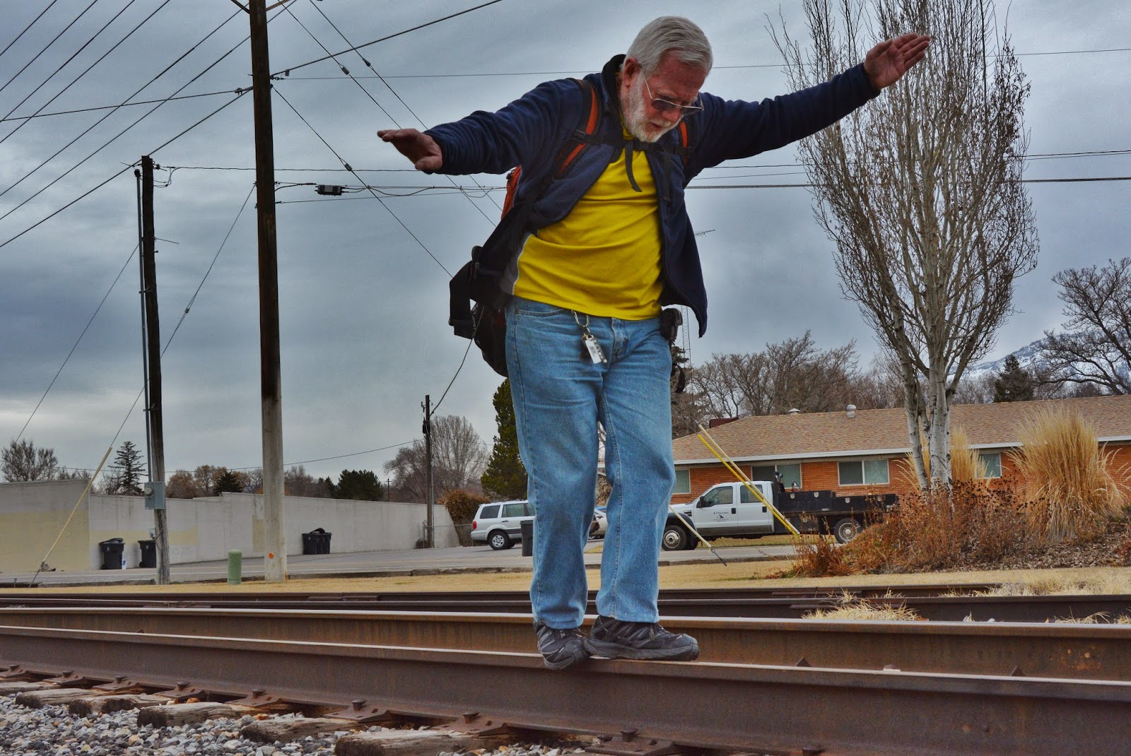
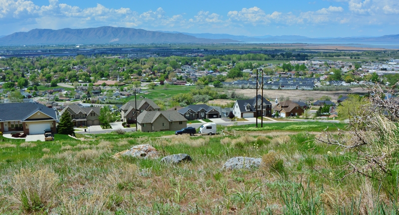
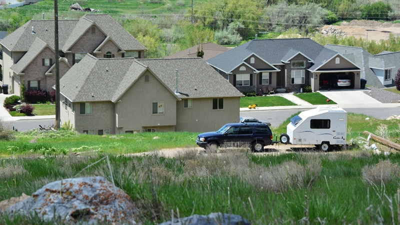
To avoid loosing my footing and falling into a ravine, you also need good balance. So every other day I walk the rails some, working at being able to do a good distance without falling as I could as a yougster–when I could also even jump back and forth without falling. I won’t go that far with a pack, but I am working on my balance too, near where my Cabin A trailer is parked in American Fork, Utah.
I backpack with purposes that make it interesting and a lot less painful, like: Always having a sharp eye out for wildflowers, mushrooms, animals, birds, what I call “textures of nature,” or even…..Big Foot….do you see him in the shot below?
You’ll notice it was a bit dark….like as though I was seeing him in a dream when resting and dozing off on the trail…….
……but also noticing carefully the difference between good mushrooms, and deadly poisonous ones, like Gray Panther we see above…….
and recording them with my camera to enjoy forever, and be able to SHARE with all of you.
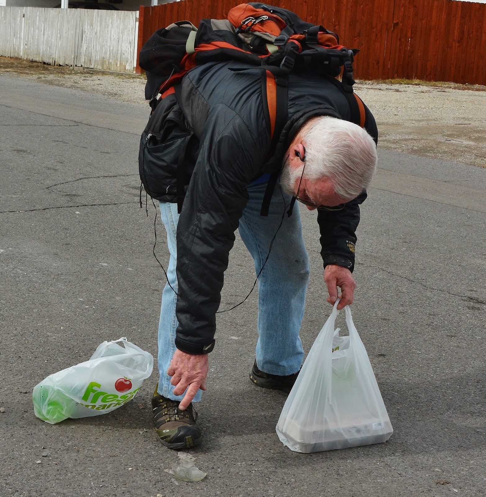
Likewise I exercise with purposes too, one of which is to pick up things that might cause one of you to have a flat tire…I’m trying to be “MY BROTHER’S KEEPER!” So below you see me bending over to pick up something that could do someone a lot of damage–with the benefit to me of doing MANY BENDING EXERCISES!
In this case it happens to be part of a broken bottle that could not only give someone a flat tire, but totally ruin the tire….so I pick it up to add to my collection.
My “Winter collection” is more than 10 lbs. of all kinds of stuff,
Much of this could puncture or ruins tires of my American Fork neighbors.
While I have benefited by maintaining my strength,
HOW MANY HAVE I SAVED? HOW MANY BENEFICIAL BENDING EXERCISES?
Also many coins–some very old. I’ve got to clean them one of these days.
At 16 years old I had a dream that I would be dedicating all my “riches” to helping some needy people. Will the “RICHES” come from one of these coins?
By now you might be thinking like many who see me hiking around town with a pack on my back, stop and offer me handouts, or offer me a ride. I joke with them about not being a “weird old guy” …..
…….rather, exaggerating a lot, saying “I’m an eccentric millionaire!” Now the dirty little secret is out that likely I’m the one who needs to somehow become …….a millionaire!
Among the collection are also a few square nails…….very old, like used by the early 1867-1880 Tie Hackers.
SO, I SAVED THE WORLD (of American Fork) by helping many avoid a flat or ruined tire!
……..but, among them is one that is separate…down to the left as I missed it!
I forgot to take a picture of the flat tire, so this one was photo-shopped to show I SAVED EVERYONE ELSE, BUT COULDN’T SAVE MYSELF! So, off to the repair shop………..
……..and WOW, how they took care of me!
I SAVED THE WORLD, but NOT BEING ABLE TO SAVE MYSELF I NEEDED THE TIRE FACTORY So, in American Fork, go to Zack, Quin and the shop at: 109 East 100 North
Hey you guys…..since I apparently can’t SAVE MYSELF, don’t throw screws or nails onto the street, and if you see any, PLEASE PICK THEM UP!
NOW TO THE “OPPS MATTER OF LIFE and DEATH” and MORE SPRING COMEBACK MIRACLES Note: Further along where I mention the matter of “life and death” I’ll insert a link our friend Dean Michell from the Division of Wildlife Resources sent to give us more information on this important subject of “Rattlesnakes”
In my last post I suggested you get a friend or your kids and go on a hike in the foothills of the Wasatch and observe with awe the evolution of Spring. Let me add ONE WORD OF CAUTION!
All of us should remember that with the warming of Spring snakes awaken and come out of their winter hibernation–including RATTLESNAKES. This is a time when they also begin shedding their old skin and it is a time when they are basically blind, and their rattlers are ineffective. They are covered by their shedding skin, and are soft and don’t produce the usual rattle or buzz. Yet they know when there is danger and sense the presence of YOU, or ONE OF YOUR KIDS and will blindly strike assuming they are in danger.
It is perhaps rare to have such an encounter, and I haven’t experienced it this year, but I did once and have been cautious over all these years. Let me tell you that story.
It was back in the 80’s on May 15th when I decided to climb Little Squaw Peak (north of Squaw Peak and Rock Canyon east of Provo, Utah). Just as I approached the peak I stepped between two bushes and luckily saw just in time a rattler that awkwardly tried to strike at me–“awkwardly” as his shedding skin slowed him down. I took another couple of steps towards the peak, covered with leafing out brush and there was another rattler–so I actually can’t say I climbed Little Squaw Peak. I headed down with a lot of care and twice more jumped just in time, once as a rattler on each side of me tried unsuccessfully to get me. Enough said that I went down the mountain a lot more carefully than I had gone up, and I’ve been careful since. Five rattle snakes in a matter of just a few minutes will have you watch out from then on. None of them were capable of producing the warning buzz.
Only one other time in our foothills have I encountered a rattle snake and that was on the Y Trail. It was later in the season and he used his rattle. I actually captured him and had him in a cage for a while, as I had also done when working on a Wildlife Project in the West Utah Desert where many times rattle snakes were encountered.
So be careful, and tell your kids about the danger. It’s not likely kids will pay attention, but it is also a good idea in the Spring to wear long pants, like Levis thick enough to give you some protection.
DON’T LET MY WORD OF CAUTION SCARE YOU INTO STAYING HOME AND WATCHING TV. JUST BE CAREFUL! It is also a great idea for you and your kids to learn about rattle snakes, and what to do if you do have an encounter. Remember Google is a great tool.
Dean Mitchell from the DWR sent the following: Hi Cordell,
Glad to hear that you’re healing nicely and getting in shape for the High Uintas. I really enjoy reading your posts!
Your last post contained a great reminder for hikers and backpackers about rattlesnakes. Thanks for reminding people about being aware while enjoying Utah’s landscapes.
This information, as well as a lot of other information about wildlife awareness and safety, has been compiled by a program called Wild Aware Utah. Check out the website at: wildawareutah.org
The website contains information about living with cougars, bears, moose and many other species. More information is being added regularly.
Hope to see you on the trail this summer!
Dean
Dean Mitchell Conservation Outreach Section Chief ——————————————
Utah Division of Wildlife Resources 1594 West North Temple Suite 2110, Box 146301 Salt Lake City, Utah 84114-6301 —————————————— Office: (801) 538-4816 Fax: (801) 538-4709 deanmitchell@utah.gov http://www.wildlife.utah.gov
NOW TO MY CONTINUING EFFORTS TO GET READY TO BACKPACK IN THE HIGH UINTAS and EVEN RUN HALF MARATHONS AGAIN?
NOTE: For the first time in a long time I’m actually jogging every day, then hiking in the afternoons. THIS IS ALL AN INCREDIBLE MIRACLE FOR WHICH I’M VERY GRATEFUL TO THE DR. AND TO THE LORD!
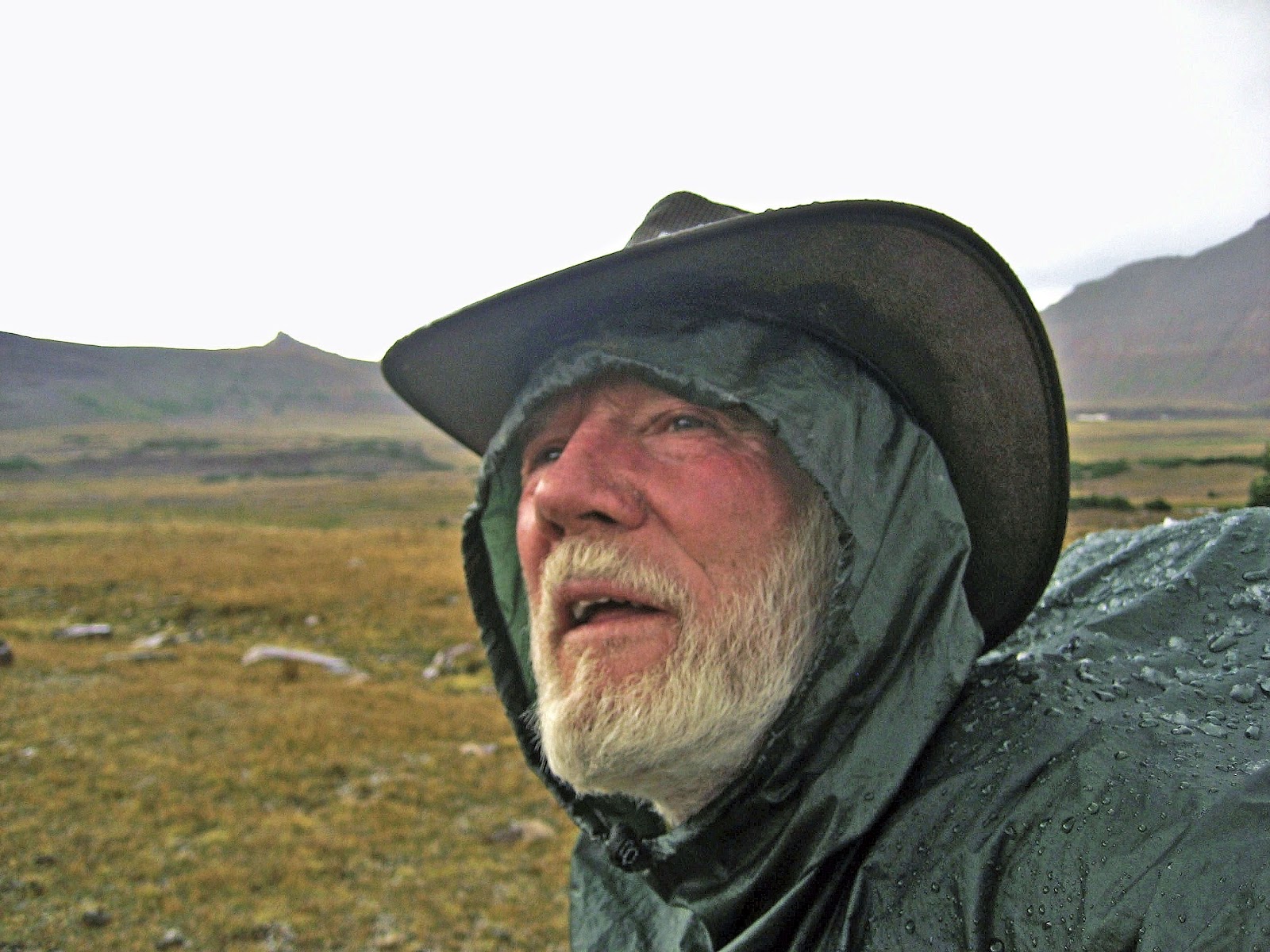
Another parking spot along the foothills for my tiny “CABIN” with interesting neighbors who must wonder about this eccentric old guy, on this hike heading for Little Rock Canyon and the Crags of the Wasatch. I won’t say much, but just show you some of the beauties I was blessed with seeing.
ONE SUGGESTION: Get your kids a little point-and-shoot camera and help them make a collection of the flowers, the rocks and minerals, and more. When you purposely look for the beauties of nature you will be amazed at how our world is full of wonder and awe and strong testimonies for many of us of our Creator and how He has blessed us.
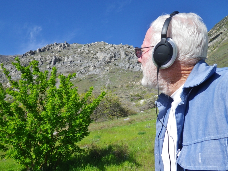
I stopped to take better photos of this shrub. Note: I have stopped using my Bose headphones in the outdoors as they block out the sounds of nature.
Meadow Salsify began blossoming just after my last post.
Now heading up the Little Rock Canyon trail where I got stimmied last Fall.
Heading for what I have called “The CRAGS OF THE WASATCH”
It’s all steeper than these photos show. The wide-angle lens flattens some the image.
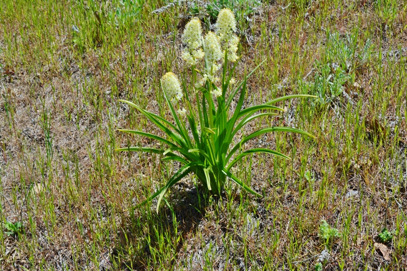
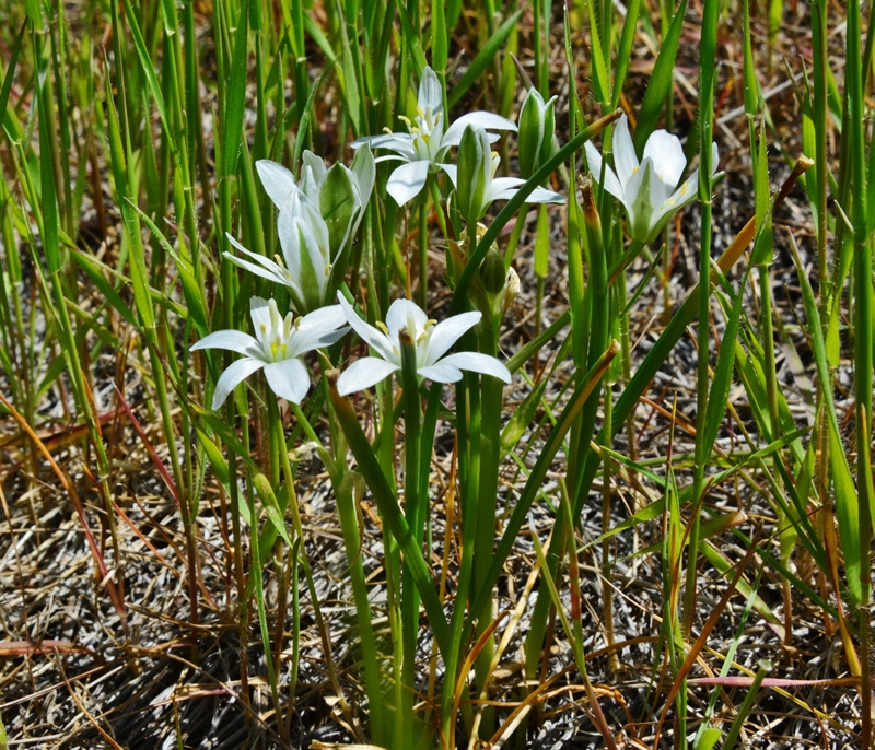
The first SEGO LILY of Spring. This is the Utah State Flower.
Game trails crisscrossing everywhere.
Keep a close eye on this one as it develops into an incredible blossom.
……and DON’T FORGET THE ROCKS and MINERALS….
…..and what grows on them.
The powder blue one is new for us. What are they?
LICHENS. Do you remember what two life forms partner up for each other’s survival?
It is FUNGUS and ALGAE that have a symbiotic relationship, each helping the other to survive.
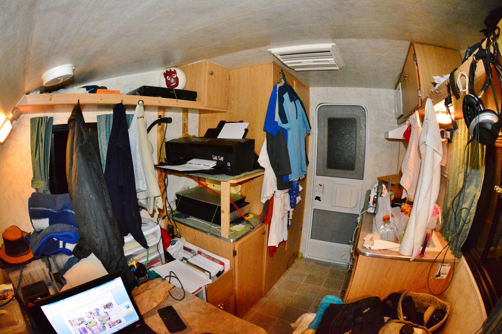
Back to the “CABIN” to put on the computer the photrographs, enhance them, discard some, and get them ready to share. Then compose a newsletter for the Guatemalan Foundation and send via email to our list, and then print for those we don’t have emails for and have it ready to send tomorrow. The Foundation’s projects among needy Mayans are managed by native volunteers who do a tremendous amount of good, but need our support. I have done this volunteer work for 50 years and now do it from my Cabin and from Pulbic Libraries where we get free internet access. Check it out at: www.guatemalanfoundation.org A handful of our “High Uintas Friends” make important contributions and repeat them several times each year.
Parked at Walmarts in Springville, using the Honda generator to run the printer. Our first electricity on our plantation in a remote area of Guatemala in 1968 was also provided by a small Honda generator. Looks like we have come FULL CIRCLE!
For the first time in years I’m hiking and working at getting back in shape with NO PAIN! I can now put my socks on without going through a stretching routine and getting down on the floor, and a few days ago I was even able to properly and painlessly cut my toenails!
A million thanks to Drs. RICHEY, JACKSON, and COLLEDGE and all the medical personnel that helped make this miracle happen.
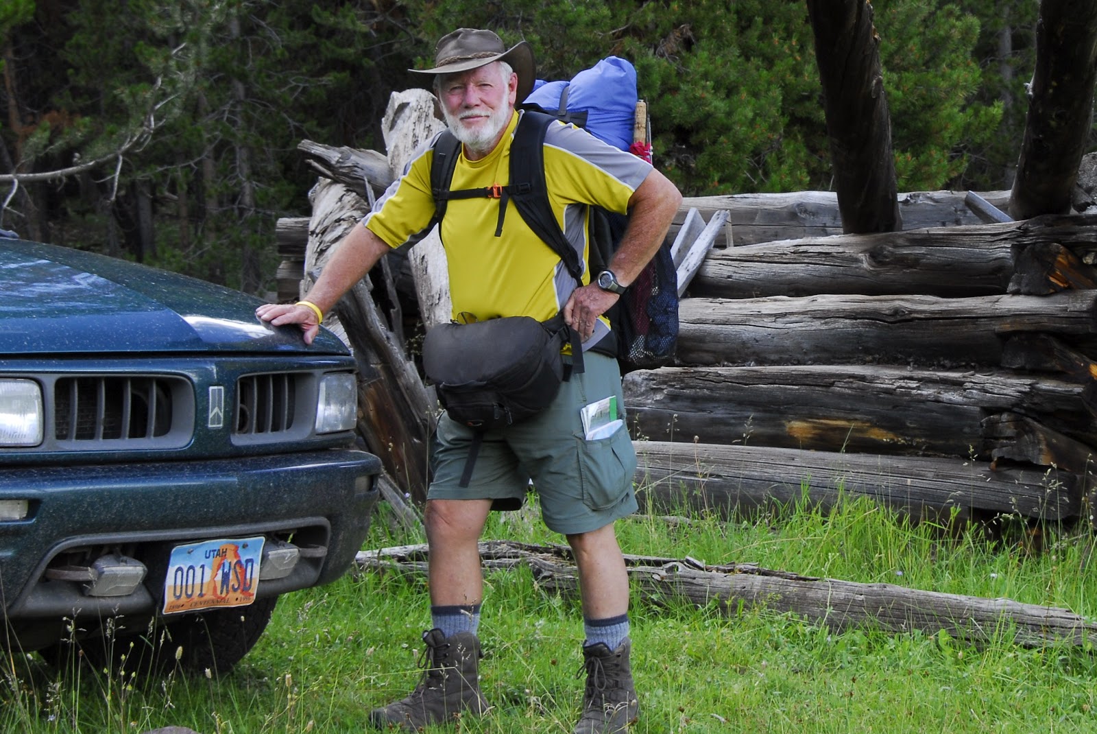
I am supposed to wait until June 1 to shoulder a backpack, but I’m going into the hills with my 15 lbs. of camera equipment, plus .45 Colt Defender, water and lunch–adding up to around 20 pounds.
Following is my first set of photographs from my Springville camp site near the Crags of the Wasatch in Little Rock Canyon.
ENJOY SPRING IN THE FOOTHILLS OF THE WASATCH — and take your kids on hikes to learn of the great awakening in the outdoors.
MY “CABIN” IN THE FOOTHILLS–soon to be in the High Uintas
VESTIGES OF 2012
Brilliant green creeping up the mountains–GRAB YOUR KIDS AND GO HIKING.
Seemingly a bit scarce and drab still–but all of a sudden a stunningly green tree appears.
Then look down amidst the developing green at our feet and look for the miniscule. You’re wrong! There are flowers there, I promise you. See below.
Take along a magnifying glass for the tiny but beautiful little flowers an 1/8th of an inch small.
Help your kids focus on the small incredible beauty most never see. I do my best to zoom in for you.
Many plants are just sprouting. Look for them and their beautiful textures and keep them in mind for your next hike to see how they develop.
Help your kids look down into the heart of the plants and see what it is sprouting, and what it might become by the next time you go hiking.
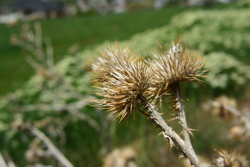
What will this become? You will likely be surprised how incredibly beautiful it will be. Have them notice the spines–have them be careful with some. What will this one develop into? Will it have a flower? Make sure and folllow the same trail in a week or so, and later through the summer.
Likely the most common plant of the foothills is what we call “scrub oak,” the real name being “Gambles Oak.” The leaves are beginning to sprout. Notice the orange growths on the rough bark. What is that? It is one of the most prolific and fascinating life forms in the outdoors, what we call Lichens–at the end of our hike I’ll show them on all the rocks and tell you a bit about them. Hey, you parents, Google the word and tell your kids about this incredible life form. I’ll mention just a bit at the end. Is the wood good for anything except firewood? After I show the beautiful leaves, I’ll show you a thing or two I do with it.
Did you ever imagine scrub oak leaves could be so beautiful? How will they look in the Fall? Make sure and go on another hike or two then. Now to one beautiful creation I make with Gambles Oak. Have you ever seen a more beautiful natural, rustic frame? Yes, it’s made from humble scrub oak. A secret: The corners are the tricky part. They don’t have to be square or rectangular as you can see below framing a beautiful Native cutthroat trout from East Red Castle lake .
Now to something beautiful, but very controversial as seen below.
It’s called:
Donkey-tail or Myrtle Spurge, usually just SPURGE.
SPURGE is considered a noxious weed that is spreading along the Wasatch Front. Among many it causes a very serious allergic reaction, so DON’T TOUCH IT! Google it to learn more.
But, there’s no denying that it is beautiful and get’s even better on zooming in.
Probably the most common seen from the outskirts of town.
Brilliant orange catches our eye. What’s it’s name? Maybe a good project would be to take along the Audubon Wildflower Fieldbook and learn the names.
We haven’t got very far up the hill and already seen so much. I confess that I stop so often, especially on my first hike in an area, that I don’t really cover very much distance.
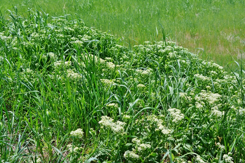
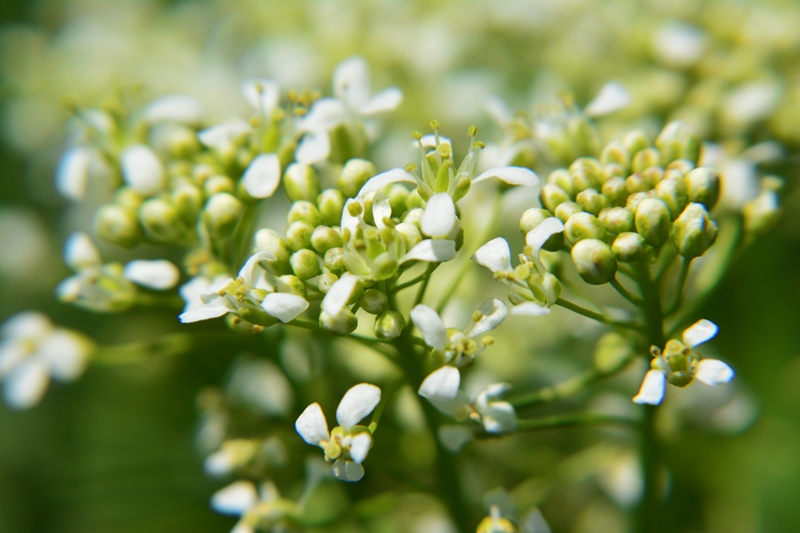
This beautiful flower is everywhere in the early season.
It gets more beautiful the closer you get. How long will it last?
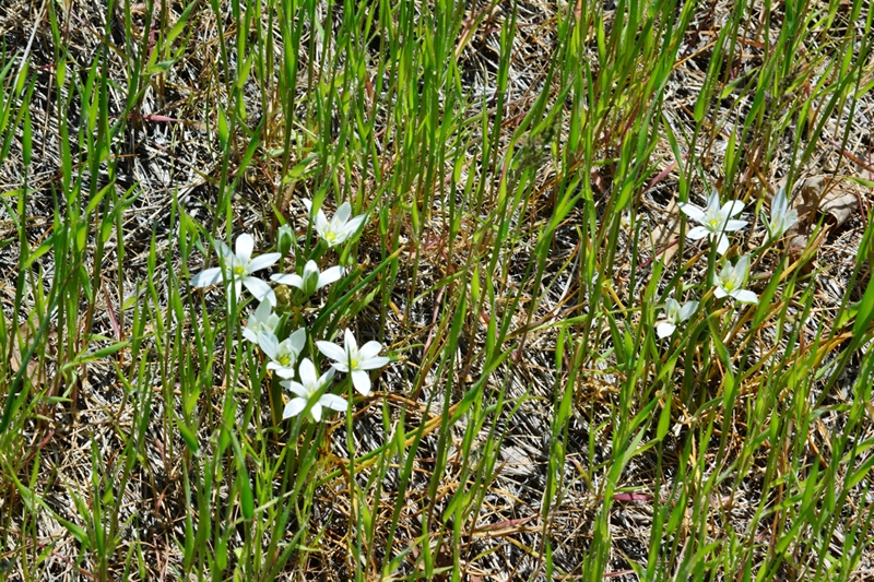
Small, but with beautiful color.
Here’s the same flower in a different, and earlier stage of development.
This is another early season flower that doesn’t last very long.
As is the case with many of these flowers, they can also be seen all around the cities. I’ve seen one home lot with this flower as thick as dandelions. I’ll get a shot of it and insert tomorrow.
This plant doesn’t seem to have what we can call a flower, but just wait…..
Keep an eye on it as the season progresses, and you will see bursting out of each bud a profusion of what is likely the smallest of the wildflowers.
This is one of the Utah varieties of vetch. Next you will see it in another color.
Sorry about the sun-spot. Look past that and see this shrub’s beautiful blossoms.
Get closer–zoom in.
Now to what might be the most fascinating life form of our hills and mountains: LICHENS. Of course you should have also been helping your kids notice the incredible rocks and minerals of the Wasatch. For more on that see my COMEBACK YouTube Video #15, and use the 70 rocks and minerals shown there to also help your kids appreciate the wonders of our hills and mountains.
The splotches on these rocks, everywhere from dull unattractive ones to brilliant orange and yellows are LICHENS.
Very slowly these living organisms help break down our rocks–don’t stand around and try and notice the changes, unless you plan on being a few million years old!
There are many thousands of varieties of lichens from our deserts, foothills and right up to Kings Peak.
It is a partnership form of life in which a fungus combines or cooperates with an algae, or visa versa, to make life possible for both. Scientists call it a “symbiotic relationship.” Google it and learn a few details so you can make this fascinating life form literally come alive for your kids.
Ones, like this brilliant orange, and yellow below, were used by the Indians, or to be politically correct, Native Americans, as dyes and paints.
We got a bit of exercise and a big dose of inspiration from the beauties of the great outdoors.
Now back to our little camp and get all of these shots on the computer, and internet to share with all our friends.
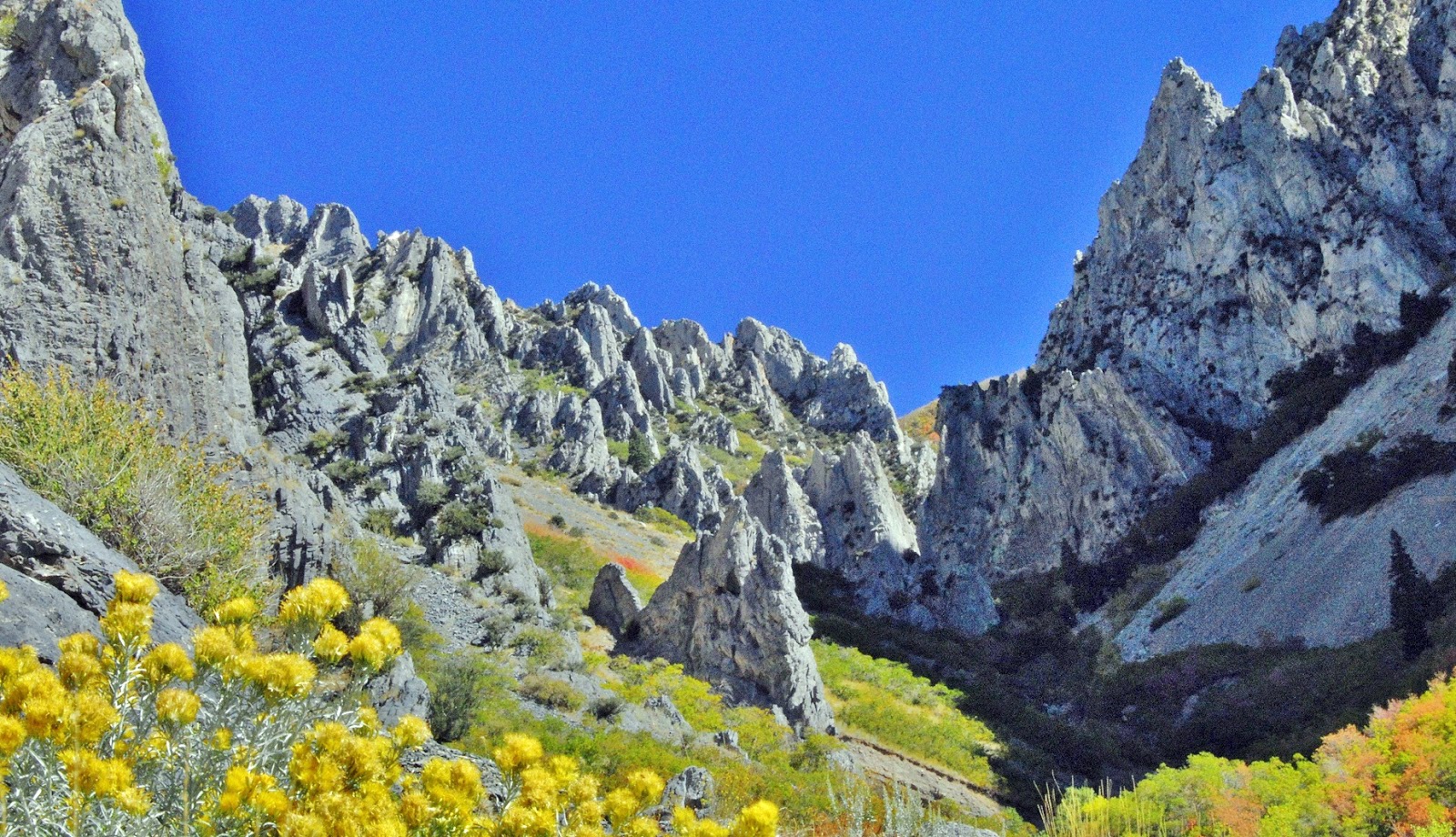
GOODNIGHT SPRINGVILLE and UTAH VALLEY. Next up we begin getting stronger going up the mountain a bit, and even up the Little Rock Canyon trail–that last Fall I couldn’t manipulate when I was trying “to fake not being a cripple”– to see what unique shots we can get literally surrounded by the Crags of the Wasatch you see below in the Fall.
Click below to see the 10 minute long YouTube Video #9-Part 1-PREPARE or ELSE….
I now have posted the details of my plans on the 2012 Backpacking Schedule page. The topographical maps and elevation profiles are the same as for last year. A couple of the routes on the maps are in reverse order of what I will actually do, but the details are the same.
PHOTO/ESSAY“PREPARE OR ELSE…..”
(scroll down and enjoy at your leisure)
NOTE: You can search for any item or area mentioned in this report using the search machine at the top of the page. For example: Searching for “Crow Basin” refers you to 4 reports and any comments that have been made in this blog, and the YouTube video. Searching for “tie hackers” gives 16 references, etc.
As I did in the YouTube video #9, I’ll share in this photo/essay some of what I have learned in backpacking 1,500 miles in the High Uintas Wilderness since 2003.
I’ll be in my 77th year when I head for the High Uintas on August 1st and will be prepared for whatever…..with Spot Tracker and satellite phone within reach. Tune in to KSL OUTDOORS RADIO every Saturday morning at about 6:35 a.m. to get my report via sat phone provided by SkyCall Satellite and Russ Smith and listen to reports from outdoorsmen from all over the world. Check this website (blog) in late July or August to get the link to follow me on Google Earth via the Spot Tracker.
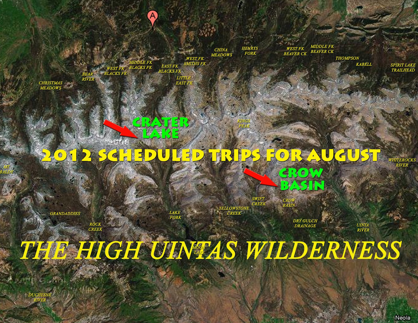
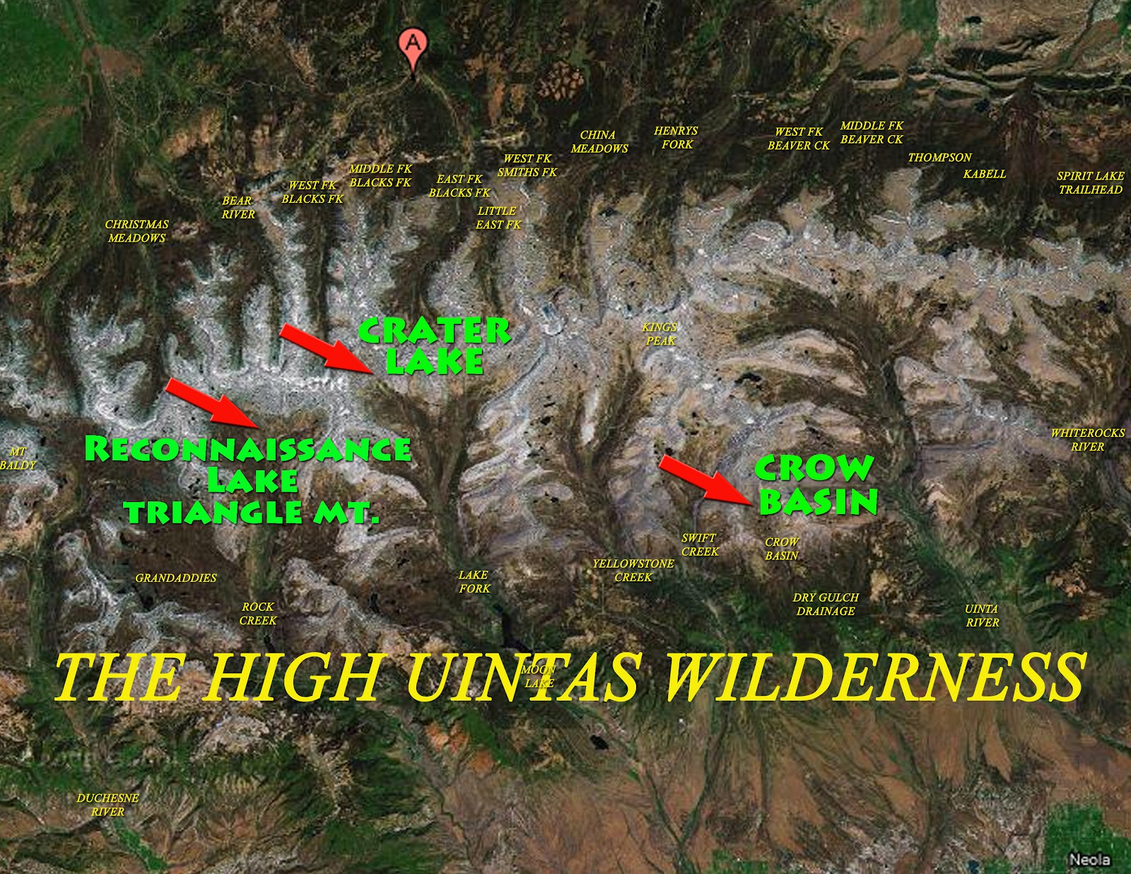
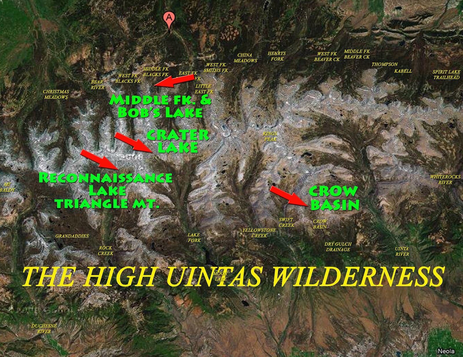
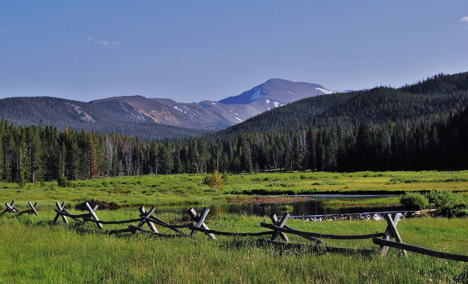
First up let’s take a quick glance at the 4 trips I plan on taking during the month of August,. I’m waiting until August this summer as there will be fewer mosquitoes, the weather will most likely be better, and the streams low and more easily forded. Of course I’m still dealing with my High Uintas Wilderness Project, so the trips will be in the Uintas.
The trips will not necessarily be taken in the order we outline here–in fact the last one will for sure be the first backpack taken to begin the season. Here we begin with the one that is impressive due to having wonderful aerial photographs. from Jonathan Jaussi–thanks, Jonathan.
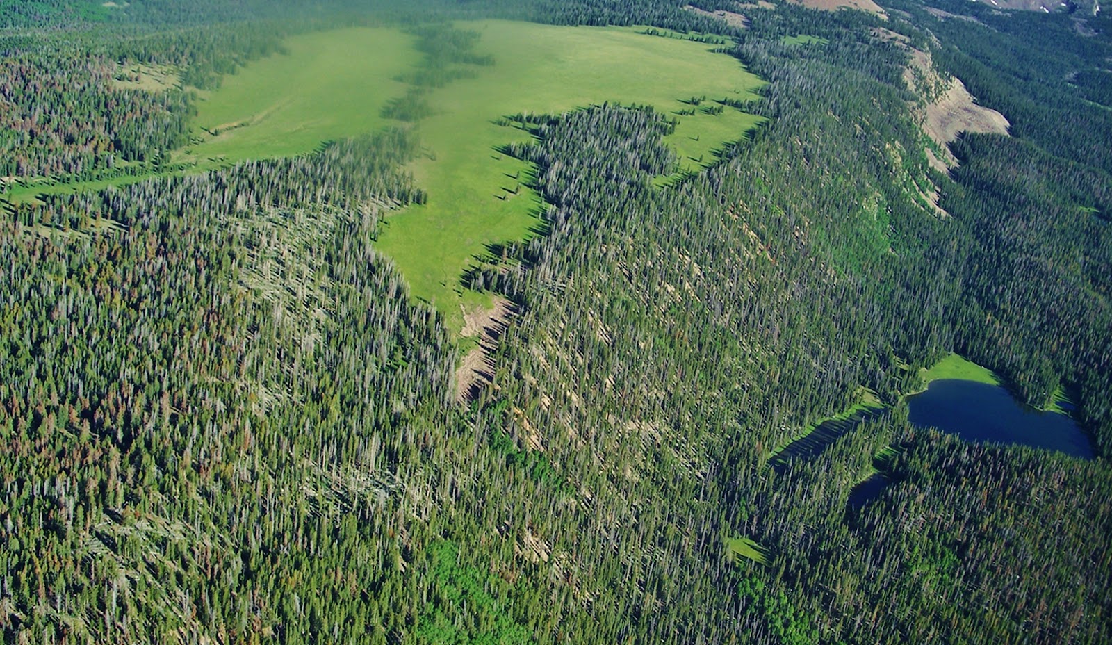
Crow Basin is part of the Dry Gulch Drainage, the smallest in the High Uintas. It is sandwiched between the Yellowstone and Uinta River Canyons on the South Slope. The view above is looking north up Crow Canyon with12,194 ft. high Flathead Mountain on the right, and Mt. Emmons dominating the scene. Emmons is the 4th highest peak in Utah and the Uintas, at 13,440 ft. Following that ridge to the left you come to 13,387 ft. Mt.Jedediah, 5th highest, and eventually Utah’s highest, Kings Peak. at 13,528 ft.
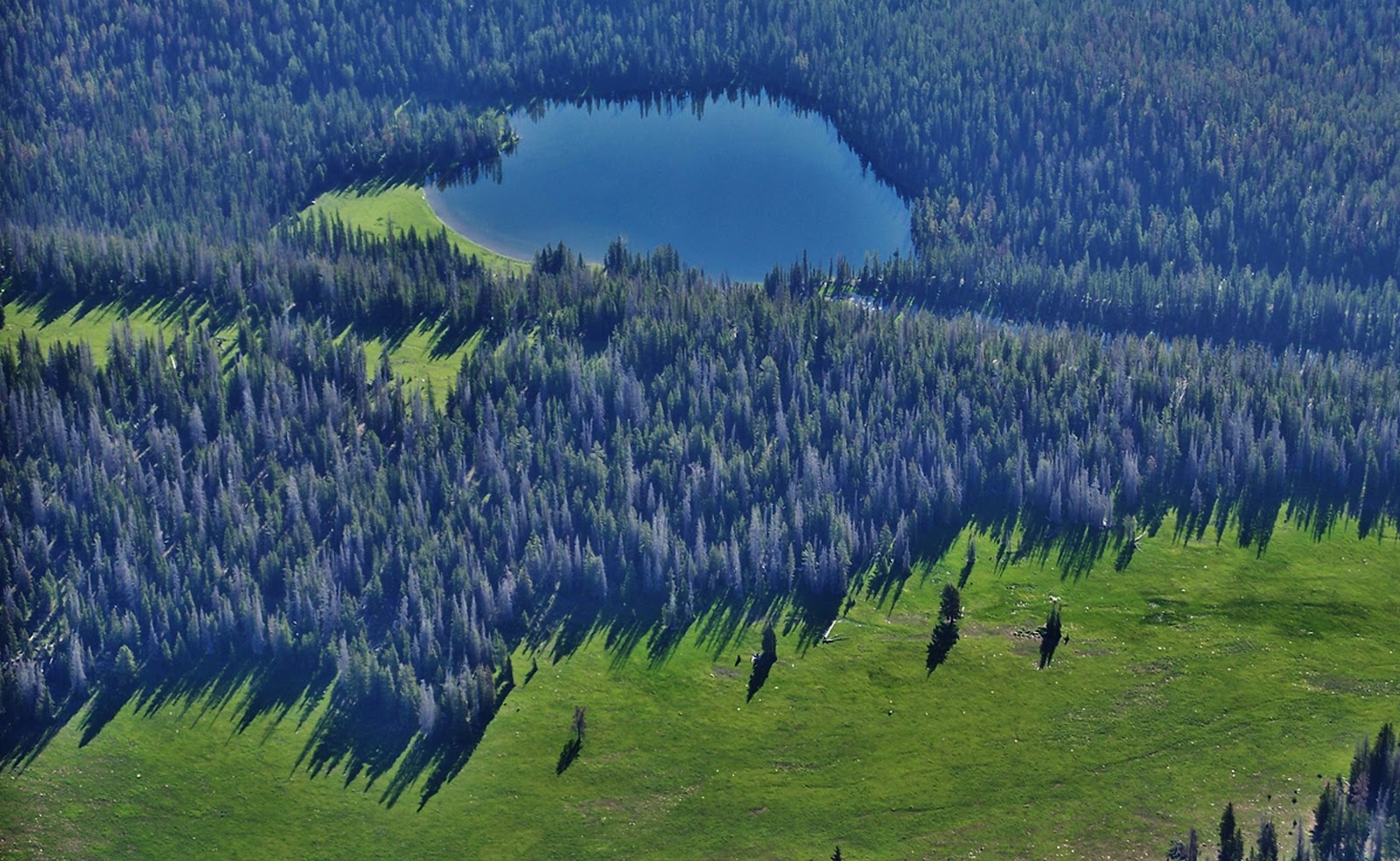
Above we are looking south down Crow Canyon seeing some of the 9-10 lakes in the basin that have fish.
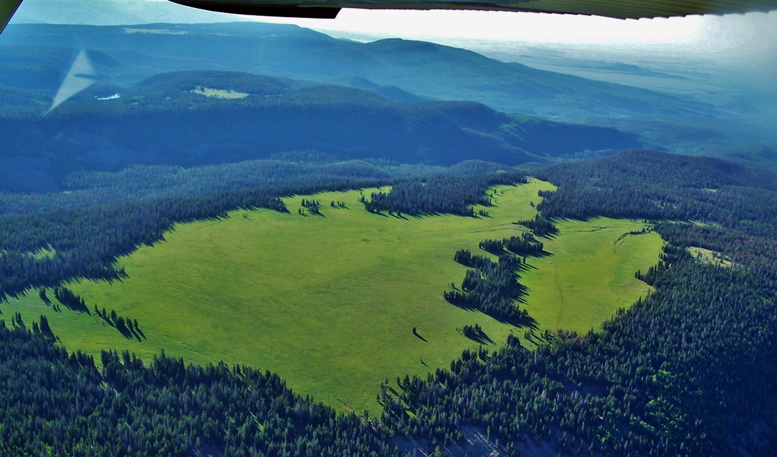
Here we are moving to the west seeing above to the right Jackson Park. Right in the center of this photograph is the escarpment I got to last year which kept me from going down into the basin. Along this same escarpment to the left, or south, you get to areas of pines and aspens where perhaps one could get down into the canyon although very steep and rocky.
From up the ridge we look south towards beautiful Jackson Park.
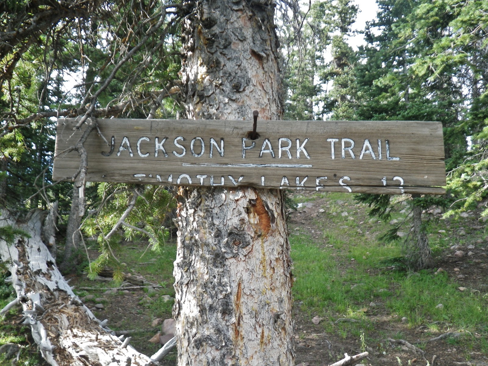
We are moving towards the west looking southeast and if you look closely to the right of the pines that divide the right quarter, you can see a fine line that is the trail coming out of the pines where is found the only sign in the area I insert below. (NOTE: If you can’t see said trail, click on the image to enlarge.) That trail continues up into the Swift Creek drainage, then forks, the trail going north west climbs 11,613 ft. Bluebell Pass, the right fork takes you to the Timothy and Carrol Lakes a distance of 13 miles.
This sign is next to the only spring in the area. Last year I camped near here.
Now we have moved around to the southwestern edge of the Park. In the middle is where I found the only water in the area that comes from a spring at the edge of the second grouping of pines.
We’re looking at Jackson Park from the south with Crow Canyon on the right. Possibly a good pathway down into the canyon is from the far southern point of the park in the lower middle of this photograph, and from there swing up the canyon to the basin.
I will likely first attempt getting down into the canyon from this southern part of Jackson Park.
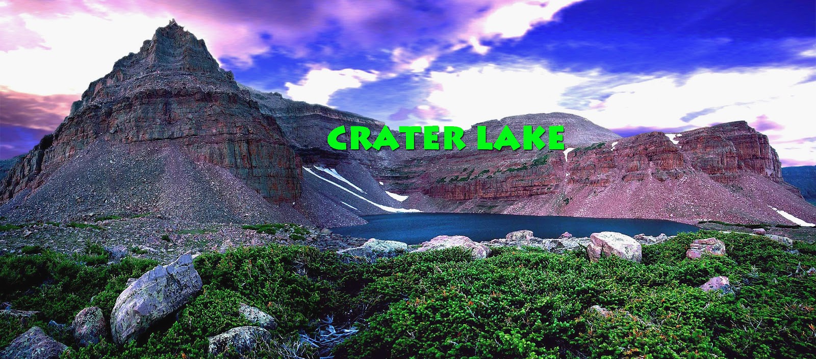
Another of my priority trips is to Crater Lake a truly exotic area I’ve never seen a picture of in any of the guide books. You can come up Lake Fork from Moon Lake on the South Slope, a gradual elevation gain hike of around 20 miles.
A shorter, but a much more adventurous and spectacular route of 16 miles is from the East Fork of Blacks Fork Trailhead on the North Slope. In the upper reaches you climb 12,165 foot high East Fork Pass (my name) with 13,219 foot high Mt. Lovenia dominating the scene.
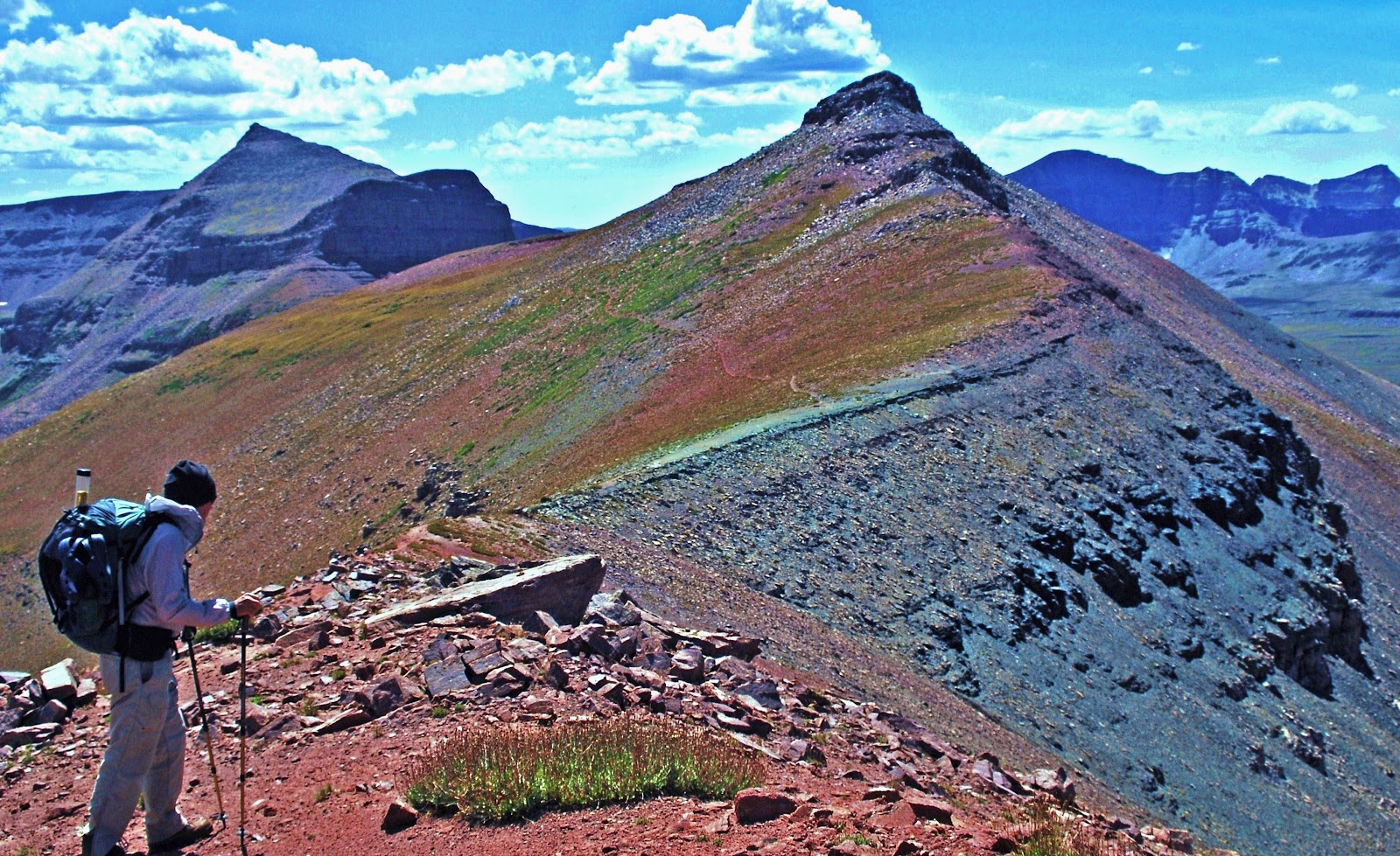
Here I am coming from Mt. Lovenia, with the trail (and pass) to the left.
My buddy, Ted Packard is looking from East Fork Pass towards Red Knob. You can see faintly the trail along the slopes of Red Knob winding its way towards the pass along the spine of the High Uinta Mountains. You actually go down 465 ft. in elevation to get to Red Knob Pass.
We are now on 11,700 ft. Red Knob Pass looking towards the Dead Horse area at the head of the West Fork of Blacks Fork on the North Slope. We will follow the Higfhline Trail to the left down into the South Slope’s Lake Fork Drainage.
Now on the South Slope in the Upper Lake Fork Drainage’s arctic tundra we see our objective in the middle of the photograph–Explorer Peak in the dead center at whose base in a glacial cirque is Crater Lake. Once switch-backing down from Red Knob Pass you go off-trail but as you can see it’s easy hiking.
Here we are at one of the jewels of the Uintas–its deepest lake at 147 feet. For years I have yearned to get up on the ridge to the north, or right, and bivouac there to attempt getting a spectacular wide angle photograph of the lake and Explorer Peak. This trip will likely be the last of the summer, and depending on how I’m doing, I might just go from here east towards Porcupine Lake and Pass, even climbing the pass to test the unnamed lakes above North Star Lake in the Garfield Basin, then backtrack to Squaw pass and the alpine lakes of Little East Fork of Blacks Fork, where Bigfoot has been reported seen more than in any other area. From there back to the Trailhead. That could be more than I can chew, but we’ll see……stay tuned.
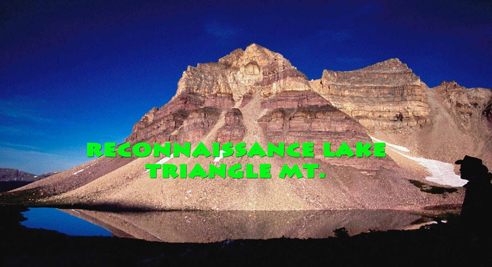
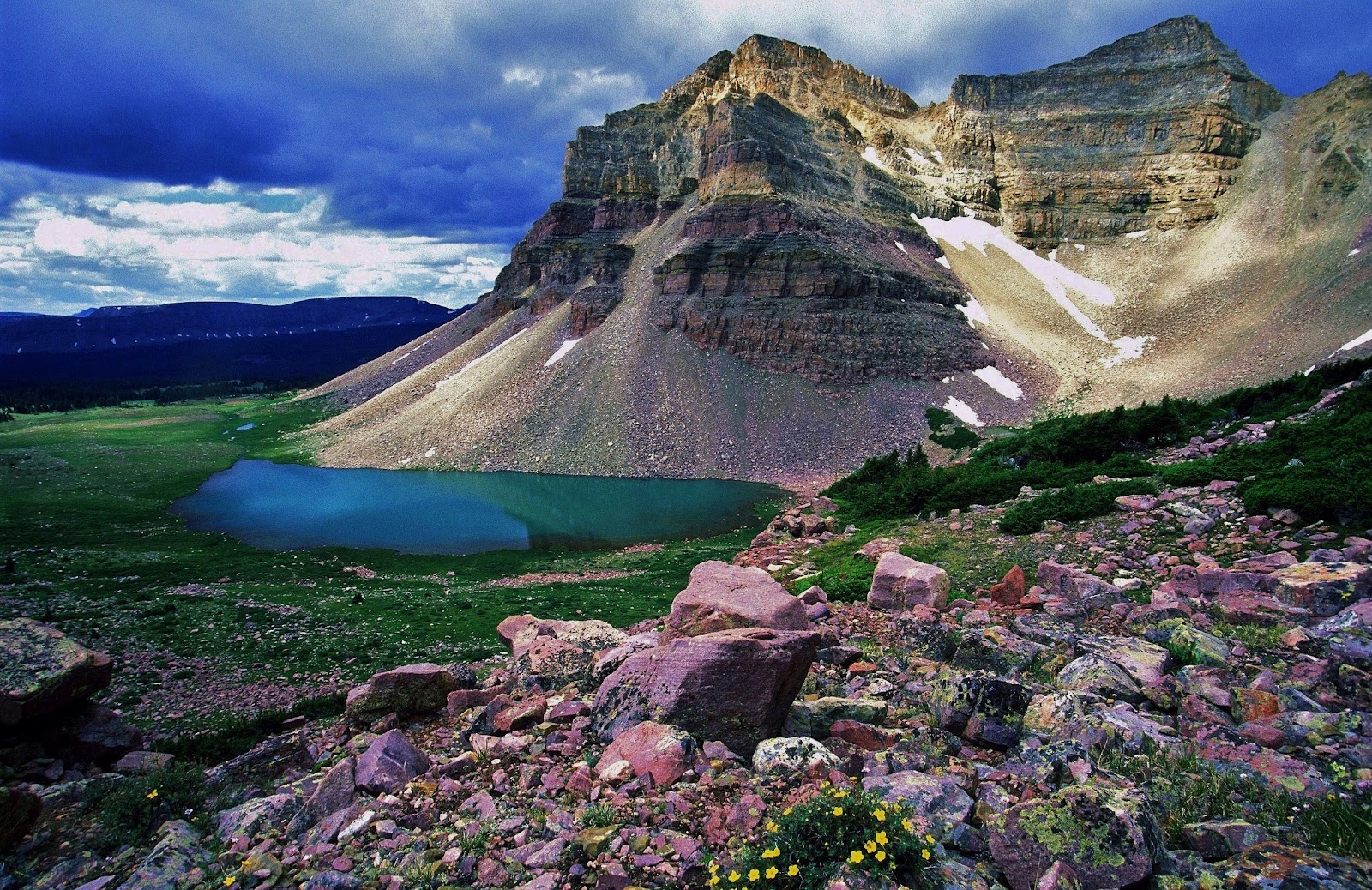
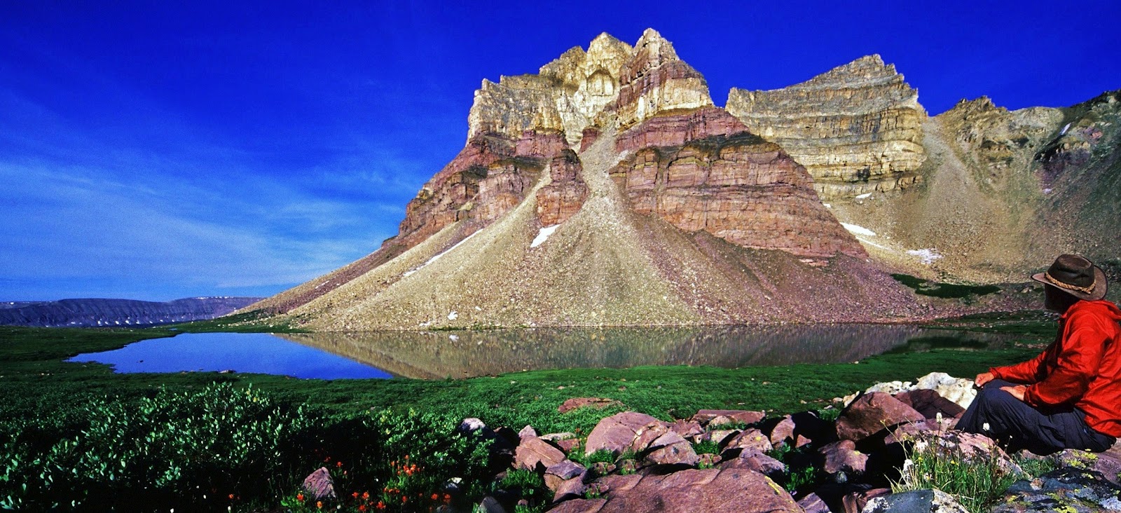
The 3rd backpack will be to the off-trail Reconnaissance Lake and Triangle Mt. area at the head of the Rock Creek Drainage. Access is from the Highline Trailhead on the Mirror Lake Scenic Byway. The hike leads you up over Rocky Sea Pass and east to the Rock Creek Drainage. I will follow the above timberline trail that circles the far reaches testing the waters of several remote lakes and on to Reconnaissance Lake–about 20 miles from the Trailhead.
For me this beautiful alpine scene rivals Red Castle as the most beautiful mountain scene in Utah.
Triangle Mountain is 12,385 feet high, with the lake above timberline at around 11,150 feet elevation.
I have been to this area 3 times, but love it so much that I hope to be able to make it one more time before considering hanging up my backpack.
While in this wonderful area I will attempt a few extras, like, climbing the saddle to the east to get photographs far below of Allsop Lake and the East Fork of the Bear River on the North Slope–such as was done by my friend Doug Perry and his boys a few years ago. From here I will also get back on the trail and follow it east to Ledge Lake and continue towards Dead Horse Pass, detouring off trail briefly to get improved photographs of Continent Lake (you can see what I’ve got on my “1000 Mile Whirlwind Backpack in the High Uintas “)
The 4th area we will enjoy seeing here, but which will actually be my first backpack of the season, is to little visited and mysterious North Slope’s Middle Fork of Blacks Fork, part of my purpose being the pursuit of greater understanding of the “unsung American heroes” the TIE HACKERS, without which the West wouldn’t have been won. Pretty bold statement, right?
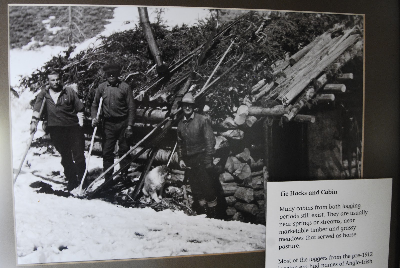
For those who don’t know what the heck I’m talking about, permit me to give a very brief explanation. Above we see a tie hack cabin moved piece by piece from the Steele Creek area and put back together at the Mt. View Ranger Station to the north in Wyoming.
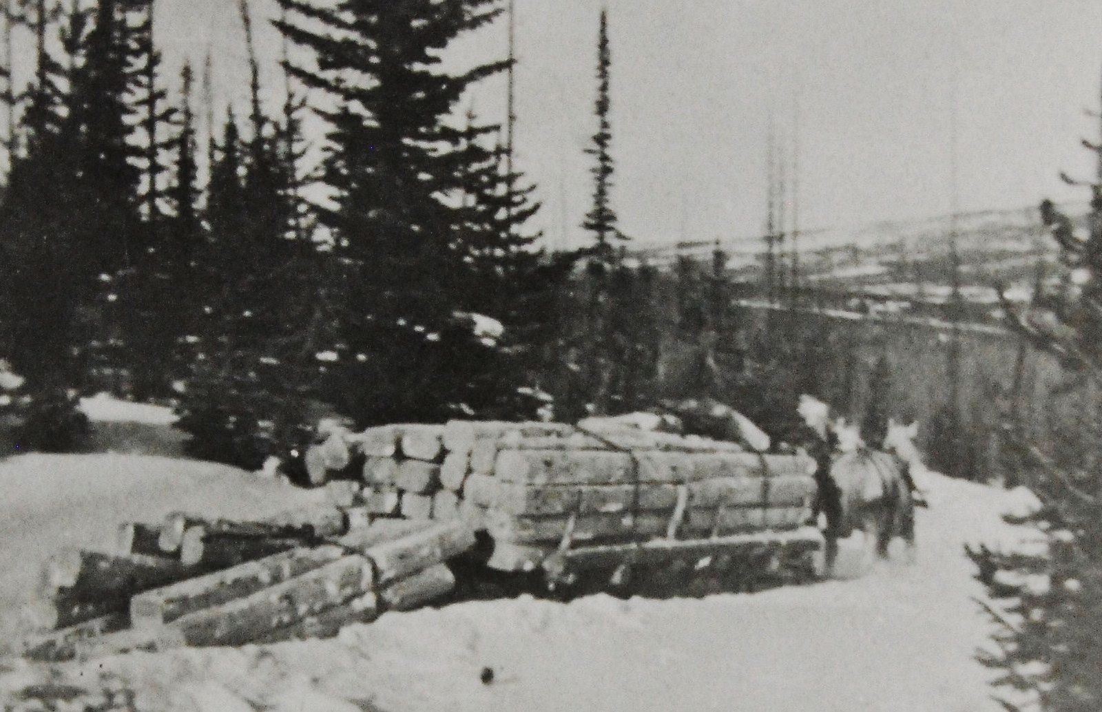
In 1867 the Transcontinental Railroad was being constructed to the north of the Uintas in Wyoming and millions of railroad ties were needed.
Rugged Irish immigrant lumbermen were sent into the Uinta’s North Slope, and other areas to work 12 months a year making railroad ties with their broadaxes.
Much of their work was done in the winter time when they could more easily transport the ties using sleds.
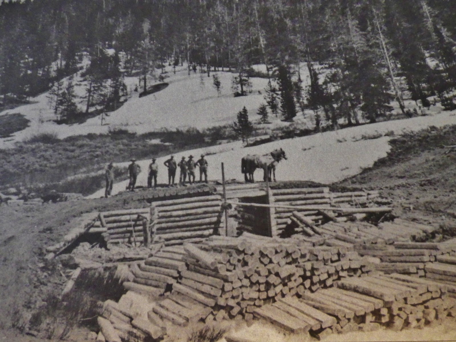
They were accumulated in the river and creek beds behind what they called “splash dams.” When the thaw came and the lakes behind these temporary dams filled up the dams were blown with dynamite and the ties were washed or “splashed” downstream into Wyoming where they were picked up by the railroad.
These tough tie hackers built their cabins, and small communities in the lodgepole areas of the Uinta’s North Slope.
The area where I have found and photographed the most ruins is an area that is never mentioned in any of the books, scientific studies, and Forest Service reports. It is the little visited beautiful Middle Fork of Black’s Fork that leads to 13,165 ft. Tokewanna Peak. This will be my 3rd trip into the area. This trip, among other purposes, is to begin getting my mountain legs and lungs in shape–acclimatizing myself for higher and more difficult elevations.
For the first couple of days I will be at elevations between 9,000 and 10,000 feet crisscrossing back and forth across the canyon mapping and photographing all the sites, and dating all of them–either from the early 1867-1880 period, or the 1912-1935 period.
I’m just showing 2 sites here of the dozen or so I have found and photographed. The one above was quite large and possibly a dinning hall, also used by the tie hackers for dances and social gatherings.
That task accomplished, and hopefully acclimatized, as in recent years I have experienced some High Altitude Sickness, I will then move up the canyon towards Tokewanna Peak and Bob’s Lake.
Bob’s Lake is on the right side of the ridge coming off the peak. Three smaller lakes are found in the drainage to the left of the ridge.
Bob’s Lake will be my first objective in the high country. Three years ago I caught very strong Tiger Trout, and I would hope that they are still alive and much larger. From Bob’s Lake I will climb the ridge to the east, or left, and drop over into another branch of the canyon.
In this area there are three small lakes, two of which possibly have fish and I will test them and report.
Unless you are a young buck that has kept yourself in good shape with a lot of physical activity, you’d better be willing to work real hard at getting in shape. Hiking with a load on your back above 10,000 feet is no cake walk–in fact the stress is multiplied several times over normal hiking. If you are in your 77th year, such as will be the case with me, you have to do much, much more.
For three years I have persisted in having a job that is the perfect job for me to have a chance at being in shape. Some have called my job “the lowest in the food chain” but I have found that going on an hour walk three times a week has me going downhill. I need much more, and in my job as a “shopping card herder” I do around 7 miles 4 times a week, half of it pushing long chains of carts, jumping at the chance of doing all the heavy lifting possible with customers, and I’m known for jogging a lot to help a customer with purchases, or go get a stray cart.
Of course that’s only a part of the need. The rest I do at home putting a pack on my back and getting hours in while watching Utah Jazz games, and other things on TV. Right now, in April I’m doing it with a 50 lb. pack. That will increase up to 65 pounds as the backpacking season approaches. I also do 40 to 60 push ups during time-outs as seen in the YouTube video.
Some of you might remember what happened last season. I took 2-1/2 months off from my work to have one heck of a backpack summer.
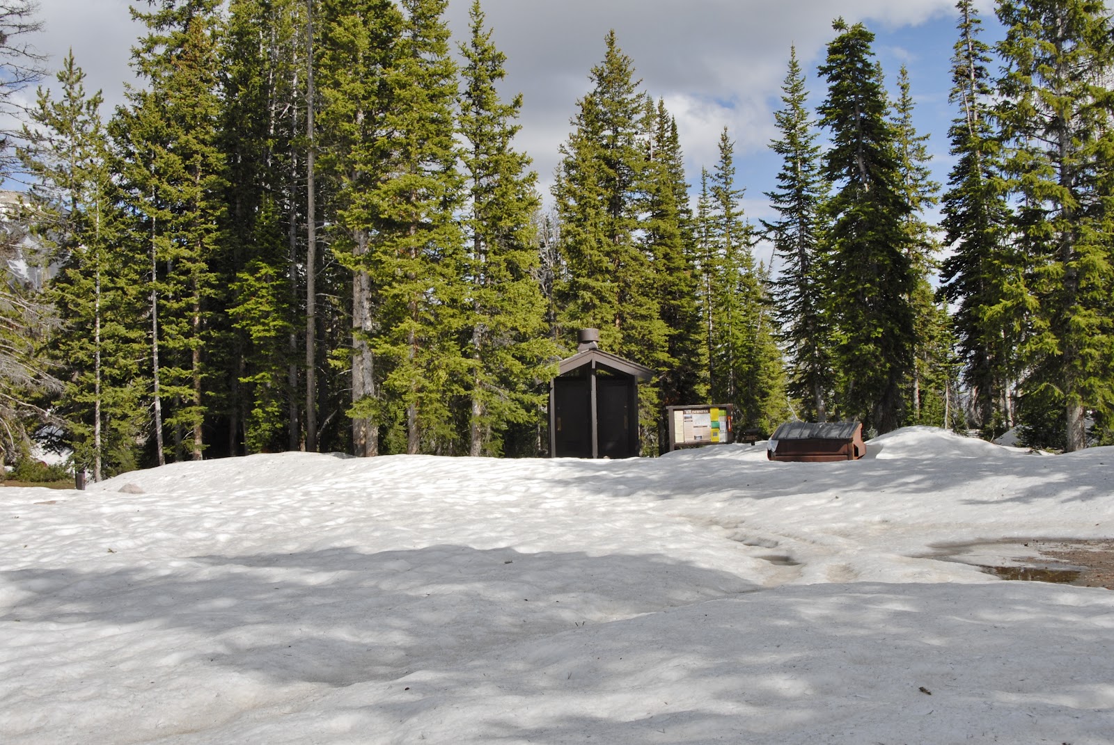
My first trip was a bust as everything was still snowed in. I drove around, took photographs, checked with the Forest Service, and did YouTube videos reporting conditions, but didn’t get any exercise.
The 2nd and 3rd trips and weeks were pretty much the same. Trailheads snowed in, roads washed out, and bridges down. The high country was inaccessible like I had never seen before. The forest Service recommended waiting until August.
I finally was able to get to a Trailhead and go backpacking, but found that a month of inactivity had really hurt me. When you’re older you lose your conditioning much faster, and have a much harder time getting it back. Being out of shape produced a domino effect–not just phsical weakness, but also my weakened condition had High Altitude Sickness slow me down.
Having a tough time, I weakened in more ways than one, and dreamed of Forest Gump running around the country for 3 years, having accumulated a following, when he all of a sudden stopped turned around and was about to speak. Someone yelled out, “Quiet he’s going to say something!” He did, saying,
I came to that conclusion too, thinking “I’m finished!”
That was after my survival experiences on the trail to Garfield Basin, and again at Jackson Park frin where I headed down the trail with a terrific thunder storm bearing down on me all the way. I moved pretty good and did the 6 miles in record time. Pretty soon, reflecting on how well I did and felt, I recalled how I’ve preached, “NEVER GIVE IN!”
So I concluded I was far from finished. I just had to keep working, working out, and next summer work right up to the day before I put on my pack for my first backpack.
Then I will be wise with that first trip and gradually get used to the extreme stress of high altitude hiking with weight on my back and keep pecking away at my scheduled trips, one by one and do the best I can, but with a foundation of hard work, and feeding my body properly as will be outlined in Part 2.
So tune in to Part 2 that will be coming in a week or so.


.JPG)
.JPG)
.JPG)


.JPG)
.JPG)
.JPG)

.JPG)
.JPG)


.JPG)
.JPG)
.JPG)
.JPG)
.JPG)
.JPG)
.JPG)


.JPG)
.JPG)
.JPG)
.JPG)
.JPG)
.JPG)
.JPG)
.JPG)
.JPG)
.JPG)
.JPG)
.JPG)
.JPG)
.JPG)
.JPG)
.JPG)
.JPG)
.JPG)
.JPG)
.JPG)


.jpg)

.jpg)
.jpg)
.jpg)

.jpg)
.jpg)


.jpg)
.jpg)


.jpg)
.jpg)


.jpg)
.jpg)

.jpg)
.jpg)


.jpg)
.jpg)


.jpg)
.jpg)
.jpg)
.jpg)


.jpg)
.jpg)
.jpg)
.jpg)

.jpg)
.jpg)
.jpg)
.jpg)
.jpg)
.jpg)
.jpg)
.jpg)