
THE ASSAULT ON “LITTLE ANDY LAKE” near MOUNT JEDEDIAH, and being ABUNDANTLY BLESSED WHILE HOPEFULLY BLESSING OTHERS! & the ACID TEST OF MY RESOLVE TO “NEVER GIVE IN….EASILY!”
****************************
UPDATE: Sept. 20, 2016, 5:30-6:00
Since successfully clawing my way up the Slide Canyon timber “chute” to the launch site, my legs have been sorer–especially my thighs–than I ever remember in my whole life, but now have to build on that & with good weather still will:
EXPLORE TODAY THE BUCKLEY MOUNTAIN TIMBER SLIDE….
& FINISH WHAT I STARTED IN 2014 WHEN AFTER A MILE OR SO REALIZED I WAS SICK WITH “SHINGLES” & HAD TO RETREAT TO CIVILIZATION
SPOT TRACKER
TOUGH….BUT MADE IT…REPORT UNDER CONSTRUCTION
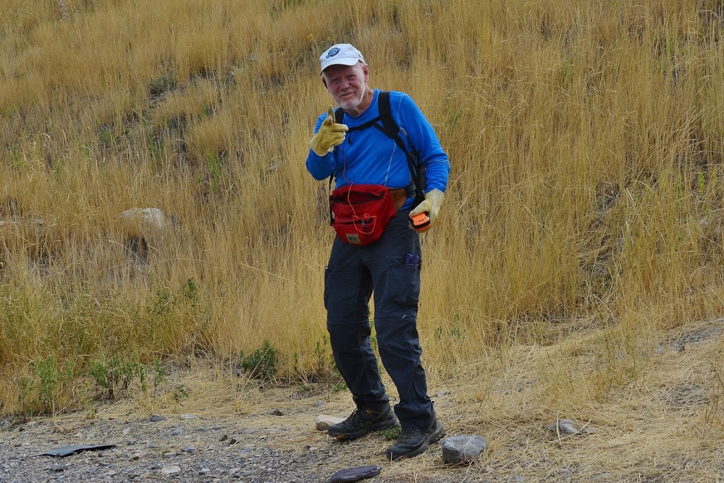
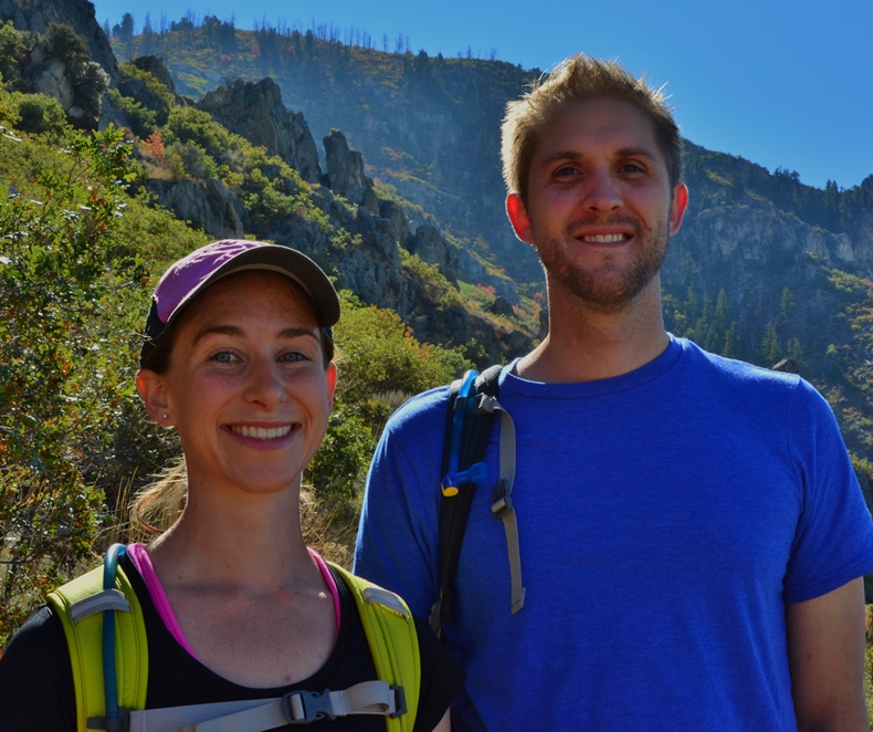
As you can see I again went prepared to protect my arms and hands from the jungles of scrub oak, maple & other underbrush…worse than any jungles in Guatemala, and, you can’t see it in this shot, but I also had on my hip my Colt .45 Defender, as I’d seen fresh cougar signs on previous explorations up Buckley Mountain….nothing encountered this time.
*****************************
PIONEER TIMBER SLIDES:
Slide Canyon to top of Slide Mountain
& UCLA Cheerleaders?
This project started back in 2014, first to get me in shape for High Uinta backpacking, and then after backpacking, keep me in shape & investigate a fascinating, and courageous effort by the pioneers mostly unknown
among present day residents.
It began on researching the history of Provo, Utah.
In this article I noticed one simple phrase
that awakened my curiosity.
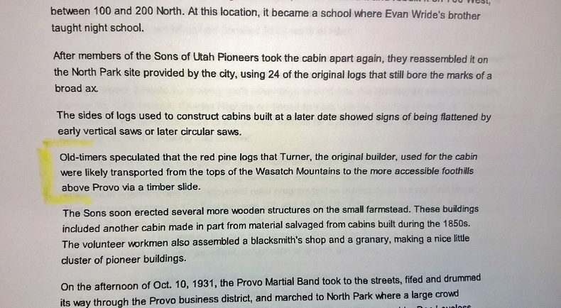
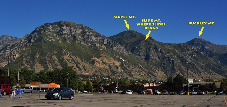
“Slide Canyon,” between Y & Maple Mountains east of Provo, and a visible pathway coming down the Canyon, and another down the face of what we always called Maple Mountain, all of a sudden came alive in my mind and sparked my curiosity. Further research taught me that the pioneers called the front part of Maple Mountain, “Slide Mountain.”
Eventually that Spring, early Summer, and Fall, I made 8 exploratory trips of discovery into the mountains and began posting on my website photo/essays of those adventures….and a couple of them were very literally
“bloody survival adventures.”
By the end of the 2014 hiking season I put it all together in one 47 minute long
YouTube video that was & is quite historic. The title page seen below……
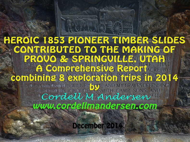
There is also a Photo/Essay covering the same information, but with text where you can see the quotes & photographs
*****************************
NOW TO THE 2016 SEPTEMBER EXPLORATION
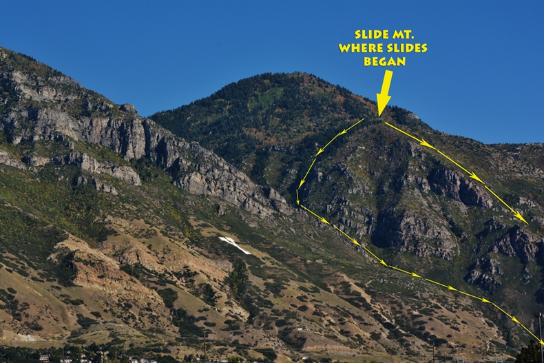
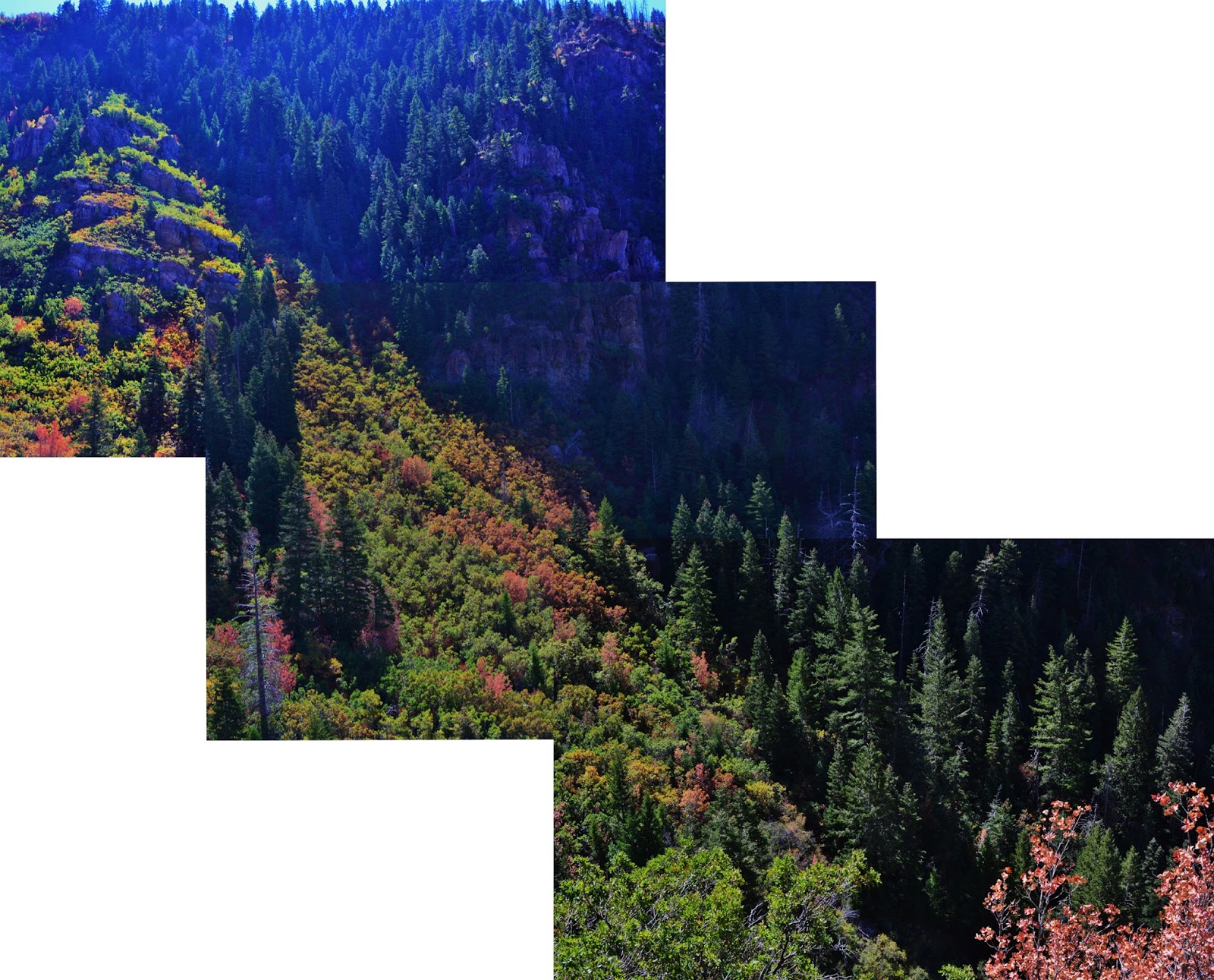
The one on the left that goes down into Eagle Pass and then down Slide Canyon is the focus of this exploration–particularly the portion that goes from the ravine up to the top of Slide Mountain. The lower portion is reported on in the mentioned YouTube video.
…. maybe a Hot Dog & Refreshment Center
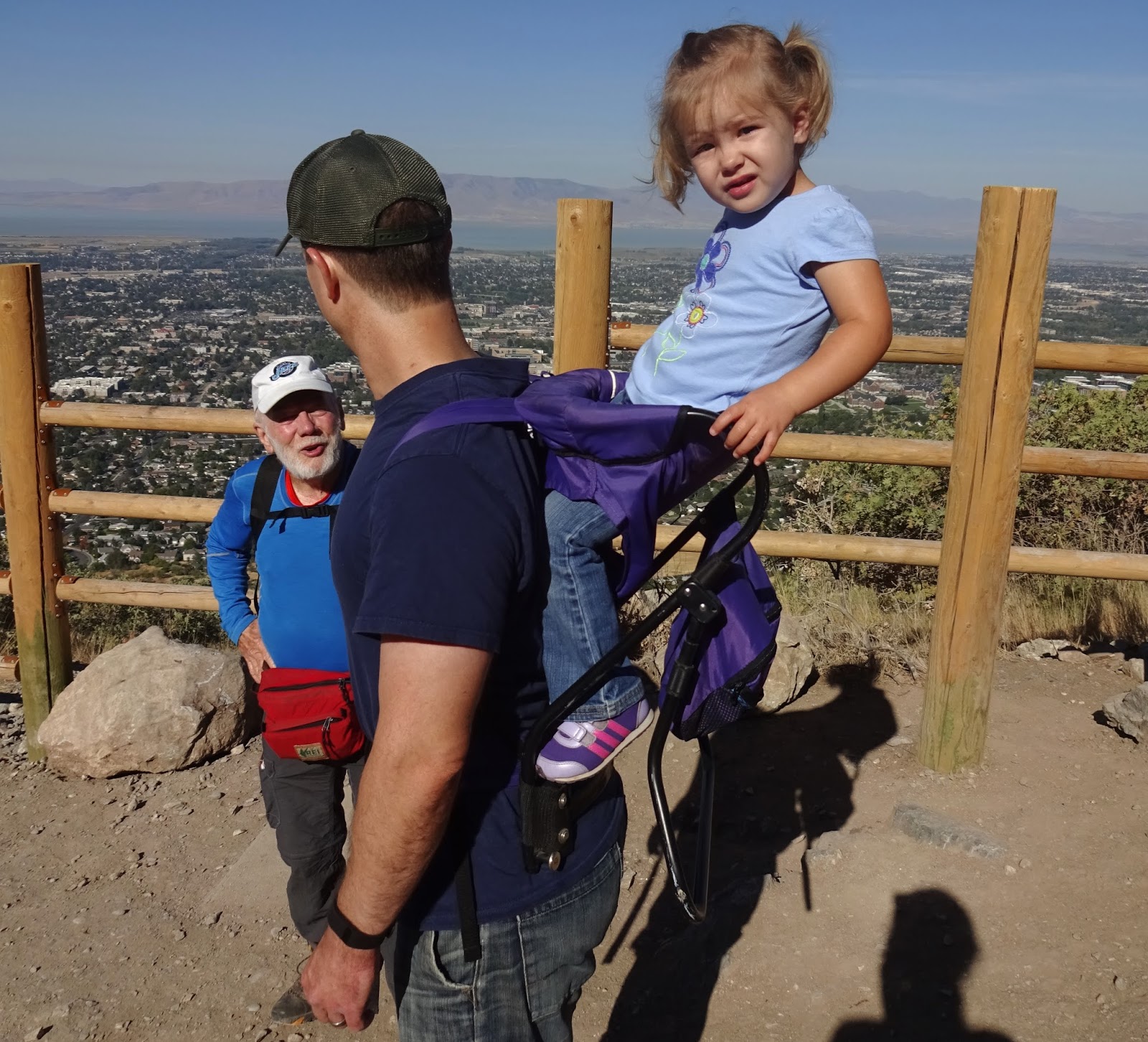
Meet KIMBERLY & WILLIS PUEBLO and family
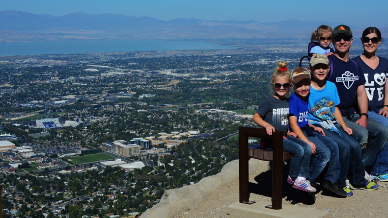
Evelyn, Dallin, Mason, Olivia, Willis & Kimberly
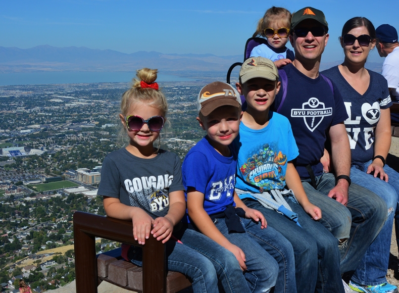
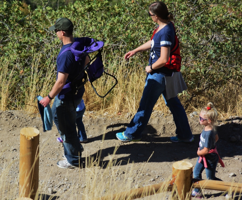
BUT THE PHOTO SHOWS WHY IN MY
YOUTH I WAS NICKNAMED
“LITTLE ANDY”
GUESS IT’S THE ANGLE, BUT I LOOK LIKE A MIDGET OR WILLIS IS A GOLIATH!
&
CONGRATULATIONS, MASON, FOR YOUR WIN!
***********************************
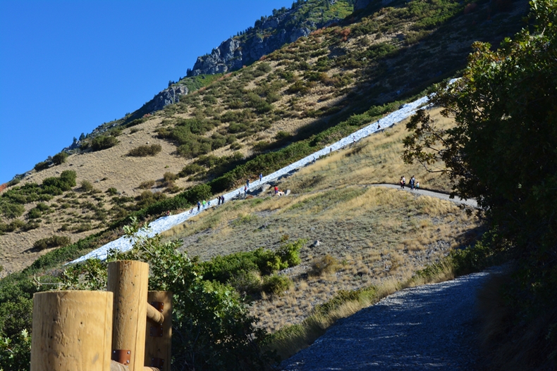
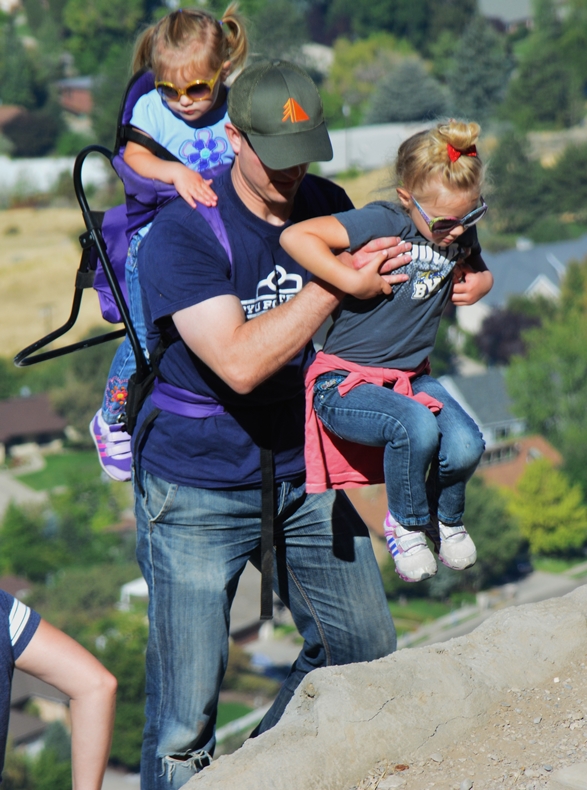
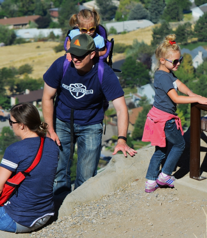
THE EXCURSION TO THE Y IS A MUST FOR EVERYONE
In 1847, when the pioneers led by Brigham Young came into the Wasatch Front, there was some consideration given to settle in Utah Valley. The area had been visited in 1776 by Fathers Escalante and Domingues who had established in their short visit a good relationship with the Timpanogos-Ute Indians. The Utes of Colorado called the Timp-Utes, “THE FISH EATERS,” due to much of their diet coming from the abundant fish (“speckled trout,” and suckers) from the clear waters of the streams flowing from the mountains, and the then clear water of Utah Lake.
These Catholic explorers named the valley,
“The Valley of Our Lady of Mercy of Timpanogos,”
and in a letter to the King of Spain, said, it was….
“….the most pleasing, beautiful, and fertile site in New Spain.”

“The Valley of Our Lady of Mercy of Timpanogos,”
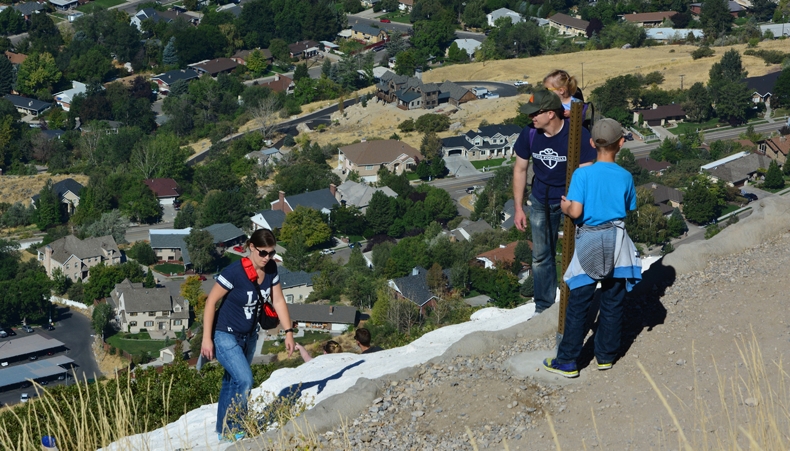
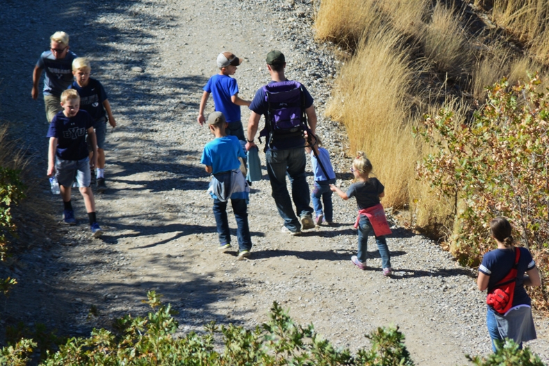
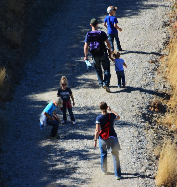
UCLA cheerleaders (or fans) made the hike too and with
a few cheers cast a spell upon the BYU football team….
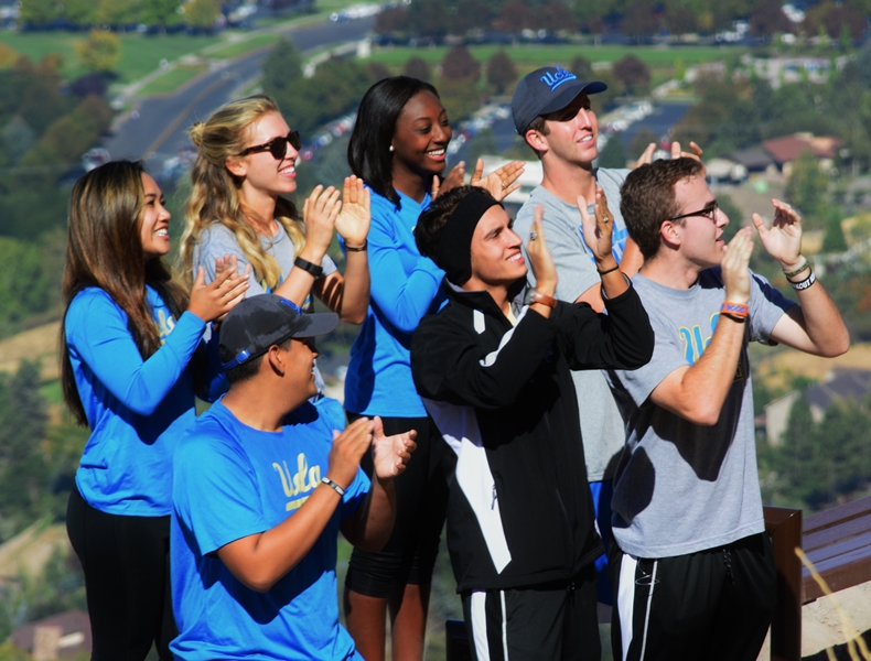
…….for the evening game!

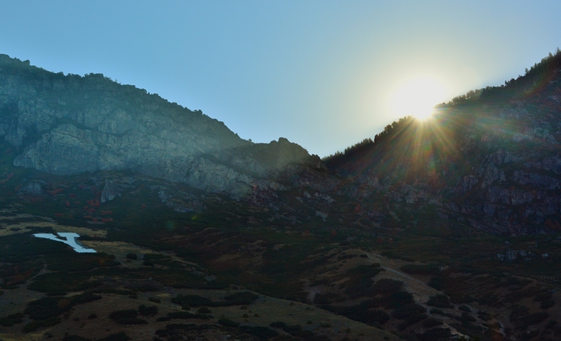
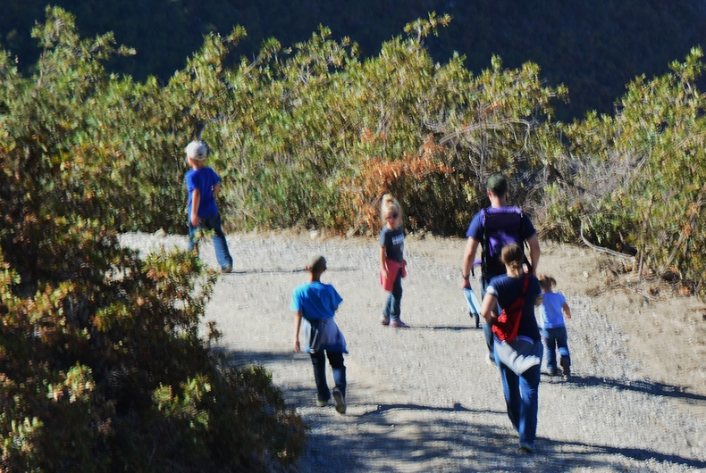
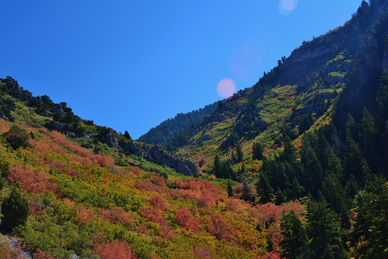
NOW, UP THE TRAIL TOWARDS EAGLE PASS…
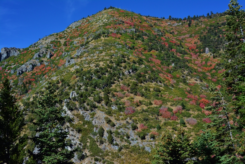
….with Slide Mountain ahead & above us.

“Hey, do you speak KEKCHI?”
was the surprising question of a tall young man, with his girl friend hiking up the trail, and passing me.
They wondered what an old guy like me was doing climbing a mountain, and in the conversation I mentioned of course the “Timber Slide” thing, but that previously I had lived and worked for 35 years in Guatemala….which had him asking about the main dialect from the Alta Verapaz area of Guatemala.
Nine years before he had been an LDS missionary in the Polochic/Chulac area where back in 1976-79 I had been involved in getting missionary work going in that area….and then in 1990-92 built and operated 2 schools in Chulac as the Field Director of the GUATEMALAN FOUNDATION.
http://www.guatemalanfoundation.org/

a zoomed in shot of him.
I gave them my card and hope they email me so I can send them these pictures, and add them to my long list of “High Uinta Friends.”

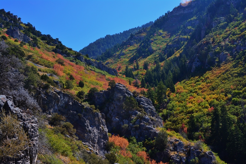
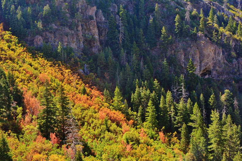
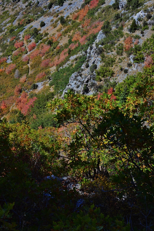
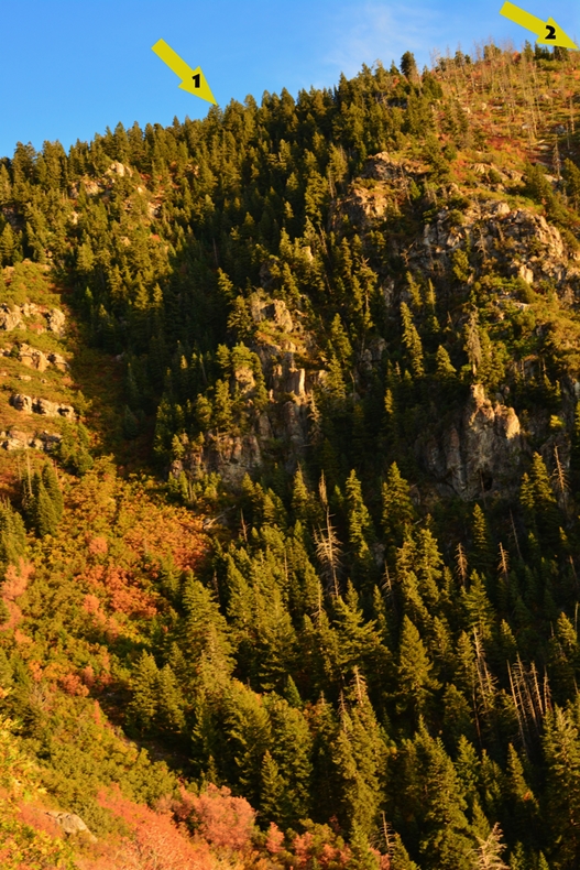
Now up the trail through Eagle Pass. Below is a shot down into the ravine showing the pathway of the timber slide which is a bit up out of the ravine. This picture shows clearly the steepness of the terrain our pioneers worked in and did miracles!
From here in Eagle Pass the slide went down the canyon to the foothills. I’ll insert a picture below from here showing it going down the canyon.
The launch site for the slide was up there on the top of Slide Mountain where I hoped to get to on this exploration.
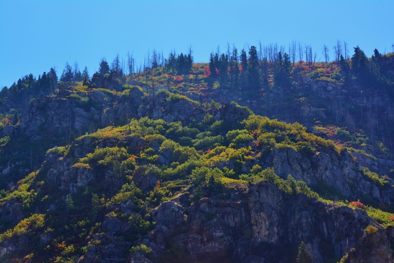

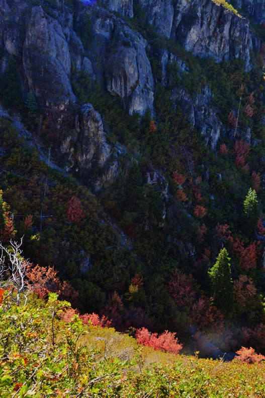
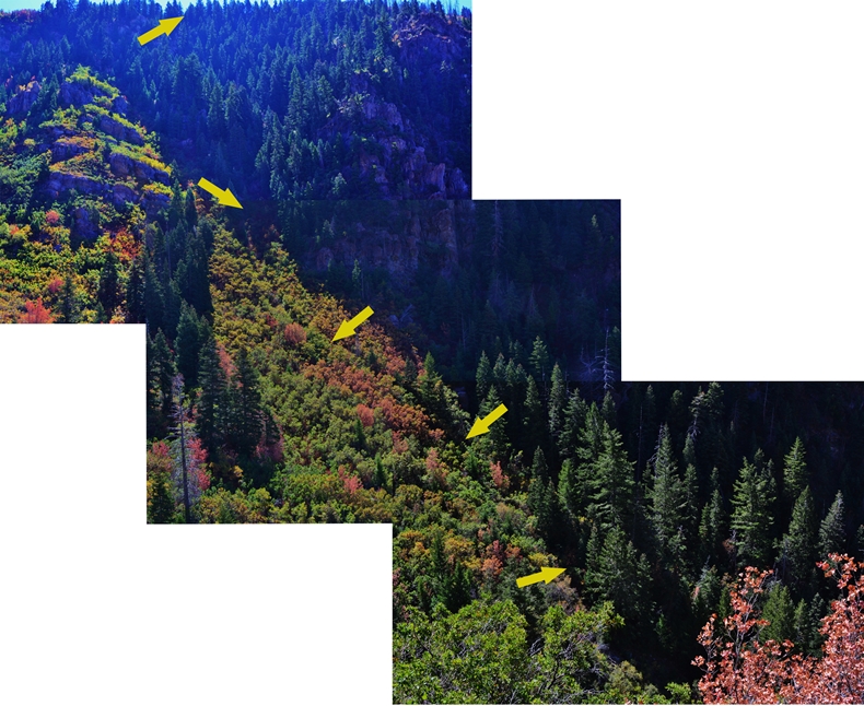
I’m getting up the ravine where looking across to the south we can see the area where the pioneer timber slide came down from the top of the mountain.
In the picture above…do you see the pathway coming down from the pines?
It is now 12:47 and taken me 3:15 hours to get here….a bit slow, but what with all the socializing, and needed rest stops for an old 80 year old…not too bad!
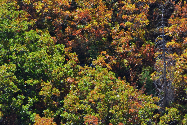
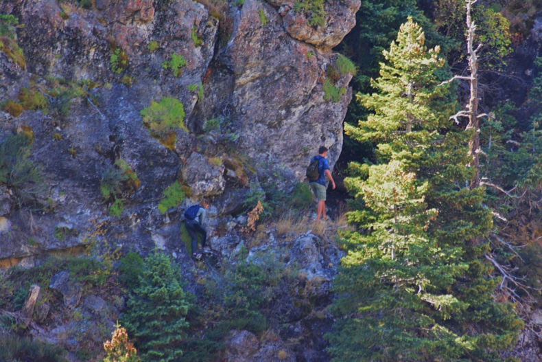
But as I was preparing to go down into the ravine, I heard voices from the pathway area, and zoomed into see a couple!
WHAT! SOMEONE HAD BEATEN ME TO THE PATHWAY!

I then watched them leave the pathway, and work themselves to the right.

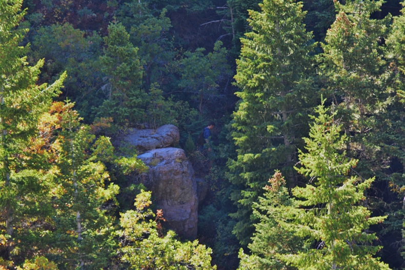
An overall view indicated they were heading for a cave on the right. They likely didn’t have any idea about the pioneer timber slide pathway they had used.

The young lady sat down at the cave to adjust her boots, and then continued catching up with her boyfriend.


I soon found the trail that is slightly visible here and there from Google Earth views.
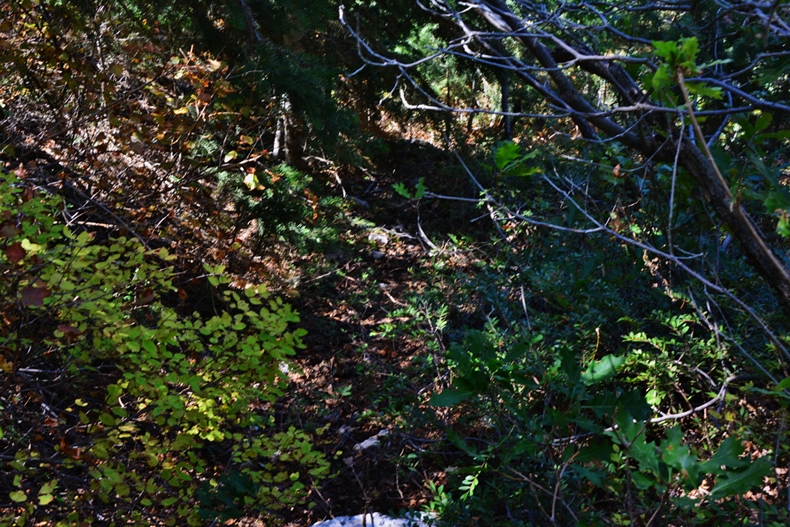
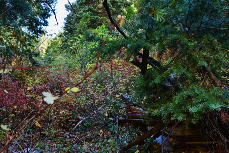
It’s hard to distinguish with so much scrub oak, maple and other underbrush, and is a trail that actually hasn’t been used for 150 years. The view above is looking up the canyon, the one below looking down.
Among other things I was looking for artefacts from the slide. The task was difficult with a carpet of leaves on top of 150 years of erosion and deterioration.
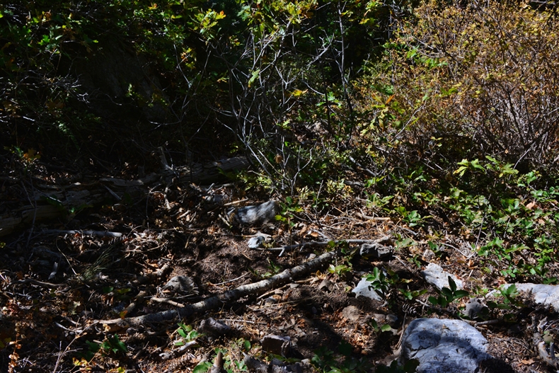
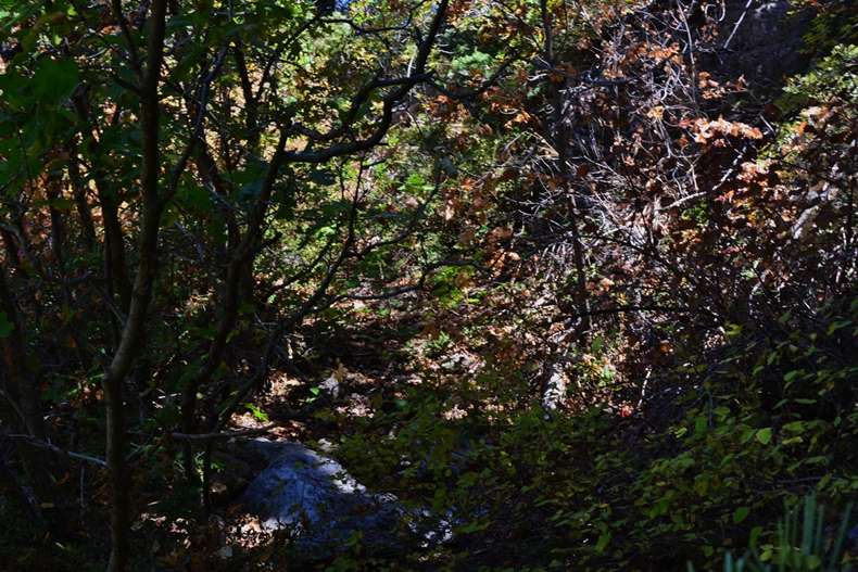
I followed it up a ways, taking pictures ahead of me and behind, but finally decided to go back down, and then leave the trail struggling through the jungle of brush to find the slide pathway.
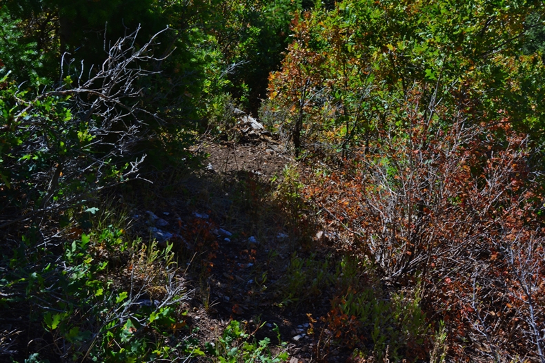
Here it is, looking up towards the pines….although it’s difficult, if not impossible to recognize because of all the vegetation….that by the way was MUCH WORSE THAN ANY TREK I EVER TOOK THROUGH THE JUNGLES OF GUATEMALA!
Below we are looking down the pathway, with the valley in view.
It is now 2:43 PM.
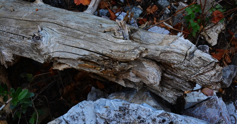
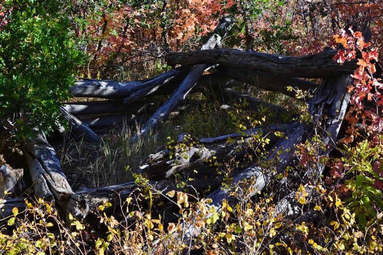
Below is pictured one of the few items we could call “artifacts.” This entire, very steep and remote area is where people just don’t come and go, so a piece of wood like this found here is not a coincidence. A few of these pieces of wood were found, cut with an ax, about 6″ in diameter, that must have been support pieces for the slide.
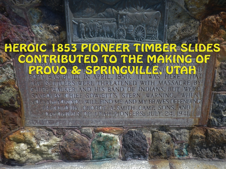
“Workmen finished the timber slide down Slide Mountain in November. George A. Smith informed the editor of the Deseret News that the two-mile-long timber slide ran from the top of the mountain to the foothills below. ” p.133
“Large logs as well as small ans [ones] would run with great rapidity….We would often start timbers at the top end of the slide an[d] it would run the entire [way to the] loading place with out a stop.”
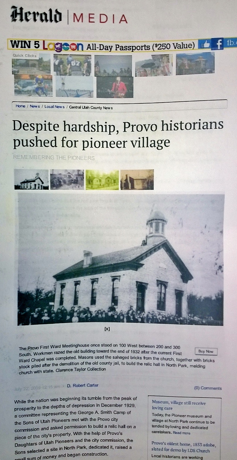
The information quoted above comes from two historical books by D. Robert Carter,
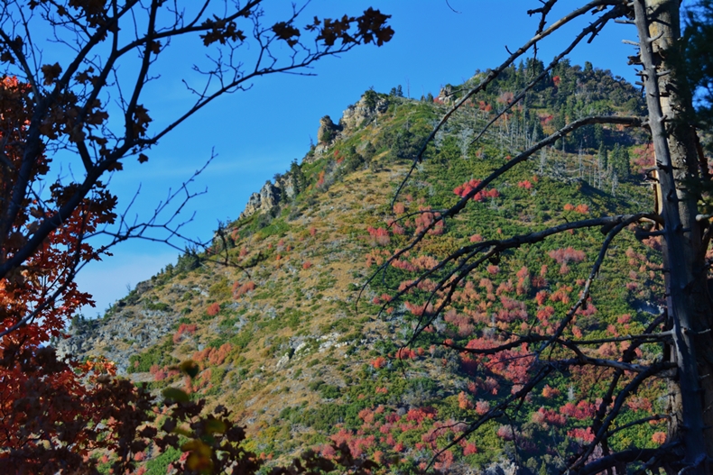
At 3:33 PM we look down the slide or chute pathway,
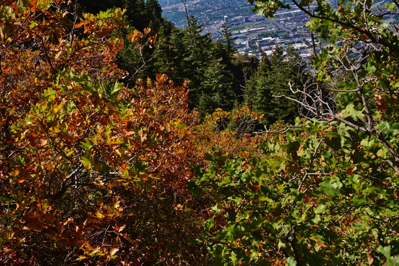
and below look from this spot across the canyon at the south side of Y Mountain.
The struggle up the slide pathway didn’t get any easier, forcing my way through jungles of underbrush, but which I used to grab onto to pull myself upward.
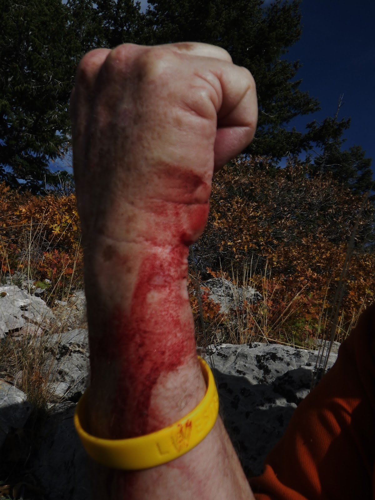

But this time I went better prepared with a long sleeved shirt, and my elk skin gloves, so no blood except on my shins.
REACHED THE TOP OF SLIDE MOUNTAIN
Made it by 5:37 and took a needed rest & lunch stop, and got a shot of Y Mountain’s south side.
WHAT DID I LEARN?
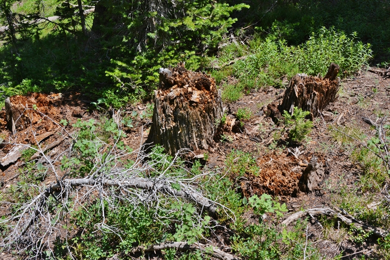
I did find a number of pieces of old, mostly rotted wood, cut with an ax. I was hoping for more, but we’re dealing with a slide or chute made in the 1853-60 period, around 160 years ago, and as I learned with the tie hackers on the Uinta’s North Slope, stumps from the 1867-1880 period were almost always completely rotted away. So I was lucky to find at least a few pieces, likely braces. I was hoping to find square nails, as I did in my tie hacker explorations, but so far nothing. Note: If you don’t know who the tie hackers were, go to my website where I have around 14 photo/essays and YouTube videos on said “unsung heroes who helped win the West!”
SO YOU CAN SEE WHAT HAPPENS TO WOOD OVER TIME
WHAT I DID LEARN:
The nearly total fatigue I felt just trying to follow the slide pathway, showed me clearly that the pioneers were tough as nails to have been able to actually build a timber slide out of logs in very rough, steep country, and then go up there daily to cut timber they likely drug to the launch sites with horses or oxen, then…I repeat what was quoted previously from Mr. Carter’s books:
“Large logs as well as small ans [ones] would run with great rapidity….We would often start timbers at the top end of the slide an[d] it would run the entire [way to the] loading place with out a stop.”
Then quoting the journal of a John C. Dowdle, who wrote: [It worked] “admirably as far as tried.” John and his brother Robert, worked on the construction of the slide, harvested logs to be used as fuel and lumber, and slide them down the chute. Since lumbermen used the slide mainly in the winter, they labored under unfavorable working conditions. Dowdle said at times the snow was from two to eight feet deep on the mountain. Alexander P. Chesley, who helped cut and slide the timber, lived in such destitution that he had to wrap his feet in burlap sacking in place of shoes. Working in these dire circumstances presented at least one advantage. Dowdle wrote, ‘By laboring in this manner during the winter we made a tolarable good living.'” p.133
My admiration for the pioneers grew exponentially once more, and I am filled with gratitude for the work and sacrifices they made to help make possible so many blessings we now enjoy–and we in turn should in our own way focus some of our energies also on making the world a better place for others.
NOW TO GET HOME BEFORE DARK
NOTE: I of course went prepared with basic survival items: My SPOT tracker, headlamp with fresh batteries, weatherproof matches, a good pocket knife, and smart phone, plus a little extra food and water.By 5:55 I was on my way down to Maple Flats and passed by the ruins of this cabin discovcred on previous explorations in 2014.


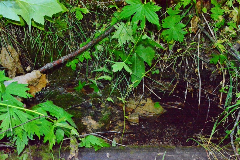
The little used trail is a bit tricky to find, as there are game trails all over, but if you find it you will soon find the only spring in the entire area. The old corroded pipe is just barely seen on the left, disquised by moss and vegetation.


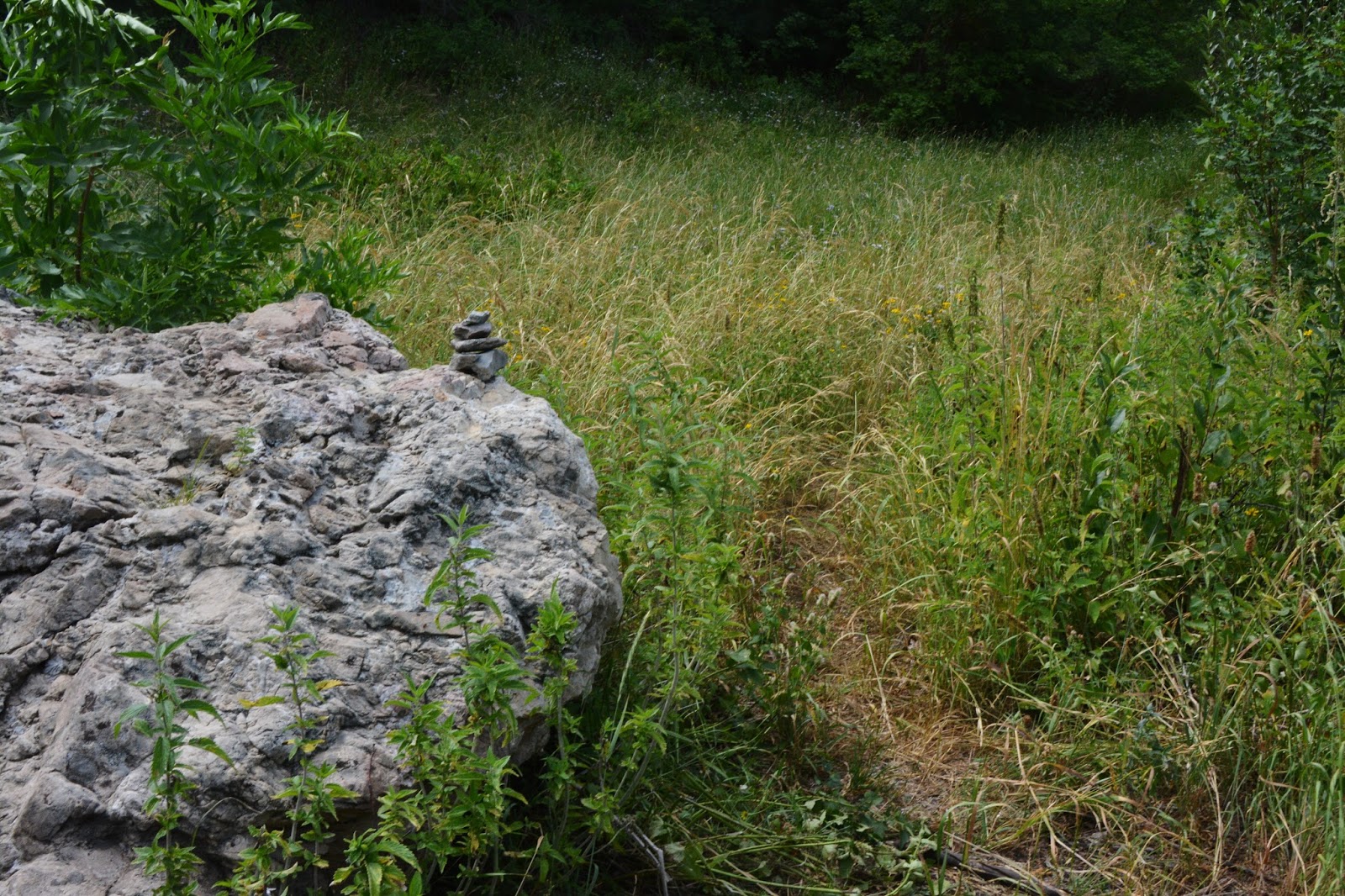
Coming up the trail you get to the first meadow, and you will notice a well defined trail to the right taking you 20 yards or so to the spot you see below.
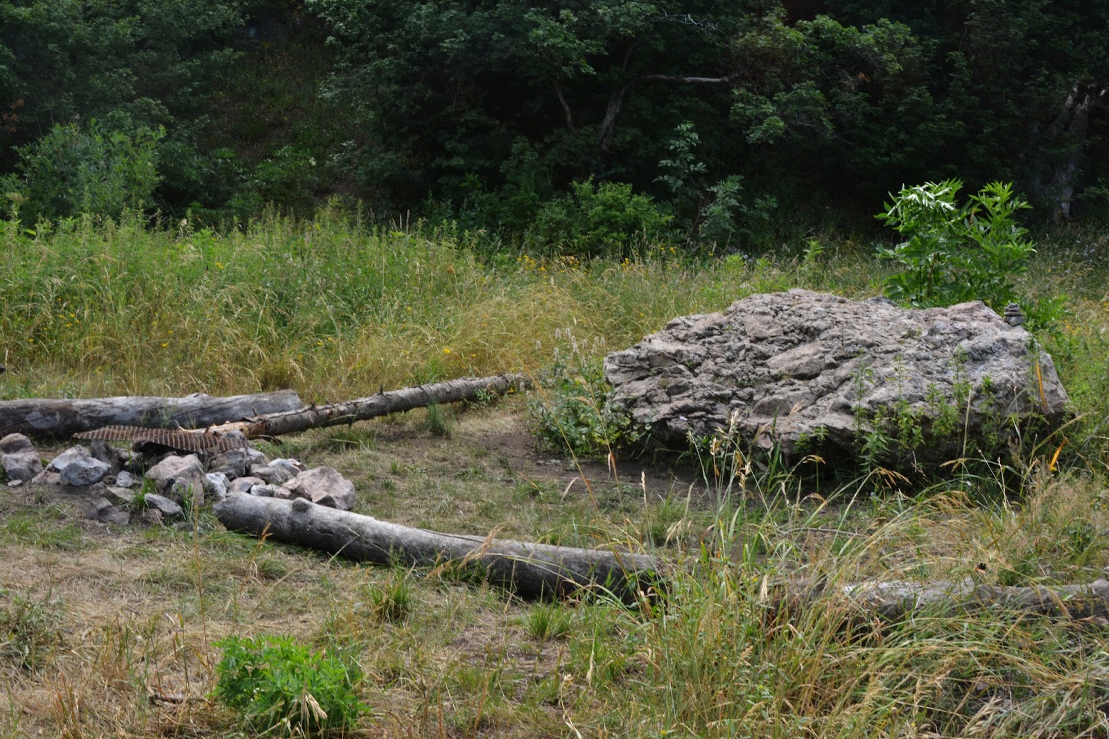
The trail takes off to the right of the large rock….with my little pile of rocks on top so you won’t go wrong.
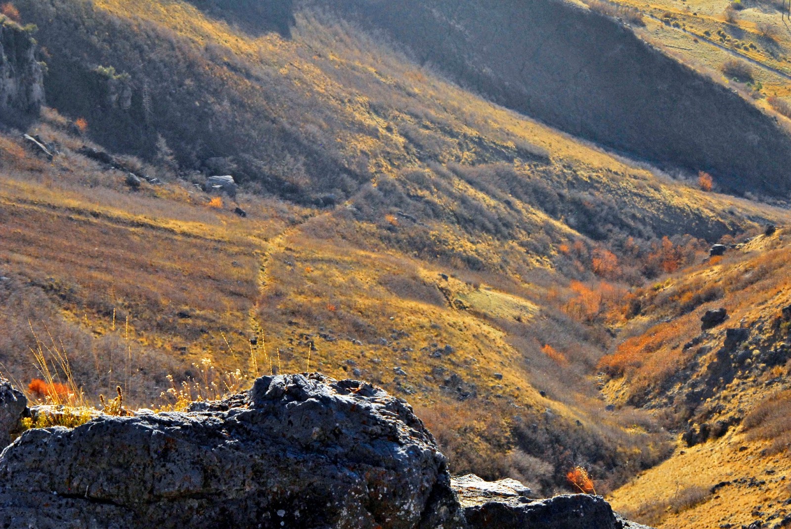
By 7:30 PM I was a bit below where I crossed the ravine, and we are looking up at the area where the slide comes down into the canyon.

“….the most pleasing, beautiful, and fertile site in New Spain.”
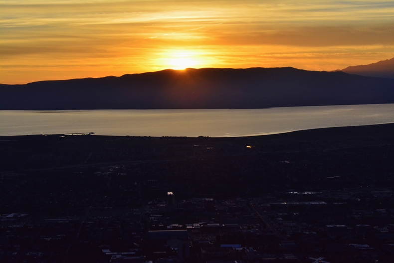
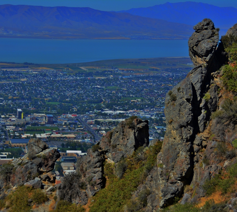
Soon I arrived at the Y and once again took a rest/eat stop that I needed pretty bad as my legs were getting pretty rubbery!
I watched the Lavell Edwards Stadium fill up with people for the BYU vs UCLA game and could actually hear and understand some of what was on the PA system….in spite of my hearing which is the one body part that is in such bad shape that I find myself avoiding group social gatherings!
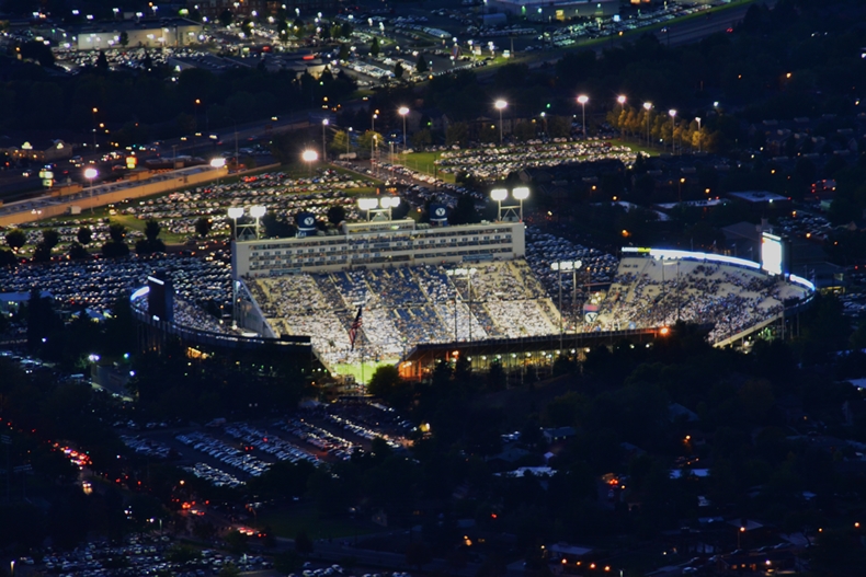
By 8:16 the game was about to start and I was tuned in with my tiny Apple square thingy, and hoped that listening to something interesting would help me make it to the parking lot in the dark–the trail sort of visible with the lights from Provo.
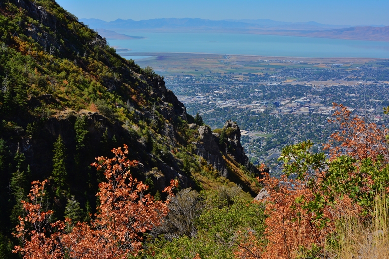
So I took a last shot of the Valley focusing on the LDS Temple at the mouth of Rock Canyon where in my youth I had great success hunting cottontail rabbits–as well as many other cherished adventures, and headed down the trail, grateful for having mostly achieved my purpose….and more than anything else………

……….EXPERIENCING A GREATLY ENHANCED APPRECIATION FOR WHAT OUR PIONEERS DID SO WE COULD BE SO BLESSED TODAY….
….AND LITERALLY IN AWE AS I CAN’T EVEN IMAGINE HOW THEY COULD HAVE DONE WHAT THEY DID TO HELP BUILD PROVO, UTAH.
************************
Next up:
Finishing my exploration of the 1st Pioneer Timber Slide, which was on Buckley Mountain, between Provo & Springville
*********************