December 6, 2014 – SaturdayCOMING: FIRST: A final combined Photo/Essay & SECOND: A YouTube video of 8 exploratory trips to discover and unravel thisHEROIC PIONEER ENDEAVOR WITHOUT WHICH PROVO, & SPRINGVILLE TOO, MIGHT NOT HAVE BEEN BUILT……at least not as quickly and easily!******************UPCOMING TOO...A photo/essay describing one of those trips: A SURVIVAL STORY THAT SAVED MY LIFE & COULD SAVE MANY THAT DIE NEEDLESSLY!************************
Saturday, Nov. 8, 2014WILL EXPLORE LAST OF ALL THE BUCKLEY MT. PIONEER TIMBER SLIDENov. 10th, RESULTS: Made the exploration that was tough and I got really tired, then discovered that I was coming down with SHINGLES while doing it, and now working on overcoming this NEW CHALLENGE! I’ll get to a report soon.
Monday, Oct. 20, 2014
PIONEER TIMBER SLIDE LAUNCH SITE….DOWN TO PROVO FOOTHILL
Click for SPOT TRACKING
HOW DID IT GO?
Three cheers!….IT WAS HARD & BLOODY, but I MADE IT….following pathway all the way down to Provo
Photo/essay soon…I’ll let you know.
Upper portion of the Slide Mountain exploration
Click here for previous reports
Pioneer timber slides contribution…..
FROM FORT to VILLAGE to PROVO, UTAH
While I’ve had to hunker down close to Utah Valley for most of the summer due to several emergencies–and forced to pretty well suspend the backpacking aspect of my High Uintas Project, I’ve tried to keep in shape focusing on mountains nearby–those associated with Provo and its pioneer founders who did incredible things that few if any know anything about.
I hope what I’ve been learning through research and exploring will be of interest to a few and help us appreciate a lot more what our ancestors did to make possible what we all enjoy today here along the Wasatch Front.

In 1847 when the pioneers, led by Brigham Young, came into the Wasatch Front there was some consideration to establish themselves in Utah Valley. It had been visited in 1776 by Fathers Escalante and Dominguez, who developed in their short stay a good relationship with the Timpanogos-Ute Indians. The Utes of Colorado called them the “FISH EATERS,” due to much of their diet coming from the abundant fish (“speckled trout” and suckers) found in the clear streams flowing out of the mountains, and the then clear waters of Utah Lake.
These Catholic explorers named the valley,
“The Valley of Our Lady of Mercy of Timpanogos,”
and in a letter to the King of Spain, said, it was …
“…the most pleasing, beautiful, and fertile site in New Spain.”
The priests promised the Indians they would return and establish here a Catholic Mission. Can you imagine how different the history of Utah would have been if they had of done so?
But they never returned.
Famous explorer and mountain man, Jedediah Smith, passed through the valley in 1826 and described the lake as “Little Uta Lake,” previously known as Timpanogos Lake. A year later Daniel Potts, another early explorer called it, “Utaw Lake.”
Brigham Young had several reasons to choose the Salt Lake Valley as “THIS IS THE PLACE,” one practical one being it would be just a little simpler during the first years of survival as there were basically no Indians there they would have to contend with. There were in Utah Valley–the Timpanogos-Utes. The same for north of the Salt Lake Valley up into southern Idaho, also under consideration, but there the warlike Shoshone Indians dominated.

So, in 1849 a group came to the valley, who were Mormons, but most of them “not called” to do so by the prophet and described as rough, tough, independent, backwoods frontiersmen, whose “foolhardiness” reportedly “led to hot encounters with the Utes…” and who used “….. alarming tactics to mercilessly crush the Utes.”
The Indians were upset with the settlers for killing wild game, leaving less for them, and they retaliated by stealing cattle and horses. Eventually the conflicts “…culminated in the largest Indian battle fought within the present boundaries of Utah,” on February 9-10, 1850, called, “The Battle of Provo River,” that occurred approximately where the Deseret Industries store is today in north Provo.
Information from D. Robert Carter’s book, FOUNDING FORT UTAH

We can see from the first artist’s depiction of Fort Utah a wagon loaded with logs from which the fort was built, they needed timber products–for construction and fuel. We see that in the picture above showing a large log cabin that served as the school, meeting house, and what we today would call a “cultural hall,” we see the pioneers needed lots of timber.
In a July 22, 2009 PROVO DAILY HERALD article by historian D. Robert Carter, entitled “Despite hardship, Provo historians pushed for pioneer village,” he states:
“Old-timers speculated that the red pine logs…..used for the cabin were likely transported from the tops of the Wasatch Mountains to the more accessible foothills above Provo via a timber slide.”

So, with that mention is born the subject I have been researching, trying to understand, and unravel in my several explorations into the mountains east of Provo we see above and below. Carter states in his book FROM FORT TO VILLAGE:
The “….population was growing so rapidly and the need for timber for building was so great that many of the relatively accessible trees in the canyons would soon be cut down. Large stands of coniferous trees near the tops of the mountains and high up on the north facing slopes of the canyons beckoned. In order to harvest these trees, lumbermen built timber slides on which they could expeditiously whisk logs to roads in the bottoms of the canyons where men could load them onto wagons…”. page 133
We are seeing the lower portion of what I call Maple Mountain that rises up from Maple Flats, but this lower portion of the mountain, from the Flats down, is perhaps described in this quote:
“Workmen finished the timber slide down Slide Mountain in November. George A. Smith informed the editor of the Deseret News that the two-mile-long timber slide ran from the top of the mountain to the foothills below. ” p. 133.
From the journal of John C. Dowdle, we find a little detail, one reference saying, it worked “admirably as far as tried.” John and his brother Robert, worked on the construction of the slide, harvested logs to be used as fuel and lumber, and slide them down the “chute.” p.133
Quoting further from Carter’s book,
“John later wrote that part of the slide consisted of small logs on the bottom and large logs on each side, making a sort of trough. To form the lower end of the slide, the laborers dug a ditch down the mountainside. Concerning the efficiency of the slide, Dowdle stated, ‘Large logs as well as small ans [ones] would run with great rapidity….We would often start timbers at the top end of the slide an[d] it would run the entire [way to the] loading place with out a stop.'” pages 133-34
In the above photo we are likely seeing in the bottom portion what is described as “laborers
[having] dug a ditch down the mountainside.”
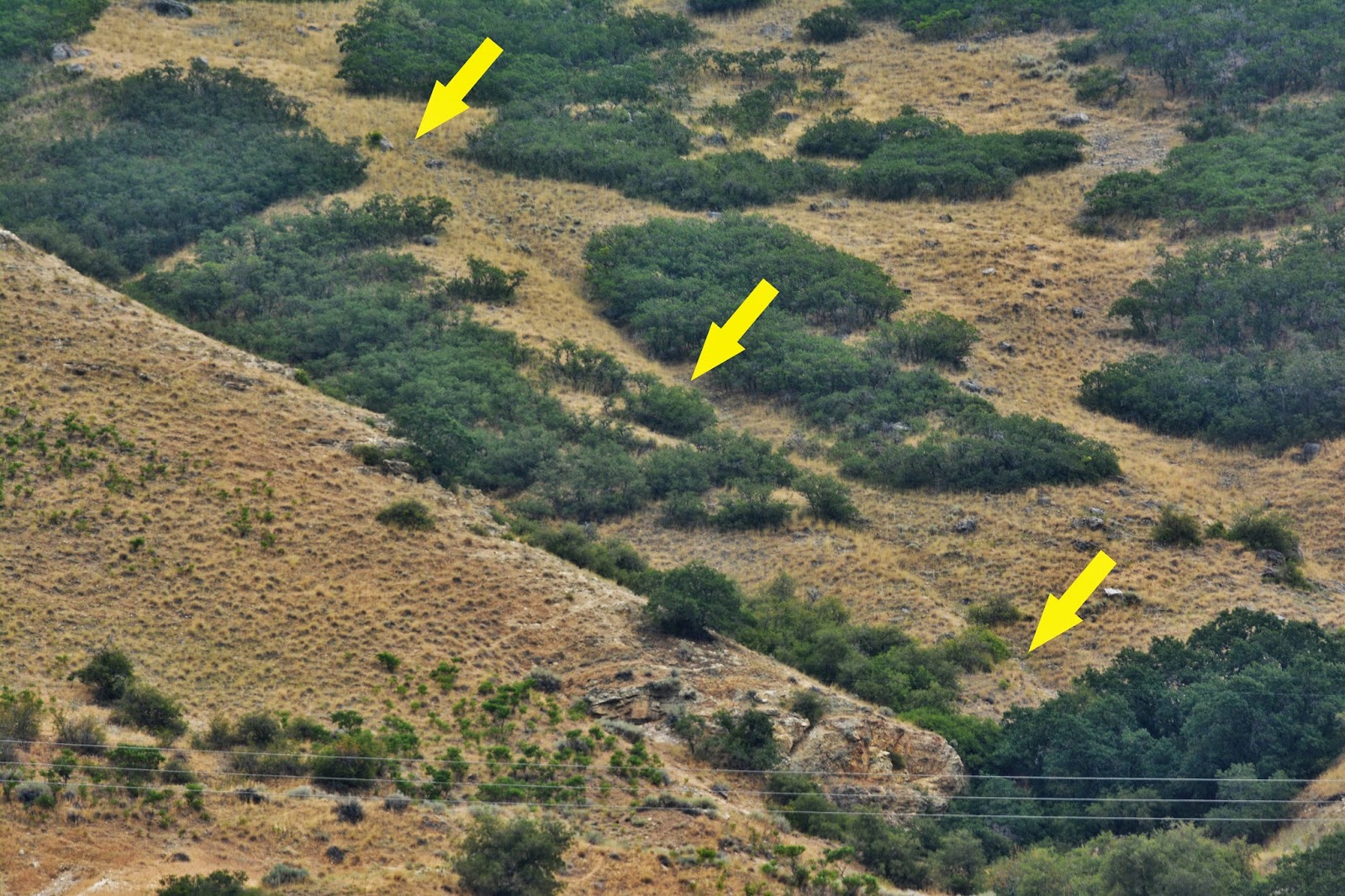
In the above view of that lower portion of the slide, we can’t distinguish it very well, but moving a bit north for a different angle, it appears as indicated by the arrows below.
It’s well to mention that the ditch-like depression is not the ravine coming down the face of the mountain, as that is a bit further to the left in the photo, sort of disguised by the oak brush–all is seen clearly in the Fall photograph two photos up. Yet it’s hard for me to understand how in such terribly rough and rocky terrain they could have dug the ditch with just pick and shovel.
So up I go scratching and clawing my way along the very steep mountain….indicated by seeing how steep the ridge north of me was.
Looking down the pathway with Provo in the background.
Looking up towards the cliffs, but in the foreground a curious area of scrub oak (Gambles oak) that had been chopped down and seemed to be coming up with new sprouts.
In the middle left of this picture we can barely see an area where the ravine and slide pathway coincide to get through an opening in the cliffs. That point will be about half-way to the top.
Off to the north we see a white spec…..No, it’s not dirt on my lens, or on the monitor screen. Let’s zoom in and see what the heck it is…maybe a flying saucer?
It’s a, what do we call them? …..a parachute glider. I know some of them climb Y-Mountain hauling all their equipment and then launch themselves over the valley. As I zoom in more……
..….a Golden eagle glides into the area, and I quickly squeeze off a shot, giving me a title for this report,
UP AGAIN WHERE EAGLES…..AND OTHERS DARE!
So, up and up I go….grateful for being able to do it, which wouldn’t have been possible in 2012 when it looked like I was going to be a cripple!
And also grateful that my new “glitch” being PERIPHERAL NEUROPATHY, doesn’t seem to stop me when I have a pack on my back, and doing heavy duty things!
We are getting closer to the …..what should we call it? Maybe THE NARROWS where the ravine and pathway coincide and we bid farewell to our parachute glider.
And, yes, there are plenty of what I have called TEXTURES OF NATURE or VISIONS OF NATURE.
……and wouldn’t you know it, HERE COMES THE BEAUTIFUL AUTUMN COLORS!
Color also all of a sudden appears out on Lake Timpanogos….let’s zoom in.
It must be some kind of algae that appears as the water warms.
We are approaching now THE NARROWS….
Looking up and looking down.
I had found no old pieces of wood, or square nails, which disappoints me.
But I was happy for the view, and happy to be alive and still be able to get up WHERE EAGLES DARE, and for a strong cell phone signal, so took a picture or two and texted, and even emailed to family and friends……..
…..and grateful for the two quarts of ice cold water….still with a bit of ice.
So here was our first photo of the objective to explore the pioneer timber slide.
In yellow where I’d got to for this exploration, only halfway, but had got a very late noon start.
To get to the top of Slide Mountain, we resort again to Google Earth, following the pathway in a very rough area.
And continue towards the nobby hill to the west of Maple Flats.
Here we are to the top of the front mountain….Maple Flats to our right. To the upper right we see where the other slide that goes down Slide Canyon begins.
I’ll remove the text so you can see unimpeded the view.
Above is the overall area, the SPOT Track showing where I had got to on my overnight to Maple Flats.
Below we can distinguish the slide coming down from the top of Slide Mountain, into Slide Canyon that follows down the canyon usually just up out of the ravine, opposite the Y Mountain Summit Trail.
The pathway comes down out of the coniferous forest the Daily Herald 2009 article quotes “old timers” calling them “red pine logs.” We see below the coniferous forest referred to, but “red pine” trees are found from Newfoundland west to Manitoba and south to Pennsylvania and in Virginia, West Virginia, and a few in New Jersey and Illinois. The pioneers apparently were referring to our Engleman spruce and Douglas fir we see here in Slide Canyon.
If you look carefully you can see the pathway of the timber slide curving down across the picture from the forest above and making a sharp turn down the ravine as seen below..

It then plunged down the steep canyon, just up out of the ravine. I still can’t quite imagine how they could have actually built a “… slide consisted[ing] of small logs on the bottom and large logs on each side, making a sort of trough” down through these areas. It wouldn’t have been possible either for a log to come down the “chute” and make a sharp turn without jumping out of the chute or slide. The description previously cited, saying, “Large logs as well as small ans [ones] would run with great rapidity….We would often start timbers at the top end of the slide an[d] it would run the entire [way to the] loading place with out a stop.” That description seems more likely to refer to the slide on the face of Slide Mountain, and not this one in Slide Canyon. However, once down to the ravine, the logs could maybe make a run to the bottom with stopping…….. still lots of questions,.

In either case, here, or on the face of the mountain, a log to go down at a 45 degree angle all the way to the bottom without stopping could certainly qualify as being “whisk[ed]” down the mountain….at incredible speeds! Concerning the Hilliard Flume the Forest Service described it a “WILD RIDE” with water carrying wood products down into Wyoming at 15 miles/hour. That journey couldn’t even come close to what this WILD timber slide ride was like!

On February 5, 1853 “The Utah County Court Minutes” indicate that permission was given to Thomas King, T.J. Willis, a Mr. Curtis and others to build “a timber slide & the timber in a Kanyon [Slide Canyon] next S[outh] of Rock Kanyon.” Further along the record states that “the slide down Slide Mountain” was finished in November when the Deseret News was advised “that the two-mile-long timber slide ran from the top of the mountain to the foothills…” I quoted the same when referring to the slide down the face of the mountain because the one reference is to “Slide Mountain” and the other to “Slide Canyon,” two names that might refer to the same slide, but there are two slides and the two descriptive terms seem to fit the different slides.
NOW BACK TO THE FACE OF “SLIDE MOUNTAIN”
On the right you can see where I got to….about half-way up the mountain. From there the slide came down from above through the ravine or NARROWS, and from that point down it was a relatively straight slide down, with the bottom portion perhaps a ditch as previously mentioned. From that high point I angled down across the opposite side-hill to the bottom so that I could look back and take shots of the slide path on the other side as seen in the following two pictures.


That pretty well is the report on the two slides down to the Provo foothills, but now we come to the fact that these two slides were not the first in the Provo area.
THE FIRST TIMBER SLIDE AUTHORIZED
I quote again information that comes from “The Utah County Court Minutes, from February through July 1853.”
“Early in 1853, Alfred Walton, Jerome Benson, and a Mr. Wilson received permission from the Utah County Court to build a timber slide down the canyon located between the two peaks rising south of Slate Canyon. This slide would be located conveniently between Provo and Springville. In order for the grant to be valid the company had to build the slide during the coming season. If the men constructed the slide, they could control it and have jurisdiction over the timber on the mountain above it..”
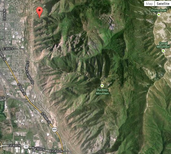
This permission was granted first, for the area known as Buckley Mountain that has two peaks, with a ravine separating the higher on the north from the lower on the south. So via Google Earth we fly south to Buckley Mountain.
Here we see south of Slate Canyon the two peaks of Buckley Mountain in the late Fall and Winter
Now let’s zoom in and see what we find.
Sure enough a pathway is visible in the right center, angling down to the foothills. Zooming in we see more clearly a pathway, similar to what we see in the lower portion of Slide Canyon.
Now back to Google Earth with the arrows pointing to the lower portion of the slide pathway coming down to the foothills. On the left is the gravel quarry between Springville and Provo
….and we proceed up the canyon between the two peaks.
The pathway continues about half way up the mountain ……..
.……and stops at the base of some cliffs. This must be the one referred to in the Utah County Court Minutes and quoted by Carter in his book.
To conclude, I quote again from Carter’s book, original information coming from footnote 15. Chapter 9: Business as Usual, and page 134:
“‘Large logs as well as small ans [ones] would run with great rapidity….We would often start timbers at the top end of the slide an[d] it would run the entire [way to the] loading place with out a stop.’
“Since lumbermen used the slide mainly in the winter, they labored under unfavorable working conditions. Dowdle said at times the snow was from two to eight feet deep on the mountain. Alexander P. Chesley, who helped cut and slide the timber, lived in such destitution that he had to wrap his feet in burlap sacking in place of shoes. Working in these dire circumstances presented at least one advantage. Dowdle wrote, ‘By laboring in this manner during the winter we made a tolarable good living.'”
FORT UTAH
THE FIRST SCHOOL & LDS MEETING HOUSE IN UTAH VALLEY
“The Valley of Our Lady of Mercy of Timpanogos,”
and in a letter to the King of Spain, Priest Dominguez said, it was …
“…the most pleasing, beautiful, and fertile site in New Spain.”
UTAH VALLEY & PROVO, UTAH
2014