2013 FIRST TRIP–Mirror Lake Scenic Byway and Piedmont Ghost Town

Click below to see previous post:

“Opps…I forgot a matter of life or death”…More of Spring…and KSL podcasts, plus links to Comeback photo/essays and videos 

Note:  I have added to the above post an important letter with links from our friend Dean Mitchell at the DWR.  Go back to check it out.

MIRROR LAKE SCENIC BYWAY OPENS and

SEARCH FOR THE LIVING IN A GHOST TOWN

May 25-27th

NOTE:  A correction can be found at the end, along with a comment about my sanity!

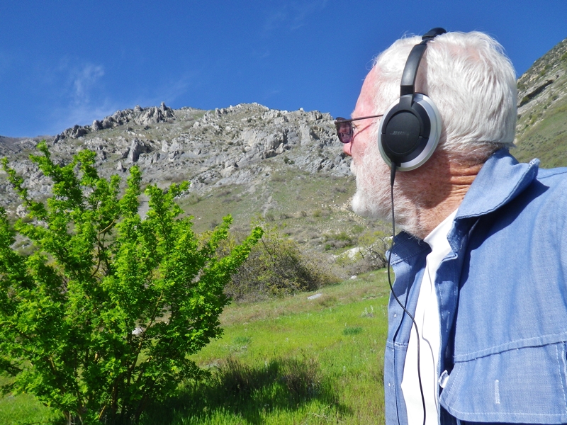
For a number of years I attempted to always be one of the first to drive the Mirror Lake Scenic Byway but apparently for the 2012 Season, due to back surgery on May 24th and the attempt to avoid becoming a cripple I got slowed down,  but I did make the trip on May 19th with my daughter, Mahana. Following is a photo of the Provo River Falls, and then one on Bald Pass on that day, May 19th, 2012. 
Provo River Falls (above ) — May 19, 2012– Bald Mt. and Pass (below)

Provo River Falls (above) —  June 28, 2011 — Bald Mt. and Pass (below)

Bald Mt. and Pass on June 5, 2010

NOW TO THE 2013 “FIRST TRIP” REPORT May 26-27th

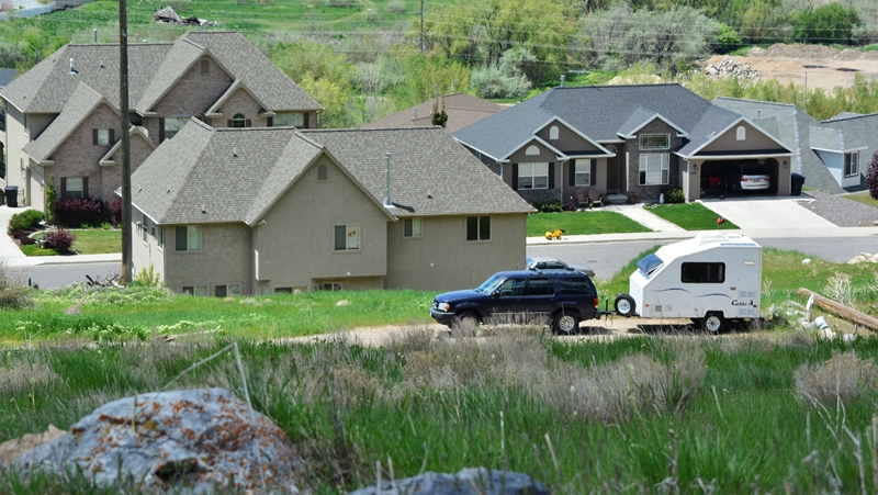
The trip with my compact “Cabin A” trailer began at the Western “Gateway to the Uintas” in Kamas, UTAH where also begins the Mirror Lake Scenic Byway which opened on May 25th.
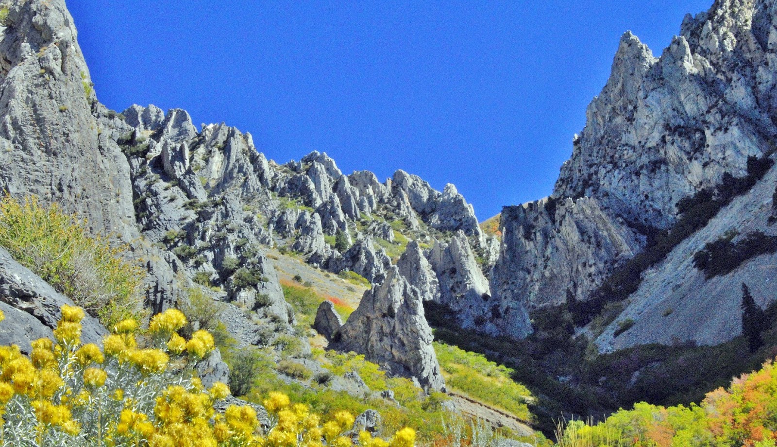
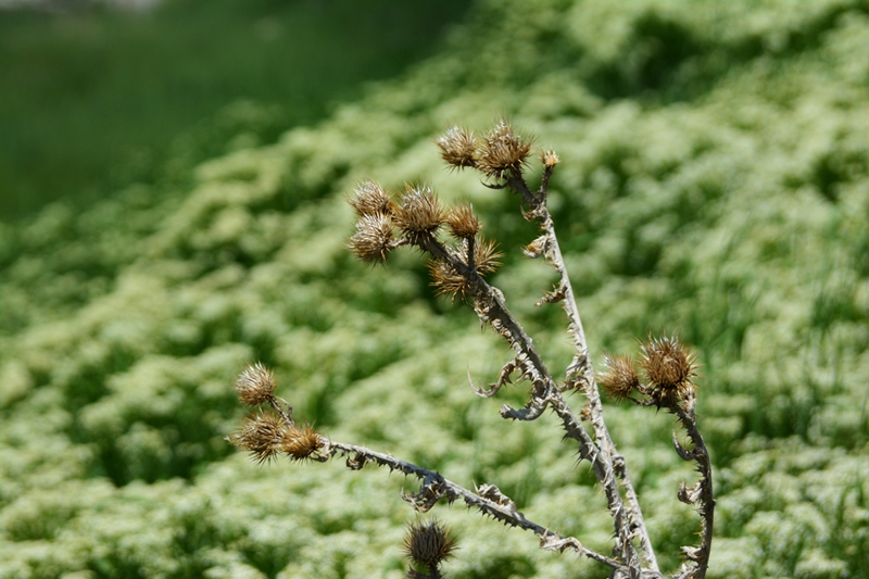
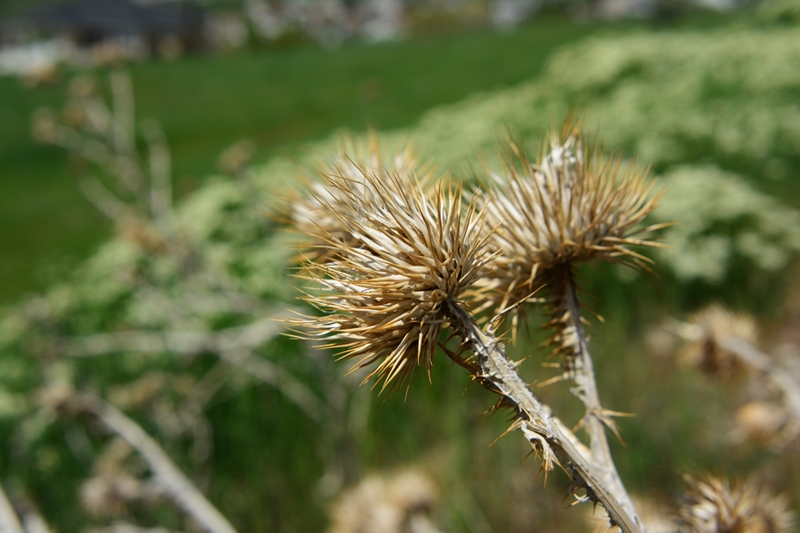
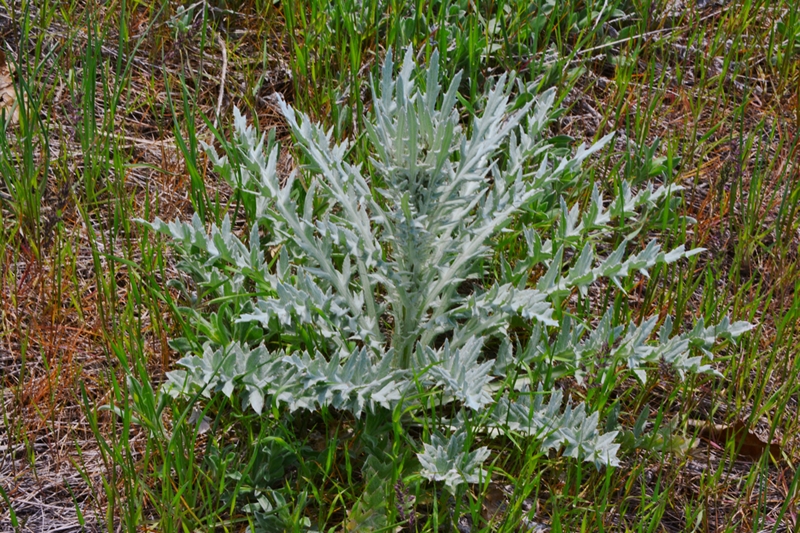
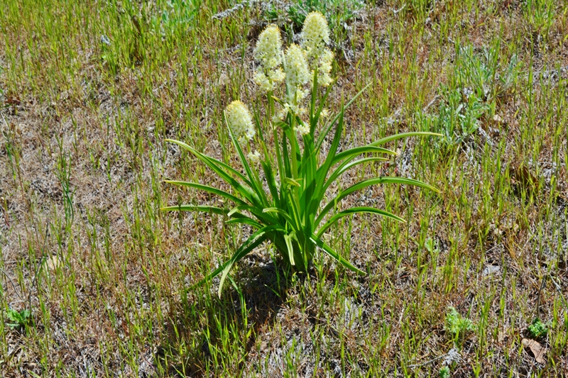
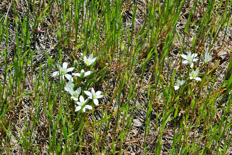
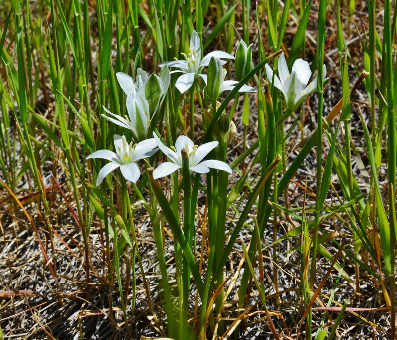
 No attempt will be made in this brief photo/essay to identify the sprinkling included of the first wildflowers of the season.

 The increased elevation had my bag of potatoe chips inflated to the bursting point.

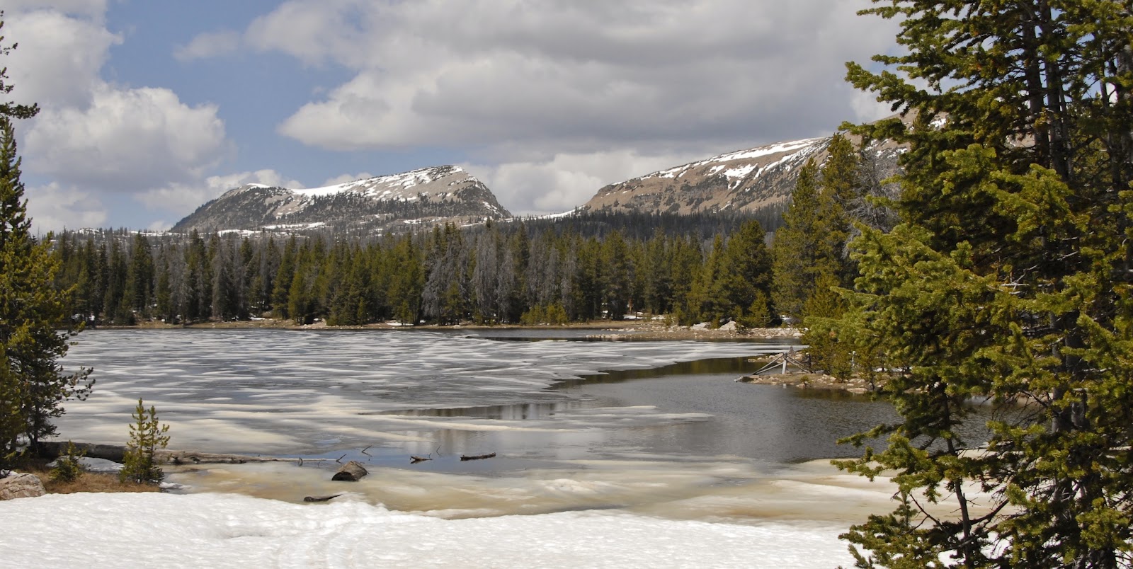
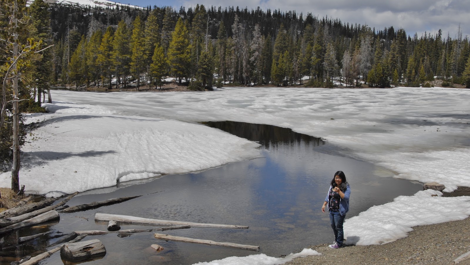
 You can back up and compare the snow depth with other years, 2013 with much more snow than the 2012 season, but less than 2010 and 2011.
 Mt. Hayden is seen directly down the highway as we begin the descent to  the snowed-in Mirror Lake junction.
 Of course the road in to the famous Highline Trailhead is still snowed in, and will be for another couple of weeks–depending on the weather.
 From the snowbound High Uintas we descend north towards Wyoming and Evanston and then take I-80 East about 20 miles to Exit 24 that has us on a gravel road that leads to the Piedmont ghost town.

 We will travel 7.5 miles south on this well maintained road.

 We parallel Muddy Creek which as will see is well known in the pioneer history of the West.
 Most of this 7.5 miles has us passing through lands of the Guild Ranch.  As we will see the Guild family was the second to settle in Piedmont in around 1865, and continue in our day.

 Here we see a panorama of MUDDY CREEK.  Read below how historic an area we are seeing.


 We are heading south and see in the distance the snow covered peaks of the High Uinta Mountains.
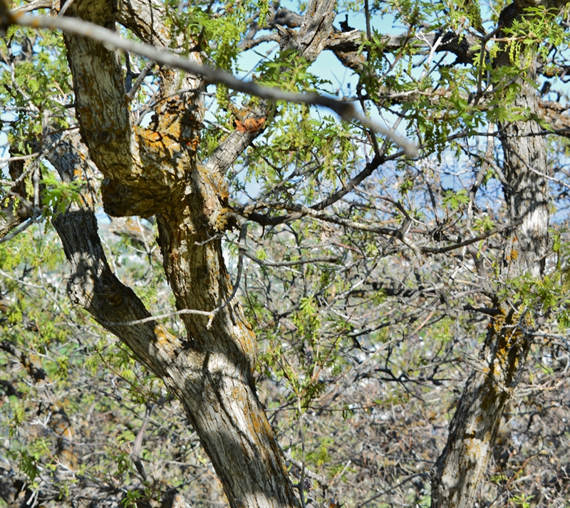
 Ruins of the area’s pioneer past can be seen all along the road.
 Soon we see the prominent “beehive” charcoal kilns of Piedmont, Wyoming 140 years ago a historically important town of around 200 for a short time with the Transcontinental Railroad running down its main and only street.
 The historic site has been fixed up since I first visited the area 4 years ago.  Very interesting explanations about the importance of the area are now available to the visitors.  I’ll insert them below and encourage you all to read and learn about this important era of our country’s development.

 I’ll zoom in on some of the important explanations, like THE FIRST RESIDENTS, and BUTCH CASSIDY, the most famous Mormon train and bank robber, and CALAMITY JANE!

 Moses Byrne, the founder in 1857, along with his wives (Catherine who lived in Piedmont, and Anne, who lived in Ogden) were all converts to Mormonism from Europe (England and Italy) who migrated to Utah in 1854.  I’ll relate more of the interesting history in the upcoming book.
 The Guild family joined the Byrnes  in Piedmont in 1864.  Marie Guild and Catherine Byrnes were sisters from Piedmont, Italy.  The Guild family focused on ranching and to this day are the owners of the area ranch land that includes the ghost town.  Their ranch is centered a couple of miles southwest on the road that connects to the Mirror Lake Scenic Byway at the Sulphur Reservoir.
 With the Union Pacific Railroad station there where needed water was abundant, as well as wood and charcoal, the community grew to around 200 with  a General Store, two story hotel, school, post office, livery stable, newspaper and four saloons.  The tie hacks in the Uintas provided wood for the kilns, other wood products, and used Piedmont as an entertainment and supply center.  Soldiers from Fort Bridger also used it for rest and recreation on the weekends.

 Below is the interesting story of the charcoal kilns, and the production of charcoal used in the smelters in Utah and other areas.  Read on and learn about something I certainly didn’t know before.


 The large building seen above was the school. 
 I had come for another visit focusing on Memorial Day as I had noticed that the cemetery which you see further along was still being used some.  I had noticed dried up flowers that had recently been placed on several of the grave sites, and there were burials in 1996 and 1998.  I had photographed in 2009 all the tombstones and done a study showing that of the 25 legible names 28% had either been still-born or died before reaching the age of 4.  Another 28% died before the age of 15.  Apparently the pioneer life was no easy task!   I wanted to learn more and thought I’d maybe meet someone on Memorial Day.


 The above two photos I had taken in 2009 on my first visit as well as several that follow.
 There are NO TRESPASSING signs which I respected and so took these shots from the road.

 I learned that this home, nearest to the kilns, and with the cemetery in the background was Moses’ Byrnes home.

 Another view of the Moses Byrne’s home.
 The cemetery was my target area.  I parked near a road that led to the cemetery and waited, but dozed off a bit, awakening as a 4 x 4 pickup slipped by me and went up the road.  I got my camera and recorder and hiked as fast as I could towards the cemetery.
 There I met Kelly Crompton Bussio and J.D., her husband and had a fascinating conversation.
 Kelly’s first husband, Brent Crompton, was buried in the cemetery in 1996, after he lost his life in an airplane accident in Montana in which Kelly was left paralyzed from the shoulders down.  Kelly’s mother-in-law is Fae Byrne Crompton a direct descendant of Moses Byrne.  She is still alive, around 87 years old, living in Orem, Utah and Kelly promises me I’ll have an enthusiastic visit with her.  Fae was born in Piedmont and lived there until graduating from high school–which is another fascinating story soon to be told.  I will be calling her in a day or so.
 J.D. is Kelly’s current husband who brings his wife yearly to decorate her deceased husband’s grave you see below.  The Byrne family will have their annual Family Reunion next week in Robertson, a ranching community to the east on the road to Mountain View and Ft. Bridger.  Part of their reunion is making the journey to Piedmont to decorate the grave sites.
 Kelly was kind enough to tell me some crucial stories that I was able to record and will write about, as well as what I learn from Fae.  Below is the tombstone of Moses and Catherine Byrnes.
 In 1998 another of Fae’s sons, Craig, was also buried here, being the most recent.  It is now a family rule that to be buried in the cemetery one has to be a direct descendant of the original settlers.
 I hitched a ride back to the main road with J.D. and Kelly and finally got into one of my photos–look carefully and you an see me.
 Kelly gave me permission to walk in among the remaining buildings and so I made a quick swing checking them out, along with this antelope that went ahead of me.


This was the school with one teacher handling 1st through 8th grades.
 Square nails, as I explain in other photo/essays identify this as a site from the 1800’s as round, wire nails we know today weren’t invented and produced until 1910.
 Square nails were seen everywhere.  There were also round ones, indicating repairs done after 1910 and up to 1940 when the end came for Piedmont.


 I couldn’t  resist a shot with a fish-eye lens.  Sorry for not getting it all in focus.


 At the corner of the above ruin was the plaque you see below.


 This one had a plaque too, still in good condition.


 The 3rd home’s plaque didn’t fare as well as the others, and apparently is lost to history.


 Many more ruins are just piles of rotting logs.
 The cattle have taken over most of the ruins using them for shelter.  The school ruin even has a cattle feeder trough built into one side of it.
 If you have taken the time to read and learn about PIEDMONT I’m sure you will feel well fed in learning just a little more about our pioneer heritage.  I hope to include  more interesting facts into my writings. I’ll do another post in a few days based on the recorded interview with Kelly at the cemetery on Memorial Day (May 27th), and then with Fae and her husband on May 30th getting a host of good historical information.
“NOT ALONE!”
A few friends and family have wondered about my sanity with this new solitary life, but I talk to a lot of people as mentioned, and am never alone as my son Jesse out of compassion gave me a companion, as seen below–WILSON!  Me and Tom Hanks have a lot in common!
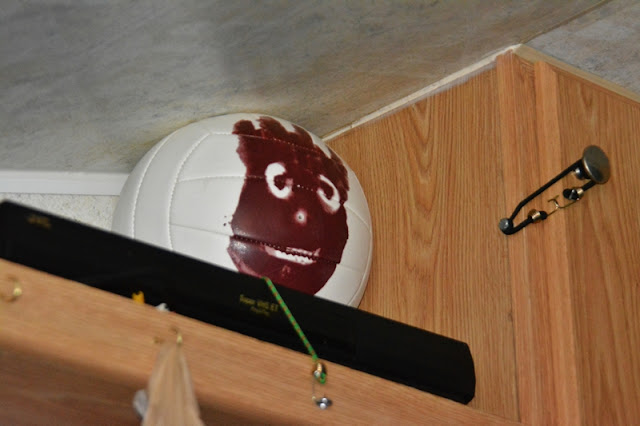
First COMEBACK EFFORTS WITH TITANIUM HIP–SPRING in the Wasatch Foothills

My last post was:

A NEW LIFE–TO ACCOMPLISH GOALS!

Previous to that:

SURPRISE…A NEW GLITCH! A New Surgery Monday–April 


WOW–Spring and MY NEW LIFE!
For the first time in years I’m hiking and working at getting back in shape with NO PAIN!  I can now put my socks on without going through a stretching routine and getting down on the floor, and a few days ago I was even able to properly and painlessly cut my toenails!  

A million thanks to Drs. RICHEY, JACKSON, and COLLEDGE and all the medical personnel that helped make this miracle happen.


I am supposed to wait until June 1 to shoulder a backpack, but I’m going into the hills with my 15 lbs. of camera equipment, plus .45 Colt Defender, water and lunch–adding up to around 20 pounds.   

Following is my first set of photographs from my Springville camp site near the Crags of the Wasatch in Little Rock Canyon.  
ENJOY SPRING IN THE FOOTHILLS OF THE WASATCH — and take your kids on hikes to learn of the great awakening in the outdoors.

 MY “CABIN” IN THE FOOTHILLS–soon to be in the High Uintas

 VESTIGES OF 2012


 Brilliant green creeping up the mountains–GRAB YOUR KIDS AND GO HIKING.

 Seemingly a bit scarce and drab still–but all of a sudden a stunningly green tree appears.


 Then look down amidst the developing green at our feet and look for the miniscule.  
You’re wrong!  There are flowers there, I promise you.  See below.

 Take along a magnifying glass for the tiny but beautiful little flowers an 1/8th of an inch small. 

 Help your kids focus on the small incredible beauty most never see. I do my best to zoom in for you.

 Many plants are just sprouting.  Look for them and their beautiful textures and keep them in mind for your next hike to see how they develop.


 Help your kids look down into the heart of the plants and see what it is sprouting, and what it might become by the next time you go hiking.

 What will this become?  You will likely be surprised how incredibly beautiful it will  be.  Have them notice the spines–have them be careful with some.


 What will this one develop into?  Will it have a flower?  Make sure and folllow the same trail in a week or so, and later through the summer.

 Likely the most common plant of the foothills is what we call “scrub oak,” the real name being “Gambles Oak.”  The leaves are beginning to sprout.  Notice the orange growths on the rough bark.  What is that? 
It is one of the most prolific and fascinating life forms in the outdoors, what we call Lichens–at the end of our hike I’ll show them on all the rocks and tell you a bit about them.  Hey, you parents, Google the word and tell your kids about this incredible life form.  I’ll mention just a bit at the end.

Is the wood good for anything except firewood?  After I show the beautiful leaves, I’ll show you a thing or two I do with it.


 Did you ever imagine scrub oak leaves could be so beautiful?  How will they look in the Fall?  Make sure and go on another hike or two then. Now to one beautiful creation I make with Gambles Oak.

  Have you ever seen a more beautiful natural, rustic frame?  Yes, it’s made from humble scrub oak.  A secret:  The corners are the tricky part.  They don’t have to be square or rectangular as you can see below framing a beautiful Native cutthroat trout from East Red Castle lake . 

 Now to something beautiful, but very controversial as seen below.
It’s called:
 Donkey-tail or Myrtle Spurge, usually just SPURGE.

SPURGE is considered a noxious weed that is spreading along the Wasatch Front.  Among many it causes a very serious allergic reaction, so DON’T TOUCH IT!  Google it to learn more.

But, there’s no denying that it is beautiful and get’s even better on zooming in.


Probably the most common seen from the outskirts of town.


Brilliant orange catches our eye.  What’s it’s name?  Maybe a good project would be to take along the Audubon Wildflower Fieldbook and learn the names.


We haven’t got very far up the hill and already seen so much.  I confess that I stop so often, especially on my first hike in an area, that I don’t really cover very much distance.

This beautiful flower is everywhere in the early season.


It gets more beautiful the closer you get.  How long will it last?

Small, but with beautiful color.


Here’s the same flower in a different, and earlier stage of development.

This is another early season flower that doesn’t last very long.

As is the case with many of these flowers, they can also be seen all around the cities.  I’ve seen one home lot with this flower as thick as dandelions.  I’ll get a shot of it and insert tomorrow.


This plant doesn’t seem to have what we can call a flower, but just wait…..

Keep an eye on it as the season progresses, and you will see bursting out of each bud a profusion of what is likely the smallest of the wildflowers. 

This is one of the Utah varieties of vetch.  Next you will see it in another color.


Sorry about the sun-spot.  Look past that and see this shrub’s beautiful blossoms.


Get closer–zoom in.

Now to what might be the most fascinating life form of our hills and mountains:
LICHENS.  Of course you should have also been helping your kids notice the incredible rocks and minerals of the Wasatch.  For more on that see my COMEBACK YouTube Video #15, and use the 70 rocks and minerals shown there to also help your kids appreciate the wonders of our hills and mountains.

The splotches on these rocks, everywhere from dull unattractive ones to brilliant orange and yellows are LICHENS.

Very slowly these living organisms help break down our rocks–don’t stand around and try and notice the changes, unless you plan on being a few million years old!

There are many thousands of varieties of lichens from  our deserts, foothills and right up to Kings Peak.

It is a partnership form of life in which a fungus combines or cooperates with an algae, or visa versa, to make life possible for both.  Scientists call it a “symbiotic relationship.”  Google it and learn a few details so you can make this fascinating life form literally come alive for your kids.

Ones, like this brilliant orange, and yellow below, were used by the Indians, or to be politically correct, Native Americans, as dyes and paints.


We got a bit of exercise and a big dose of inspiration from the beauties of the great outdoors.

Now back to our little camp and get all of these shots on the computer, and internet to share with all our friends.

GOODNIGHT SPRINGVILLE and UTAH VALLEY.

Next up we begin getting stronger going up the mountain a bit, and even up the Little Rock Canyon trail–that last Fall I couldn’t manipulate when I was trying “to fake not being a cripple”– to see what unique shots we can get literally surrounded by the Crags of the Wasatch you see below in the Fall.


A NEW LIFE–TO ACCOMPLISH GOALS!

My last post was:

SURPRISE…A NEW GLITCH! A New Surgery Monday–April 8th

It all boiled down to my left hip being all worn out, resulting in painful bone-on-bone, leaving me no choice but to go for a new surgery.  If you didn’t see the X-ray showing that, click on the above link, then come back for my report on:

COMPLETE HIP REPLACEMENT SURGERY

I had forgot to tell Dr. Jackson that I wanted the ball end of my femur–to mount on something and have like a trophy– he was to saw off to replace with titanium, and asked him about it afterwards, but he said it was too late and besides I wouldn’t want to see it as my bone was so hard they had to use something like a chisel and hammer to take it off in 4 pieces.  I’m exaggerating his description for sure, but didn’t get the “trophy.”  Dr. Jackson did a great job in the 2 hour surgery and came to see me when I couldn’t even begin to lift my left leg without help to get down and go for my first walk.

Above are the BEFORE, on the left,  and the AFTER to the right.
The 2nd day I early walked for 3 laps and felt great, but by the afternoon the pain blocker began wearing off and my vision of soon backpacking began to wain.

I was deeply impressed by all the medical staff who took care of me, and as I did while at Reams Supermarket, did my best to learn everyone’s name and took pictures of most.  Below is the 13″ x 19″ card I made and posted today  (Thursday the 18th, one week after being released) at the hospital.
I’m grateful for the visits made by my family, for my brother, Marlo, who brought me a walker on loan, and for Jesse who picked me up and took me home.

The instructions called for use of the walker for 6 weeks–but after using it on Thursday and Friday, I could lift my leg without help, and the walker just got in my way so was gratefully stored in a corner of the living room.  Dr. Jackson didn’t chew me out today for that, just smiled and said he had expected such, but to be careful–NO BACKPACKING FOR 6 WEEKS!

The instructions ordered me to not drive for 3 weeks, but there were urgent needs and so the next day I carefully tried it and since I drive with my right leg have continued.

Now to the ‘NEW LIFE:”  
My last 5 children, I have been a Mr. Mom to for the last 20 years, have grown up and I am proud to say they are becoming independent.  In all of that my remaining assets have been exhausted and so I will grow up too and go independent in a way to accomplish best my purposes:  First, finishing my High Uintas Wilderness Project with research, investigations, and explorations all around the Uinta Mountains and up into Southern Wyoming.  Second, while doing so persist in managing as a volunteer the Guatemalan Foundation and our altruistic projects among the Mayas in Guatemala.

To do so I will go mobile in my tiny 7′ x 11′ self-contained travel trailer, pulled behind my upgraded car, a Ford Explorer.  Since I was a young kid I dreamed of one day having a “cabin in the mountains,” but my 40 years helping the Mayans didn’t make me rich, so that dream was

forgotten a long time ago–until one day recently

 I SAW IT!


It is a 2006 model so inexpensive enough to handle, but doesn’t look used at all.


The spacious and well equipped kitchen, dining/living room and bathroom.
As you might perceive, I have modified it for my needs, building into it drawers, and shelves for my large 13″ x 19″ printer, my flatbed scanner, and with my high end laptop with unlimited access to the internet, I will be able to get to work and doing more than I have been able to do all these years.  Under the cabinets on the right I will soon install two more storage batteries connected to solar panels on the roof.  Everything is cushioned underneath and for travel held securely in place with bungy cords.

Of course I will be in abundant contact with the Satellite Phone from Russ and Skycall Satellite, plus my SPOT Personal Tracker, and reports each Saturday morning to Tim Hughes and KSL OUTDOORS RADIO.
The FIRST REPORT will be heard this Saturday, April 20th between 6:00-8:00 AM.
Click on the highlighted link to take you to KSL Online, or tune in to 1160 AM or 102.7 FM

I will also be in contact with the world with a high end cell phone that will give me unlimited internet access when in my mobile unit.

I will appreciate any comments, questions, or suggestions–and maybe an occassional invite for  a first class hot shower!!!!

SURPRISE…A NEW GLITCH! A New Surgery Monday–April 8th

“FAKING NOT BEING A CRIPPLE”  HIT A SNAG!
My “COMEBACK” described in my 5 YouTube videos all of a sudden took a wrong turn, so back to the specialists.  They tried another cortisone shot in a new spot in my spine, guided by x-ray technology that was supposed to make possible my remaining 150 miles of backpacking in the High Uintas Wilderness in July and August.  If that worked another surgery would be necessary to make it permanent.  But it didn’t work with some new  problems that had cropped up, so back to the drawing boards. 

Dr. Alan Colledge had done the shot, and I went back to him for a refund!  I described my whole experience and the new painful conditions.  He seemed to immediately suspect what had cropped up, and took an x-ray, I’ll insert below.  My right hip seen on the left side of the x-ray shows a distinct ball  and joint separation.  The left one, on the right, is all mushy with bone on bone.  NOTE:  Don’t be embarrassed by the shot of my private parts–THE ZIPPER IS UP!
The hip replacement surgery is scheduled for Monday morning with two or three days in the hospital, and then a six week recuperation period at the end of which I’m promised  I’ll be hiking again and I should be ready for my scheduled backpacking in the summer–and hopefully insist on NEVER GIVING IN in my 78th year.  I’ll keep you all informed.

SCROLL DOWN FOR LINKS TO ALL THE COMEBACK VIDEOS that will be in chronological order:

High Uintas Open–YouTube videos on BACKPACKING PREPARATION — Surgery Recovery

Do you recognize this unique scene?  Something wrong with it?

BACK SURGERY SAGA PUTTING ON HOLD 2012 BACKPACKING — The whole story


MIRROR LAKE SCENIC BYWAY and WOLF CREEK PASSES OPEN click for info
This is the earliest opening in my experience
To report accurately I made a quick trip up the MIrror Lake Scenic Byway–Utah Highway 150  on Saturday, May 19th,  to be able to report to all my High Uinta Friends.  Below are a set of photographs, some of them partnered up with similar shots taken on June 28, 2011.  You should all recall that 2011 was a heavy snow year and the Mirror Lake Highway didn’t open until June 28th, but with a lot of snow.  That made backpacking access very difficult until late July. As you can see it is much different this year.  Actually the Highway was open about a week ago.
We first stop at Provo River Falls, seeing it on the left last year, and then on the right today.  Obviously we are in for a very dry year,
Up the highway we stopped to observe Teapot Lake with ice breaking up.  Notch Pass is seen in the distance.

Next we come to Lilly Lake the above portion on the north side of the highway.  There were a few fisherman.

The high point on the highway is Bald Mt. Pass.  On the left in 2011 there were 4 foot drifts still. Today,  40 days earlier, almost nothing.
Over the pass we pulled out to view Moosehorne Lake below with slushy ice still, with Hayden Peak on the left, and Mount Agassiz on the right.
We are looking east towards Mt. Agassiz, the Naturalist and Four Lakes Basins, and Cyclone Pass.
As we head north towards Hayden and Agassiz peaks we can’t help but notice little snow.
In fact the difference is stark!  Backpacking will be possible easily by mid-June in some areas.
From Mirror Lake, that still had slushy ice on it, we climb towards Hayden Pass and stop to get a shot of Butterfly Lake that looks about the same as it did last year on July 8th.
We went as far as the Highline Trailhead, the most famous and most used in the Uintas. It looked about the same as on July 8th last year.  No access yet to the parking lot, but I suspect it will be clear of snow by early June.
I hope this report has been of interest to you. I now have to go to work and do PART 3 of the series I have been doing to help us all get ready for the backpacking season.  It will deal with GEAR.  I’ll do my darndest to get it done before I report in for my surgery on May 24th–and thus have my backpack ready for my first backpack.
If you are alert you will notice that the High Uintas Project is very alive as during my recovery I will post some interesting historical reports related to the High Uintas that you might not have heard of, and I suspect that I’ll beat the prognosticators in even getting some of my 4 trip schedule done before the snow flies–likely the trip scheduled first:  HOT ON THE TRAIL OF THE TIE HACKERS ON THE MIDDLE FORK OF BLACKS FORK and BOB’S LAKE
.
We all need to have GOALS and boy have I got them.  Make out a list of your’s and work on them.

BACK SURGERY SAGA–Putting on Hold 2012 Backpacking and the High Uintas Project

The NEW OBSTACLE I mention in Part 2 has me putting on hold Part 3.  Give me a week or so.
UPDATE:  April 20, 2012  Scroll down to see what the specialists concluded and the treatment that will have me overcoming the “obstacle” and  backpacking still in my 77th year. 
May 16th UPDATE:  “overcoming the obstacle”  got a bit more complicated, so it looks like the“backpacking still” will mostly be this old guy doing it in my 78th year!  “I’m going under the knife”  as there is too much of me still working pretty good TO GIVE IN!  
May 17th UPDATE:  On May 24th I will undergo surgery for my  “degenerative lumbar spinal stenosis.”  That translated to High Uinta geezer English is:  “I’m a worn out old guy!” Recovery can take as long as 12 months, but  knowing me, the Dr. thinks I might be ready to backpack by August 24th. I’ll apparently be in the hospital at least 3 days, then a week or so of bed rest at home, and then gradually get back in shape and hope to at least do what I have listed as my first trip for this summer.   I will do my darndest and see how it goes.   While I recuperate and recover I’ll be doing all the research I need to put all this together, but before the surgery I’ll do PART 3:  GEAR so that it might be in time to help all of you with a suggestion or two.. and  then I’ll keep you updated on things like the Mirror Lake Scenic Byway opening, and do some YouTube videos and photo/essays on a few of the fascinating historical aspects of the Uintas you probably don’t know about, etc. 


May 17th UPDATE:  On May 24th I will undergo surgery.
I will appreciate the prayers of all my High Uinta Friends and my large “congregation of REAMS customers, employees and friends.”


BACK SURGERY June 9th UPDATE:  
 “Transforaminal Lumbar Interbody Fusion L4-L5” was done on May 24th. I returned home on the 26th with instructions to not bend over, twist, or lift anything.  By my first post-surgery visit on June 5th  I was afraid I had exercised too much and  maybe done some damage, but the x-rays showed all was fine.  I’ll insert an x-ray below showing the titanium thing-a-ma-jiggs installed in my spine to keep things straight until bone grows up to make me strong again.  

In spite of the pain, etc. Dr. Richie still believes I will be able to backpack by late August.   I have good days, and bad days, one of my daily walks being to REAMS “where everybody knows my name.”  It’s my CHEERS!  Yesterday, a painful day with difficulty sleeping, had me finally at midnight seeing a DVD my son David gave me–“127 DAYS,”    WOW!  Aaron Ralston did everything wrong to get himself into his impossible situation–but what he did to survive will stop me forever from whining about a little pain.

SURGERY COMPLICATIONS  July 18th Update
I was doing fine with my recovery for about 2-3 weeks when I had increased my daily walking, twice a day, to a total of  as much as 6 miles.  But then left leg pain and weakness took over and the Dr. suspected that my persistence at continuing to work with pain for 3-4 months possibly caused nerve damage.  He told me to back off on the exercise and re-evaluate at my July 17th visit.  I was in tough shape for that visit, and today as I report.  I did go through a couple of weeks of hell to get off the narcotic pain killer and sleep aid prescribed by the Dr. and am struggling to get along with over the counter pain killers.
The next step is for the Dr. to try and learn what the heck’s going on by having me undergo a
 “CT  Myelogram L Spine” scan in a week after somehow going through 7 days without Excedrin, Ibuprofen or Noxaprene (pain killing blood thinners).  Last night was the first with basically not being able to sleep.  I will find a way to get through it, and do my darndest to finish what I started and avoid being “JUST A BUNCH OF HOT AIR!  I always have in mind:

CT Myelogram scan results….July 27th
My doctor and the radiologist concluded from the scan that everything is normal and that I should experience a full recovery.  I just have to be patient and very careful with walking and exercise as apparently there was nerve damage and being an old guy now has recovery happen in slow motion! That for sure will have me waiting until August 2013 to accomplish the four trips planned for this summer and give me enough time to learn to walk all over again and have sufficient  strength to get the job done.  I’ll insert two print outs below  from the scan the doctor gave me.

GRANDADDY OF UTAH HIKING SLIDE SHOWSl!


Click here:  SEE BLOG  Go to SLIDE SHOWS to see one of your choice.

TO SEE THIS YouTube VIDEO CLICK ON THE IMAGE BELOW
The video slide show begins with a couple of incredible aerial photographs of Crow Basin and Jackson Park, taken by friend Jonathan Jaussi (soon I’ll do a post of all his wonderful collection in preparation to conquer the area in August 2012).  Thanks, Jonathan.
To give you a glimpse of over 140 varieties photographed–around 40 new, I’ve put them all into a fast moving YouTube video slide show 12 minutes long.  There’s no sound, nor attempt to identify them–yet.  I will work on that during the long winter to ward off “cabin fever” and then do the big job of updating  the wildflower albums in the Galleries section with THE BEST OF THE BEST–likely bringing the total varieties to around 280. In most cases I try and show the entire plant, then zoom in. 

 If you enjoy the presentation, or any others on the website, a small  donation  would help keep the effort going.

WHAT FOR 2012 (besides the Mayan end of the world!)?
The “Forest Gump Moment” mentioned in my last trip report was only momentary.  On that trip to Jackson Park and Crow Basin   (YouTube video) I did so well doing the 6 miles to the car that I’m convinced I’m far from finished.  So I’m now back in training at REAMS SUPERMARKET, in Springville to be ready for 4 trips in August of 2012.  Drop by the store at 759 E. 400 South– I’d love to serve you while keeping in shape. I’m grateful for that opportunity to serve, and appreciative of the management and owners for giving me a job that literally helps keep me alive and raring to go in the Uintas and I’m even planning on running again (15th time) in 2012 the Coban International Half Marathon in Guatemala.
If you want to know other details about what keeps me  moving (and I promise it will do the same for you), click on:
Note:  Supplements and anything you purchase from Amazon by clicking on my links, earn a small commission for the High Uintas Project, and you’ll get them cheaper and fast.  

INTERESTED IN KNOWING WHAT FOUR TRIPS?

1.  CROW BASIN
2.  MIDDLE FORK OF BLACKS FK–tie hacker exploration and Bob’s Lake/Tiger trout
3.  TRIANGLE MOUNTAIN/RECONNAISSANCE LAKE and CONTINENT LAKE
4.  CRATER LAKE/EXPLORER PEAK via East Fork and Red Knob Passes

**************************************************************

NEW ADDITION TO THE ARTICLE about Energy 
COMING DOWN WITH A COLD
OR IN SUSPICIOUS CONDITIONS FOR GETTING ONE?

When working hard on the trail the fatigue you experience, sometimes coupled with getting a little wet in the rain, and especially coupled with advancing years, will lower your resistance and might  bring on a debilitating cold.  To ward it off, and/or get better quicker I have always recommended ZICAM Cold Remedy, but recently a new product has appeared that I feel is more effective, and half the price.  It is called COLD-EEZE, pictured below.  NOTE: You can get this cheaper at the pharmacy or supermarket than on Amazon.  
Don’t wait to start sucking on them until you are sick, but do so at the first suspicion of maybe it happening and immediately start taking also the increased dose of Wellness  capsules explained above.  In most cases you will avoid getting sick, or if you start a bit late, you will get over it much quicker.  This will be the cheapest through the above link.


Salt Lake Tribune article on High Uintas Project–KSL Podcast–links to Comments and Survival

The High Uintas Project is talked about (21:00) and near end of hour (49:18) a report from Cordell

The Blog:  HIKING UTAH asks the question:
Hiked much in the Uintas? He’s got you beat  click on that to see details
This was sort of a teaser introduction for the article written by the 
Tribune’s Outdoor Editor, Brett Prettyman, and published on Oct. 4, 2011.  

Thanks, Brett, for doing a great job reporting on the High Uintas Project.
Apparently they changed the format of this section printing horizontally filling the whole page with the panorama of what some think is the most beautiful mountain scene in Utah–Triangle Mountain and Reconnaissance Lake (see it full screen and high definition at the end of this post–in several versions from dawn to twilight).  It is off-trail in the remote upper Rock Creek drainage of the Uinta’s South Slope and as far as I can tell has never been published before.  I’ll show it, and all the 13 photos from the online version of the article,  but include descriptions of each, and insert the magnificent record wild trout caught from some of them.  
Click on the link below to go to the article, and then come back to see the photo album with detailed captions, Comments, and Survival discussion.
Click on the following link for  my discussion on related SURVIVAL issues and SPOT Tracker demonstration


NOW FOR THE REST OF THE STORY
In the newspaper version they  printed two black and white photographs, which follow in full color:
NOTE:  Click on the photos to enlarge
The Tribune’s caption:  Cordell Andersen takes in the beauty of Red Castle Peak in the High Uinta Mountains. Below, Andersen enjoys a meal near Kings Peak. 
My comment:  If you  saw the black and white versions printed in the newspaper you will understand why the book I envision on the High Uintas must have mostly color photographs. 
Now to the set of online photographs with captions and a handful of critical additions:
Here I am crossing the arctic tundra of the upper Lake Fork drainage in mid-September when it turned into the  survival experience mentioned in the article. Click on that if you want to learn the details.  As mentioned when up at 12,165 ft. on the ridge in the background and in need I had a satellite phone and I was talking to  Russ Smith from Skycall Satellite who “called in the cavalry.”    The cost was covered by my insurance and my 10% deductible payment.  I mention that as there were related negative comments in the Tribune’s online version.  Scroll down to see them.


Before continuing my review of the photos from the online Tribune article, let’s insert something else to set the stage for those who aren’t sure where the High Uinta Mountains are and how extensive.  First a Google Earth view showing the Uintas in relation to the Wasatch front/Salt Lake City,  Wyoming on the north, and Colorado to the east–this is impressive even for those of us who know the Uintas.

Below we zoom in on just the Uinta Mountain Range–actually the Wilderness Area, the light portions indicating the above timberline/arctic tundra  areas which you can see are very extensive–only beat by the San Juan Mountains of Colorado. 

Now to the Tribune’s photo album of my photographs.

This was the  Tribune’s first of the online album.  It is actually quite unattractive unless you know some detail. Their caption is:  Beard Lake in the High Uinta Mts.
.Let me tell you the rest of the story. This alpine lake is near  11,769 ft. Trail Rider Pass,  20 miles from the nearest trailhead,  between the Lake Atwood Area and the Painter Basin–all part of the Uinta River drainage.  Above it is a no-name 13,247 ft. peak I call Beard Peak.  To our right are the slopes of  the 13,387 ft. mountain I have named Mount Jedediah which I’ll get to in a moment.  Here, in what some maps designate as lake U-74,  a giant  hooked jawed Eastern Brook trout you see below grabbed my Thomas Cyclone.
This brookie’s body descends down  into  transparent water about 3 feet deep.  I let him swim around while getting out my tripod for a good picture of what I knew for sure was a new  Utah State record by several pounds, but then he was gone.  So we’ll never know for certain but his length was estimated at between 24 and 30 inches which would have had him weigh from 9 to 11+ lbs.  The Utah State record brookie weighed 7.5 lbs. from the Boulder Mountains.  Whatever his weight might have been this brookie shows that the Uintas don’t have to play second fiddle to any other place in America.  Click on the following  link for a discussion on the world record brook trout.

This is a little different version of the same picture in the Tribune album, composed and used by the High Desert Museum of Bend, Oregon for one of its displays.

My caption for this picture in my Lightweight Backpacking article refers to my 27 day expedition.  It is:  Pumped up on the 11th day heading for Crater Lake.  Equipment and food weight down to around 67 lbs. with a much stronger body. Believe me that doing this was about the most invigorating thing I have ever done in my life. But, no matter what your age, you shouldn’t attempt this without proper training and planning. Remember I trained for it for years, jogging daily, running half-marathons, and 2-3 times a week hiking 4 miles around the rolling hills of my farm in Guatemala with a 100 lb. bag of fertilizer on my back.  Without this I would have never been able to do what I did–and enjoy it. If you’re not willing to pay the price, don’t attempt anything similar.
 In the center of the image is Explorer Peak and in a glacial cirque at its foot is found Crater Lake you see below.
Beautiful Crater Lake, the Uinta’s deepest at 147 ft., is another of the most inspiring spots in the Uintas, but which again is not shown in any of the books on the Uintas.  I still have the vision of the ultimate photo of this scene being taken from the ridge on the right with a wide angle lens capturing the lake and Explorer Peak.  I still hope to bivouac up there for that “perfect shot.”
From the deepest, we go here to the largest lake in the High Uintas, Grandaddy Lake, one of the 26 lakes in the Grandaddy Basin, with well known mountains in the background:  From the left, Mt. Baldy, Hayden Peak, Mt. Agassiz, and Spread Eagle Peak.
With winter approaching in mid-September I got this panorama of the backbone of the High Uintas from 12,165  ft.* East Fork Pass (my name) at the head of the East Fork of Blacks Fork, with 13,219 ft. Mt. Lovenia out of sight far to our left, then Red Knob, in the distance to the right Mt. Beulah, and last  at the edge of the image  the slopes of 13,165 ft. Tokewanna Peak. *Note:Previously on my website I stated that East Fork Pass was 12,300 ft. but I have corrected myself.

Here I’m viewing at sunset Utah’s highest mountain, 13,528 ft. high Kings Peak.  One of my captions for this scene is:  
KINGS PEAK as the setting sun turned it to gold, so far the only gold I have found in the High Uintas.
This photograph was taken on the “survival backpack” as explained a bit further along and in the BACKPACK LIGHT and SURVIVAL segment where the image of my bivouac camp is also featured.

Down the ridge south of Kings Peak we come to Mt. Jedediah that guards no-name U-75 lake where on my 27 day expedition I caught the  large brook trout seen below.  The 13,387 ft. high mountain, 5th highest in Utah, was (unofficially) named by me for who I think was the most outstanding of the explorers and mountain men of the west, Jedediah Smith. In my Crow Basin trip report I added about him:  Smiths Fork, born in the Red Castle area on the North Slope, is also named in honor of Jedediah Smith, who along with his men first trapped the North Slope in the 1820’s.  “Diah” as he was sometimes affectionately called was a giant among those early explorers different in that he carried (and read) his Bible, did not swear, nor drink and refused to have to do with  women of ill repute. 

Here I insert another image related to no-name U-75.  This fat brookie was 17 inches long and from 5-6 lbs.  To arrive at that estimate I based the calculation on an 8 lb. cutthroat that was 21 inches long.  Click on that  and then the following to see the math logic involved.

11,130 ft. high East Red Castle Lake guarded by the multiple Red Castle Peaks was also another of those remote lakes that produced larger than normal native cutthoroat trout as you see below.

For more information on FISHING THE UINTAS, click on that link.
Another heavy bodied native cutthroat trout from East Red Castle Lake.
Young Rocky Mountain Goat on East Grandaddy Mountain. For photographs of most of the Animals of the Uintas, click on that link.  Go to the GALLERIES page to see  Mountainscapes,  WildflowersOrigen and RocksUinta Friends, etc.
This shot will have to represent the continually growing collection of wildflowers.  As soon as I have time to update the Gallery album with the new varieties I’ve photographed the total will likely surpass 250.

The Tribune article also mentioned my exploration and research on the “tie hackers,” without whom the West wouldn’t have been won.  My 7 photo essays on them can be represented by the opening page of one of them seen below.  Links to all of them can be found on my Articles page.
There is some exciting and fascinating history related to these incredibly tough guys who worked 12 months a year in the Uintas.  Check out the reports, one of which is represented below in a 1867 photograph of one of their ghost towns–Beartown, described as “the liveliest, if not the most wicked town in America.”  It grew to 2,000 people in 2 years and then disappeared like Sodom and Gomorrah.  I found the exact spot as seen in the photograph below.  This relatively unknown story will be part of my book. 
We now come to the full page spread in the Tribune article.
We end where we started with this beautiful scene of Triangle Mountain and Reconnaissance Lake.  I will not hang up my backpack until I can experience live one more time this incredibly inspiring corner of God’s great creation.  Below see other views  from daylight till twilight.

An unforgettable dawn.

In my 3 visits to the area I’ve never seen another human being and always had a truly wonderful wilderness experience.


Click here for COMMENTS & CONTROVERSY from the online Tribune article.


Click here for related SPOT TRACER DEMO and SURVIVAL issues  from the article.


Comments and Controversy from the Salt Lake Tribune article

A few COMMENTS including a bit of CONTROVERSY
From the Salt Lake Tribune article


“I want to be like this guy when I grow up.”  


“Im so proud to be part of his family and I hope one day his grandchildren can love the
Uintas Mountains as much as he does!” 
  Diana


“Love it.  Utah is certainly host to some magnificent and humbling vistas.  I know a few people that traverse the high Uintas on a regular basis.  That terrain and isolation is for only the most experienced.  Not only does it work out the body – it works out the mind.   1500 miles.  Great story !! “

“Great story! I would love a chance to do the same.”

“This guy is a treasure trove of information on so, so many levels. I hope he gets many opportunities to share his stories and knowledge.”

“Great article!  Great pictures!  Kudos to Mr. Andersen.”

“I wonder who pays for his rescues? “
 from Escaped from Zion

“I do.  Don’t worry your tax dollars go to fund UTA land buy-outs…”

“I’d rescue him but not arrogant  you!”

“Oh no, here comes the SLtrib crack incident expert brigade.”

***********************************

“There was only one rescue. Are you saying people shouldn’t go because they might need to be rescued?”
**************************************
Reply from Escaped from Zion
“I think it’s great he hikes by himself and carries a satellite phone. I’m just wondering if the county billed him for his rescue?”
Comment from Basinboy
“Unfortunately, the county taxpayer picks up the bill for his escapades and other search and rescue operations in wilderness areas.”
**************************************

               Brett Prettyman  in reply to EscapedfromZion

                                                                                                        and Basinboy

“His rescue was via LifeFlight from the U. I assume his insurance paid for it. There was no Search and Rescue.”
****************************************
Cordell Andersen’s reply to Escaped from Zion and Basinboy
“Thanks, Brett, for your comments.  Let me just add a word or two.  In the caption of the first photograph  I make a simple reply to EscapedfromZion, but will repeat it here.  My insurance covered the cost of the LifeFlight helicopter, minus my portion being a 10% deductible. “

NOTE:  At the end of this post I will insert what I recommend should be done by everyone going into the wilderness to avoid what happened to Eric Robinson this past summer in the Uintas.  He is the 64 year old Australian lost in the mountains.  My recommendations would avoid such happening in 99% of the cases. 
Let’s now go back to the comments:

“Wow. Incredible story and an incredible man. An inspiration to us all. The Uintas truly are legend. So unique in how they are built. Massive unbroken stretches of tundra, the like of which do not exist below Canada or Alaska. I am still learning of the wonders of the place. So many hidden waterfalls, hanging lakes and hard to access places and peaks. 
Some incredible photos of some of the  ‘secret’ spots I have been to over the years. I have long thought Reconnaissance Lake was one of the most spectacular sites in this country. It literally brought me to tears when I first saw it. Red Castle (East Fork of Smiths Fork), is my preferred access to Kings. Even a picture of the rarely seen east peaks of Red Castle. Love this article.”

“That is simply awesome Cordell!  What a great article about a truly amazing man and some magnificent country! 

Congratulations from someone who is proud to call you my internet friend!”
Steve

Luke wrote: “VERY COOL Cordell!”
“Great article Cordell!  I was just Deer hunting last week near Suicide Park and saw many tie hacker cabins I had never seen before.  I immediatly thought of you:)  I think I’ll try to get into Crow lake next year thanks to you. 
I’ll let you know if i make it.”
-Nick

“Great article, Cordell.  And now a book?  Fantastic!  I always wanted to have a rich and famous friend!  Take care.”
Doug

“Way to go Cordell!”
Tim Hughes

Shellee Sabey Bond “You ROCK Cordell! Keep on hiking!”


Julie Andersen-Versteeg   “SOOO cool Dad…you’re an inspiration to us all!!!”


Jolene Andersen  “Great article!!!  My son-in-law, Jared, saw it and forwarded.  I’m so proud of your accomplishments!!”


Breea Duerden Dunn  “Way to go Grandpa!” 
  

“I’m proud of you Gramps!” Bronson Duerden

Isabela Versteeg“I’m proud of you Gramps!” 
Terran Snyder   “That’s really awesome gpa!! Way to go.”

“Thanks for sharing the video.  Again congratulations are much deserved for the story in the Salt Lake Tribune.  It’s an amazing and interesting life that you have lived and are still busily engaged with.  Much admiration is given on my part for the love and sharing you have been willing to give to others including myself. Hope Reams is aware of the jewel they have in your service.  Have a wonderful evening.”  
 Connie Ann

Debbie    “This is so fantastic!  Congratulations!”
Lars Rasmussen   “I hope you are able to return to Triangle Mountain.  You are amazing!”


Brynn Duerden   from Australia  said:  “CONGRATS, GRANDPA!!! Y  R  AWESOME!”


“Read about your travels in this morning’s Tribune, and went immediately to your website. A wonderful story and beautiful photographs.  At my young age of 77, which I will celebrate on the 7th of October (with those numbers I should celebrate it in a casino), it is unlikely that I can prep myself to follow in your trailblazing footsteps, so will be somewhat satisfied with reading stories like yours, and enjoying the photos of things I have only imagined but not yet seen.  I have been an architect most of my life, and have survived and surveyed four high peaks.    Thanks for your story.  Respectfully,
Ray Kingston (one of the few Kingston Monogamists)


Teri Antti wrote:  
“Yes Uncle Cordell,very inspirational.  Since I turned 48 yesterday and can’t believe I am that age!  I haven’t hardly got started in life, so please keep inspiring me!”


“Hi Cordell.  Im glad that you are reconsidering your ‘Forest Gump Moment.’  We enjoyed your reports over the years and look forward to the next summer to do it all over again at KSL Outdoors Radio.  
Your SatPhone Buddy, 
Russ Smith”


Dear Cordell, 
I found out about you while reading the recent Tribune article.  The love of my life has also been the High Uintas.  There were so many places that I wished  to explore, but a series of health problems and my age have prevented me from getting there.  While I have done many day hikes and a few short backpacks in the Uintas, I have dreamed of getting to places like Red Castle and Crater lake.  You have brought those places to me.  Your photography, determination and stamina is awe inspiring.  The Uintas have provided me with such spiritual rejuvenation and I can tell, for you too.  In fact, I call myself a “Uintatarian”!  The fish, oh my!  The spectacular mountainscapes.  Thank you so much for bringing these great places to life for me again.  Oh how I wish I could do what you do.
Rosemary Lasko

Crow Basin-Dry Gulch REPORT — NEVER GIVE UP!

NOTICE–Monday, Aug. 22:
Made it back from Jackson Park/Crow Basin.  Within a day or two I’ll have up and running a fascinating YouTube video slide show, and a post here following the same outline, but with links that will be very beneficial to all. It will be entitled something like:
WOW…JACKSON PARK/CROW CANYON..SAW IT!  SURVIVED IT!  NEXT?
Also another one entitled:
ALMOST “SPOT 911” … Prepare to Beat the Odds!
 In the meantime you can see  what I did on SPOT TRACK Trip #7 clicking on  Hybrid and zeroing in to see all the details.


CONCERNING THE LAST TRIP (#6): 
WERE YOU SUPER-OBSERVANT?–Following SPOT Tracking?

After 2 miles of one tough jeep road for my small SUV I parked and started a tough hike up into unknown territory where eventually I would have to leave the trail and navigate down into a trail-less box canyon and Crow Basin.  I left home my 13 lbs. of photo equipment and went with my tiny Pentax water-proof point and shoot camera, but did have on my waist my Colt .45 Defender.
Absent around my waist for the first time in 1,470 miles of backpacking is my photo waist pack. No tripod either, nor heavy extra batteries, etc.  13 pounds for each of the 26,000 steps taken in a half-marathon adds up to 338,000 pounds less weight lifted!  


In an afternoon of hiking I made around 4.5 miles, but felt like it  was much more.   From there the next morning  I made my report via sat phone to KSL Outdoors (at the 6:35 point).  Afterwards, seeing where I thought I had to go still, I  wondered if this old 76 year old mountain man could do it.  I should have had a GPS to know exactly where I was, but did hit my SPOT tracker–so later at home I knew where I had been, and that I had been closer than imagined.  
But, I decided on another option for the trip and headed back to the car.  My SPOT tracks reveal I had aborted the original plan and wandered east checking out the Dry Gulch Road, and then crossed Indian Lands to the Uinta River Trailhead.  From there I made a big swing up and around  the previously unknown Whiterocks Drainage–clear up to  where the Highline Trail goes by Chepeta Lake.  It was from there that the 64 year old Austrailian had left to head West and to date is still lost.  I will eventually give you a report on this area–outside the Wilderness Area, and a guide to help you all enjoy it.

Upper Whiterocks Drainage panorama showing on left Fox/Queant Pass, then in center, North Pole Pass and on far right the Chepeta Lake area.

From there I decided to head for the Hacking Lake/Leidy Peak far east end of the Highline Trail and hike in to Gabbro Pass, but my brakes had become very mushy, and when heading for
Vernal and that high country area, the brakes got worse and so in wisdom I turned around and headed for  my Springville home and the wonderful Johnson family repair shop.
The master cylinder needed to be replaced–now done, so I’ll head out tomorrow (Wed. 8/17) to do the Crow Basin thing–NOT GIVING UP! (or GIVING IN as said famously by Winston Churchill).
 Above shows the Crow Basin target area, and where I started and where I got to (#2 and then tracks #4, #5, and #6 on the return to the car).
 The 64 year old lost in the Uintas had a Personal Locater Beacon, but apparently wasn’t using it.  With a SPOT Tracker, key locations along one’s trail can be marked and found easily by the friends on one’s message list and Search and Rescue–as seen above.   Don’t go without one as shown on the right panel–clicking there, you can get one cheaper than anywhere and earn for the High Uintas Project a small commission.
 Above shows SPOT Track #2, where I had got to.  From there another mile and I would have been to Jackson Park where the trail ends.  From there I will have to find the right spot to bushwack/boulder hop down into Crow Canyon and 10,350 ft. high Crow Lake and from there explore the lakes up to timberline and the 11,000 ft. high DG-14 lake.

Equipped with better maps and Google Earth views, as seen above,  showing where I had got to, and exactly to where I had to proceed to accomplish my goal, I stand a chance of accomplishing my goals and exploring the “last High Uintas drainage never visited.”  
I AT LEAST WILL ONLY GIVE UP WITH GREAT DIFFICULTY!
Click on SPOT TRACK to follow me in this exploration.

Once again I will give my sat phone report to KSL OUTDOORS Saturday morning from somewhere up in the high country.
Remember you can rent sat phones and SPOT Trackers from our good friend Russ Smith at SKYCALL SATELLITE 

It’s not Skycall Communications anymore, rather SKYCALL SATELLITE, but the phone numbers all work still as do the highlighted links.