ON HOLD…THE DREAM SCHEDULE…+ NEW BALANCE STRATEGY….PREPARE VIDEO #1


Once you are working on that EVERY DAY, add to it the ideas in the 2nd PREPARE YouTube video:
Note:  keeping in mind that in 2012 I hadn’t undergone hip replacement surgery that freed me from pain and gave me NEW LIFE…but the supplements & suggestions are very valid.


Then..
KEEP FROM GETTING CABIN FEVER DURING THE LONG, COLD WINTER by

OPENING YOUR EYES with the following video.

NEW LIFE Creates UNIMAGINABLE PLANS FOR 2014-15

PLANS FOR MY 79th, 80th, & 81st YEARS

Now with “no pain for the first time in 30 years”  my imagination and dreams for the future soar out of control. extending my Project for one, and likely two  more years- finishing  in my 80th year!

 Following is my list of “dreams”  for the future.  All of this is in keeping with my repeated theme since the beginning of my High Uintas Wilderness Project::


“NEVER GIVE IN!  NEVER!  NEVER! NEVER!”
Sir Winston Churchill

My age of course has me realistically modifying it just a bit, to:
“NEVER GIVE IN ….. EASILY!”
Note:  If you’re new and don’t quite understand all of this, check out my last YouTube  video that summarizes my 2013 activities, including 100 miles of backpacking “against all odds!”  :
SCROLL DOWN FOR THE VIDEO

Now…THE DREAM LIST: Later I’ll add photos, topo maps, distances, etc.


NOTE:  If any of my family are interested I’ll squeeze in each summer a Family Backpack too.


NOTE:  Feb. 24th, 2014.  The following was my original Dream List, now totally outdated and up to 14 trips, plus one (if I’m still alive by that time).  I’ll leave it here as originally posted  for history’s sake.  The updated and enhanced Dream List will be put back on the web by February 28th, and will be introduced by a report to KSL Outdoors Radio the next morning.
1.  Moon Lake/Lake Fork Trailhead – South Slope –  LOOP – Atwine, Clements, Stewarts,  Twin, and Aspen Lakes and back to Trailhead–thus beginning the season with an easy short trip.

2.  Moon Lake/Lake Fork Trailhead – South Slope – LOOP –  East Basin Pass,  Horshoe, and Picture Lakes, Cleveland Pass, Diamond, Mid, Rudolph Lakes, and Tworoose Pass, Tworoose, Kidney, Island and  Brown Duck Lakes, and back to Trailhead..

3.  Upper Stillwater/Rock Creek Trailhead – South Slope – LOOP – Shamrock, Squaw, and Rock Lakes, then up Rock Creek to:  Anderson, Phinney, Ledge, and Continent Lakes on to Deadhorse Pass (for a piciture or two), and back down to:  Doug, Boot and Reconnissance Lakes and to Allsop Saddle for a picture, then back to Trailhead.

4.  Uinta River Trailhead – South Slope – LOOP – to North Park, Painter, Milk, U-75, and Beard Lakes,   Trail Ryder Pass (11,700 ft.), then to George Beard Lake and Basin, down to  Atwood, Roberts, Allen, Allred, Carrol, and B-29 Lakes,  on  to Roberts Pass, Oke Doke and Chain Lakes and back to Trailhead.

5.   West Fork Whiterocks Trailhead – South Slope – LOOP – Queant, Cleveland Lakes and Fox/Queant Pass (11,360 ft.), down to Crescent, Fox, Brook Lakes and up to North Pole Pass (11,800 ft.), then Taylor Lake and back to Trailhead.

6.  Middle Beaver Creek Trailhead – North Slope – LOOP – Beaver,  Coffin  and no-name Lakes and Thompson Pass then back to Trailhead.

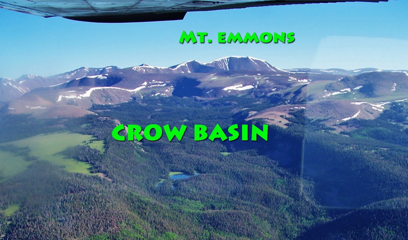
7.  East Fork Blacks Fork Trailhead – North Slope – LOOP – Little East Fork, Squaw Pass (11,742 ft.) Porcupine Lake, and Pass (12,360 ft.), 3 no-name lakes above North Star Lake in Garfield Basin, back over Porcupine Pass, on to Lambert Lake, and to Crater Lake for the “picture of all pictures”  from north ridge above Crater Lake, up to Red Knob Pass (11,700 ft.), up to East Fork Pass (12,150 ft.) and down East Fork of Blacks Fork to Trailhead.

With this accomplished I will have completed my goal of climbing all the passes in the Wilderness and tested and reported on fishing in 60 more alpine lakes, added to the hundreds already reported on.

NOTE:  If you got this far you are possibly thinking I’m out of my mind to consider  doing all of this…maybe because of my age, maybe because I’m just a little guy whose nickname in my youth was “Little Andy.” 
 There were 5 “Andy’s” on the football team so I was designated as the 
“Little” one, who welcomed the challenge head on and laughed at the scoffers. 


 Let me  add that I have dreamed my end would come —tongue in cheek–in one of the following ways…anyone of which will be just fine with me–and a lot better than going out as a “couch potato!”  

1.  Backpacking in the High Uintas, 

2.  Running one more time in the International Half Marathon 
in Coban, Guatemala, or 

3.  After taking out a few of the Mexican Zetas Drug Cartel thugs in Alta Verapaz, 
Guatemala, I’m  finally  sent to my rest with a smile on my face!  

“DEATH BE NOT BORING…….I’ve lived well.  I’ve adventured widely.  I will not die poorly.”   by Jonathan Dorn

“NEVER GIVE IN ….. EASILY!”

YouTube video #6-2013 BIG FOOT up Little East Fork?

The Last Backpack?…..to give BIG FOOT one more chance to find me to take his “Family Portrait.”

From August 13-17 I accomplished this backpack up mysterious Little East Fork of Blacks Fork, up over 11,742 foot high Squaw Pass and down to Oweep Basin’s 11,300 ft. high Porcupine Lake where I caught the most colorful Eastern brook trout I have ever caught. Slow acclimatization to the alpine elevations–that has become a problem I have had to work patiently with in my 78th year, had me taking longer (3 days) than hoped for to get to Porcupine Lake.   This forced me to forget my plan of continuing over Porcupine Pass to test the waters of 3 no-name lakes in the upper Garfield Basin. Likewise I had to cancel my plan of going in  the other direction to Crater Lake.  Thus, the decision to go back over Squaw Pass and down Little East Fork with the idea of giving BIG FOOT another chance to find me. This resulted in two incredible BIG FOOT related experiences shown in this YouTube video.  ENJOY!
NOTE:  Going alone had me taking all the following precautions:  (1.) Topo map and route posted on my website;  (2.) Using daily my SPOT Tracker so all would know I was alright and exactly where I was on Google Earth;  (3.) Having a SKYCALL satellite phone for emergencies and for reporting in on KSL Outdoor Radio;  (4.) Carrying all the stuff needed for “old guy”  emergencies, even to suture and treat a  wound and more;  and (5.) always hiking with great caution realizing I couldn’t afford to take a mis-step or make a mistake!

THE LAST BACKPACK?

NOTE:  I had an incredible backpack up to Squaw Pass and down to Porcupine Lake, then back to give BIG FOOT one more chance for the Family Portrait–and had TWO personal experiences….then met a whole bunch of new, beautiful High Uinta Friends–and within a day or two I’ll  have online the YouTube video you will all enjoy. 
Then on to LONETREE and on to the site of the first Rocky Mountain Man Rendezvous on the Uinta’s Henrys Fork River, and to  Manila, Utah, but it was in Lonetree I learned that great things can  come from a tiny place on the map–and that will be within a few days another YouTube video or two that came from a miraculous encounter!  I’M NOT KIDDING!
I will advise all of each new creation, the opening of the first being…..

To access the YouTube videos of the Tie Hack speech at the Wyoming Historical 
Society in Evanston, SCROLL DOWN

THE LAST BACKPACK…? To give BIG FOOT one more chance to find me to take his “Family portrait.”
NOTE:  This backpack, outlined below, is a relatively tough one for someone my age–going on 78–and so will be attempted with great caution.  I will proceed in accordance with how my body adjusts and adapts to the rigors encountered.  I carry with me and use daily a SPOT Personal Satellite Tracker, and a satellite phone. I leave with my family  my phone number and a time when I have it turned on each day in case the family needs to call me.  As you can see  below I leave a map showing my route.  All of these things should be done to be safe in the mountains.
To access a topographical map of the area click on MAP
To follow my route click on:  SPOT TRACKER


On Monday, August 12th,  I will drive to the East Fork of Blacks Fork Trailhead and on August 13th head up Little East Fork.  I will  bushwhack up to the above timberline lakes in that drainage and go cross-country to Squaw Pass.   NOTE: I have always been fascinated by the handful of remote, above timberline and off-trail lakes in this area and hope to be able to get to them, test their waters for fishing, get some good photos and report to all of my High Uinta Friends.
 From Squaw Pass I will descend to Porcupine Lake and will do one of three things: 
1.  If there is any doubt about my conditioning to safely proceed I will just return to the Trailhead following the trail down Little East Fork. 
2. If I feel up to it I will climb Porcupine Pass (2nd highest in the UIntas)  and test the waters of three no-name lakes, seen below to the center-left,  above North Star Lake in the Garfield Basin.  NOTE:  Again these 3 lakes have escaped me inspite of having gone by them quite a few times.  I would hope to not rest until I remedy this mistake, test the fishing, get some good photos, and report to all of you.  I will then return to the Trailhead following the trail over Squaw Pass and down Little East Fork.
3.  If I feel in superlative condition I will go from Porcupine Lake west to Lambert Lake and Meadow and from there to Crater Lake, seen below, to try one more time for that perfect photograph of the Uinta’s deepest lake (147 ft.).    I will return via Red Knob Pass, East Fork Pass, a spectacular area seen below after the Crater Lk. picture,  and then follow the trail down  East Fork of Blacks Fork to the Trailhead.
Crater Lake, the Uinta’s deepest at 147 feet

The Deadhorse area seen from 11,700 ft. Red Knob Pass


The spine of the High Uintas looking west from 12,150 ft. East Fork Pass

Remember to listen to my satellite phone report to KSL Outdoors Radio on Saturday, August 17th, at about 6:40 A.M.

For your safety and that of your group you can rent a SPOT Personal Satellite Tracker, and satellite phone from Russ Smith at SKYCALL SATELLITE.


What now?…..CROW BASIN and the Pioneer “YEEHAW TRAIL!”

WHAT NOW?   

On Thursday, August 1st, at NOON  I will be speaking at the monthly meeting of the Wyoming Historical Society at the County Museum in Evanston on:
“The TIE HACKERS:  Unsung American Heroes without whom the West might not have been won!”

 Then do research at Dubois, Lonetree, Burntfork, the Site of the 1st Mountain Man Rendezvous on the High Uinta’s Henrys Fk., then on to Manila and to the South Slope of the High Uintas in Vernal and the Uinta Basin.
Click here if you want to follow me…Spot Tracker Trail

SCROLL DOWN FOR THE CROW BASIN ADVENTURE

Thankfully I withstood the “ACID TEST” and had one great backpack in the High Uintas Wilderness, now having explored all the drainages.  In my mind I did it in honor of the Utah Pioneers–for July 24th, and especially my great-grandmother, Alice Brooks (Andersen), survivor of the Martin Handcart Company.  As it worked out it was this  incredibly faithful and courageous 21 year old, and companions, who inspired me, in my 78th year,  to  
“NOT GIVE IN,”  rather pass the test and finally make it to CROW  BASIN.

This “historic YouTube video” is the CORRECTED, IMPROVED and ENHANCED version.

MUCH WAS EXPERIENCED,  and MUCH WAS LEARNED ENRICHING MY LIFE and I believe my YouTube video report will be WORTHWHILE FOR ALL–and you will meet 4 new HIGH UINTA FRIENDS.

For more information and great photographs of CROW  BASIN, plus some very valid opinions of one of the new High Unta Friends, Darren McMichael, go to his website at: http://www.outdooradventuresutah.com/

NOW THE ACID TEST…Crow Basin!…YouTube Video #2-2013 Exploring MYSTERIOUS MIDDLE FK of BLACKS FK and BOB’S LAKE

From July 19-24  I work on exploring CROW BASIN – part of the smallest drainage in the High Uintas between the Yellowstone and Uinta Rivers on the South Slope.

  I had to move the schedule ahead 1 day.  I will leave for Duchesne on Thursday the 18th, to consult with the Forest Service, and hope to be on the trail on the 19th and call KSL Outdoors Radio on the 20th to report my progress.

 If interested see the map and you can even watch the YouTube Video of my 2011 effort to get there.  You can follow me at SPOT tracking.    

 I will begin the exploration with an “OK” when I leave the car.  Thereafter I will end each day with an “OK”  when I set up camp, and at the end of the exploration when returning to the car.  If in the middle of any day an “OK” appears, it will be because of wanting to mark some special location.

Below is friend Jonathan Jaussi’s aerial photo of the area:

YouTube Video #3-2013 Searching for the Hilliard Flume Ghost

YouTube Video #2-2013 Exploring Middle Fork of Blacks Fork.  

See at the end a whole bunch of new incredibly beautiful and handsome HIGH UINTA FRIENDS


Sorry about the cover photo.   I wasn’t given much of a choice, but it is an interesting Google Earth view of one of the 14 tie hacker sites I found, mapped, photographed, measured and dated.  Learn more in this video about these touch guys without whom the West wouldn’t have been won!

MIRACULOUS SUCCESS WITH BACKPACK No.2–YouTube coming–NOW RESEARCH and EXPLORATION

VIDEO COMING…as soon as I get back to civilization and fast internet……in the meantime enjoy BOB’S LAKE and TOKEWANNA PEAK
Since coming down from Tokewanna Peak I have been doing very productive research in Mountain View, Lyman and Evanston, Wyoming, and now will be doing so in the NorthWestern High Uintas.  Follow me on the SPOT website clicking on the following link:  FOLLOW ME


MADE IT!….1st 2013 Backpack–Warmup in THE GRANDADDIES

BACKPACK #2 Middle Fork of Blacks Fork
I will likely be on the trail by Wednesday, June 26, and first be mapping and photographing all Tie Hack sites, each with SPOT OK, and hopefully by Friday or Saturday, hike up to above timberline Bob’s Lake and then explore two other small lakes in the drainage.  I will then move on to Backpack #3 and advise.
SPOT TRACKER LINK

“MADE IT….NOT WALKING LIKE A PENGUIN OR A DUCK….ANYMORE!”

  Here’s the report,  with a YouTube video

BACKPACK #1 – The Grandaddies, Palisades Lake, 
and an Introduction to
The Most Unique Museum West of the Mississippi

 CAME BACK WITH SOME INCREDIBLE TROPHIES!!!!

Scroll down for the previous post:

1st  2013 BACKPACK –Warm-up in THE GRANDADDIES

On Wednesday, June 12th, a Wilderness trail crew will head up the Hades Canyon trail.  I’ll give them one day to clear fallen timber from my path and head up the trail on the 13th.  The road up Hades Canyon is open to the Grandview Trailhead.  No word on conditions but the word is out that we are in for the driest season in 10 years, and so the trail should be passable, even though perhaps a bit wet.  
 In 2007 I made my first trip to the Grandaddies on about June 15th, and it was dry and dusty.  That trip was made with my “football ankle” reconstructed and held together with 3 screws and a tendon transplant.  This time I’ll be doing it with a new titanium hip–done 2 months ago, but now without pain anywhere for the first time in 30 years!  I’m excited to say the least to be doing this in my 78th year, when just a few short months ago I was resigning myself to be a cripple.
I’m planning on 4-5 days my objectives being:  The native cutthroat spawn on the west side of Grandaddy Lake, and Palisades, Lost and Powell Lakes.