
NOTE: None of the photographs can be used without written permission from Cordell Andersen.
EMAIL: cordellandersen@hotmail.com
You should all be aware of special Facebook Page:
Cordell Andersen Photography, and the STORE,
where many of my photographs from the High Uintas are available.
where many of my photographs from the High Uintas are available.
Click for PREVIOUS POST on
SCROLL TO THE END to see a brief report on
The Coban International Half Marathon
The Coban International Half Marathon
HIGH UINTAS ACCESSIBILITY UPDATE
**************************
BACKPACK #1-2016
June 24-28: GRANDVIEW TRAILHEAD
To Grandaddy Lake, Fern Lake, Shadow Lake, Powell Lake & others in vicinity
***************************
Update: Sunday, June 19, 2016
FROM MIKE SLATER TODAY
Hello Cordell, just wanted to give you report on our weekend trip into the Granddaddy Lakes basin. My wife Ronda and daughters Janelle and Amber were able to make it with me to Granddaddy Lake without getting our feet wet. There was snow on the trail particularly once you got to Hades pass (attached photo of my wife) where there was snow that we had to step around or walk through. We had to look around a little to find places to camp out of the snow. We did not go past Granddaddy Lake so I'm not certain what is beyond there but again the majority of the snow, as is typical this time of the year was just coming down the north side of Hades pass but was very doable. By this coming weekend it should be very open. No ice on Heart or Granddaddy Lake but as you can see there is snow around the lake and in the basin. Over the night the temperature probably got down to around 35. Once again we had anexcellent trip, love getting up there. Take care and hope to see you on the trail, Mike


Wednesday, June 15One friend, Mike Slater & family, plan on attempting a backpack on Thursday, June 16 & will report….
Monday, June 13, 2016
Email from Sheila at the Forest Service in Duchesne
You can now access the Grandview Trail Head, but still a lot of snow at the pass and in the Basin. The lakes are still frozen over. In most areas the snow line is around 10500 in elevation, anywhere higher than that expect post holing. Our trail crew and wilderness rangers have reported very high river crossings, so not recommended. Expect 3 feet of snow on most wilderness passes at 12,000 feet. Trail crews have just begun clearing downed trees on accessible trails. If folks still want to backpack in, please advise them on conditions and to be extra cautious on campsite selection due to potential of falling hazard trees.
If any of you have questions please call….
If any of you have questions please call,
Sheila L Harper, Customer Service Representative,
p: 435-738-2482 x5200
f: 435-781-5215
sharper02@fs.fed.us
f: 435-781-5215
sharper02@fs.fed.us
FOREST SERVICE
*****************************************************
Friday, June 10th
Grand View Trailhead:
The road is now open to the trailhead, but there is snow on the trail
SEND ME A REPORT IF YOU MAKE IT, WITH A PICTURE OR TWO.
NEW REPORT…evening Friday, June 10th
John Lawton just emailed me the following message regarding the Grandaddy Trail:


NEW REPORT…evening Friday, June 10th
John Lawton just emailed me the following message regarding the Grandaddy Trail:
6/10/16 The trail is pretty clear the first half mile with only patches of snow cover here and there. Half way up the trail to the pass, the snow starts to get pretty thick with 1ft of coverage over the trail being pretty common. Up at the pass there are still 3ft drifts covering parts of the trail on the south facing part of the pass and lots of water running down the trail. I didn’t hike down too the lakes, but Grand Daddy and Heart are still frozen. The small pond at the pass is starting to thaw. Even with lots of snow there are patches of rocks and dirt exposed at the top of the pass and its melting fast. Attached some pics that you can use.
John Lawton


A MILLION THANKS…JOHN
DAILY SNOW DEPTH UPDATINGS:
6/5/16 6/15/16
BALD MT. PASS: 10767 ft….=31″……=19″
NOTE: All areas previously reported now at basically -0-
On Saturday, June 4th I explored:
WOLF CREEK PASS–NORTH FORK OF THE DUCHESNE RIVER
and THE GRAND VIEW TRAILHEAD “Gateway to the GRANDADDIES”
Then…….
THE MIRROR LAKE SCENIC BYWAY–BALD MT. PASS–
and THE HIGHLINE TRAILHEAD.
A few photos of the trip follow, most of which are self explanatory:
NEW INFORMATION TODAY, June 7th, FROM FOREST SERVICE:
ACCESS TO SOUTH SLOPE TRAILHEADS: Rock Creek, Lake Fork/Moon Lake, Yellowstone/Swift Creek, Uinta River, Whiterocks…..all reachable, but streams running very high, with snow above 10,000 ft. More info on Friday, or when advised by Forest Service.

Along the way…..just had to get a shot or two of this unique outdoor lover and his special kind of tough exercise machine!


Have to admire the guy…..but backpacking is still my preference!


Of course I just couldn’t resist inserting the beauty of one of the early bloomers….Western blue flax, Linum perenne


Wolf Creek Pass has been open for about a month or more


The North Fork of the Duchesne River on the Defa Dude Ranch road….


SPLASH DAM collapsed…..it would have never worked anyway–to wash logs down the rugged canyon with two many snags along the way.


What remains of the lake.


Clossed due to “snow,” but not much in sight, so I suspect it won’t be long before being opened to the Trailhead. I’ll investigate with the Forest Service and post an update here on Monday, June 6th.
NOW TO THE ……..
MIRROR LAKE SCENIC BYWAY
MIRROR LAKE SCENIC BYWAY

FIRST STOP….always at the PROVO RIVER FALLS, which
is a raging stream with the shirt-sleeve warm weather melting the snow rapidly!


The lakes along the highway have ice breaking up quickly…above looking north towards Mt. Watson….and below turning around and looking south..


Bald Mountain Pass still with around 24′ of snow.

The panorama a little further along shows quite a bit of snow from Hayden Peak on the left, to Mt. Agassiz.

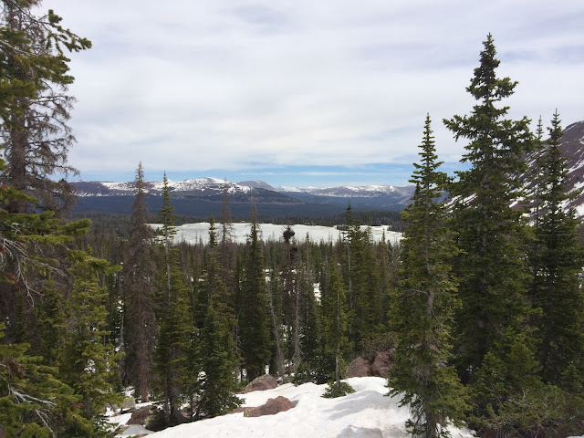
Above the east side of Mt. Baldy…..and below we see through the trees Mirror Lake still iced over, but it will go quickly with our continued hot weather.

Below, Pass Lake………

……..as we begin the climb up to Butterfly Lake and Hayden Pass.


Butterfly Lake…..above.

On Hayden Pass and the entrance to the famous HIGHLINE TRAIL, there are still a couple of feet of snow, so it will likely be 2-3 weeks before we can head east on the trail.
My bet, is on the GRANDADDY TRAIL from the Grand View Trailhead–in no longer than two weeks…….even the road to that trailhead likely open within a week, but with a wet trail to Hades Pass and to the Grandaddies. My plan is to head to the Grandaddies first on June 25th for a 4-5 day backpack….to start getting in shape for my big objective: “LITTLE ANDY LAKE” in July.