IMPORTANT NOTE TO BUY BOOK: I suggest you choose PayPal as it is the fastest. You don’t have to have a PayPal acct. just click on it, then click on “Create an Account,” and you will be given options for any Credit or Debit card of your choice.
SCROLL DOWN FOR ACCESS TO ALL OF THE HIGH UINTAS NEWSLETTERS, and TO SEE THE INCREDIBLE VARIETY OF INFORMATION IN THE BOOK.
COUNTDOWN TO UINTAS OPENING– SNOW DEPTH ON KEY PASSES
Date: May 1: BALD MT. PASS = 86″ – WOLF CREEK PASS = 46″
********************************
CLOSED — June 20: BALD MT. PASS-32″
OPEN — Monday June 24: BALD MT. PASS- 28″–
NOTE: I MADE AN EXPLORATORY TRIP TODAY AND WILL GET ON MY WEBSITE A REPORT WITH PICTURES LATER TONIGHT (Monday) OR TOMORROW. I’M RIGHT NOW TRYING TO FINISH A YouTube VIDEO TO PROMOTE THE BOOK. ONCE DONE i’LL GET THE PHOTO/REPORT ON THIS WEBSITE, INCLUDING THE STATUS OF THE GRANDVIEW TRAILHEAD.
Snow plowing of the MIRROR LAKE SCENIC BYWAY began Monday-June 17th, and will likely take a week or more before the Scenic Byway is open. and I’ve got to add that the North Slope Rd. for one to do the AUTO-LOOP TOUR, promoted in my book, will likely have at least one difficult stretch, at Elizabeth Pass that is 10,235 ft. high– so best check with the Forest Service in Evanston or the Bear River Ranger station before attempting said road.
The Mirror Lake Scenic Byway is still closed –the chance for this week Sat. 6/22 is “very slim,” and most likely will be next week.
NOTE: The elevation of Hades Pass, “Gateway to the Grandaddies” is approximately the same as Bald Mt. Pass–so this pass–closed still– is an indication of accessibility to the Grandaddies from the Grandview Trailhead.
OPEN — June 18: WOLF CREEK PASS =officially with no snow.
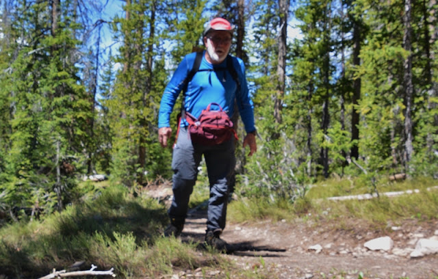
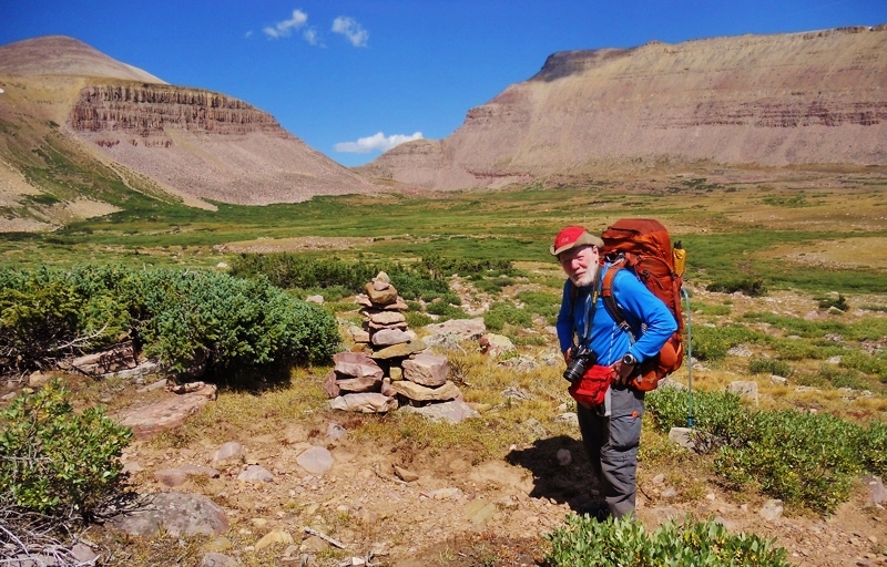
The gate for the Hades Canyon Road to the GRANDVIEW TRAILHEAD is open but still only passable to the Splash Dam on Thursday, June 20th. Maybe to the Trailhead inside of a week, but even when the Trailhead is accessible, the trail to Hades Pass and the Grandaddies will be difficult, as attested to by the high runoff engulfing the bridge up from the Trailhead–seen below in 2011 on July 8th– so be patient. Check with the Duchesne Forest Service Ranger Station for current conditions –Tel. 435-738-2482.
The Duchesne River was expected to reach FLOOD STAGE (13.3 feet) by Thursday 6/20 , so the thaw is happening quickly. It is “comparable to June 2011 when the river reached f;ppd stage – 14.4 feet.”

**************************************
HIGH UINTAS NEWSLETTERS – beginning on April 19, 2019
- #0 – VOW FULFILLED–eBOOK NOW AVAILABLE
- #1 – A FREE GLIMPSE OF BOOK – BYU Radio interview link
- #2 – UINTA OPENING WATCH —ALL ABOUT SAVING LIVES
- #3 – AN EASY WAY TO GET BOOK – a thumb drive
- #4 – GOLDEN SPIKE CELEBRATION—SOMETHING MISSING — only in the Book
- #5 – HISTORY, LIFE SAVING STORIES, LEGENDS-BIG Foot, LITTLE & SMALL Foot
- #6 – NOT GIVING UP-TAKING NO GUFF–YOU’LL LOVE THIS LIFE SAVING BOOK!
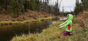
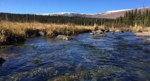
- #7 – REPORTS FROM HENRY’S FORK & HADES CANYON
- #8 – IT’S ALL ABOUT SAVING LIVES – Index listing for “SURVIVAL”
- #9 – “LITTLE ITALY’S (Hanna) FIRST LADY” encourages with her smile: “Buy the book!“
4/30/19 1:00PM, 30 minute interview on BYU Radio: CONSTANT WONDER then click on backpacking the Safe Way

KSL Outdoors podcast 4/20/19 Book announced
KSL Outdoors podcast 4/27/19 Cordell’s report
KSL Outdoors Radio podcast 5/11/19 Cordell’s report from Promotory Point in 1869
At the 14 minute point I was introduced as having been the only now living who was there for the Golden Spike at Promontory Point 150 years ago….hear what I had to say about it.
I was in studio for the 2 hour show with historic discussions about the “UNSUNG AMERICAN HEROES WITHOUT WHOM THERE WOULDN’T HAVE BEEN A TRANSCONTINENTAL RAILROAD OR WINNING OF THE WEST.”
May 18, 1st segment: 18 minutes introduction–I’m at the 11 minutes point.
May 18, 2nd segment: TIE HACKS “Unsung American Heroes” 20 minutes
****************************
Below is the TABLE OF CONTENTS: History, Legends & Life Saving Stories –
INFORMATION NOT IN ANY ONE BOOK ON THE PLANET