UINTAS OPEN — SEE THE GRANDVIEW TRAILHEAD “Gateway to the Grandaddies,” & MIRROR LAKE SCENIC BYWAY AREA including THE HIGHLINE TRAILHEAD & more……
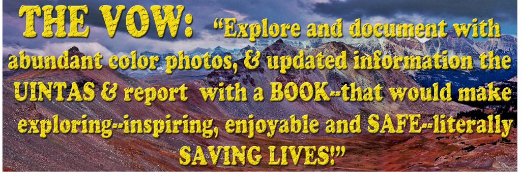
I HAVE GRATEFULLY LEARNED THAT WHAT MY BOOK PROMOTES SAVED AT LEAST 4 LIVES WE KNOW ABOUT LAST YEAR. LET’S DO IT AGAIN IN 2020!
****************
PLEASE FORGIVE ME FOR HAVING FAILED SO FAR TO MAKE AVAILABLE AS PROMISED:
THE GUIDE FOR DOING THE HIGHLINE TRAIL ……with information on short detours to see the most scenic spots in the Uintas & for fishing information, but I have now been struggling for going on 3 weeks with CORVID-19 as well as struggling with my back pain that is making me a cripple-made worse a month ago when on an exploratory trip in the Uintas taking by far the worst fall of my life–THAT SHOULD HAVE KILLED ME, but it has made much worse my back problems!
I HOPE TO GET IT DONE ALONG WITH SAFETY TIPS DURING JULY. In the meantime get my book to help in your planning.
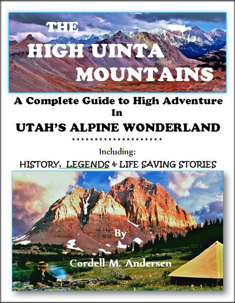
You can get the digital BOOK for $19.95. Just click on the link PURCHASE BOOK
Watch 9 min. YouTube video describing the book, click on that link
SCROLL DOWN TO PREVIOUS POST FOR MORE INFORMATION
“THE GATEWAY TO THE GRANDADDIES”
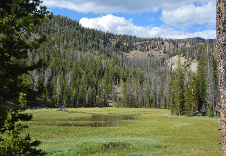
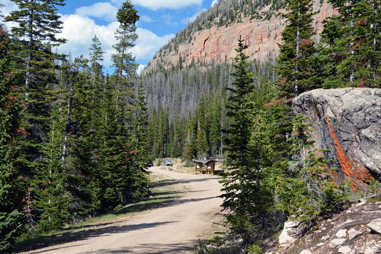
The road along the North Fork of the Duchesne River is in great shape, and past Defa’s Dude Ranch the gate is open to drivce up Hades Canyon you see here, with Lightning Ridge crossing the picture. No sign of snow.
Up to the Splash Dam there is no sign of snow, with the road in good shape.
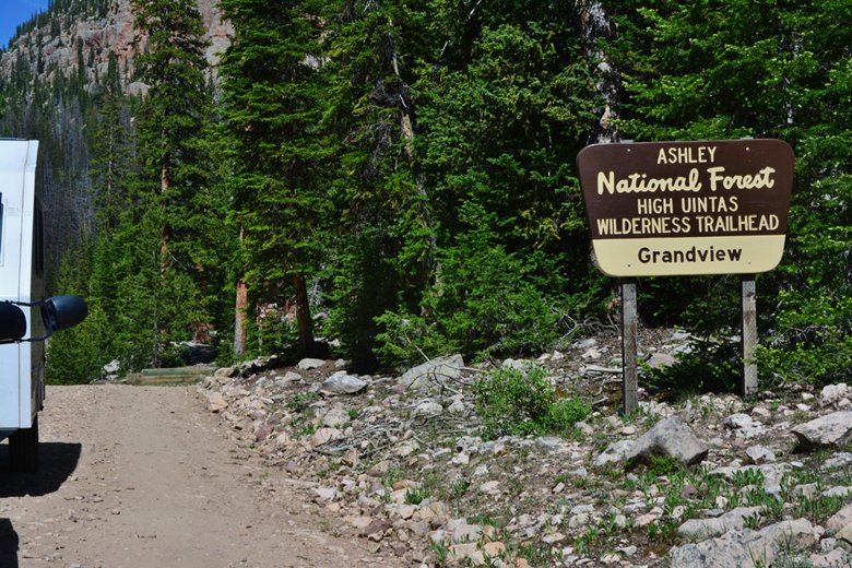
In the vecinity of the GRANDVIEW TRAILHEAD there is a little snow along the road, but the road is dry.
On Thursday, June 11th there were three or four vehicles in the upper parking lot.
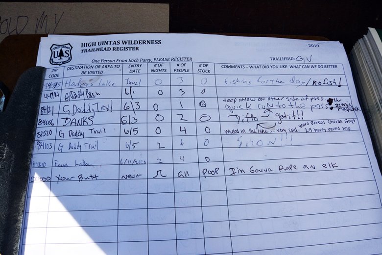
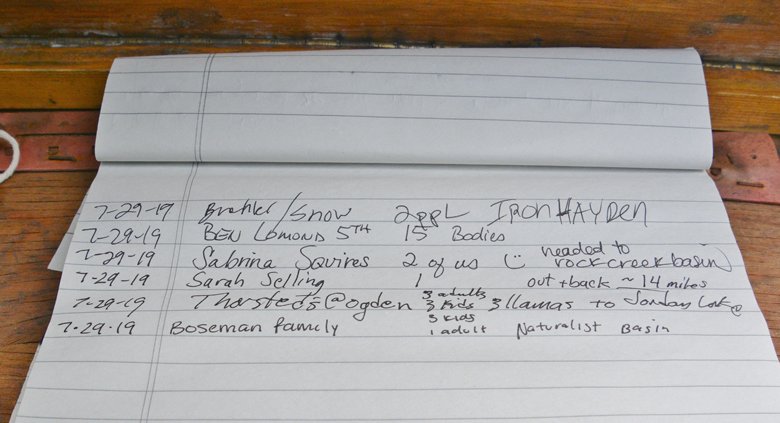
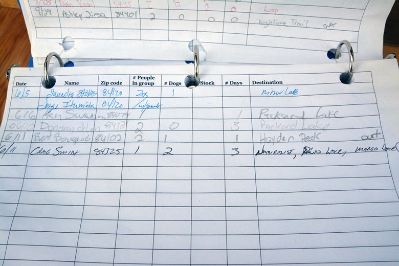
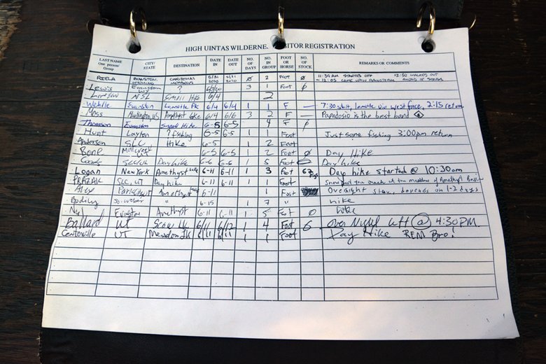
Here’s a view of the Register, with entries from June 3 on mentioning having had to deal with lots of snow. One entry on June 11th lists a party of 4 going for two nights to Fern Lake.
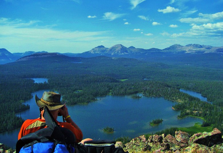
For sure this weekend of June 12th, Saturday the 13th and Sunday the 14th the parking lot will fill up with day hikers and backpackers. GOOD LUCK & let me know how you do. Above I’m on the East Grandaddy Mountain saddle, viewing Grandaddy Lake and the Basin.
NOW ON TO THE MIRROR LAKE SCENIC BYWAY
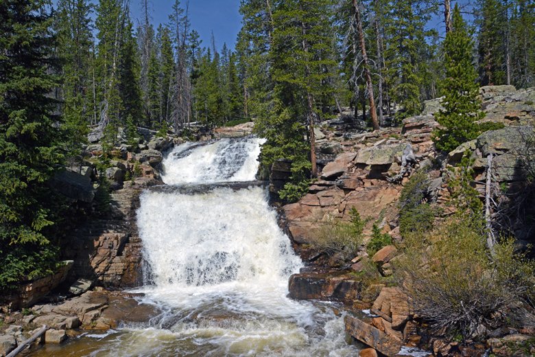
Here we see the PROVO RIVER FALLS . All the lower areas along the Highway are open with campers here and there, and all the minor trailheads in the lower country are open.
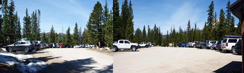
Here is a rough panorama of both sides of the CRYSTAL LAKE TRAILHEAD with a lot of cars as you can see.
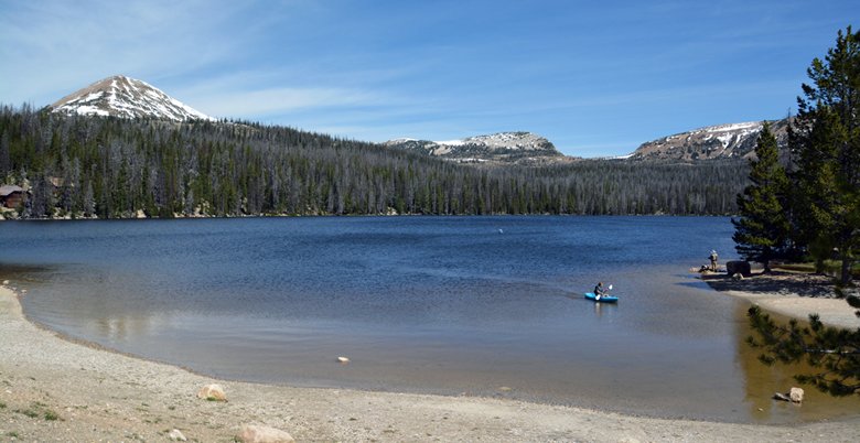
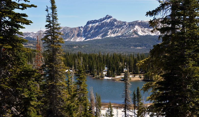
This is TRIAL LAKE at the entrance to the Crystal Lake Trailhead area, with NOTCH PASS in the right distance, pretty well free of snow.
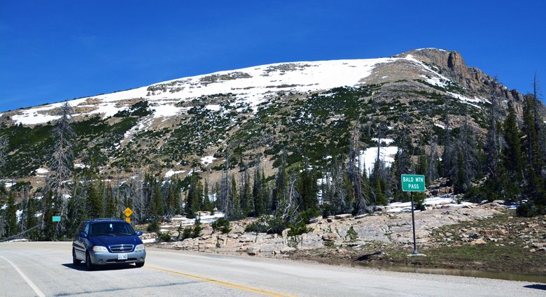
Here we are on 10,759 foot high BALD MT. PASS, with snow here and there, and still no access to the Trailhead and parking lot.
Here we are coming down into the Mirror Lake area with Hayden Peak on the left center, and Mt. Agassiz on the right.
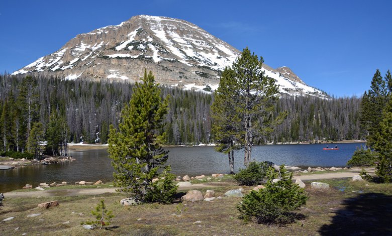
We are here at the Hayden Peak Overlook, with Moosehorn Lake in the foreground.
We are seeing a portion of Mirror Lake with Bald Mountain in the background. There were a couple of cars in the Mirror Lake Trailhead parking lot.
Further along we swing by Pass Lake and then on the left is the entrance to the Pass Lake Trailhead.
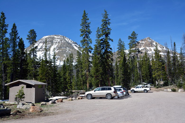
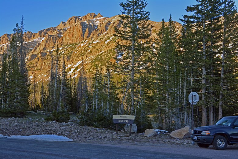
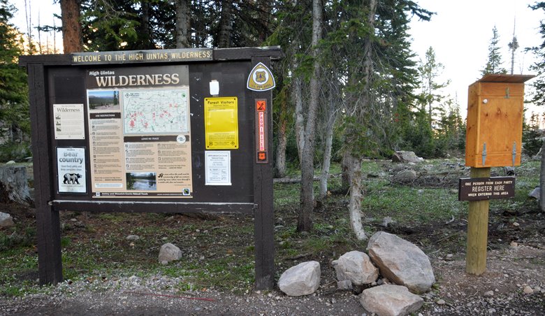
Then we come to the entrance to the HIGHLINE TRAILHEAD, with just a little snow on the road to the parking lot, but it will be gone by tomorrow, but the lot was filling up when I dropped by on Friday.
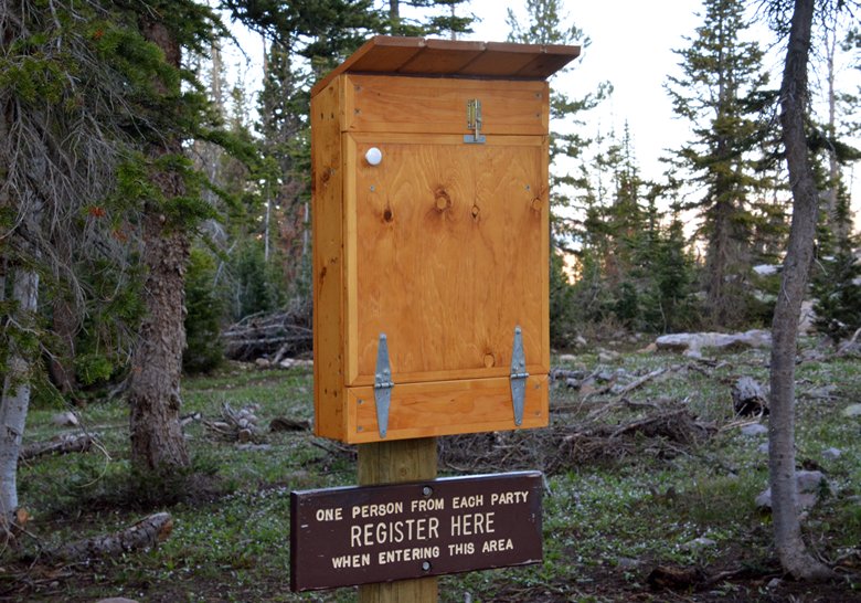
The TRAILHEAD has an addition as those of you familiar with it will notice. It is a new register.
This was the register in 2019 and before, usually just a few pages ripped out of a notebook. I never could figure out why the Trailhead of THE MOST IMPORTANT TRAIL IN ALL OF UTAH….THE “HIGHLINE TRAIL” was so humiliated!
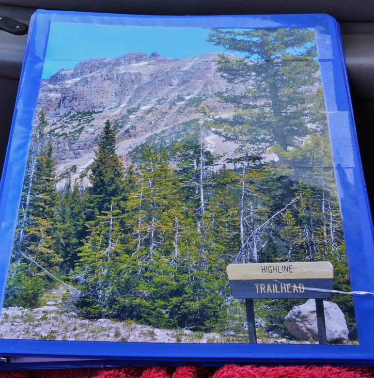
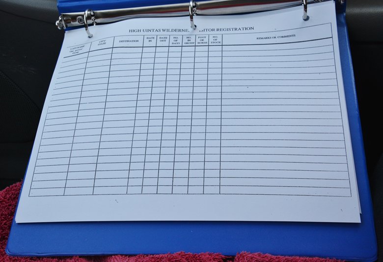
I tried to remedy that in 2019 by fixing up a register and gifted it to the Forest Service, as you can see above, with pages I photocopied filling it as seen below.
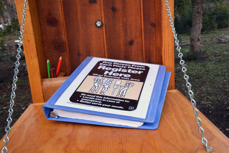
Well, something finally happened….A NEW VERY NICE REGISTER.
The FOREST SERVICE changed very appropriately the cover photo, but I was pleased to find my loose-leaf binder now put to use and filled up with great pages for maybe the first time in history.
A few trips have been attempted, like one to PACKARD LAKE which is at a lower elevation and likely accessible without too much snow in the way. The Naturalist Basin, and points further east might be a little more difficult now, but when I came back by on Friday, the parking lot was filling up with adventurers. LET ME KNOW HOW YOU DO.
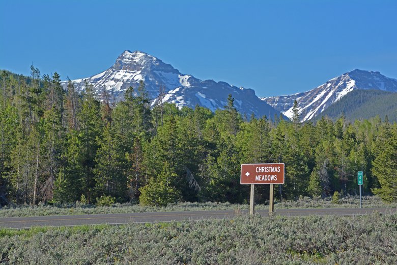
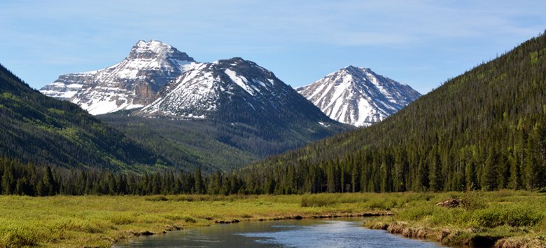
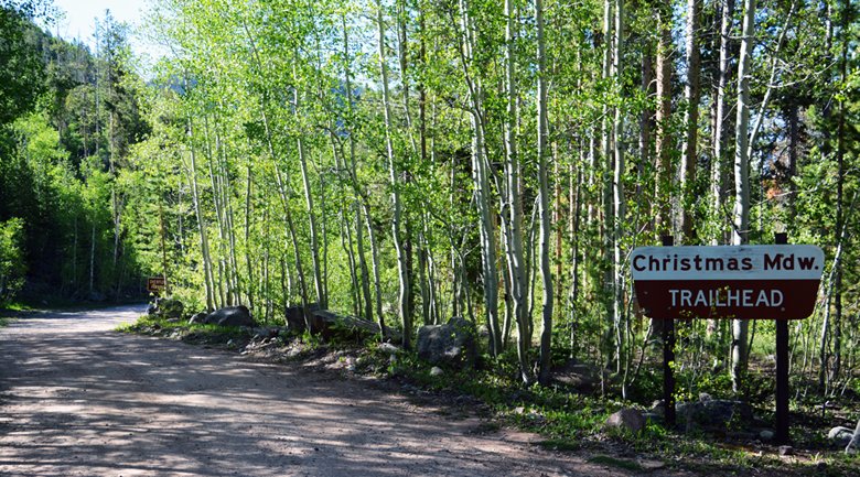
Then down to the North Slope seeing magnificent OSTLER PEAK, and the road to Christmas Meadows and the Christmas Meadows/Stillwater Trailhead.
OSTLER PEAK & SPREAD EAGLE MOUNTAIN.
The TRAILHEAD is about 5 miles from the Mirror Lake Scenic Byway.
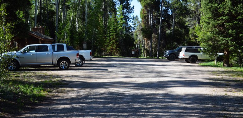
Quite a bit of activity as the Trailhead is in lower country, but with trails to the Amethyst Basin, and to Middle Basin with Ryder & McPheeter Lakes, and to West Basin with Lake Kersuh. I would suspect there would be quite a bit of snow in the high country still.
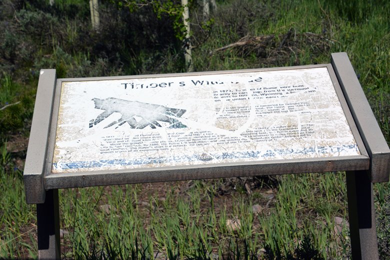
Last of all about 100 yards in on the Whitney Road, is found what was once a magnificent display on the HILLIARD FLUME. It’s a story I tell in my book, about the tie hackers, and all of such displays would be more than worthwhile replacing….HINT, HINT!
scroll down for all the information you will need to get my book which has all the updated information, and topographical maps you will need for unending adventures in our wonderful HIGH UINTA MOUNTAINS.
One Reply to “UINTAS OPEN — SEE THE GRANDVIEW TRAILHEAD “Gateway to the Grandaddies,” & MIRROR LAKE SCENIC BYWAY AREA including THE HIGHLINE TRAILHEAD & more……”
Hi Cordell,
Good to hear from you!
Thank you for the pictures and updates of the High Uinta’s!
Well done!
We will explore as much of these locations as we can very soon.


Hi Cordell,
Good to hear from you!
Thank you for the pictures and updates of the High Uinta’s!
Well done!
We will explore as much of these locations as we can very soon.
Best wishes, strength and good health to you!