
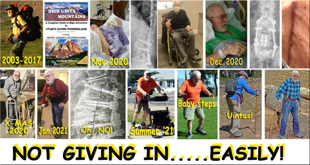
I’M SHARING MY EXPERIENCE AS IT COULD BE OF HELP TO SOME OF YOU THAT LIKELY WILL HAVE CHALLENGES ALONG YOUR PATH — QUITE A FEW HAVE ASKED ME TO SHARE MY EXPERIENCE…..BASICALLY OF…… “NEVER GIVING IN, NOR GIVING UP ……….EASILY!”
This winter my exercise devise has been the stairs below the American Fork Fitness Center, gradually doing more and more laps–up & down, until getting up to doing 32 laps with the goal of doing 40 a day by backpacking season.
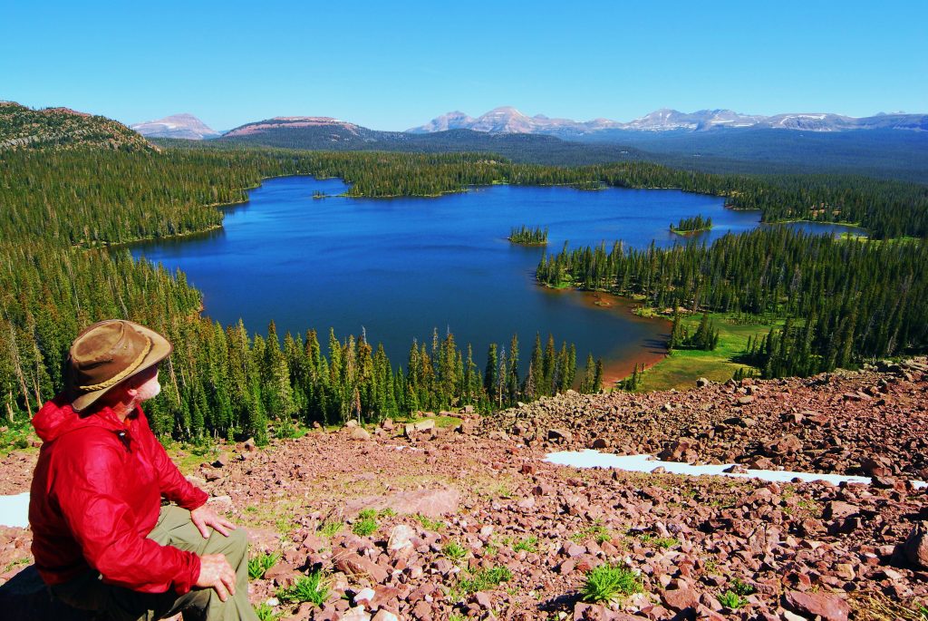
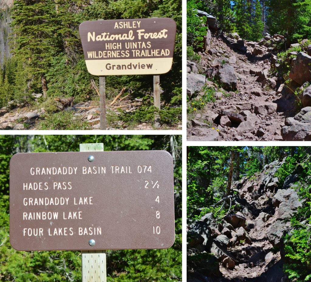
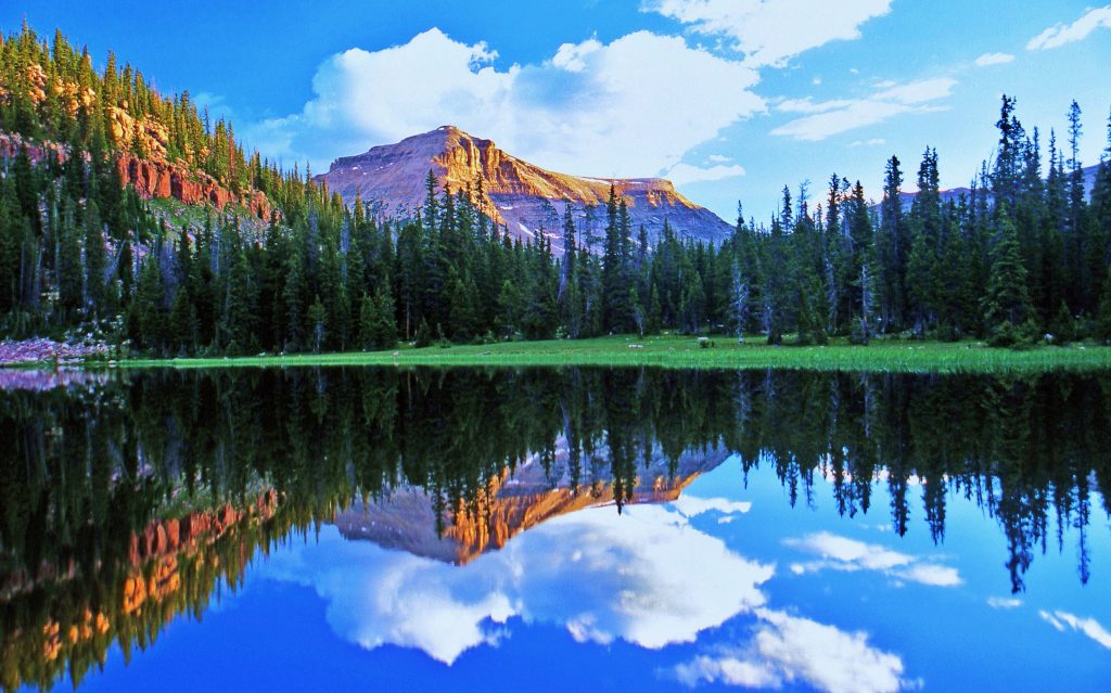
Doing 40 laps would be equal to the elevation gain from the Grandview Trailhead up to Hades Pass that we call “THE GATEWAY TO THE GRANDADDIES.” I’ll insert below a wonderful photograph of Grandaddy Lake, the largest in the High Uinta Mountains. There are 26 alpine lakes in the Grandaddy Basin.
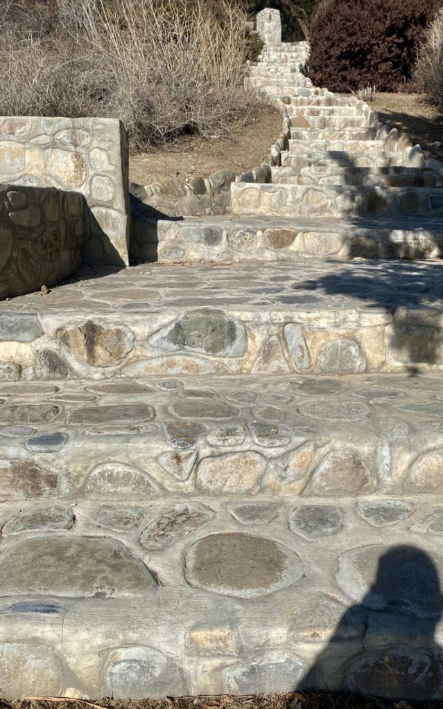
BUT I HAVE REALIZED THAT TO PREPARE ME FOR HIGH UINTA TRAILS–LIKE SOME STRETCHES OF THE HADES PASS TRAIL YOU SEE BELOW, THEY HAVE STEPS THAT ARE MUCH HIGHER THAN THE ONES I’VE BEEN DOING SEEN ABOVE, SO I DO THOSE STAIRS TO WARM UP, AND THEN GO EACH DAY TO WHERE THE STEPS ARE AT LEAST 50% HIGHER….YOU’LL SEE AFTER “the rocky trail.” …
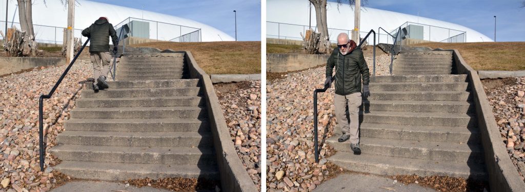
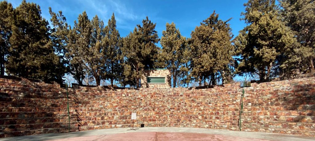
SO, I’M BACK TO THE AMERICAN FORK AMPHITHEATER JUST WEST OF THE LDS TEMPLE, WHICH PREVIOUS TO ALL THE PRESENT PROBLEMS I USED TO HELP KEEP ME IN SHAPE DURING THE OFF SEASON. THE STEPS HAVE HAND RAILS WHICH I NEED AS MY BALANCE ALSO VANISHED ALONG WITH MY ABILITY TO WALK.
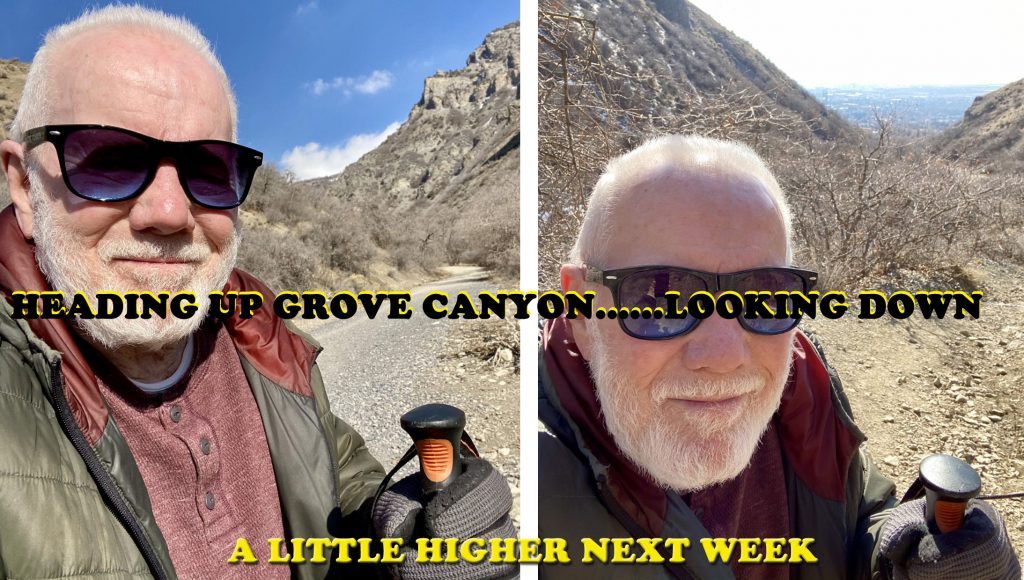
AS I EXPLAINED IN THE PREVIOUS POST, THE ABOVE EXERCISES ARE DONE 5 DAYS A WEEK. FOR THE 6th DAY I GO EAST TO THE FOOT OF MT. TIMPANOGOS, AND USE THE GROVE CANYON TRAIL. AS SEEN BELOW–for last week–USING TREKKING POLES I HEADED UP THE TRAIL FOR ABOUT 30 MINUTES TO WHERE THE TRAIL LEAVES THE ROAD & WILL ADD ON ABOUT 100 YARDS/WEEK.
EVERYTHING I’M DESCRIBING LIKELY SEEMS SORT OF “MICKEY MOUSE” FOR MOST OF YOU, BUT CONSIDERING THAT A YEAR AGO I COULDN’T EVEN WALK, & STILL HAVE THE DANGEROUS MISALIGNMENT OF MY SPINE WITH CONSTANT PAIN–but I think is gradually being reduced as I exercise more, I FEEL EXTREMELY BLESSED TO BE ABLE TO DO WHAT I’M DOING–and I CAN ADD THAT IT FEELS WONDERFUL TO HAVE AGAIN DEVELOPING MUSCLES THAT ACTUALLY FEEL THE SORENESS & STIFFNESS THAT COMES AFTER A HEAVY WORKOUT!
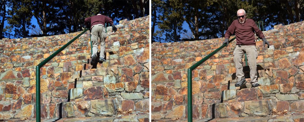
NEXT I WILL GRADUATE TO THE HIGHER STEP UPS–SEEN BELOW AT THE Amphitheater, but with NO HAND RAILS, so will use my trekking poles, and hope to get strong enough with good balance to not need the poles–and then be ready for the HIGH UINTAS!
NOW…….AGAIN WE GO INTO THE HIGH UINTA WILDERNESS from the CHRISTMAS MEADOWS/STILLWATER TRAILHEAD ON THE NORTH SLOPE.
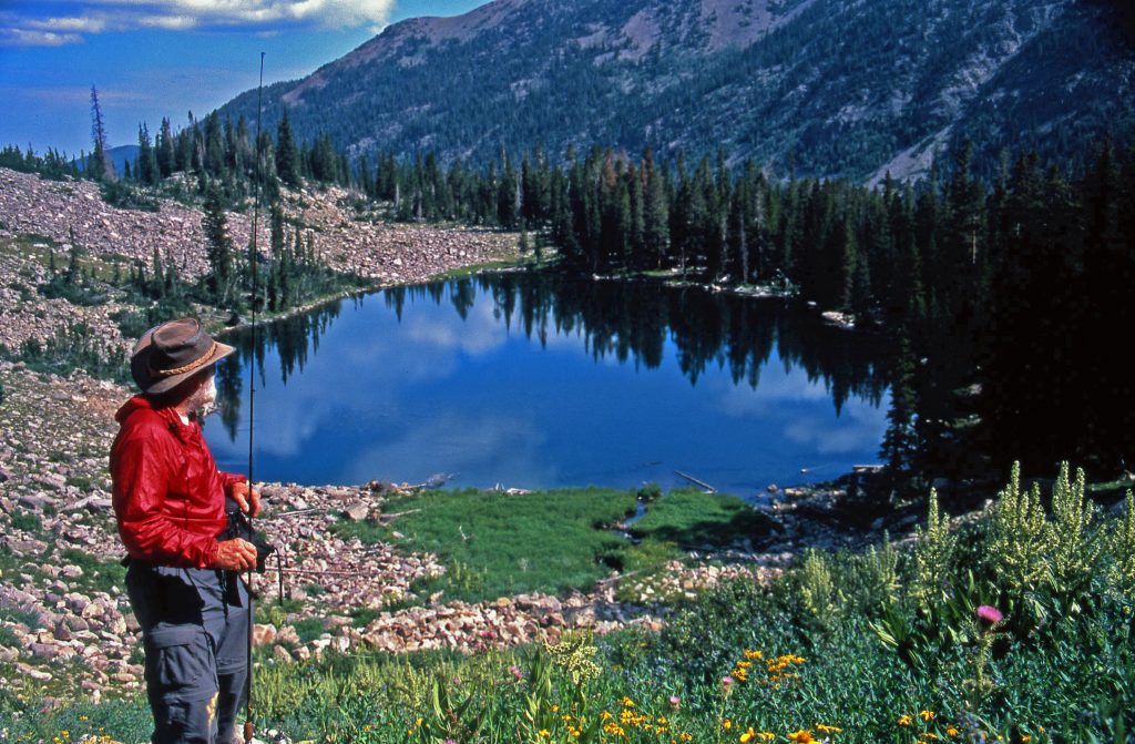
LAST WEEK WE WENT UP STILLWATER FORK OF THE BEAR RIVER and SAW KERMSUH, RYDER & McPHEETERS LAKES. BACK DOWN THE TRAIL, BEFORE THE KERMSUH TRAIL, or 2.4 miles up from the Trailhead, WE COME TO A SIGN POINTING TO THE EAST WITH A TRAIL THAT CLIMBS UP ALONG OSTLER FORK OF THE BEAR RIVER, OUT OF THE CANYON LEADING US TO THE AMETHYST BASIN. My book gives all the distances, and information, including topographical maps of the beautiful area with Ostler Peak on our right. Along the way you can go off-trail to visit Salamander Lake, then continue up into the high country with large Amethyst Lake at the end of the trail, but along way are also off-trail Ostler Lake, as well as Toomset Lake. I’ll insert photos of Ostler Lake with my daughter Mahana fishing and Ostler Peak in the background, and then Amethyst Lake with it’s turquoise colored waters.
From the north end of Ostler Lake, if you go off-trail down along the edge of the mountain you come to TOOMSET LAKE, seen below. It is small, but full of colorful brook trout.
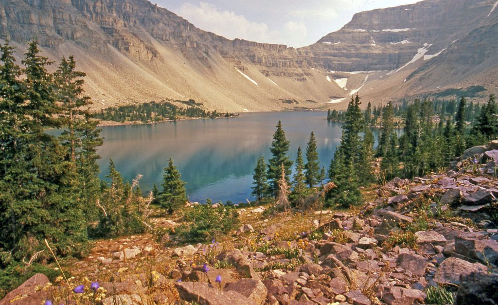
At the head of the Amethyst Basin is found quite large and beautiful–with its turquoise colored waters–AMETHYST LAKE.
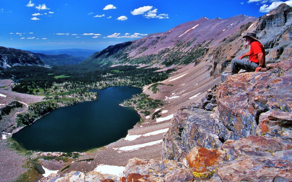
Below we are still in the Rock Creek Drainage on the South Slope of the Uintas, looking north over Brinkley Lake at the southern side of Ostler Peak.
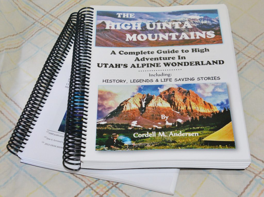
All of the information on what wonderful areas are accessible from the Christmas Meadows/Stillwater Trailhead, including topographical maps with distances inserted, and updated information on the fishing in each lake, and much more, is found in my book seen printed below–but available online. Once you have it on your computer you can put it on a thumb-drive and have your favorite printer make for you a copy as seen below. Scrolling down you will find information on the printer I use. Or you can print yourself the pages you will need for your backpack, and take the print-out with you to guide you in your adventure.
*********************
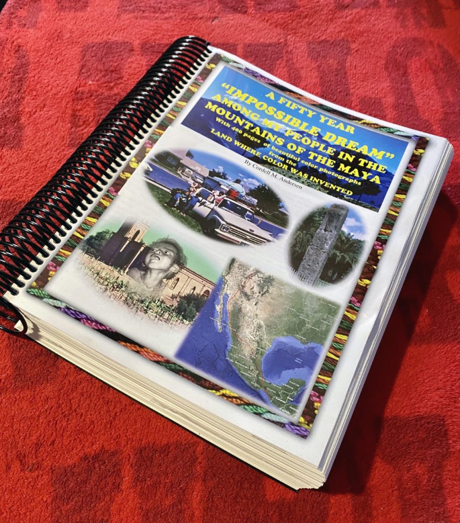
MY SECOND BOOK THAT DETAILS MY 68 YEAR LOVE AFFAIR WITH THE MAYA — WITH OVER 1,000 COLOR PHOTOS
THE HISTORY HIGHLIGHTS A DILEMMA THAT ALL SEEKERS OF TRUTH SHOULD BE INTERESTED IN….CLARIFYIED with VOLTAIRE’S COMMENT……scroll down to the beginning of the last post to see what he said….
Click on this link to READ & SEE THE DETAILS OF THE MAYA STORY https://www.guatemalanfoundation.org/
****************************************