
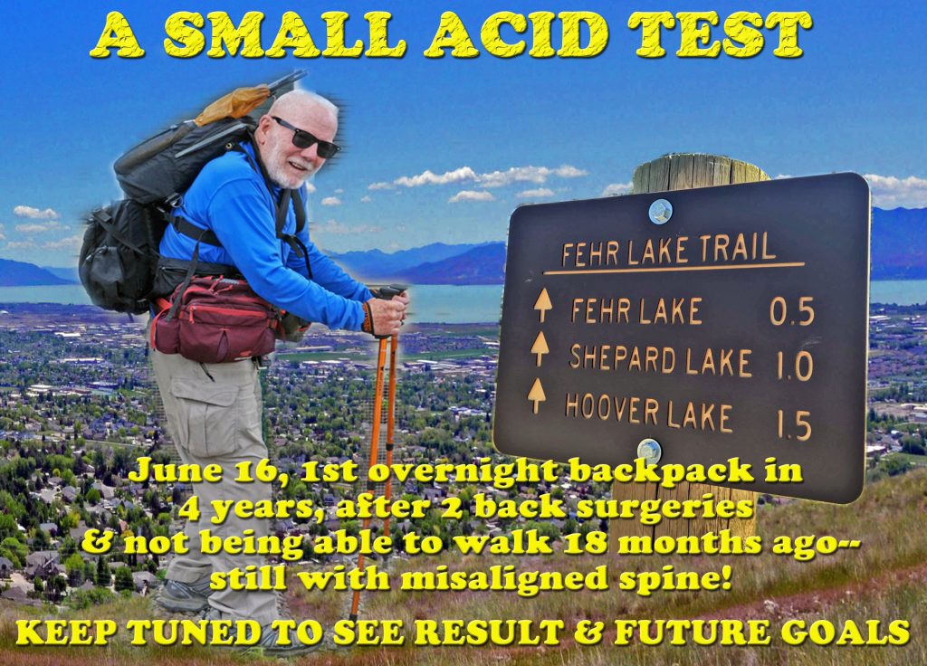
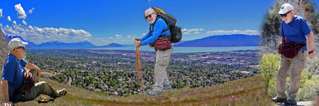
I will drive up to the Bald Pass area on Wednesday, June15, check the oxygen level in my blood for High Altitude problems, more common for those more vulnerable, then sleep in my car, and if all looks good, will do the same small hike I wasn’t ready for last year–to FEHR LAKE, using ultra lightweight backpacking techniques (as I can’t put more than 5 lbs. on my back, rather the remainder in 3 waist packs) get to Fehr Lake and spend the night there, hopefully eating a brook trout or two. The next day return to the Trailhead and home to process the experience and report here and on Facebook, then the goal of THE GRANDADDIES–coming FULL CIRCLE, 70 YEARS AFTER MY INTRODUCTION TO THE GRANDADDIES when 16 in 1952!
****************************
FOR INFORMATION ABOUT MY LIFE AMONG THE MAYA: Go to the GUATEMALAN FOUNDATION’S website with the final addition from the movie which REVEALS THE ANSWER TO the……
..MOST IMPORTANT PERPLEXING QUESTION IN MY ENTIRE 50 YEAR MAYA HISTORY::

Check out the VERY LAST VERSION of the MAYA BOOK with
THE “MODERN AMMON’S” LEGACY!
If BOURNE is what attracts your curiosity…and it should, it will best be understood after going through the history where you will find it in Section 29, page 464.
**************************
VISIONS OF NATURE…..FROM LAST WEEK:
FIRST, A COUPLE OF HIKES ALONG THE TIMPANOGOS FOOTHILLS & HIKES UP GROVE CANYON WITH TONS OF WONDERFUL
“VISIONS of NATURE”
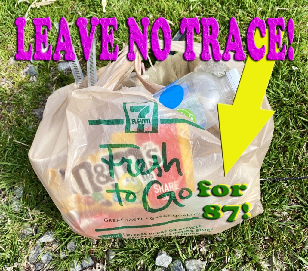
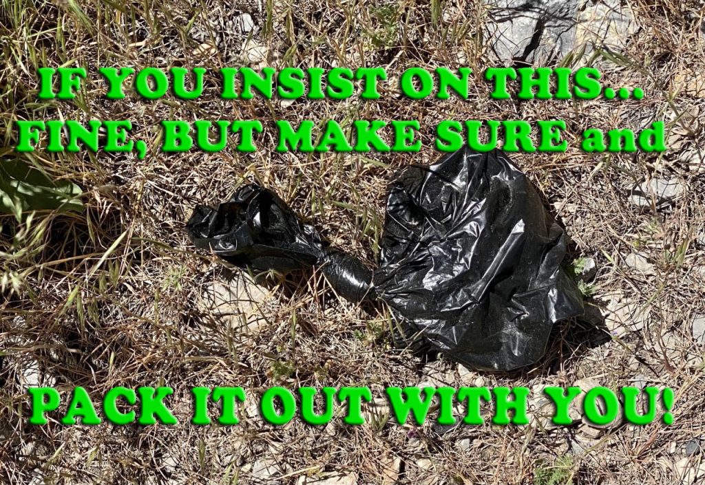
JUST STICK THE BAG IN YOUR POCKET TO TAKE HOME….& HOPE IT DOESN’T LEAK!!!!
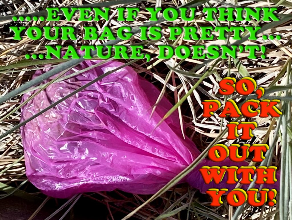
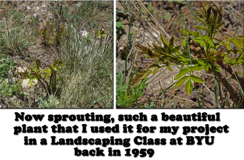
DO YOU REMEMBER THE ABOVE PICTURE FROM ONE OF MY FIRST HIKES UP GROVE CANYON? I SAID WE’D NOTE LATER WHAT WAS TO DEVELOP. So, below HERE IT IS.
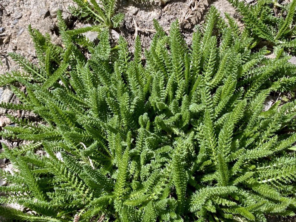
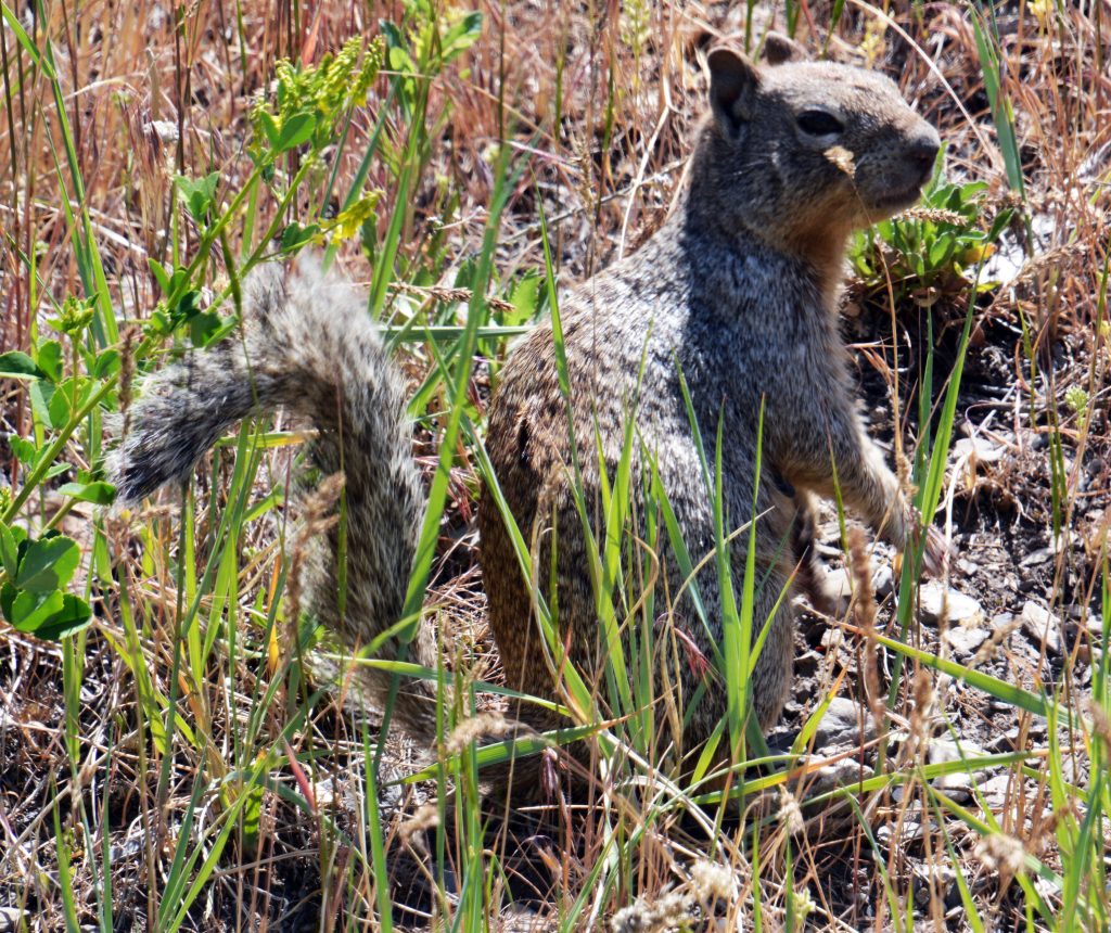
MORE WONDERS OF NATURE & SIGNS SUMMER IS HERE….WITH A ROCK SQUIRREL OUT OF HIBERNATION.
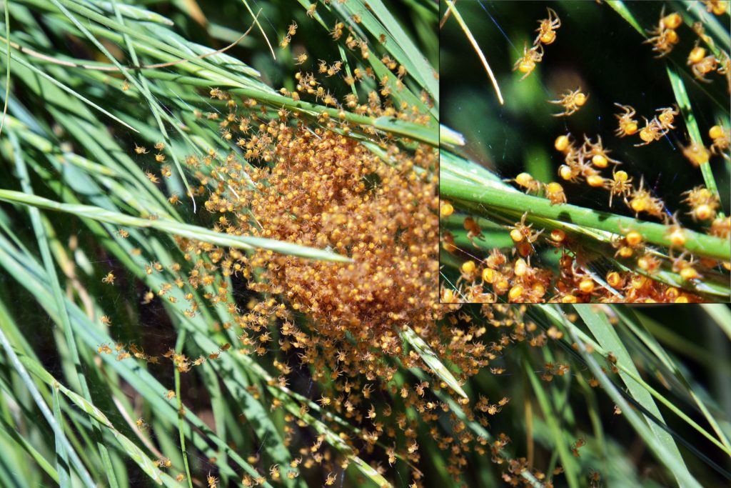
NATURE AT WORK WITH MORE SPIDERS IN ONE SCENE THAN WE’VE PROBABLY EVERY SEEN BEFORE.
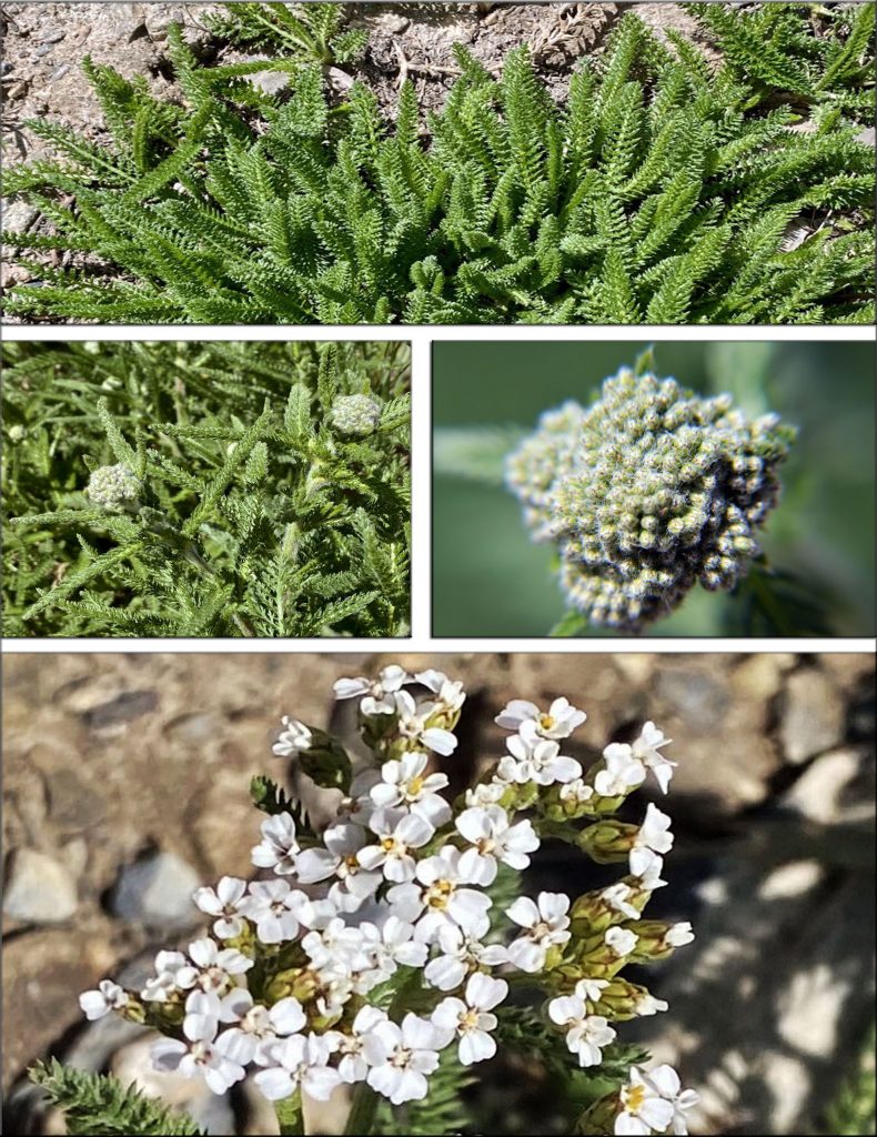
BELOW, WE SEE HOW IT WILL DEVELOP AS THE SUMMER PROGRESSES.
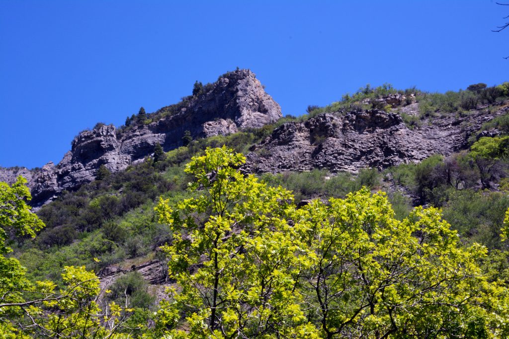
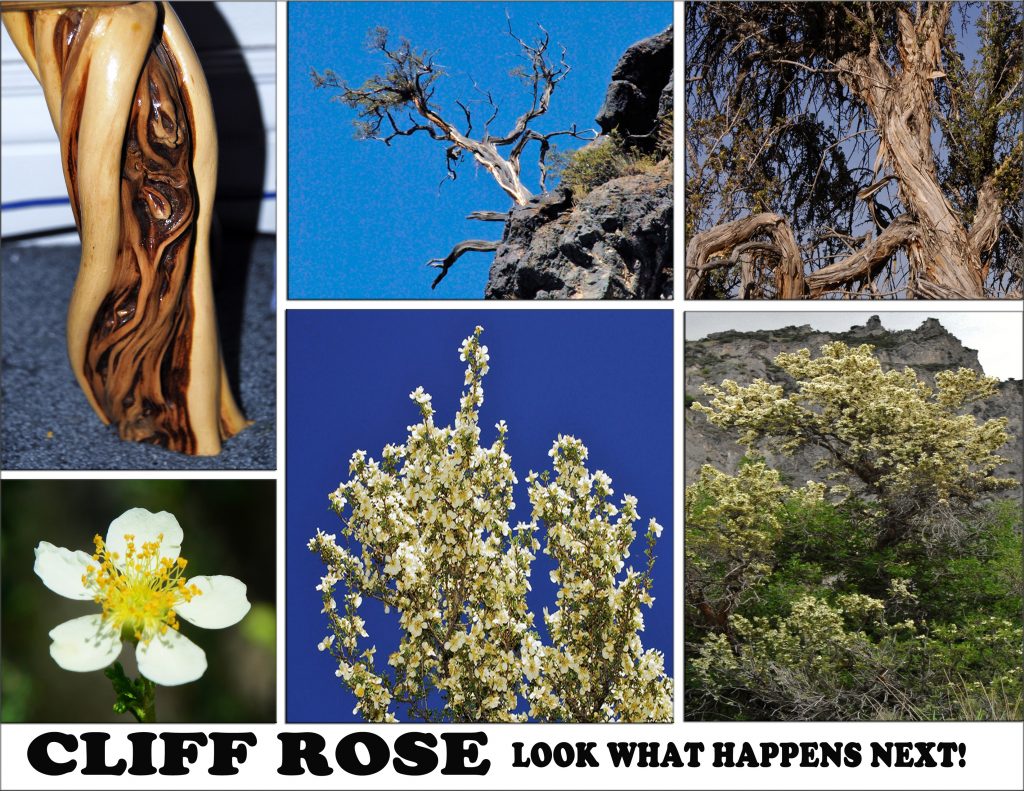
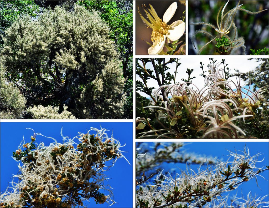
LOOKING UP AT THE CLIFFS ABOVE US WE REMEMBER
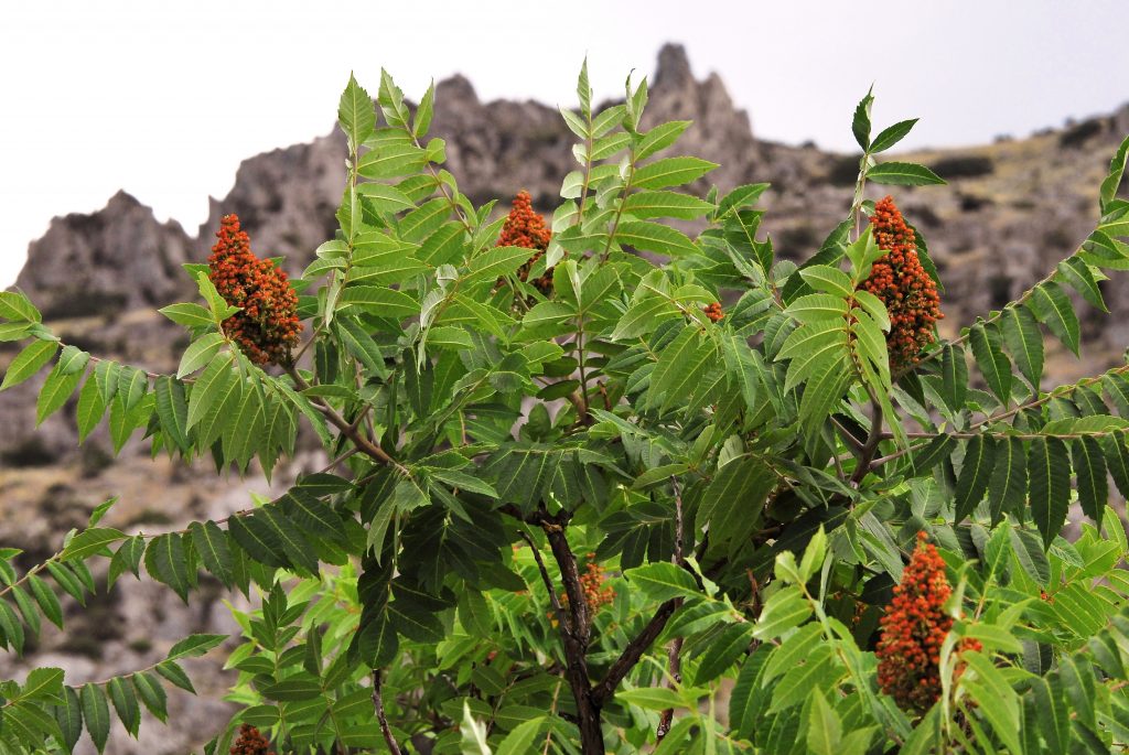
“CLIFF ROSE,”
THAT I TOLD YOU WOULD HAVE A SPECTACULAR DEVELOPMENT AS SEEN IN THE PANELS BELOW.
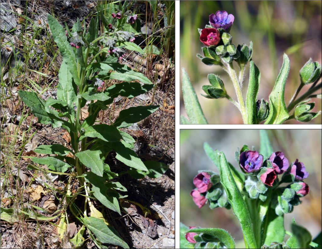
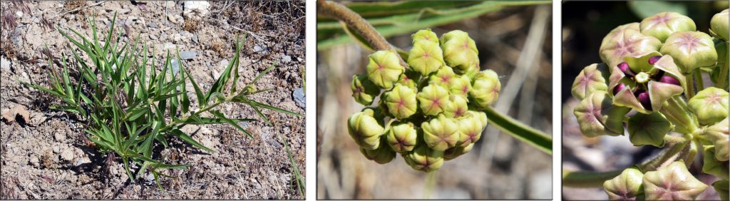
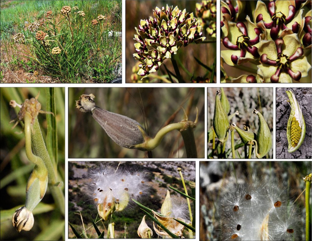
NOW WE COME TO ANOTHER FOOTHILLS PLANT WITH ITS MAGNIFICENT DEVELOPMENT OVER THE SUMMER…..IT IS:
SPIDER MILKWEED
AND NOW BLOSSOMING
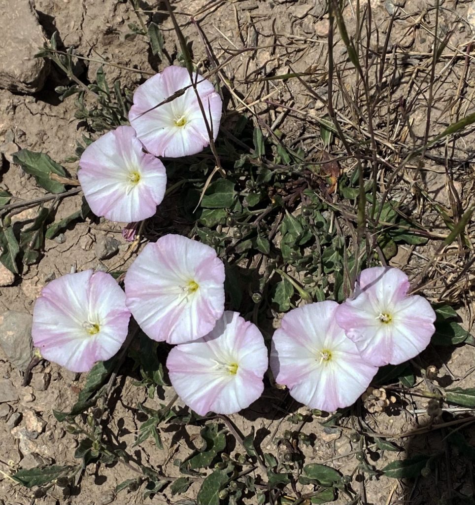
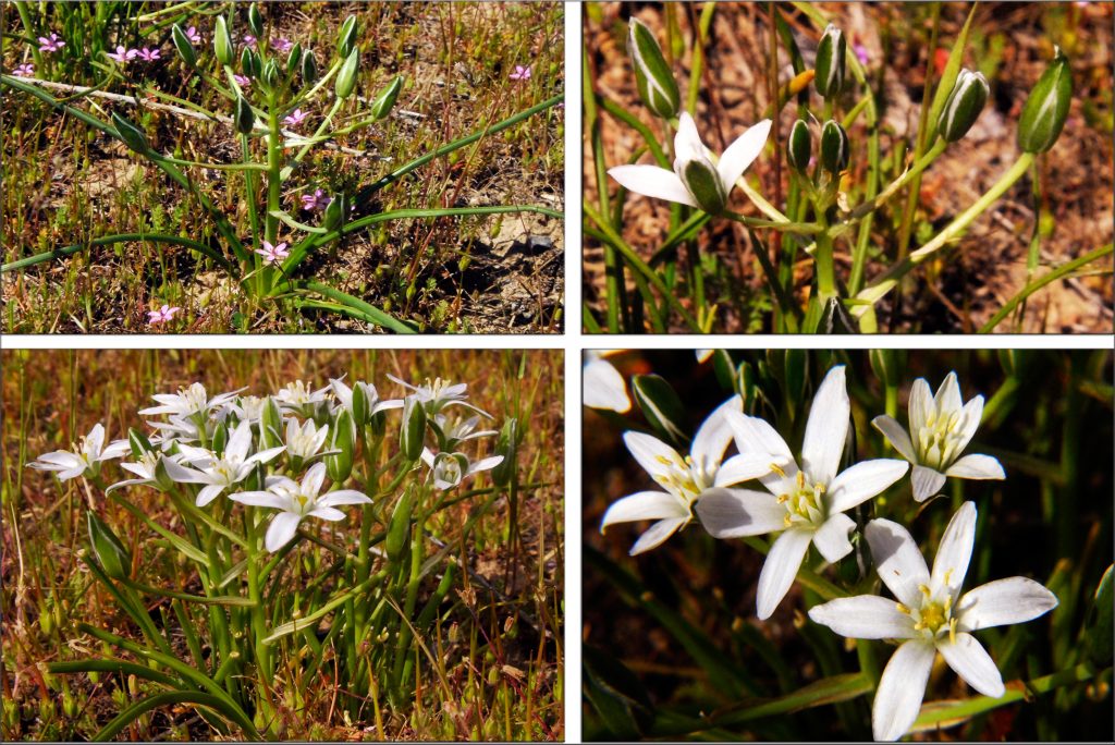
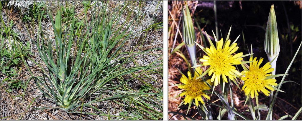
MEADOW SALSIFY
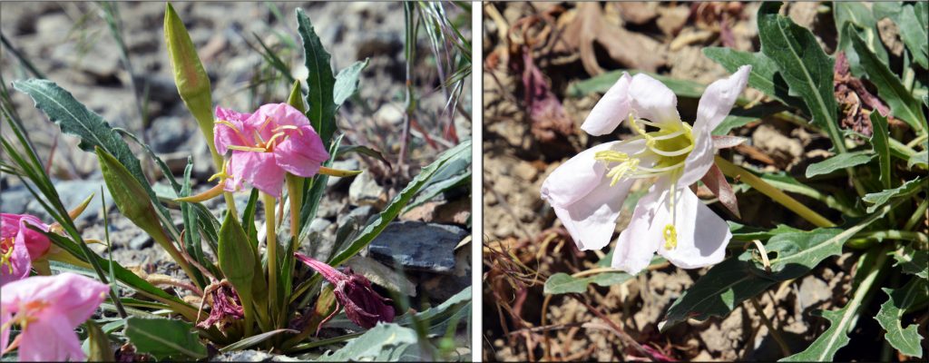
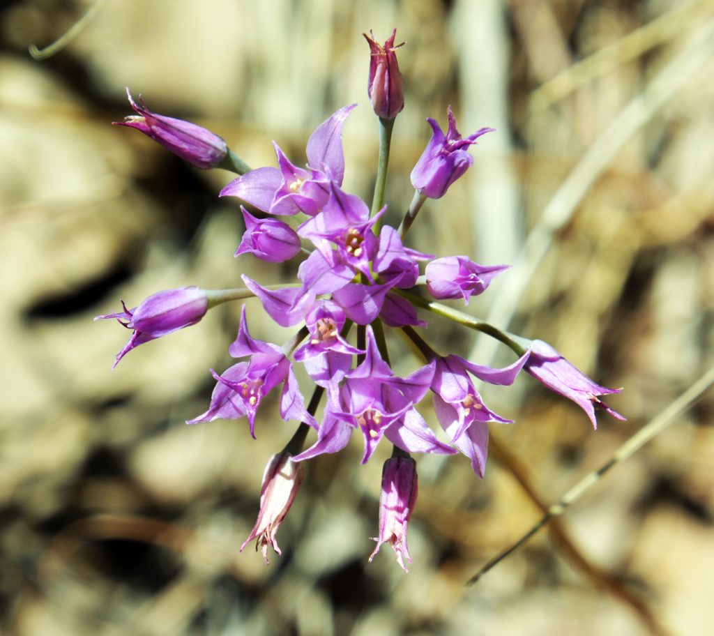
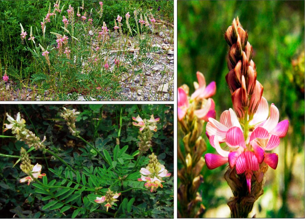
AND, FOR ME ONE OF THE MOST BEAUTIFUL OF OUR FOOTHILL WILDFLOWERS…..
STEPPE SWEETPEA
********************************
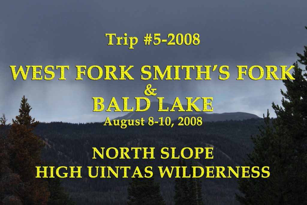
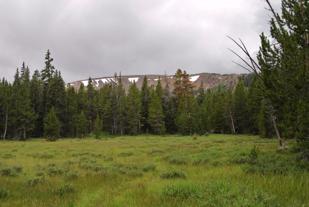
NOW TO OUR HIGH UINTA WILDERNESS TOUR on THE NORTH SLOPE
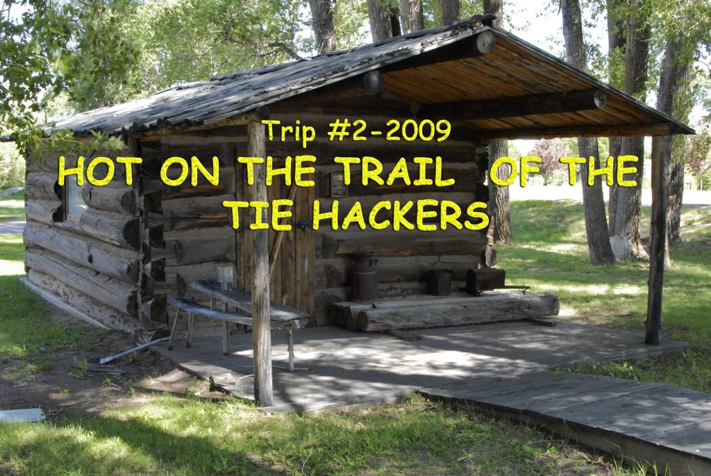
Last time we had got to the East Fork of Blacks Fork Trailhead with wonderful options for some of the best outdoor experience you will ever have. Now ON TO THE WEST FORK OF SMITHS FORK, along with some of the best TIE HACKER SITES IN THE WORLD!
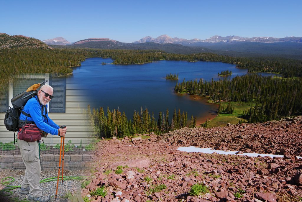
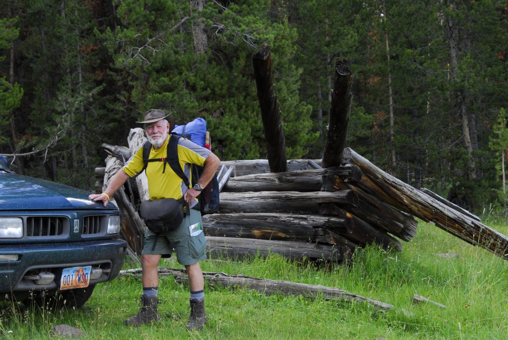
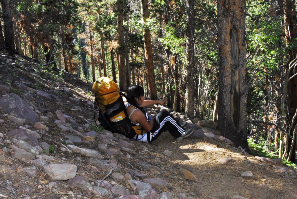
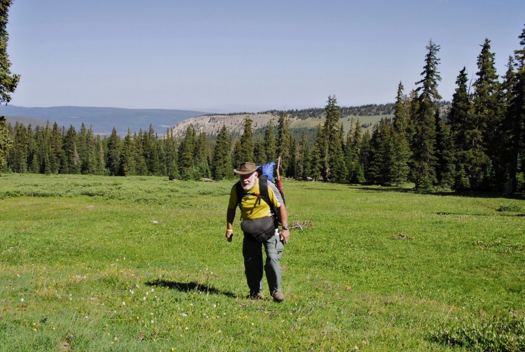
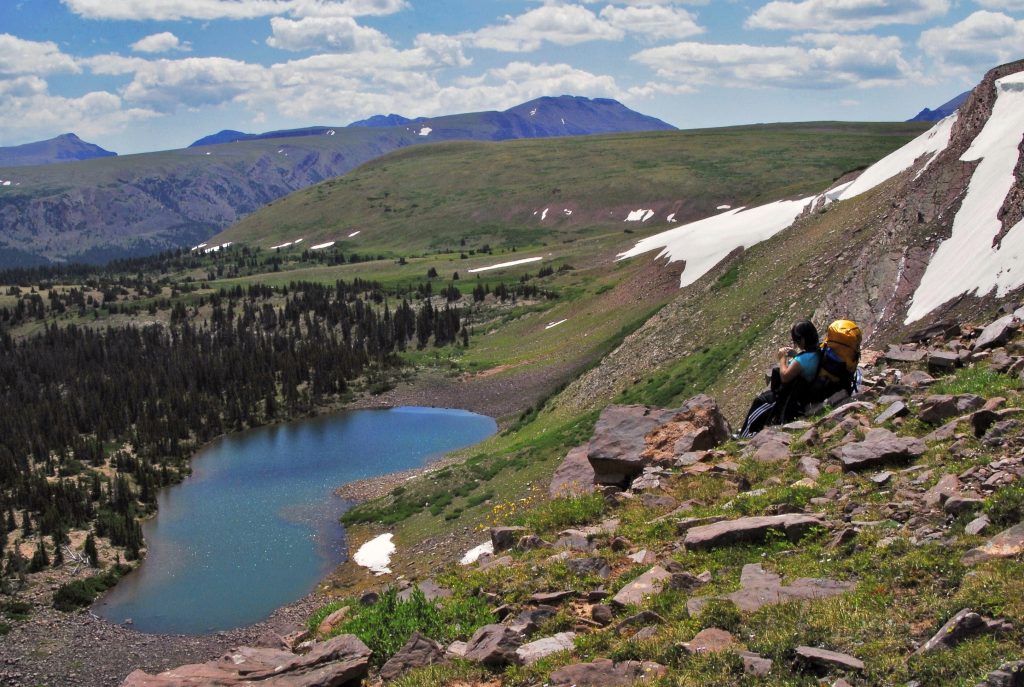
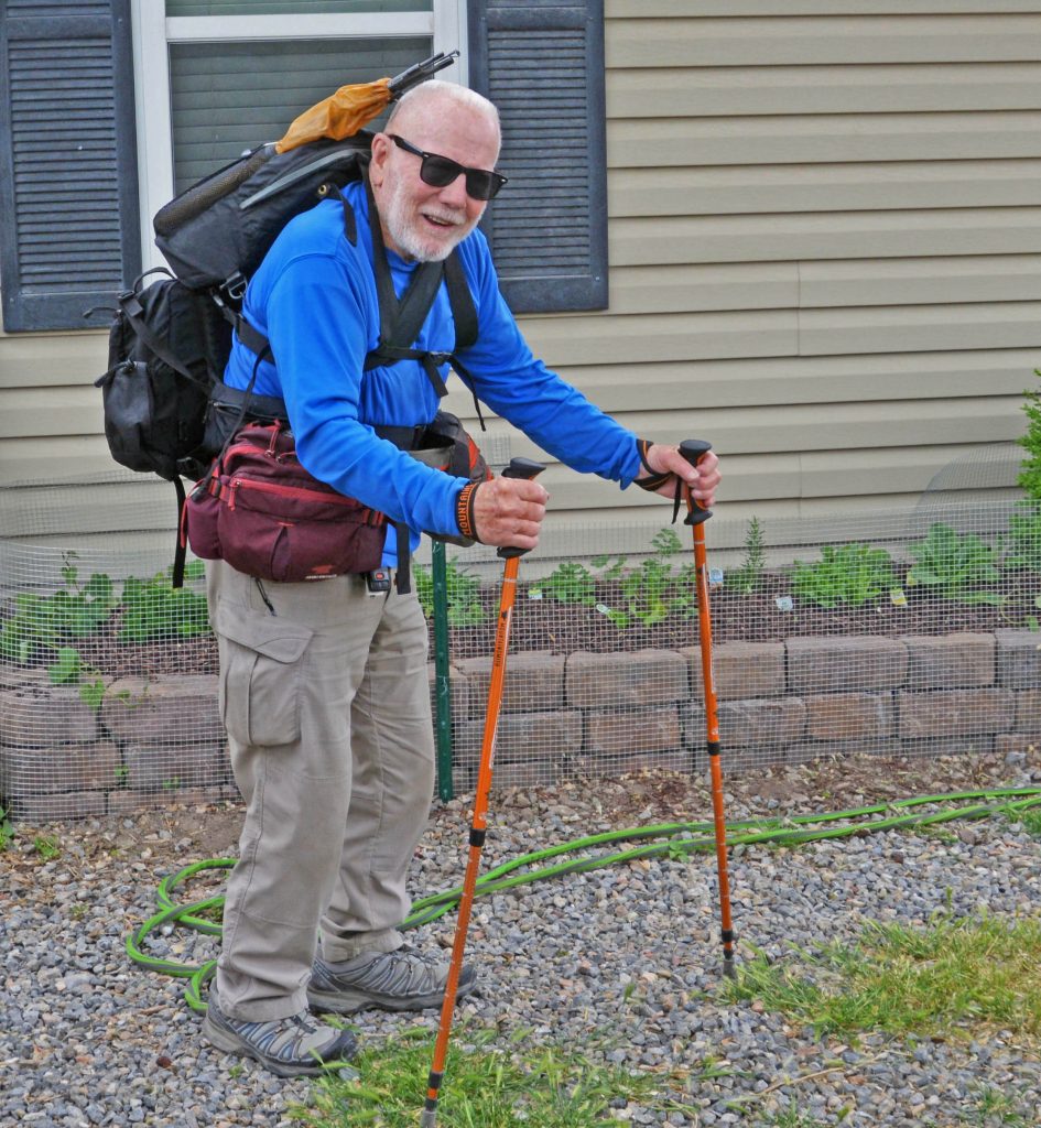
I’M READY TO GO….CAN’T CARRY ANYTHING SIGNIFICANT ON MY BACK….so have on my back only a tiny pack with poncho (also used as my shelter), air mattress, rain parka & fishing equipment — weighing 5 lbs. THEN TWO WAIST PACKS IN FRONT with Nikon camera & accesories, and in the other crucial survival stuff. AND BEHIND MY LUMBAR WAIST PACK with sleeping quilt, and other equipment. TOTAL WEIGHT FOR A SEVERAL DAY BACKPACK=about 20 lbs. (1/4th of that my Nikon camera and lenses).
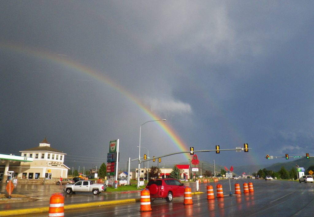
As I was heading for what I call “JEDEDIAH SMITH COUNTRY” this scene in Heber bid me a LUCKY FAREWELL!
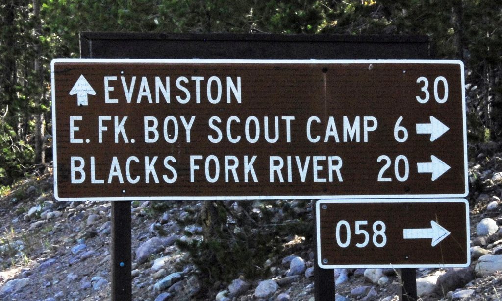
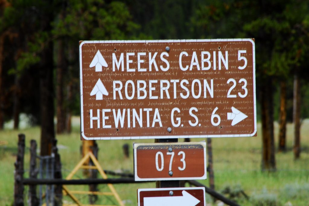
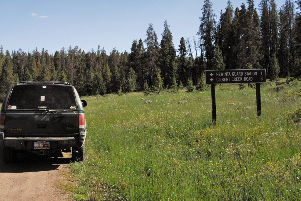
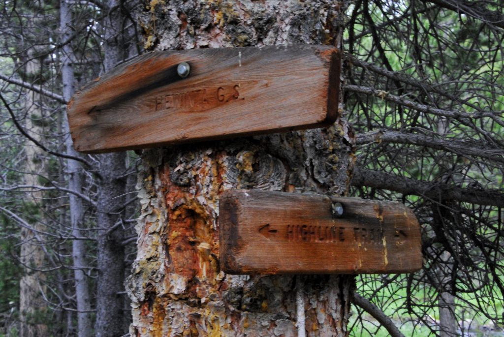
For details, get THE BOOK, but we head for Kamas, and then up the Mirror Lake Scenic Byway, then down to the North Slope Road and east to the Blacks Fork River. At the junction to the East Fork of Blacks Trailhead, turn north. In a mile or so you come to this sign pointing east to the Hewinta Guard Station.
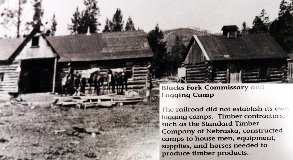
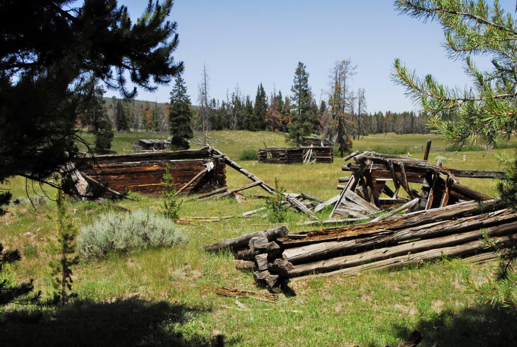
But I suggest you take a little detour keeping on the main road for a mile or so, and visit the OLD BLACKS FORK COMMISSARY GHOST TOWN–of course of the TIE HACKERS! See my book for details.
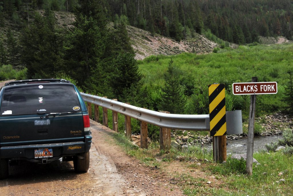
Then return to the Hewinta Road and turn east crossing the river. The road ahead is narrow, with a few rough spots, but not bad. Just be careful of logging trucks.
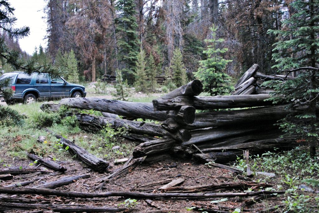
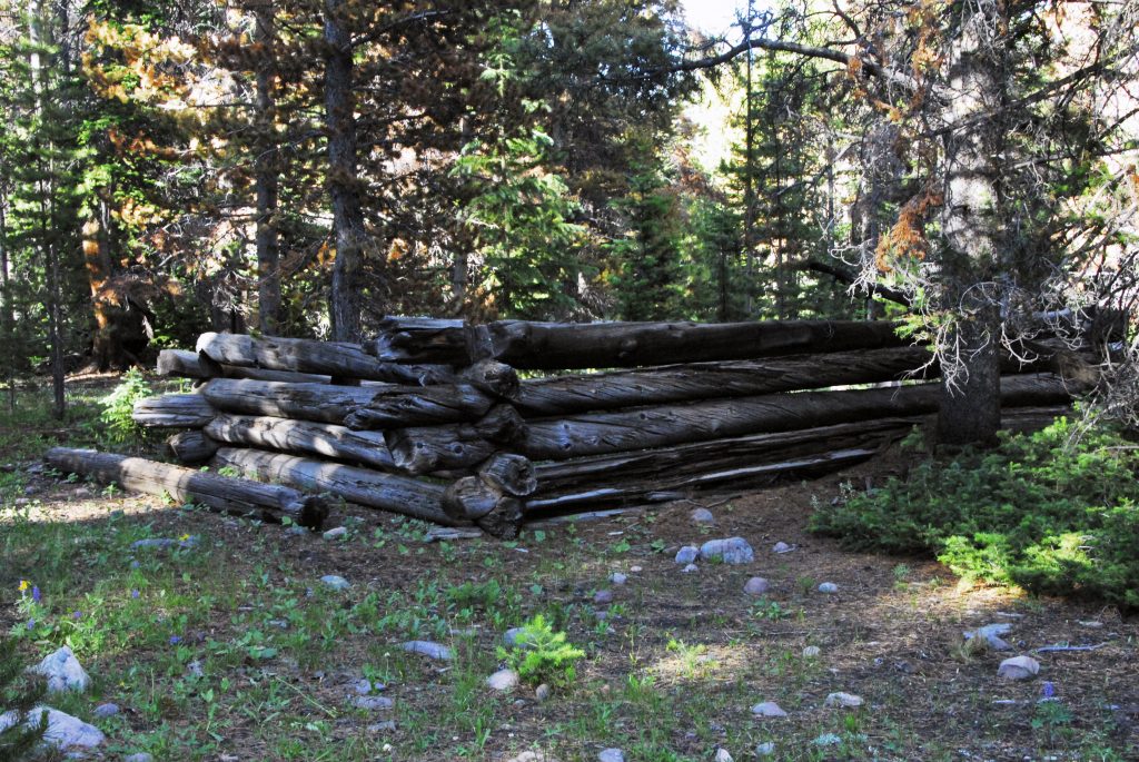
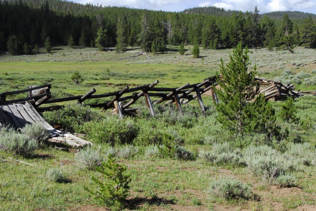
If you keep a sharp eye out, you will notice in this 6 mile stretch several tie hacker ruins. Check them out and see if you can date them: OLD PERIOD FROM 1867-1880, or NEW PERIOD FROM 1910 – 1935?
At this point and sign there is a road that heads north. In a couple of miles you will come to the Wyoming border, and at that point on the left is:
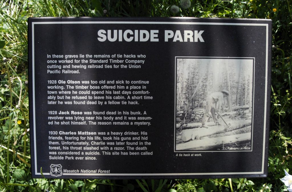
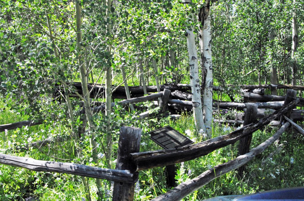
As Tie Hackers got too old to make railroad ties, or became obsolete due to mechanization, some of them , most of whom didn’t have families to help them, couldn’t take it and this tiny memorial is to them, with 3 marble plaques–which you’ll have to move aside the vegetation to see–Commemorating our “unsung hero’s” lives.
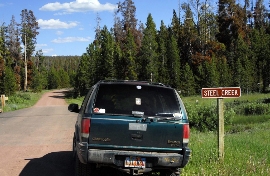
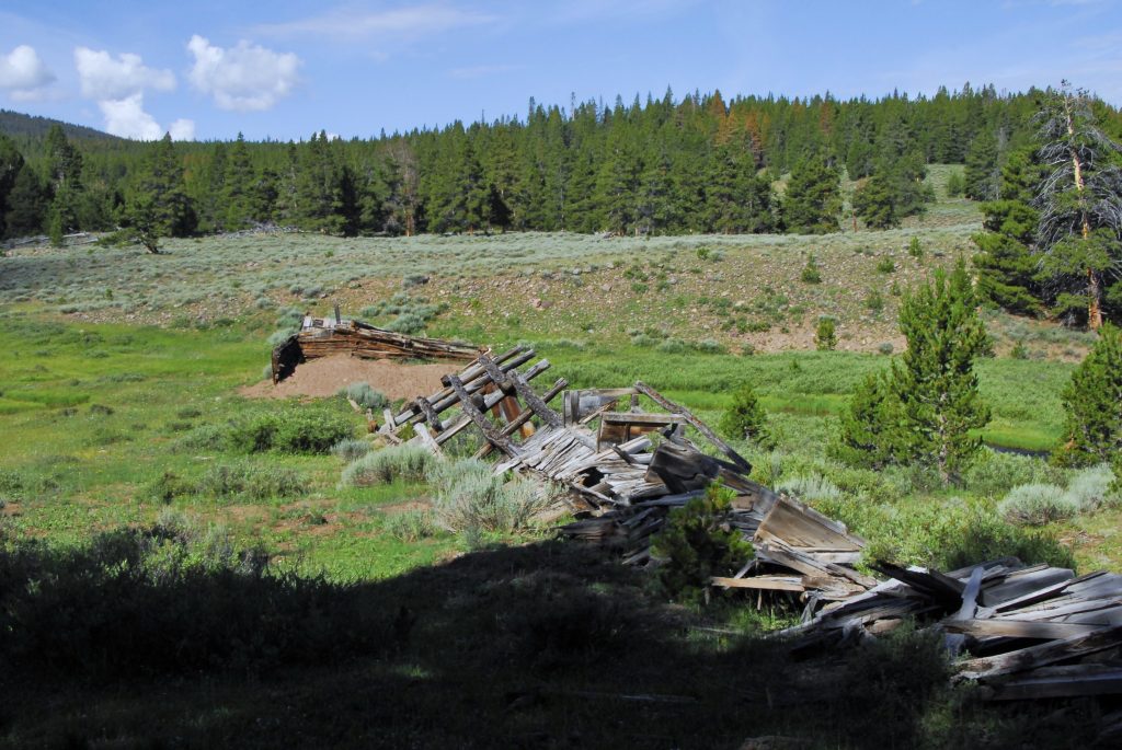
Back at the North Slope Road, just a bit past the junction is this sign to the creek. Up stream is the Tie Hacker site, called The Steel Creek Commissary, where two cabins were dismantled, one of them reconstructed behind the Bear River Forest Service office, and another at the Forest Service office in Mt. View, Wyoming. To get to the archaeological site, continue a little further to the road to the Hewinta Guard Station, and a short distance you come to a road turning towards the site.
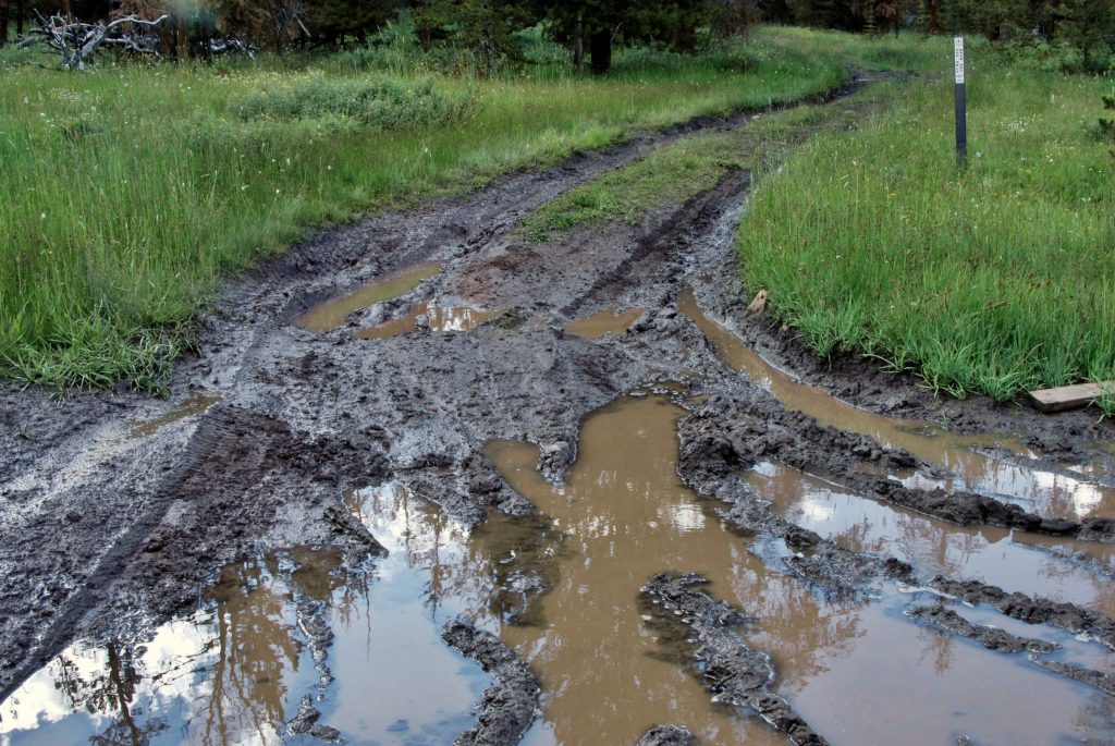
On the Forest Service steel post on the right–after you get stuck in the mud–the sign WARNS YOU YOU COULD GET STUCK! Best park and walk the few hundred yards to the site.
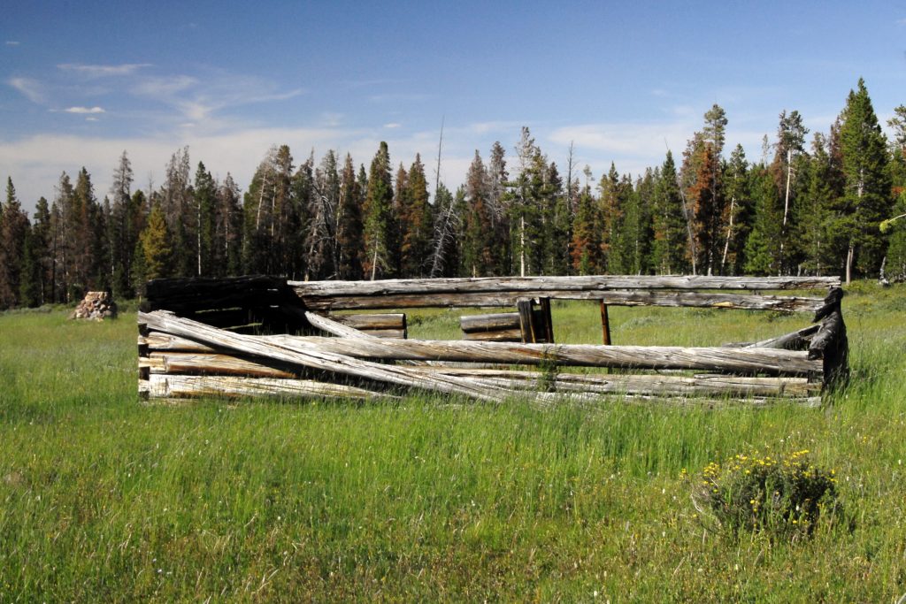
Once again, with information I’ve given you in previous posts, or in my BOOK, you can date this site.
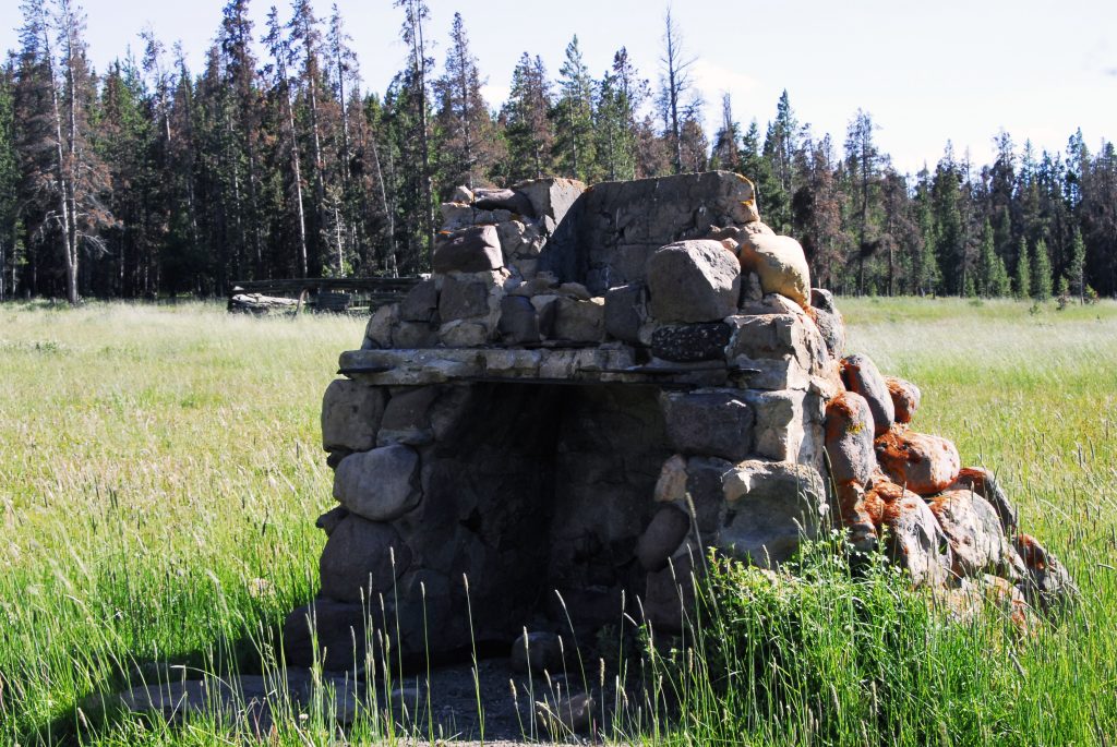
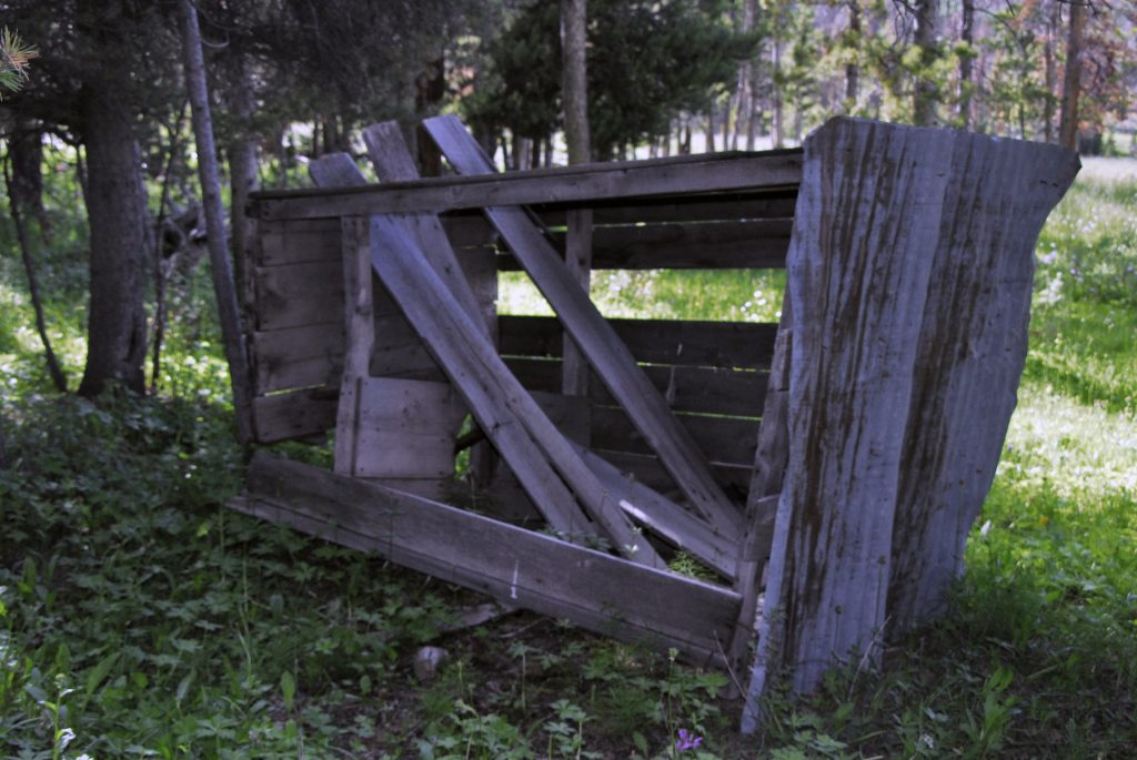
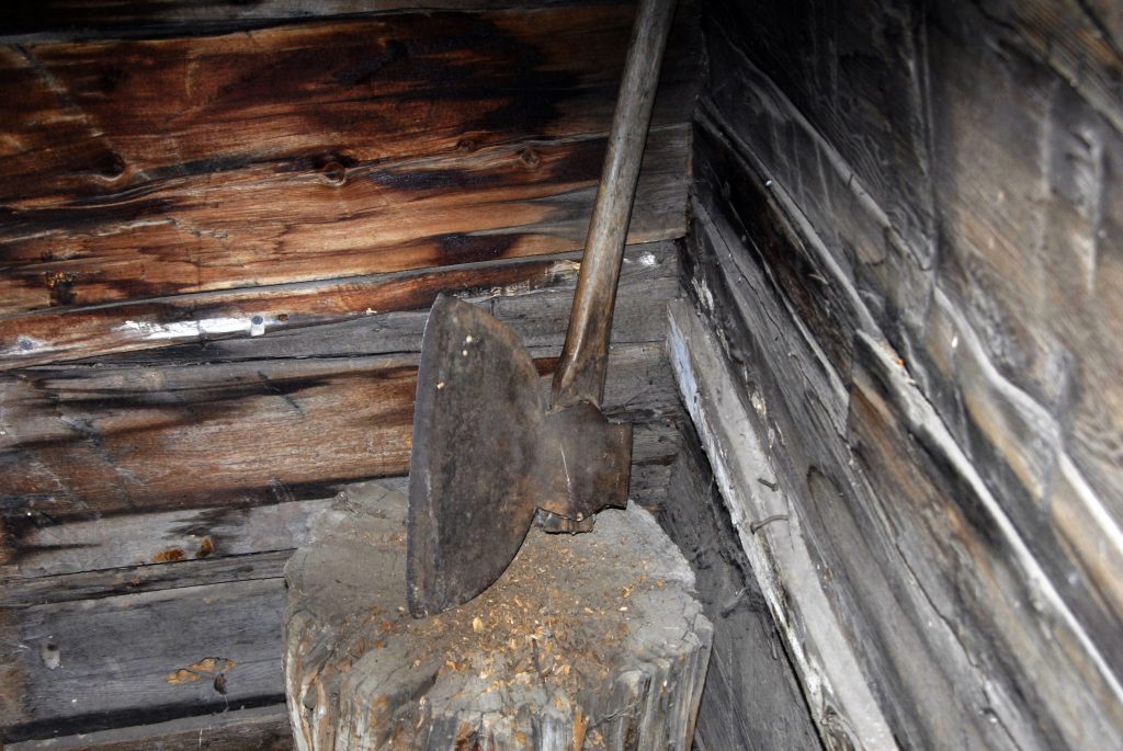
Above is seen–tipped over– one of the few outhouses I’ve seen in Tie Hacker ghost towns. If you look closely down to the right in middle of the ruins you will find the outhouse hole all filled up, and nearby the lid to the one-holer. BE CAREFUL WITH THE FILLED UP HOLE….IT MIGHT BE QUITE DEEP!
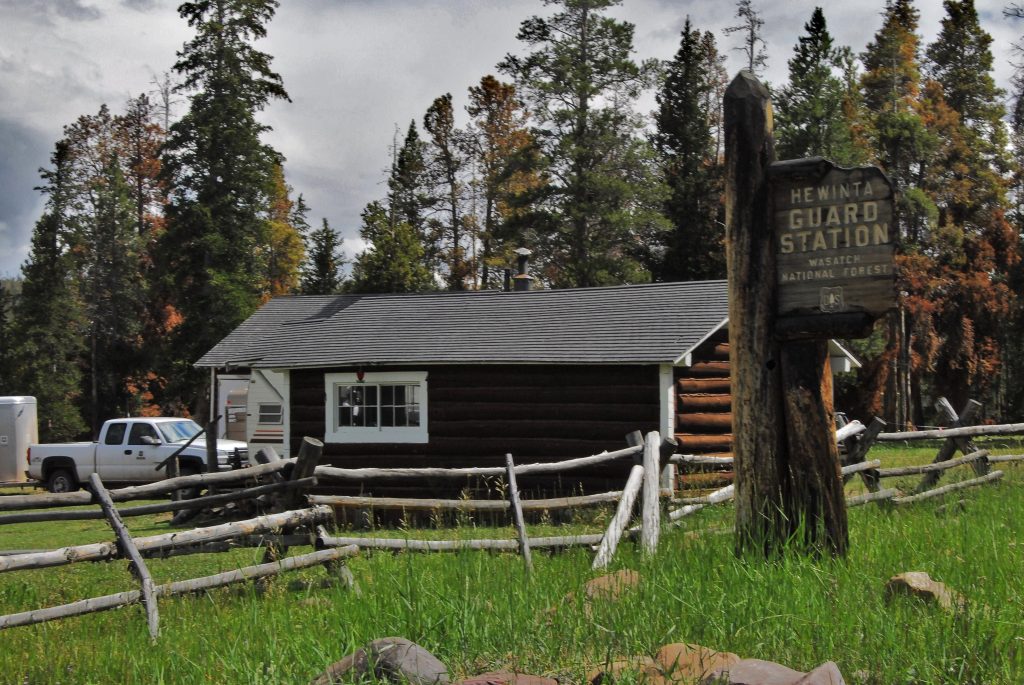
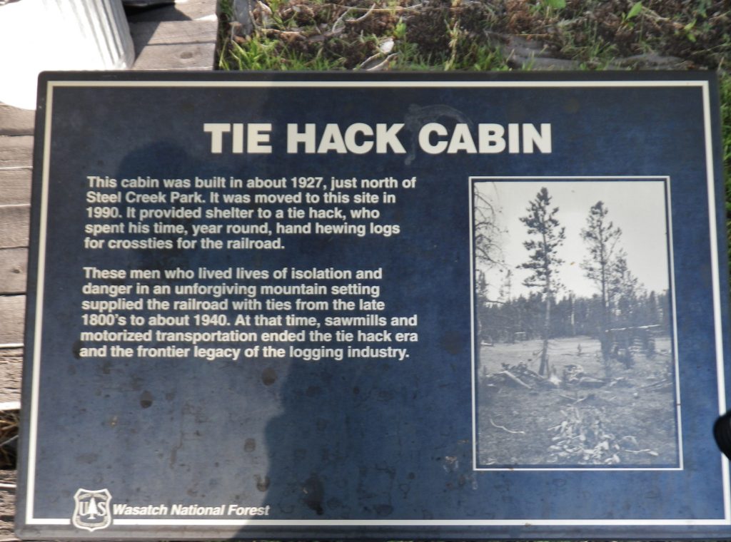
On that main side-road you will soon come to the HEWINTA GUARD STATION, that on my first trip was being lived in, so I knocked and was lucky to meet BOB & TERESA FASCINELI. By the way, the cabin was built by the Tie Hackers in 1927, and with a few modern updates is still in use.
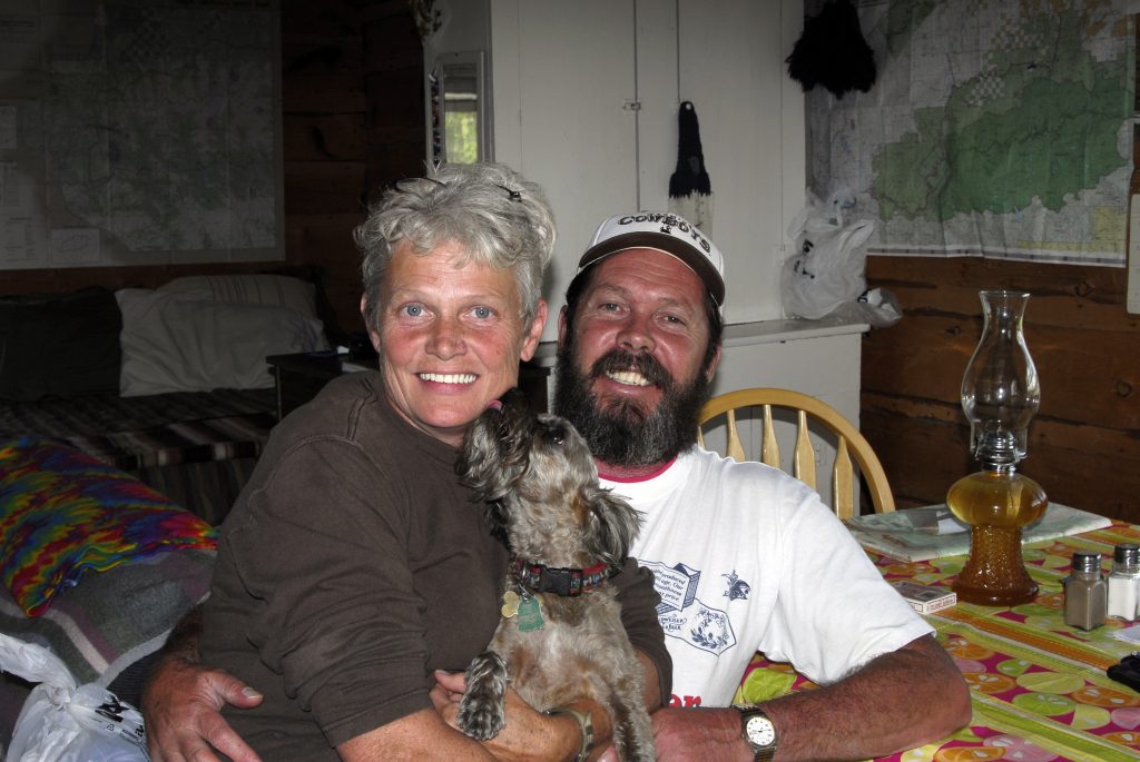
They live most of the year in Green River, Wyoming. Teresa was then, and at least up to 2016–when I ran into her on the Kings Peak Trail on horseback, works the summers as a Wilderness Ranger using a horse. They were the first to really open my mind to the history of the Tie Hackers, for which I’ll always be grateful. It has made my High Uinta explorations much more interesting and worthwhile, which history in my BOOK, makes it one of the few publications that tell their story and gives them the credit due.
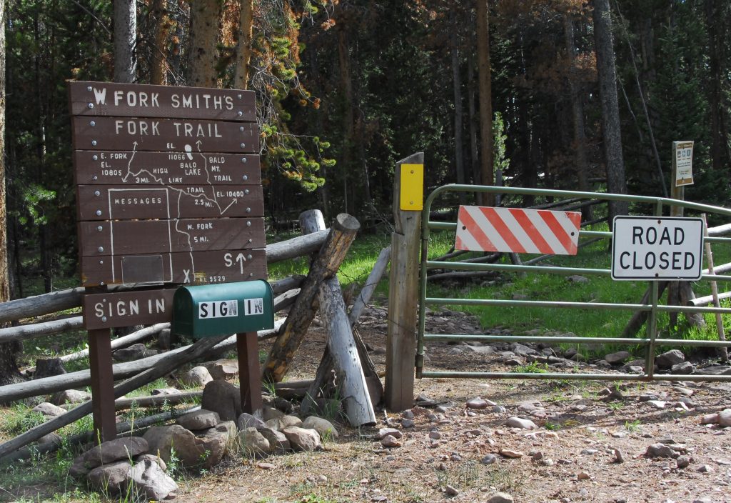
Up the same road a mile or so, you come to what we’ll have to call the “UNOFFICIAL WEST FORK OF THE SMITHS WORK TRAILHEAD.”
At this TRAILHEAD, you can’t miss the first Tie Hacker ruin. Yes the tie hacks are “heroes” but if you didn’t know, my real OUTDOOR HEROE’s name was given to the nearby river–SMITHS FORK of the GREEN RIVER. While still a teenager living in California, my father gave me and my brother, Marlo, a book entitled, HIDDEN HEROES OF THE ROCKIES, and prominent in it is the young man, JEDEDIAH SMITH, who replaced Tarzan as my REAL HERO!
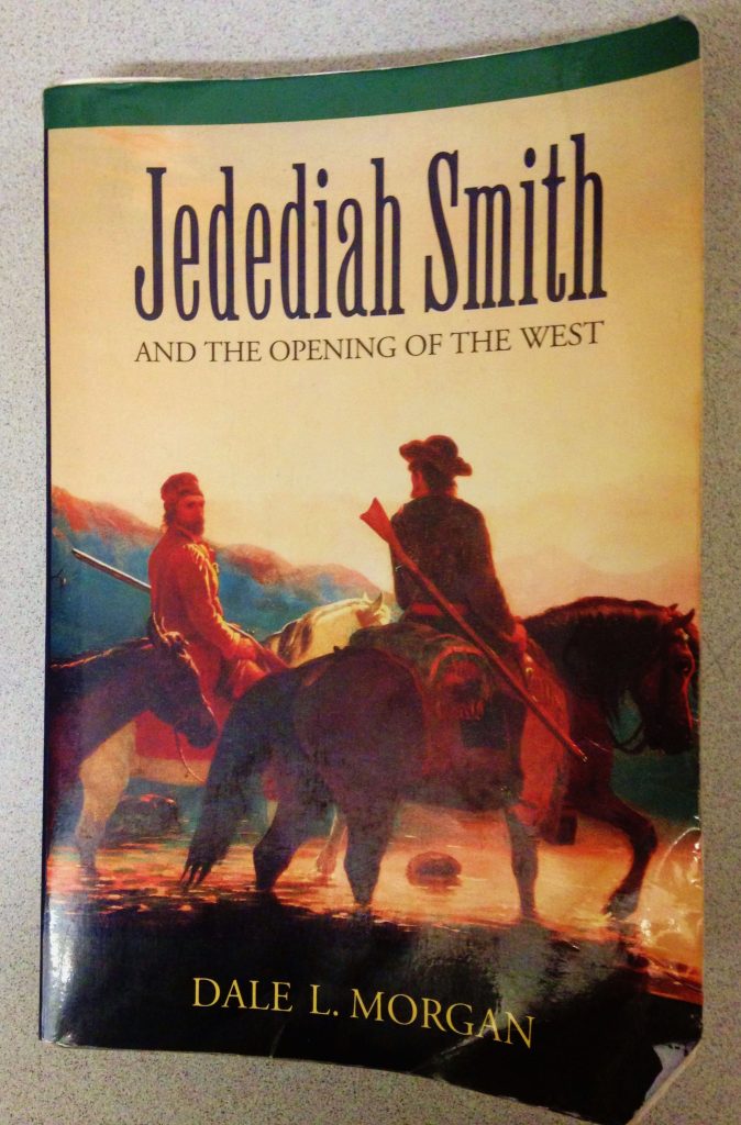
In my HIGH UINTA MOUNTAINS book, I give a summary of his life–which all by itself is worth the purchase price of the BOOK. On pages 236-242 of my book, among others tells his story. Let me just list briefly a few things this young man who in the main section about his life I call him, “THE MOUNTAIN MAN OF ALL MOUNTAIN MEN!”
- He re-discovered South Pass so critical in the development of the west.
- Was the 1st man to reach California overland from the American frontier–an amazing journey following basically Interstate 15, attacked by Indians loosing almost all of his men, and all of their horses, then crossing the Mohave Desert on foot.
- The first to cross the Sierra Nevada Mountains following basically the route of U.S. highway 6 to Utah.
- The first to cross the length and width of the Great Basin.
- The first to reach Oregon by a journey up the California coast.
- Smith, Sublette and Jackson were the first to take wagons to the Rocky Mountains.
- He survived the three worst disasters of the American fur trade, the last left him almost alone among 40 dead companions.
- He was the first to lead a team of fur trappers on the North Slope of the Uinta Mountains,
- He WAS UNIQUE among unbelievably tough mountain men and explorers, famous for CARRYING HIS BIBLE and “DIDN’T USE TOBACCO, LIQUOR, NEVER SWORE, AND STAYED AWAY FROM LOOSE WOMEN!”
Author Dale Morgan in his book about Jedediah, said: “Jedediah made the lone wilderness his place of meditation, the mountain top his altar, and he made religion an active, practical principle, from the duties of which nothing could seduce him. His firm belief that faith must find expression in works emerges……”
He did all of the above and more from the age of 21 when he signed on as “a hunter” with one of the first expeditions to the Rocky Mountains by Ashley and Henry in 1822, then in 1831, as Morgan says to end his book, “……he fell under the spears of savages, and his body has glutted the prairie wolf and none can tell where his bones are bleaching, he must not be forgotten!”
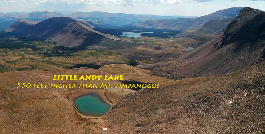
I am doing my best to not let him be forgotten, and have named in his honor the 5th highest peak in Utah calling it MOUNT JEDEDIAH–13,387 ft. high, down the ridge from Kings Peak, and guarding the tiny lake given my name as a youth, “Little Andy Lake.” (page 242) I’ll insert Mt. Jedediah’s picture below.

TO NEVER FORGET MY HERO OF THE CONQUERING OF THE WEST I named 13,387 foot high–5th highest mountain in Utah–
MOUNT JEDEDIAH
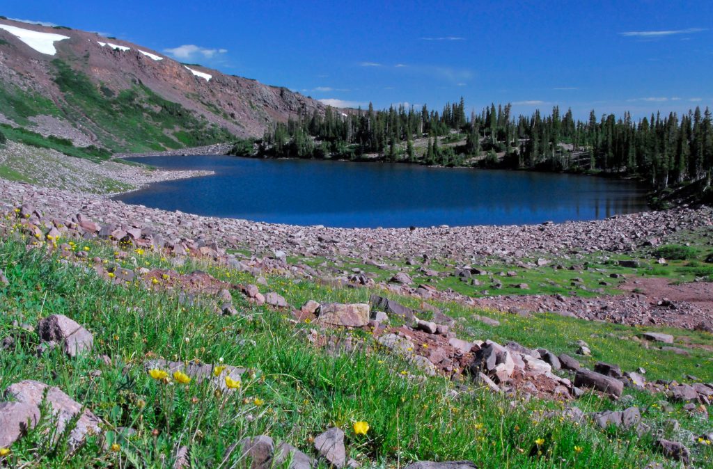
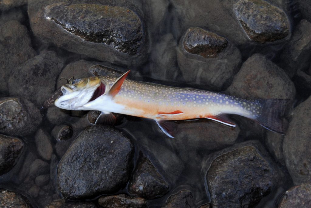
It is down the ridge from Utah’s highest, Kings Peak, and at the head of the Uinta River’s Painter Basin, with Trail Rider Pass on the left. The lake is U-75 where I have caught huge brook trout, but even a larger one was caught in Beard Lake up near the pass–that would have been Utah’s record by far. The lake named for me, “Little Andy Lake” is up much higher at 12,302 ft. high we see below.
MOUNT JEDEDIAH is the shadowed mountain on the far right, with Beard Lake at its foot, and Lake Atwood in the distant/middle of the photo.
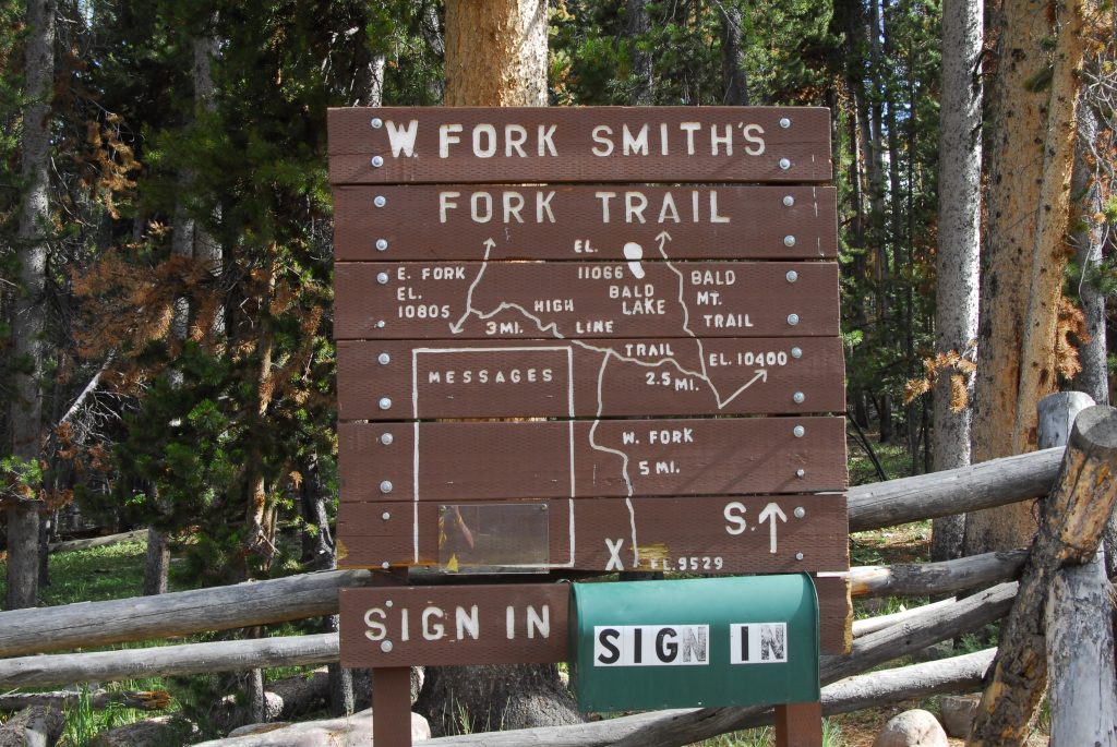
Our hike to BALD LAKE will follow the route on the above map south until we hit the North Slope Highline Trail, we’ll see in a moment.
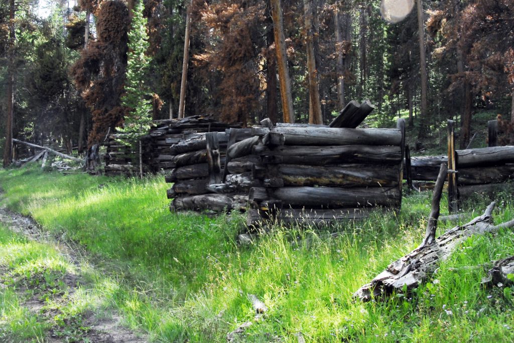
But, first we soon are seeing another Tie Hacker site along the trail.
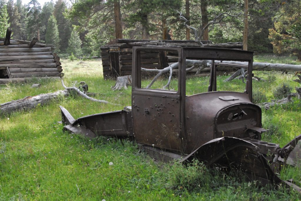
Eventually coming to one with an old Model T-Ford pickup–which by the way I have been told it is now GONE!
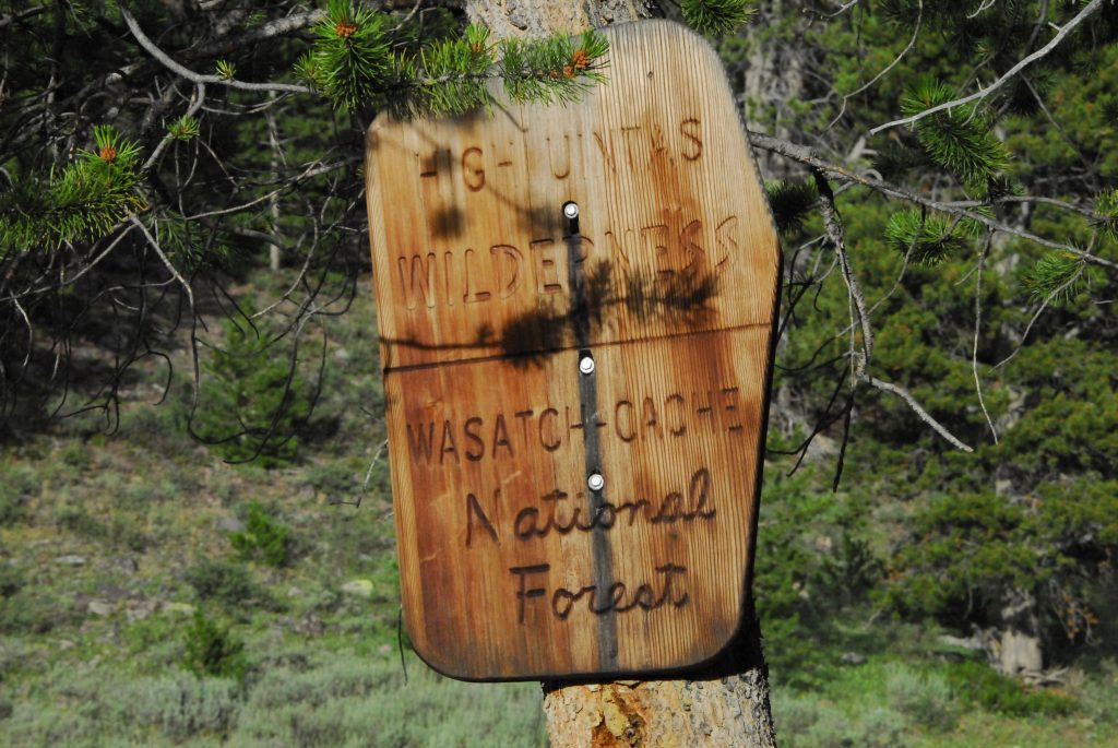
Soon after passing the HIGH UINTA WILDERNESS sign, we come to a very important site of what was called…..
….a SPLASH DAM.
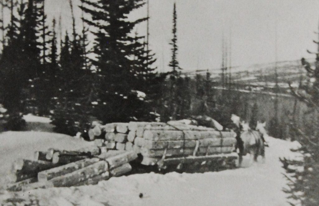
The Tie Hackers did most of their work in the winter when they could move the railroad ties more easily using sleds. They would be accumulated behind the SPLASH DAM, waiting for the Spring run-off, when the reservoirs would fill with the ties covering the surface. When all was in readiness, the Tie Hackers would BLOW THE DAM WITH DYNAMITE, and with a……
…..SPLASH!
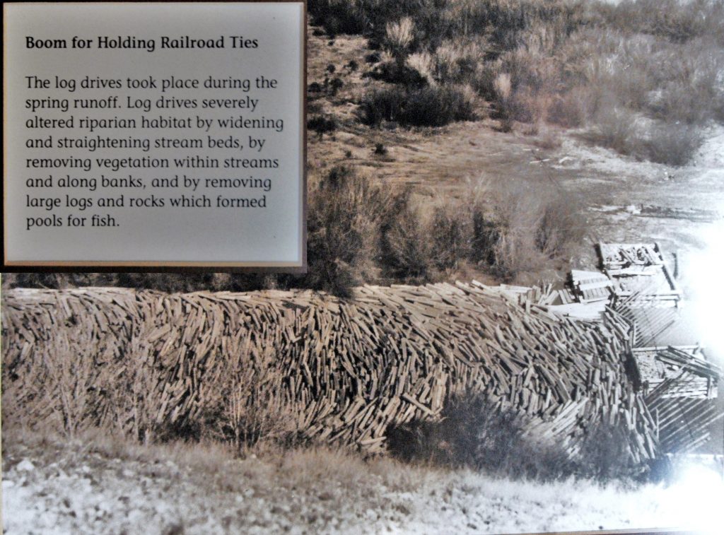
……..the ties would be washed downstream, herded along by the Tie Hackers who would follow them north into Wyoming where they would be picked up by workers from the Transcontinental Railroad construction.
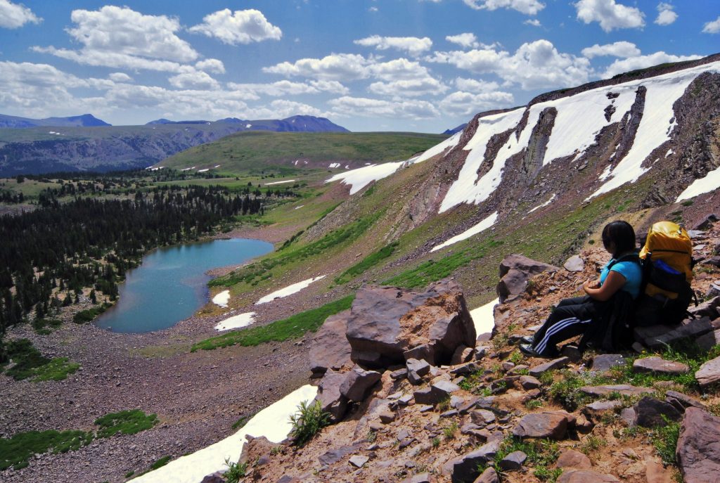
We have now come to the North Slope Highline Trail, and just a little to the west we leave the trail and go cross-country towards the mountain with snow–which is Bald Peak, and from where in a past report I pictured my daughter Mahana viewing the lake from up above.
The MAHANA picture was taken a week before from up there where the snow drifts are. I’ll insert it below.
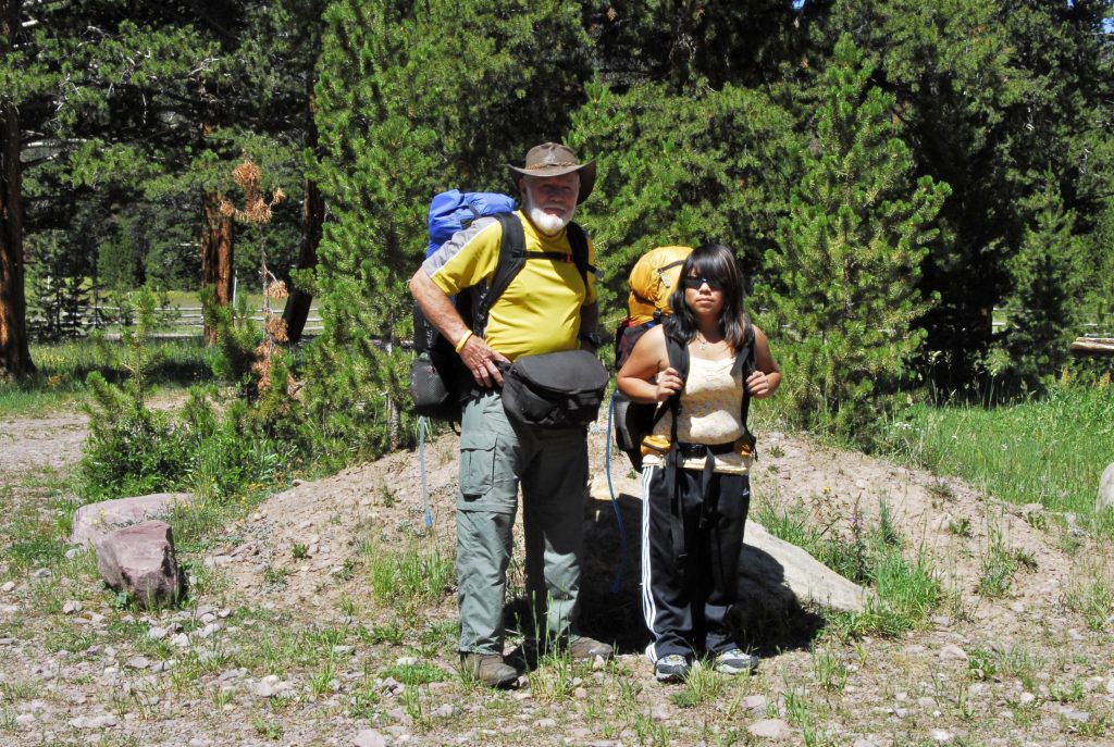
At this point it is best to remind all that perhaps a good, if not the best way to Bald Lake is from the East Fork of Blacks Fork Trailhead, as done by my daughter and I–as described in what I call on my website Trip #4. That way is also a great way to get to the Red Castle area, rather than going up Smith’s Fork 14 miles. Each way has it’s advantages. Below the title picture I’ll insert a couple of pictures of this wonderful route to Bald Lake, and to the Red Castle area.
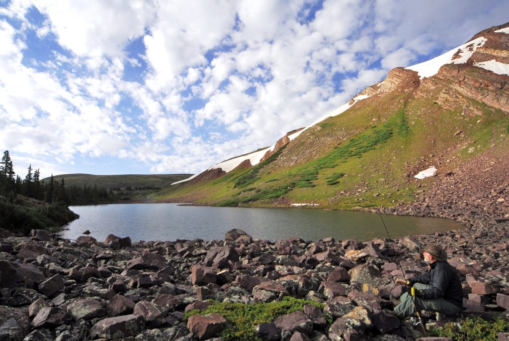
From the East Fork of Blacks Fork Trailhead, it is a steep climb up above timberline–during that climb I took the Title shot looking down on the East Fork of Blacks canyon. Once you make the climb, it is then wonderful hiking to Bald Mountains and Lake, and on to the Red Castle area.
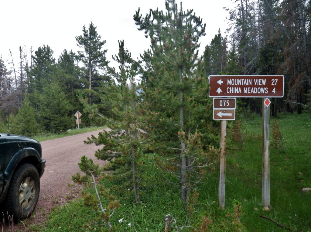
But, back down the trail, and out to the North Slope Road you have a choice to make. You can return the way you came, back to the Mirror Lake Scenic Byway, 26 miles, or go north 27 miles to Mountain View, Wyoming, and from there return to Utah on Interstate 80 going through Evanston. Or, if you are doing the 856 MILE AUTO-LOOP TOUR OF THE UINTA MOUNTAINS, head east thru China Meadows, etc.
If you choose to go through Mountain View, don’t miss going to the Forest Ranger Station to see the Tie Hacker cabin that came from the Steel Creek Commissary.
Also if you’re going this way, you could also turn off I-80 at the right point to visit another site connected to the Tie Hackers: THE PIEDMONT GHOST TOWN as mentioned below, with full details in the BOOK.
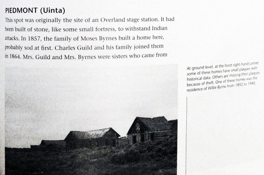
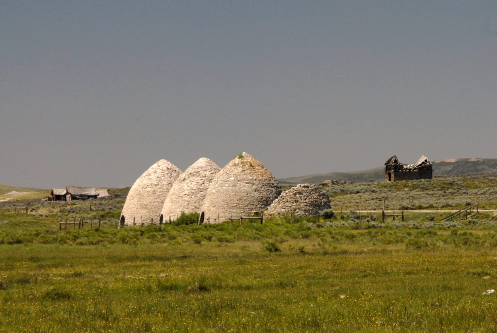
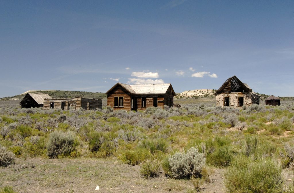
PIEDMONT is a very important ghost town, with kilns used to make charcoal with tie hacker wood. It actually grew at one time to around 11,000 people, even with a hotel where Butch Cassidy once stayed with his gang, and many other fascinating stories, some of which I tell in my book.
You can see in the distance, across the creek, the cemetery and I couldn’t resist so made a visit and photographed every headstone, and a bunch with no name markings. My study showed many children who died in their infancy, indicating that the pioneer life wasn’t easy.
I was surprised noticing that it was still being used, and so made plans to be there on MEMORIAL DAY 2013 to hopefully meet someone from Piedmont–living or dead.
And I actually did meet the woman who had buried her husband there in 1996. She was Kelly Crompton Bussio, and through her I met her mother-in-law, Faye Byrne Crompton, the then 87 year old Matriarch of the family living in Orem, Utah. Faye was raised in Piedmont until graduating from high school, and is a direct descendant of Moses Byrne, founder of Piedmont. All of course explained in my book.
From Piedmont you can return to I-80 and follow it to Evanston, or using my book as a guide, follow County roads to the Mirror Lake Scenic Byway, and just a mile or so north you should visit this….Historic turn-out.
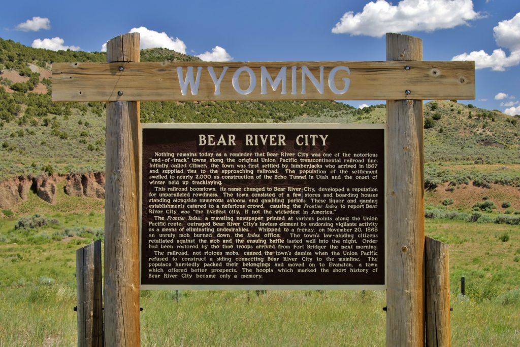
Or, if you continue to Evanston, you can return to Utah following the MIrror Lake Scenic Byway, and 10 miles south of Evanston you will see one of several turn-outs with fascinating history, like the one about BEAR RIVER CITY or BEARTOWN, which was described in pioneer times as the site of the “bloodiest battle among white men in the history of Wyoming,” and “The liveliest if not the most wicked town in America!” All connected to the tie hackers.
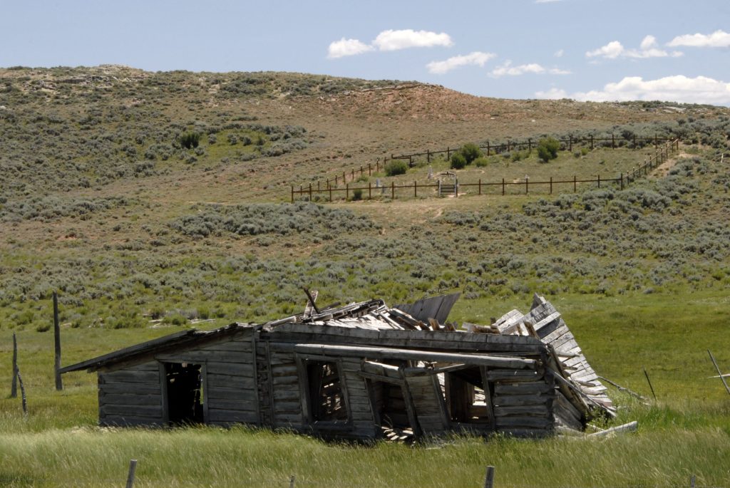
Below is an old photograph of the town, and in the bottom photo, if you’ll note the two skylines, you’ll see it is the exact location of the town–where it is said, “There are no artifacts.” But of course I found a few, as well as learning the whole story that includes………
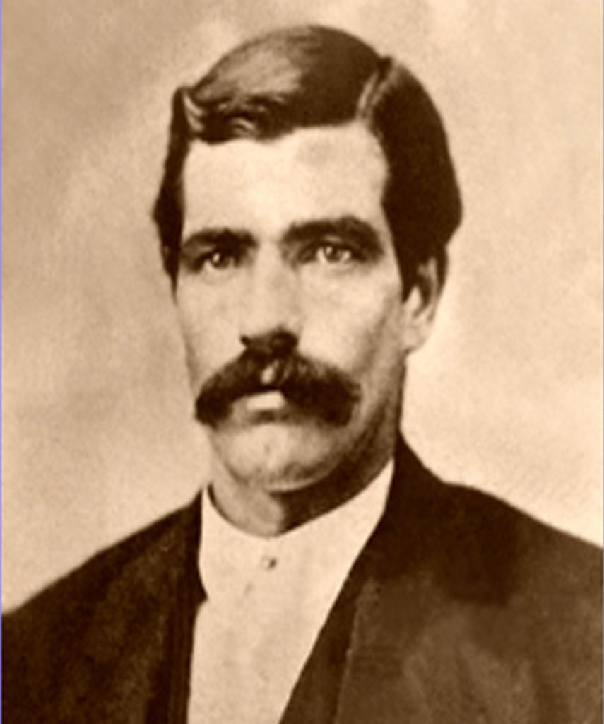
…..the life story of the man who became President Eisenhower’s HERO, TOM “BEAR RIVER” SMITH. Tom, as the Marshal, tried to stop the “bloodiest battle” and was wounded, but was nick-named “Bear River” which comes out of the Uintas and passes near the town. From there he went on to be the Marshal in Abilene, Kansas where he was known as “The Bare Knuckle Marshal,” and was finally killed in a shoot-out with crooks. It is said that every time President Eisenhower visited his home-town, Abilene, he would go and put flowers on Tom’s grave. It has been said from my brief recounting of the history in my BOOK, that it would MAKE A GREAT WESTERN MOVIE–and A TRUE ONE!
I hope and pray that you have enjoyed this post, and if so, let others know what I’m doing my darndest to share with all interested.
FOR DETAILS, INCLUDING TOPOGRAPHICAL MAPS, ABOUT THIS HIGH UINTA TOUR & SUGGESTED BACKPACK/EXPLORATION, PLUS AN 89 PAGE GUIDE TO DO THE 856 MILE AUTO-LOOP TOUR, & MUCH MORE…..
GET THE BOOK!
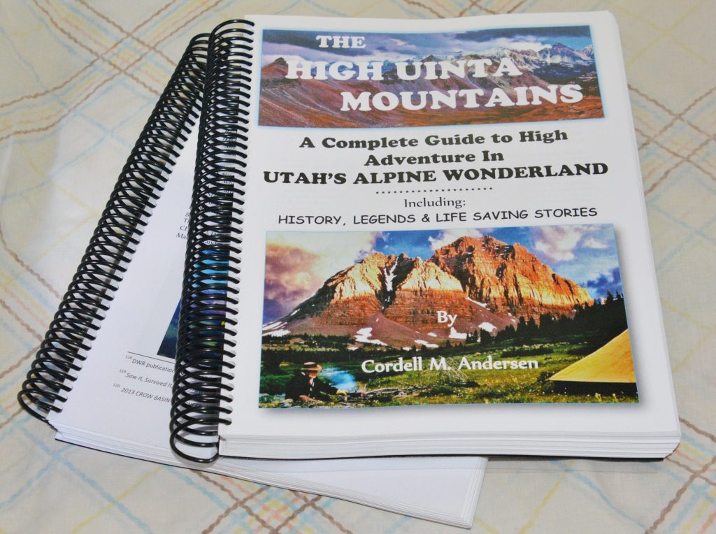
The 730 page digital book is a Guide for adventuring in the Uintas, but also with HISTORY, LEGENDS, the SURVIVAL STORIES OF THOSE WHO DIDN’T MAKE IT & WHY, plus my 8 SURVIVAL STORIES and WHY I’LL BACKPACK THIS SUMMER IN MY 87th YEAR, plus a detailed APPENDIX (among other things has the Anti-Aging Challenge writing), & 14 PAGE INDEX, AS WELL AS TOPOGRAPHICAL MAPS WITH ROUTES, DISTANCES & LABELS — get an online copy of this book, some have called THE ENCYCLOPEDIA OF THE UINTA MOUNTAINS, send me $20 (don’t be afraid of sending a $20 bill as we aren’t south of the border) along with your email address, and I will immediately email you the link to download the book with my permission to share once with a friend. Or, send $25 for a thumb drive that will have the book, plus The History of it’s creation as detailed in a speech I gave at the Utah Valley Historical Society; plus my CHECKERED HISTORY & VISION QUEST–0-22 years. Send to:
Cordell Andersen, 444 Elm St., American Fork, Utah 84003
THE PLAN IS TO THIS WEEK KEEP WORKING ON GETTING STRONGER & DEVELOPING MY BALANCE WHICH I LOST ALMOST COMPLETELY–and by EARLY NEXT WEEK DRIVE UP THE MIRROR LAKE SCENIC BYWAY, CHECKING UP ON THE BALD MT. PASS HOW MY OXYGEN LEVEL IS–and if it’s a bit low, camp out in my car for a day until it normalizes.
THEN DO THE SAME HIKE I TRIED LAST YEAR TO FEHR LAKE–just a half mile, but THIS TIME GET PAST THAT ROCKY AREA I WASN’T READY TO DO YET–BUT AM NOW and GET TO THE LAKE AND CAMP, EAT A FEW BROOK TROUT, and return the Trailhead.
IF THAT GOES WELL, I WILL LIKELY DO ANOTHER OVERNIGHTER perhaps from the PASS LAKE TRAILHEAD TO SCOUT LAKE.
I WILL THEN REPORT WHAT FOR ME ARE MONUMENTAL ATTEMPTS AS 18 MONTHS AGO I COULDN’T EVEN WALK & HAD NO MUSCLES LEFT IN MY LEGS.
THEN I HOPE, BEFORE JULY & THE ONSLAUGHT OF MOSQUITOES, TO DO A HISTORIC BACKPACK TO….
THE GRANDADDIES!

THE HIKE TO HADES PASS & DOWN TO THE LAKE MIGHT TAKE ME ALL DAY, BUT I WANT TO SEE ONE MORE TIME THE AMAZING SPAWN OF THE NATIVE CUTTHROAT TROUT UP THE 3 CREEKS ON THE WEST SIDE OF THE LAKE & REPORT HERE WITH SPECTACULAR PHOTOS!
THEN? WHO KNOWS…..BUT SET ANOTHER GOAL & DO MY DARNDEST and REPORT!
^^^^^^^^^^^^^^^^^^^^^^^^^^^^^^^