

Click on the following links for recent posts:
DREAM LIST OF BACKPACKS-LAUNCH-SPOT Link–TOPO MAPS, etc.
*********************************
Trip #1 REPORT: The “ACID TEST” To East Brown Duck Basin….Success? Future?
*********************************
SPOT LINK
Sunday July 13 – UPDATE
In spite of ominous weather I made the effort to get to LAKE LORENA, had an incredible experience…even though kicking and screaming, scratched & scared…. I failed to get to the finish line…yet had WONDERFUL SUCCESS!
A CONTRADICTION? You’ll have to check it out to
see….and judge.
DETAILS COMING:
A simplified Photo/essay (like a slide show with captions),
&
a complete photo version in a YouTube Video without narration.

For details click on the Dream List above.
PREPARATION: I’ll have to admit getting hooked on the World Cup, even though the U.S. was eliminated…..so I want to be around for the games on Tuesday & Wednesday–then immediately on termination of that game leave for the East Fork of the Bear River Trailhead to sleep Wednesday night there and get an early start on Thursday for LAKE LORENA. I know that Dave Cawley beat me to it last week (see KSL Outdoor Radio Facebook page) but he didn’t test the fishing, and I have plans for unique photographs that I can’t rest until attempted.
NOTE: KSL Outdoors Radio seemed to indicate that Dave discovered this isolated Jewel through my website. The hike’s elevation gain was misunderstood on the program indicating it was something like 3,500 ft. but it is rather 1,662 ft. in the 4 mile hike. The trailhead’s elevation is about 9,130 ft. from which you drop down a couple of hundred feet then climb 1,662 ft. to the lake at 10,562 ft.
In the meantime……Daily I’m up at 6:00 now building on the conditioning and improvement I’ve achieved in 2 backpacks, and hoping to “increase the pace, lengthen my stride and stretch out the distances” by jogging every morning and in the evening walk around a couple of blocks with my 40 lb. backpack. Then doing all the Guatemalan Foundation work, while helping with a couple of family situations that need attention,
NOTE: To get the whole story with many details like, names, elevations, distances & jokes– read the captions that will take you maybe 20 minutes. To just focus on enlarged photos, click on the image below and see photos one by one.


It began at the Highline Trailhead at 10,347 ft. altitude along the Mirror Lake Scenic Byway–Utah Highway 150, with Hayden Peak guarding the area.


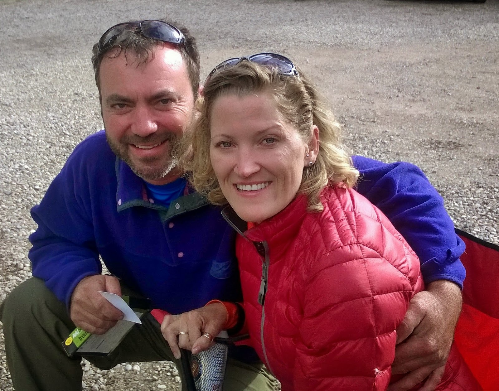CORDELL+and+CANDY+WOLKING.jpg)
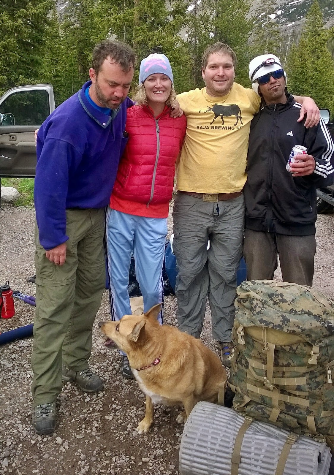CORDELL+and+CANDY+WOLKING+-Brandson+Farley+-Nate+Gardner.jpg)
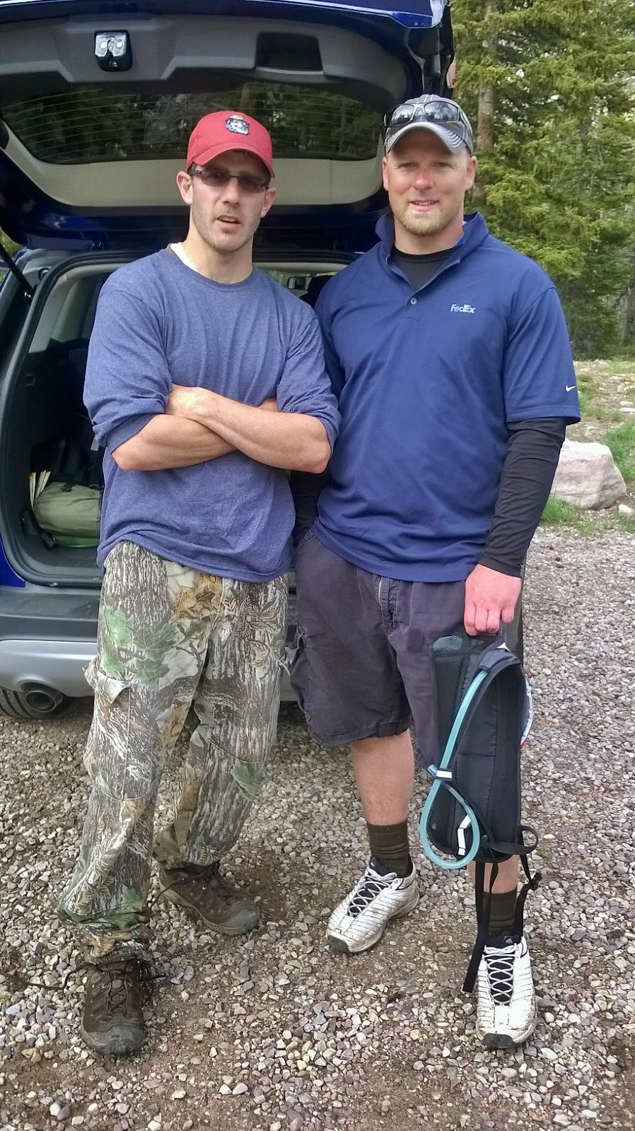+JASON+HOWES-DANNY+DRAKE.jpg)
Let family & friends know where you’re going. I had posted the day before the following on my website, along with the topographical map that showed the route I was going to take.


Have and use a SPOT Personal Satellite Tracker. I used it when I was ready to head down the trail hitting the OK button that emailed my prepared message to the 10 on my list letting them know I was on my way and exactly where that starting point was.

Prior to leaving for the mountains you program your SPOT Tracker using your computer with the name of your backpack, a short message, and 10 emails of friends, who will receive the OK message via email. Part of that message, seen below, is a link they can click on to instantly connect to Google Earth and see my exact location. My first OK is from the starting point. Also I put on my trip announcement, seen above, a link to the SPOT website where anyone interested can go everyday to see if I’m okay and see on Google Earth exactly where I am .


..……… especially when alone, is to have a satellite phone. Groups, such as Boy Scouts or Explorers, should have one phone in the group (and one SPOT Tracker) ….and I’m sure parents will love the comfort daily of knowing their children are safe and would be happy to chip in to cover the rental cost from SKYCALL SATELLITE

Only once has it been necessary for my own need, which story I related in my speech at Coalville a few months ago.
The photo below is outdated in the name of Russ’ business, but the phone numbers are the same.


READY TO MOVE!


Some ask me how I stand going “alone?”
But, as you’re seeing, for me backpacking is usually a social experience with many new friends each trip….like the mosaic below of all my new “friends” from 2013.
How can one feel lonely with so many good friends?


Actually my total of wildflowers photographed now comes to 316 from the foothills to Kings Peak–316 testimonies of our wonderful Creator.


I then prepared my recovery drink to restore my apetite and have me feeling good enough to go fishing.


The next day I headed south on a day hike to Wyman, and Packard Lakes, and to witness again the Canyon of the East Fork of the Duchesne River. In my photo waist pack I had my SPOT Tracker, clipped on one side the sat phone, and on the other side my Colt .45. In addition I had my headlamp, and weatherproof matches in case of any emergency need of light or fire. My food was another of my home-made energy drinks, and water.

Another mushroom. I’m not quite ready to say a lot about them….so for the present have extreme caution.


About half a mile, including some elevation gain, I arrive at WYMAN LAKE. It’s a pretty lake that looks like it should have fish, but the pamphlet states that it is subject to winter-kill, but occasionally stocked . I tested its waters for fish at the inlet, and here and there around the edge as I followed the trail to the south end, but with no sign of fish.

Here’s a fish-eye view looking north towards Mt. Agassiz.
I then continued on towards Packard Lake, but with one suggestion for the hiker. The trail divides, the main one going up over a hill which then drops down to Packard Lake. The right hand fork continues over level ground skirting the edge of meadows and then comes to the Canyon following near the edge up to Packard Lake. It’s no big deal, but it’s easier and will give you a glimpse of an incredible canyon that those who take the other trail often never even see–and they miss one of the great sights of this hike.

Here is the SPOT Tracker view of the hike in the area down to Packard Lake. From the Trailhead where I hit the OK button first, then at Scudder Lake, and then at my base camp at Wilder Lake. Then on the day hike I hit it again at Wyman Lake, then on the edge of the Canyon, and at Packard Lake, and last of all in the evening when returning to my base camp..

PACKARD LAKE, at 10,000 ft., guarded by Mt. Agassiz, is always visited with the Ted Packard family in mind. Ted was one of the first two who introduced me to the High Uintas in 1952. Those two, Ted Packard and Charlie Petersen, along with me in 2008 had our Golden Anniversary Backpack to the Red Castle Area you see below .


The other Packard on my mind at this lake is Ted’s son,Mike who is another great High Uintas Friend we see above. Without them I might have never had the interest in backpacking to Packard Lake. Thanks, to both of you.
As mentioned above, some Packard Lake visitors get there going up over the hill, come down to the lake, circle it, camp and fish it without ever realizing that just 50-100 yards to the south is a canyon you see below on this Google Earth view

Let me show you….the outlet stream from the lake which soon ends….

…..and then turns into a waterfall at the beautiful edge of the canyon.


Expanding our view we look up the Canyon of the East Fork of the Duchesne River towards the Four Lakes Basin, and almost visible is Cyclone Pass.


Zooming in on the river has me thinking that this would be a great Fall backpack, after the mosquitoes are gone, hiking and fishing the river up from Defa’s Dude Ranch.

Back to Packard Lake we observe the Yellow Pond Lilies beginning to surfacer.


Fishing produced pan sized Eastern brook trout, but also one that was larger, and some very hard hits–one that took my lure and I could see the colorful brookie thrashing around with a Thomas Cyclone in his lip. Hope he survives and is one day caught by a fisherman–who can return to me the lure for a nice reward!

Soon I headed back to my base camp at Wilder Lake.

I relaxed resting from my several mile long day hike, and prepared to head out the next morning, always in awe enjoying the beautiful changing scene as the sun sank into the western sky.


A flickering campfire at the inlet had me zooming in……..

I understand the warming emotion of a family campfire as the night’s chill comes on, but somehow we’ve got to make a sacrifice moving at least 200 feet from the water, and thus avoid violating the law as these campers are doing.


I guess with this sunset view of Mt. Agassiz we should end the show…..but I had to get out of there and along the trail the next morning had experiences I have to share.


So the next morning, June 30th, I bid farewell to Wilder Lake and headed up the trail.
As always, SPOT Tracker at hand ready for emergency use, as well as sat phone clipped on my camera waist pack, and on the other side my Colt .45. The camera, that was taking the picture, would be hanging around my neck with one hand steadying it and ready to click off that once-in-a-lifetime shot. No need of trekking poles–not enough hands to work them anyway…and they do require “work” expending extra energy, a luxury this old guy can’t afford.
That “once-in-a-lifetime shot” might be like one of the following which I would have never got if I was hindered by trekking poles;


Soon I was back to the Highline Trail.


Along the stream the Bluebells are budding out and will soon add their beautiful flowers to the scene.


The tiny Alpine Lewisia makes its contribution to the magnificent hike–but you have to zoom in to appreciate its beauty..

And I wasn’t about to stop meeting wonderful new High Uinta Friends….and little did I know that just around a few bends in the trail a really WOW one would appear in a flash!

….but first I met Kevin McDowell and Joe Hoffman…who signed in and parted with a shout….“Don’t ever stop backpacking!”

Alpine buttercup along with a host of others raised my spirits even a little higher.


Soon a Boy Scout group, came down the trail…..

….and I met BEN KENNALEY, and CLARK JONES..


Ben’s father and others brought up the rear….all heading for the Naturalist Basin.

Then in a FLASH a “WOW MOUNTAIN RUNNER” with her running companion whipped by me in a blur…..

I yelled after her, asking, “How far are you going?” Without stopping–mountain runners stop for nothing…she shouted back, “I’ll go 6 miles and then turn around!”
Incredible to say the least. How I admire these runners on these tortuously rocky trails and lung killing high altitudes. I thought of waiting for her to return at the Trailhead, ready to shout,
“HEY, WILL YOU MARRY ME?”
Us old guys can sometimes get away with that kind of joking that no one is going to take seriously, but I had stops to make along the return trip home, so stalked up the trail, soon seeing Mt. Baldy off to the west…..

….and soon I was at the Trailhead having done around 12 miles, including extras, and hit the OK button on my SPOT Tracker….

Sending this message to the world…..that I had made it, not experienced High Altitude Sickness this time, and while slow, got stronger, giving me hope for the future……

.. then headed for my tiny “Cabin A” home, freshened up a bit and set alongside of me some snacks for the road, and headed for the first stop–Bald Mt. Pass.


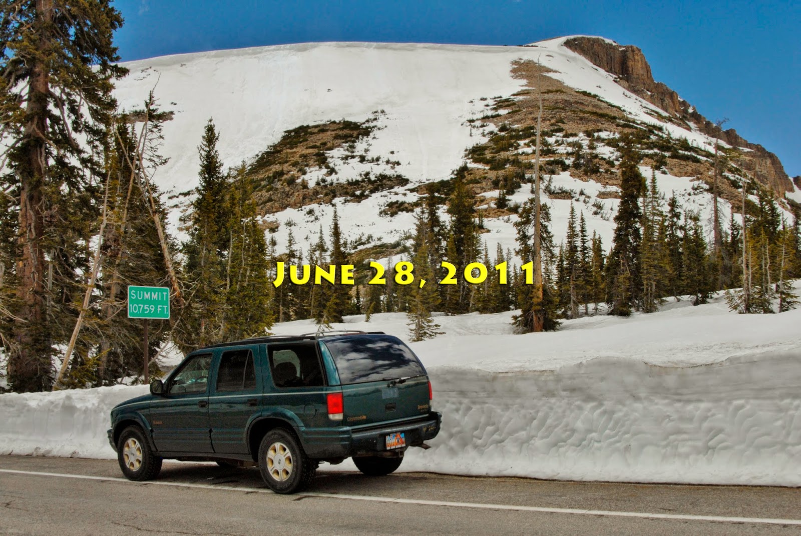
Then on to PROVO RIVER FALLS for the annual photograph to also give us an idea about the season, compared to other years.


While at the Falls I all of a sudden recognized someone, and she recognized me….

She was the “WOW MOUNTAIN RUNNER!” and I met JENNY POWERS, and told her that I had almost waited for her at the Trailhead to ask, “Will you marry me?” and quickly qualified that to make sure she knew I was just an old guy doing my best to joke my way through what’s left of my life.

She picked up on the thought and mentioned her boyfriend might want to fight me over her. We talked about the High Uintas Wilderness Project–my going on 1,700 miles of backpacking, and my years in Guatemala–with the prediction on leaving in 1967, “You’ll come running home with your tail between your legs in 6 months!” ….and finally I did come “running home with my tail between my legs” but 35 years later!
. I learned she is from Georgia, and wants to backpack the Highline Trail later this summer but thinks her and female companion will have to eat a lot of fish….but she doesn’t know how, so asked me to teach her. As we were saying goodbye, she asked, “Can I hug you?” How could I refuse such a nice request…..so I got paid for my 12 torturous miles on the trail with one great hug!
I recalled at Reams Supermarket where I worked from 2009 to 2012 as likely the oldest “shopping cart herder” in the world where I loved to serve the ladies (and everybody else too), but was restricted by management to receiving and giving hugs only to those over 90!
WOW! IT’S GREAT TO BE FREE!
Then on to Coalville and Summit County Courthouse.


NaVee Vernon, the Historical Director, had advised me that they had framed the large print I had donated and I was curious to see it.

Susan Avard, of the Office of Community Development, and NaVee took me to a Conference Room and showed me the beautiful framed photograph of what many think is the most beautiful mountain scene in Utah and it’s in Summit County as is nearly all the North Slope.

At Coalville I hit the Ok button and then headed for the Wasatch Front……….
……. American Fork where I hit the OK button on my SPOT Tracker to end the trip.

So here we see the whole trip as it is on the SPOT Tracker website, showing all the OK signals and the message sent as seen below.

NOW THE ANALYSIS OF “ACID TEST #2”

Did I make any progress so as to avoid the “Forest Gump reaction?”
I’m happy to say that progress was made. I didn’t experience any High Altitude Sickness, my balance greatly improved, and I felt great on finishing the trip….of course “the hug” helped a lot!
But I was embarrassingly slow that would make most of my scheduled trips too long and quite impossible as too much food would be necessary. Besides, I rationalize, most of those “Dream Backpacks” are to areas I have already been through, so they aren’t critical to my project. I’ll just back off a bit but still keep working at getting back in shape, with shorter trips, and hope to eventually be back to what I consider normal–if there is anything normal for an old guy in his 79th year.

So no “GIVING IN” yet, rather carefully, and persistently going forward doing the best I can and hope to eventually be able to “Pick up the pace…lengthen my stride..and increase the distances.” .…but fill in my time with what is now critical research and writing.
So keep an eye on my website where I’ll announce further attempts to get the job done.

Another great write-up. I'm looking forward to reading about your next trip!