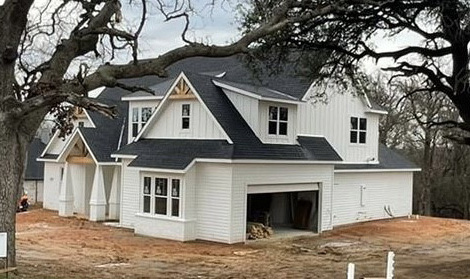
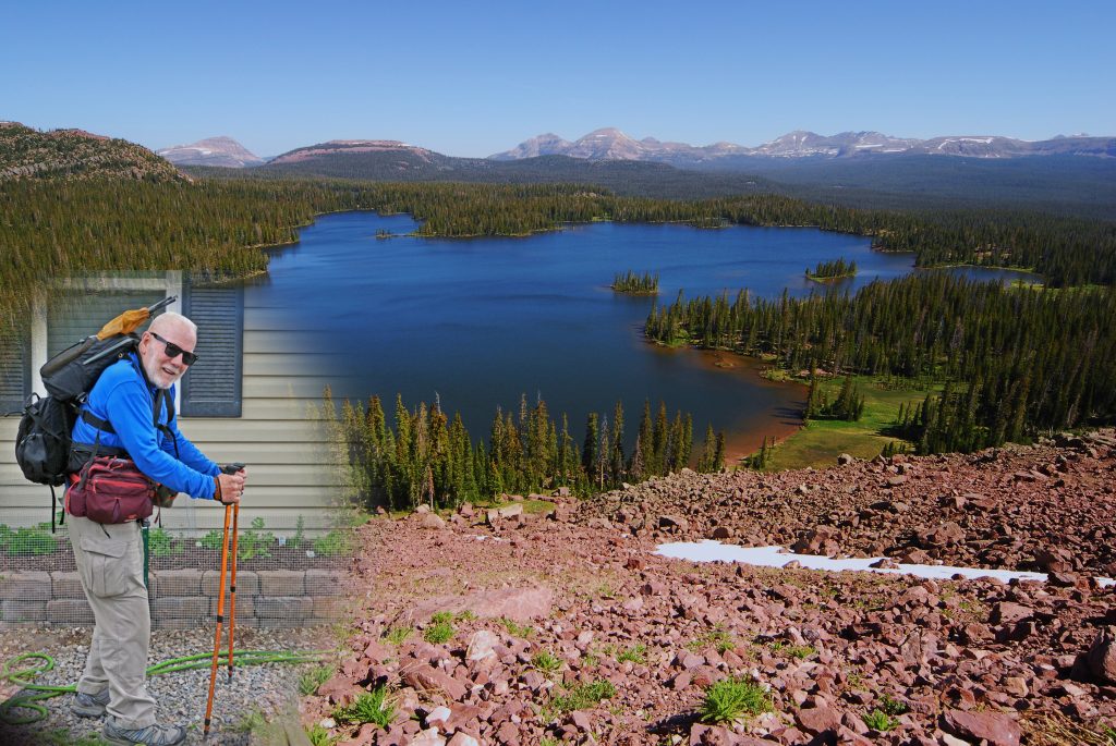
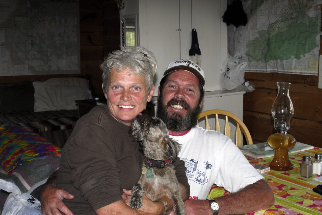
Looking forward to the SPRING for outdoor exercise, but in the meantime we were invited for Christmas with my son Cordel Ammon “Lito,” his wife Diana and two cute grandchildren in the home they just built in Azle, Texas….so in two cars–Nephi’s and Mahana’s, we drove in caravan 1,150 miles to Azle, Texas.
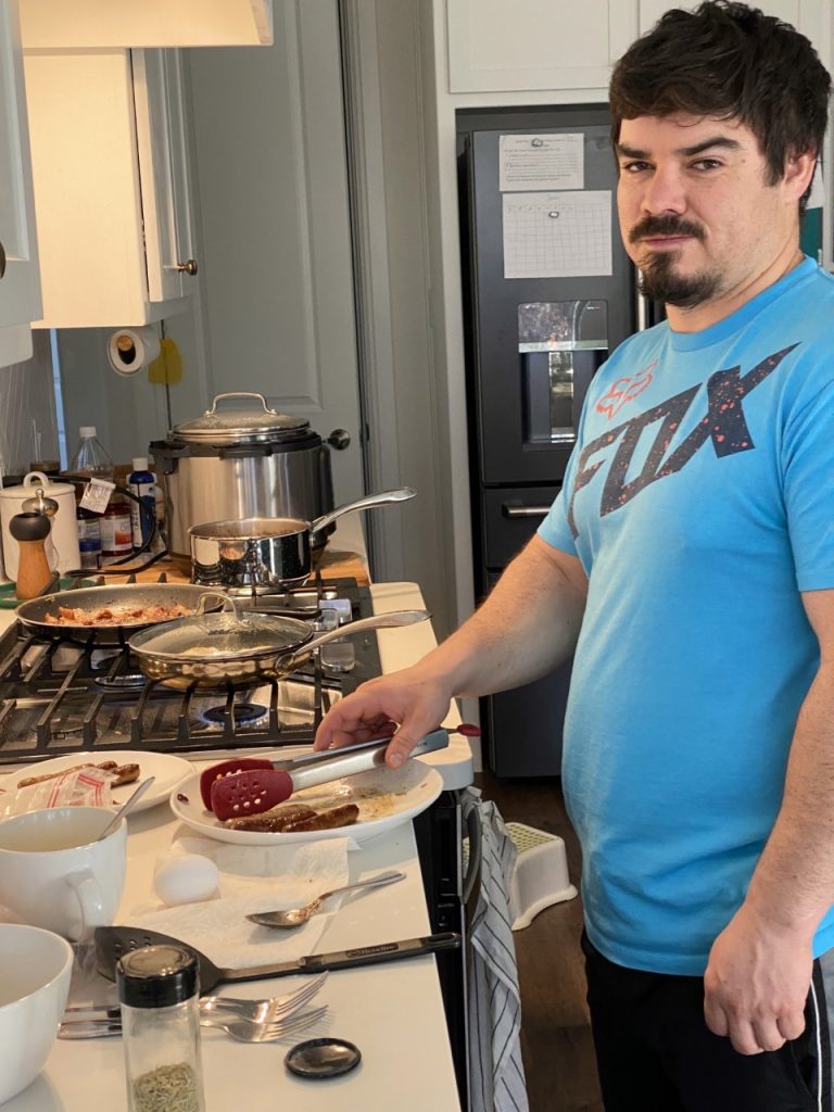
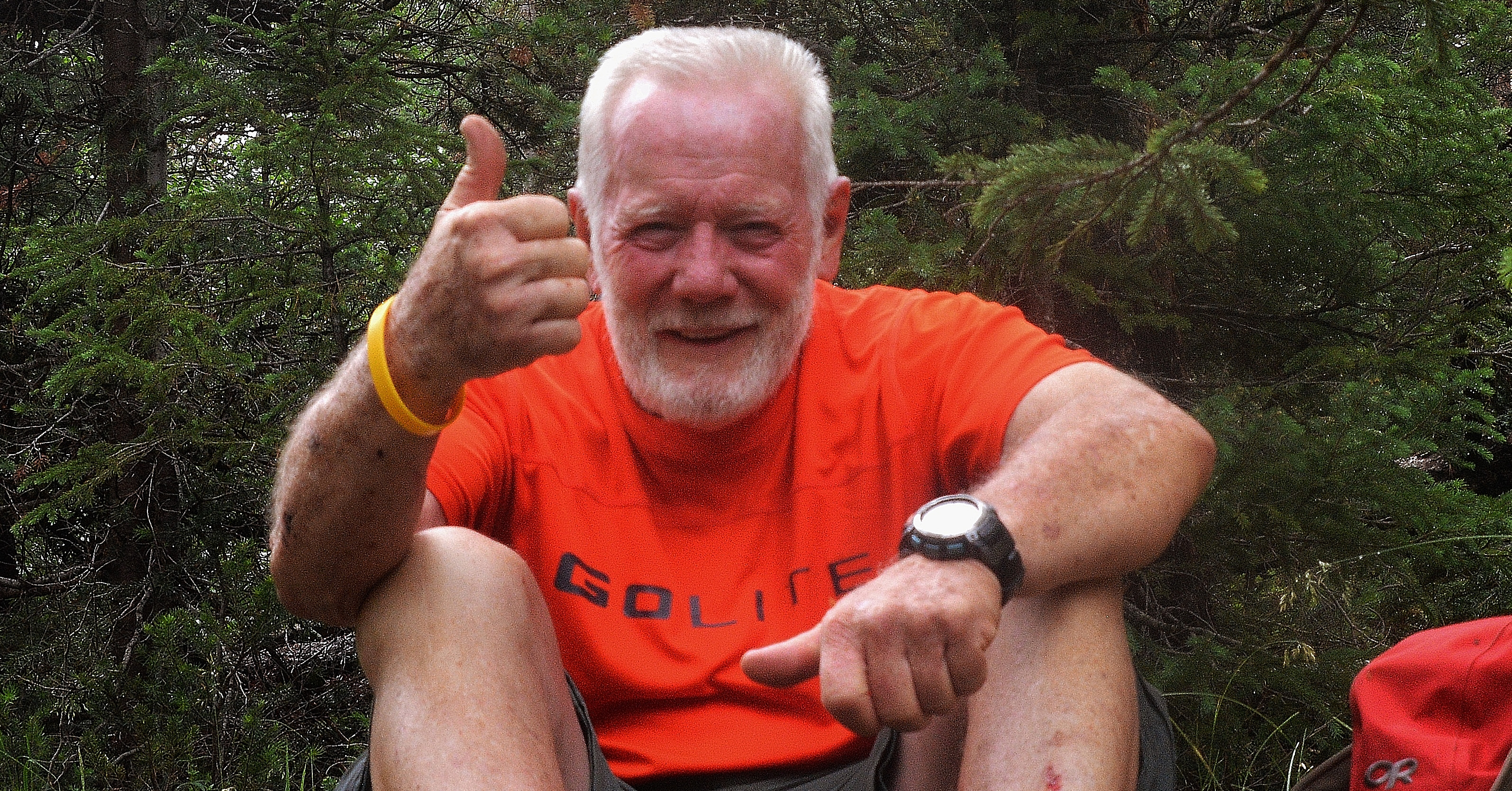
LITO as I call him (from CordeLITO) is one hard working son I’m very proud of, working in the oil industry in Texas, and my personal chef while with them in Texas.
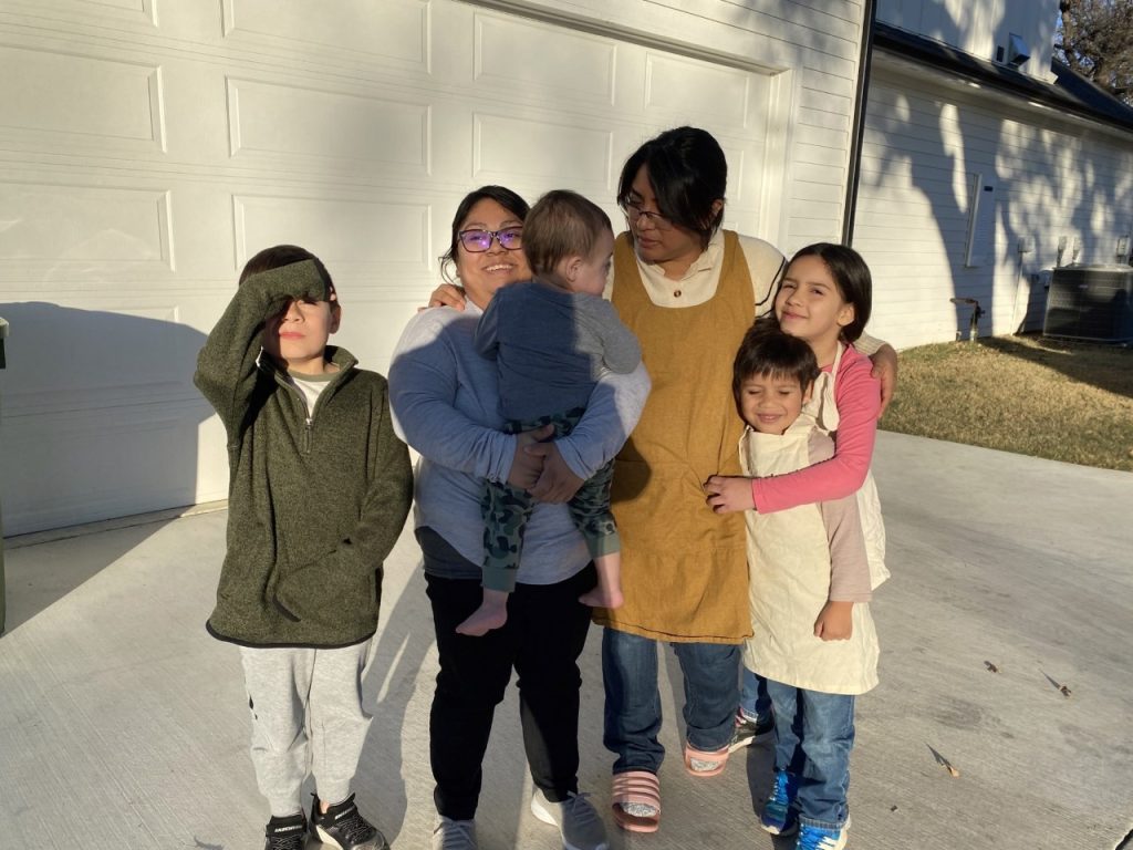
Mahana (from Valparaiso) with her two, Ryan and William, and Diana (from Coban) with her two, Rebeca and James
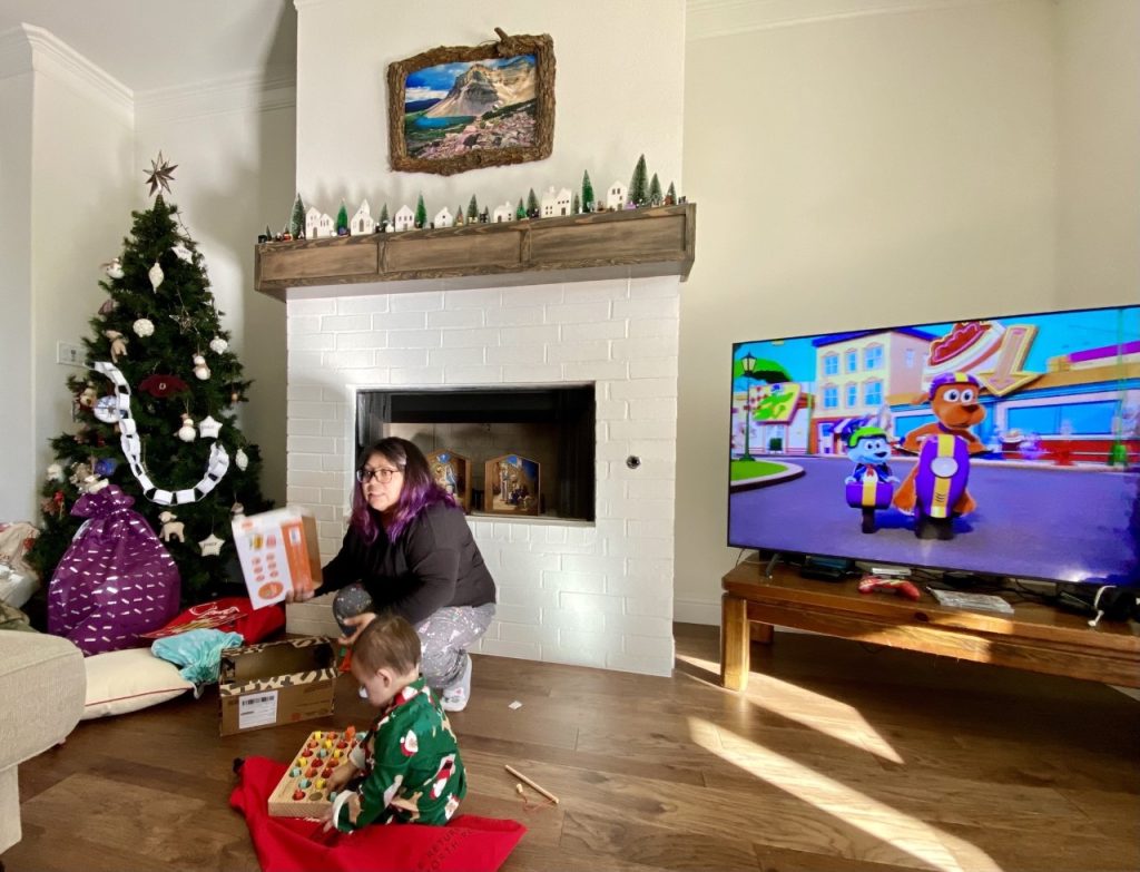
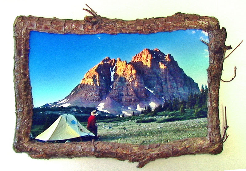
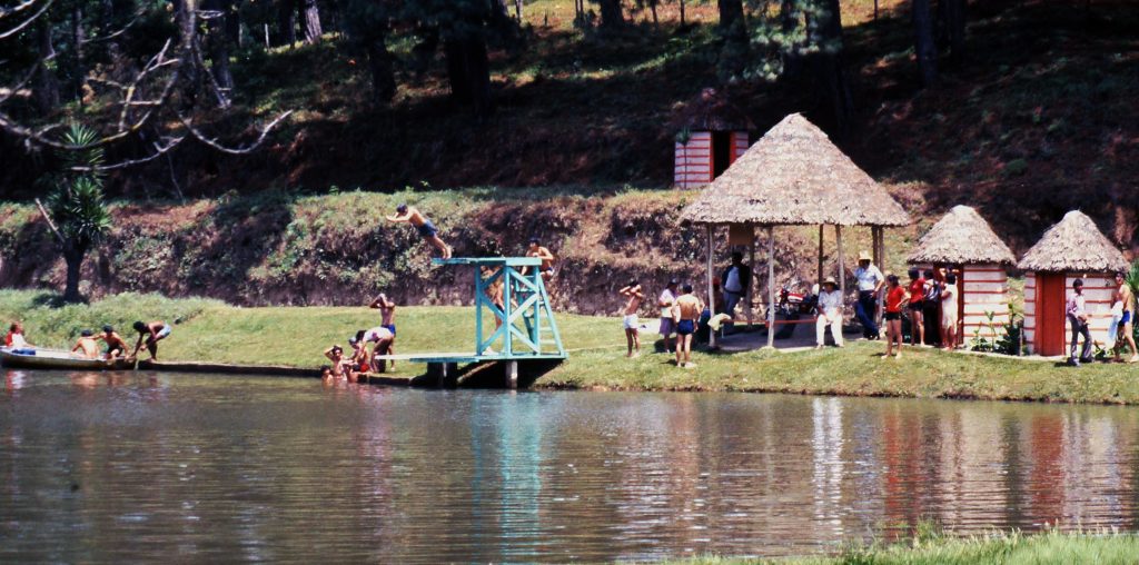
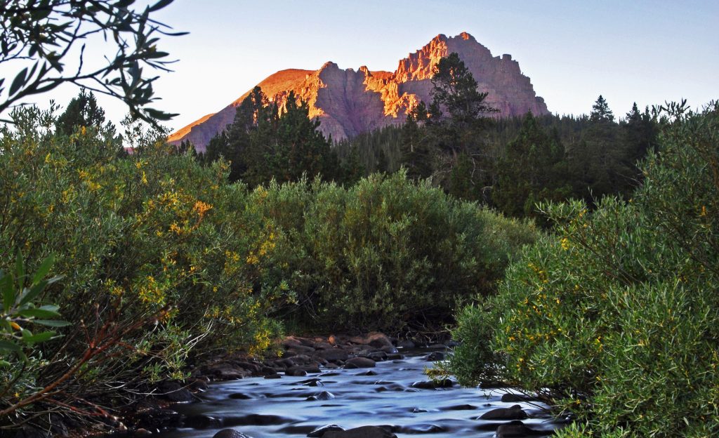
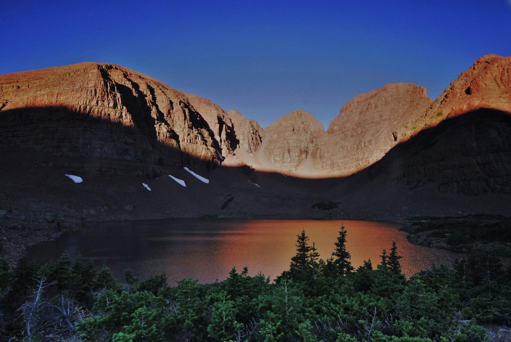
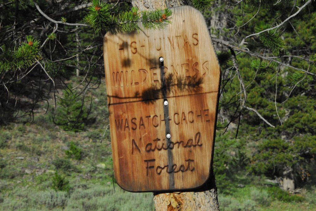
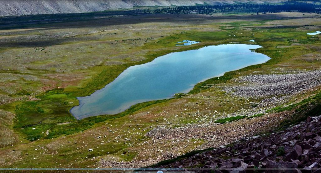
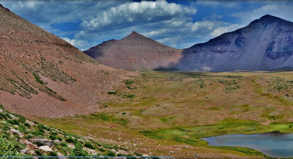
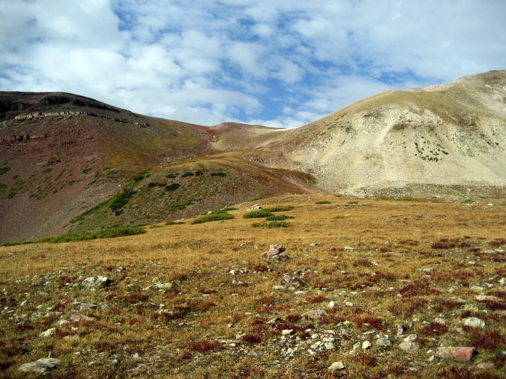
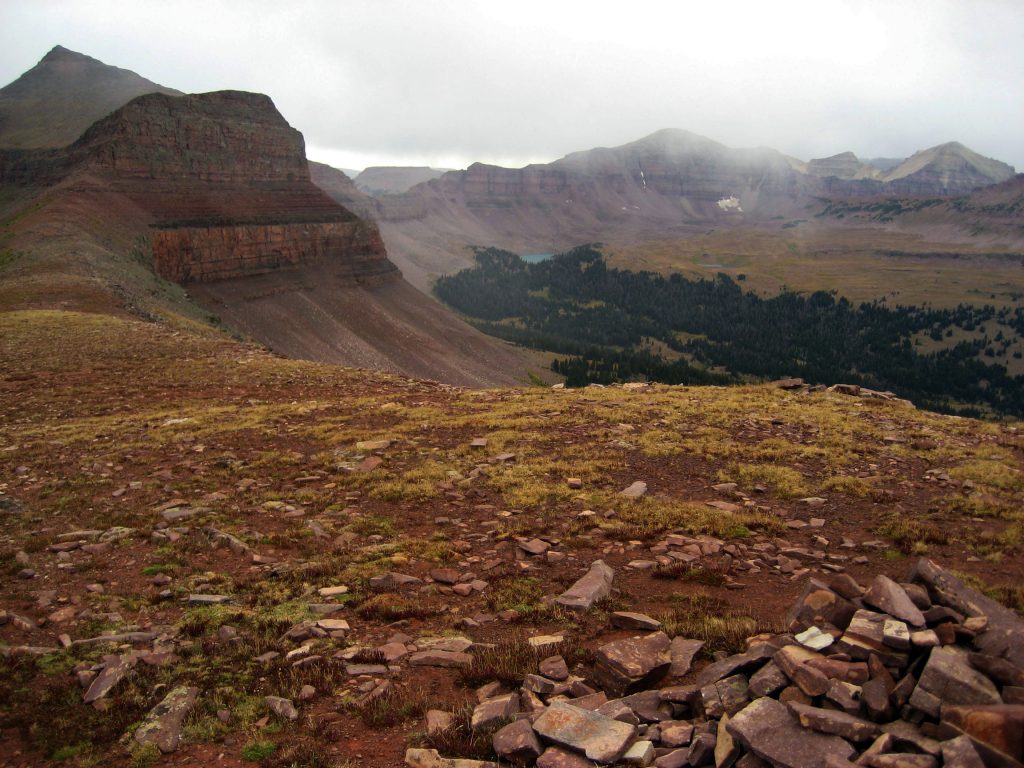
The day after we arrived, was Christmas and we gathered in the living/TV room, appropriately decorated with one of my rustic picture frames and a much loved High Uinta Mountain scene:
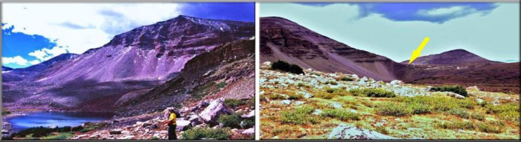
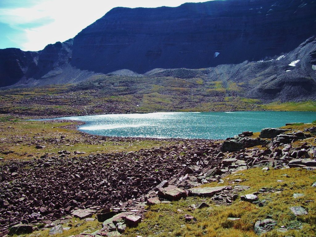
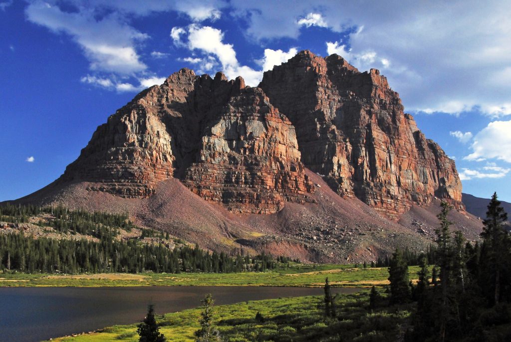
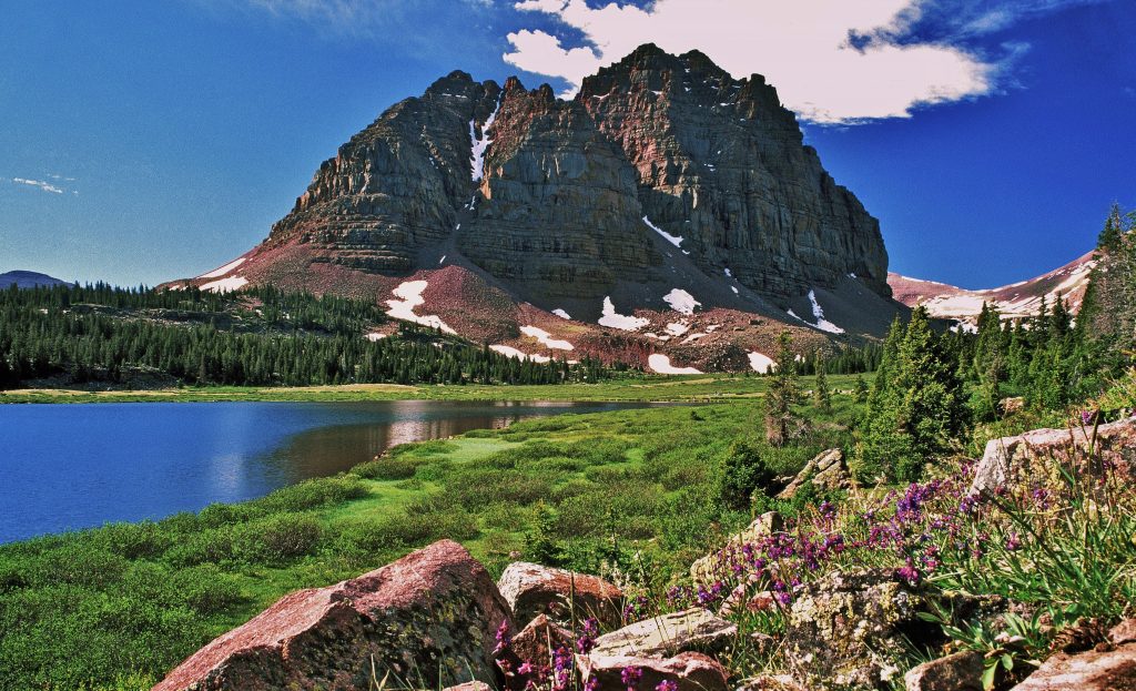
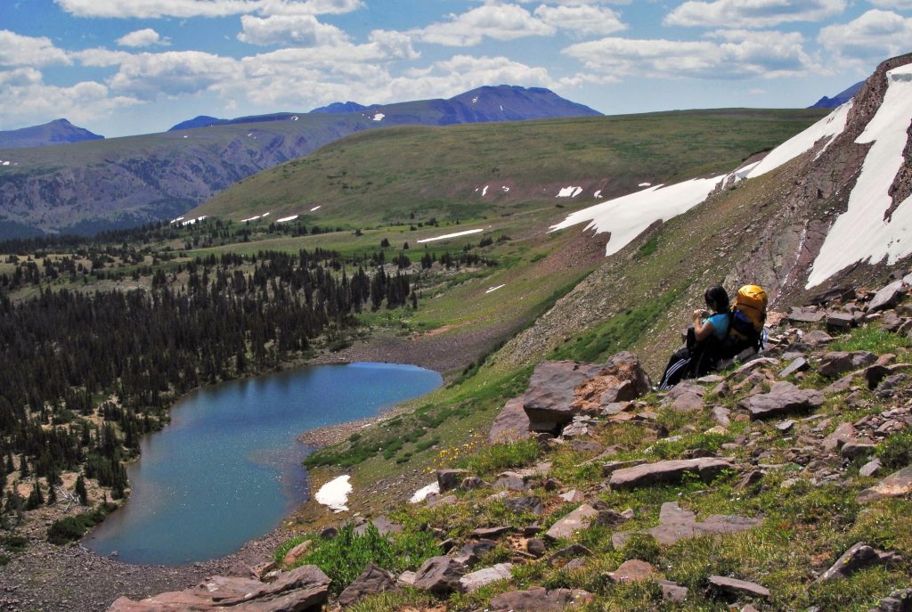
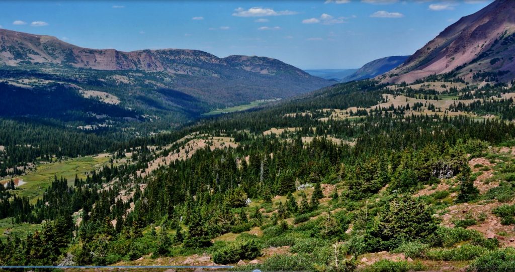
Triangle Mountain and Reconnaissance Lake, rival to Red Castle as the most beautiful outdoor scene in Utah!
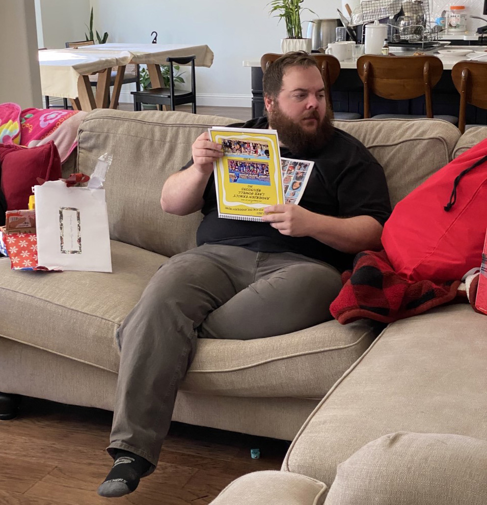
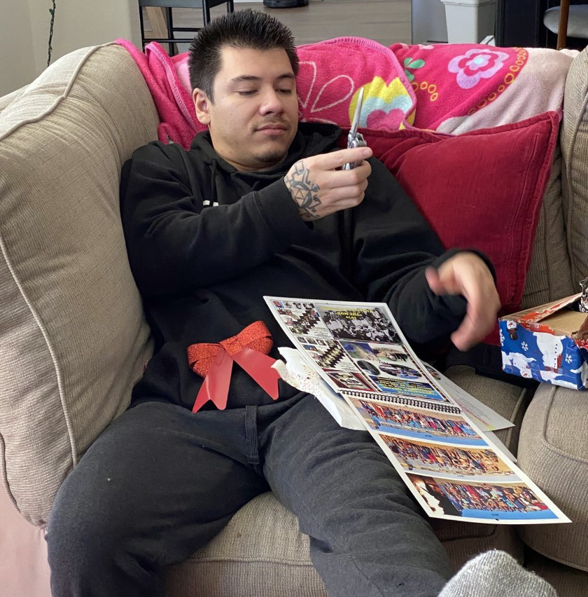
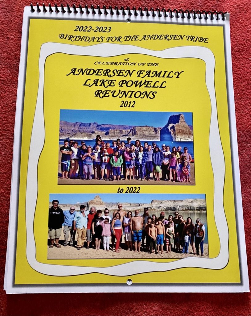
Calen was the first to open one of the many envelopes I had prepared for the entire family, finding that for the first time since 2016 I had the energy to put together a much enlarged FAMILY BIRTHDAY CALENDAR for 2022-23, including a Family Photo Album. a booklet of 24 pages.
Nephi, with whom I traveled, checking out the gift I put together for my large family, now with at least 105 children, grandchildren and great-grandchildren, the gift was the
with 24 pages of beautiful color photos of my wonderful Andersen Clan families….best I’ll insert a picture of it below that I had printed for all the family. You can see it by clicking on the link above and if interested download it to your computer.
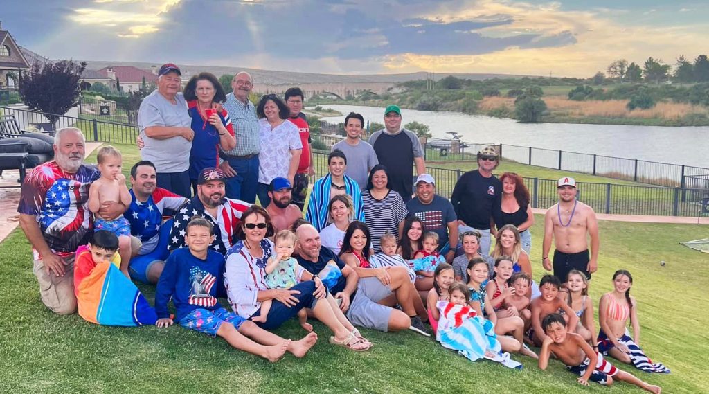
The main theme was to celebrate 11 years of the ANNUAL ANDERSEN FAMILY LAKE POWELL REUNION, with all the group photos, plus most of the individual attendees, and then some historical photos of the Andersen and Morgan families when I was a child, along with photos of most of the rest in the family who have not been able to be at the Reunion, as well as the growing David & Terri Andersen family Reunion….they now having 21 grandchildren and a family reunion in New Mexico larger than the Lake Powell one….I’ll insert a picture of it below:
THE BIRTHDAY CALENDAR & FAMILY PHOTO ALBUM also has a tribute to those in the family who have passed on:
Michelle “Pepita,” Celestina, and Julie.
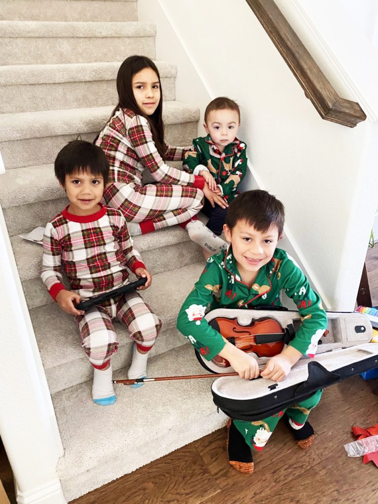
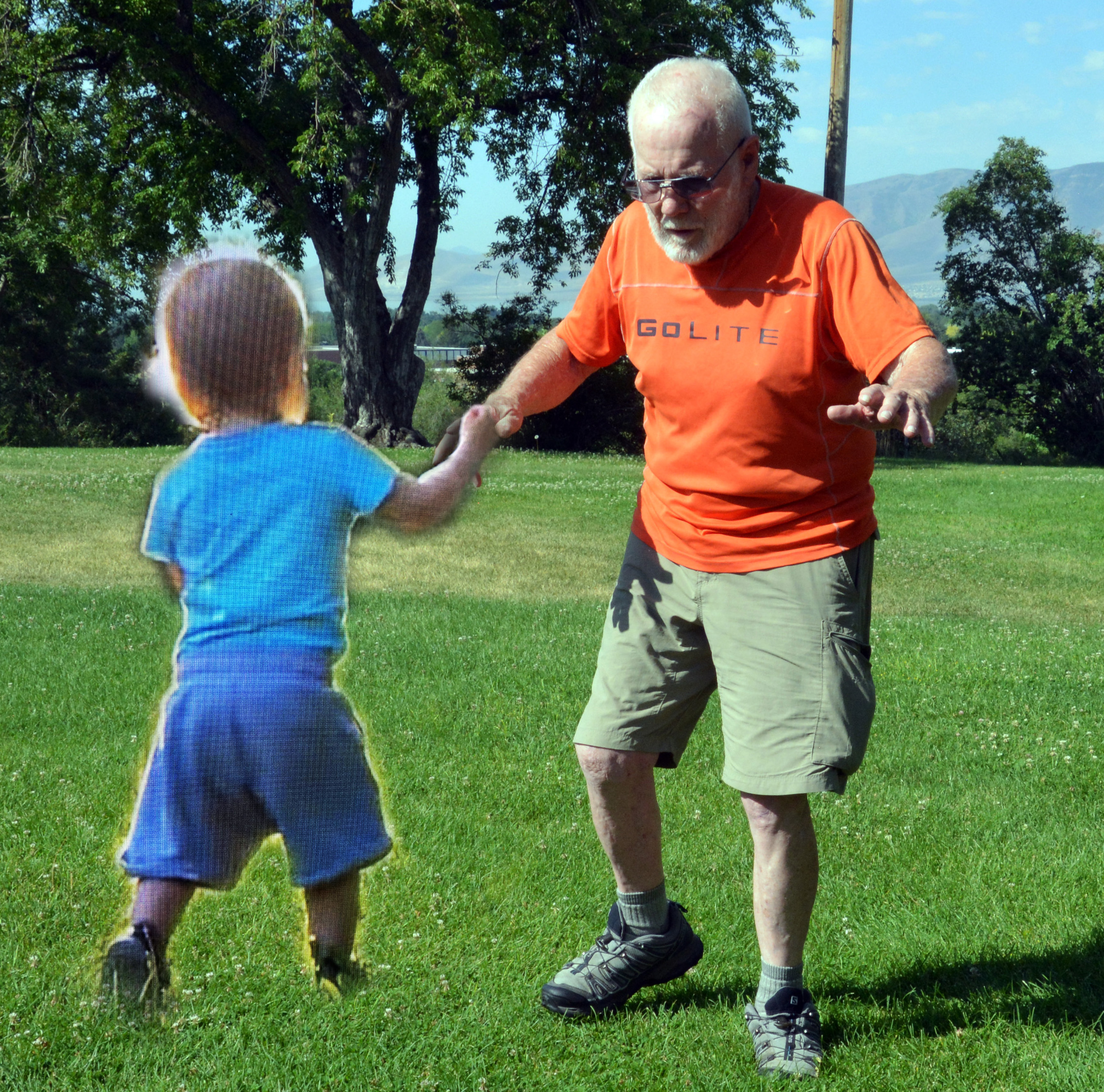
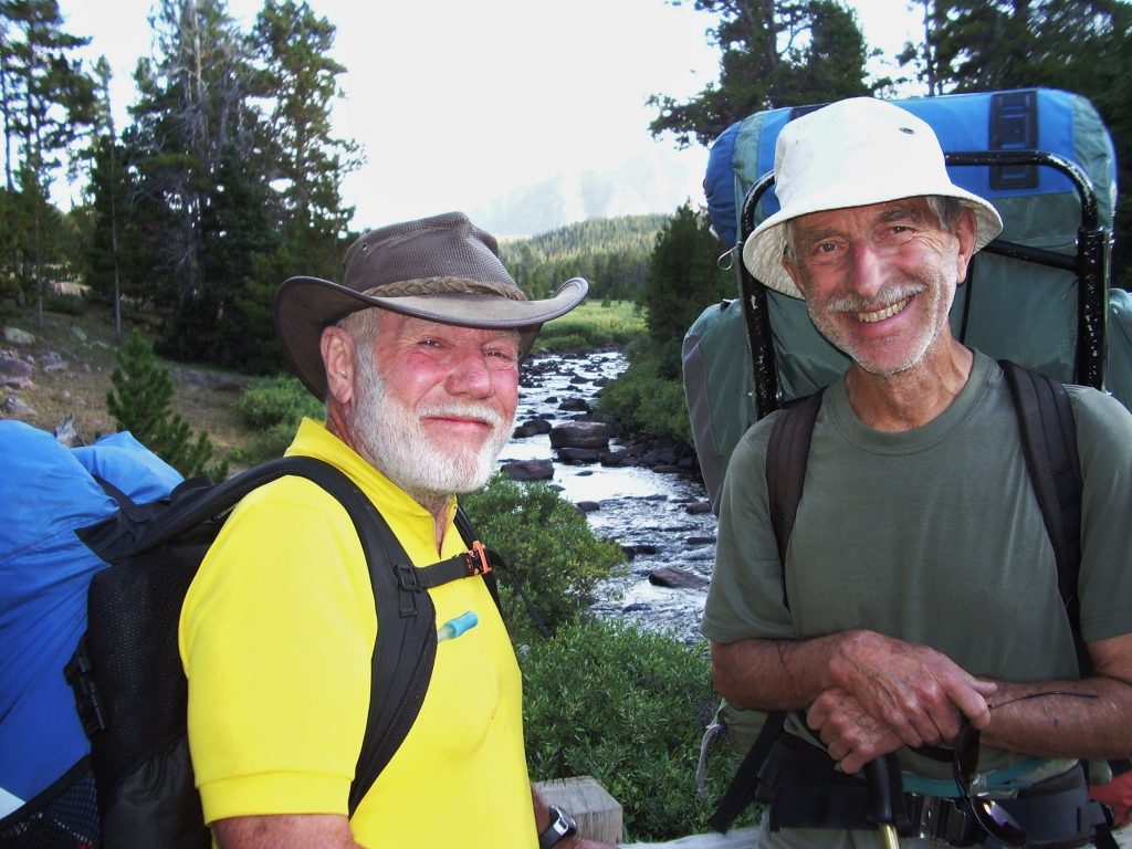
Here are my four grandchildren with us in Texas, all appropiately with color coded pijamas, Lito & Diana’s, James and Rebeca, and Mahana & Calen’s, Ryan and William.
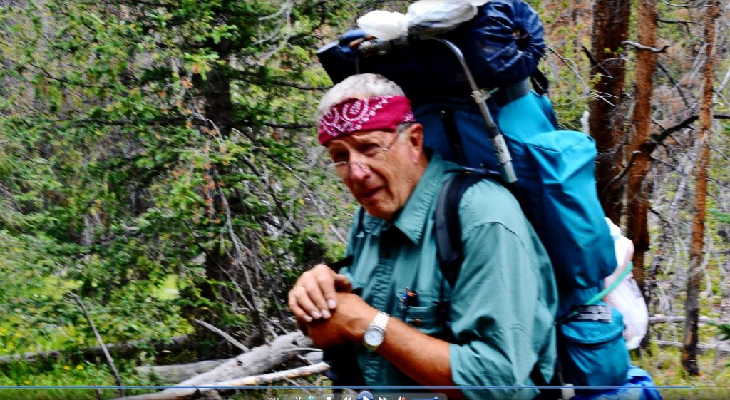
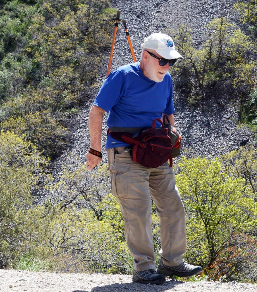
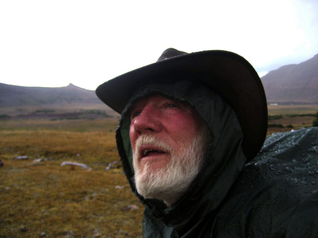
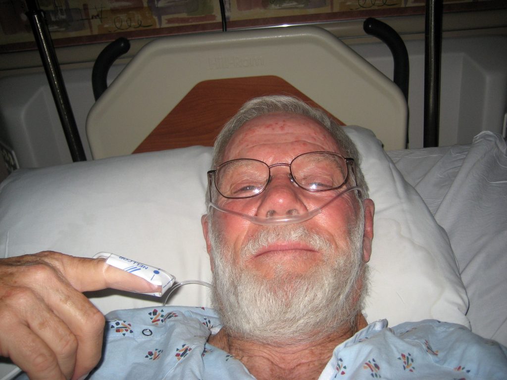
But, sadly, we apparently picked up something quite contagious on the drive down, and so all of us from Utah started getting sick, beginning with me in the picture with my son, Lito.
So we packed up and returned to Utah…..eventually with 100% of us from Utah all getting the upper respiratory congestion, headaches, etc. we first thought to be a new strain of Covid-19, but on being tested that wasn’t it. I didn’t have any fever, except for slightly the first day, but with me it went on for a month, until I finally worked out a routine of supplements & Mucus Relief, that worked permitting me to breath freely with no wheezing for the first time in years, but I came out of it feeling at times like I’ve lost almost completely by balance, and extremely weak– seemingly having lost all the conditioning I had worked so hard at to come back from not being able to walk two years ago.
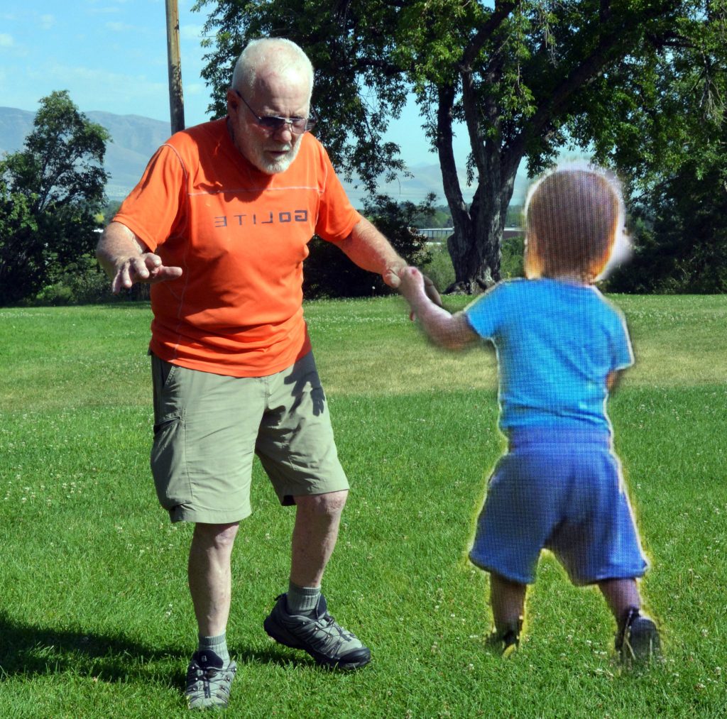
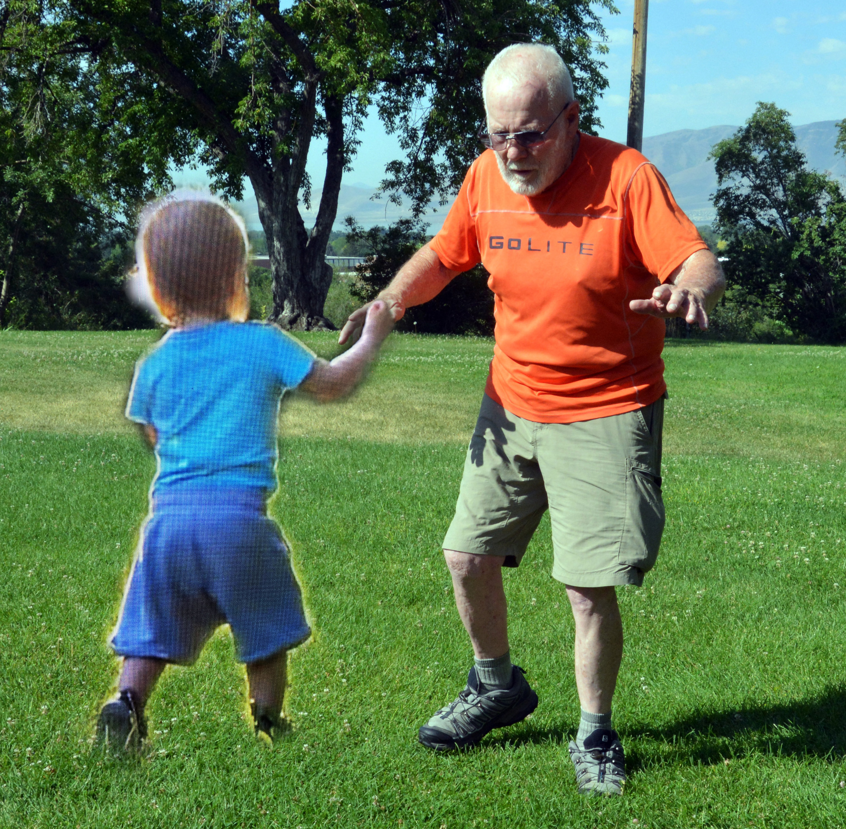
Coming out of the sickness I sometimes I needed my young GUARDIAN ANGEL all over again, and I’m finding ways to work on keeping my balance without any gadgets, and almost being able to walk a straight line and getting strong again…..
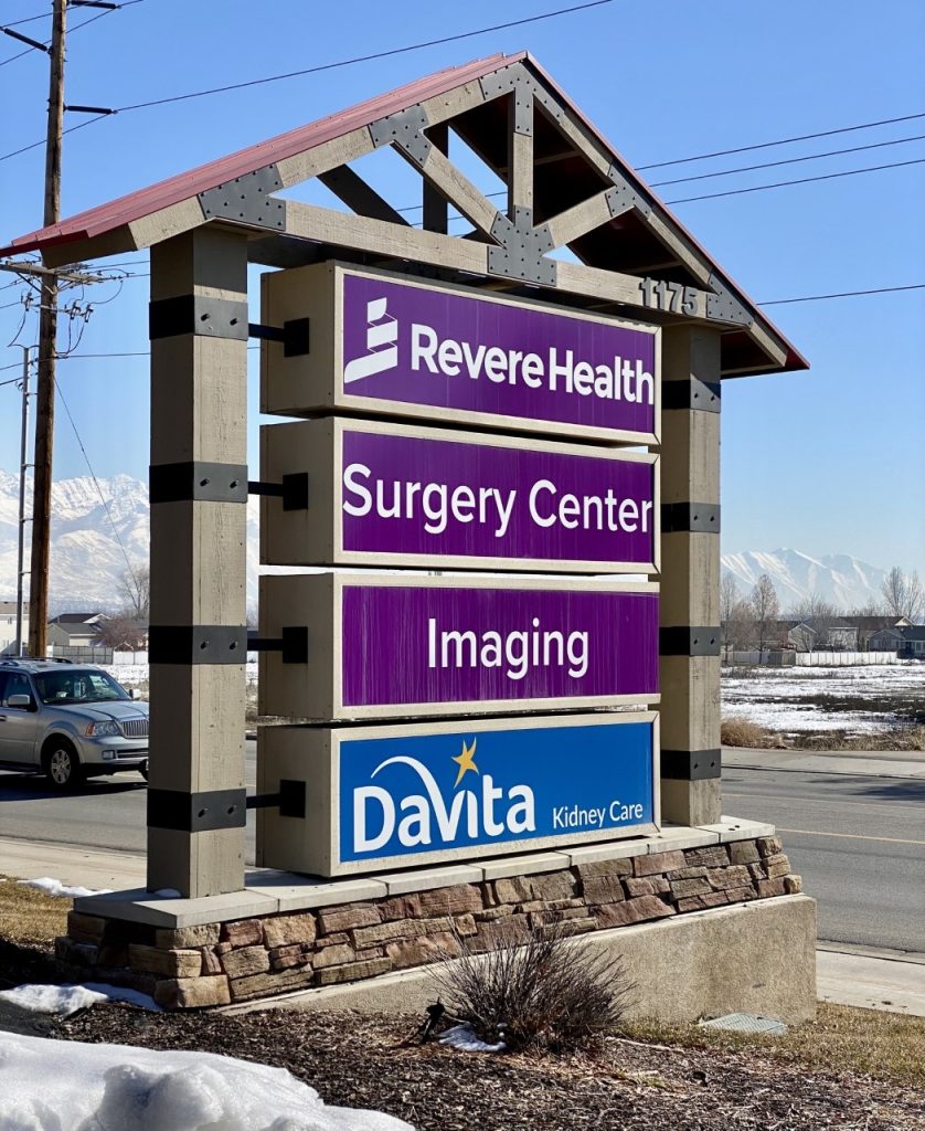
So, now for me back to the STAIRS, but not outside with the cold, rather inside at my Revere Health Clinic that has two floors….
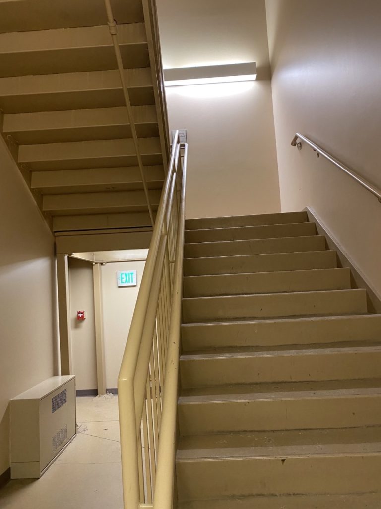
……. but the stairs keep going up to a 3rd floor with locked door where the heating and air conditioning units are….but that gives me 3 flights of stairs, or 52 stairs up and 52 down for each repetition.
And from the 3rd floor looking down. So, as difficult as it has been, I’m still the same old stubborn guy who WON’T GIVE UP….EASILY, but I look forward to warmer weather as doing my exercise outdoor with fresh air and sunlight makes a big difference….
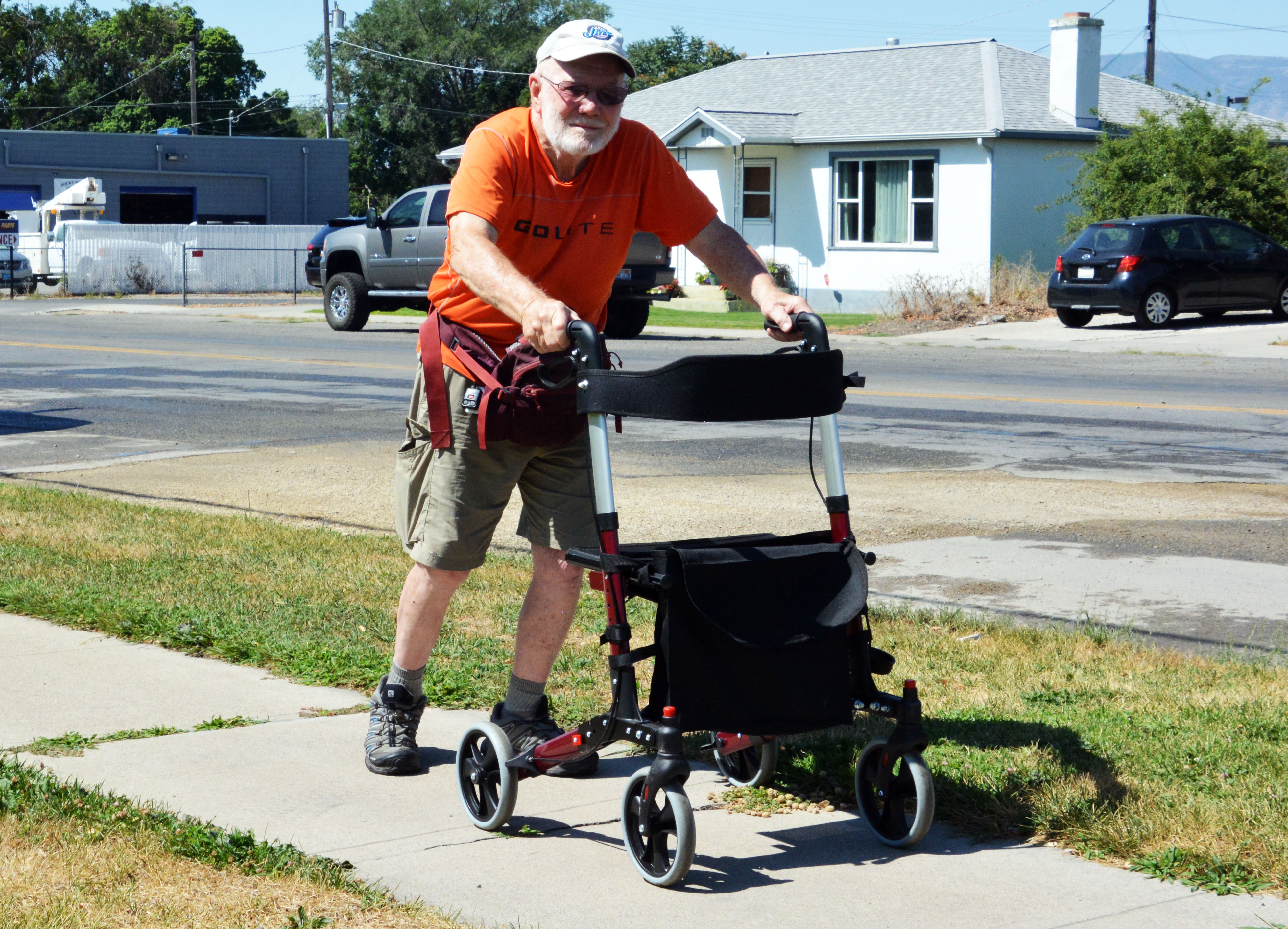
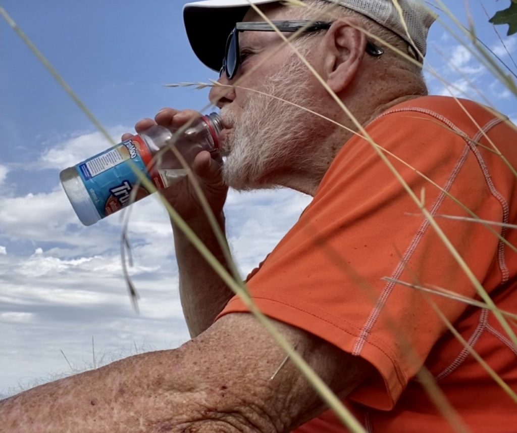
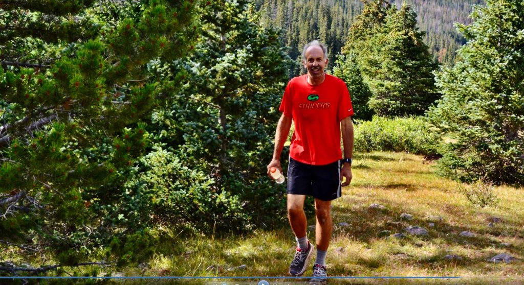
There were a couple of days recently above freezing so I did go outdoors, and my little GUARDIAN ANGEL went with to help me the first time or two. I’ll be outdoors whenever the weather is reasonable. To equal 2 repetitions of the 3 floors of stairs at the clinic I have to do 5 repetitions on the outdoor stairs. I’ve now increased to 10 repetitions or laps I think I called them before. I’m making progress…..and thrilled with my Mickey Mouse efforts…but, CONSIDERING HOW WEAK I FELT JUST A FEW DAYS AGO, I FEEL VERY BLESSED TO BE MAKING SUCH RAPID PROGRESS–that’s the way it goes for one who DOESN’T GIVE IN, NOR GIVE UP …… EASILY!
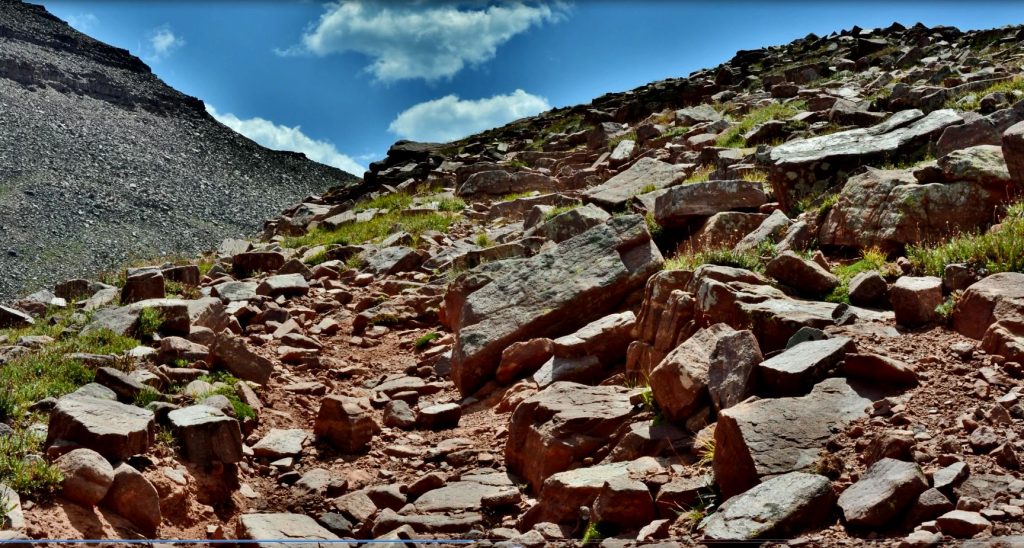
…….but I look forward to again working out in the foothills of Timpanogos, and then back to the wonderment of the HIGH UINTA MOUNTAINS and its unending VISIONS OF NATURE seen below in several of my rustic picture frames that I also look forward to making again soon.
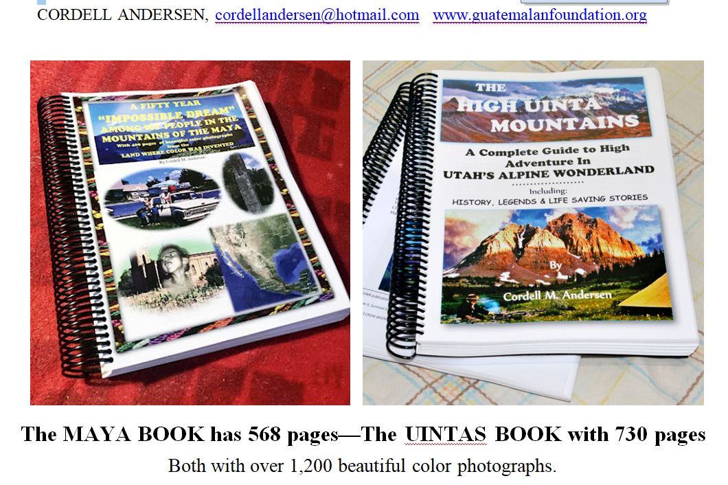
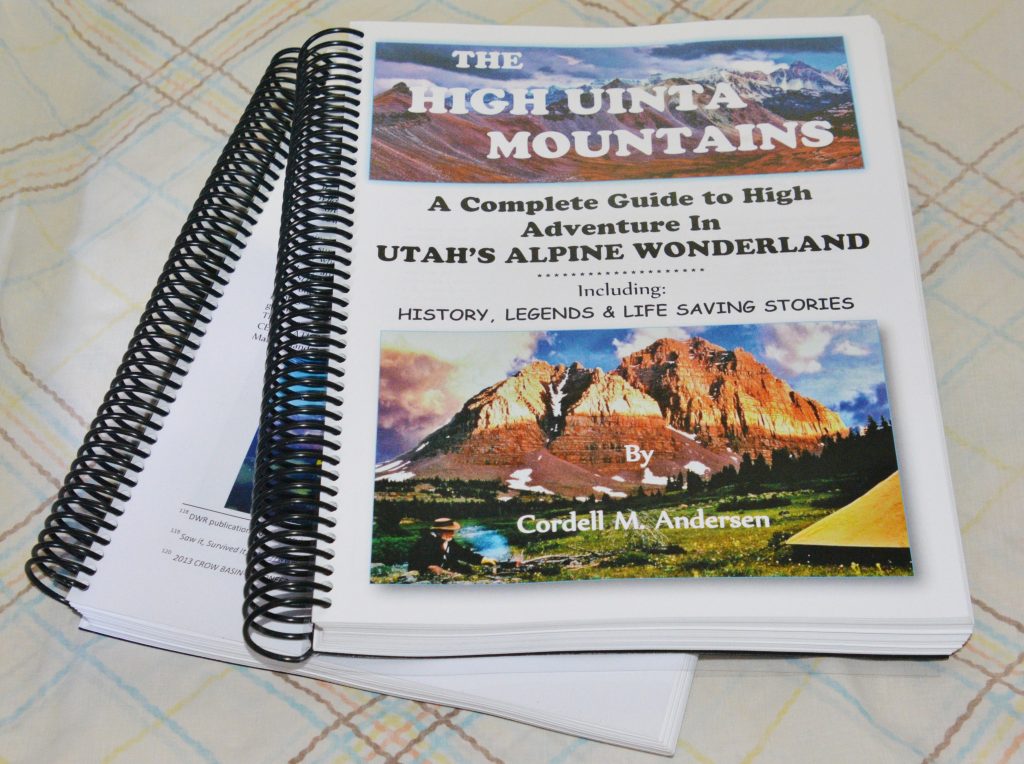
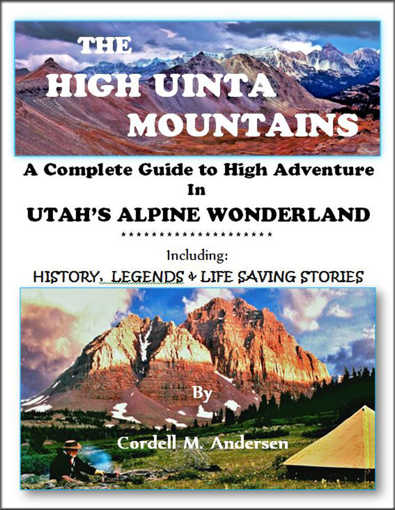
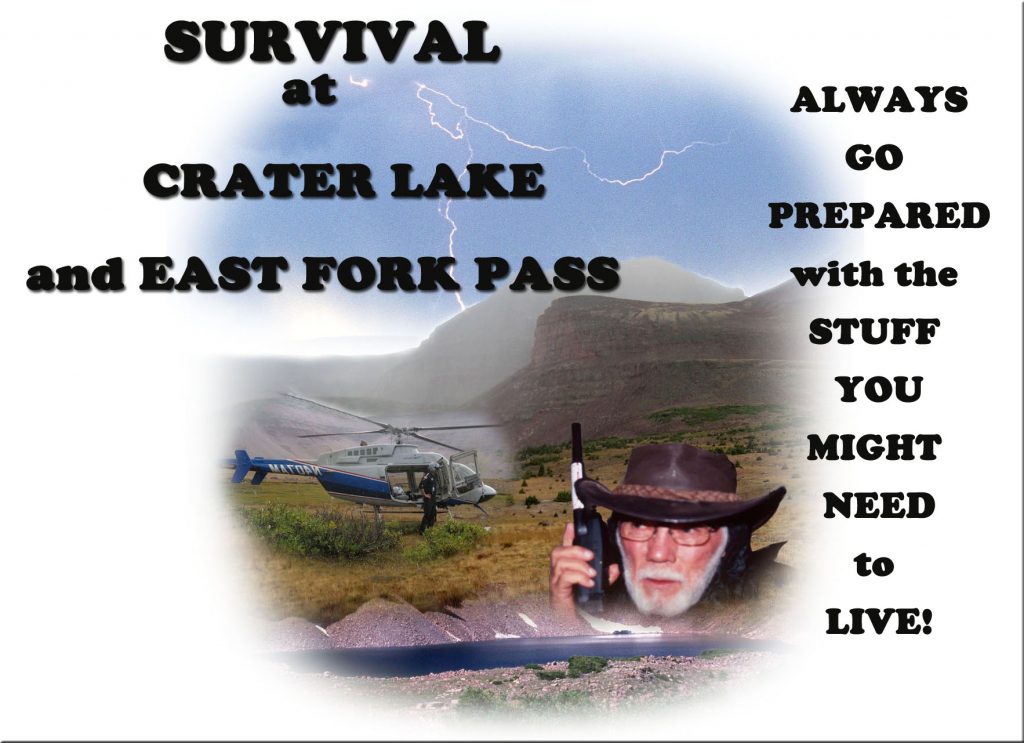
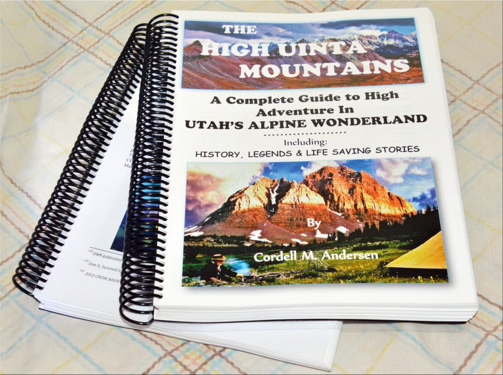
THE HIGH UINTA MOUNTAINS BOOK….
….. is a Guide for adventuring in the Uintas, the 1st chapter is an 89 page guide to do an 856 MILE AUTO-LOOP TOUR OF THE UINTAS that shows them equal to or better than many National Parks.
Then follows 3 chapters that are GUIDES FOR HIKERS & BACKPACKERS–the ONLY BOOK WITH UPDATED INFO–including TOPOGRAPHICAL MAPS–of all the trailhead areas–WITH ROUTES, DISTANCES & LABELS —
All of the book is unique as it has springkled throughout the HISTORY, LEGENDS, the SURVIVAL STORIES OF THOSE WHO DIDN’T MAKE IT & WHY, plus my 8 SURVIVAL STORIES and WHY I’LL BACKPACK NEXT SUMMER IN MY 88th YEAR!
Plus a detailed……..APPENDIX , that among other things has the Anti-Aging Challenge writing that can GIVE YOU NEW LIFE & 14 page INDEX.
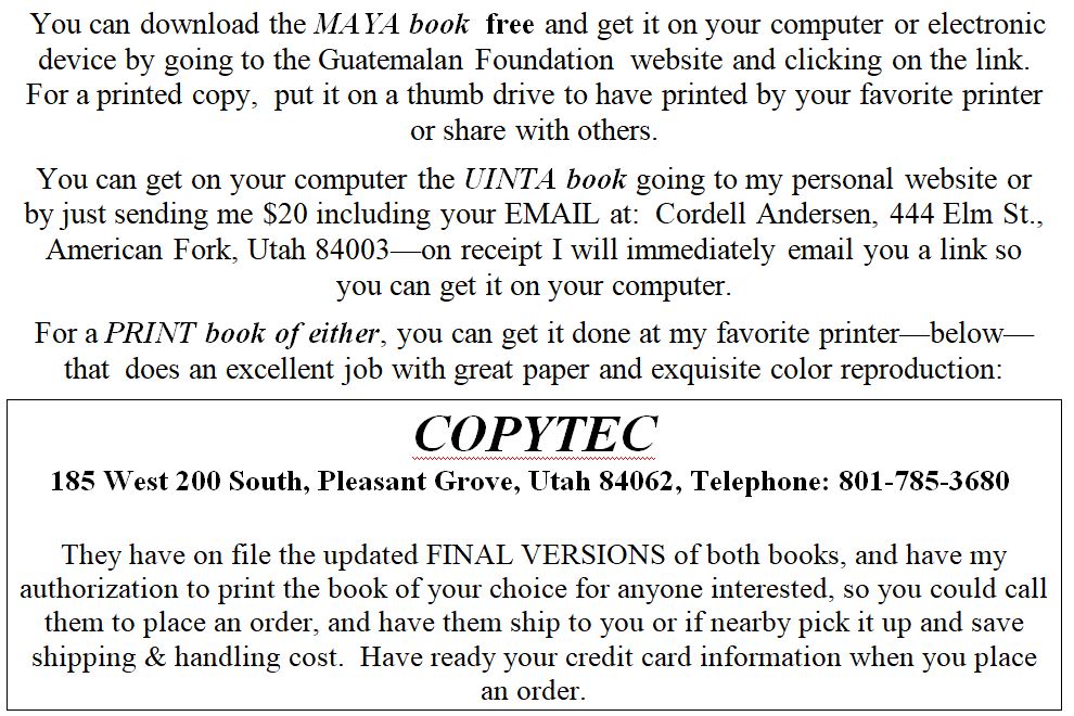
To get an online copy of this book, some have called THE ENCYCLOPEDIA OF THE UINTA MOUNTAINS,send me $20 (don’t be afraid of sending a $20 bill as we aren’t south of the border) along with your email address, and I will immediately email you the link to download the book with my permission to share once with a friend.
Send to: Cordell Andersen, 444 Elm St., American Fork, Utah 84003
TO AVOID PAYING ME FOR THE ONLINE UINTA BOOK, GETTHE PRINTED BOOK OF YOUR CHOICE, BY GOING TO TO THE INFORMATION BELOW THE PICTURES:
JUST THIS WEEK THE FINAL, UPDATED & ENHANCED VERSION of The MAYA BOOK WAS PRINTED FOR ME AT COPYTEC COSTING ME $153.37, so I can now hold it in my hands and read it to constantly remind me HOW THE LORD BLESSED ME with being an instrument in his handsto do our darndest to help quite a few Mayans to“blossom!”
A lot of very good NEW INFORMATION about the details of the book are included in a description of the MAYA BOOK on the Guatemalan Foundation website:https://www.guatemalanfoundation.org/I heartily suggest you go there and read the entire introduction.
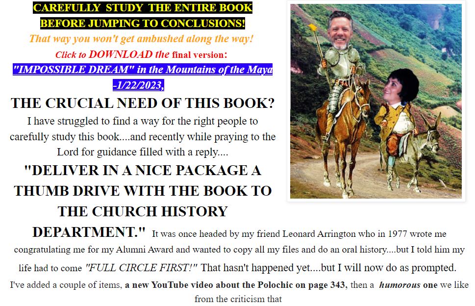
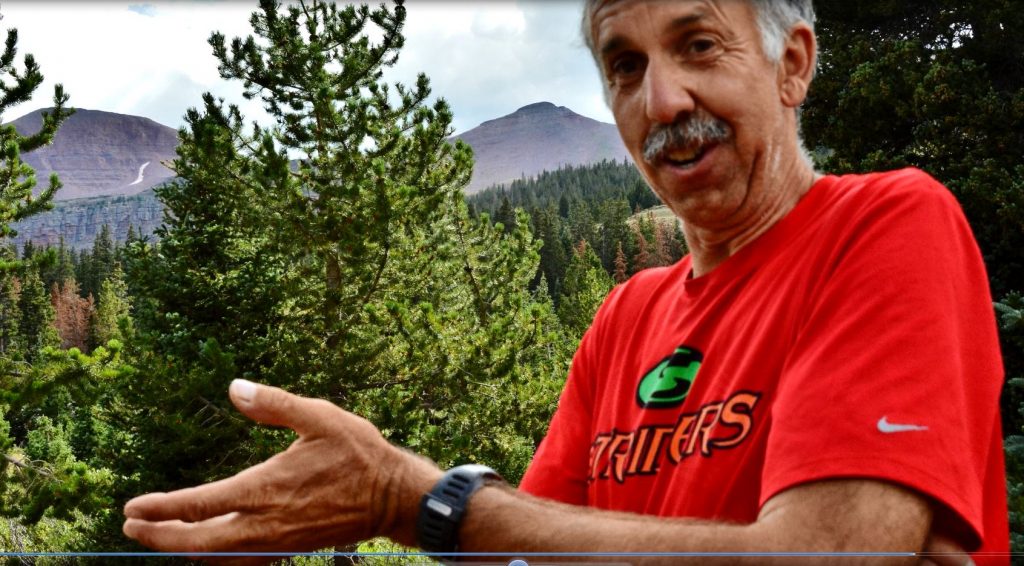
You’ll notice in the INTRODUCTION to the BOOK on the website, INSPIRATION I RECEIVED AS TO WHAT I SHOULD DO WITH THE BOOK, which I have now done, on Monday, January 31st….I’ll insert a photo of a portion of that explanation….but go to the website to get the WHOLE STORY!
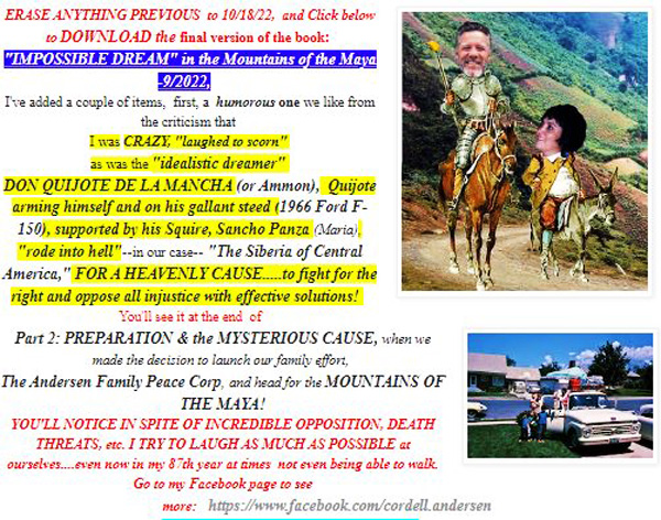
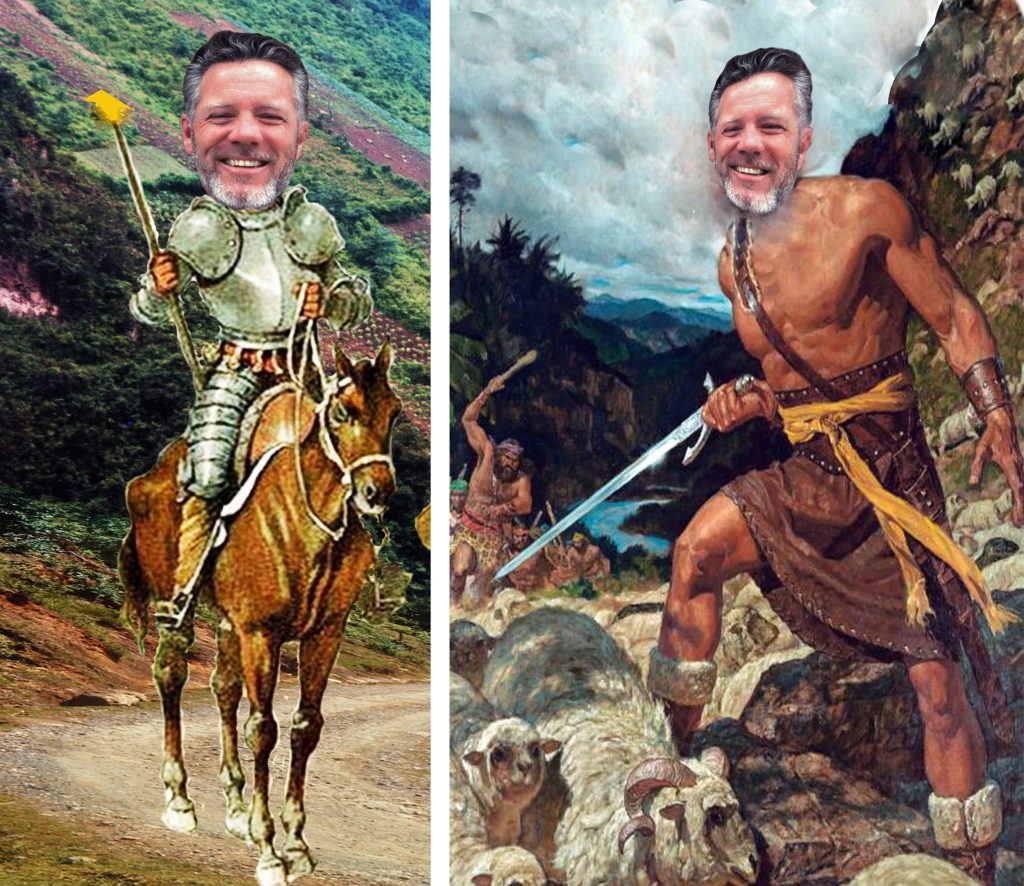
……….I was CRAZY, “laughed to scorn” as was the“idealistic dreamer”DON QUIJOTE DE LA MANCHA (or Ammon), Quijote arming himself and on his gallant steed (1966 Ford F-150), supported by his Squire, Sancho Panza (Maria & later, Maria Elena), “rode into hell”—in our case—“The Siberia of Central America,” FOR A HEAVENLY CAUSE…..to fight for the right and oppose all injustice and save lives with effective solutions! Eventually it was said we…..
….. “SAVED THOUSANDS, & AIDED MANY TENS OF THOUSANDS OF MAYANS TO GET AN EDUCATION!”
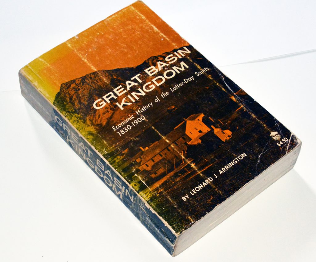
NOTE: The quote from the Guatemalan Foundation website, mentions Leonard Arrington..LDS CHURCH HISTORIAN, who was the author of the book that was my GUIDE & MANUAL for working among the Mayans for most of my life with the pioneer principles that brought them from poverty & persectuion to PROSPERITY, best insert a picture below…..
As explained in my MAYA BOOK, page 346, this incredible book described in our history the God revealed principles of CONVERSION, GATHERING, COOPERATIVISM & EDUCATION among my pioneer ancestors that made them great–and we were applying them at Valparaiso that was studied by a sociologist from the National Electricity Institute in Guatemala, who concluded…..
“THE VALPARAISO CENTER FOR INDIAN DEVELOPMENT IS AN OASIS OF HOPE & JUSTICE FOR THE POOR.”
…..yet strangely later criticized by one modern religious leader, page 318-322 , when I was warned to not use said principles or possibly be destroyed, but….at that time in 1977 when Arrington first contacted me, he had become briefly the CHURCH HISTORIAN for the LDS Church and we became good friends and he wanted to copy all my letter files and do an oral history, but I told him my LIFE HAD TO COME FULL CIRCLE FIRST…..which hasn’t happened yet but I was nonethless moved to take 5 years writing the 68 year history–MY MAYA BOOK. Leonard was the one who began to open up the Church archives some for the first time but sadly didn’t last very long. Now, will my MAYA BOOK be hidden in the archives? You can still get it on your computer clicking on:
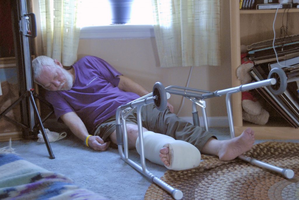
2 YEARS AGO AFTER A BOTCHED SPINE SURGERY MY RIGHT LEG DIED, and I couldn’t walk with my legs soon loosing all their muscle , and as documented on this website you can see by scrolling way down, and down………I FORCED THAT LEG TO COME ALIVE WITH UNCEASING EFFORTS and soon WITH DIVINE HELP LEARNED TO WALK AGAIN LIKE A BABY, etc., etc.
I HAVE REASON TO BELIEVE THAT IN SOME CRITICAL SITUATIONS IN MY LIFE THERE HAS BEEN INTERVENTION OF ONE OF MY “GUARDIAN ANGELS” this one being an EXPERT in BABY STEPS!
THEN A MONTH OR TWO AGO MY GOOD LEFT LEG STARTED DYING–but I learned what I had to do to KEEP IT AWAKE and ME MOVING….NOW AGAIN FOR THE WINTER ON THE STAIRS EVERY DAY below the American Fork Fitness Center, and very carefully now HAVE BOTH LEGS FEELING THE SAME and every day–gradually with great caution–INCREASING JUST A LITTLE EVERY WEEK and optomistic about how far the COMEBACK will take me.
The STAIRS face south so any snow melts quickly–making possible doing enough laps every day to keep both legs from dying on me!!
I’M TRULY GRATEFUL FOR THE ENCOURAGEMENT FROM MY FAMILY & A FEW REALLY CHOICE FRIENDS like noted on my Facebook page, and quoted on the post BEFORE this one…… they likely never dreamed how important a nice word or two would be to encourage me in my “Impossible Dream” of the High Uintas Project as well as my “Dream….” to persist for half a century giving a helping hand to needy MAYANS…so thanks again to my many Friends!
THE HIGH UINTA MOUNTAINS BOOK….
….. is a Guide for adventuring in the Uintas, the 1st chapter is an 89 page guide to do an 856 MILE AUTO-LOOP TOUR OF THE UINTAS that shows them equal to or better than many National Parks.
Then follows 3 chapters that are GUIDES FOR HIKERS & BACKPACKERS–the ONLY BOOK WITH UPDATED INFO–including TOPOGRAPHICAL MAPS–of all the trailhead areas–WITH ROUTES, DISTANCES & LABELS —
All of the book is unique as it has springkled throughout the HISTORY, LEGENDS, the SURVIVAL STORIES OF THOSE WHO DIDN’T MAKE IT & WHY, plus my 8 SURVIVAL STORIES and WHY I’LL BACKPACK NEXT SUMMER IN MY 88th YEAR!
Plus a detailed……..APPENDIX , that among other things has the Anti-Aging Challenge writing that can GIVE YOU NEW LIFE & 14 page INDEX.
To get an online copy of this book, some have called THE ENCYCLOPEDIA OF THE UINTA MOUNTAINS,send me $20 (don’t be afraid of sending a $20 bill as we aren’t south of the border) along with your email address, and I will immediately email you the link to download the book with my permission to share once with a friend.
Send to: Cordell Andersen, 444 Elm St., American Fork, Utah 84003
TO AVOID PAYING ME FOR THE ONLINE UINTA BOOK, GETTHE PRINTED BOOK OF YOUR CHOICE, BY GOING TO TO THE INFORMATION BELOW THE PICTURES:
JUST THIS WEEK THE FINAL, UPDATED & ENHANCED VERSION of The MAYA BOOK WAS PRINTED FOR ME AT COPYTEC COSTING ME $153.37, so I can now hold it in my hands and read it to constantly remind me HOW THE LORD BLESSED ME with being an instrument in his hands to, as someone said,
“SAVED THOUSANDS & HELPED MANY TENS OF THOUSANDS OF MAYANS GET AN EDUCATION!”
A lot of very good information about the details of the book are included in a description of the MAYA BOOK on the Guatemalan Foundation website:https://www.guatemalanfoundation.org/I heartily suggest you go there and read the entire introduction. Below are the first two pages from the website:
NOW WITH THE WINTER…..back to my “STAIRS–FREE EXERCISE MACHINE” every day they’re free of snow–to keep alive and awake my legs, my heart and my mind (& spirit)!
The STAIRS face south so any snow melts quickly–making possible doing enough laps every day to keep both legs from dying on me–and it so far is working cancelling out my left “good leg” from dying as was happening a few weeks ago!
************************************
NOW BACK TO A COUPLE OF WEEKS AGO AND MY POST ABOUT MEETING CHALLENGES ALONG THE PATH OF LIFE……BRINGING IT UP-TO-DATE WITH MY CONFESSIONS………….scroll down to see………….. WHO I RECEIVED HELP FROM
NOW, BACK TO THE PREVIOUS POST….WITH THE DIVINE ADDITION….
……but, SURPRISE, SURPRISE….RAN HEAD ON INTO ANOTHER GLITCH!
A little bit ago on this post I said, “ My good left leg started dying as had the right one, but different as I began feeling pain down the outside of my leg and gradually weakening so I couldn’t lead with it anymore–neither up, nor down and could only trust my previously dead, right leg!”
Now a few weeks later, and after actually doing my High Uinta “hike” and some big-time hikes up the front of the Timpanogos foothills…..
…..THAT PAIN HAS RETURNED & GROWN COMING CLOSE TO MAKING ME A CRIPPLE….AGAIN!
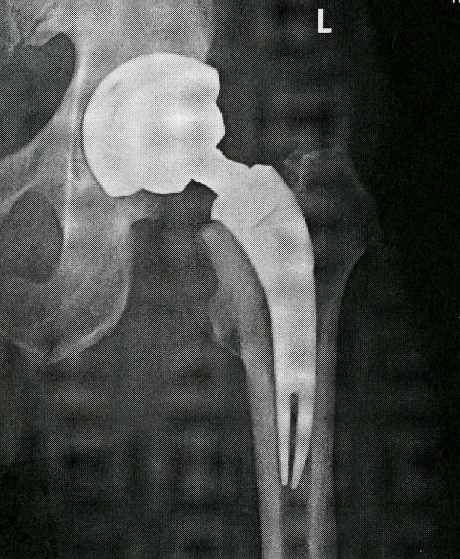
With every step the pain now hits me at the lower portion of my TITANIUM HIP–where inserted into the bone as seen below, and then travels travels down to my knee and lower leg and today 10/11 I couldn’t use that leg to step up at the American Fork Amphitheater but could keep it stiff to step down, and had to abandon the stairs and just walk around some with hands on hips straightening my back–NOT ACCEPTING AS MY “NEW NORMAL” THE HUMPED OVER POSITION which my spine surgeon told me at the last visit I
“had to accept as the new normal!“
FOLLOWS A COMMENT OR TWO & MY REPLY ON FACEBOOK when reporting the above:
Maren Topham from Facebook
She first said: “If anyone can figure out how to solve this “glitch” it’s you, my friend. So good to read a post from you. Stay strong!“
MY REPLY TO Maren:WOW…SO GOOD TO HEAR FROM YOU. I want all to know you were one of the first to really motivate me in my High Uinta Project….when 16-18 years ago at a clinic in Provo you saw one of my color photographs of Red Castle Peak and told me you thought it was beautiful. You might not remember that, but I will never forget and always be grateful for YOU…one of the most beautiful VISIONS OF NATURE I’VE EVER SEEN. God bless you and your family. Your Trail buddy, Cordell
Maren Topham: “Oh my goodness, you are the sweetest person in the world! I’m so glad you came into my life all those years ago. You taught me so much about over coming obstacles and keeping a positive attitude and the power of determination! You’ve done wonderful things with your life and your talent with photography and love for nature. So glad I could be a small part in it. “
MY ADDITION TO MY FACEBOOK REPORT:
“I’LL KEEP TRYING TO FIGURE OUT HOW TO SOLVE THIS NEW GLITCH & DO MY DARNDEST TO NOT ACCEPT BEING A HUNCHED OVER OLD RODEO CLOWN!
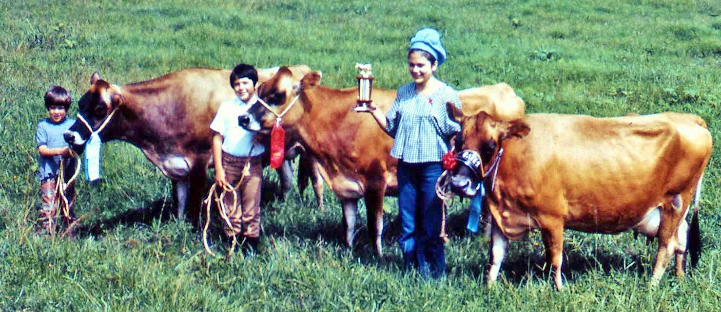
“I’ll accept the RODEO CLOWN, nick name given me in Guatemala by Keith Hoops a BYU professor of Agriculture/Animal Husbandry who visited me at Valparaiso and our Dairy, asking me where our alfalfa fields were. I pointed to our lush pasture grass that had 23% protein–as high as alfalfa–with our cows on that grass 365 days a year..
…but since we didn’t have alfalfa and silage–like is used in the U.S., he started calling me a “RODEO CLOWN” which I loved ALL THE WAY TO THE BANK–with profits making possible quickly paying off the large bank loan as well as the mortgage on the plantation. I also laughed lovingly at the Rodeo Clown label when 2 of our cows and a heifer all defeated in a livestock show the Central American Grand Champion of the Jersey Breed!!!
“I still love to be called a “Rodeo Clown,” as well as a crazy old “Modern Don Quijote de la Mancha,” a “Modern Ammon,” and “Little Andy!”
*******************************
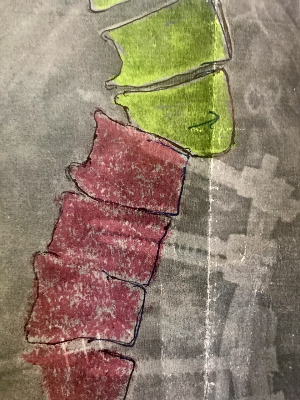
24 MONTHS AGO, after apparently a botched surgery on my spine, MY RIGHT LEG DIED & I COULDN’T WALK–the muscles in my lower legs disappeared and only bone was left like I was a holocaust victim! I was a bit different than Almanzo in the following story on LITTLE HOUSE ON THE PRAIRIE, as he got terribly discouraged at first–I NEVER DID even when diagnosed with cancer in 2003, but always was blessed with my “NEVER, NEVER GIVE IN, NOR GIVE UP” attitude. So, I went to work but in my attempts to -–awaken feeling, build muscle again, be able to walk and be independant-–a couple of falls left MY SPINE DANGEROUSLY MISALIGNED AS SEEN BELOW. The titanium appliances were perhaps doing more harm than good.
IT’S QUITE EASY TO SEE THAT A FALL COULD CAUSE THE LOWER VERTEBRAE TO SLIP OFF OF THE ABOVE ONE AND CUT THE SPINAL CHORD!
A FALL COULD LEAVE ME COMPLETELY PARALYZED OR DEAD…..So great caution was advised by my spine surgeon, saying,
“DON’T DO ANYTHING STUPID!” .
My spine surgeon said he could straighten it out but the surgery would take at least 6 hours with possible complications, and no guarantee, he adding something like, “I’ve never done such a surgery on someone your age, but you are healthier than others your age, but I wouldn’t do it unless you were in so much pain you didn’t want to live any longer!”
My decision was to try and live with it, and do my best to adjust, adapt, and strengthen myself.
THE YEAR LONG+ HISTORY of my CHALLENGE FOLLOWS:
AS REPORTED HERE TIRELESS & PAINFUL HOURS WERE SPENT WITH MY OWN VERSION OF PHYSICAL THERAPY, COUPLED WITH A LOT OF PRAYER-–FOR MONTHS IN BED with isometric exercises, and all kinds of exercises with my legs, helping with my hands the dead leg to begin movement and wake up , then gradually to actual movement inside my tiny mobile home-–learning the “log roll” to sit up, grabbing on all the things close in every direction to sit, to stand, to fix my picnic-like meals, and eventually scoot into my tiny shower room, sit on the toilet and using a flexible shower-head, actually take a shower, then outside onto the porch Jesse had built for me with its down-ramp and railing, then using special canes Jesse got for me, and then a wheel chair my good friend Garth Norman provided to get me to the clinic and then the hospital for an emergency surgery, next a walker my daughter, Mahana, got for me, then using shopping carts as walkers around store parking lots I actually worked up to doing 2-3 miles a day.
I didn’t know what the Lord had in store for me, but I was willing to accept whatever condition he felt best–but DETERMINED TO PUSH MYSELF and LET HIM HELP ME ACHIEVE JUST AS MUCH AS WAS POSSIBLE!
Next, another good friend, Paul Edmunds got for me a nice walker gradually using it going farther and farther from home (American Fork) eventually on the paved jogging/bicycle paths to Highland and Lone Peak High School, then all the way up to half-marathon distance (13.2 miles) to Alpine & back forcing my dead leg to come alive and keep up with the good leg and building muscle again.
It was on those long “walks” that travelers called 911 that had the police offer to save “an old guy with a walker on the highway!” I thanked them, but insisted on getting home by myself, and twice beautiful young women attempted “love kidnappings” which I bravely resisted with a smile telling them “thanks a million, but I’m doing great!” I apparently DIDN’T LOOK GREAT, but gradually got better as I repeated those long “hikes” with my walker, THEN ON TO THE NEXT STEP….with DIVINE HELP–LEARNING TO WALK LIKE A BABY with no aids….except a HEAVENLY ONE WHO WOULD TAKE ME BY THE HAND!
.……at the parks on on grass to provide soft landings learning to walk again like a baby–but I can’t brag about doing it on my own, as I had the divine help of one of my Guardian Angels! He also helped me learn how to fall like a baby does to not break anything, and how to get up on my feet without help of any earthly gadgets.
Another of those–years before in the MOUNTAINS OF THE MAYA– I came to believe was my GUARDIAN ANGEL–our beautiful MICHELLE “PEPITA” — story told in my MAYA BOOK, pages 293-294
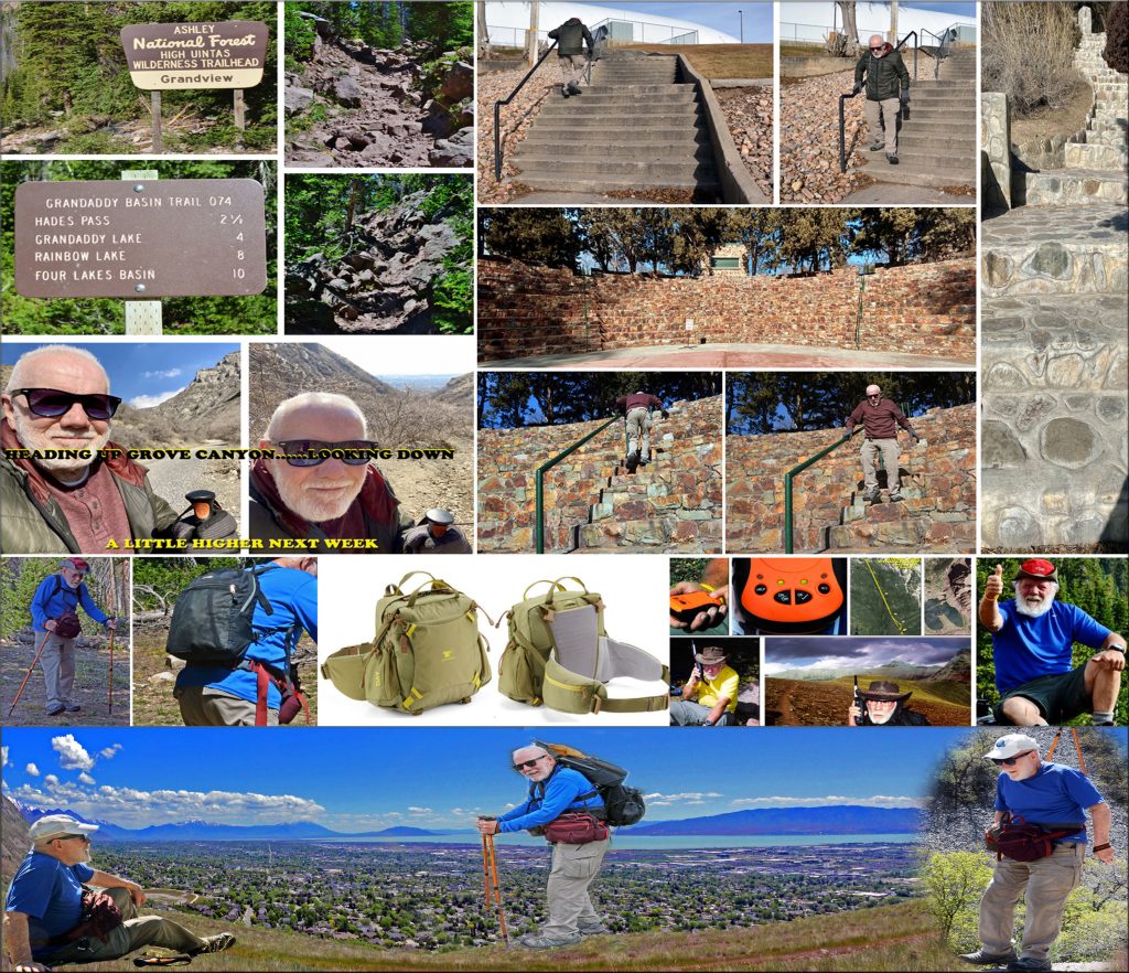
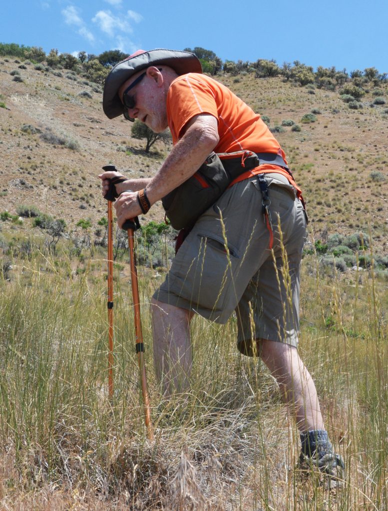
NOW BACK TO THE PRESENT: I then headed for the hills using trekking poles, so the FOOTHILLS OF MT. TIMPANOGOS became my FREE “EXERCISE MACHINE” up Grove Canyon, and hikes along the foothills every other day–doing a mile, then two, and three and always….
…. SHARING WITH ALL OF YOU the magnificent & inspiring
“VISIONS OF NATURE” ….
…..you can all see scrolling down, and down and down some more! All of this in hopes of being able to BACKPACK IN THE UINTAS AGAIN….actually dreaming of doing at least a mile at high altitude on rocky trails & maybe even an overnighter!
I would use a tiny day pack weighing only 5 lbs. but mainly I got special waist packs, the large one on my behind a “lumbar waist pack” as I couldn’t put any significant weight on my spine.
SEVERAL ATTEMPTS WERE MADE UP TO BALD MT. PASS–by the way along the way I learned to drive again my car, first using exclusively my good left leg.
NOTE: The first time my car disappeared my boys, Jesse and Nephi were shocked and when I returned THEY CONFISCATED MY KEYS!
I finally did a test drive and showed them I could do it safely. Of course I’m now back to driving normally.
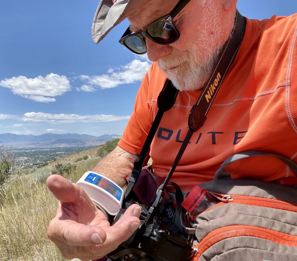
BUT AT HIGH ALTITUDE I HAD TO SEE HOW MY BODY WOULD REACT TO HIGH ALTITUDE–that as I got older in my High Uinta Project became a problem, and as previously reported I RAN INTO TROUBLE WITH EVEN A SHORT WALK AT 10,700 ft. HAVING ME QUICKLY OUT OF BREATH, ALONG WITH DANGEROUSLY ERRATIC BLOOD PRESSURE–sometimes TOO LOW (93/55 with 120/80 as normal), sometimes HIGH. Below 95 is experienced “with people who are dying!”
I also was shocked when it seemed like my good left leg started dying as had the right one, but different: The right one just lost all feeling as though it wasn’t there; the left one just a couple of weeks ago began feeling pain down the outside of my leg and gradually weakening so I couldn’t lead with it anymore–neither up, nor down and could only trust my previously dead, right leg! So, I had to back off and do some special work to…..
….. keep ALIVE & AWAKE BOTH LEGS!
I finally figured I could do it–carefully, my way.
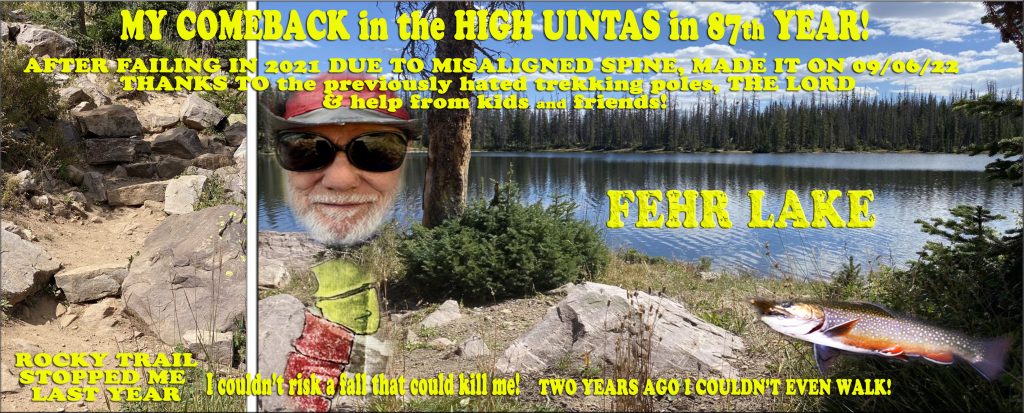
So, as my last report stated on Monday, September 5th:
“LITTLE ANDY HAS DISAPPEARED!“
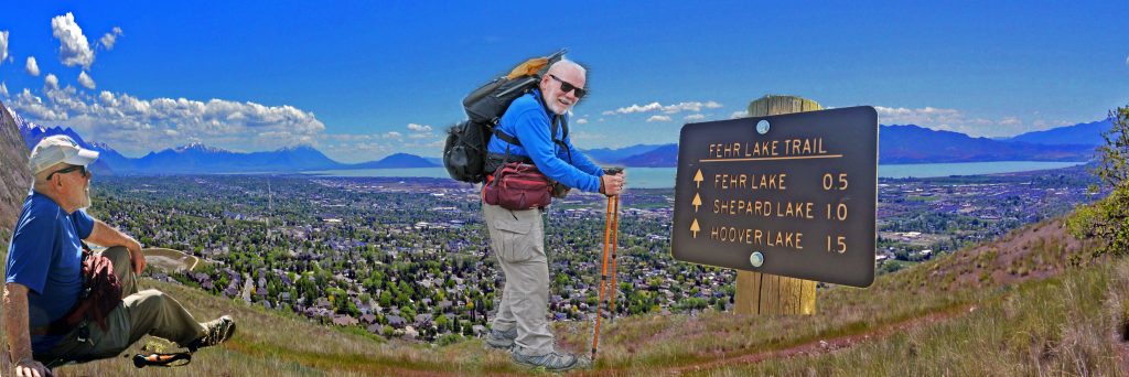
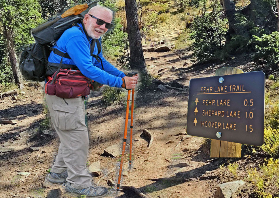
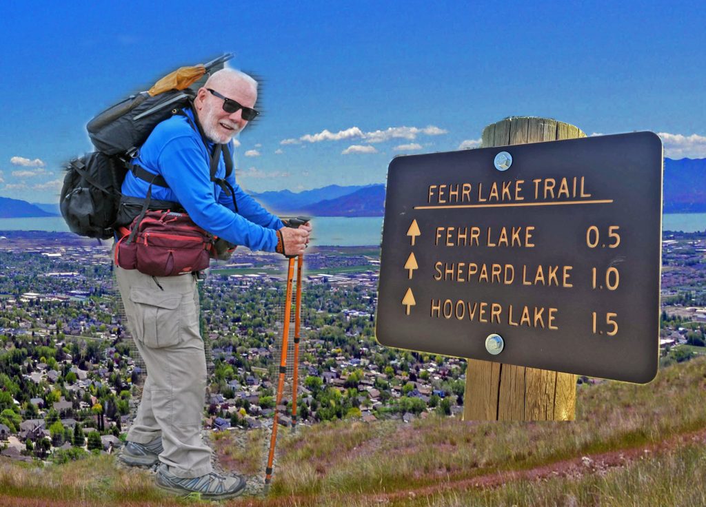
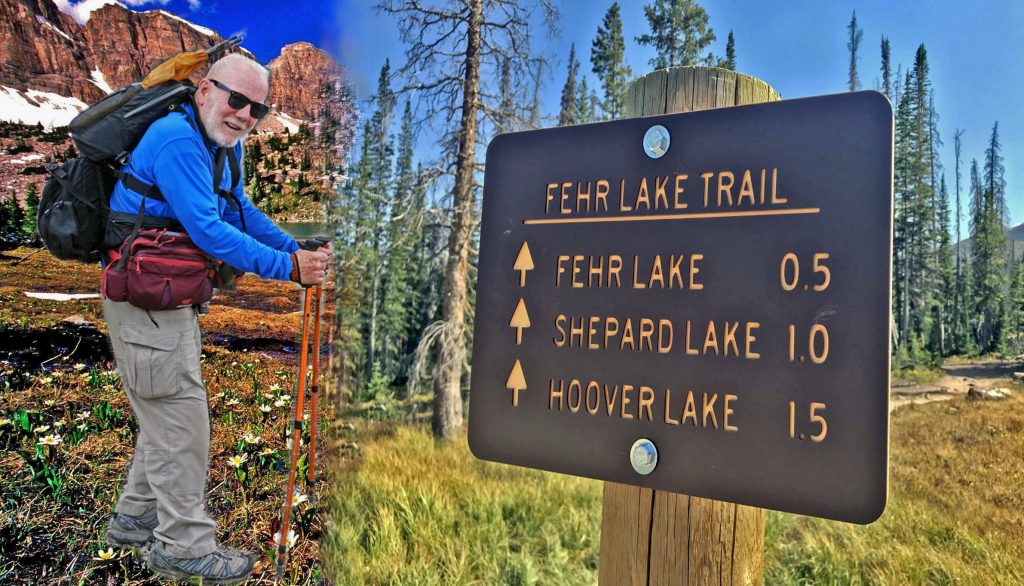
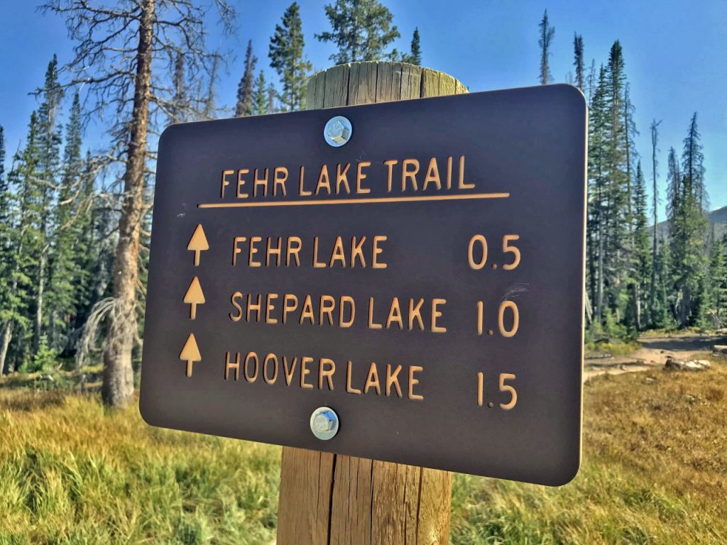
Only to reappear back in civilization on Wednesday, September 7th with the story in this photo/essay having MADE IT TO FEHR LAKE!
But, the following was necessary to adjust to the altitude. Once at 10,769 ft. Bald Mt. Pass, I parked and without doing any exercise, stayed there the night sleeping in my car to aclimatize before any hiking. My oximeter first showed my oxygen in my blood a little low–in the 80’s. For 24 hours I had been taking Diamox to help my body adjust, and continued that the next day. The next morning my vitals were all OK. So I prepared my hike to Fehr Lake with about 20 lbs. of equipment, fishing gear, food and water in my waist packs. But down the trail a bit I didn’t feel good, and found that my blood pressure was low….not as dangerously low as the last attempt, but I just felt that the load I wasn’t accustomed to, coupled with the altitude, was perhaps just too much, so I wisely returned to the car, yet determined to get to Fehr Lake.I rested a bit and prepared to just make it a day-hike with only emergency items, fishing gear and food for the day.
I headed for Fehr Lake again, and this time felt much better, made it through the rocky area with large steps down–that had stopped me last year, and got to the lake-bowed my head with a prayer of gratitude to the Lord, had my picnic lunch, did a little fishing, but as mentioned previously my balance was mostly lost in all of this ordeal over the last 3 years, and in rocky, uneven terrain always needed at least 1 trekking pole. Spin fishing was a problem as I had to use both hands to hold the rod and operate the spinning reel, and didn’t have a 3rd hand to steady me with the trekking pole, so every time I would begin reeling in my lure I would begin losing my balance–NOT GOOD ON THE EDGE OF A LAKE! I could only continue finding a rock to sit on near the water.
Balance is a big part of my problem and would make wading and fishing a stream, like my beloved Beaverhead River in Montana–IMPOSSIBLE…even STUPID!
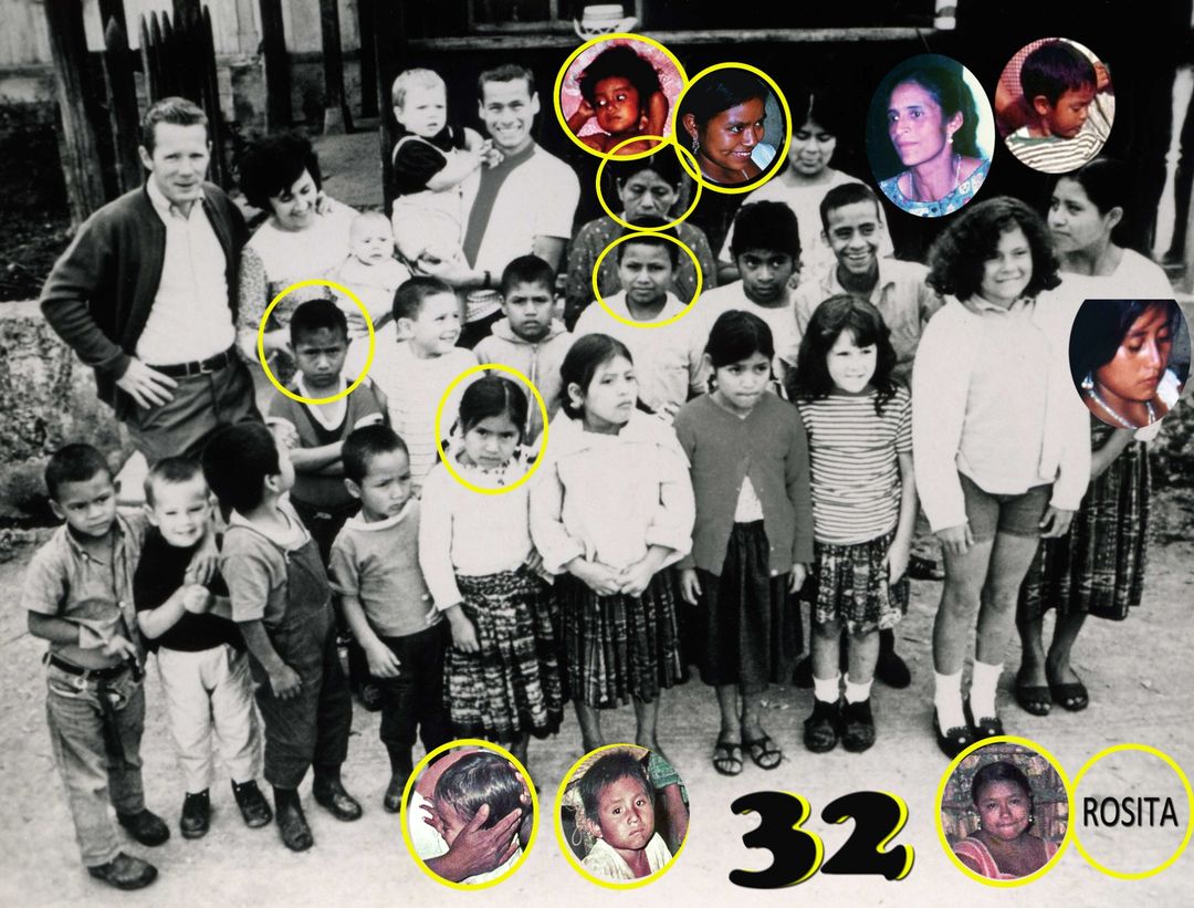
After a little succes I finally headed for the Trailhead, and was in the middle of–for me–the dangerous rocky area with big steps up, when two elderly ladies passed me, and stopped to talk. One of them recognized me when I mentioned doing my Uinta Project after returning from living in Guatemala for 35 years, remembering especially I had a lot of children and asked how many? I replied with a smile,
“Only 15, but some were adopted!”
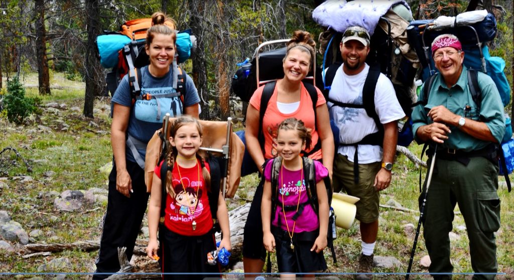
At the early October Family Reunion at Lake Powell, the family figured out that I have 84 grandchildren and great grandchildren…..so far!
NOTE: If she meant my Central House Family in Guatemala–there would eventually be over the years around 300 who called me “PAPA!”
NOTE: At the end of this post is a FREE link to my book a….A FIFTY YEAR “IMPOSSIBLE DREAM” AMONG THE MAYA that explains all of the above.
I made it back to the trailhead fine, learning I could easily do more-–GIVING ME AMPLE TIME TO ACCLIMATIZE,monitor my vitals carefully, and WITH THE LORD’S HELP do a lot better with some of the lessons learned.
SO, FOR ME THE FUTURE LOOKS BRIGHT FOR MY 88th YEAR–I’ve just got to keep moving & keep awake BOTH legs as well as the rest of me–physically and spiritually!
THERE WAS A TIME WHEN I WOULD BE EMBARRASSED WITH ACKNOWLEDGING SUCH A SMALL GOAL IN THE HIGH UINTAS, but all things considered I AM SO GRATEFUL FOR HAVING BEEN ABLE TO BEAR THE PAIN & THE DIFFICULTY OF REACHING THIS FIRST SMALL GOAL…...and it will keep me moving, exercising through the fall, winter and spring–doing innumerable miles and doing my best to keep my legs awake and get stronger--to interestingly be hopefully capable of doing a few miles in the Uintas, but more importantly all the time be mentally, physically and spiritually awake and capable of meeting greater goals more in keeping with what I came to believe was my overall purpose in this world….
….SAVING LIVES!
NOTE: Several who bought the book have emailed me thanking me for “saving their lives,” plus a Forest Service officer told me a couple of summers ago that 4 had been saved that summer by using the SPOT TRACKER I used and recommended!
Since publishing the book only one hiker/backpacker has died in the High Uintas….and he was one WHO DIDN’T GET MY BOOK!
SO, GET THE BOOK & SAVE YOUR LIFE or that of A LOVED ONE!
“BIRDS FLY OVER THE RAINBOW, WHY OH WHY CAN’T I?”
“CLIMB EVERY MOUNTAIN, FORD EVERY STREAM, FOLLOW EVERY RAINBOW…..TILL YOU FIND YOUR DREAM!”
“A DREAM THAT WILL NEED ALL THE LOVE YOU CAN GIVE….
…..EVERY DAY OF YOUR LIFE, FOR AS LONG AS YOU LIVE!”
*********************************
THE STORY OF MY LIFE ….FOLLOWING EVERY RAINBOW….SEEKING MY DREAM ……ATTEMPTING MY BEST TO “SAVE LIVES” IS TOLD IN MY TWO BOOKS.
The story of my first 80+ years, THE “IMPOSSIBLE DREAM” IN THE MOUNTAINS OF THE MAYA, an online book 568 pages long with over 1,200 color photos, you can download free clicking on the link below the photo of the printed version. “FREE” as I told the ladies, “….because it in part tells my religious history and I don’t believe in making money off of religion–not even a ‘modest living allowance!’” The ladies heartedly agreed!
JUST THIS WEEK–09/19/22–THE FINAL, UPDATED & ENHANCED VERSION, WAS PRINTED FOR ME AT COPYTEC (info below) COSTING ME $153.37, so I can now hold it in my hands and read it to constantly remind me HOW THE LORD BLESSED ME with being an instrument in his hands to, as someone said,
“SAVED THOUSANDS & HELPED MANY TENS OF THOUSANDS OF MAYANS GET AN EDUCATION!”
A lot of very good information about the details of the book are included in a description of the MAYA BOOK on the Guatemalan Foundation website:https://www.guatemalanfoundation.org/I heartily suggest you go there and read the entire introduction.
NOTE: There is no promotion of any kind asking for donations as I retired the Foundation on its GOLDEN ANNIVERSARY on August 19, 2017— 50+ years doing my darndest!
**********************************
Then overlapping the last 18+ of those 80+ years–my life story is completed withTHE HIGH UINTA MOUNTAINS BOOK—which I’m told has saved lives & will continue to do so as more and more of you get the book following the information below the picture.
NOTE FROM AUTHOR (me): “I’m really enjoying now reading my book again, and I must say that IT IS PRETTY DARN GOOD, so far outdoing in every aspect any other book about the Uintas.”
IS THERE ANYONE OUT THERE WITH EXTENSIVE PUBLISHING EXPERIENCE WILLING TO PROMOTE THIS BOOK & GET RICH? IT SHOULD BE IN EVERY LIBRARY IN THE U.S. & IN THE HANDS OF EVERY OUTDOOR LOVER, but I haven’t known how to promote it properly & now getting too old to do it justice. I WOULD ALMOST GIVE IT TO SOMEONE WHO COULD DO IT RIGHT! LET ME KNOW.
The 730 page digital book is a Guide for adventuring in the Uintas, but also with HISTORY, LEGENDS, the SURVIVAL STORIES OF THOSE WHO DIDN’T MAKE IT & WHY, plus my 8 SURVIVAL STORIES and WHY I’LL BACKPACK THIS SUMMER IN MY 87th YEAR, plus a detailed APPENDIX (that among other things has the Anti-Aging Challenge writing), & 14 page INDEX, as well as TOPOGRAPHICAL MAPS–of all the trailhead areas–WITH ROUTES, DISTANCES & LABELS — to get an online copy of this book, some have called THE ENCYCLOPEDIA OF THE UINTA MOUNTAINS,send me $20 (don’t be afraid of sending a $20 bill as we aren’t south of the border) along with your email address, and I will immediately email you the link to download the book with my permission to share once with a friend.
Send to:
Cordell Andersen, 444 Elm St., American Fork, Utah 84003
To get a printed version like you see above, get the online book, then put it on a thumb drive and take to your favorite printer. Office Max will do it, but ask them to lighten up the pictures as the one they did for me had the pictures too dark.
To get a printed version like you see above, get the online book, then put it on a thumb drive and take to your favorite printer. Office Max will do it, but ask them to lighten up the pictures as the one they did for me had the pictures too dark.
By far my favorite printer is
COPYTEC,
185 West 200 South,
Pleasant Grove, Utah 84062
Telephone: 801-785-3680
THEY HAVE IN THEIR COMPUTER THE UPDATED FINISHED VERSIONS OF BOTH BOOKS & ARE AUTHORIZED BY ME TO PRINT BOOKS FOR ANY OF YOU, SO YOU CAN CALL THEM ON THE PHONE, MAKE YOUR ORDER, AND GIVE THEM YOUR CREDIT CARD INFO TO PAY, INCLUDING ANY SHIPPING COST, or pick up yourself if you are in the area.
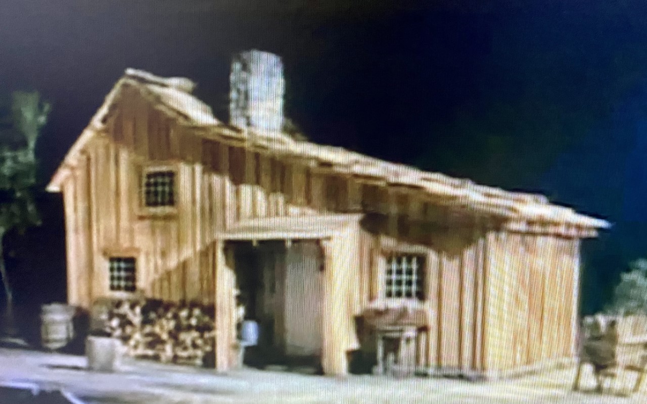
HERE COMES THE NEW INSERT INTO WHAT WAS TO POSSIBLY BE MY LAST POST THIS SEASON…..BUT, all of a sudden–MY STORY– was on one of my favorite TV series--so wholesome, pure, entertaining, and so inspiring–so I’ve been watching an episode almost every evening, (9 seasons are available)
LITTLE HOUSE ON THE PRAIRIE,
The Ingall’s house with Mary, Laura (“Half-pint”), and Carrie, was to eventually grow adding Grace, Albert, James and Cassandra–something like our CENTRAL HOUSE FAMILY in Guatemala grew, and grew, and grew some more!
WOW…WHAT I WOULDN’T GIVE TO BE ABLE TO STILL BUILD MY “LITTLE CABIN” ON THE FRINGES OF THE HIGH UINTAS….SOMETHING LIKE “LITTLE HOUSE ON THE PRAIRIE”
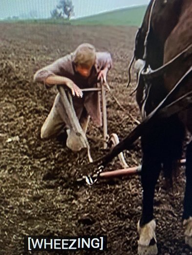
Season 8, Episodes 17 & 18 tells sort of a similar LIFE & DEATH CONFRONTATION I FACED IN THE LAST COUPLE OF YEARS,entitled:“DAYS OF SUNSHINE, DAYS OF SHADOW,”that I have shared in an email to my High Uinta & other friends with some detail below…but just a little as I hope I’m enticing you to look for it on Amazon Prime, or YouTubetv, etc……maybe even enhancing your lives by starting with Season 1 and go all the way to Season 9 with the wonderful Director and lead actor, Michael Landon, who plays Charles Ingalls. It is a pioneer kind of series, actually taken from the diary and books written by Charles & Caroline Ingall’s daughter, Laura Ingalls Wilder, one of the stars in the inspirational segment I review below with a series of pictures & just a little caption info to lead to the next image.
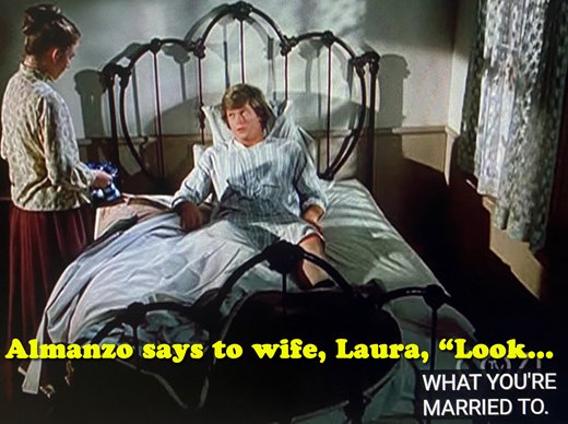
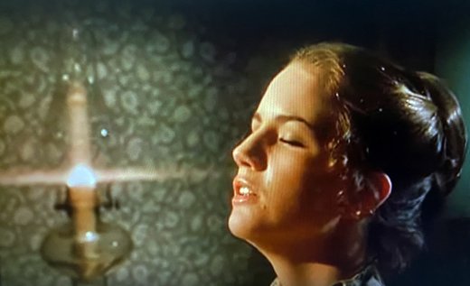
Almanzo, Laura’s husband, experiences diptheria, and then a stroke leaving him a cripple, similar to what happened to me.
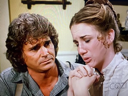
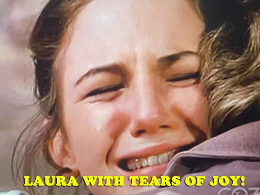
Charles comforts his daughter Laura, Almanzo’s wife.
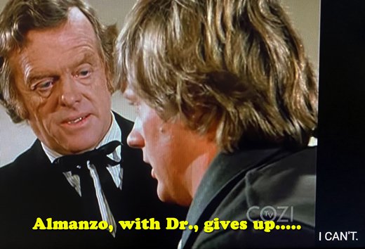
Dr. Brown attempts to encourage Almanzo with exercise that would require incredible effort, but Almanzo gives up as it is too painful and seemingly no progress.
Laura prays for, supports Almanzo and encourages him, but he gives up accepting being a cripple and actually wants to die.
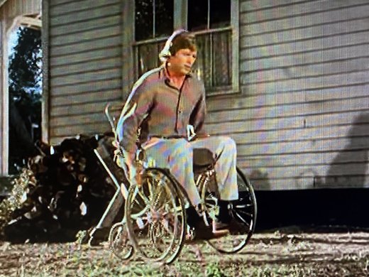
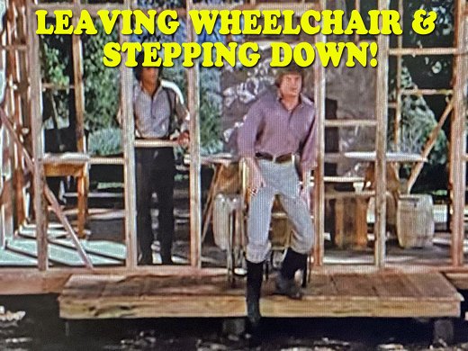
Almanzo throws his crutches at Laura and the doctor, and resigns himself to a wheelchair and just watching life go by.
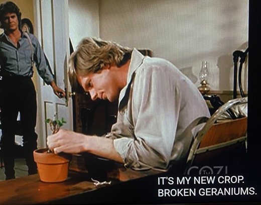
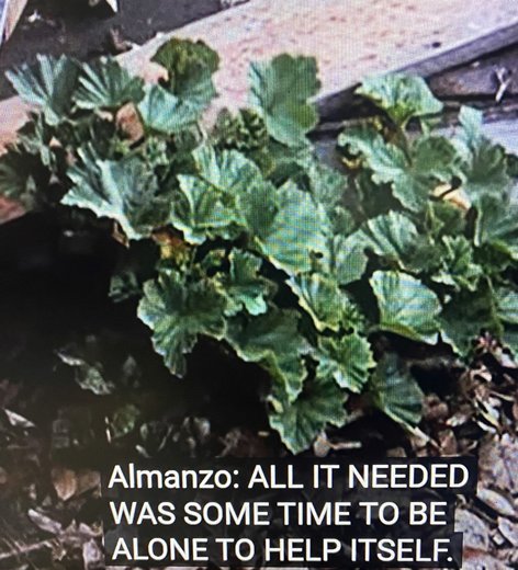
He wastes away his life attempting to help a geranium plant come to life and grow.
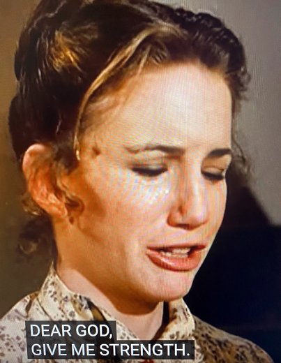
Laura prays fervently for her husband, and attempts to help him in every way, but all of a sudden realizes she has been helping too much, and gets angry at him not trying hard enough. Part of the family tragedy was being hit by a tornado that destroyed their home and their farm, plunging Almanzo even into deeper depression, but always with his father-in-law, Charles Ingalls trying to encourage him in the right ways.
But one day Almanzo notices amidst the debri of his destroyed house his GERANIUM PLANT, and learns a lesson…….his helping the plant was misguided and didn’t work…IN THE RUINS OF THE DESTROYED HOME THE PLANT GREW……..I CAN INSERT HERE THAT MY KIDS…the ones close-by: JESSE, NEPHI, MAHANA & MARCIA all understood this, didn’t help me with things I could do for myself–which I pretty much wanted to do anyway and not be a burden anymore than absolutely necessary. So they let me work hard to solve my problems for WHICH I DEEPLY THANK ALL OF THEM.
So, Almanzo went to work with Charles first helping to build in a barn two railings so he could grab onto something to help, and began taking steps, AGAIN, AGAIN & AGAIN, until he could do it on his own, and all of a sudden surprised Laura with being able to carefully walk again, and helping Charles build themselves a new home….another LITTLE HOUSE ON THE PRAIRIE!
24 MONTHS AGO, after apparently a botched surgery on my spine, MY RIGHT LEG DIED & I COULDN’T WALK–the muscles in my lower legs disappeared and only bone was left like I was a holocaust victim! I was a bit different than Almanzo in the above story, as he got terribly discouraged at first–I NEVER DID, but always was blessed with my “NEVER, NEVER GIVE IN, NOR GIVE UP” attitude. So, I went to work but in my attempts to –awaken feeling, build muscle again, be able to walk and be independant–a couple of falls left MY SPINE DANGEROUSLY MISALIGNED AS SEEN BELOW. The titanium appliances were perhaps doing more harm than good. A FALL COULD LEAVE ME COMPLETELY PARALYZED OR DEAD…..So great caution was advised by my spine surgeon, saying, “DON’T DO ANYTHING STUPID!” .
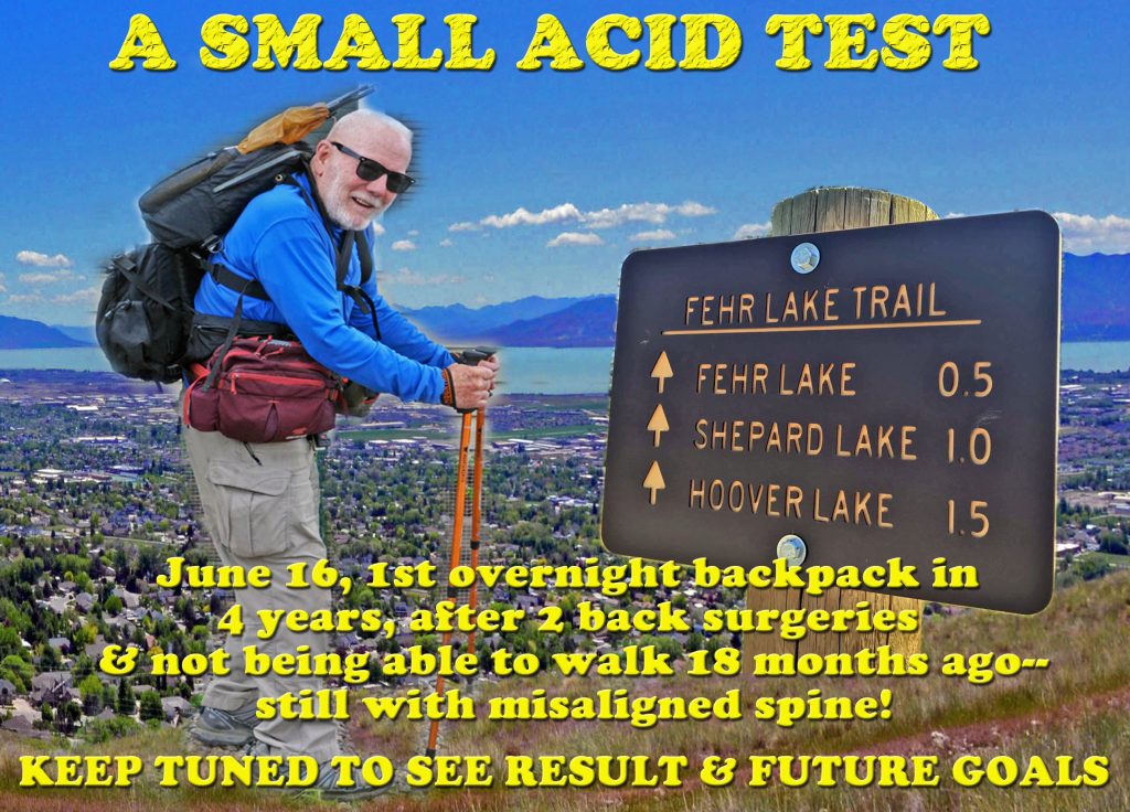
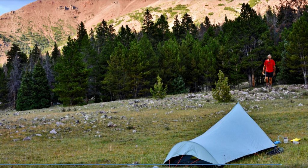
AFTER THE HOLIDAY RUSH TO THE COOL OF THE MOUNTAINS>>>look for me to NOT ACCEPT “GIVING UP…” and DISAPPEAR FOR A FEW DAYS.–to then all of a sudden report here & on my website that I followed the suggestions in my HIGH UINTA MTS. BOOK to manage HIGH ALTITUDE SICKNES & made the COMEBACK DOING AN ACTUAL OVERNIGHT BACKPACK
TO HELP FIND HIM….and TO AVOID YOU DISAPPEARING TO NEVER BE FOUND, GET THE BOOK!
The 730 page digital book is a Guide for adventuring in the Uintas, but also with HISTORY, LEGENDS, the SURVIVAL STORIES OF THOSE WHO DIDN’T MAKE IT & WHY, plus my 8 SURVIVAL STORIES and WHY I’LL BACKPACK THIS SUMMER IN MY 87th YEAR, plus a detailed APPENDIX (among other things has the Anti-Aging Challenge writing), & 14 page INDEX, as well as TOPOGRAPHICAL MAPS WITH ROUTES, DISTANCES & LABELS — to get an online copy of this book, some have called THE ENCYCLOPEDIA OF THE UINTA MOUNTAINS,send me $20 (don’t be afraid of sending a $20 bill as we aren’t south of the border) along with your email address, and I will immediately email you the link to download the book with my permission to share once with a friend.
Send to:
Cordell Andersen, 444 Elm St., American Fork, Utah 84003
To get a printed version like you see above, get the online book, then put it on a thumb drive and take to your favorite printer. Office Max will do it, but ask them to lighten up the pictures as the one they did for me had the pictures too dark. By far my favorite printer is COPYTEC, 185 West 200 South, Pleasant Grove, Utah 84062
Telephone: 801-785-3680
*******************************
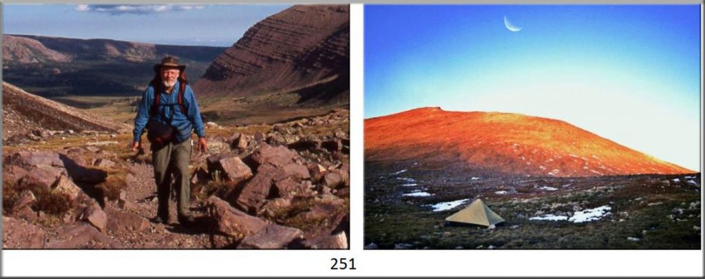
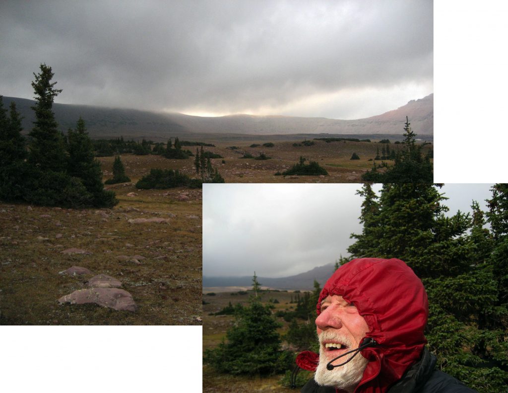
SPECIAL ALERT ( Today-8/25-Including follow-up the day after this with a DEATH ALERT!): Last week I was to finally do a 2-3 day backpack into an area beginning with a steep 500 ft. climb up….less than 1/2 mile, then level for a ways….toScout Lake, followed by another steep 500 ft. climb up 1 mile to my objective Lofty Lake. But, all of a sudden my foothill hikes got complicated and SCARED THE HECK OUT OF ME, AS MY “GOOD” LEFT LEG STARTED WEAKENING AND GOING DEAD AS HAD HAPPENED 2 YEARS AGO WITH MY RIGHT LEG DYING WITH ZERO STRENGTH and over 2 months my lower leg muscles disappeared!
WITH THIS NEW ALERT, I HAD NO CHOICE BUT to THROW IN THE TOWEL!
But, DIDN’T GIVE UP, NOR GIVE IN, so began carefully experimenting–but now reversing with step-ups leading with my previously dead leg, and with gradually increased exercise, and a lot of prayer. By last Sunday I felt life coming back into my left leg, and by Monday, August 22nd felt both legs the same with about 50-75% normalcy. I became determined to yet do a backpack THIS SUMMER, but not the one with steep climbs, rather what I attempted and failed at last summer–a 1/2 mile hike to Fehr Lake--which hike hurt me then, but, I now feel confident with my renewed awakening in my left leg, that I can do the Fehr Lake hike safely, and believing the previous plan with steep climbs, up, and then down, could have been deadly for me.
So I’m leaving now, August 24th to drive up the Mirror Lake Scenic Byway, and when I get to the Fehr Lake Trailhead, if oxygen level in blood is good, as well as blood pressure, and I still feel 50-75% strength and aliveness in both legs, will likely this afternoon make it and camp out for one night at Fehr Lake, eat a nice trout for my dinner, and return tomorrow–HAVING MADE YET ANOTHER COMEBACK, WITH GREAT HOPES FOR THE FUTURE IN MY 88th YEAR! If there are ominous signs, indicating a problem with high altitude, or heart problems……..yes, still being sort of dumb, but NOT STUPID….I will just return home or sleep the night in my car and return tomorrow….
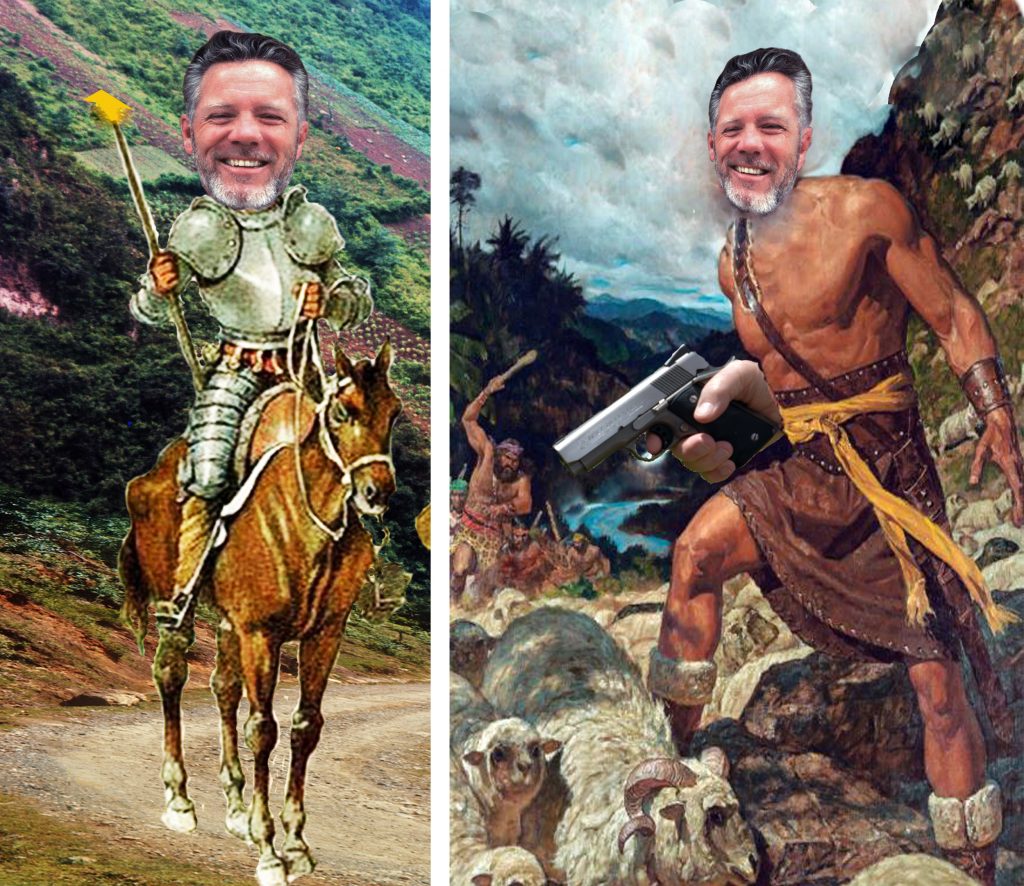
For you tough backpackers, this MUST SOUND LIKE A JOKE…RIGHT? But, for me…who couldn’t even walk, with a dead right leg 20 months ago, THIS COULD BE A SUPREME ACHIEVEMENT….and HOPEFULLY A NEW BEGINNING FOR AN OLD GUY ACCUSED OF BEING EITHER, A MODERN DON QUIJOTE DE LA MANCHA, or for the Mormon community, A MODERN AMMON……..to move towards my 90’s!
TODAY, August 25th, WITH A SPECIAL REPORT FOR AN OLD GUY ……. WHO FOR AT LEAST TODAY FEELS LIKE THAT “OLD GUY” AFTER MY ATTEMPT YESTERDAY IN THE UINTAS!
I made it to the Trailhead, just a mile past Bald Mountain Pass, but not feeling 100% with a little headache, nonetheless got ready for the short hike, but first checked my oxygen blood level, which wasn’t too bad, but in the upper 80’s, but Blood Pressure a bit LOW, and I didn’t feel too good, so tested myself with a short 1/8 mile hike without waist packs, and returned to the car and was out of breath, felt a bit dizzy and too tired for such a short hike.
My Oximeter still showed my oxygen level slightly low, but my BP cuff reading SCARED THE HECK OUT OF ME! It read: 93/55 I hate to fail–being sort of DUMB…..
…but NOT STUPID, so got the car going, and headed for home before the dizziness got the worst of me!
I’ll admit I had to rest once along the way, but made it home and got my laptop going to the internet and researched LOW BLOOD PRESSURE….which REALLY SCARED THE HECK OUT OF ME, BUT HAD ME FEELING VERY GRATEFUL!
A reply to one question was: “Overall, older adults with a blood pressure reading of 90/60 mm Hg or lower is considered too low (hypotension).
“Excessively low blood pressure may cause dizziness or FAINTING and increase the risk of FALLS!
“When an individual is APPROACHING DEATH, the systolic blood pressure will typically drop below 95!”
Mine was 93 so for this time it was good that I chickened out and headed for lower country, rather than stubbornly heading down the “Mickey Mouse” trail to Fehr Lake!
What does all of this mean for my future? Might be that I will put on hold for a time QUIXOTICALLY fighting off those pesky wind-mills, or temporarily flick onto safety my Colt .45 Defender and have on hold for now AMMONICALLY attempting to eliminate all the law breakers!
IF YOU DON’T HEAR FROM ME FOR A WHILE, CHECK THE OBITUARIES FOR A REFRESHINGLY HUMOUROUS……OF COURSE LONG…..but WORTHWHILE FINAL FAREWELL!
******************************************
FOLLOWS THE PREVIOUS POST WHICH IS PATRIOTICALLY ALWAYS WORTH LOOKING AT AGAIN AS WELL AS HAVING YOUR BREATH TAKEN AWAY BY“GRACE & THE KING’S PEAK TRAIL,”and ALWAYS THE WONDERFUL…….
“VISIONS OF NATURE!“
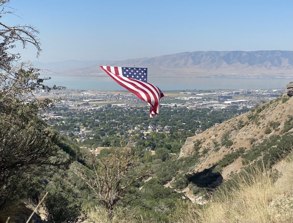
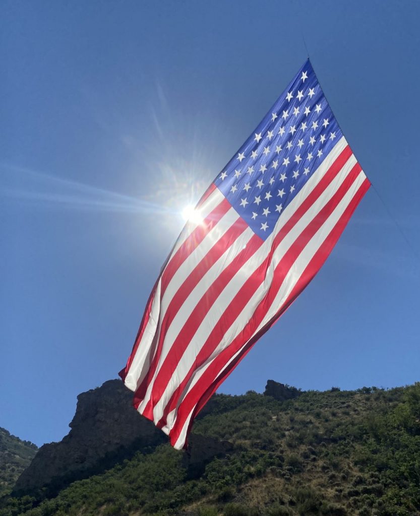
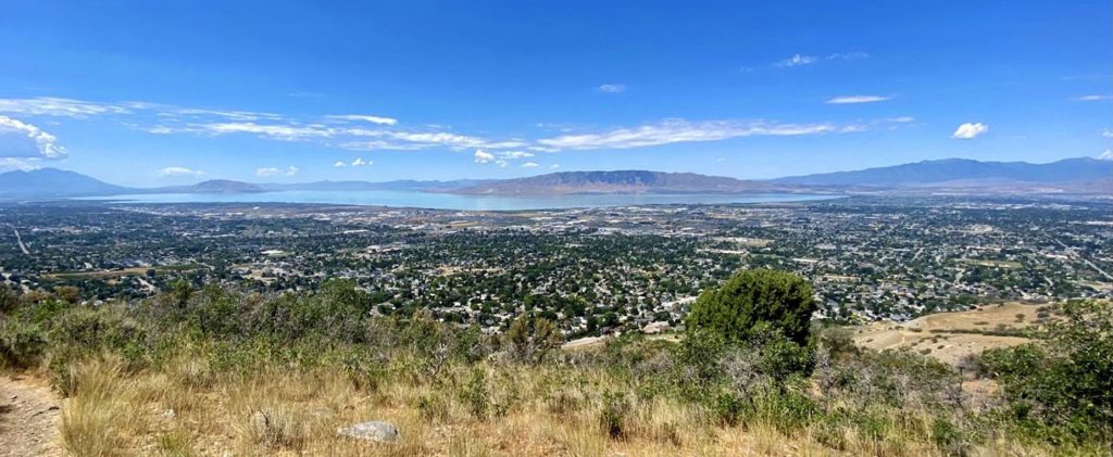
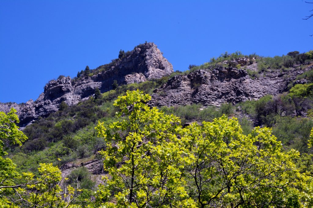
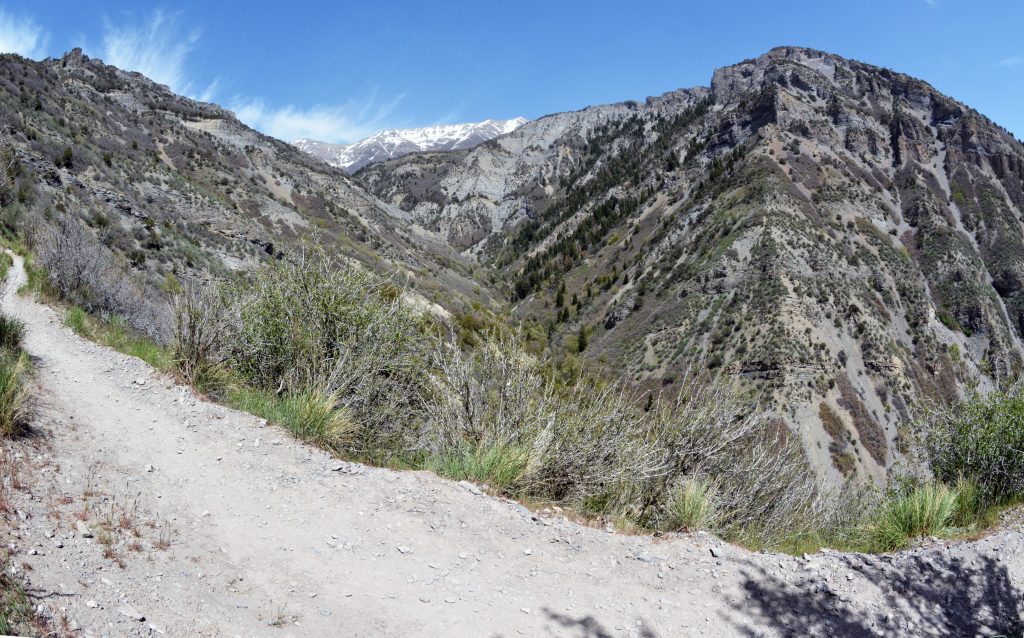
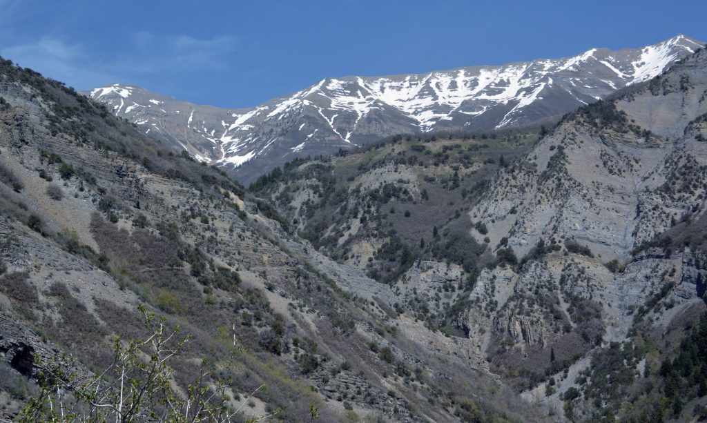
OUR WONDERFUL GROVE CANYON….in the foothills of MT. TIMPANOGOS, FOR JULY 4th!
Interestingly I met on the trail President Evanson and his wife, from Canada, who are the Leaders of the OREM/UTAH LDS MISSION.
I goofed in my COMEBACK from not being able to walk 18 months ago, by pushing myself too quickly and peaked months before my hoped for BACKPACK TO THE GRANDADDIES in mid-June, so I had backed off, and…..SURPRISE, SURPRISE….I LOST MY CONDITIONING! It’s lost so quickly for an old 86 year old, and then so hard to get it back.
SO I FAILED AT MY MID-JUNE BACKPACK…..but am determined to do my best to get it done in mid-August. SO–in spite of the heat– WENT TO WORK AGAIN–3 to 4 times a week– GRADUALLY DOING HARDER, AND LONGER HIKES….BUT PLANNING IT OUT SO I’LL PEAK MID-AUGUST AND HOPE TO MEET MY GOAL. So here I am doing as I love to do–SHARE THE WONDERS OF THE TRAIL WITH MY FRIENDS!
SO THIS IS STILL MY HOPE & MY DREAM!
I’ll admit that as I sort of started new with short hikes, and then stretch them out a bit….IT WAS ALL OF A SUDDEN REALLY HARD..AGAIN…….so much so that I almost decided it was just too much for me to handle, and came close to another FOREST GUMP MOMENT! “I’m tired and I think I’ll go home now!” ……..but I kept at it and there has been noticeable progress.
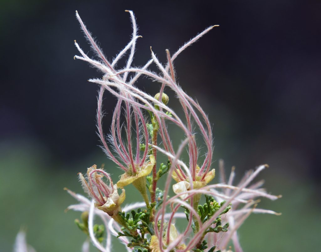
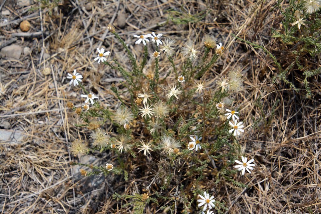
INSPIRATION FROM WHAT I CALL “VISIONS OF NATURE” ALWAYS HELPS ME A LOT!
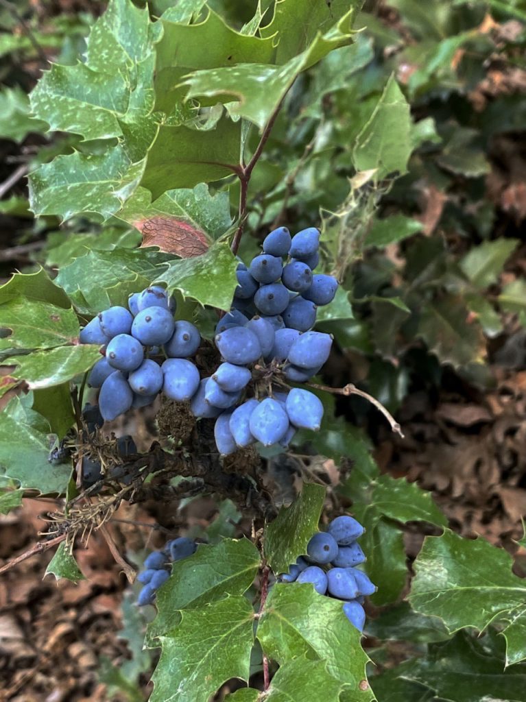
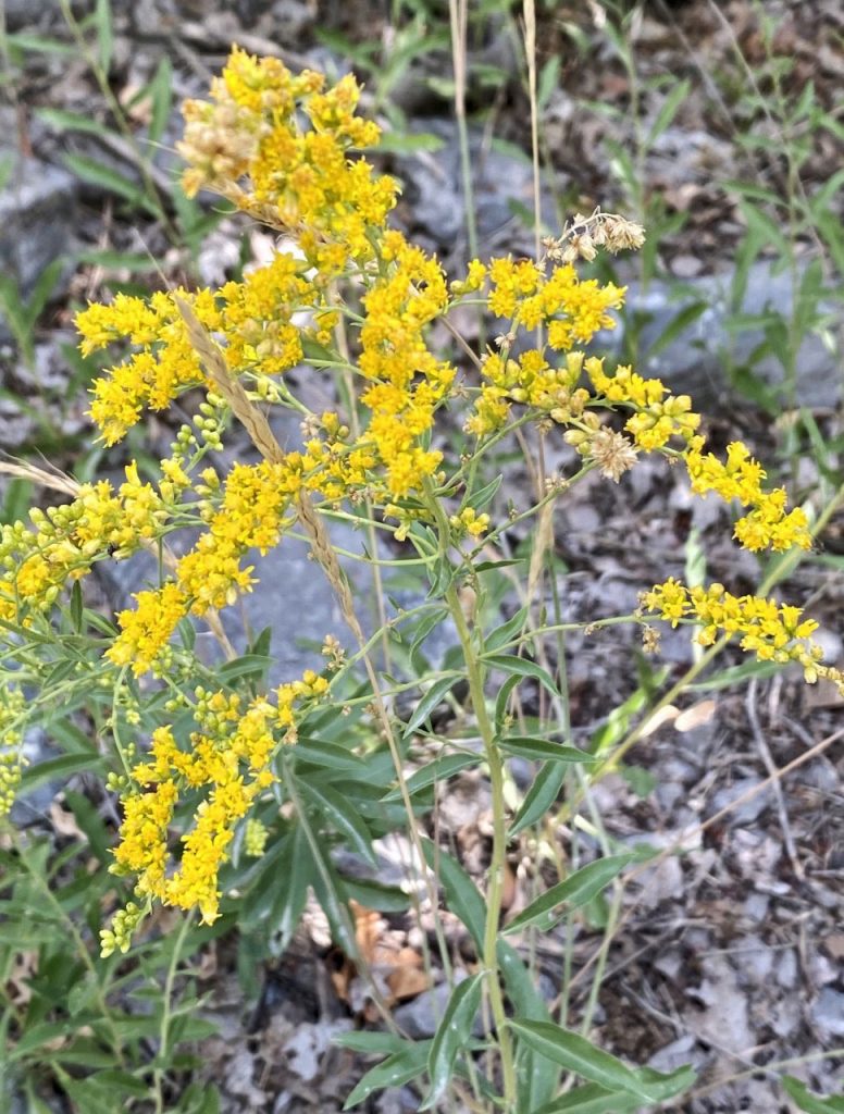
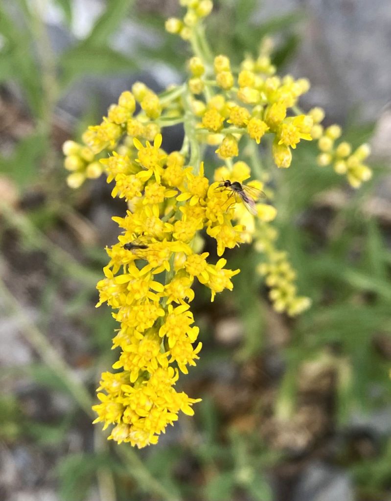
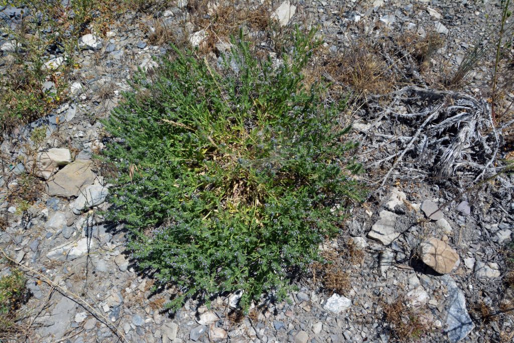
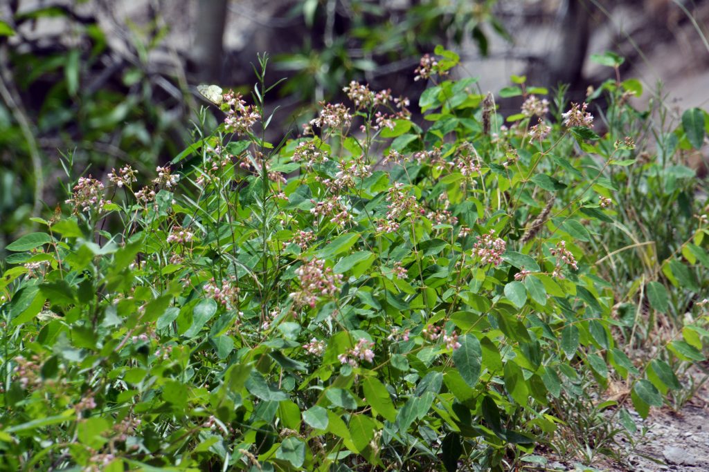
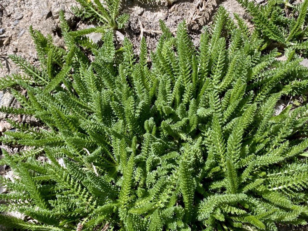
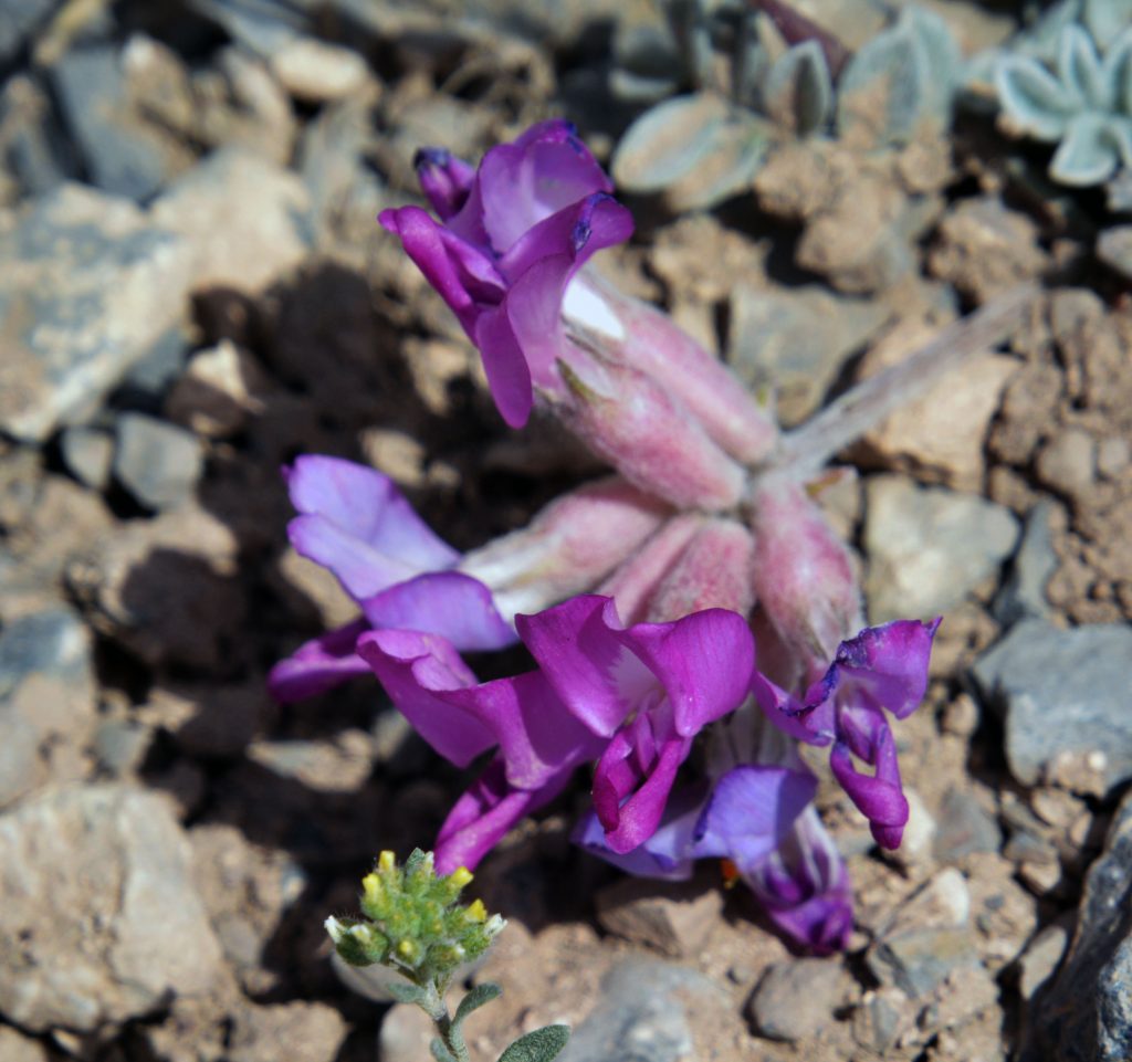
OREGON GRAPE
I gradually got higher and higher. Usually every other day, and rather than my noontime, or afternoon hikes, got smart and usually did it by 9:00 AM, or earlier.
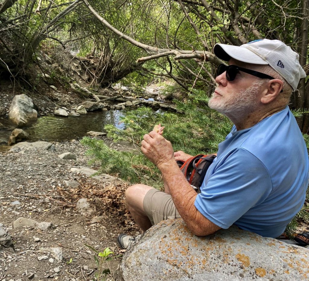
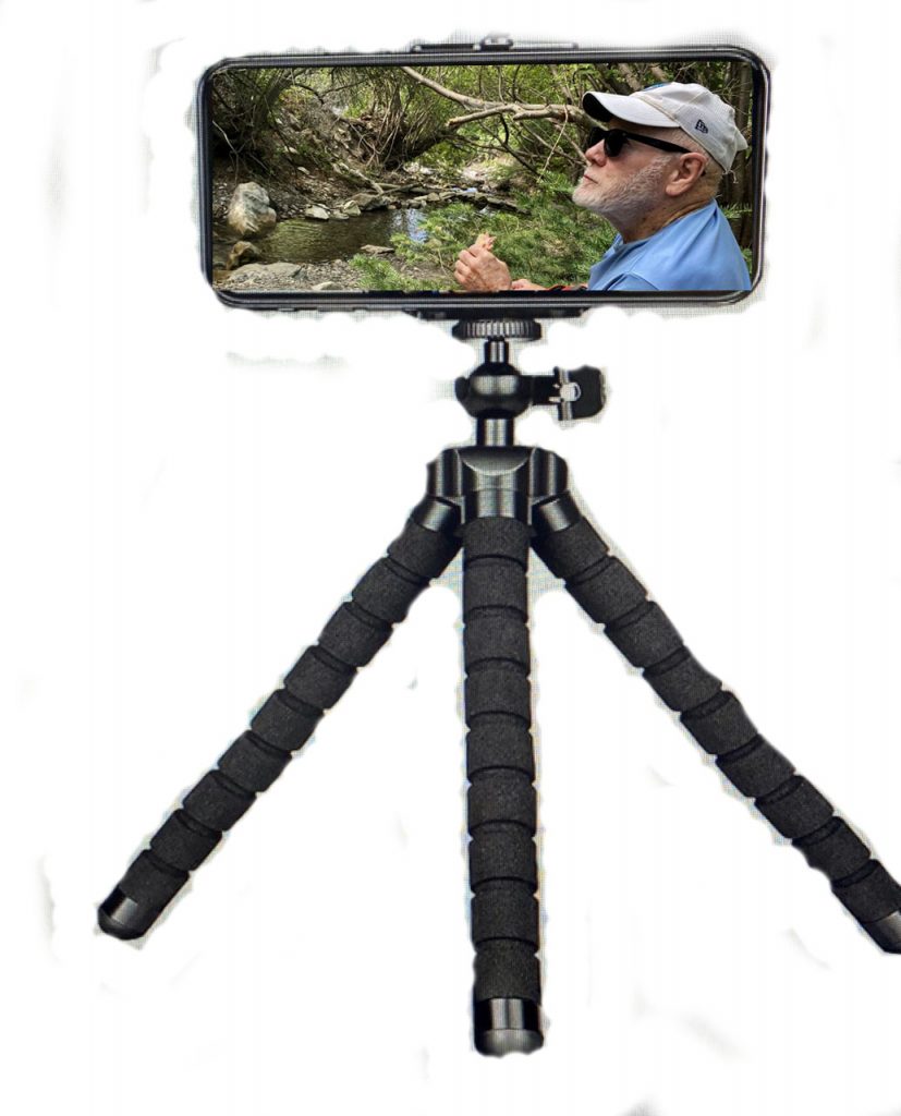
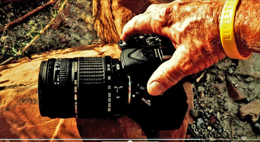
…….and becoming more realistic with my goal of actually doing a 2-3 day backpack or two in the Uintas, and worked on getting the weight I would carry down to under 20 lbs. I decided I would have to sacrifice my BELOVEDNIKON camera and incredible lenses: 14-400 mm. zoom lens, as well as my Fish-eye lens , but rather using my iPhone, I worked on piling up rocks and setting it pointed towards where I’d be and put it on video, then edit to save the shots I needed, like this one.
My tech savvy boys, Jesse and Nephi, reminded me about Google, and Amazon, and so a very lightweight piece of equipment was acquired real cheap, along with a tiny remote.
I was gradually getting higher and higher up where I had got to before.
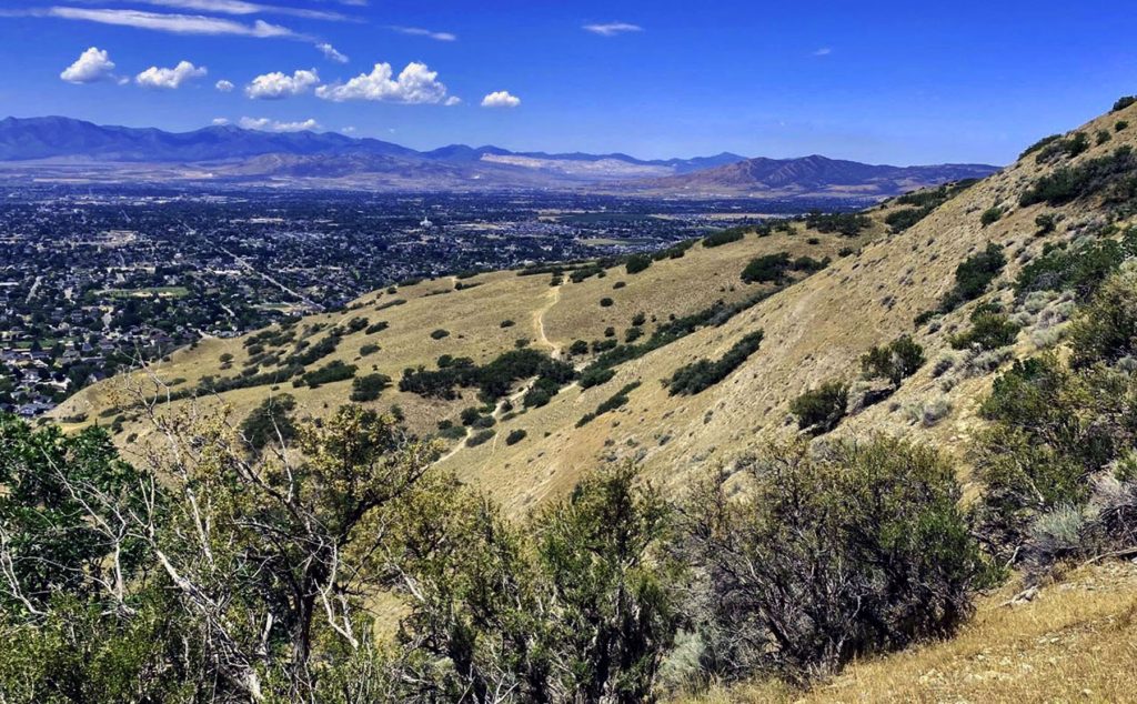
…..and finally got back up to the VALLEY VIEW SPOT, which I’ve now done 3 Saturdays in a row, and each time taken a different route back down to be building strength and stamina, and eventually get to the point where I can do it and ENJOY IT, RATHER THAN IT BEING PURE TORTURE, which it was the first time of the 3. I’ve got to get to where a hike into the GRANDADDIES is enjoyable, and even inspiring!
The first of the 3 hikes to the VALLEY VIEW SPOT, I came back down following the trail. For the 2nd time I looked north as we see in this photo, but …….
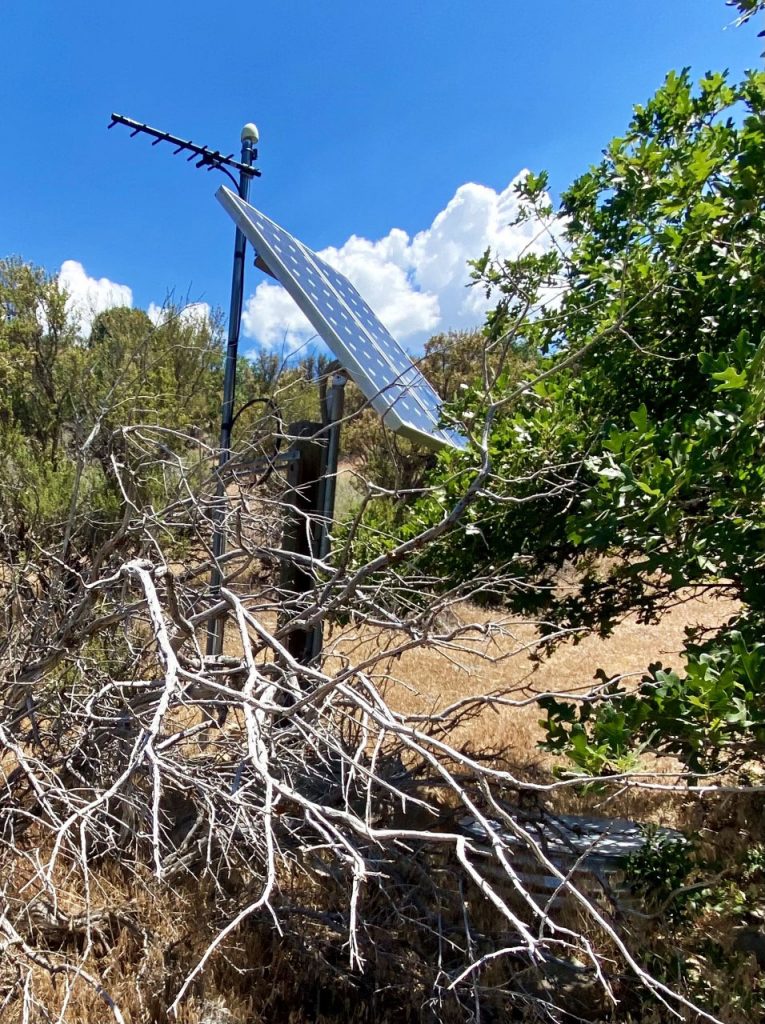
……..I went down to photograph an earthquake detection site, you see below.
From here I sort of went straight down the mountain, but pretty soon it got real steep and dangerous for me, so had to switch-back over to where it was a little safer, but it was a tough hike for me that had my muscles really sore for the next few days.
YOU’LL NEVER KNOW HOW WONDERFUL IT WAS TO ACTUALLY HAVE MUSCLES BACK TO GET SORE, as 18 months ago the muscles had disappeared and I had no strength!
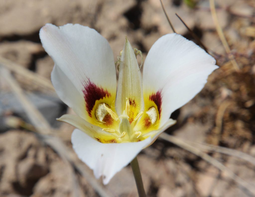
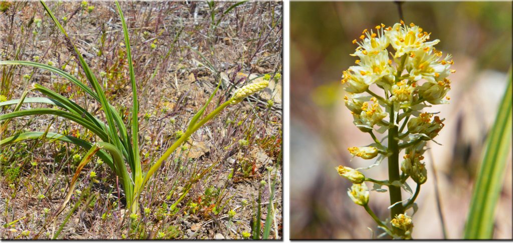
On my 3rd hike to the VALLEY VIEW SPOT, I decided to head north and got on a trail that climbed up higher and eventually got me back down to the trail you see below where I had made a bunch of hikes, and where I had seen my first SEGO LILY, Utah’s State Flower.
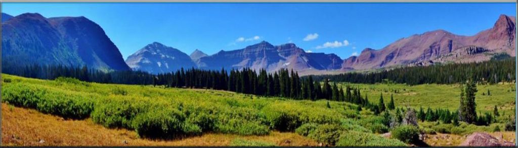
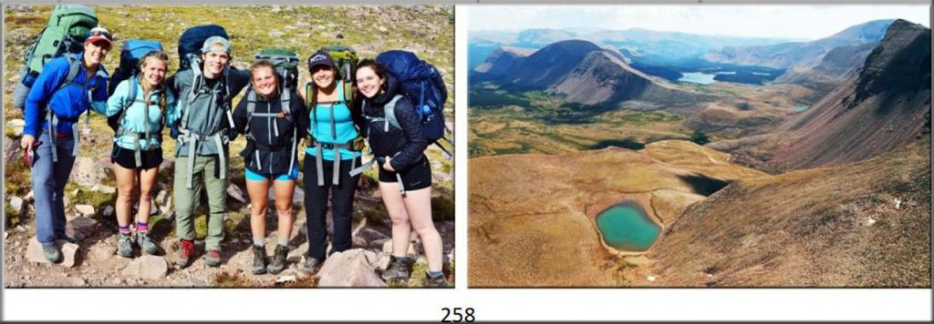
NOW IT’S TIME FOR OUR TOUR OF THE HIGH UINTA MOUNTAINS, North Slope, moving on from our last tour to the Red Castle area, we come to one of the most used trails in the High Uintas–THE HENRY’S FORK TRAIL, “GATEWAY TO KINGS PEAK!”
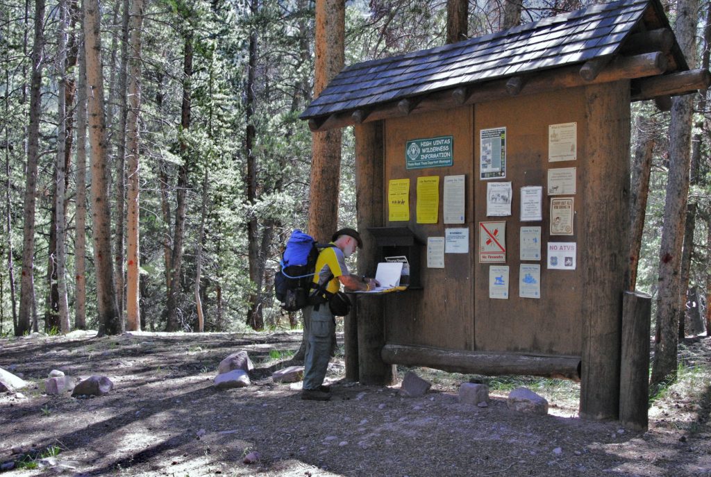
YOU REALLY NEED TO HAVE MY BOOK. I’ve been sharing the book in sort of outline style, hoping it would awaken your interest in getting the BOOK, and all the information I’m purposely not sharing in these posts, like the details of the SURVIVAL stories, all kinds of WONDERFUL BACKPACKING OPTIONS FOR EACH TRAILHEAD, the TOPOGRAPHICAL MAPS with trails I have added, with labels and distances, and up-to-date information on the lakes, etc. At the end of this post I’ll insert again the photo below and add all the information you’ll need to get an online copy, and how you can also get it printed yourself to hold in your hands and read as I’m doing again now myself–and just have to add…….
…..IT’S PRETTY DARNED GOOD–NOTHING ELSE LIKE IT!
My SURVIVAL ADVENTURE ended with my life SAVED. IT’S DETAILS HAVE SAVED OTHER’S PEOPLE’S LIVES TOO!
THE HENRY’S FORK BASIN.
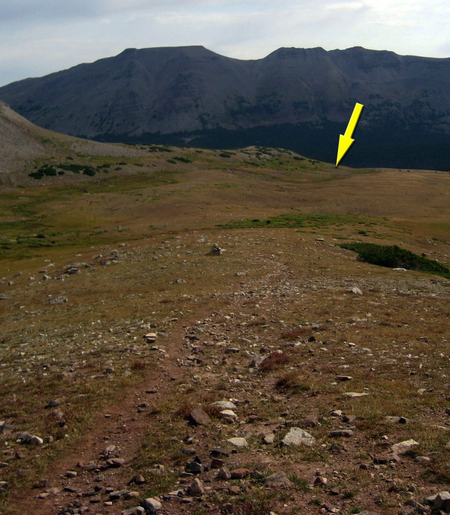
It was late in the season, 2004, and I was camped just under Anderson Pass & KINGS PEAK! I was limping as had had an emergency surgery on my “motorcycle knee” just 30 days before.
My camp, up where the yellow arrow is pointing, was way above me as I had taken a day hike down to U-75 where I had caught huge brook trout. Mt. Jedediah I have named is above the lake. But on that hike I became deathly sick, and somehow had to make it back up to my camp to survive. My book tells the details of how I made it back, then laid there for two days waiting for the emergency antibiotic to begin taking affect. Snow was on its way……so I had to get out of there soon!
After two days, I made it to Anderson Pass to get this picture, and the next day had to move towards the Trailhead, 16 miles to the north.
I had to move carefully so as to not work up a sweat and let the sickness know it had a great chance to take me down for the count. I made it down to the meadows below Kings Peak and there tripped, but caught myself to prevent falling, but sprained my ankle–so I was all of a sudden doing what I sometimes did to finish the International Half Marathon in Coban, Guatemala:
“LIMPING WITH BOTH LEGS, and DRAGGING ONE BEHIND ME!”
But I made it 8 miles to the Dollar Lake area and camped. Using my satellite phone I called to let the family know where I was and that I would make it out the 8 miles the next day.
But, little did I know the greatest danger would come that night when I had a heart attack and experienced one of the great miracles of my life, as explained in detail in the book. It took me all day, but I did make it to the Trailhead, and on to Ft. Bridger staying in a motel for needed rest.
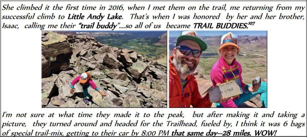
The BOOK in this Henry’s Fork section has the ASTOUNDING STORY of 11 year old GRACE Hirschi we see here leaving her father, Jake, in her dust as she zeroes in on KINGS PEAK.
The amazing and inspiring story of JAKE HIRSCHI’S FAMILY: GRACE, ISAAC, and 7 year old NORA is told in several sections of the book. Just that alone is worth the purchase price!
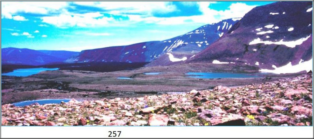
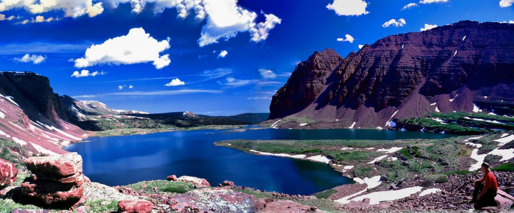
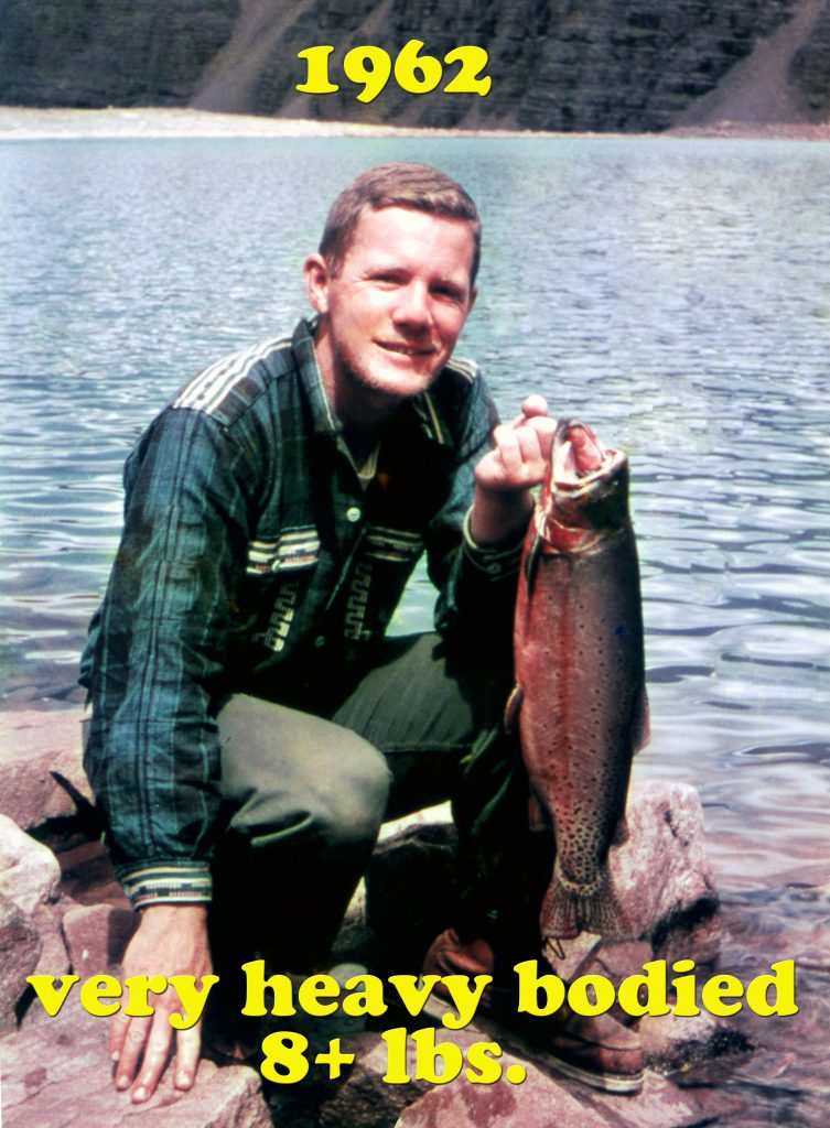
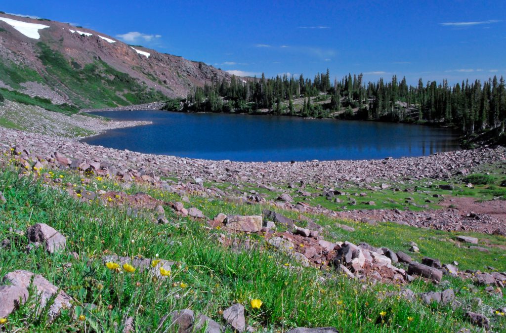
The Henry’s Fork/Kings Peak Trail takes you up over Gunsight Pass, and to the Highline Trail then up to Anderson Pass and Kings Peak, but the trail can also take you over Trail Rider Pass to this beautiful sight seen below with Lake Atwood in the distance, where my buddy, Ted Packard caught the Utah (unofficial–19.5 inches) record Arctic Grayling in 1962, and in the foreground is seen an alpine basin I have named GEORGE BEARD BASIN, honoring pioneer artist/photographer George Beard. This above timberline alpine basin, rarely visited is more than worth a visit…….
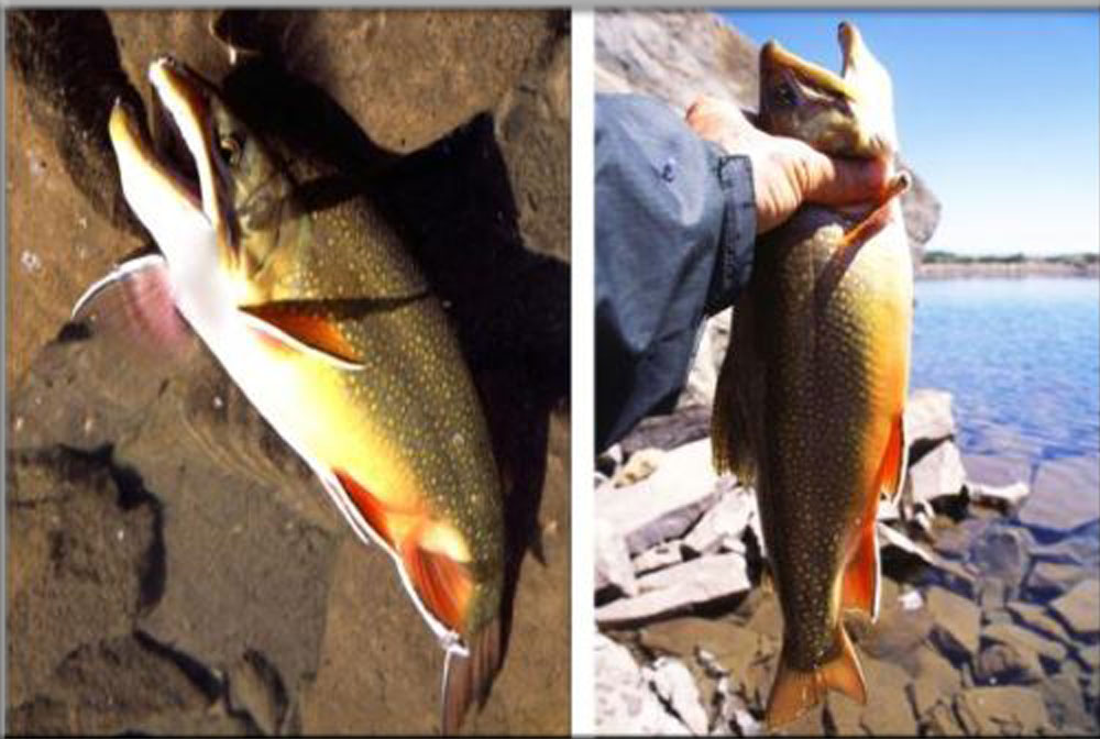
……along with Beard Lake, that is right up on Trail Rider Pass where I caught the (unofficial) Utah record Eastern Brook Trout, you see below on the left, along with one out of U-75.
The very heavy bodied, hook-jawed brookie on the left is estimated to be from 28″ to 30″ long which would have been a Utah State record.
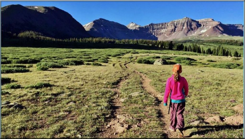
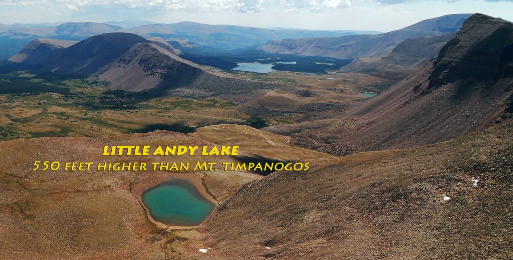
I met this group of youth from Washington on Gunsight Pass. They promised to take for me a picture from South Kings Peak of “LITTLE ANDY LAKE” you see on the right, given my nick name as a youth. It is the highest lake in Utah at 12,307 ft.
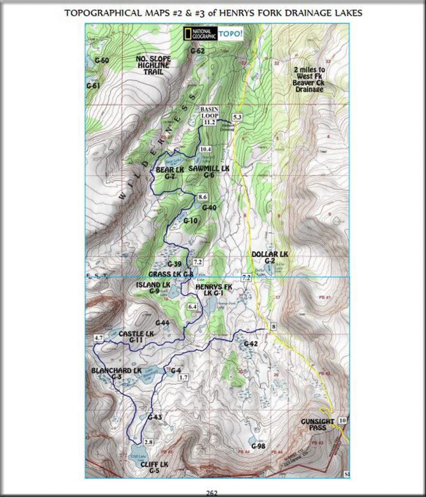
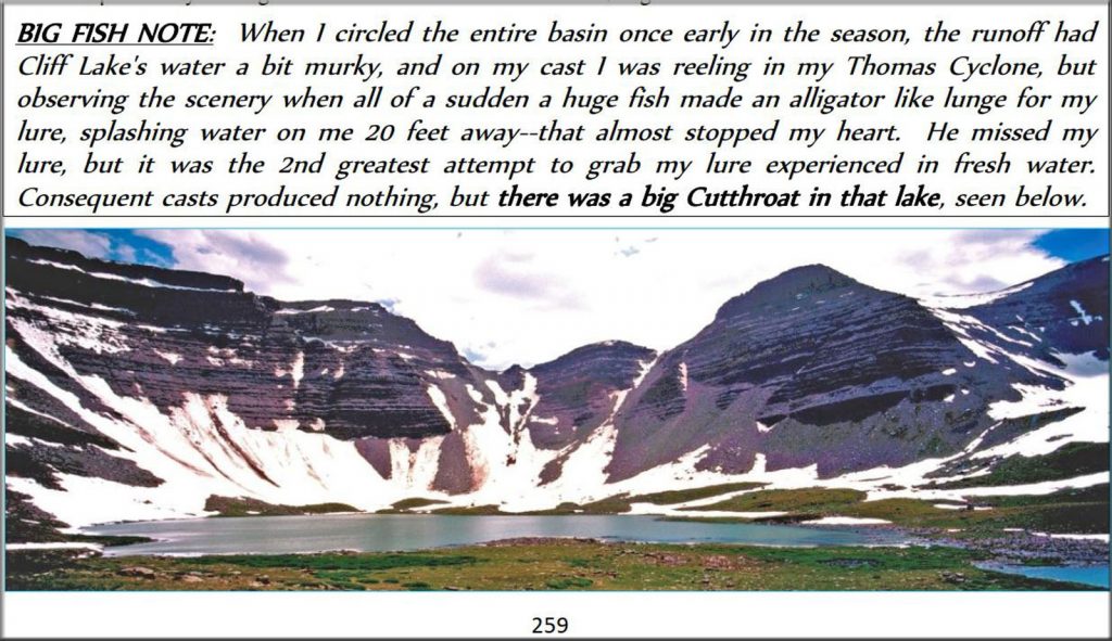
I include this topographical map, from the book, to show you the many lakes in the Henry’s Fork Basin, the highest being Cliff Lake we see below in a page shot from the book. The book has detailed information on each of the many lakes.
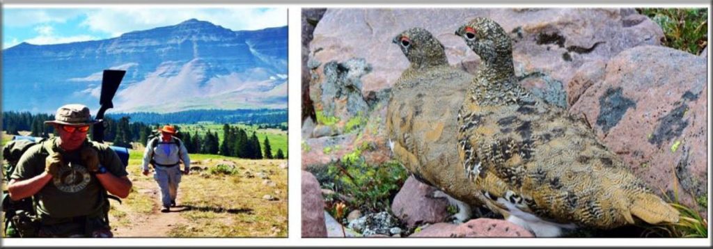
From the Henry’s Fork Basin, over to the area around Kings Peak, is where I have seen the most Ptarmigan in the High Uintas. Here I ran into a couple of hunters searching for them.
ALL IN ALL A WONDERFUL AREA FOR HIKING, BACKPACKING, EXPLORING, FISHING, PHOTOGRAPHING WILDLIFE, & BEING INSPIRED BY THE LORD’S WONDERFUL VISIONS OF NATURE, WHICH OF COURSE INCLUDE AS MANY MOOSE AS SEEN ANYWHERE IN THE UINTAS.
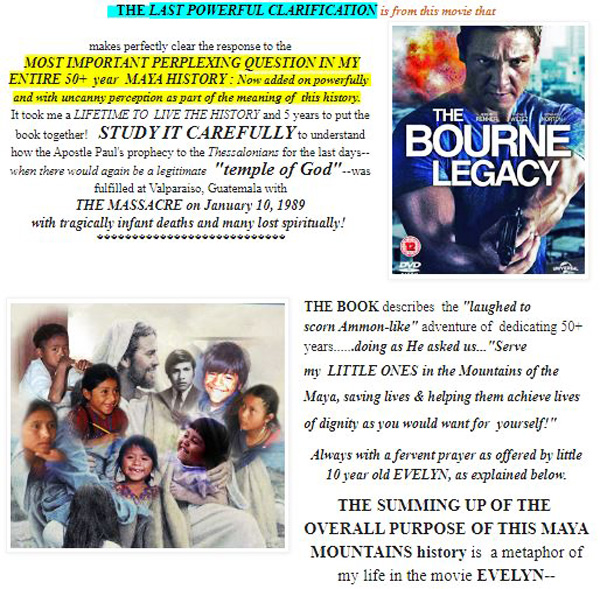
FOR INFORMATION ABOUT MY LIFE AMONG THE MAYA: Go to the GUATEMALAN FOUNDATION’S website with the final addition from the movie THE BOURNE LEGACY which REVEALS THE ANSWER TO the……
..MOST IMPORTANT PERPLEXING QUESTION IN MY ENTIRE 50 YEAR MAYA HISTORY::
Check out the VERY LAST VERSION of the BOOK now with
THE “MODERN AMMON’S” LEGACY!
Download free theBOOKabout my life among the Mayans.
If BOURNE is what attracts your curiosity…and it should, it will best be understood after going through the history where you will find it in Section 29, page 464.
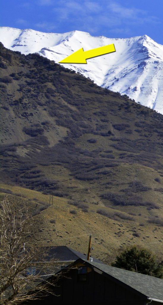
Up to Grove Creek Trailhead again to test me! The goal going up the front of the hills to the arrow way above me…..and on ahot day!
For you TRAIL RUNNERS, remember this competition.
Here’s my history from back 18 months ago when I couldn’t walk, or stand to take a shower. I WENT TO WORK, STEP BY STEP….UNTIL CONQUERING UTAH VALLEY. Would I be ready?
I had slacked off some time ago, and apparently lost my strength and endurance, so this week each day I was at Grove Canyon and each day pushing myself to do a little more, and it was hard, especially with the hot weather. But I wanted to go up the front of the mountain to the view spot.
MY SPINE WAS STILL DANGEROUSLY MISALIGNED AS YOU SEE HERE & WAS PAINFUL. I HAD TO BE REAL CAREFUL.
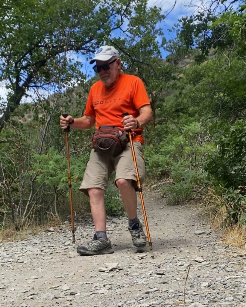
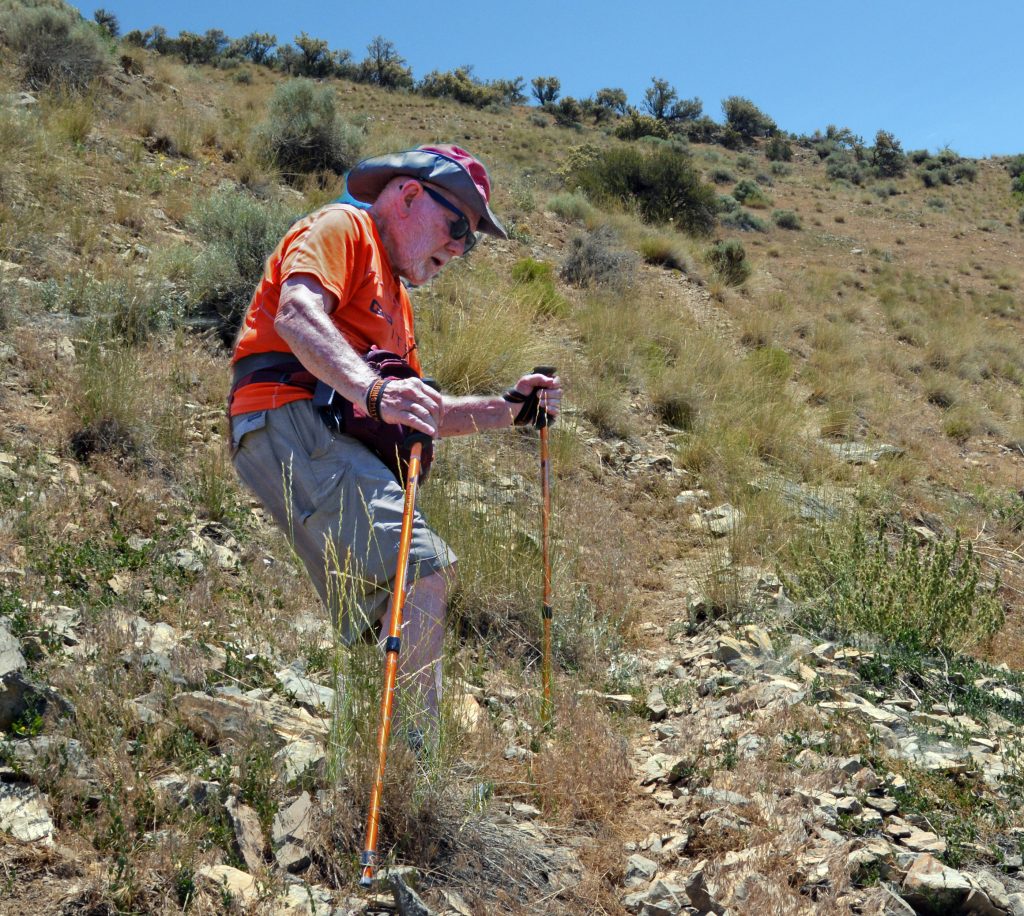
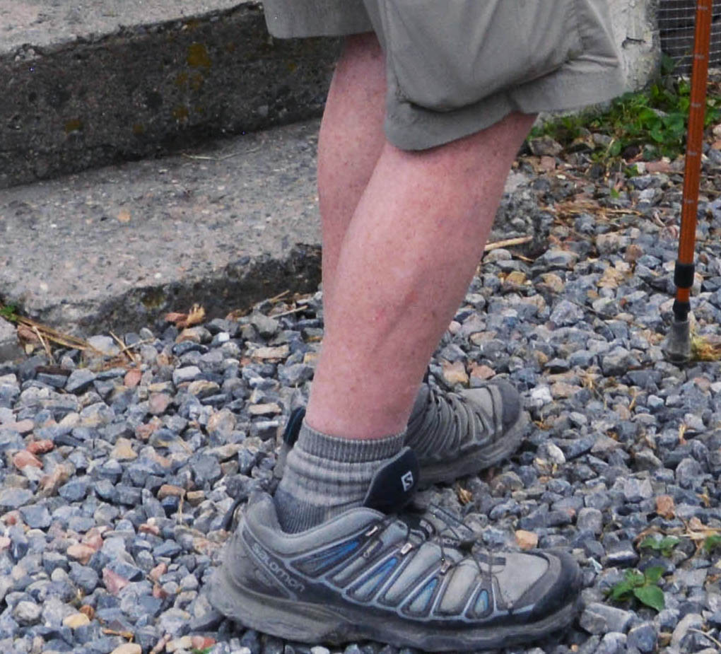
My SPINE SURGEON INSISTING I ALWAYS USE MY TREKKING POLES!
I had to always cope with my HIGH BLOOD PRESSURE, so before starting had it finally down by around noon, and then on the trail checked myself periodically. Oxygen in my blood and HIGH ALTITUDE SICKNESS would be no problem, but had to get strong to have it working right above 10,000 feet.
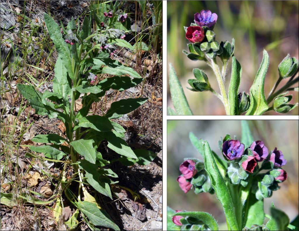
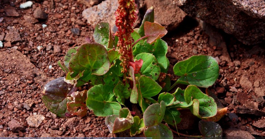
As I climbed I checked on plants I was monitoring, and documenting their development.
This one hadn’t blossomed yet.
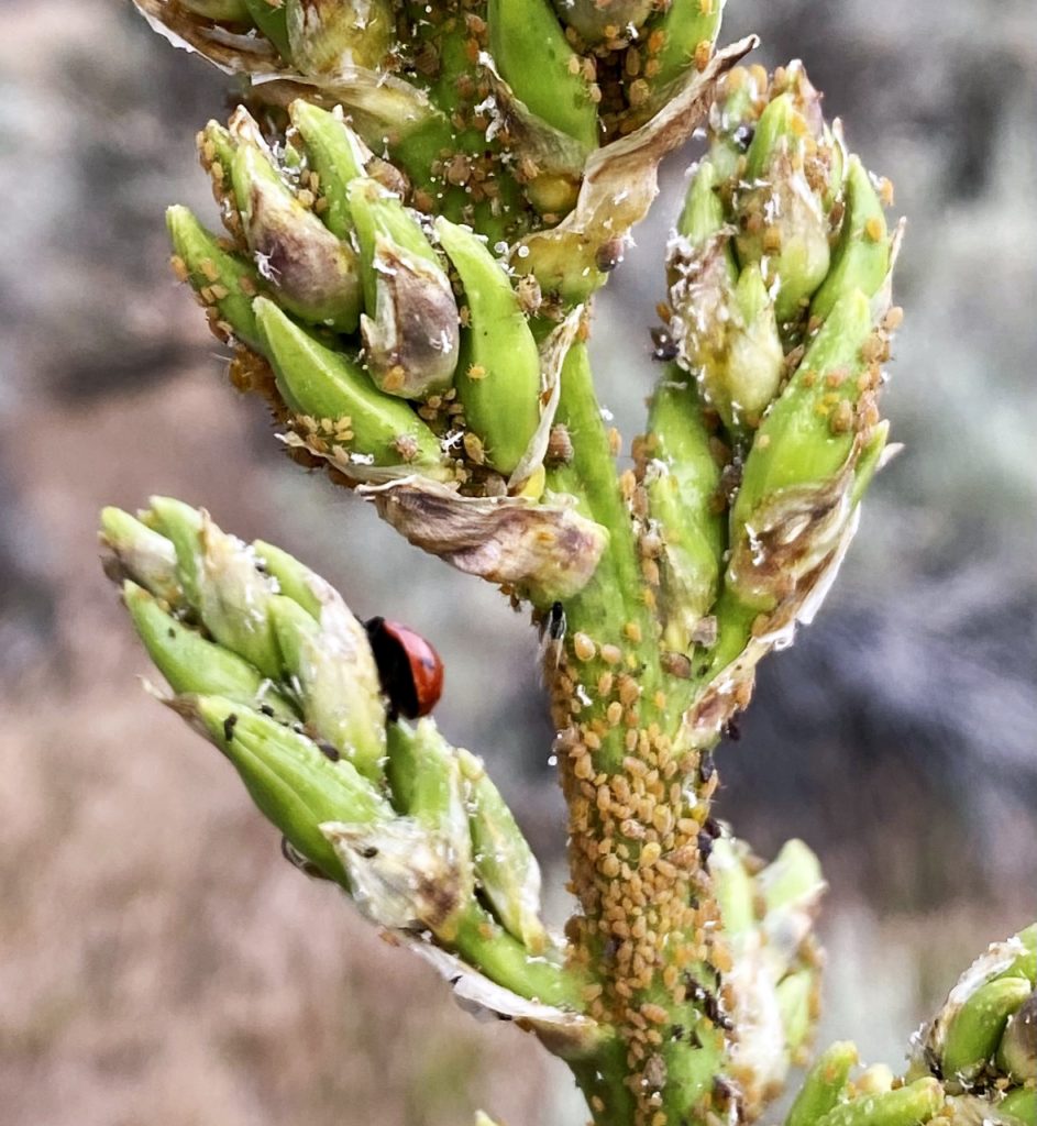
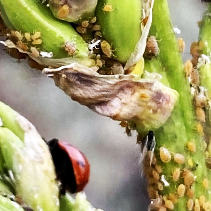
But had the problem of APHIDS, very tiny sap sucking insects, their ENEMY being the wonderful LADYBUG that during it’s life-span can eat up to 5,000 aphids!
This LADYBUG needed some help. A LADYBUG is about 1/8th inch long, making aphids smaller than 1/32nd inch long.
TO CONTROL APHIDS IN YOUR GARDEN YOU CAN EVEN BUY ON AMAZON.COM BAGS OF LADYBUGS!
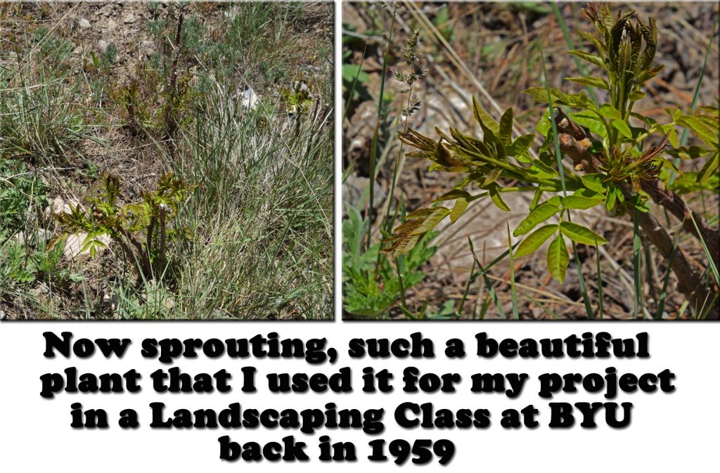
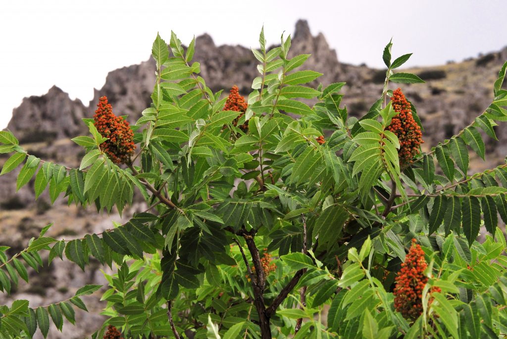
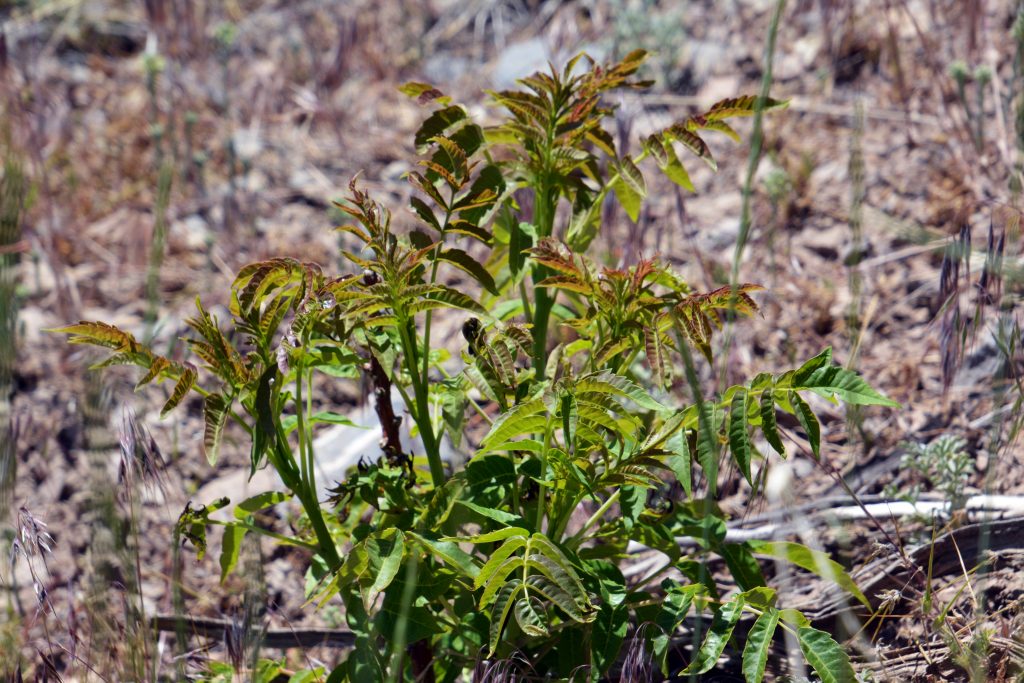
This plant, the SMOOTH SUMAC, you will recall I used as one of the native plants to landscape our first apartment.
Here it is at full maturity.
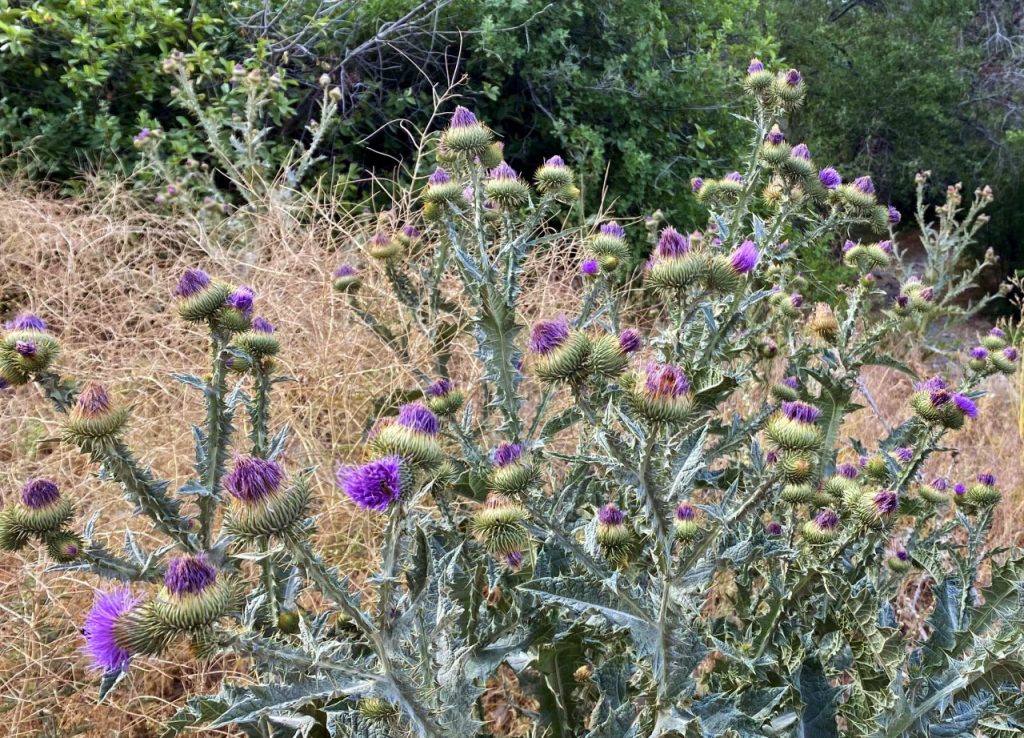
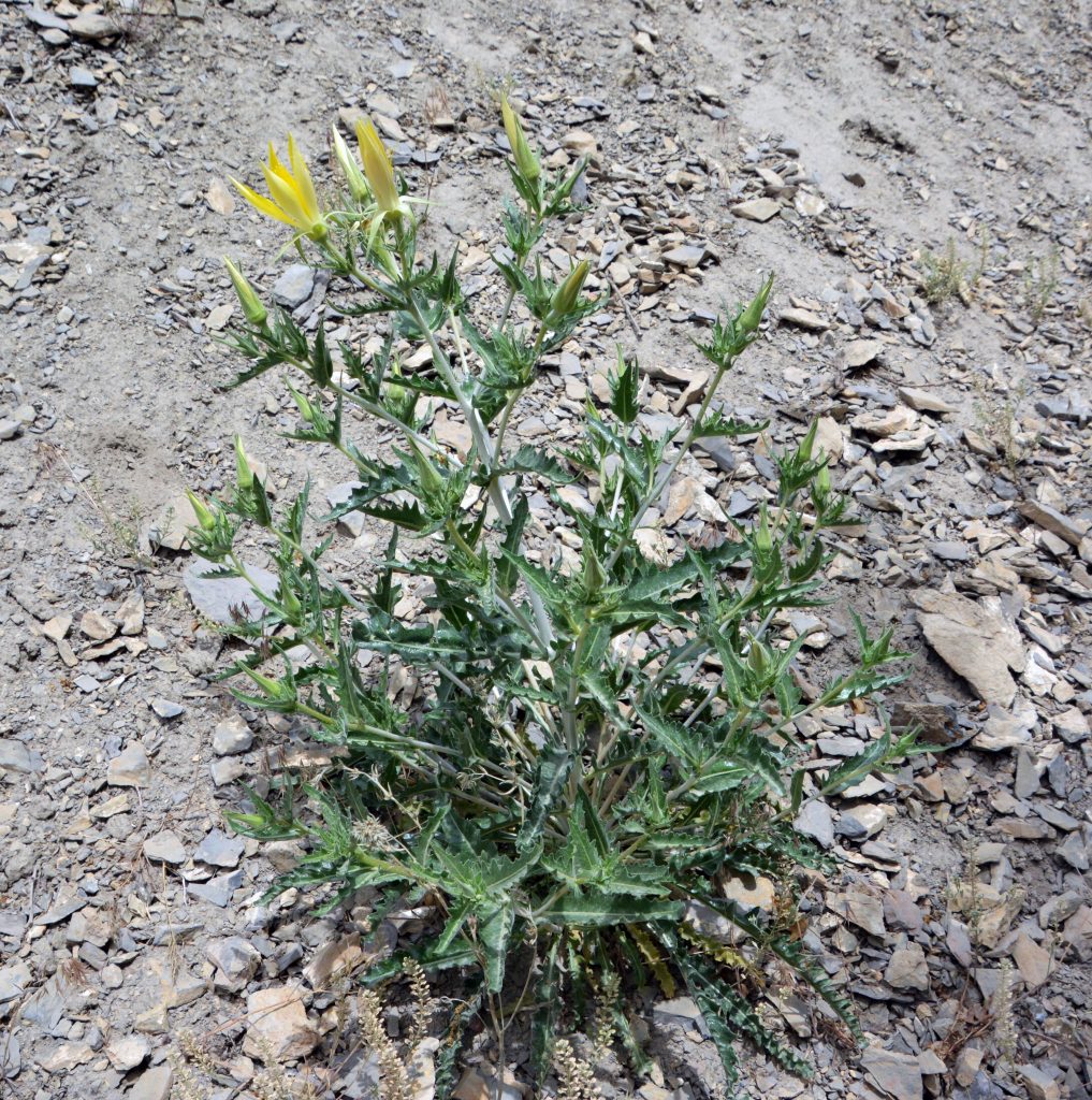
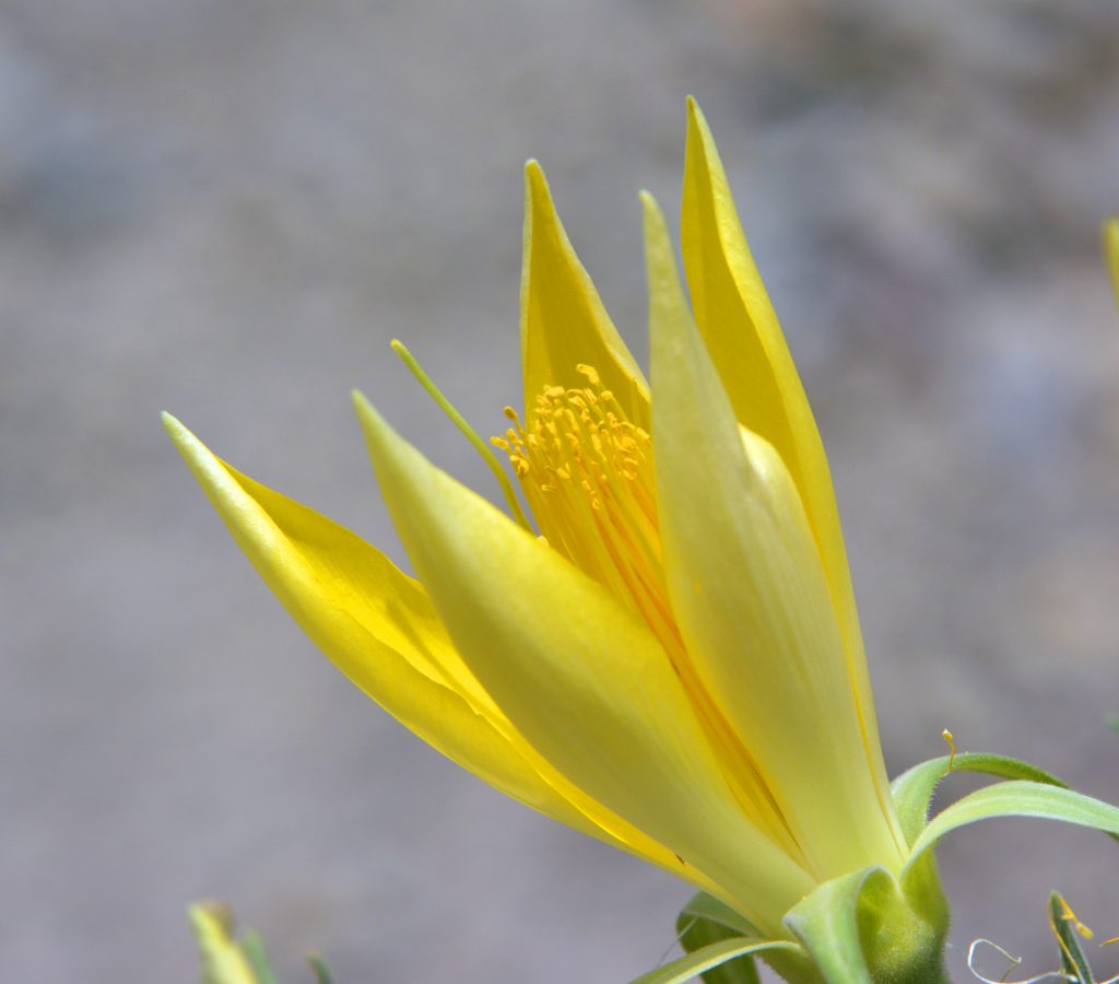
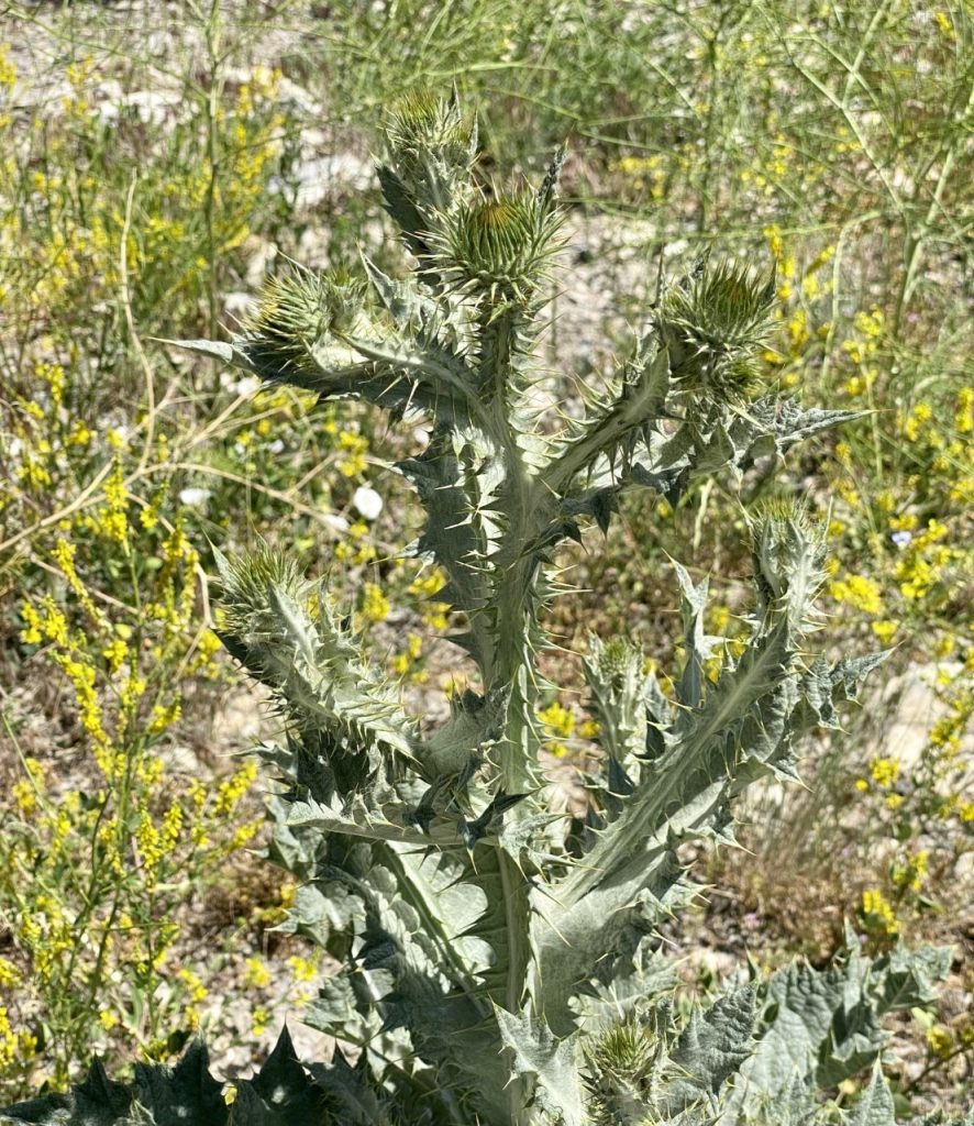
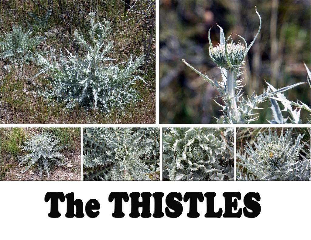
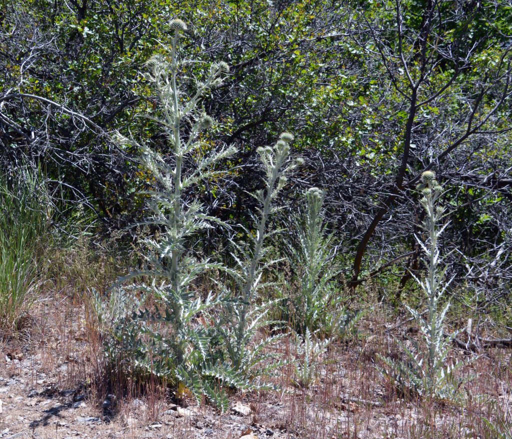
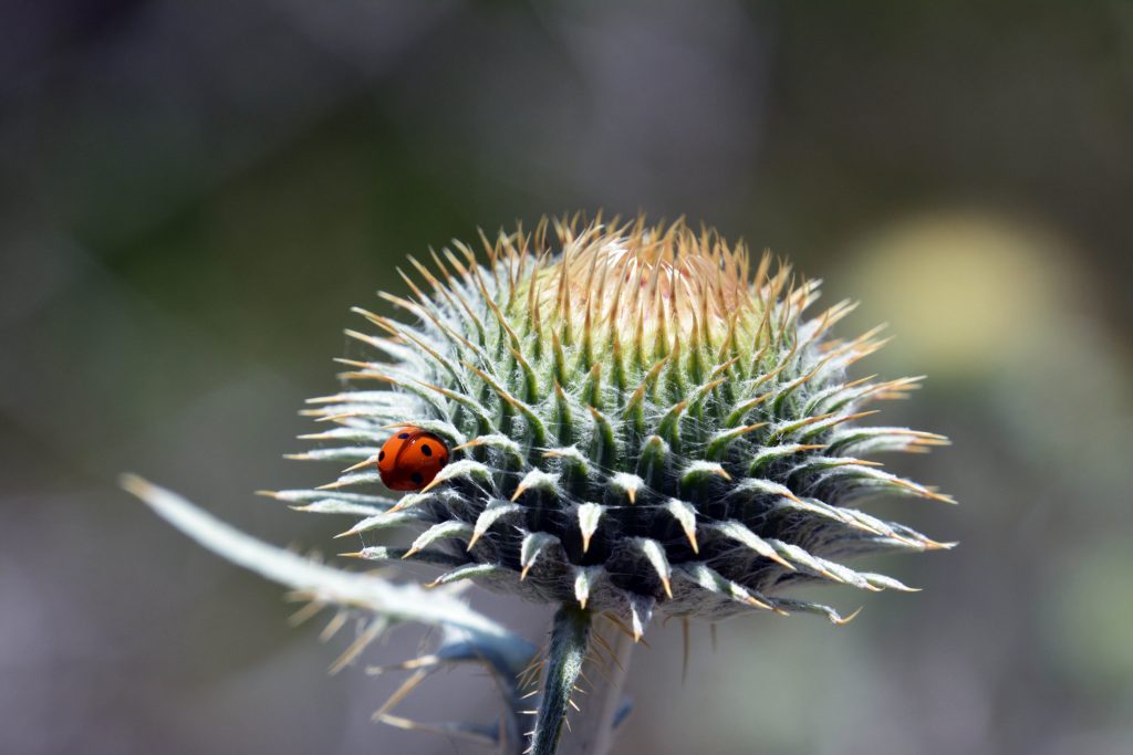
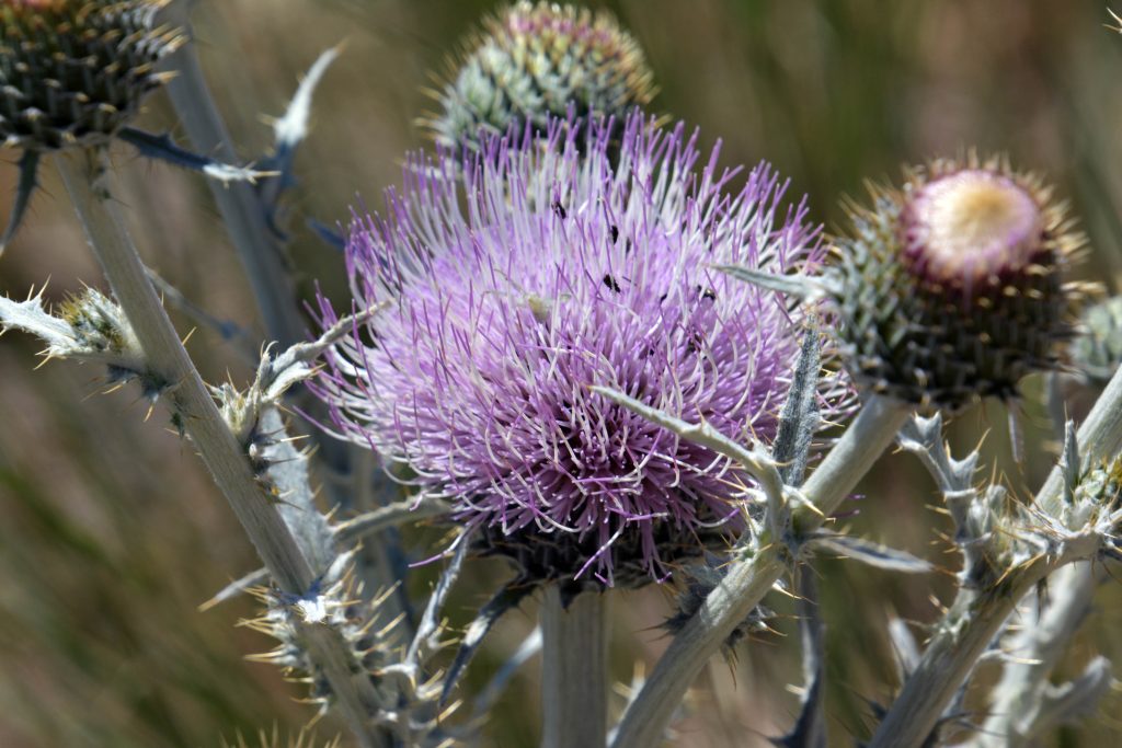
There are a number of varieties of THISTLES in Utah, all pretty ominous with their prickly thistles.
This is one of the common ones.
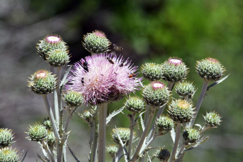
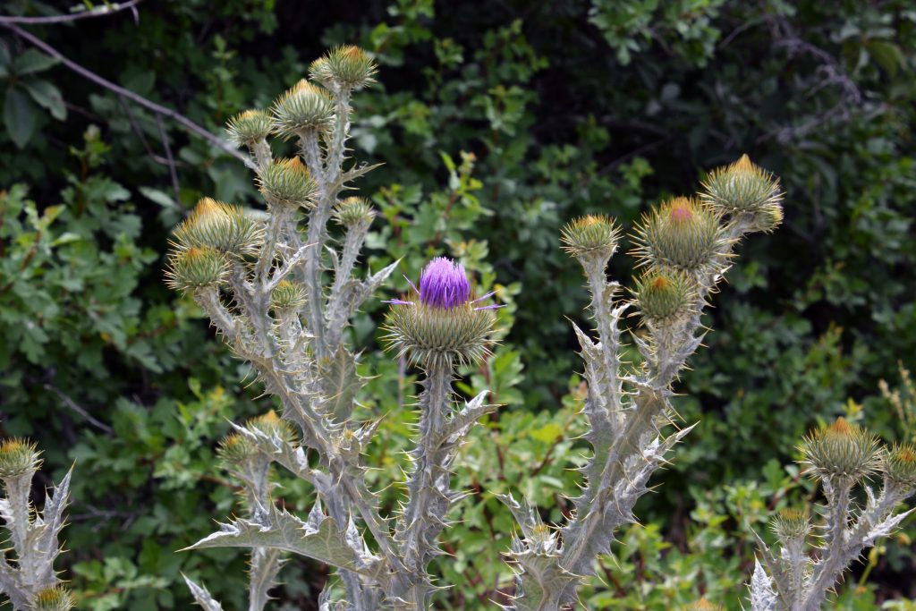
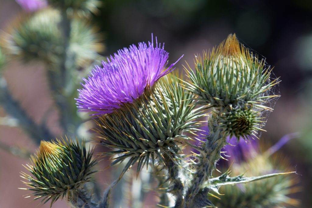
This one a larger variety, that is especially beautiful with its purple flower.
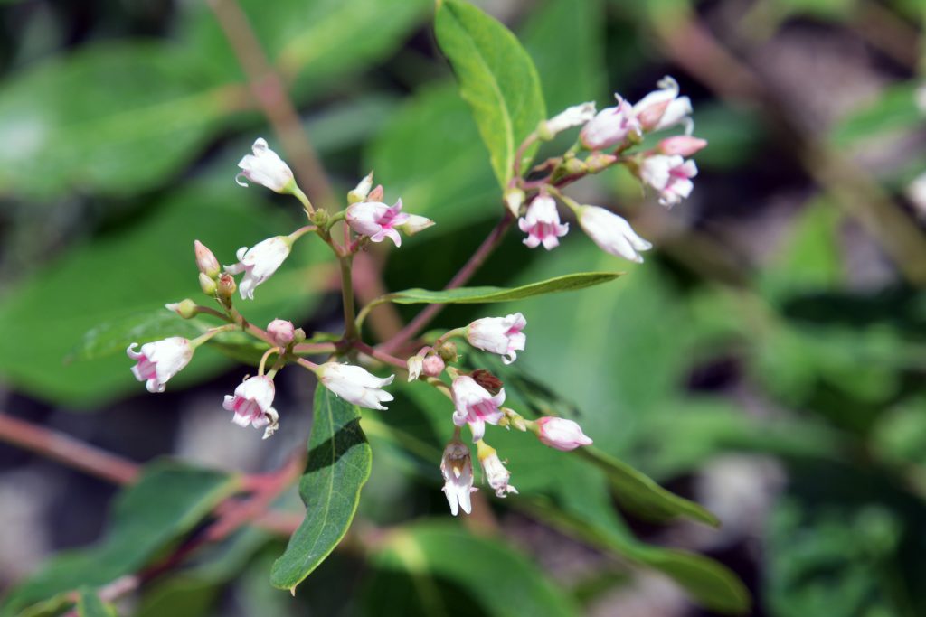
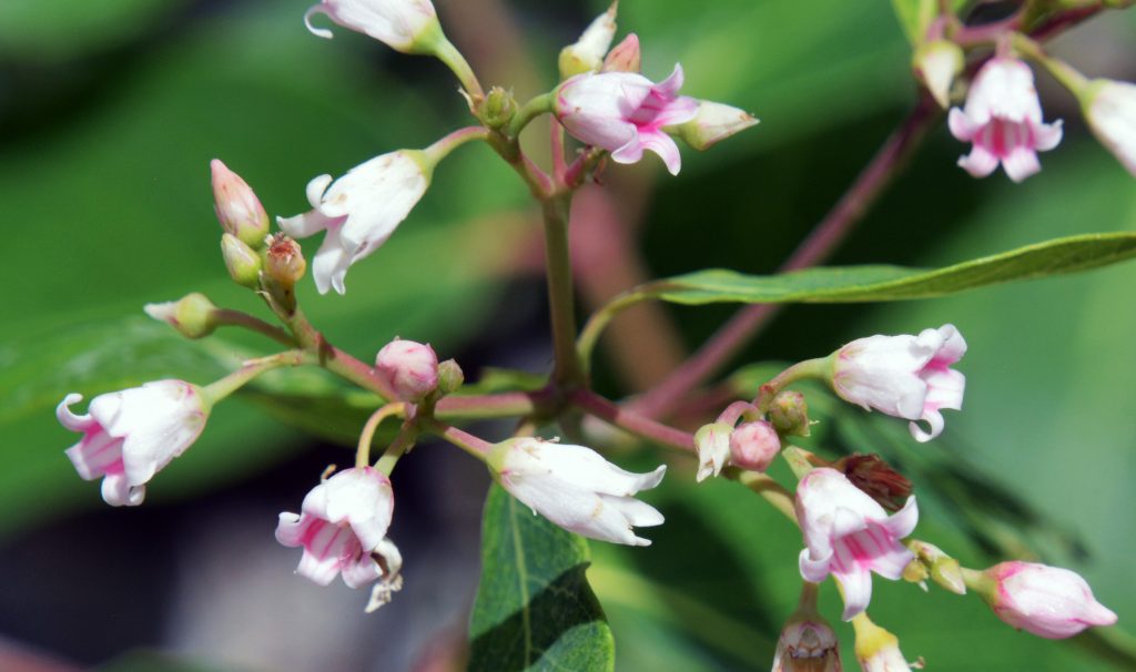
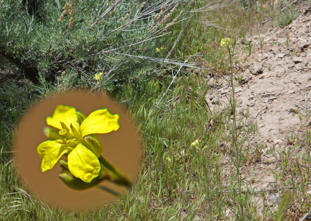
Here we come to a new plant that is blossoming with its very tiny yellow/white flower.
We have zoomed in on the flower about 1/8th inch in diameter. You can now see its wonderful beauty.
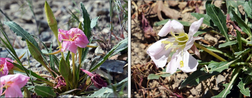
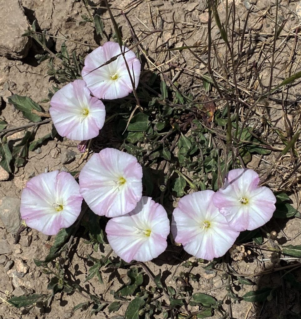
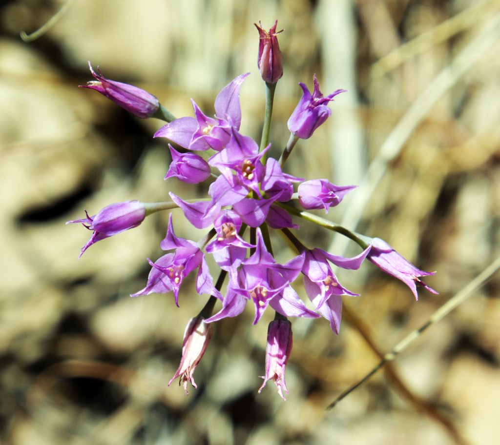
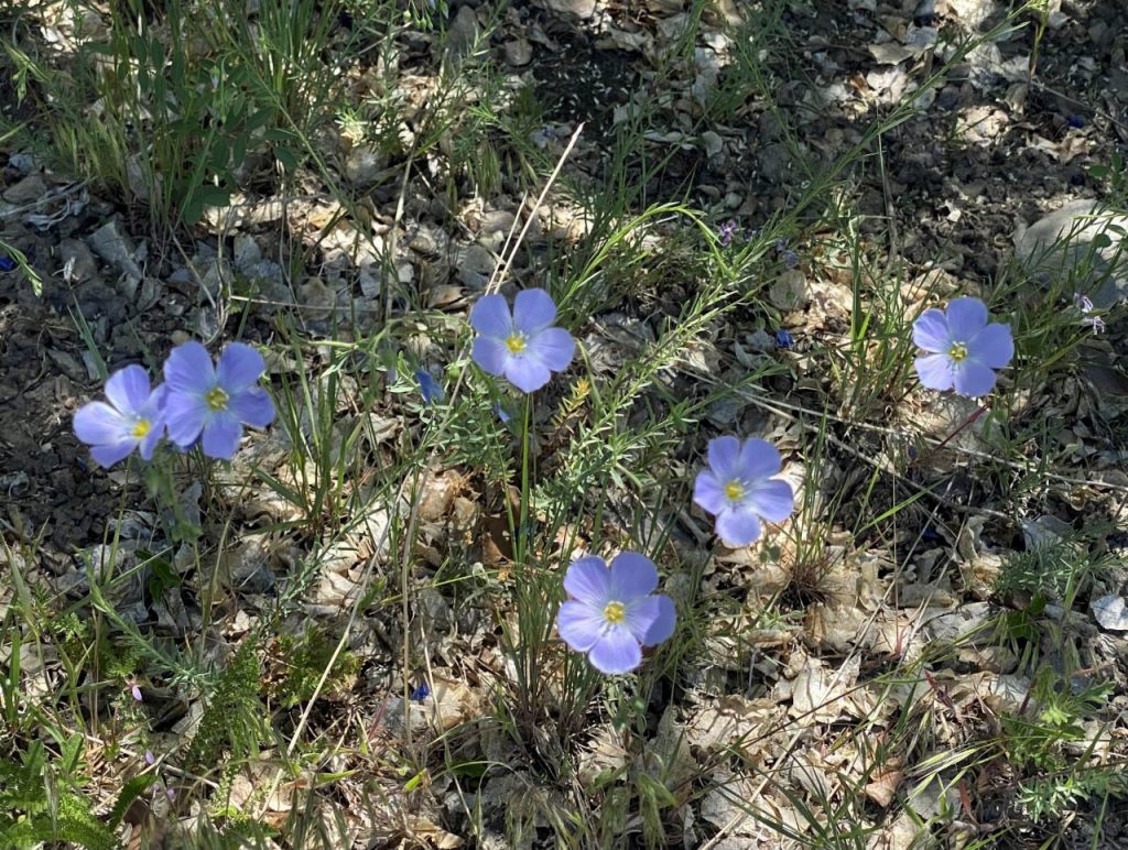
Do you remember the beautiful Western Blue Flax?
Here is the flower that has developed into its seed producing phase.
This is another plant we started noticing early on, and then got back to it a month or so later….
… when it blossomed.
From blossoming, it entered the next stage producing seeds for propagation of another season. Isn’t nature incredible…..the wonderment of the Lord’s creations!
It’s been awfully dry lately, having us in a true desert environment, but nature hasn’t ended its beautiful array of color and magnificence.
See what I mean?
This little friend, along with us, is keeping a close eye on nature to make sure he isn’t bushwhacked from up above, or from below by other creatures.
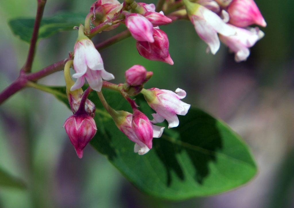
Another plant has developed for us and has to perhaps be one of the very tinyest of powder blue flowers, we’ll zoom in on…..
Maybe it’s more a light purple in color.
This one surprised me, so I’m not sure what it developed from…..
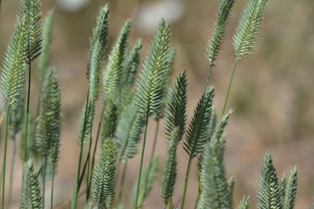
.…..and always with one of the many varieties of grasses, also with it’s surprising fascination.
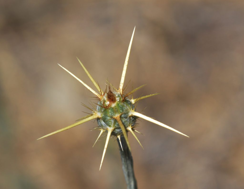
I’m not sure what this one was…..
…but can see it is pretty sharp…..
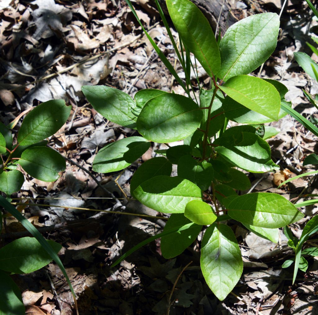
This one, with its beautiful green leaves impressed me and was photographed early on, and has now developed and shows us its tiny, but very beautiful flower in the following pictures….
To appreciate its beauty you have to zoom way in……..
……..and look inside to see the wonderful colors.
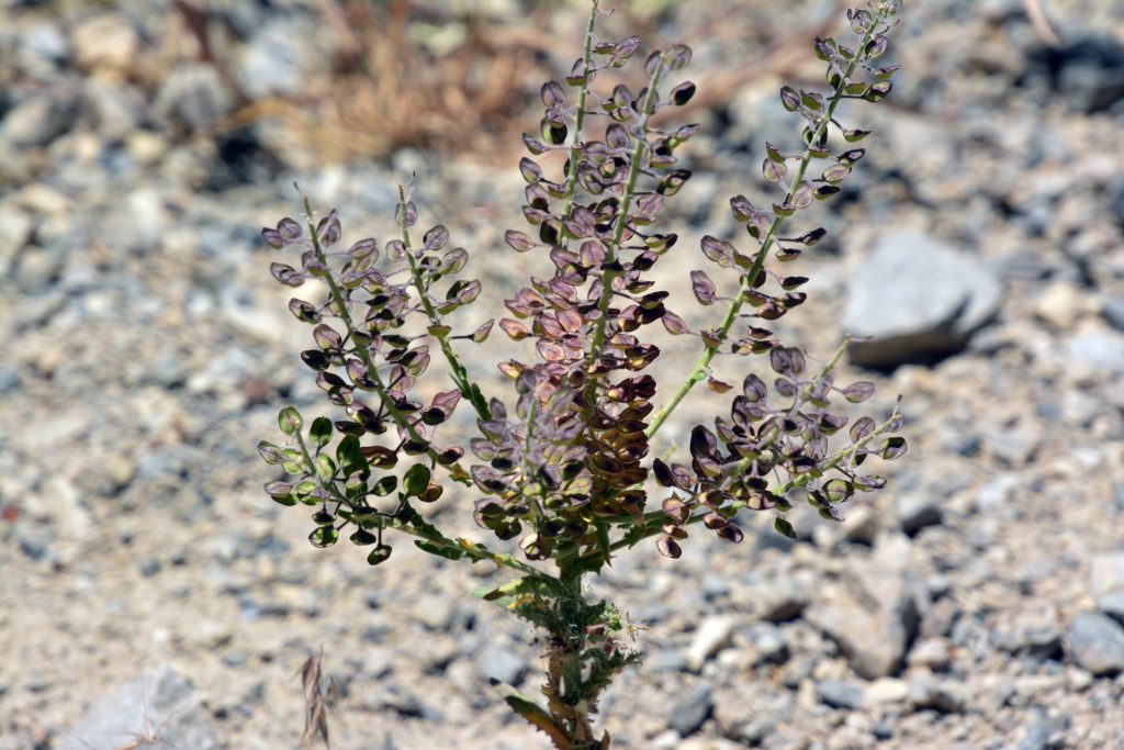
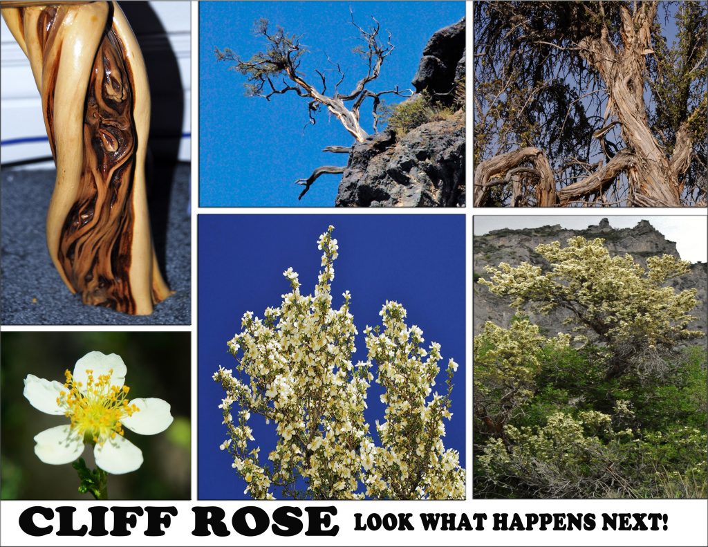
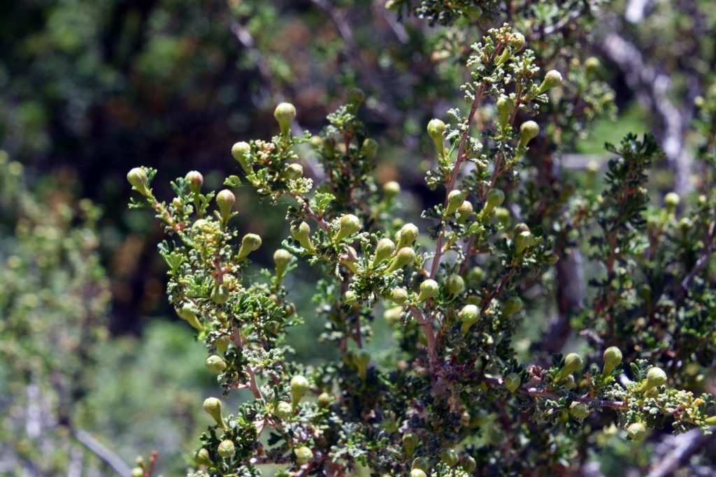
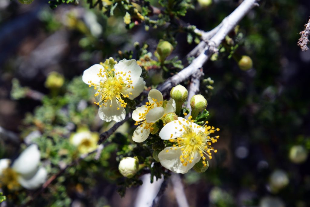
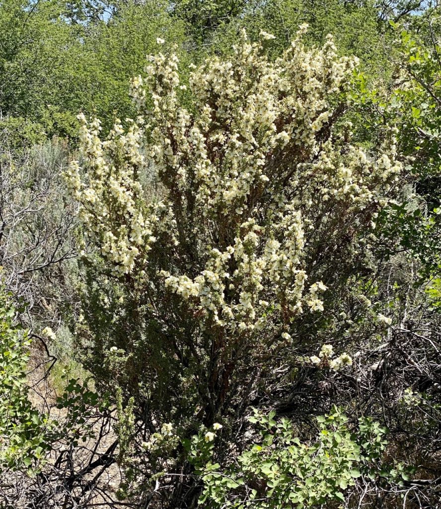
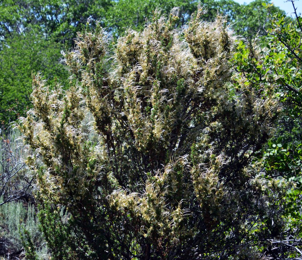
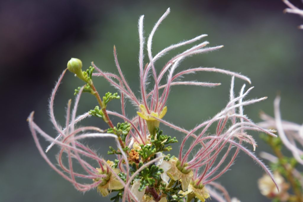
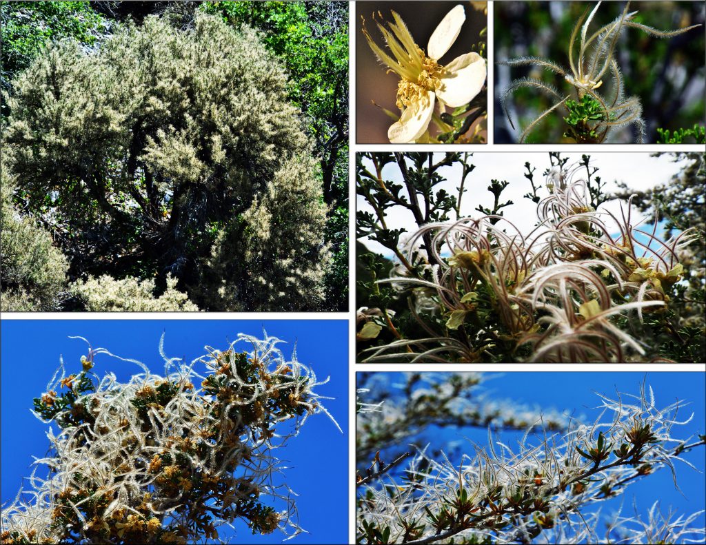
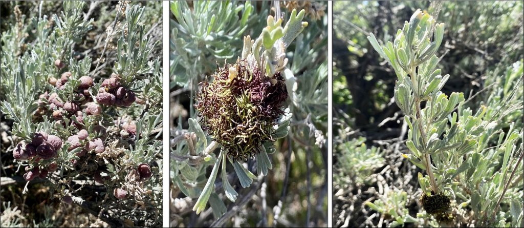
……and we can’t forget the development of CLIFF ROSE, from it’s beautiful flower, and it’s development……
With this one, we see all three of its stages…..
I had seen way up high a deer trail that angled across a very steep, rocky slope and decided to try it to get up to the top. Normal people could have managed it alright, but it got real dicey for me. It doesn’t look so bad in the picture, but it was much worse than it looks, and, coupled with me being pretty tired—–you know, when your leg muscles begin to tremble with every step up….or step down. With my trekking poles I have to continually lean into them, as a fall backwards could be more than dangerous, and I have always advised people on a steep slope you have to lean into the mountain, so that if you fall you fall into the mountain, rather than toppling down the steep slope–which for me and my misaligned spine, would be almost sure DEATH! Such a violent fall could easily shift the vertebrae’s and even cut the spinal chord producing death, or at best paralysis!
Several times in stepping up, my terrible balance problem had me teetering, not sure whether I would go forward, or fall backwards, and it scared the heck out of me–or SCARED SOME SENSE INTO MY THICK SKULL. IT WAS GETTING TOO DANGEROUS FOR ME TO CONTINUE, and so I carefully moved down the mountain. Moving down had at times my right leg–which had died and lost all of its muscle, but with a lot of work I got it working again, although still far from being as strong as my left leg, but being trembling tired, it at times gave me the impression it could give in and collapse, as happened early on causing my devastating falls that hurt me real bad.
AGAIN CAUTION WAS A MATTER OF LIFE & DEATH, and waiting for my BACKPACK TO THE GRANDADDIES became a priority–maybe until after a summer of getting stronger, and hopefully being able to see the GRANDADDIES ONE MORE TIME in late August after the mosquitoes are gone….and if I make that, SET NEW AMBITIOUS GOALS,all helping me persist with life while doing my darndest to accomplish more of something of importance, as I have tried to do all my life….SEE MY TWO BOOKS TO SEE WHAT I MEAN.
The overall experience had me BEING WISE, rather than STUPID, and making the decision I wasn’t quite ready for a 3 day backpack to the GRANDADDIES….YET!
It had me recalling how a year ago with my WALKER I had lengthened out my hikes to actually doing the Half-marathon distance of 13.2 miles all the way from American Fork to Alpine and back.
The night before I DREAMED I HAD FINALLY BEAT THE KENYANS IN THE COBAN INTERNATIONAL HALF-MARATHON…..USING MY WALKER!
MY DREAMS came into focus and I recalled another similar experience I write about in my MAYA BOOK HISTORY, which I’ll insert here for your enjoyment….it dealt with the lake I created on my plantation in Guatemala you see in this picture.
THE STORY:
Eventually we built our swimming area, seen here , and throughout all my years at Valparaiso I tried to keep up my record of always bathing daily in our lake, even once starting an ESKIMO CLUB that to be a member one had to make a dive daily into the lake even when the temperature dropped to freezing—4 times in 35 years!
I eventually installed electric lights in our “balneario” so when I had to bath at night I’d flip the switch and…..
.….take my dip in the dark of night—ALL LIT UP! “Once when bathing late at night, waist deep in the water, I was ambushed by two guys with guns, but I was ready for them with my 9mm pistol underneath my towel, got the drop on them and they resisted so I had no choice but to shoot them. I then calmly walked home dressed quickly, got my pickup to load their bodies, and drove over past Tactic to a secluded spot and dumped their bodies—as I had been told by the Police and Army to do!” This was another of many adventures among the MAYA—
THIS ONE IN MY DREAMS!
—one of many such warnings given me that had me usually prepared to avoid such deadly encounters.
We’ll for NOW AT LEAST, this picture of megetting to the GRANDADDIES, will also have to BE IN MY DREAMS!
Although, don’t count me out for late August when the mosquitoes are gone!
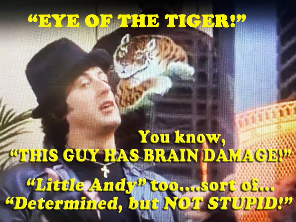
To pump up for a CHALLENGE like “Getting to the Grandaddies” I watch a couple of the ROCKY movies, and will take the advise of Creed to get back “THE EYE OF THE TIGER!” Yes, as with Rocky, it was said he had “BRAIN DAMAGE” for thinking about becoming the Champion, and it could also be said about me that I have“brain damage”to be thinking about BACKPACKING TO THE GRANDADDIES in my 87th year, but I do claim to be “DETERMINED, but NOT STUPID!”
So, you’ll have to keep tuned into see what happens!
**************************************
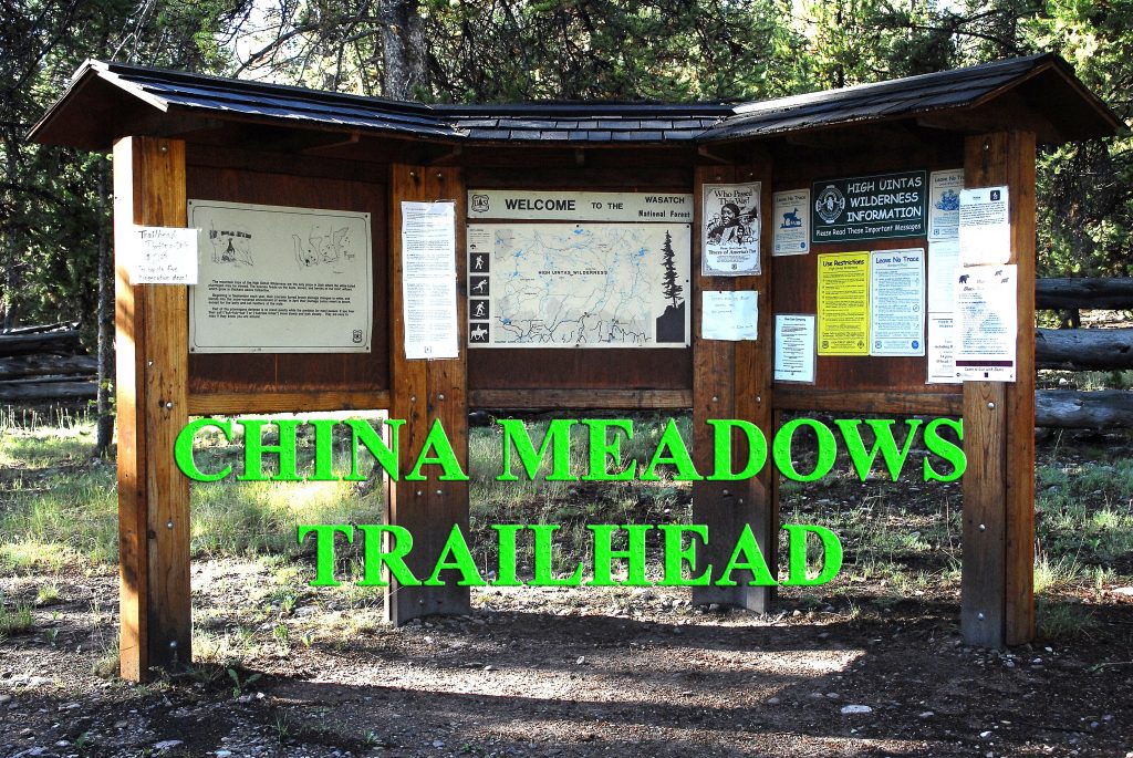
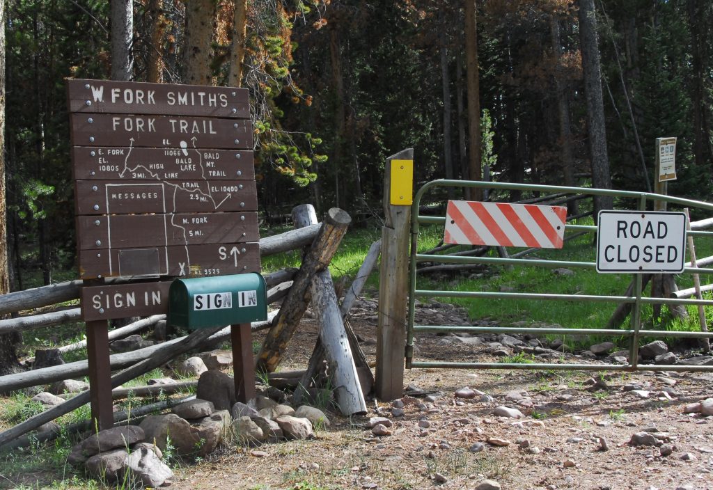
The last stop on the TOUR was at the West Fork of Smith’s Fork. From there we travel 6 miles further east to the Smith’s Fork, and the CHINA MEADOWS TRAILHEAD. We are 32 miles from the Mirror Lake Scenic Byway. GET MY BOOK FOR ALL THE DETAILS.
This is the usual jumping off point to head to the RED CASTLE AREA, even though you should recall that I have suggested a wonderful way to get there would be from the East Fork of Blacks Fork Trailhead, and go up above timberline to Bald Mountain and follow that trail to Red Castle. From China Meadows, it will be 14 miles to Red Castle. GET MY BOOK FOR ALL THE DETAILS, INCLUDING TOPOGRAPHICAL MAPS. For this TOUR I’ll use pictures from a backpack made in 2008 THAT WAS HISTORIC!
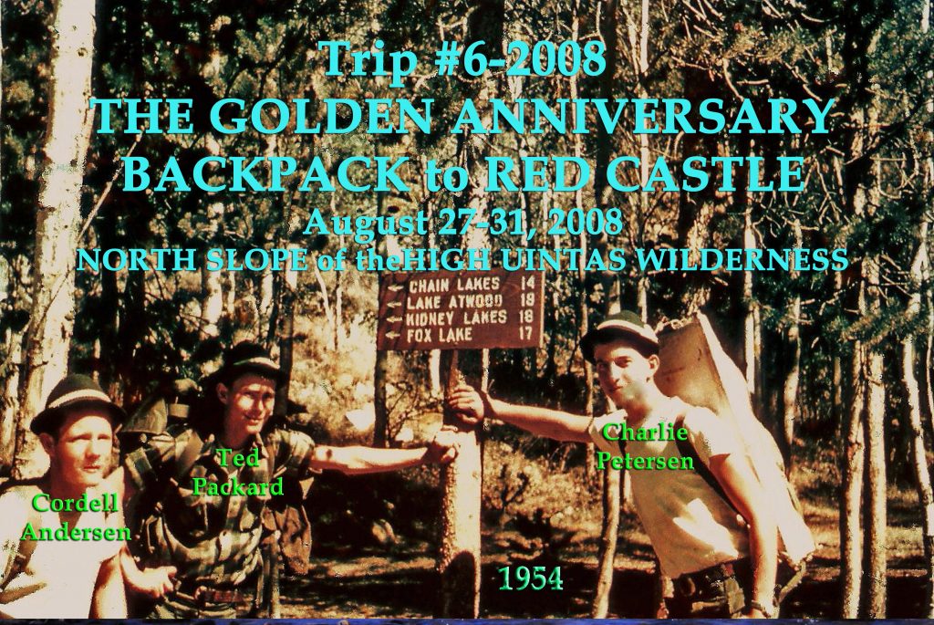
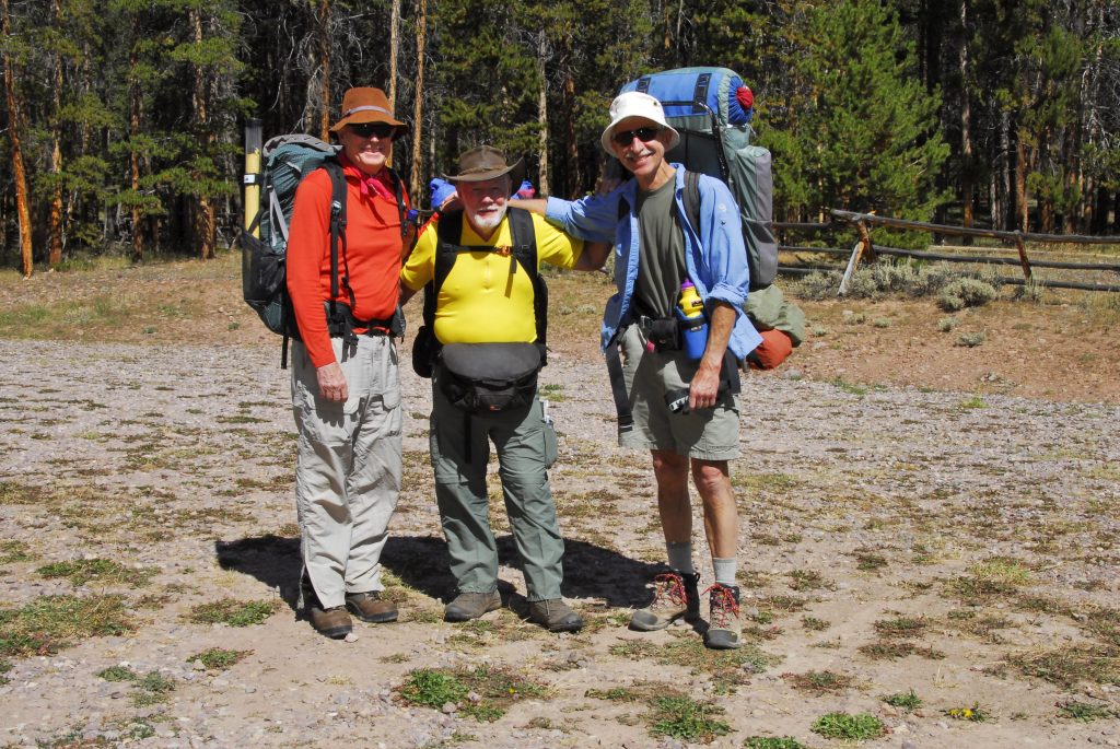
It involved the ORIGINAL THREE BACKPACK BUDDIES, who you see here Me, Ted Packard, and Charlie Petersen, the picture of us in 1954 at the end of a 14 day backpack crossing the entire Primitive Area.
Around 50 years later we went again together on what we called THE GOLDEN ANNIVERSARY BACKPACK to RED CASTLE. Here we are at the Trailhead.
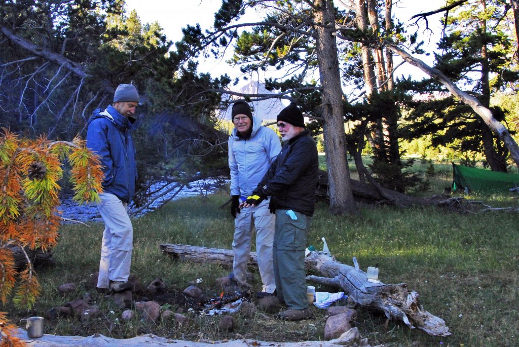
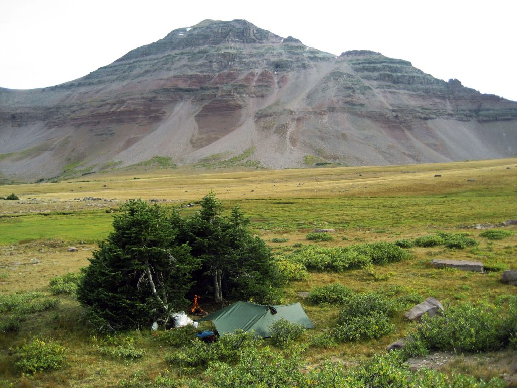
Here we are at our camp the first night.
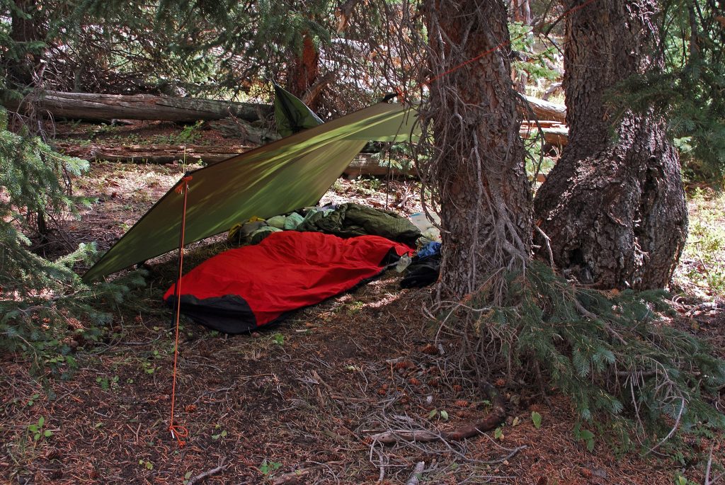
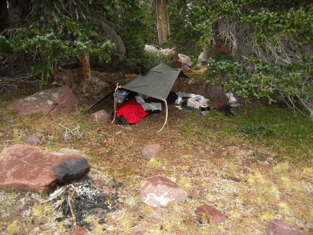
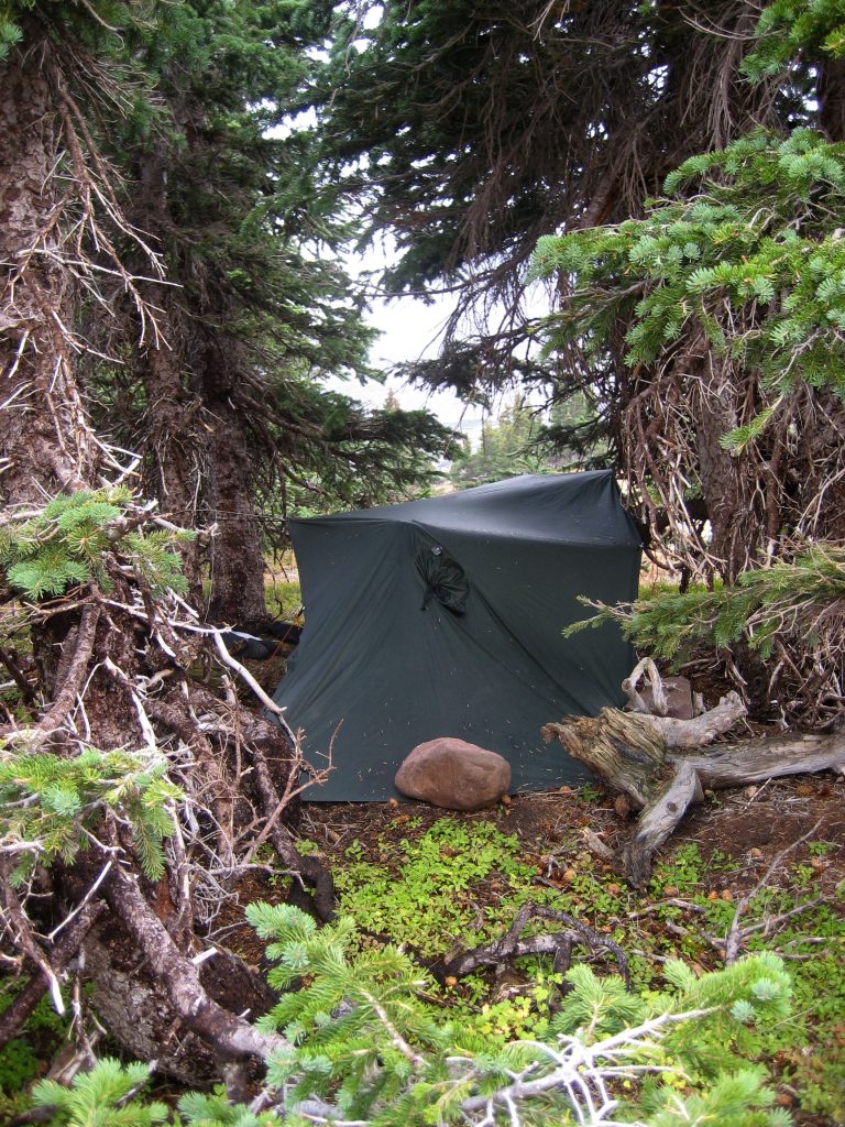
This was my “lightweight camp” not using a tent, rather my poncho as a lean-to, and sleeping quilt inside a bivouac bag. This is basically the system I will be using now in my 87th year to backpack again.
Red Castle Peak now comes into view.
Here I am early in my Wilderness Project, camping below Red Castle Peak. This picture was later printed in BACKPACKER MAGAZINE.
On our 2008 backpack, we are swinging around Red Castle Lake, to camp our first night at …….
….. EAST RED CASTLE LAKE.
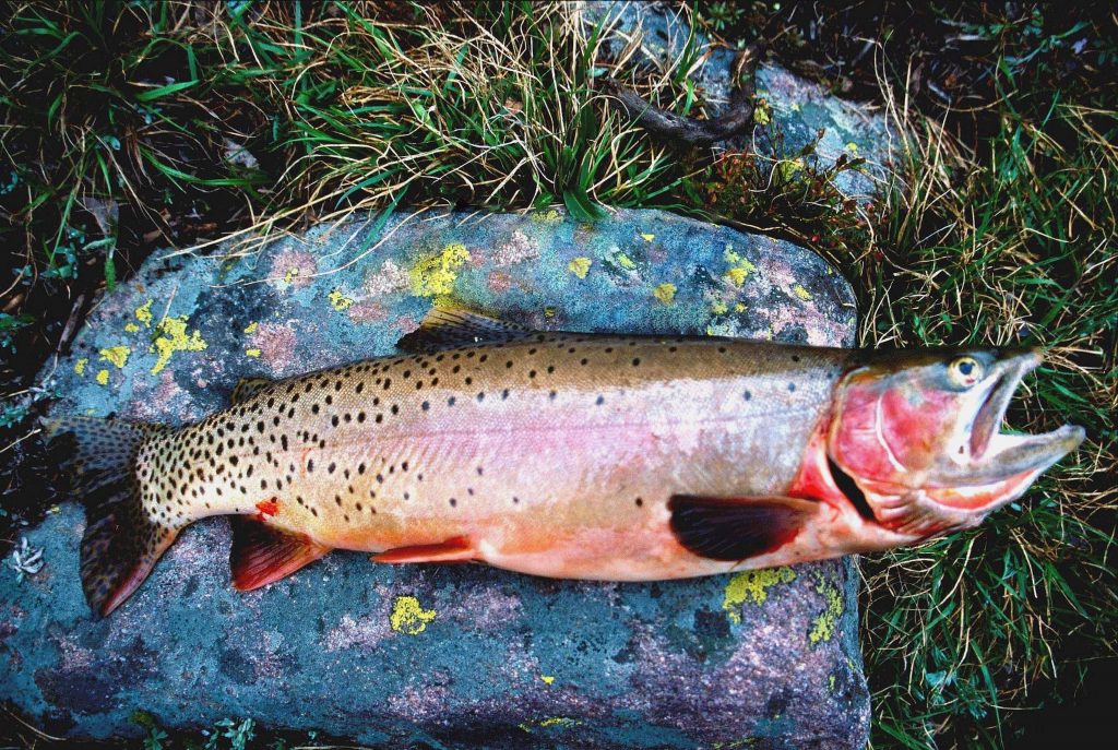
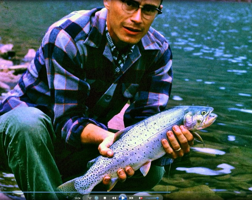
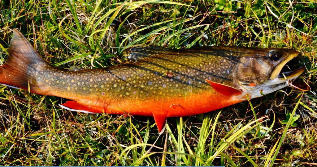
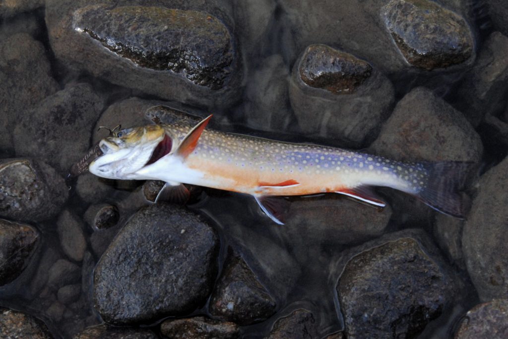
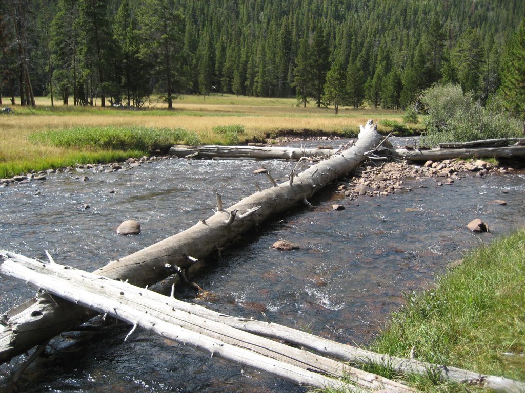
On that prior trip, probably in 2004, I had caught this very heavy bodied Native Cutthroat trout in East Red Castle Lake. The lake now also has Tiger trout.
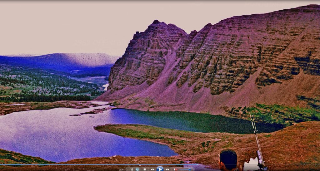
From East Red Castle Lake, we came down swinging around the peak, and climbed up to RED CASTLE LAKE found above timberline at 11,267 ft. elevation and have climbed up to near Upper Red Castle Lake to make my camp.
This is my favorite photograph of RED CASTLE LAKE & PEAK on the western side of the mountain, when on July 4th I found Upper Red Castle Lake still frozen over.
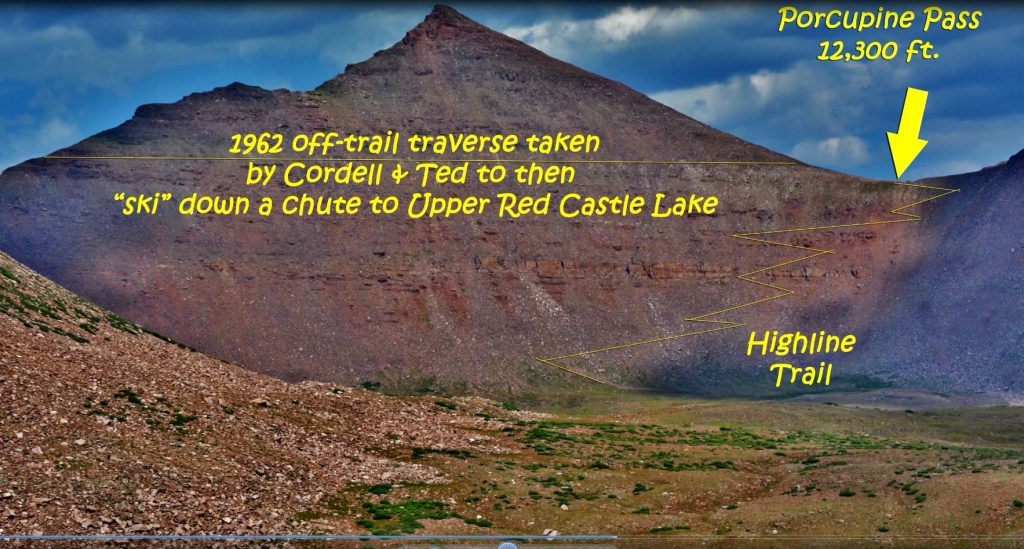
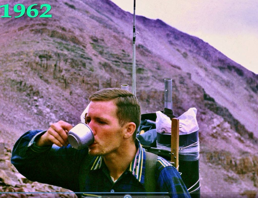
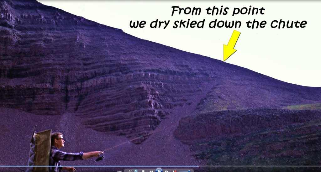
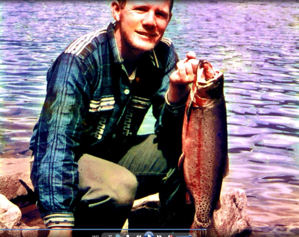
Here is Upper Red Castle Lake, at about 11,700 ft. elevation, where in 1962 Ted and I came over the mountain from Porcupine Pass, and dropped in on this high alpine lake and immediately began catching very large Native Cutthroat trout as I mentioned in a previous report.
To get an accurate weight we buried him in a snow drift to take him out uncleaned the next day. On returning to the snow bank all but the tail half had been eaten by some animal. Back home the lighter tail half weighed 3.5 lbs. so we calculated the live weight uncleaned would have exceeded 8 lbs.
RED CASTLE PEAK over Lower Red Castle Lake.
Another of the Peak and lake.
Ted took this picture at the end of our backpack of Charlie and myself. Charlie and Ted wrote the Forward for the High Uinta Mountains book.
I bid farewell to the High Uintas, until next week, with this beautiful scene put together for us by our kind Creator and Lord. Below you will find information about how to get the book, some are calling “THE ENCYCLOPEDIA OF THE HIGH UINTA MOUNTAINS.”
The 730 page digital book is a Guide for adventuring in the Uintas, but also with HISTORY, LEGENDS, the SURVIVAL STORIES OF THOSE WHO DIDN’T MAKE IT & WHY, plus my 8 SURVIVAL STORIES and WHY I’LL BACKPACK THIS SUMMER IN MY 87th YEAR, plus a detailed APPENDIX (among other things has the Anti-Aging Challenge writing), & 14 PAGE INDEX, AS WELL AS TOPOGRAPHICAL MAPS WITH ROUTES, DISTANCES & LABELS — get an online copy of this book, some have called THE ENCYCLOPEDIA OF THE UINTA MOUNTAINS,send me $20 (don’t be afraid of sending a $20 bill as we aren’t south of the border) along with your email address, and I will immediately email you the link to download the book with my permission to share once with a friend. Or, send $25 for a thumb drive that will have the book, plus The History of it’s creation as detailed in a speech I gave at the Utah Valley Historical Society; plus my CHECKERED HISTORY & VISION QUEST–0-22 years. Send to:
Cordell Andersen, 444 Elm St., American Fork, Utah 84003
**********************************
FOR INFORMATION ABOUT MY LIFE AMONG THE MAYA: Go to the GUATEMALAN FOUNDATION’S website with the final addition from the movie which REVEALS THE ANSWER TO the……
..MOST IMPORTANT PERPLEXING QUESTION IN MY ENTIRE 50 YEAR MAYA HISTORY::
Check out the VERY LAST VERSION of the BOOK with
THE “MODERN AMMON’S” LEGACY!
Download free theBOOKabout my life among the Mayans.
If BOURNE is what attracts your curiosity…and it should, it will best be understood after going through the history where you will find it in Section 29, page 464.
I spent a couple of days up around the Bald Mountain Pass in the High Uintas, but consistently had signs of High Altitude problems with low oxygen levels in my blood, as well as persistent High blood pressure, and terrible balance problemswhen encountering it difficult to hike across snow drifts on the trail..…so, for dumbly trying in my 87th year to actually do an overnight backpack, I’M STILL NOT STUPID, so backed off and will likely try again in a few days the…….
Looks like I haven’t worked hard enough, so will remedy that starting today–after FATHER’S DAY CELEBRATION, and do more for a few days and then…….do my darndest to COME FULL CIRCLE from my 1st BACKPACK TO THE GRANDADDIES in 1952–70 YEARS AGO described in the PREFACE to my BOOK, which you should all have to……
……GUIDE YOU ENJOYABLY & SAFELY IN YOUR OUTDOOR ADVENTURES:
NOTE: While testing myself, and hoping my vital signs would normalize, I read from the beginning my BOOK, and….even myself found it inspiring and encouraging to NEVER, NEVER, NEVER GIVE IN, NOR GIVE UP…..EASILY! I promise….YOU WON’T BE DISAPPOINTED!
The 730 page digital book is a Guide for adventuring in the Uintas, but also with HISTORY, LEGENDS, the SURVIVAL STORIES OF THOSE WHO DIDN’T MAKE IT & WHY, plus my 8 SURVIVAL STORIES and WHY I’LL BACKPACK THIS SUMMER IN MY 87th YEAR, plus a detailed APPENDIX (among other things has the Anti-Aging Challenge writing), & 14 PAGE INDEX, AS WELL AS TOPOGRAPHICAL MAPS WITH ROUTES, DISTANCES & LABELS — get an online copy of this book, some have called THE ENCYCLOPEDIA OF THE UINTA MOUNTAINS,send me $20 (don’t be afraid of sending a $20 bill as we aren’t south of the border) along with your email address, and I will immediately email you the link to download the book with my permission to share once with a friend. Or, send $25 for a thumb drive that will have the book, plus The History of it’s creation as detailed in a speech I gave at the Utah Valley Historical Society; plus my CHECKERED HISTORY & VISION QUEST–0-22 years. Send to:
Cordell Andersen, 444 Elm St., American Fork, Utah 84003
**********************************
FOR INFORMATION ABOUT MY LIFE AMONG THE MAYA: Go to the GUATEMALAN FOUNDATION’S website with the final addition from the movie which REVEALS THE ANSWER TO the……
..MOST IMPORTANT PERPLEXING QUESTION IN MY ENTIRE 50 YEAR MAYA HISTORY::
Check out the VERY LAST VERSION of the BOOK with
THE “MODERN AMMON’S” LEGACY!
Download free theBOOKabout my life among the Mayans.
If BOURNE is what attracts your curiosity…and it should, it will best be understood after going through the history where you will find it in Section 29, page 464.
I will drive up to the Bald Pass area on Wednesday, June15, check the oxygen level in my blood for High Altitude problems, more common for those more vulnerable, then sleep in my car, and if all looks good, will do the same small hike I wasn’t ready for last year–to FEHR LAKE, using ultra lightweight backpacking techniques (as I can’t put more than 5 lbs. on my back, rather the remainder in 3 waist packs) get to Fehr Lake and spend the night there, hopefully eating a brook trout or two. The next day return to the Trailhead and home to process the experience and report here and on Facebook, then the goal of THE GRANDADDIES–coming FULL CIRCLE, 70 YEARS AFTER MY INTRODUCTION TO THE GRANDADDIES when 16 in 1952!
****************************
FOR INFORMATION ABOUT MY LIFE AMONG THE MAYA: Go to the GUATEMALAN FOUNDATION’S website with the final addition from the movie which REVEALS THE ANSWER TO the……
..MOST IMPORTANT PERPLEXING QUESTION IN MY ENTIRE 50 YEAR MAYA HISTORY::
Check out the VERY LAST VERSION of theMAYA BOOKwith
THE “MODERN AMMON’S” LEGACY!
If BOURNE is what attracts your curiosity…and it should, it will best be understood after going through the history where you will find it in Section 29, page 464.
**************************
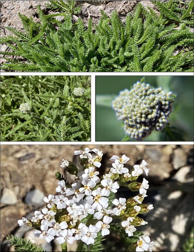
VISIONS OF NATURE…..FROM LAST WEEK:
FIRST, A COUPLE OF HIKES ALONG THE TIMPANOGOS FOOTHILLS & HIKES UP GROVE CANYON WITH TONS OF WONDERFUL
“VISIONS of NATURE”
JUST STICK THE BAG IN YOUR POCKET TO TAKE HOME….& HOPE IT DOESN’T LEAK!!!!
DO YOU REMEMBER THE ABOVE PICTURE FROM ONE OF MY FIRST HIKES UP GROVE CANYON? I SAID WE’D NOTE LATER WHAT WAS TO DEVELOP. So, below HERE IT IS.
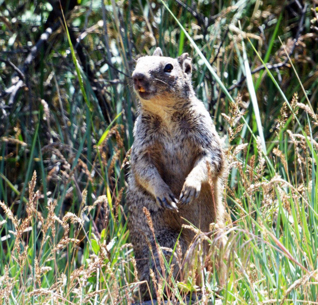
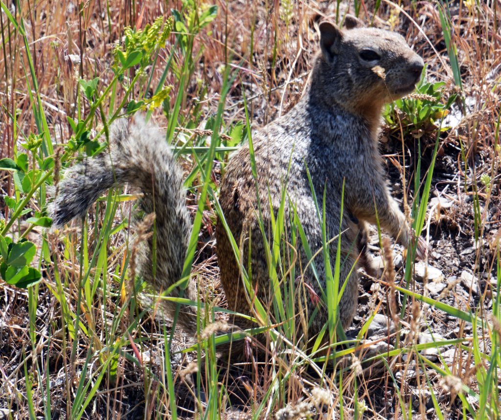
MORE WONDERS OF NATURE & SIGNS SUMMER IS HERE….WITH A ROCK SQUIRREL OUT OF HIBERNATION.
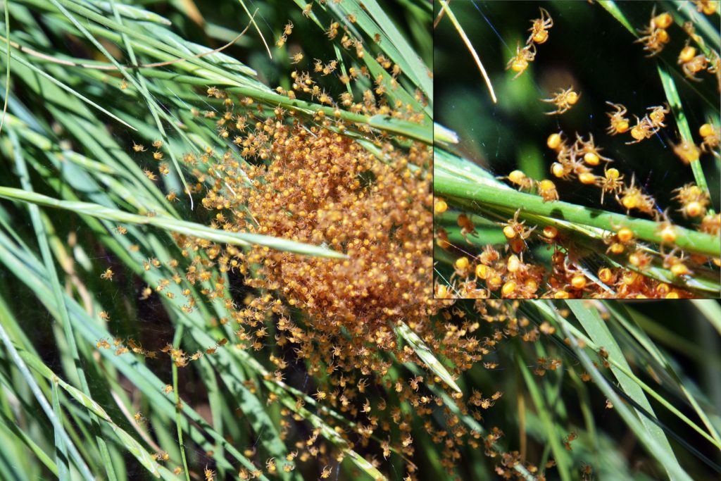
NATURE AT WORK WITH MORE SPIDERS IN ONE SCENE THAN WE’VE PROBABLY EVERY SEEN BEFORE.
BELOW, WE SEE HOW IT WILL DEVELOP AS THE SUMMER PROGRESSES.
LOOKING UP AT THE CLIFFS ABOVE US WE REMEMBER
“CLIFF ROSE,”
THAT I TOLD YOU WOULD HAVE A SPECTACULAR DEVELOPMENT AS SEEN IN THE PANELS BELOW.
NOW WE COME TO ANOTHER FOOTHILLS PLANT WITH ITS MAGNIFICENT DEVELOPMENT OVER THE SUMMER…..IT IS:
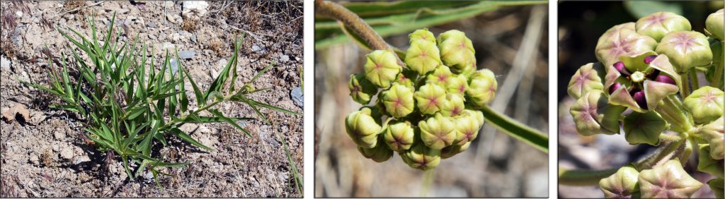
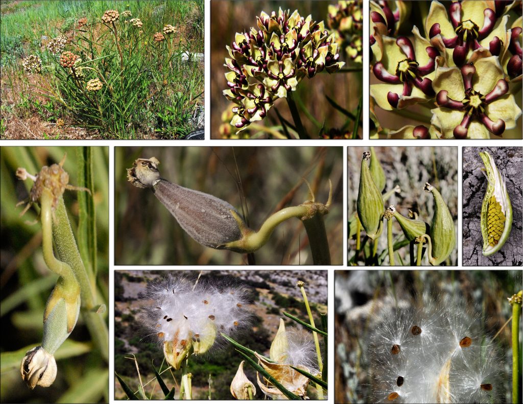
SPIDER MILKWEED
AND NOW BLOSSOMING
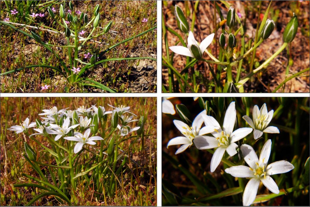
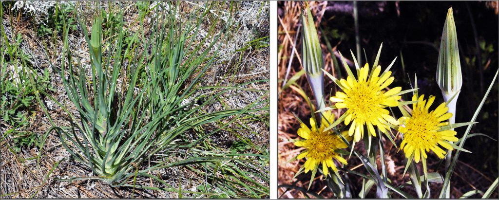
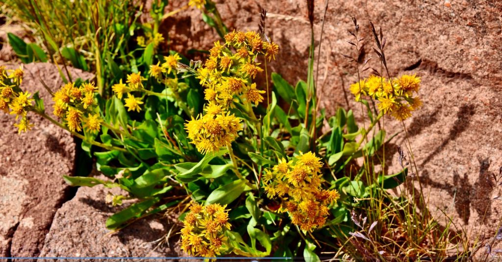
MEADOW SALSIFY
AND, FOR ME ONE OF THE MOST BEAUTIFUL OF OUR FOOTHILL WILDFLOWERS…..
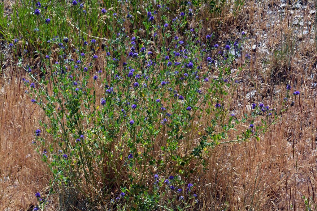
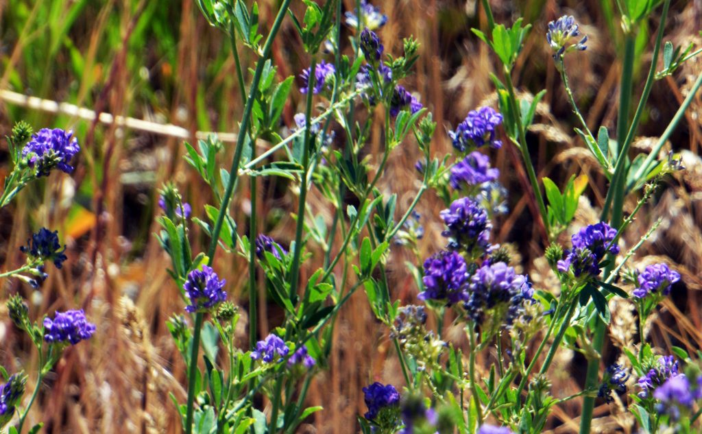
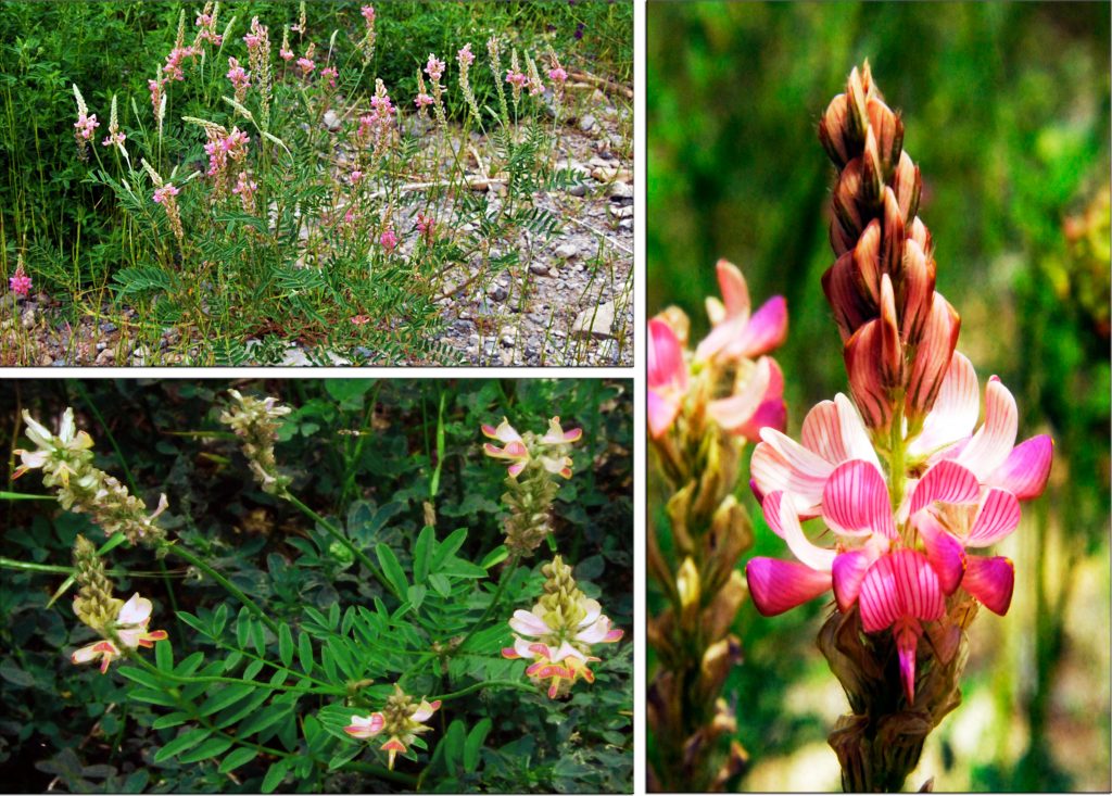
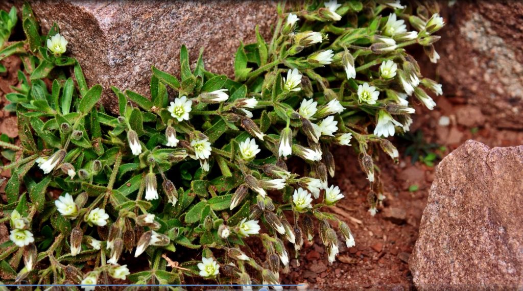
STEPPE SWEETPEA
********************************
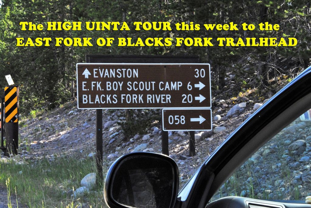
NOW TO OUR HIGH UINTA WILDERNESS TOUR on THE NORTH SLOPE
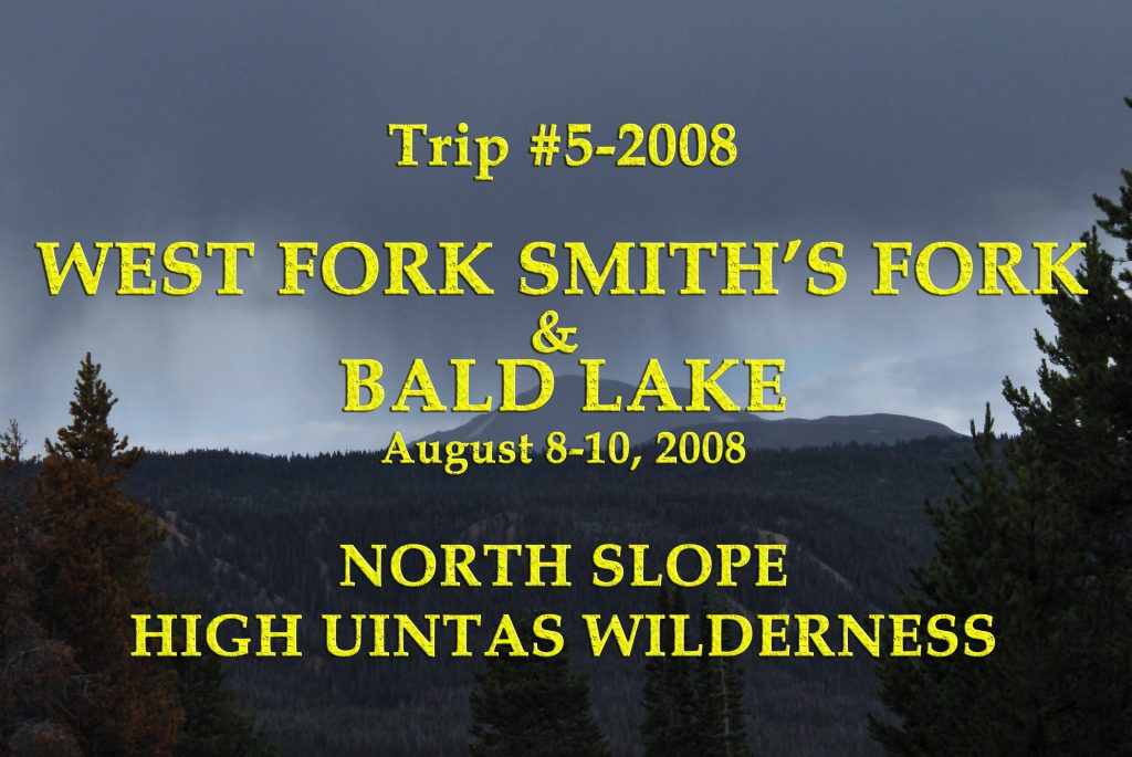
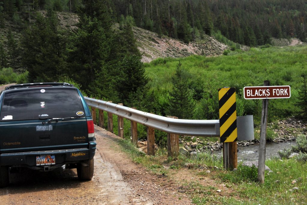
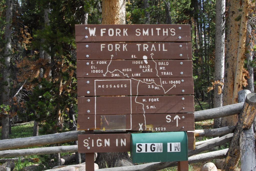
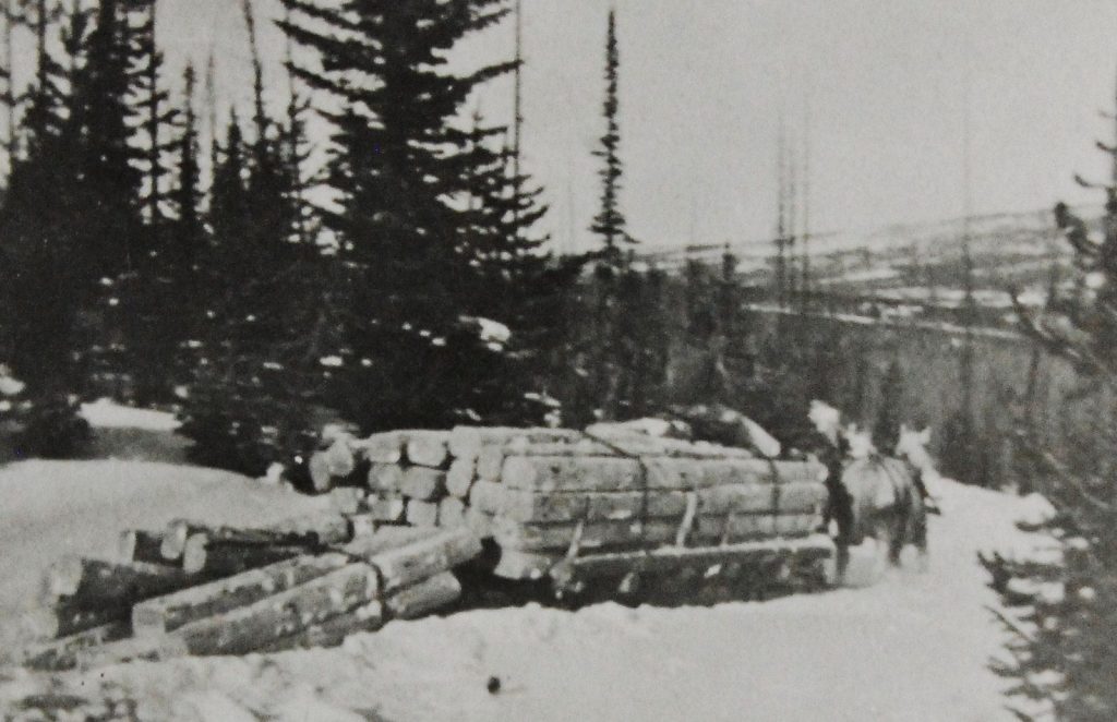
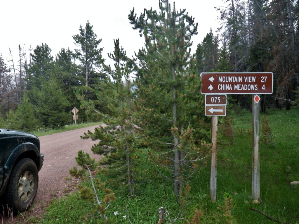
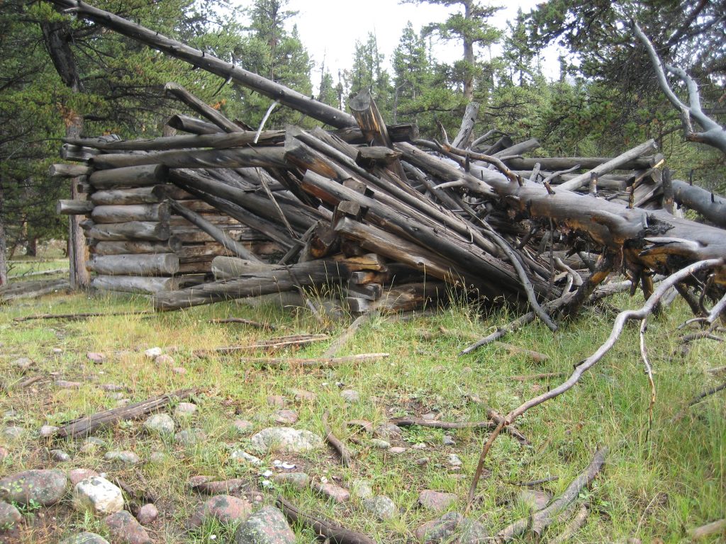
Last time we had got to the East Fork of Blacks Fork Trailhead with wonderful options for some of the best outdoor experience you will ever have. Now ON TO THE WEST FORK OF SMITHS FORK, along with some of the best TIE HACKER SITES IN THE WORLD!
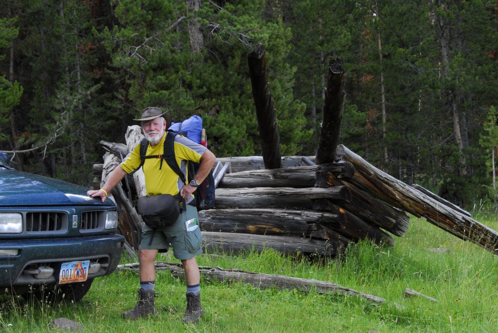
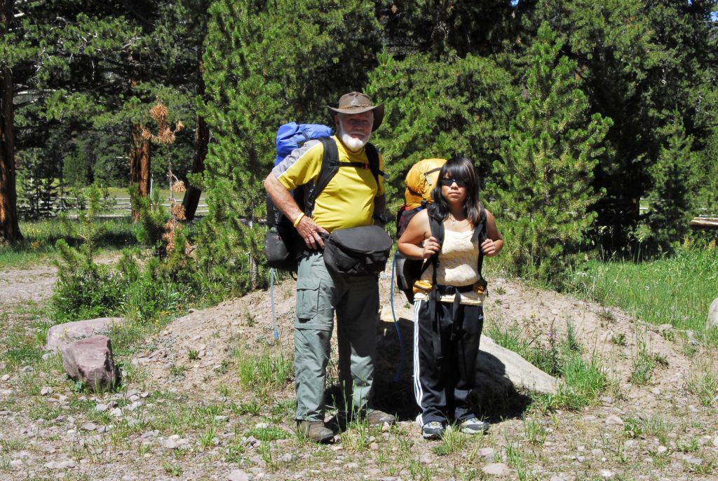
I’M READY TO GO….CAN’T CARRY ANYTHING SIGNIFICANT ON MY BACK….so have on my back only a tiny pack with poncho (also used as my shelter), air mattress, rain parka & fishing equipment — weighing 5 lbs. THEN TWO WAIST PACKS IN FRONT with Nikon camera & accesories, and in the other crucial survival stuff. AND BEHIND MY LUMBAR WAIST PACK with sleeping quilt, and other equipment. TOTAL WEIGHT FOR A SEVERAL DAY BACKPACK=about 20 lbs. (1/4th of that my Nikon camera and lenses).
As I was heading for what I call “JEDEDIAH SMITH COUNTRY” this scene in Heber bid me a LUCKY FAREWELL!
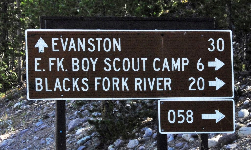
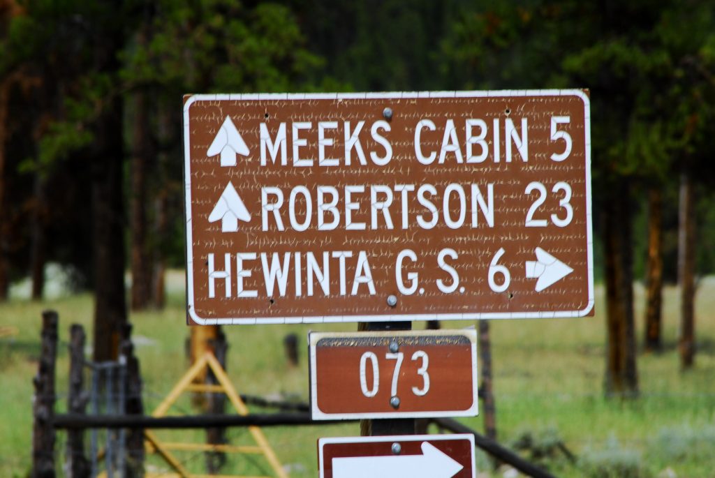
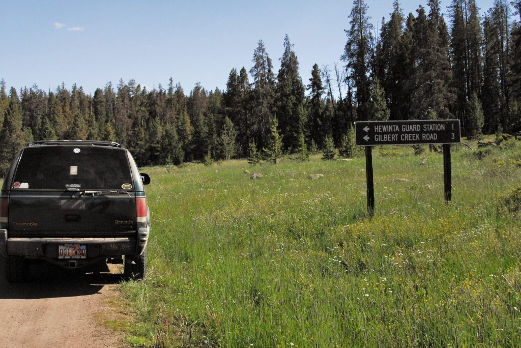
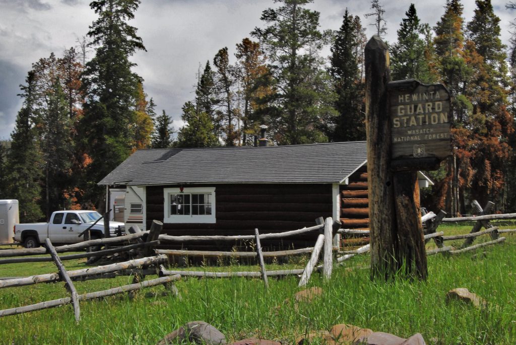
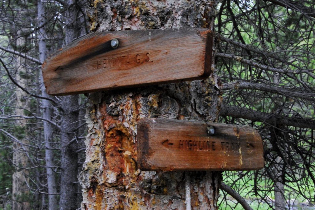
For details, get THE BOOK, but we head for Kamas, and then up the Mirror Lake Scenic Byway, then down to the North Slope Road and east to the Blacks Fork River. At the junction to the East Fork of Blacks Trailhead, turn north. In a mile or so you come to this sign pointing east to the Hewinta Guard Station.
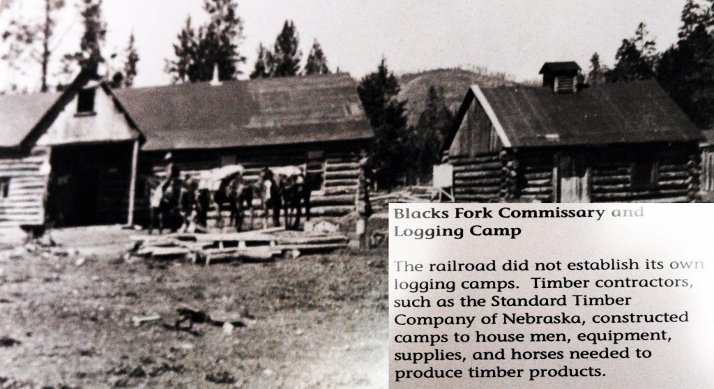
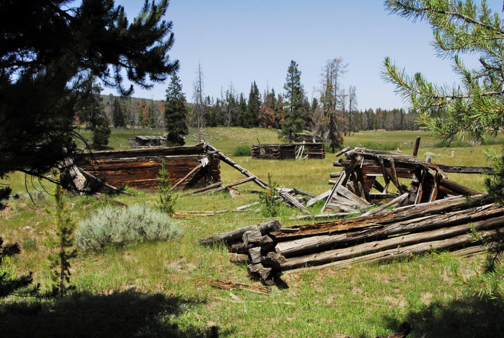
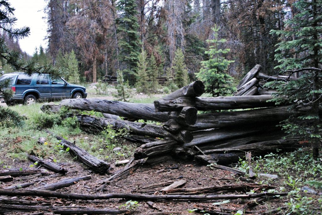
But I suggest you take a little detour keeping on the main road for a mile or so, and visit the OLD BLACKS FORK COMMISSARY GHOST TOWN–of course of the TIE HACKERS! See my book for details.
Then return to the Hewinta Road and turn east crossing the river. The road ahead is narrow, with a few rough spots, but not bad. Just be careful of logging trucks.
If you keep a sharp eye out, you will notice in this 6 mile stretch several tie hacker ruins. Check them out and see if you can date them: OLD PERIOD FROM 1867-1880, or NEW PERIOD FROM 1910 – 1935?
At this point and sign there is a road that heads north. In a couple of miles you will come to the Wyoming border, and at that point on the left is:
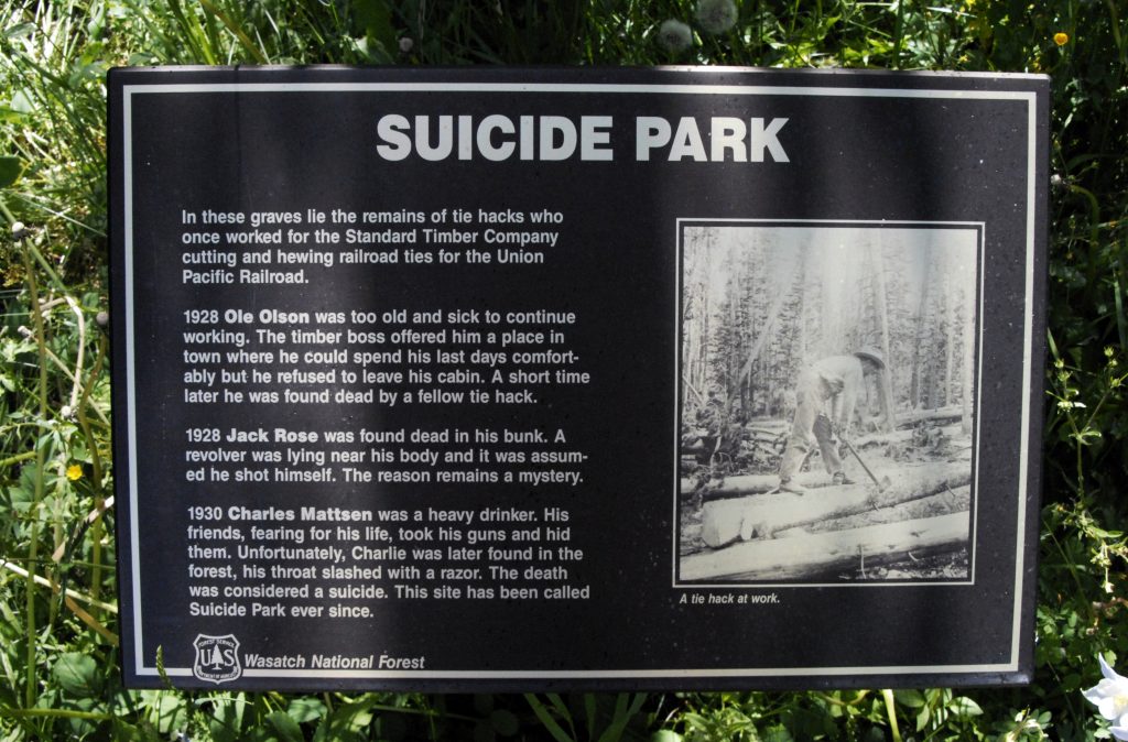
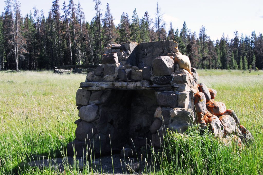
As Tie Hackers got too old to make railroad ties, or became obsolete due to mechanization, some of them , most of whom didn’t have families to help them, couldn’t take it and this tiny memorial is to them, with 3 marble plaques–which you’ll have to move aside the vegetation to see–Commemorating our “unsung hero’s” lives.
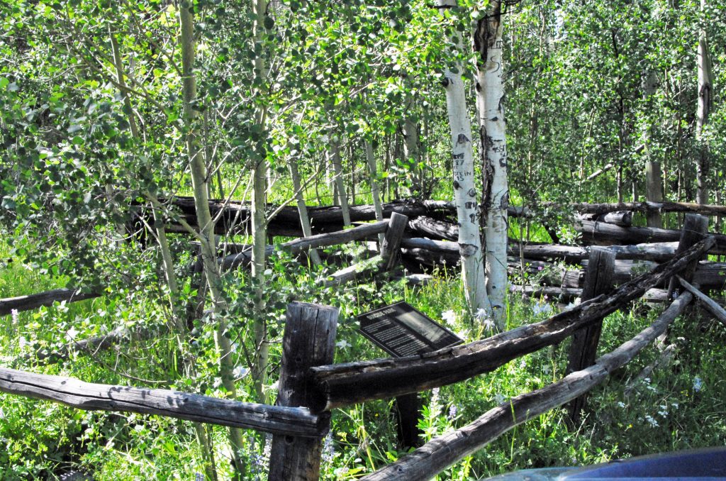
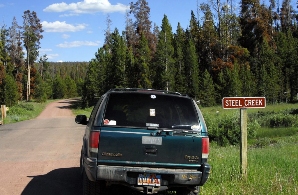
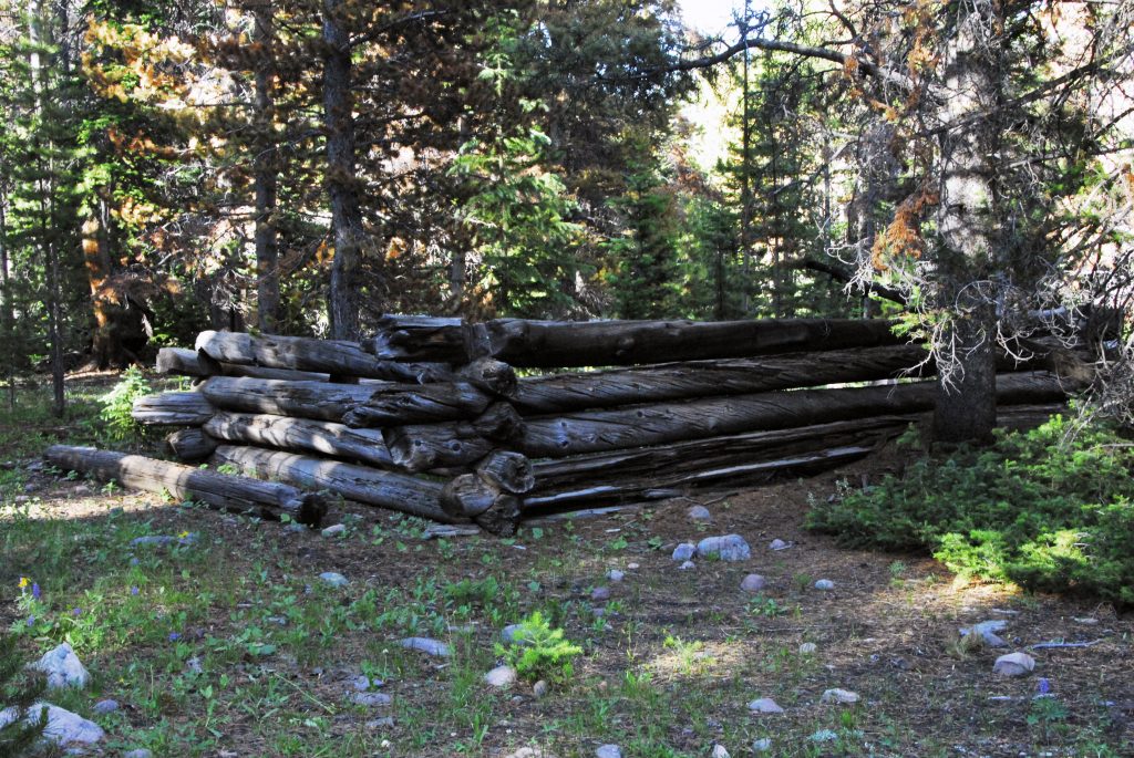
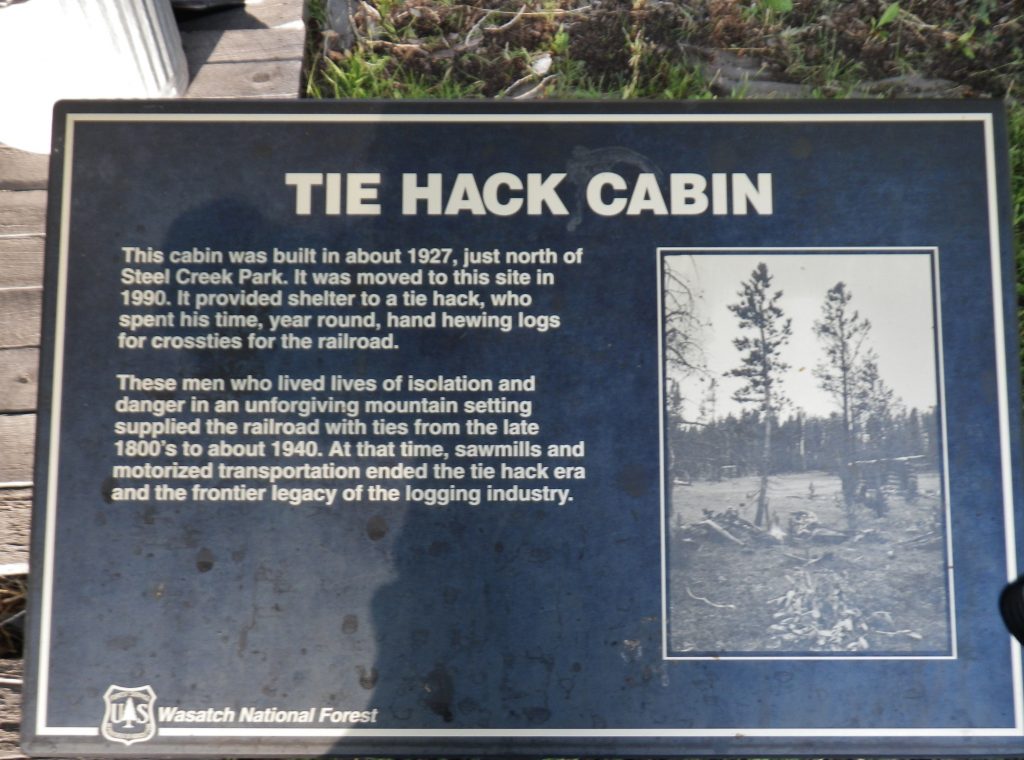
Back at the North Slope Road, just a bit past the junction is this sign to the creek. Up stream is the Tie Hacker site, called The Steel Creek Commissary, where two cabins were dismantled, one of them reconstructed behind the Bear River Forest Serviceoffice, and another at the Forest Service office in Mt. View, Wyoming. To get to the archaeological site, continue a little further to the road to the Hewinta Guard Station, and a short distance you come to a road turning towards the site.
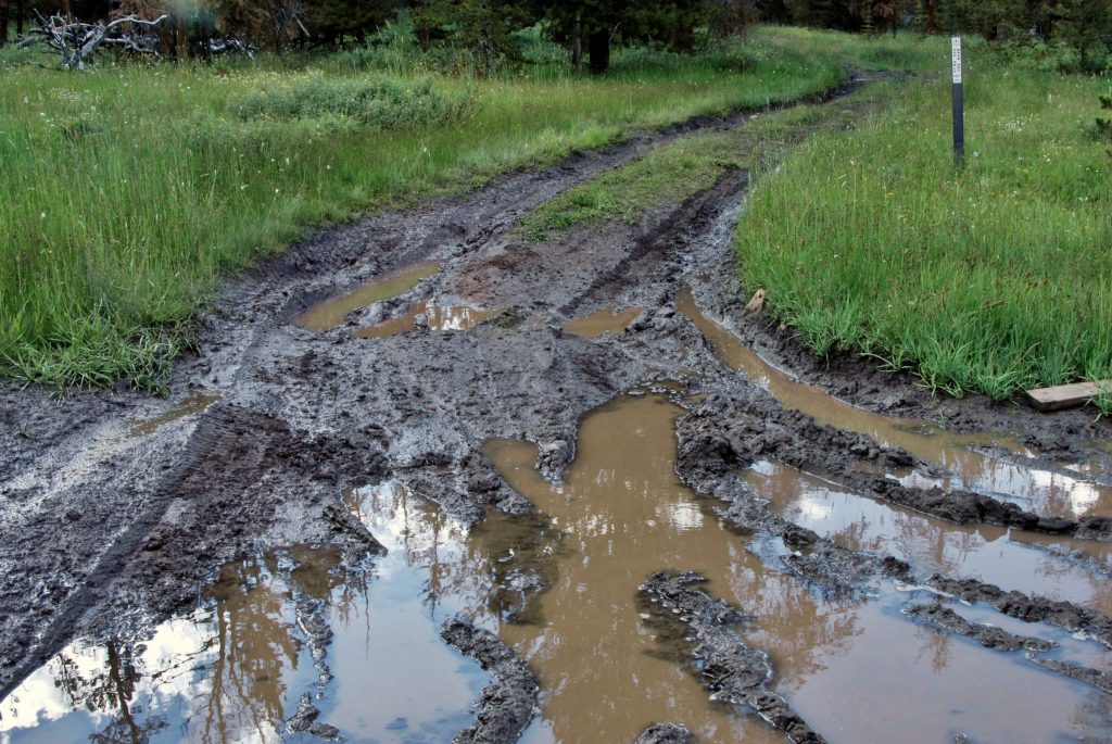
On the Forest Service steel post on the right–after you get stuck in the mud–the sign WARNS YOU YOU COULD GET STUCK! Best park and walk the few hundred yards to the site.
Once again, with information I’ve given you in previous posts, or in my BOOK, you can date this site.
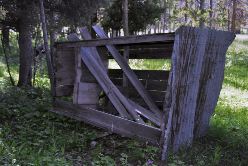
Above is seen–tipped over– one of the few outhouses I’ve seen in Tie Hacker ghost towns. If you look closely down to the right in middle of the ruins you will find the outhouse hole all filled up, and nearby the lid to the one-holer. BE CAREFUL WITH THE FILLED UP HOLE….IT MIGHT BE QUITE DEEP!
On that main side-road you will soon come to the HEWINTA GUARD STATION, that on my first trip was being lived in, so I knocked and was lucky to meet BOB & TERESA FASCINELI. By the way, the cabin was built by the Tie Hackers in 1927, and with a few modern updates is still in use.
They live most of the year in Green River, Wyoming. Teresa was then, and at least up to 2016–when I ran into her on the Kings Peak Trail on horseback, works the summers as a Wilderness Ranger using a horse. They were the first to really open my mind to the history of the Tie Hackers, for which I’ll always be grateful. It has made my High Uinta explorations much more interesting and worthwhile, which history in my BOOK, makes it one of the few publications that tell their story and gives them the credit due.
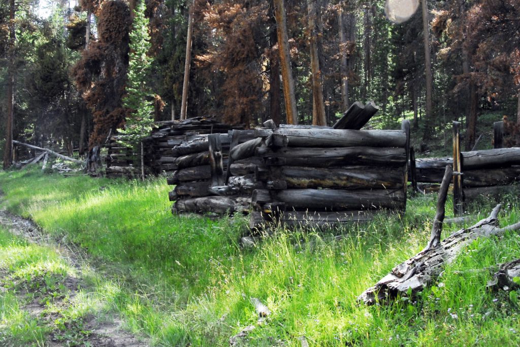
Up the same road a mile or so, you come to what we’ll have to call the “UNOFFICIAL WEST FORK OF THE SMITHS WORK TRAILHEAD.”
At this TRAILHEAD, you can’t miss the first Tie Hacker ruin. Yes the tie hacks are “heroes” but if you didn’t know, my real OUTDOOR HEROE’s name was given to the nearby river–SMITHS FORK of the GREEN RIVER. While still a teenager living in California, my father gave me and my brother, Marlo, a book entitled, HIDDEN HEROES OF THE ROCKIES, and prominent in it is the young man, JEDEDIAH SMITH, who replaced Tarzan as my REAL HERO!
In my HIGH UINTA MOUNTAINS book, I give a summary of his life–which all by itself is worth the purchase price of the BOOK. On pages 236-242 of my book, among others tells his story. Let me just list briefly a few things this young man who in the main section about his life I call him, “THE MOUNTAIN MAN OF ALL MOUNTAIN MEN!”
He re-discovered South Pass so critical in the development of the west.
Was the 1st man to reach California overland from the American frontier–an amazing journey following basically Interstate 15, attacked by Indians loosing almost all of his men, and all of their horses, then crossing the Mohave Desert on foot.
The first to cross the Sierra Nevada Mountains following basically the route of U.S. highway 6 to Utah.
The first to cross the length and width of the Great Basin.
The first to reach Oregon by a journey up the California coast.
Smith, Sublette and Jackson were the first to take wagons to the Rocky Mountains.
He survived the three worst disasters of the American fur trade, the last left him almost alone among 40 dead companions.
He was the first to lead a team of fur trappers on the North Slope of the Uinta Mountains,
He WAS UNIQUE among unbelievably tough mountain men and explorers, famous for CARRYING HIS BIBLEand “DIDN’T USE TOBACCO, LIQUOR, NEVER SWORE, AND STAYED AWAY FROM LOOSE WOMEN!”
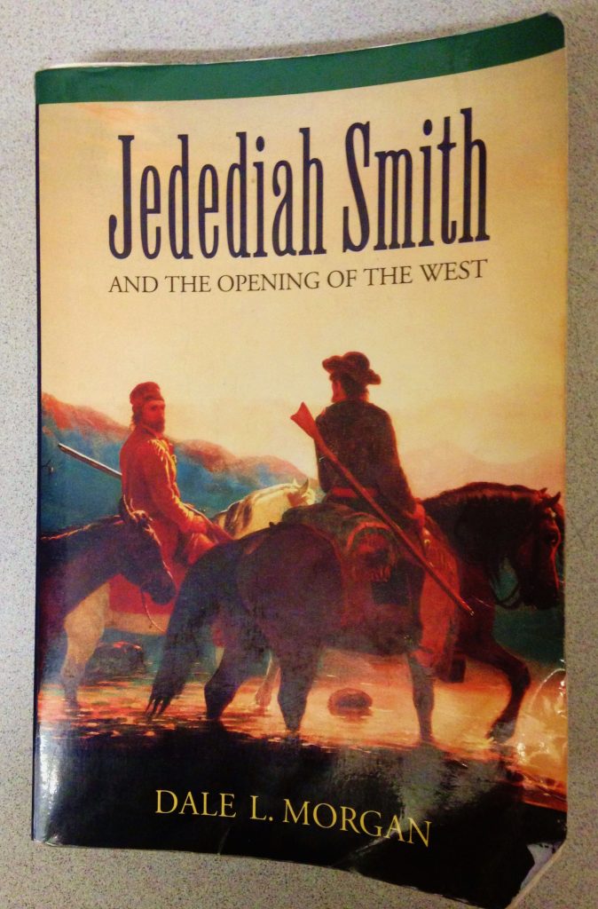
Author Dale Morgan in his book about Jedediah, said: “Jedediah made the lone wilderness his place of meditation, the mountain top his altar, and he made religion an active, practical principle, from the duties of which nothing could seduce him. His firm belief that faith must find expression in works emerges……”
He did all of the above and more from the age of 21 when he signed on as “a hunter” with one of the first expeditions to the Rocky Mountains by Ashley and Henry in 1822, then in 1831, as Morgan says to end his book, “……he fell under the spears of savages, and his body has glutted the prairie wolf and none can tell where his bones are bleaching, he must not be forgotten!”
I am doing my best to not let him be forgotten, and have named in his honor the 5th highest peak in Utah calling it MOUNT JEDEDIAH–13,387 ft. high, down the ridge from Kings Peak, and guarding the tiny lake given my name as a youth, “Little Andy Lake.”(page 242) I’ll insert Mt. Jedediah’s picture below.
TO NEVER FORGET MY HERO OF THE CONQUERING OF THE WEST I named 13,387 foot high–5th highest mountain in Utah–
MOUNT JEDEDIAH
It is down the ridge from Utah’s highest, Kings Peak, and at the head of the Uinta River’s Painter Basin, with Trail Rider Pass on the left. The lake is U-75 where I have caught huge brook trout, but even a larger one was caught in Beard Lake up near the pass–that would have been Utah’s record by far. The lake named for me, “Little Andy Lake” is up much higher at 12,302 ft. high we see below.
MOUNT JEDEDIAH is the shadowed mountain on the far right, with Beard Lake at its foot, and Lake Atwood in the distant/middle of the photo.
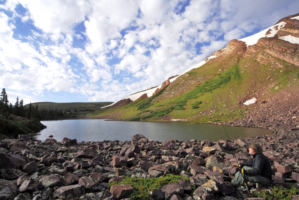
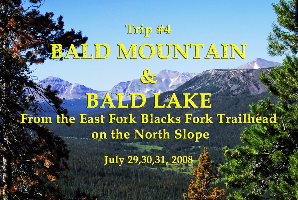
Our hike to BALD LAKE will follow the route on the above map south until we hit the North Slope Highline Trail, we’ll see in a moment.
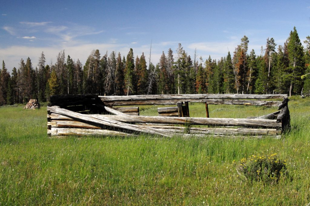
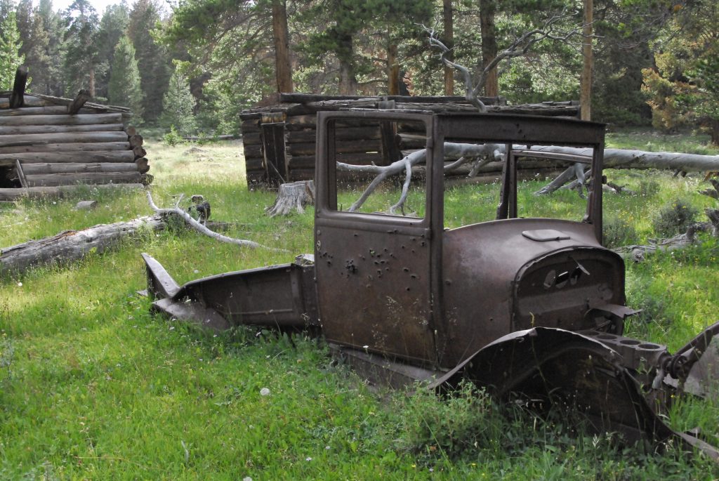
But, first we soon are seeing another Tie Hacker site along the trail.
Eventually coming to one with an old Model T-Ford pickup–which by the way I have been told it is now GONE!
Soon after passing the HIGH UINTA WILDERNESS sign, we come to a very important site of what was called…..
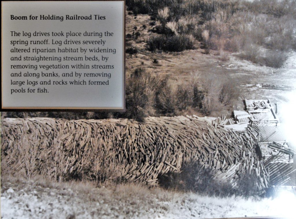
….a SPLASH DAM.
The Tie Hackers did most of their work in the winter when they could move the railroad ties more easily using sleds. They would be accumulated behind the SPLASH DAM, waiting for the Spring run-off, when the reservoirs would fill with the ties covering the surface. When all was in readiness, the Tie Hackers would BLOW THE DAM WITH DYNAMITE, and with a……
…..SPLASH!
……..the ties would be washed downstream, herded along by the Tie Hackers who would follow them north into Wyoming where they would be picked up by workers from the Transcontinental Railroad construction.
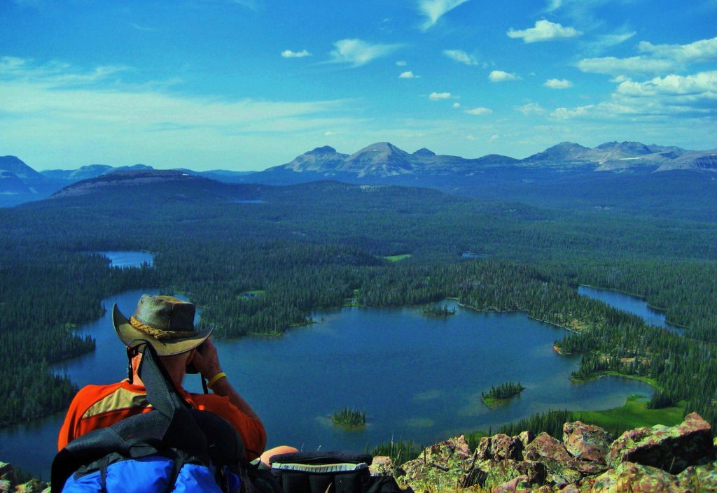
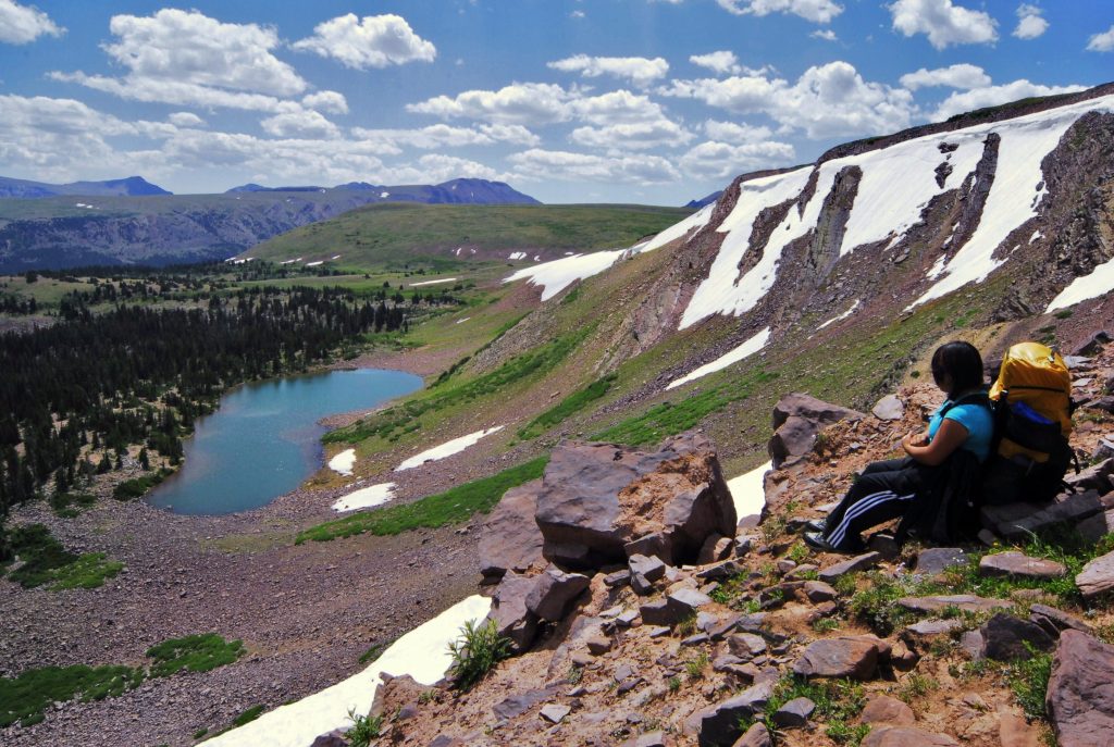
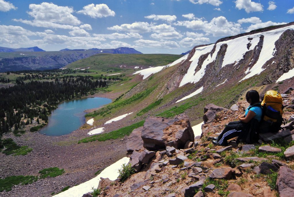
We have now come to the North Slope Highline Trail, and just a little to the west we leave the trail and go cross-country towards the mountain with snow–which is Bald Peak, and from where in a past report I pictured my daughter Mahana viewing the lake from up above.
The MAHANA picture was taken a week before from up there where the snow drifts are. I’ll insert it below.
At this point it is best to remind all that perhaps a good, if not the best way to Bald Lake is from the East Fork of Blacks Fork Trailhead, as done by my daughter and I–as described in what I call on my website Trip #4. That way is also a great way to get to the Red Castle area, rather than going up Smith’s Fork 14 miles. Each way has it’s advantages. Below the title picture I’ll insert a couple of pictures of this wonderful route to Bald Lake, and to the Red Castle area.
From the East Fork of Blacks Fork Trailhead, it is a steep climb up above timberline–during that climb I took the Title shot looking down on the East Fork of Blacks canyon. Once you make the climb, it is then wonderful hiking to Bald Mountains and Lake, and on to the Red Castle area.
But, back down the trail, and out to the North Slope Road you have a choice to make. You can return the way you came, back to the Mirror Lake Scenic Byway, 26 miles, or go north 27 miles to Mountain View, Wyoming, and from there return to Utah on Interstate 80 going through Evanston. Or, if you are doing the 856 MILE AUTO-LOOP TOUR OF THE UINTA MOUNTAINS, head east thru China Meadows, etc.
If you choose to go through Mountain View, don’t miss going to the Forest Ranger Station to see the Tie Hacker cabin that came from the Steel Creek Commissary.
Also if you’re going this way, you could also turn off I-80 at the right point to visit another site connected to the Tie Hackers: THE PIEDMONT GHOST TOWN as mentioned below, with full details in the BOOK.
PIEDMONT is a very important ghost town, with kilns used to make charcoal with tie hacker wood. It actually grew at one time to around 11,000 people, even with a hotel where Butch Cassidy once stayed with his gang, and many other fascinating stories, some of which I tell in my book.
You can see in the distance, across the creek, the cemetery and I couldn’t resist so made a visit and photographed every headstone, and a bunch with no name markings. My study showed many children who died in their infancy, indicating that the pioneer life wasn’t easy.
I was surprised noticing that it was still being used, and so made plans to be there on MEMORIAL DAY 2013 to hopefully meet someone from Piedmont–living or dead.
And I actually did meet the woman who had buried her husband there in 1996. She was Kelly Crompton Bussio, and through her I met her mother-in-law, Faye Byrne Crompton, the then 87 year old Matriarch of the family living in Orem, Utah. Faye was raised in Piedmont until graduating from high school, and is a direct descendant of Moses Byrne, founder of Piedmont. All of course explained in my book.
From Piedmont you can return to I-80 and follow it to Evanston, or using my book as a guide, follow County roads to the Mirror Lake Scenic Byway, and just a mile or so north you should visit this….Historic turn-out.
Or, if you continue to Evanston, you can return to Utah following the MIrror Lake Scenic Byway, and 10 miles south of Evanston you will see one of several turn-outs with fascinating history, like the one about BEAR RIVER CITY or BEARTOWN, which was described in pioneer times as the site of the “bloodiest battle among white men in the history of Wyoming,” and “The liveliest if not the most wicked town in America!” All connected to the tie hackers.
Below is an old photograph of the town, and in the bottom photo, if you’ll note the two skylines, you’ll see it is the exact location of the town–where it is said, “There are no artifacts.” But of course I found a few, as well as learning the whole story that includes………
…..the life story of the man who became President Eisenhower’s HERO, TOM “BEAR RIVER” SMITH. Tom, as the Marshal, tried to stop the “bloodiest battle” and was wounded, but was nick-named “Bear River” which comes out of the Uintas and passes near the town. From there he went on to be the Marshal in Abilene, Kansas where he was known as “The Bare Knuckle Marshal,” and was finally killed in a shoot-out with crooks. It is said that every time President Eisenhower visited his home-town, Abilene, he would go and put flowers on Tom’s grave. It has been said from my brief recounting of the history in my BOOK, that it would MAKE A GREAT WESTERN MOVIE–and A TRUE ONE!
I hope and pray that you have enjoyed this post, and if so, let others know what I’m doing my darndest to share with all interested.
FOR DETAILS, INCLUDING TOPOGRAPHICAL MAPS, ABOUT THIS HIGH UINTA TOUR & SUGGESTED BACKPACK/EXPLORATION, PLUS AN 89 PAGE GUIDE TO DO THE 856 MILE AUTO-LOOP TOUR, & MUCH MORE…..
GET THE BOOK!
The 730 page digital book is a Guide for adventuring in the Uintas, but also with HISTORY, LEGENDS, the SURVIVAL STORIES OF THOSE WHO DIDN’T MAKE IT & WHY, plus my 8 SURVIVAL STORIES and WHY I’LL BACKPACK THIS SUMMER IN MY 87th YEAR, plus a detailed APPENDIX (among other things has the Anti-Aging Challenge writing), & 14 PAGE INDEX, AS WELL AS TOPOGRAPHICAL MAPS WITH ROUTES, DISTANCES & LABELS — get an online copy of this book, some have called THE ENCYCLOPEDIA OF THE UINTA MOUNTAINS,send me $20 (don’t be afraid of sending a $20 bill as we aren’t south of the border) along with your email address, and I will immediately email you the link to download the book with my permission to share once with a friend. Or, send $25 for a thumb drive that will have the book, plus The History of it’s creation as detailed in a speech I gave at the Utah Valley Historical Society; plus my CHECKERED HISTORY & VISION QUEST–0-22 years. Send to:
Cordell Andersen, 444 Elm St., American Fork, Utah 84003
THE PLAN IS TO THIS WEEK KEEP WORKING ON GETTING STRONGER & DEVELOPING MY BALANCE WHICH I LOST ALMOST COMPLETELY–and by EARLY NEXT WEEK DRIVE UP THE MIRROR LAKE SCENIC BYWAY, CHECKING UP ON THE BALD MT. PASS HOW MY OXYGEN LEVEL IS–and if it’s a bit low, camp out in my car for a day until it normalizes.
THEN DO THE SAME HIKE I TRIED LAST YEAR TO FEHR LAKE–just a half mile, but THIS TIME GET PAST THAT ROCKY AREA I WASN’T READY TO DO YET–BUT AM NOW and GET TO THE LAKE AND CAMP, EAT A FEW BROOK TROUT, and return the Trailhead.
IF THAT GOES WELL, I WILL LIKELY DO ANOTHER OVERNIGHTER perhaps from the PASS LAKE TRAILHEAD TO SCOUT LAKE.
I WILL THEN REPORT WHAT FOR ME ARE MONUMENTAL ATTEMPTS AS 18 MONTHS AGO I COULDN’T EVEN WALK & HAD NO MUSCLES LEFT IN MY LEGS.
IT’S NOT MUCH, BUT I ACTUALLY NOW SEE A BIT OF MUSCLE–ENOUGH TO GET SORE AFTER A GOOD HIKE, SO PROGRESS IS BEING MADE! I SHOULD HAVE TAKEN A PICTURE WHEN MY LEGS WERE SHOCKINGLY JUST BONE!
THEN I HOPE, BEFORE JULY & THE ONSLAUGHT OF MOSQUITOES, TO DO A HISTORIC BACKPACK TO….
THE GRANDADDIES!
THE HIKE TO HADES PASS & DOWN TO THE LAKE MIGHT TAKE ME ALL DAY, BUT I WANT TO SEE ONE MORE TIME THE AMAZING SPAWN OF THE NATIVE CUTTHROAT TROUT UP THE 3 CREEKS ON THE WEST SIDE OF THE LAKE& REPORT HERE WITH SPECTACULAR PHOTOS!
THEN? WHO KNOWS…..BUT SET ANOTHER GOAL & DO MY DARNDEST and REPORT!
WOLF CREEK PASS – OPEN for several weeks… with NO SNOW 5/27.
NOTE: The elevation of Wolf Creek Pass is about the same as the Grandview Trailhead. Hades Pass is about the same elevation as Bald Mountain Pass, so those comparisons will give you some idea about when for backpacking.
BALD MOUNTAIN PASS–Mirror Lake Byway..OPEN– NO SNOW – 6/4
Next week–as seen below with my two front waist-packs, in the rear my lumbar waist pack, & tiny 5 lb. backpack–I will do my FIRST OVERNIGHT BACKPACK to Fehr Lake & likely one other. Then before the mosquitos hatch…….
……..I will MAKE IT TO THE
GRANDADDIES!
Taking me 70 years to come FULL CIRCLE, the first backpack in 1952 and maybe(??) the last in 2022.
*********************************
The May 22, 2022 report:
THE SEGO LILY The Utah State Flower
On Saturday, May 21st, on a hike up quite high on the foothills north of Grove Canyon, I found my first SEGO LILY of this season. Before I got back to the parking lot, going cross-country I found at least a half dozen more of them.
During the First World War the flower became a symbol of peace. Karl E. Fordham’s poem “Sego Lily” portrayed the plant as an image of home, mercy, freedom, and peace for the men and women of Utah who were serving on the battlefields of Europe. The blooming stage is very short, at most two weeks. The bulb is sweet and nutritious and is the size of a walnut. It can be eaten raw or cooked as an emergency food. It tastes like a potato when boiled.
The Mormon pioneers made much use of this plant as a source of food. It is illegal to pick any wildflowers on Public Lands.
Next up – A WARNING!
As the weather warms in the Spring, snakes come out of their dens–THE ONE TO WORRY ABOUT IN UTAH OF COURSE IS THE RATTLESNAKE. To introduce you to the danger we all face now along the Wasatch Front foothills, I’ll tell you a story below the picture.
Back quite a few years ago, before my life among the Maya, when living in Provo, one Spring in the middle of May I decided to climb LITTLE SQUAW PEAK….just down the ridge north of Squaw Peak and Rock Canyon. As I approached the summit going between two large rocks I noted movement nearby–it was a rattlesnake that didn’t rattle as it was in the stage of shedding its skin to allow for more growth, and eliminate parasites. It actually struck at me, but missed. When sloughing off the old skin they are usually blind, and can’t rattle, but are aware of any danger, and will strike blindly. So NOW IS THE TIME TO BE CAREFUL.
In another few steps there was another from the other side, and when arriving at the summit there were several more–SO I CAN’T REALLY BRAG ABOUT HAVING CLIMBED LITTLE SQUAW PEAK! On my way down I was more alert and several times safely encountered more rattlesnakes. I had never before, nor since, encountered so many rattlesnakes in such a concentrated area, and the last time I found one in the foothills was when climbing to the Y, and it was a small one I captured as it was way back when it wasn’t illegal to kill or have a live rattlesnake–AS IT IS NOW!
Best mention if you find one in the wild, just leave it alone. During my 18th & 19th years when working at Dugway Proving Grounds as a hunter and trapper for the University of Utah, I captured several rattlesnakes and had them in my office in cages and they were very effective to scare off any visitors I didn’t want to see! The second they stepped into my office, they would hear the rattle and FREEZE!
There are about 7,000 people annually bitten by rattlesnakes in the U.S., most of whom get medical care quickly, with only about a dozen deaths yearly, one of whom could be you–so best not play the odds, and be very careful.
NOW INTO THE HILLS AGAIN–which I have to do every other day to help control my blood pressure, and keep getting a little stronger each time, as well as trying to get my BALANCE BACK, as I hope to actually be doing some BACKPACKING IN THE HIGH UINTAS SOON! A week from now I’ll show you my new LUMBAR WAIST PACK, and you’ve already seen last year my small 4.5 lb. backpack, all the rest being around my waist as you’ve been seeing in these reports.
My QUARTERLY VISIT WITH MY SPINE SURGEON, was this past week, and he continually seems amazed at what I’m doing, but INSISTS I USE MY TREKKING POLES ALL THE TIME! Of course, I KNOW BEST, so when it is 100% SAFE I PERSIST IN NOT BECOMING 100% DEPENDANT ON THEM. Follows a few pictures of the…….
WONDERFUL WORLD….
……even in the almost totally desert-like foothills of the Wasatch where I am blessed with high testosterone (I take daily Andro 400 Max for helping me have a good mood & recognize beauty in everything) and capable of recognizing…….
BEAUTY EVERYWHERE & FEEL GRATEFUL TO BE ALIVE!
SPENDING TOO MUCH TIME WITH THESE REPORTS, SO WON’T RACK MY MEMORY TO REMEMBER NAMES, JUST HOPE YOU ENJOY THE PICTURES I LOVE TO SHARE WITH EVERYONE INTERESTED.
Do you remember this one….that I used as a project for a LANDSCAPING CLASS AT BYU BACK IN THE 50ies?
If not, scroll down to the last post. The beauty of this bush will WOW you later when it matures!
I’ve mentioned previously the first white men to visit Utah Valley, they being Fathers Escalante and Dominguez in 1776 who in a letter to the King of Spain described the valley as,
” THE VALLEY OF OUR LADY OF MERCY OF TIMPANOGOS IS THE MOST PLEASING, BEAUTIFUL, AND FERTILE SITE IN ALL OF NEW SPAIN!”
As also mentioned before, they had a good relationship with the Timpanogos-Ute Indians and promised to return and establish here a Mission. If they had of done so, the history of Utah would be very much different than the way it worked out with the Mormons.
It was up here at the highest point of my hike, where I took the panorama of Utah Valley, that…
….. I found the first SEGO LILY.
Then on my way down cross-country, I was happy to find this UNIQUE WILDFLOWER we will see much more of soon.
This plant is just getting started. The middle shot shows the flower developing on the right of the plant. The 3rd picture shows the beginning of the blossoming process–THAT WILL ALSO WOW YOU!
Thanks to our loving & perfect CREATOR for all of HIS AWESOME VISIONS of NATURE and the WONDERS IN OUR BEAUTIFUL WORLD!MAY WE ALL BE DESERVING and APPRECIATIVE STEWARDS!
*********************************
Now, to the HIGH UINTA WILDERNESS at LITTLE EAST FORK OF BLACKS FORK & BIG FOOT
Once, way back in the beginning of my HIGH UINTA WILDERNESS PROJECT, I went to Google Maps of the High Uinta Mountains and all of a sudden I was seeing where there had been reported sightings of BIG FOOT or SASQUATCH. It indicated that most sightings were in the drainage of Little East Fork of Blacks Fork….and my interest was CAPTURED! Eventually making 3 backpacks into the area. I’ll sort of combine all of them into one trip I reported on my website as a photo/essay with lots of pictures and detail, going all the way up the drainage–ALWAYS READY WITH MY CAMERA, LENS CAP OFF, JUST IN CASE THIS “BIG FOOT LEGEND” had some truth in it! Then over Squaw Pass, and to Porcupine Lake in the Lake Fork Drainage.
In the background of this picture is Squaw Pass
For full information on how to get here, as well as topographical maps, fishing information, distances, etc. go to pages 224-231 of my BOOK–info about acquiring it will be inserted at the end of this post. The Preface to this Chapter 2, Section 8 of the book, is entitled:
“THE LEGEND OF BIG FOOT — SASQUATCH“
In that writing is told the story of my sort of mystical encounter with Big Foot, his son on horseback, and them laughing at us civilized humans needing all the sophisticated and expensive gear to survive in the Uintas! If you are really interested I could say, “GET MY BOOK!” but I’ll sort of tell the story briefly along with the wonderful adventure I had in this often overlooked area.
AS YOU PROCEED UP THIS DRAINAGE THERE WILL BE SEVERAL FORDS OF THE STREAM NECESSARY.
As you continue up the drainage you will see many of what I call VISIONS OF NATURE, with many wildflowers, mushrooms, signs of Tie Hacker culture, some strange mounds I have since learned were left by glaciers, and much more. As you go southeast you will notice off to the west side of the canyon an above timberline level up above those pines where there are 7 remote lakes, none with a name–only numbers, and all have fish. You will have to use your maps and my book to guide you.
Here I am with 11,600 ft. high SQUAW PASS behind me.
I met a sheepherder from Peru going out for supplies. Their sheep were over the pass in the Oweep Drainage.
Climbing the pass over a very rocky trail, with spots of blood here and there from the herder’s horses.
Looking back down Little Fork of Blacks Fork canyon.
On the 11,600 ft. pass.
One critter that didn’t make it.
Looking down on Porcupine Lake in the Oweep Drainage.
Looking east from Porcupine Lake towards Porcupine Pass, 12, 260 ft. high
A shot of myself on PORCUPINE PASS on my 27 day/no-resupply backpack in 2003 to begin my HIGH UINTA WILDERNESS PROJECT. I’m looking down on Porcupine Lake.
This is a shot again of Porcupine Pass, with 13,000+ Mt. Wilson rising up in the middle, and a line drawn across the picture that was the pathway for Ted and me in 1962, somehow traversing that mountain to get to the saddle above the Red Castle area.
Here I am along the dangerous traverse getting a drink from a spring. You can see my Guatemalan shirt. Five years later our family left on our RISKY & BREATHTAKING PIONEER JOURNEY TO THE MOUNTAINS OF THE MAYA!
Here we are on the saddle above the Red Castle area on that 1962 adventure. We would eventually camp high above Red Castle Lake on those vegetated cliffs on the right.
Here you see me dry skiing down the chute. You can also see an experimental backpack I made and fooled around with some.
…..and here goes Ted (Packard) going down the chute to first get to Upper Red Castle Lake. From up high we noticed fish rising on the lake and so wet a line….and WHAM!We were into some of the greatest fishing we ever found in the High Uintas.
A day or so later from our camp on the cliffs on Red Castle Lake, we hiked back up to Upper Red Castle Lake, and in the clear water noticed a school of Native Cutthroat trout, with an even larger one trailing behind, sort of like an outcast, or maybe the Leader herding his harem around the lake.
We became a little frustrated casting ahead of them as they ignored our lures, but then the wind picked up messing up our clear image of the fish, and I took one more cast where they had been…….and WHAM–THE HIGH UINTA FISH OF MY LIFE WAS ON!
He was very heavy bodied, almost like a large-mouthed black bass. I wanted to take him (or her) back to civilization whole, uncleaned to get an accurate weight for the 21″ native, so buried it in a snow drift intending to come back and get it the next day when we would hike back to civilization.
The next day as we approached the snow drift, a marmot jumped down off the snow drift. Marmots are vegetarians, but we found most of my trophy had been eaten by some critter. Only the the tail half was left, with all the entrails gone too. I carefully wrapped the half and we headed out, going down past Lower Red Castle Lake and swung around on the trail going over Smiths Fork Pass, and down through the Garfield Basin to the Center Park Trailhead and the car. Back home that, what we logically believed was the LIGHTER HALF, weighed 3.5 lbs. So we calculated that the whole fish would have exceeded 8 lbs.
Here I am at PORCUPINE LAKE, inserted with a photo from my “Expedition” I used it as the opening photograph on my Facebook page seen below (https://www.facebook.com/cordell.andersen )
Porcupine Lake is full of the most colorful eastern brook trout I have seen in the Uintas, but the whole area is scheduled for elimination of brook trout and the restoring of native cutthroat trout, along with several other such areas in the Uintas.
After camping one night on Porcupine Lake I headed back over the pass always with my camera ready for a hopeful encounter.
I was hiking down a rocky ravine, and I felt tired so sat down to rest.
I set my camera down on a rock next to me–always having it ready to get that BIG FOOT portrait–hopefully a FAMILY PORTRAIT! I dozed off when all of a sudden BIG FOOT appeared and seemed friendly, so I tried to communicate, asking him using sign language about a wife and children, but he didn’t understand, so then I tried asking what they ate? He made a movement like a prancing deer, then mimicked jumping on its back and made a wrenching movement like breaking its neck!
Then LITTLE FOOT appeared riding a horse, and I recalled that a sheep herder had reported missing a horse a couple of years ago in this area.
With this incredible scene I was very carefully–without frightening them–manipulating my camera next to me hoping to get the
“PHOTOS OF THE CENTURY!”
They communicated with each other, and pointing at my equipment were laughing, like saying, “These humans are so pathetic needing all this equipment to survive in the mountains. We get along just fine without any of that!” With that they turned and headed into the forest, me manipulating like crazy the camera with one hand, until almost out of sight, when I lunged for the camera to get a parting shot.
But, I didn’t get a good grip on the camera and knocked it off the rock and it CLATTERED DOWN INTO THE ROCKS BELOW–WAKING ME UP FROM AN INCREDIBLE DREAM! Or, had it really happened, and maybe my camera was full of the definitive proof not only of BIG FOOT, but also LITTLE FOOT!
I hopefully picked up my camera…now with a cracked skylight filter, and checked to see if I had got any photographs…..but luck wasn’t with me!
But, it was so real! I thought maybe it was like the prophets of old having a “VISION IN A DREAM” to get across to me that maybe there was something to the legend…SO I BEGAN MY HIKE DOWN THE TRAIL, MORE READY THAN EVER….WHEN ALL OF A SUDDEN I WAS SHAKEN BY WHAT SEEMED LIKE A GIANT FIGURE COMING THROUGH THE LARGE TREES!
He was wearing a red “Striders” T-shirt and carrying a water bottle! And wearing running shoes on feet that were SMALL!……….not BIG FOOT!
It was ROB WILCOX, mountain runner, with his family camped down below. He was running to and from Squaw Pass.
I told him about my mystic encounter with BIG & LITTLE FOOT, and he reacted,
“Who knows? Could be!”
I camped a little ways down the canyon, and later Rob passed by on his way down from the pass to invite me for dinner. Sadly I had just had my dinner of dehydrated food, so had to SADLY pass on what I believe were CHICKEN DUMPLINGS!
Down the trail I met a great family on a backpack. GRANDPA MIKE ATKINSON, all of a sudden looked at me, and said,
“YOU’RE CORDELL ANDERSEN!”
He continued, “My brother and I saw on your website the writing about the ANTI-AGING CHALLENGE, you describing the solution to arthritis using cod liver oil. Both of us carefully followed the system, and…..
…… IT WORKED MIRACLES FOR BOTH OF US!”
SORRY THIS PHOTO IS OUT OF FOCUS, BUT JUST HAD TO USE IT AS IT TELLS AN INCREDIBLE STORY……Here we are seeing the rewards of having a big family on a backpack–LUCKY HE WAS A ‘TOUGH AS NAILS’ EX-MARINE!”
The 730 page digital book is a Guide for adventuring in the Uintas, but also with HISTORY, LEGENDS, the SURVIVAL STORIES OF THOSE WHO DIDN’T MAKE IT & WHY, plus my 8 SURVIVAL STORIES and WHY I’LL BACKPACK THIS SUMMER IN MY 87th YEAR, plus a detailed APPENDIX (among other things has the Anti-Aging Challenge writing), & 14 PAGE INDEX, AS WELL AS TOPOGRAPHICAL MAPS WITH ROUTES, DISTANCES & LABELS — get an online copy of this book, some have called THE ENCYCLOPEDIA OF THE UINTA MOUNTAINS,send me $20 (don’t be afraid of sending a $20 bill as we aren’t south of the border) along with your email address, and I will immediately email you the link to download the book with my permission to share once with a friend. Or, send $25 for a thumb drive that will have the book, plus The History of it’s creation as detailed in a speech I gave at the Utah Valley Historical Society; plus my CHECKERED HISTORY & VISION QUEST–0-22 years. Send to:
Cordell Andersen, 444 Elm St., American Fork, Utah 84003
NOTE: You of course can take it on a thumb drive to your favorite printer and for around $190 have a printed copy as seen above in two volumes. My printer is COPYTEC in Pleasant Grove, Utah. They do a fantastic job.
WOLF CREEK PASSOPEN for several weeks… with NO snow 5/20.
BALD MOUNTAIN PASS–Mirror Lake Byway..CLOSED-21″ of snow 5/20
But first, my persistent efforts to NOT GIVE IN….EASILY, but rather make some good strides away from not being able to walk anymore….like 18 months ago, and importantly, NOT “Faking I’m not a cripple,” that I once had to do, but actually making some progress in hiking again.
Now I have graduated from the several sets of stairs that helped me begin building back muscles, and NOW go every other day to the foothills and the Grove Canyon Trailhead, TODAY with the intention of not following the trail up the canyon, and switch backing up to the “valley view” spot, but rather go straight up the mountain.
Yes, I had to give in and begin using TREKKING POLES, that I used to say were for “WIMPS!”But now on smooth, secure trails, even where the slope up, or down is not extreme, and where losing my balance won’t kill me–like falling into a ravine to never be found, I’m weaning myself off of them, swinging them up behind me and hiking normally. This is actually also helping to straightening out my spine and reducing the normal pain I feel all the time when walking or hiking.
A LITTLE HILL FOR ALL OF YOU, was for ME, considering a while back I couldn’t walk, WAS FOR ME A GIANT MOUNTAIN I HAD TO CLIMB!
So here we are the arrows indicating my starting point near the trailhead and going up a trail you can see winding its way up to the ridge. The upper arrow is a bit deceiving, as it doesn’t make it look very far, which my aching muscles today–the day after–tell me it was a pretty stiff hike for this old guy in his 87th year. For this challenge I WOULD HAVE TO USE MY TREKKING POLES!
Along the way I noticed one of the real pretty bush type plants of the foothills is beginning to sprout. You’ll see later why I used it 63 years ago to actually be a major part of the landscaping of an apartment where we lived when first married.
LATER YOU’LL SEE WHY IT IMPRESSED ME.
Soon I found this tiny cluster of yellow flowers on a long stalk and stopped for a needed rest and a photo shoot. To use my close-up lens and do it right would have required having a tripod to steady the camera, but I didn’t want to take the extra weight–already with 8 lbs.–with my Nikon camera and 14mm. x 400mm. lens, survival equipment, and a picnic lunch. So just took a bunch of shots hoping one would be sharp, and one was, even though I goofed on the background with photoshop. This flower measures about 1/8th of an inch.
I soon learned that the pathway worn smooth by hikers sliding down a quite steep section, was too steep and dangerous for me, so I had to detour off to the left following deer trails and zigged and zagged up until getting above the dangerous portion, then sort of on top of the ridge followed it up the mountain, and….yes I had to rest here and there, and so actually took longer to get to the view area, than it would have taken me to follow the trail up the canyon.
Here’s another quite tiny flower about a quarter of an inch wide, which I got with my zoom lens.
There were times during the climb, especially in the beginning, when I decided it was too dangerous for me and my condition, but rather than giving up, just took an easier and safer pathway, taking longer, but finally made it to the viewing area and photographed this plant I hadn’t seen at lower elevations.
With my fish-eye lens I got yet another panorama of beautiful Utah Valley, from on the very right the tip of the Point of the Mountain, all the way across Utah Lake with Mt. Nebo in the distance on the left. When all is in bloom, and the sky is clear with beautiful clouds, I’ll insert the actual quote from Escalante & Dominguez in their letter to the King of Spain describing this valley as the BEST THEY HAD SEEN IN THEIR EXTENSIVE TRAVELS IN THE NEW WORLD.
Another Lichen garden impressed me. If you missed the discussion about Lichens, go back a bit and learn about this unique life-form, and even better get my HIGH UINTA MOUNTAINS BOOK, with more complete descriptions of this incredible life form, 3,000+ varieties of which are found in the Rocky Mountain area.
The American vetch has been in bloom at lower elevations for some time. The Utah MilkVetch was first seen up here at the View area, but now is sprouting all over.
This is the flower of the Milk Vetch, or Ladyfinger. An extremely tiny yellow flower has sneaked into the picture at the bottom.
I had my picnic lunch and feeling much better than I thought I would, proceeded up the canyon some, but decided I would wait for another day to make it all the way to the water falls and bridge.
In this photo you can see the trail cutting across the hillside from the left.
Up high I also found another flower similar to the one first seen several weeks ago much lower, and got pictures of it and the whole plant, showing it is much different than the one on top, and smaller too.
Then headed down getting a picture here and there, many more than I’m including here, and saving them for my own enjoyment once I start getting OLD!
The variations in coloration of the Oregon grape plant always fascinate me.
And, I’ll be anxious to see how this one develops with it’s thorny stalk.
Once down in the bottom of the canyon on the trail I was impressed with vegetation coming into bloom. This one is seen in the following montage, on the bottom portion.
You Canadians should immediately recognize the leaf seen below.
Soon the various varieties of THISTLES will begin blossoming with a beauty that has us forgetting the thorny side of the plants.
Dandelions have of course been out for a long time. In fact down in the valley in our lawns they are usually the first to bloom, and the last green plants before the onset of winter. I will soon do a report on this plant, but let me say it is the first plant or flower of any kind that I remember in my life as a child 6 years old. It was in Cincinnati in 1942 when I vividly recall noticing black people, who were properly called “negros” back then (the other “n” word always sparked a fight….sometimes to the death, except among them–I know what I’m talking about as I went to high school where 30% were African Americans), but we would see them in the parks wandering around the grassy areas picking dandelion leaves and going home with bags of them to take the place of expensive green vegetables.
I have since learned they are more nutritious than most of the vegetables, and so a portion of my garden is planted intentionally with DANDELIONS.
While resting and thinking about them, all of a sudden one of the Lord’s beautiful creatures decided I was right and dropped in for some nutrition. Do you notice how its long, elephant like snout dips down into the flower?
This morning my private Sunday DEVOTIONAL had me hearing the celestial words “ALL THINGS BRIGHT & BEAUTIFUL,” preparing me for sharing with you this INCREDIBLE CREATION OF THE LORD…..or if you prefer of MOTHER NATURE!
WOW! says it all.
Yellow and white seem to be quite dominant among the VISIONS OF NATURE, so a splash of ORANGE always attracts attention.
This is a plant shown in a post weeks ago, me saying it will be interesting to see its flower blossom. We’ll, I can now show you below.
So, down the canyon I went with my trekking poles up behind me and concentrating on walking a straight line, and doing so normally….as normal as an old RODEO CLOWN in his 87th year can do!
I think I mentioned that was one of my labels in Guatemala by a BYU Agronomy professor and friend, Keith Hoops, because we bypassed the use of alfalfa hay and silage, and rather had our cows on high protein pasture grass 24/7×365 days a year, LAUGHING ALL THE WAY TO THE BANK!
I still love my nickname, RODEO CLOWN, as well as some calling me a MODERN DON QUIJOTE DE LA MANCHA!
I LOVE IT, especially my friend and LDS LEADER, Harold Brown, seriously gave me a nickname calling me a “MODERN AMMON!” That was due to my life-long love affair with the Native Americans–Mayans, Navahos, etc–See: https://www.guatemalanfoundation.org/
NOW INTO THE HIGH UINTA WILDERNESS, still on the NORTH SLOPE.
After the Middle Fork of Blacks Fork, for last week–we come to the next–the EAST FORK OF THE BLACKS FORK which is also FONDLY REMEMBERED. We are here leaving the Mirror Lake Scenic Byway to follow east the North Slope Road.
Following the signs, after about 25 miles you come to the TRAILHEAD. From the Trailhead, you can head in one of three directions. By the way, IF YOU DON’T WANT TO GET LOST…..GET MY BOOK with maps and all the info.
Nearby we see a lively VISION OF NATURE, a Red Squirrel that is lactating
My daughter, Mahana, is heading across the bridge and then will turn left to take the trail that after some steep climbing eventually comes into wide green meadow areas where it is a pleasure to hike….on the way to Bald Lake, or on and on to the Red Castle area.
I must add...IT IS A WONDERFULLY BEAUTIFUL WAY TO GET TO RED CASTLE, as you will see in the next picture or two.
See what I mean? Wonderful hiking as you climb up above timberline.
A COLORFUL HIGH UINTA LICHEN GARDEN!
Here, along the edge of the Uinta’s 2nd BALD MOUNTAIN, Mahana is looking down on Bald Lake full of feisty brook trout.
We will now backtrack to the trailhead and head up the East Fork of the Blacks Fork Trail.
NOW TO THE OTHER HIKE FROM THE TRAILHEAD…..it was to be for me my 2nd backpack to Crater Lake, and was done late in the season so hopefully the snow drift that prevented me from climbing up a chute to get on a saddle for the “PERFECT PICTURE!” It was about September 9th. It would be ONE OF MY MOST REMEMBERED BACKPACKS!
In the first couple of miles you see remnants of the Tie Hackers. About 1.5 miles from the Trailhead the trail divides, the left hand trail going up Little East Fork of Blacks Fork. We will cover that area next….and it will be exciting as it is an area where BIG FOOT has been spotted more than other areas.
Soon you cross the river. What you will find, who knows, so be prepared to wade the stream. NOW A PROBLEM: Towards the afternoon of my first day a light rain began. I set up my tent to pass the night, and realized I had a problem. I had already had a cancer surgery, and radiation treatment, as well as two Mohs cancer surgeries for skin cancer. Plus in the middle of 2004, my 2nd season of the Project, my right “motorcycle knee” had collapsed and there was an emergency temporary surgery, and I had pain pills prescribed by the doctor for that knee and also my “football ankle” that was beginning to cause a lot of pain. But, I had forgot my pain medications.
I felt like I had to go back and get them and then return to do the backpack. Since it had been raining there were a few drips inside the tent, but midway through the night they stopped. When I felt thirsty and tried to drink some water I found my water bladder was frozen. The drips had stopped because my tent with it’s coating of water was frozen over me like it was an igloo! In the morning I headed for home, got what I needed and returned, but had decided that I didn’t really need a tent–for sure no mosquitos anymore– and could save the weight and use my poncho, and bivouac bag as seen in the next picture.
I made about 10-11 miles that first day of the 2nd attempt and set up my camp protected by some alpine firs as seen above, with 13,219 FT/ Mount Lovenia in the background.
Ahead was my pathway to 12,150 ft. pass I labeled EAST FORK PASS.
Here I was on the Pass, with Mt. Lovenia in the background. The weather again was closing in on me. Those of you who are sharp will notice the vegetation was green, so this picture was taken early in the season on a previous exploration. In September all would be golden-tan with winter coming on as you’ll see in the following pictures.
Do you remember from my posts who named this mountain and why? Yes, it was famous pioneer artist, photographer, naturalist and explorer, GEORGE BEARD, who named it after his beloved wife.
It was from up here where I got this photograph of THE SPINE OF THE UINTAS seen from here like no where else.
Below I’ll insert a set of three photos of this magnificent scene at different seasons of the Uinta’s short season.
It’s my buddy TED PACKARD seen in the lower panorama.
From East Fork Pass you actually go down towards Red Knob Pass, about 11,700 ft. in elevation. We see here the very most upper reaches of the Lake Fork Drainage on the South Slope.
This is the view from Red Knob Pass looking towards the Deadhorse Lake area.
And here we are looking towards my destination, Explorer Peak, with a sliver of Crater Lake seen in the glacial cirque at its foot. At the pass I put on my rain pants, parka, and poncho, and from here to the foot of Explorer Peak, I was constantly rained, and snowed on.
I set up my camp in the protection of some trees, as by then I was feeling sick….like the flu. I had a slight fever, and had the additional complication of a molar that was aching on my only good side, as the other side also had a dental problem. I couldn’t chew anything. My jerky was cut up in small pieces and put to soak as was everything I had to eat and swallow whole. I of course was prepared with pain medications, and with a complete emergency anti-biotic treatment that I immediately started taking–doubling the first dose to give it a good start.
The thought of getting up to Crater Lake had disappeared from my mind. I had to focus on getting well enough to get out of there and survive. As I rested for two days to give the antibiotic time to begin taking effect, I listened to the news on my small radio, and was hearing that snow was on it’s way. For sure I had to get out of there in two days.
I had a satellite phone, with an extra battery, but as I tried to use it, I couldn’t get a signal as I was right up against the mountain. I used up an entire battery trying, and then stopped trying to have enough battery left to get a call out once I was on my way away from the mountain. In my weakened state my big challenge was to climb Red Knob Pass, then keep going up to East Fork Pass, before dropping down.
Interestingly I had with me a READERS DIGEST with Reese Witherspoon’s beautiful smile along with a title: LAUGH MORE, LIVE LONGER! So I decided to record on my little recorder all the jokes and funny stories, and as I tackled the challenge of climbing over that big mountain, I would listen to all the jokes and funny stories and LAUGH MY WAY OVER THAT COTTONPICKING MOUNTAIN!
After two complete days of rest I began feeling somewhat better, packed up and was on my way. I knew I had to be careful, hike slowly, carefully and not give the sickness a chance to know it had a GREAT CHANCE OF KNOCKING ME DOWN FOR THE COUNT!
I got about halfway to the mountain and at the last large pines stopped to try the phone. I immediately got my buddy Ted Packard on. He said he would call the Forest Service and get the weather report for my area, and get back to me. A little while later he called and told me the Forest Service reported it was going to snow that night and to “STAY PUT AND DON’T MOVE OR YOU’LL DIE!” But, that by morning it would clear some when I could move.
I set up my camp and waited.
There was some sun showing through in the morning, so I moved towards Red Knob Pass, and got out my tiny recorder….
I literally laughed my way to Red Knob pass, but as I approached it, I began feeling sick, weak, a headache, but I had too keep moving up towards East Fork Pass, so I CONTINUED TO TRY MY BEST TO LAUGH MY WAY TO THE PASS...until the weather made my situation a bit desperate!
As moved I took all but my last medications for pain and high blood pressure, and as I approached the pass, a blizzard hit me with winds like I had never experienced in the Uintas.
NOTE: You don’t see any blizzard in the photo…..I couldn’t take a photo in that deathly survival situation–so the photo was photoshopped inserting me, but I couldn’t figure how to photoshop SNOW & THE RAGING WIND!
I felt pain coming up my left arm, and pains and pressure on my chest like it would burst, plus nausea and worsening of the headache, and I got out my satellite phone…..luckily I getting Russ Smith from Skycall Communications on the line. He was about to leave for a commitment somewhere, but afterwards told me he recognized I was in a desperate situation, so not only kept me on the line, but also formed a conference call with the Sherriff from Summit County.
As I was talking I was moving down as I had to get out of that blizzard. The sheriff said something about trailering some horses to the trailhead and coming for me, but I somehow got across that something quicker was needed.
So they got on the line the University of Utah emergency helicopter service, and it was agreed they’d come after me, but I had to get down off of that mountain where they could land, or where I could survive on my own if it came to that. I had to get back to that little clump of alpine firs where I had camped coming in.
But they needed my coordinates, so Russ went to work to help me figure out how to do that with the sat phone, which I finally accomplished, and then the call was cut….
…… As I came down quickly in elevation I began feeling markedly better, and finally I got to my spot. I tried to call, but nothing, but set my phone on a rock turned on ready for a call. In about 30 minutes it rang, and it was the helicopter pilot telling me they were 4 minutes out and to put something bright on the ground so they could locate me. I put my bivouac bag out held down with rocks, and all of a sudden here the helicopter came.
I was waving my hands, but smart enough to not yell as you see people do in the movies. He flew right over me and disappeared. But I was in radio contact, and got them turned around and coming in lower, and they spotted me and landed.
By then I was feeling great, thanked them for coming and just said, “Just take me down to the Trailhead and I’ll drive home!” They didn’t pay any attention, and hooked me up to their machine.
As they were doing so, I said, “Well, at least take me to the LaVell Edwards Stadium in Provo as BYU’s game is about to begin!” Don’t know what was wrong with them, but they didn’t laugh, shut me up with an oxygen mask, saying the oxygen in my blood was half of what it should have been, my blood pressure was sky high, and my pulse at around 135 even though I’d been resting for half an hour.
They loaded me and my pack in and we were on our way!
Flying over my beautiful High Uintas!
At the University of Utah Hospital they wheeled me in and were all over me, my mirror image seen, if you look carefully in the ceiling thing.
By the next morning all my vitals were fine, and Jesse came to pick me up, then we headed for the Trailhead and I drove my car home. For sure I had multiple problems, but the one that overall seems to be now glaring, was that my weakness caused by several things had triggered THE SILENT KILLER–HIGH ALTITUDE SICKNESS. When I got higher and higher climbing that mountain, it got worse and worse, and when I came down 1,300 ft. in elevation I felt pretty good, even though my vitals still needed some attention.
If I had to do it all over again, I would have said, “To heck with climbing that cotton picking mountain, I’m hiking down the canyon to Moon Lake and from there have Jesse come and get me, then go for the car.” I could have likely made it fine, and saved the $1,000 the helicopter ride cost me (without my insurance it would have cost $10,000)!
SO GET MY BOOK AND LEARN ABOUT THE SILENT KILLER. I tell in the book the most prominent survival stories of this century, including 8 of my own, and I have been told by several that LIVES HAVE BEEN SAVED BY THE BOOK!
FOR FULL INFORMATION ON THIS & OTHER AREAS, AS WELL AS TOPOGRAPHICAL MAPS WITH ROUTES, DISTANCES & LABELS — get an online copy of this book, some have called THE ENCYCLOPEDIA OF THE UINTA MOUNTAINS,send me $20 (don’t be afraid of sending a $20 bill as we aren’t south of the border) along with your email address, and I will immediately email you the link to download the book with my permission to share once with a friend. Or, send $25 for a thumb drive that will have the book, plus The History of it’s creation as detailed in a speech I gave at the Utah Valley Historical Society; plus my CHECKERED HISTORY & VISION QUEST–0-22 years. Send to:
Cordell Andersen, 444 Elm St., American Fork, Utah 84003
**************************
THE SEQUEL…..
On that 2006 survival backpack, my “FOOTBALL ANKLE “ from a football injury in 1953 started giving me trouble–and actually finally wore out requiring surgery in early 2007 shown on the page I put together.
After returning from the hospital, my kids came in the house finding THIS! They were beginning to panic, but Jesse noticed I was softly snoring and ALIVE. So, they quickly got a camera and shot this WONDERFUL PHOTO!
After months of recovery I all of a sudden was IN DEEP TROUBLE!
This was my first and last ordeal learning about the acute dangers of taking PERCOCET + AMBIEN and feeling WONDERFUL sort of for a time until realizing I had become addicted!
I went COLD TURKEY, suffered the pains of HELL for a week, I don’t think sleeping at all, but finally SURVIVED….AGAIN! — learning my lesson to never let that happen again.